Gorse Piece Plantation

Wood, Forest in Derbyshire Derbyshire Dales

England

Gorse Piece Plantation

Hazelford Hall above The Hope Valley
Hazelford Hall above The Hope Valley Credit: Neil Theasby

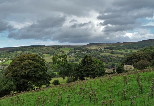
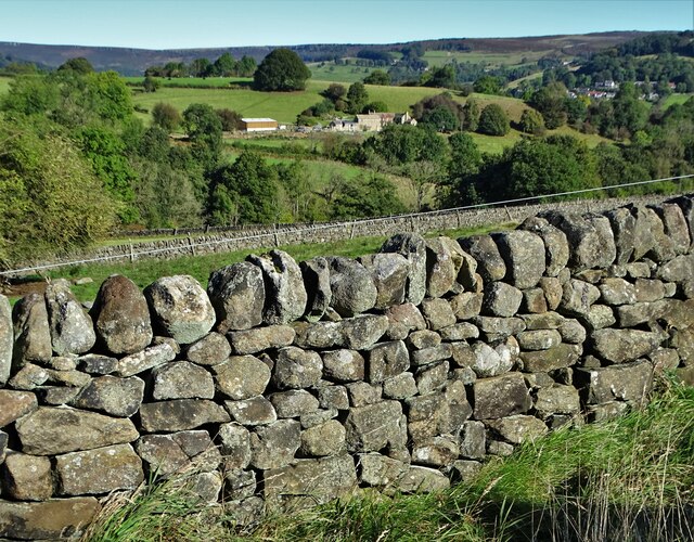
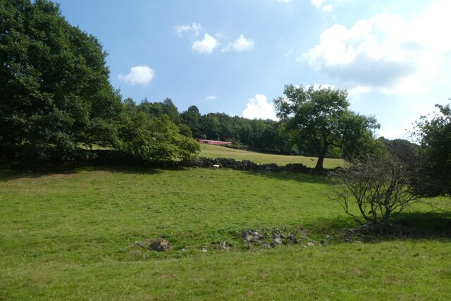
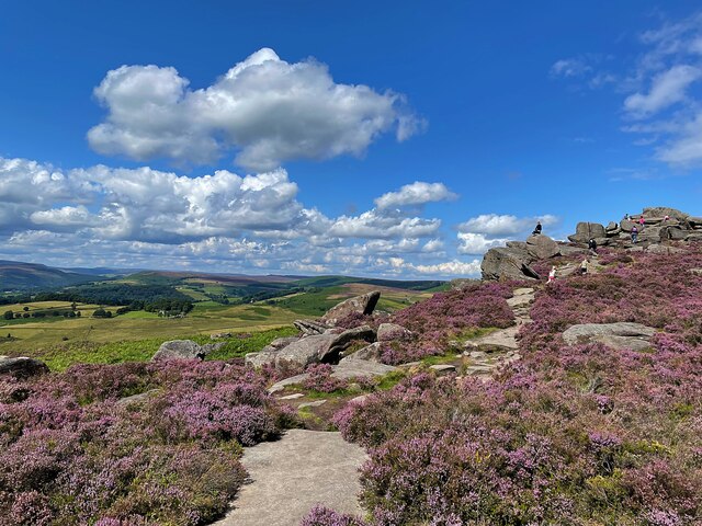
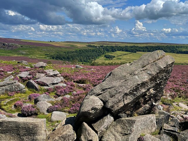
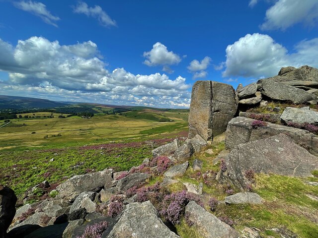
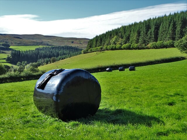
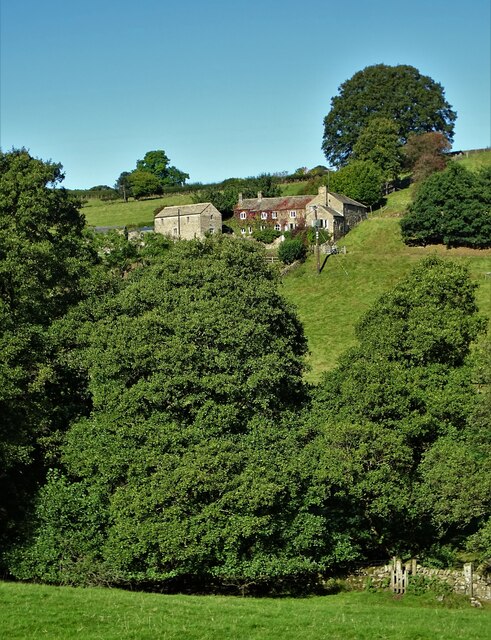
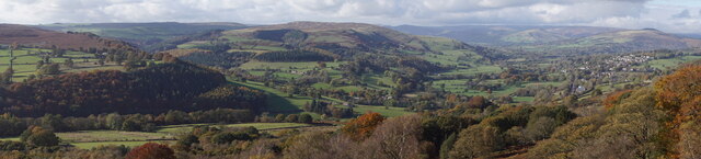
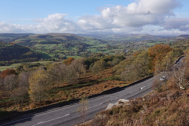
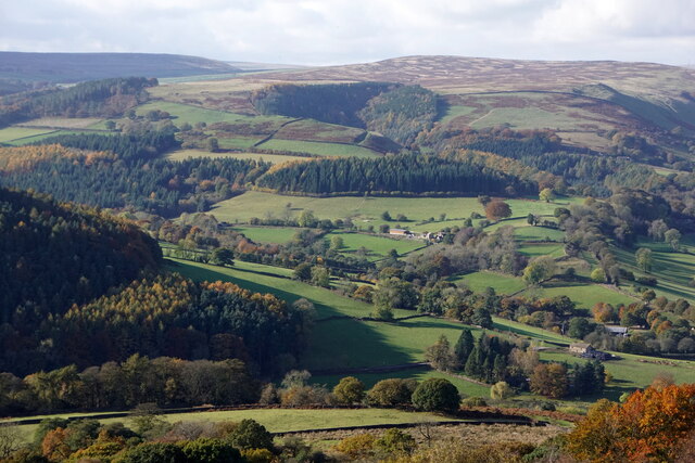
Gorse Piece Plantation is a picturesque woodland located in Derbyshire, England. Covering an area of approximately 200 acres, this enchanting forest is known for its diverse flora and fauna, offering a serene and tranquil escape from the hustle and bustle of everyday life.

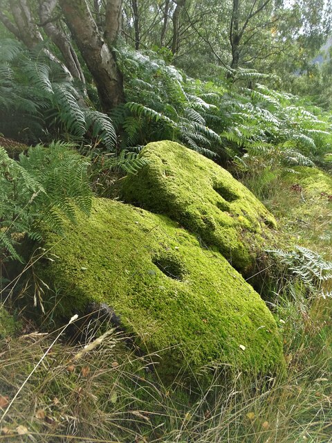
The plantation is predominantly composed of ancient oak trees, creating a dense canopy that provides shade during the summer months. The forest floor is carpeted with a plethora of wildflowers, including bluebells, primroses, and orchids, which bloom in vibrant colors, adding to the enchanting atmosphere of the woodland.

Gorse Piece Plantation is also home to a rich variety of wildlife. Bird enthusiasts will be delighted to spot species such as woodpeckers, owls, and thrushes, while keen-eyed visitors may catch a glimpse of elusive mammals like deer and foxes roaming freely through the trees. The forest is also known for its diverse insect population, with butterflies, bees, and beetles thriving in the woodland habitat.

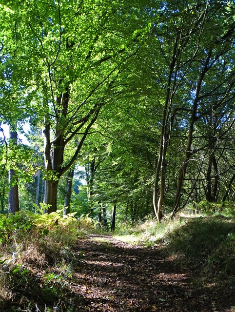
The plantation offers a network of well-maintained walking trails, allowing visitors to explore the beauty of the woodland at their own pace. These trails wind through the trees, over babbling brooks, and up gentle hills, offering breathtaking views of the surrounding countryside.

Gorse Piece Plantation is a popular destination for nature lovers, hikers, and photographers alike. Its natural beauty, peaceful atmosphere, and abundant wildlife make it a truly remarkable place to visit and immerse oneself in the wonders of nature.

If you have any feedback on the listing, please let us know in the comments section below.

Gorse Piece Plantation Images

Images are sourced within 2km of 53.330807/-1.646182 or Grid Reference SK2381. Thanks to Geograph Open Source API. All images are credited.

Hazelford Hall above The Hope Valley
Drystone wall  with view to Broadhay
Drystone wall with view to Broadhay
Moss covered and abandoned millstones In Oxhay Wood. It is said that a day arrived in the early twentieth century when the demand for millstones suddenly dried up.
Moss covered and abandoned millstones
In Oxhay Wood. It is said that a day arrived in the early twentieth century when the demand for millstones suddenly dried up.
Towards the railway A DB class 66 hauls a train towards Grindleford on the Hope Valley Line.
Towards the railway
A DB class 66 hauls a train towards Grindleford on the Hope Valley Line.
B6001 above the Derwent Looking along the road between Grindleford and Hathersage.
B6001 above the Derwent
Looking along the road between Grindleford and Hathersage.
Path towards Coppice Wood
On Hathersage Moor Looking north west from the footpath below Over Owler Tor
On Hathersage Moor
Looking north west from the footpath below Over Owler Tor
On Hathersage Moor Looking south east from Over Owler Tor
On Hathersage Moor
Looking south east from Over Owler Tor
On Hathersage Moor Looking north west from Over Owler Tor
On Hathersage Moor
Looking north west from Over Owler Tor
It's not that deep Overtaking on the stepping stones
It's not that deep
Overtaking on the stepping stones
Hay bales wrapped in plastic With Birch Low to the right. One wonders how much plastic is used in this way in The British Isles each year. Farmers never used to use it.
Hay bales wrapped in plastic
With Birch Low to the right. One wonders how much plastic is used in this way in The British Isles each year. Farmers never used to use it.
Broadhay Not to be confused with nearby Broadhay Farm
Broadhay
Not to be confused with nearby Broadhay Farm
In Callow Wood
In Callow Wood
Pheasant feeder near Broadhay
At the junction of Birley Lane and Coggers Lane Looking towards Hope Cement Works in The Hope Valley.
At the junction of Birley Lane and Coggers Lane
Looking towards Hope Cement Works in The Hope Valley.
Surprise View from Millstone Edge
Leadmill, from Surprise View, Millstone Edge
Show me another place!

Gorse Piece Plantation is located at Grid Ref: SK2381 (Lat: 53.330807, Lng: -1.646182)

Administrative County: Derbyshire

District: Derbyshire Dales

Police Authority: Derbyshire

What 3 Words

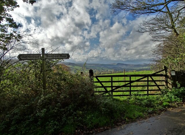
///younger.upstairs.shipyards. Near Hathersage, Derbyshire

Related Wikis

St Michael and All Angels' Church, Hathersage

St Michael and All Angels’ Church, Hathersage, is a Grade I listed parish church in the Church of England in Hathersage, Derbyshire. == History == The...

Hathersage railway station

Hathersage railway station serves the village of Hathersage in the Derbyshire Peak District, in England. == History == The station was opened on 25 June...

Hathersage

Hathersage ( HATHə-sidge) is a village and civil parish in the Peak District in Derbyshire, England. It lies slightly to the north of the River Derwent...

Hood Brook

Hood Brook is a stream in the Derbyshire Peak District, originating near Stanage Edge, close to Robin Hoods Cave. == Background == Hood Brook flows south...

Master's Edge

Master's Edge is an 18-metre (59 ft) gritstone arête that is a rock climbing route in the "Corners Area" of Millstone Edge quarry, in the Peak District...

Higger Tor

Higger Tor or Higgar Tor is a gritstone tor in the Dark Peak, in the north of the Peak District National Park in England. It overlooks the Burbage Valley...

Stanage Edge

Stanage Edge, or simply Stanage (from "stone edge") is a gritstone escarpment in the Peak District, England, famous as a location for climbing. It lies...

Carl Wark

Carl Wark (sometimes Carl's Wark) is a rocky promontory on Hathersage Moor in the Peak District National Park, just inside the boundary of Sheffield, England...

Nearby Amenities

Located within 500m of 53.330807,-1.646182
Barrier: stile
Material: wood
Step Count: 1
Stile: stepover
Lat/Long: 53.3345414/-1.6432836
Hathersage (High Leigh)
Bus: yes
Public Transport: stop_position
Lat/Long: 53.3274009/-1.6491947
Source: Bing
Lat/Long: 53.3289766/-1.6525863
Restaurant
Maazi
Addr City: Hope Valley
Addr Postcode: S32 1BB
Addr Street: Besom Lane
Addr Suburb: Hathersage
Cuisine: indian
Fhrs Id: 1626281
Source: survey
Lat/Long: 53.3307386/-1.6535252
Pharmacy
Lloyds Pharmacy
Opening Hours: Mo-Fr 09:00-17:30; Sa 09:00-17:00
Payment Cash: yes
Source: survey
Wheelchair: limited
Lat/Long: 53.3305585/-1.6525694
Street Lamp
Source: survey
Lat/Long: 53.3307275/-1.6504943
Barrier: stile
Foot: yes
Material: stone
Source: survey;gps
Stile: stepover
Lat/Long: 53.3326939/-1.6509182
Grave of Little John
Historic: memorial
Lat/Long: 53.3329044/-1.6499815
Barrier: kissing_gate
Source: survey;gps
Lat/Long: 53.3338576/-1.6485858
Barrier: cattle_grid
Bicycle: yes
Foot: yes
Motorcycle: yes
Lat/Long: 53.3345769/-1.6437806
Post Box
Post Box Type: wall
Ref: S32 337
Royal Cypher: EIIR
Royal Cypher Wikidata: Q33102113
Lat/Long: 53.3278214/-1.6492688
Bus Stop
Hathersage (Crossland Road)
Bus: yes
Naptan AtcoCode: 1000DHSR3491
Naptan NaptanCode: dbsapmjt
Public Transport: platform
Shelter: no
Lat/Long: 53.3299119/-1.6503044
Bench
Backrest: yes
Lat/Long: 53.328988/-1.6522884
Bench
Backrest: yes
Lat/Long: 53.3287566/-1.6519471
Bench
Backrest: yes
Lat/Long: 53.3287926/-1.6519464
Bench
Backrest: yes
Lat/Long: 53.3288138/-1.6519477
Bench
Backrest: yes
Lat/Long: 53.3290509/-1.6517814
Bench
Backrest: yes
Lat/Long: 53.3289091/-1.6519403
Bench
Backrest: yes
Lat/Long: 53.3289336/-1.6519357
Hathersage (Crossland Road)
Bus: yes
Public Transport: stop_position
Lat/Long: 53.3299183/-1.6502036
Hathersage (Crossland Road)
Bus: yes
Public Transport: stop_position
Lat/Long: 53.3302452/-1.6501989
Post Box
Collection Times: Mo-Fr 09:00; Sa 07:00
Post Box Type: wall
Ref: S32 575D
Royal Cypher: GR
Royal Cypher Wikidata: Q33102273
Lat/Long: 53.3320084/-1.6497206
Drinking Water
Indoor: yes
Lat/Long: 53.3306612/-1.6534517
Defibrillator
Access: yes
Check Date: 2023-03-08
Defibrillator Location En: On outside wall.
Emergency: defibrillator
Indoor: no
Lat/Long: 53.3319716/-1.6495804
Entrance: yes
Lat/Long: 53.3319224/-1.6494323
Bus Stop
Hathersage (High Leigh)
Bus: yes
Naptan AtcoCode: 1000DHSR3492
Naptan NaptanCode: dbsapmjw
Public Transport: platform
Lat/Long: 53.3277474/-1.6492556
Bus Stop
Hathersage (High Leigh)
Bus: yes
Naptan AtcoCode: 1000DHSR3493
Naptan NaptanCode: dbsapmpa
Public Transport: platform
Lat/Long: 53.3273723/-1.6492414
Hathersage (High Leigh)
Bus: yes
Public Transport: stop_position
Lat/Long: 53.3277391/-1.6493206
Bus Stop
Hathersage (Crossland Road)
Bus: yes
Naptan AtcoCode: 1000DHSR3490
Naptan NaptanCode: dbsapmjp
Public Transport: platform
Shelter: no
Lat/Long: 53.3302332/-1.6501315
Generator Method: photovoltaic
Generator Output Electricity: yes
Generator Source: solar
Generator Type: solar_photovoltaic_panel
Location: roof
Power: generator
Lat/Long: 53.3325979/-1.6466668
Generator Method: photovoltaic
Generator Output Electricity: yes
Generator Source: solar
Generator Type: solar_photovoltaic_panel
Location: roof
Power: generator
Lat/Long: 53.3325992/-1.6464011
Generator Method: photovoltaic
Generator Output Electricity: yes
Generator Source: solar
Generator Type: solar_photovoltaic_panel
Location: roof
Power: generator
Lat/Long: 53.3323188/-1.6469646
Generator Method: photovoltaic
Generator Output Electricity: yes
Generator Source: solar
Generator Type: solar_photovoltaic_panel
Location: roof
Power: generator
Lat/Long: 53.332621/-1.6446716
Generator Method: photovoltaic
Generator Output Electricity: yes
Generator Source: solar
Generator Type: solar_photovoltaic_panel
Location: roof
Power: generator
Lat/Long: 53.3321786/-1.6426543
Generator Method: photovoltaic
Generator Output Electricity: yes
Generator Source: solar
Generator Type: solar_photovoltaic_panel
Location: roof
Power: generator
Lat/Long: 53.3288358/-1.6504857
Bench
Backrest: yes
Lat/Long: 53.3307954/-1.652004
Bench
Lat/Long: 53.3326358/-1.6510324
Bench
Lat/Long: 53.3327564/-1.6507476
Bench
Lat/Long: 53.3323373/-1.6513447
Bench
Lat/Long: 53.3325362/-1.6512588
Camp Green
Archaeological Site: fortification
Fortification Type: hill_fort
Historic: archaeological_site
Lat/Long: 53.3335725/-1.6491416
Historic: milepost
Lat/Long: 53.3306682/-1.6514219
Bench
Backrest: yes
Direction: W
Material: wood
Lat/Long: 53.3291578/-1.6509437
Bench
Backrest: yes
Direction: W
Material: wood
Lat/Long: 53.3290913/-1.6509638
Bench
Backrest: yes
Lat/Long: 53.3295426/-1.6504079
Leisure: fitness_station
Sport: fitness
Lat/Long: 53.3290325/-1.6514462
Bicycle Repair Station
Service Bicycle Pump: yes
Lat/Long: 53.3305741/-1.6534609
The data included in this document is from www.openstreetmap.org. The data is made available under ODbL.

Have you been to Gorse Piece Plantation?

Leave your review of Gorse Piece Plantation below (or comments, questions and feedback).