Carrs Wood

Wood, Forest in Derbyshire Derbyshire Dales

England

Carrs Wood

Path down from Stanton Moor
Path down from Stanton Moor Credit: David Lally

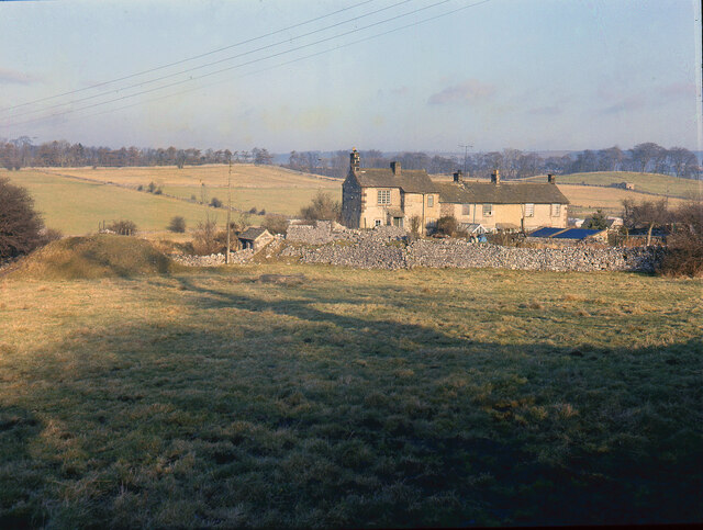
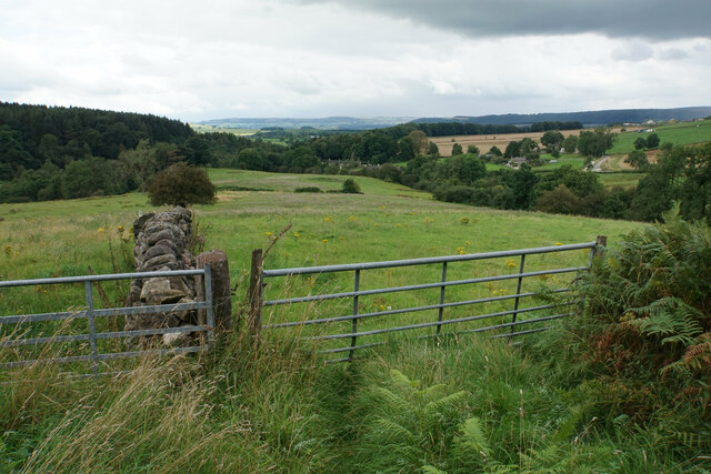
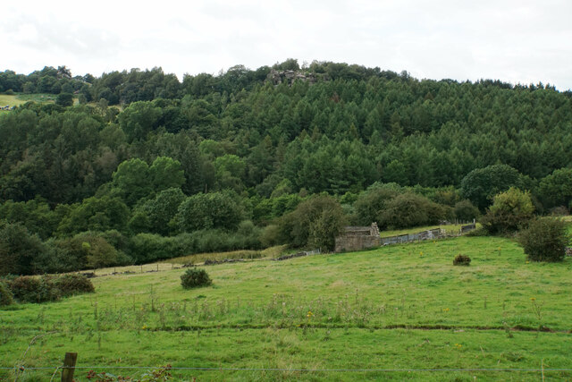
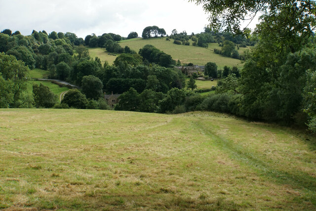
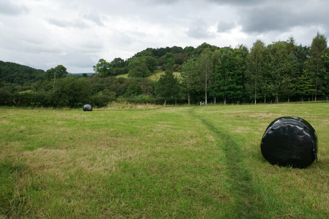
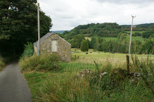
Carrs Wood is a picturesque forest located in Derbyshire, England. Covering an area of approximately 100 hectares, it is known for its diverse flora and fauna, making it a popular destination for nature enthusiasts and hikers alike.

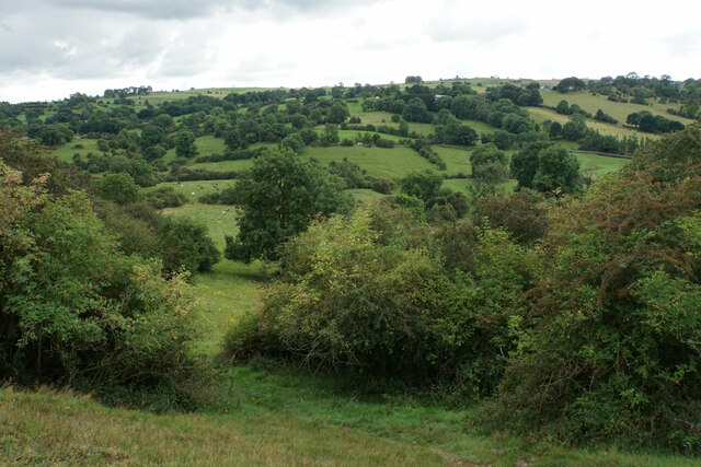
The wood is primarily composed of broadleaf trees, including oak, beech, and birch, which create a stunning and vibrant canopy during the summer months. In the autumn, the forest transforms into a tapestry of warm hues, as the leaves change color and create a breathtaking display.

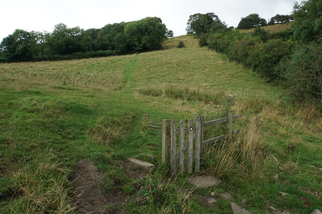
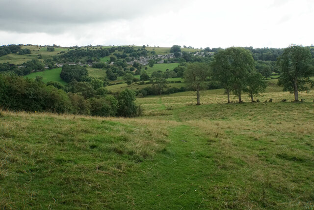
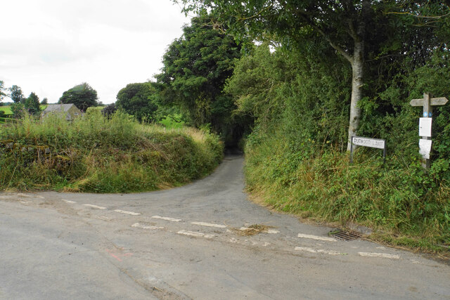
Traversing through Carrs Wood, visitors can find a network of well-maintained trails and footpaths, allowing them to explore the area at their own pace. These paths lead to various points of interest, such as secluded ponds, where one can observe a variety of aquatic plants and wildlife.

The forest is home to a rich diversity of animal species, including deer, badgers, foxes, and numerous bird species. Birdwatchers often visit Carrs Wood in search of rarer species, such as the great spotted woodpecker or the tawny owl.

For those seeking tranquility and solitude, the wood offers several secluded areas, perfect for picnics or simply enjoying the peaceful surroundings. The sound of birdsong and the gentle rustling of leaves create a serene atmosphere, providing an escape from the hustle and bustle of everyday life.

Overall, Carrs Wood is a natural gem in Derbyshire, offering a delightful blend of scenic beauty, biodiversity, and serene ambiance. Whether one is a nature enthusiast, a hiker, or simply seeking a peaceful retreat, this forest is a must-visit destination.

If you have any feedback on the listing, please let us know in the comments section below.

Carrs Wood Images

Images are sourced within 2km of 53.161936/-1.6594915 or Grid Reference SK2262. Thanks to Geograph Open Source API. All images are credited.

Path down from Stanton Moor
Leaning oak Wind-blown on Stanton Moor.
Leaning oak
Wind-blown on Stanton Moor.
Broadmeadow Shaft Adjacent to the cottages here, which were once the offices of the Alport Mining Company, can be seen a large mound which marks the site of the Broadmeadow Shaft on the Alport mines. This company was an amalgamation of various separate mining concerns and operated the very rich lead mines of this area. They were classed as the most heavily watered mines in the country and suffered from inflows of more than 6000 gallons a minute. Consequently, heavy pumping was necessary, chiefly by water pressure engines which used a column of water to power them. The well known Cornish engineer, Richard Trevithick was consulted and he was responsible for the first of many such underground machines within this region. Water to power the engine in this shaft was taken from the River Lathkill and over Alport village in wooden launders and then by a tunnel to the shaft. All the pumped water, along with that used by the engines (of which there were upwards of seven scattered throughout the workings) was drained away by the deep Hillcarr Sough, a tunnel driven from the River Derwent near Darley Dale.
Broadmeadow Shaft
Adjacent to the cottages here, which were once the offices of the Alport Mining Company, can be seen a large mound which marks the site of the Broadmeadow Shaft on the Alport mines. This company was an amalgamation of various separate mining concerns and operated the very rich lead mines of this area. They were classed as the most heavily watered mines in the country and suffered from inflows of more than 6000 gallons a minute. Consequently, heavy pumping was necessary, chiefly by water pressure engines which used a column of water to power them. The well known Cornish engineer, Richard Trevithick was consulted and he was responsible for the first of many such underground machines within this region. Water to power the engine in this shaft was taken from the River Lathkill and over Alport village in wooden launders and then by a tunnel to the shaft. All the pumped water, along with that used by the engines (of which there were upwards of seven scattered throughout the workings) was drained away by the deep Hillcarr Sough, a tunnel driven from the River Derwent near Darley Dale.
Cottages in Stanton in Peak A long thin village climbing the hillside. A shower is passing a couple of miles to the north.
Cottages in Stanton in Peak
A long thin village climbing the hillside. A shower is passing a couple of miles to the north.
Cottages in Stanton in Peak Near the bottom of the long thin village.
Cottages in Stanton in Peak
Near the bottom of the long thin village.
Field at Stanton in Peak Right at the bottom of the village.
Field at Stanton in Peak
Right at the bottom of the village.
Stanton in Peak From the bottom of the village looking up. The spire of Holy Trinity Church is seen but the village continues quite a long way past that.
Stanton in Peak
From the bottom of the village looking up. The spire of Holy Trinity Church is seen but the village continues quite a long way past that.
Stanton in Peak The village pub, the Flying Childers, is straight ahead, and the spire of Holy Trinity Church is behind.
Stanton in Peak
The village pub, the Flying Childers, is straight ahead, and the spire of Holy Trinity Church is behind.
Path to Birchover It is necessary to climb up Birchover Edge.
Path to Birchover
It is necessary to climb up Birchover Edge.
Path to Winster The village of Winster is seen on the hill ahead.
Path to Winster
The village of Winster is seen on the hill ahead.
Fields near Birchover The village is seen in the background from this point on Birchover Edge.
Fields near Birchover
The village is seen in the background from this point on Birchover Edge.
Fields below Birchover Edge Looking roughly towards Winster which is slightly off to the left.
Fields below Birchover Edge
Looking roughly towards Winster which is slightly off to the left.
Fields below Birchover Looking down towards the valley of Ivy Bar Brook.
Fields below Birchover
Looking down towards the valley of Ivy Bar Brook.
Ruined barn near Birchover Hermit's Cave and Robin Hood's Stride are rocky outcrops on the opposite hill.
Ruined barn near Birchover
Hermit's Cave and Robin Hood's Stride are rocky outcrops on the opposite hill.
Path towards Elton Elton is over the top of the hill seen ahead.
Path towards Elton
Elton is over the top of the hill seen ahead.
Path to Birchover The path leaves Dudwood Lane by Meadowside Farm. The field has been harvested for silage.
Path to Birchover
The path leaves Dudwood Lane by Meadowside Farm. The field has been harvested for silage.
Barn by Dudwood Lane The valley of Ivy Bar Brook is down to the right, and Bradley Rocks are in the trees on the other side.
Barn by Dudwood Lane
The valley of Ivy Bar Brook is down to the right, and Bradley Rocks are in the trees on the other side.
The top of Dudwood Lane The lane is also the route of the Limestone Way.
The top of Dudwood Lane
The lane is also the route of the Limestone Way.
Show me another place!

Carrs Wood is located at Grid Ref: SK2262 (Lat: 53.161936, Lng: -1.6594915)

Administrative County: Derbyshire

District: Derbyshire Dales

Police Authority: Derbyshire

What 3 Words

///astounded.tricycle.kings. Near Youlgreave, Derbyshire

Related Wikis

Nine Stones Close

Nine Stones Close, also known as the Grey Ladies, is a stone circle on Harthill Moor in Derbyshire in the English East Midlands. It is part of a tradition...

Harthill, Derbyshire

Harthill is a civil parish within the Derbyshire Dales district, in the county of Derbyshire, England. Largely rural, along with parts of the neighbouring...
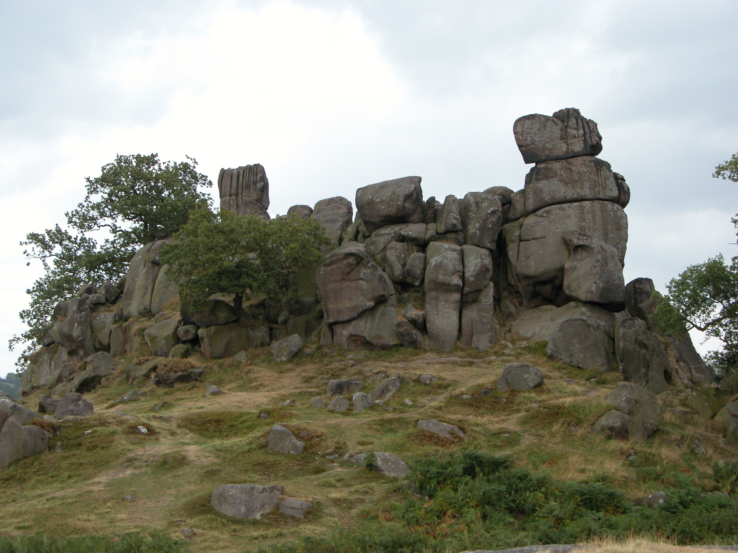
Robin Hood's Stride

Robin Hood's Stride (also known as Mock Beggar's Mansion) is a rock formation on the Limestone Way in Derbyshire close to the village of Elton. The nearest...

Doll Tor

Doll Tor is a stone circle located just to the west of Stanton Moor, near the village of Birchover, Derbyshire in the English East Midlands. Doll Tor is...

St Michael's Church, Birchover

St Michael's Church, Birchover, also known as Rowtor Chapel, is a Grade II listed parish church in the Church of England in Birchover, Derbyshire. Located...
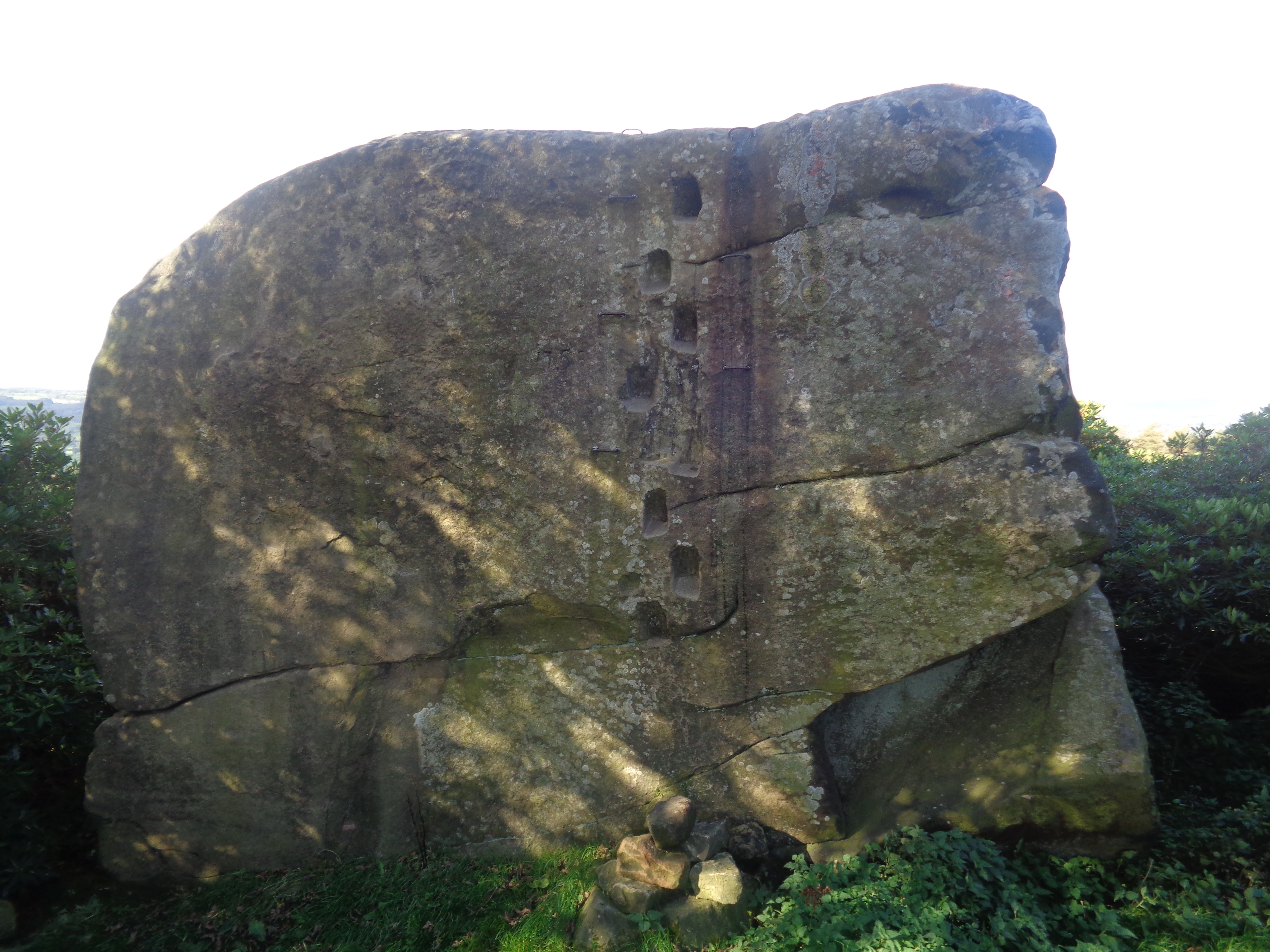
Andle Stone

The Andle Stone is a large gritstone boulder on Stanton Moor in Derbyshire. The stone block is 6m long, 4m high and lies within a low, circular, dry stone...

Harthill Moor

Harthill Moor is a small upland area in the Derbyshire Peak District of central and northern England, lying between Matlock and Bakewell near the villages...

Birchover

Birchover is a village and civil parish in the Peak District National Park in Derbyshire, England, five miles north-west of Matlock. At the 2001 Census...

Nearby Amenities

Located within 500m of 53.161936,-1.6594915
Barrier: stile
Lat/Long: 53.1587262/-1.6561118
Bus Stop
Bus: yes
Public Transport: platform
Lat/Long: 53.1606088/-1.6549124
Bus Stop
Bus: yes
Public Transport: platform
Lat/Long: 53.1607632/-1.6549639
Barrier: stile
Ele: 230.0000000
Steps: 1
Stile: wall
Lat/Long: 53.1579691/-1.662049
Barrier: entrance
Source: survey;gps
Lat/Long: 53.1633808/-1.6664246
Hermits Cave
Natural: cave_entrance
Lat/Long: 53.1577095/-1.6607304
Crucifixion
Artwork Type: sculpture
Material: stone
Tourism: artwork
Lat/Long: 53.1577115/-1.6607043
The data included in this document is from www.openstreetmap.org. The data is made available under ODbL.

Have you been to Carrs Wood?

Leave your review of Carrs Wood below (or comments, questions and feedback).