Ashlade Firs

Wood, Forest in Wiltshire

England

Ashlade Firs

The A4 passes Voronzoff Wood Voronzoff Wood is also known as Little Frith Wood. I have been unable to establish the reason for the name.  It adjoins Savernake Forest.  There is a long layby opposite it on the north side of the A4, but despite what the maps imply there is no longer a layby opposite and a little further east.
The A4 passes Voronzoff Wood Credit: HelenK

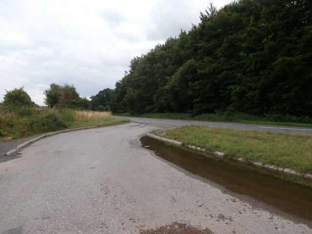
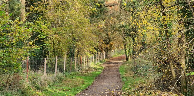
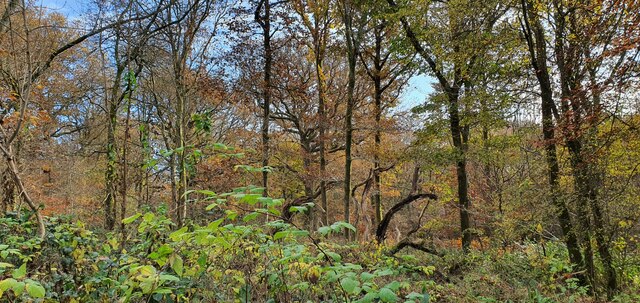
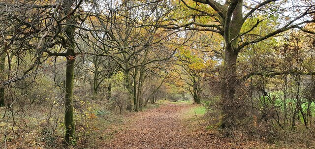
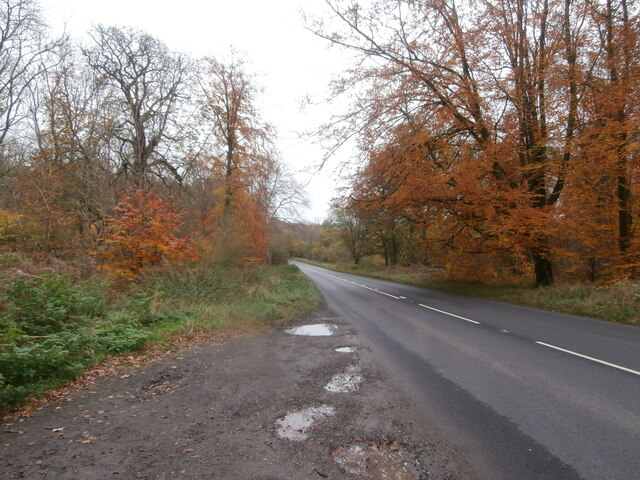
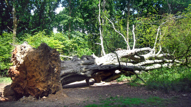
Ashlade Firs is a wood located in the county of Wiltshire, England. Situated in the southern part of the county, it is nestled within the picturesque countryside and covers an area of approximately 100 acres. The wood is predominantly made up of various species of trees, including oak, beech, and ash, hence its name.

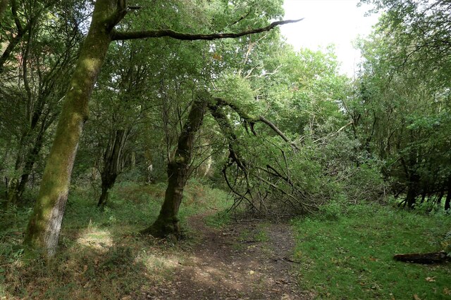
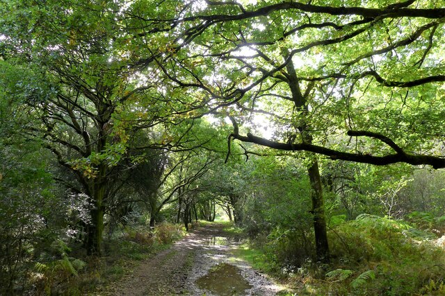
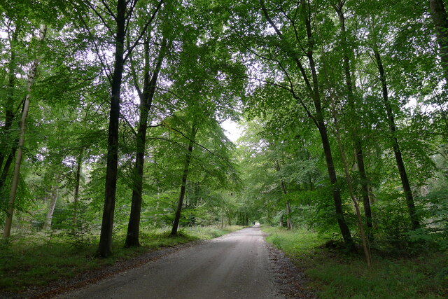
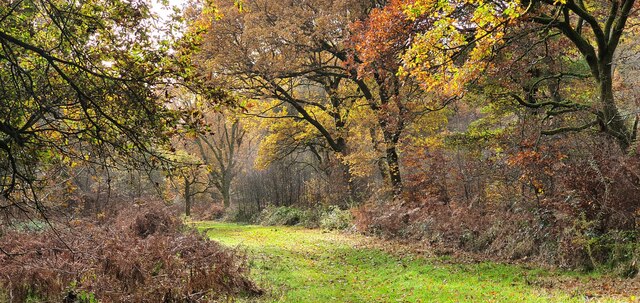
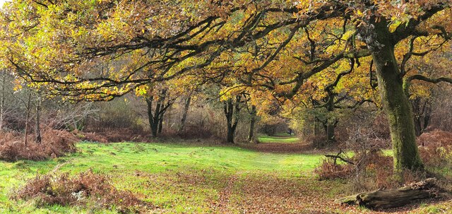
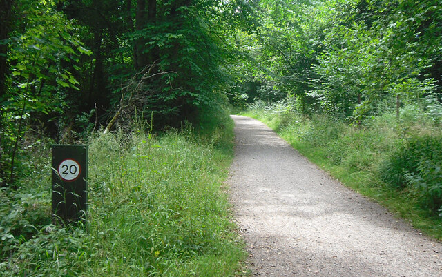
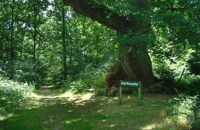
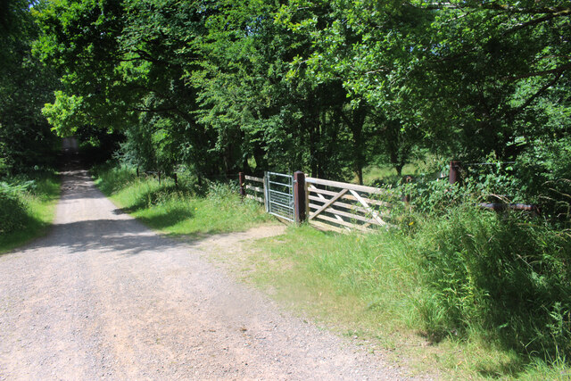
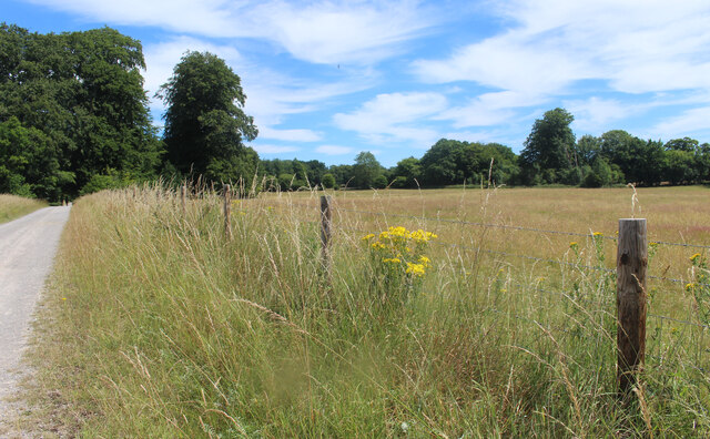
Known for its natural beauty and tranquility, Ashlade Firs attracts both locals and visitors who seek a peaceful retreat amidst nature. The wood offers a range of recreational activities, such as walking, hiking, and birdwatching. There are several well-marked trails that meander through the wood, allowing visitors to explore its diverse flora and fauna.

The forest floor is covered in a carpet of bluebells during spring, creating a stunning visual spectacle for those who visit at that time of year. Additionally, the wood is home to a variety of wildlife, including deer, foxes, and a wide range of bird species, making it a popular spot for nature enthusiasts and photographers.

Ashlade Firs is well-maintained by local authorities, ensuring the preservation of its natural habitat. The wood is easily accessible, with several nearby parking areas and public footpaths leading to its entrance. Visitors are encouraged to respect the environment and adhere to any guidelines or regulations in place to protect the wood and its inhabitants.

Overall, Ashlade Firs is a captivating woodland retreat in Wiltshire, offering a serene and immersive experience in nature for all who venture within its boundaries.

If you have any feedback on the listing, please let us know in the comments section below.

Ashlade Firs Images

Images are sourced within 2km of 51.407116/-1.6739245 or Grid Reference SU2267. Thanks to Geograph Open Source API. All images are credited.

The A4 passes Voronzoff Wood Voronzoff Wood is also known as Little Frith Wood. I have been unable to establish the reason for the name.  It adjoins Savernake Forest.  There is a long layby opposite it on the north side of the A4, but despite what the maps imply there is no longer a layby opposite and a little further east.
The A4 passes Voronzoff Wood
Voronzoff Wood is also known as Little Frith Wood. I have been unable to establish the reason for the name. It adjoins Savernake Forest. There is a long layby opposite it on the north side of the A4, but despite what the maps imply there is no longer a layby opposite and a little further east.
Broken ash, Great Lodge Bottom, Savernake Forest Savernake Forest is a 4,500 acre estate believed to hold the highest concentration of 'veteran' oak and beech trees in Europe. First mentioned as 'Safernoc' in the 10th century (and therefore older than the 'New Forest'), the area came under Norman ownership after the Conquest of 1066, and subsequently passed down an unbroken line of family ownership. It is the only forest in Britain still in private hands, but the family trustees administering the estate allow extensive, free public access (closed on only one day in the year), and the estate is managed by the Forestry Commission on a 999 year lease. <span class="nowrap"><a title="https://www.savernakeestate.co.uk/" rel="nofollow ugc noopener" href="https://www.savernakeestate.co.uk/">Link</a><img style="margin-left:2px;" alt="External link" title="External link - shift click to open in new window" src="https://s1.geograph.org.uk/img/external.png" width="10" height="10"/></span>
Broken ash, Great Lodge Bottom, Savernake Forest
Savernake Forest is a 4,500 acre estate believed to hold the highest concentration of 'veteran' oak and beech trees in Europe. First mentioned as 'Safernoc' in the 10th century (and therefore older than the 'New Forest'), the area came under Norman ownership after the Conquest of 1066, and subsequently passed down an unbroken line of family ownership. It is the only forest in Britain still in private hands, but the family trustees administering the estate allow extensive, free public access (closed on only one day in the year), and the estate is managed by the Forestry Commission on a 999 year lease. LinkExternal link
Great Lodge Bottom, Savernake Forest The track follows a shallow chalk valley heading towards Great Lodge Farm on the edge of the forest.
Great Lodge Bottom, Savernake Forest
The track follows a shallow chalk valley heading towards Great Lodge Farm on the edge of the forest.
Grand Avenue, Savernake Forest "Running right through the middle of the Forest is Capability Brown's 'Grand Avenue'. This avenue of beech trees - now a Private Road - was laid out in the late 1790's, and at just over 4 miles long it stands in the Guinness Book of Records as the longest Avenue in Britain." <span class="nowrap"><a title="https://www.savernakeestate.co.uk/" rel="nofollow ugc noopener" href="https://www.savernakeestate.co.uk/">Link</a><img style="margin-left:2px;" alt="External link" title="External link - shift click to open in new window" src="https://s1.geograph.org.uk/img/external.png" width="10" height="10"/></span>
Grand Avenue, Savernake Forest
"Running right through the middle of the Forest is Capability Brown's 'Grand Avenue'. This avenue of beech trees - now a Private Road - was laid out in the late 1790's, and at just over 4 miles long it stands in the Guinness Book of Records as the longest Avenue in Britain." LinkExternal link
Savernake Forest, Wiltshire Looking southeast along a track in Savernake Forest in the vicinity of Furze Coppice.
Savernake Forest, Wiltshire
Looking southeast along a track in Savernake Forest in the vicinity of Furze Coppice.
Savernake Forest, Wiltshire Looking south within Savernake Forest in the vicinity of Furze Coppice.
Savernake Forest, Wiltshire
Looking south within Savernake Forest in the vicinity of Furze Coppice.
Savernake Forest, Wiltshire A track within Savernake Forest, in the vicinity of Great Lodge Bottom.
Savernake Forest, Wiltshire
A track within Savernake Forest, in the vicinity of Great Lodge Bottom.
Savernake Forest, Wiltshire A view along Great Lodge Bottom within Savernake Forest.
Savernake Forest, Wiltshire
A view along Great Lodge Bottom within Savernake Forest.
Savernake Forest, Wiltshire A view along Great Lodge Bottom in the vicinity of Cadley, within Savernake Forest.
Savernake Forest, Wiltshire
A view along Great Lodge Bottom in the vicinity of Cadley, within Savernake Forest.
The A4 passes through Savernake Forest Laybys on stretches of road passing through privately-owned woodland tend to be few and far between, and poorly maintained.  This short and narrow layby beside the eastbound A4 in Savernake Forest was covered in deep puddles.  However the reward for stopping was the sight of magnificent autumn colour on the beech trees.
The A4 passes through Savernake Forest
Laybys on stretches of road passing through privately-owned woodland tend to be few and far between, and poorly maintained. This short and narrow layby beside the eastbound A4 in Savernake Forest was covered in deep puddles. However the reward for stopping was the sight of magnificent autumn colour on the beech trees.
Speed Limit on the Bridleway Church Walk, Savernake Forest, a public bridleway. Not sure who the speed limit is there for. Can you do 20 mph on a horse. Maybe.
Speed Limit on the Bridleway
Church Walk, Savernake Forest, a public bridleway. Not sure who the speed limit is there for. Can you do 20 mph on a horse. Maybe.
Old Paunchy beside Church Walk A specially named old oak tree with a strange bulge on one side.
Church Walk heads towards the now closed Christ Church at Cadley. It is the only marked public bridleway in the forest, although this is now a bit of a technicality as the forest is access land and all the tracks are available.
Old Paunchy beside Church Walk
A specially named old oak tree with a strange bulge on one side. Church Walk heads towards the now closed Christ Church at Cadley. It is the only marked public bridleway in the forest, although this is now a bit of a technicality as the forest is access land and all the tracks are available.
Close Up of Old Paunchy An ancient oak tree with a strange bulge on one side, hence the unusual name.
It actually looks like a nasty growth of some kind, with a bit of fungus for good measure, but Old Paunchy seems to be soldiering on well enough despite it.
Close Up of Old Paunchy
An ancient oak tree with a strange bulge on one side, hence the unusual name. It actually looks like a nasty growth of some kind, with a bit of fungus for good measure, but Old Paunchy seems to be soldiering on well enough despite it.
Fallen Tree in Savernake Forest An old warrior bites the dust along one of the tracks in the western part of the forest.
Fallen Tree in Savernake Forest
An old warrior bites the dust along one of the tracks in the western part of the forest.
Clearing at Thornhill The clear area is now a lot smaller than shown on older maps, where it is named as Thornhill Nursery.
The trees beyond the grassy bit are all quite young as the area returns to forest.
I don't know what goes on here now. There is a wooden building, now called Thornhill, and some sheds. Maybe a fieldwork cabin or something like that.
Clearing at Thornhill
The clear area is now a lot smaller than shown on older maps, where it is named as Thornhill Nursery. The trees beyond the grassy bit are all quite young as the area returns to forest. I don't know what goes on here now. There is a wooden building, now called Thornhill, and some sheds. Maybe a fieldwork cabin or something like that.
Great Lodge Drive, Savernake Forest One of the main tracks in the forest, with restricted access to vehicles. Other access includes less well surfaced tracks, bridleways, and narrow foot trails through the trees. Nearly all the forest is accessible.
"Savernake Forest is the only ancient forest in Britain still in private ownership having passed through 31 generations of "forest wardens" Wikipedia <span class="nowrap"><a title="https://en.wikipedia.org/wiki/Savernake_Forest" rel="nofollow ugc noopener" href="https://en.wikipedia.org/wiki/Savernake_Forest">Link</a><img style="margin-left:2px;" alt="External link" title="External link - shift click to open in new window" src="https://s1.geograph.org.uk/img/external.png" width="10" height="10"/></span>
"Since 1939 the timber of the forest has been managed by Forestry England on a 999-year lease. The private status of Savernake Forest is maintained by shutting the forest to the public one day per year."
Great Lodge Drive, Savernake Forest
One of the main tracks in the forest, with restricted access to vehicles. Other access includes less well surfaced tracks, bridleways, and narrow foot trails through the trees. Nearly all the forest is accessible. "Savernake Forest is the only ancient forest in Britain still in private ownership having passed through 31 generations of "forest wardens" Wikipedia LinkExternal link "Since 1939 the timber of the forest has been managed by Forestry England on a 999-year lease. The private status of Savernake Forest is maintained by shutting the forest to the public one day per year."
Barrier on Great Lodge Drive Great Lodge Drive is one of the main forest tracks. Vehicle access is restricted. Here it goes through one of the grassy clearings in the central part of the forest.
Barrier on Great Lodge Drive
Great Lodge Drive is one of the main forest tracks. Vehicle access is restricted. Here it goes through one of the grassy clearings in the central part of the forest.
Meadow by Great Lodge Drive There are several areas of open grassland like this in the middle of Savernake Forest.
Meadow by Great Lodge Drive
There are several areas of open grassland like this in the middle of Savernake Forest.
Show me another place!

Ashlade Firs is located at Grid Ref: SU2267 (Lat: 51.407116, Lng: -1.6739245)

Unitary Authority: Wiltshire

Police Authority: Wiltshire

What 3 Words

///fermented.cowboy.joystick. Near Mildenhall, Wiltshire

Related Wikis

Cunetio Hoard

The Cunetio Hoard, also known as the Mildenhall Hoard, is the largest hoard of Roman coins found in Britain. It was discovered in 1978 at the site of the...

Cunetio

Cunetio was a large walled town in a valley of the River Kennet in modern-day Wiltshire, England. The settlement was occupied from the 2nd century CE by...

Axford, Wiltshire

Axford is a small village in Ramsbury parish in the English county of Wiltshire. It lies on the north bank of the River Kennet, about 3 miles (4.8 km)...

Mildenhall, Wiltshire

Mildenhall ( MY-nəl) is a village and civil parish in the Kennet Valley in Wiltshire, England, immediately east of the market town of Marlborough. The...

Nearby Amenities

Located within 500m of 51.407116,-1.6739245
Ashlade Firs
Place: locality
Lat/Long: 51.4071198/-1.6763701
The data included in this document is from www.openstreetmap.org. The data is made available under ODbL.

Have you been to Ashlade Firs?

Leave your review of Ashlade Firs below (or comments, questions and feedback).