Burke Wood

Wood, Forest in Yorkshire

England

Burke Wood

Rugby pitches at Bramley Fall
Rugby pitches at Bramley Fall Credit: David Martin

Burke Wood is a picturesque forest located in the Yorkshire region of England. Spread across a vast area, it is known for its serene beauty and rich biodiversity. The forest is situated in close proximity to the town of Yorkshire, making it easily accessible for visitors.

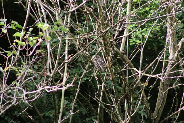
The wood is primarily composed of a mix of deciduous and coniferous trees, including oak, beech, pine, and spruce. These trees create a lush green canopy, providing a peaceful and tranquil environment for nature enthusiasts. Wildlife thrives in Burke Wood, with a diverse range of species calling it their home. Visitors may spot deer, foxes, badgers, and a variety of bird species during their exploration.

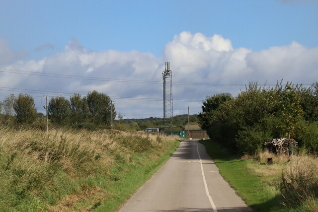
The forest offers numerous walking trails, allowing visitors to immerse themselves in its natural splendor. The trails wind through the woods, offering glimpses of babbling brooks, hidden glades, and stunning viewpoints. The forest is also renowned for its beautiful bluebell displays during the springtime, attracting photographers and nature lovers from all around.

Burke Wood is not only a haven for wildlife and nature enthusiasts but also a popular destination for outdoor activities. It provides opportunities for camping, picnicking, and even organized events such as orienteering and forest school activities. The forest management ensures its preservation and sustainability, allowing future generations to enjoy its beauty.

In conclusion, Burke Wood in Yorkshire is a captivating forest that offers a peaceful retreat amidst nature's splendor. With its diverse flora and fauna, scenic trails, and various recreational opportunities, it is a must-visit destination for anyone seeking solace in the beauty of the Yorkshire countryside.

If you have any feedback on the listing, please let us know in the comments section below.
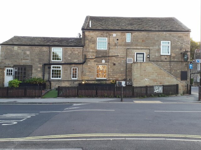
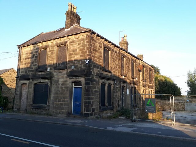
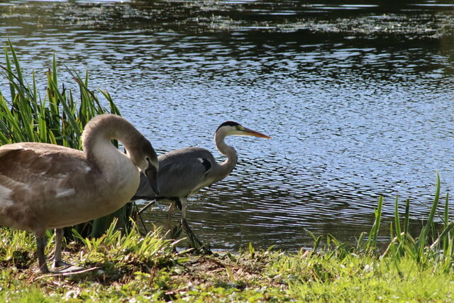
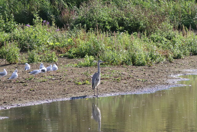
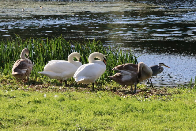
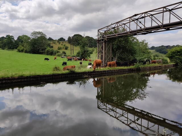
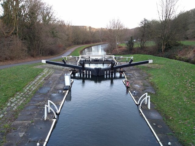
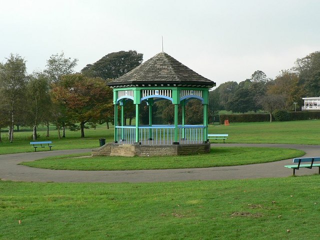
Burke Wood Images

Images are sourced within 2km of 53.832724/-1.6554007 or Grid Reference SE2237. Thanks to Geograph Open Source API. All images are credited.

Rugby pitches at Bramley Fall
Collapsed weir on the River Aire at Newlay Newlay Weir collapsed in early February 2021, during a period of very high river levels caused by recent heavy rain and snow.
The first pictures appeared locally on social media on 4th February, where you could see that water was lower in the centre of the weir. By 9th February, a large section had collapsed, leaving the river level at least a metre below the top of the weir. The water was flowing through a gap between 5 and 10 metres wide. The altered flow has washed away some of the bank just downstream, causing a large tree to fall into the water. It was also reported that contractors working on construction of the fish pass lost some equipment into the river.
The river under Newlay Bridge is now a metre lower than normal summer levels, leaving parts of the banks exposed which are normally under water.
The weir is a Grade II Listed structure (see English Heritage <span class="nowrap"><a title="https://historicengland.org.uk/listing/the-list/list-entry/1375482" rel="nofollow ugc noopener" href="https://historicengland.org.uk/listing/the-list/list-entry/1375482">Link</a><img style="margin-left:2px;" alt="External link" title="External link - shift click to open in new window" src="https://s1.geograph.org.uk/img/external.png" width="10" height="10"/></span> ). There are various reports of its age - the first weir may have been built by monks from Kirkstall Abbey. It is clear that a weir existed by the late 17th century, and the present weir dates from the 19th century. The purpose of the weir was to divert water along a goit (channel) towards Kirkstall Forge (which certainly has its origins as a corn mill built by the monks). By the late 18th century Beecroft and Butler were using the forge to make wrought iron. The goit fed into a dam from where it drove 3 waterwheels which operated drop hammers in the forge. (See <a href="https://www.geograph.org.uk/photo/6088288">SE2536 : Remains of the Kirkstall Forge </a>). 2 of the water wheels and parts of the original building still exist and are Grade II listed.
Collapsed weir on the River Aire at Newlay
Newlay Weir collapsed in early February 2021, during a period of very high river levels caused by recent heavy rain and snow. The first pictures appeared locally on social media on 4th February, where you could see that water was lower in the centre of the weir. By 9th February, a large section had collapsed, leaving the river level at least a metre below the top of the weir. The water was flowing through a gap between 5 and 10 metres wide. The altered flow has washed away some of the bank just downstream, causing a large tree to fall into the water. It was also reported that contractors working on construction of the fish pass lost some equipment into the river. The river under Newlay Bridge is now a metre lower than normal summer levels, leaving parts of the banks exposed which are normally under water. The weir is a Grade II Listed structure (see English Heritage LinkExternal link ). There are various reports of its age - the first weir may have been built by monks from Kirkstall Abbey. It is clear that a weir existed by the late 17th century, and the present weir dates from the 19th century. The purpose of the weir was to divert water along a goit (channel) towards Kirkstall Forge (which certainly has its origins as a corn mill built by the monks). By the late 18th century Beecroft and Butler were using the forge to make wrought iron. The goit fed into a dam from where it drove 3 waterwheels which operated drop hammers in the forge. (See SE2536 : Remains of the Kirkstall Forge ). 2 of the water wheels and parts of the original building still exist and are Grade II listed.
Newlay Bridge Bridge across the River Aire.
Newlay Bridge
Bridge across the River Aire.
The top section of Newlay Lane A steep residential street rising from Newlay Bridge across the River Aire.
The top section of Newlay Lane
A steep residential street rising from Newlay Bridge across the River Aire.
Broadgate Lane shops The parade currently comprises a cleaning agency, hair salon, convenience store (formerly a post office, hence the postbox on the corner), 'business  solutions' and footcare centre.
Broadgate Lane shops
The parade currently comprises a cleaning agency, hair salon, convenience store (formerly a post office, hence the postbox on the corner), 'business solutions' and footcare centre.
The Malt Brewhouse, Horsforth The pub at the top of Broadgate Lane has changed hands since 2009, see <a href="https://www.geograph.org.uk/photo/1605123">SE2438 : Bar 166 & Bistro - Town Street</a>, since which time it has gained the door in the side and steps (presumably as a fire escape).
The Malt Brewhouse, Horsforth
The pub at the top of Broadgate Lane has changed hands since 2009, see SE2438 : Bar 166 & Bistro - Town Street, since which time it has gained the door in the side and steps (presumably as a fire escape).
The Malt Brewhouse, Horsforth - brewery The micropub <a href="https://www.geograph.org.uk/photo/6957844">SE2438 : The Malt Brewhouse, Horsforth</a> brews its own beer in an outhouse, although they do sell others.
The Malt Brewhouse, Horsforth - brewery
The micropub SE2438 : The Malt Brewhouse, Horsforth brews its own beer in an outhouse, although they do sell others.
Shop being refurbished, Long Row, Horsforth
Boarded up houses, Long Row, Horsforth This short terrace looks uninhabited and possibly scheduled for demolition.
Boarded up houses, Long Row, Horsforth
This short terrace looks uninhabited and possibly scheduled for demolition.
Communications Mast at Rodley Nature Reserve Looking down the entrance road heading in to Rodley Nature Reserve towards the Yorkshire Water Works at the far end. This mast carries the EE and Three mobile networks. Photograph taken on 29/09/2021.
Communications Mast at Rodley Nature Reserve
Looking down the entrance road heading in to Rodley Nature Reserve towards the Yorkshire Water Works at the far end. This mast carries the EE and Three mobile networks. Photograph taken on 29/09/2021.
Little Owl Hiding Amongst the Trees at Rodley Nature Reserve A Little Owl observed hiding amongst the trees near the Manager's Hide at Rodley Nature Reserve. Photograph taken on 29/09/2021.
Little Owl Hiding Amongst the Trees at Rodley Nature Reserve
A Little Owl observed hiding amongst the trees near the Manager's Hide at Rodley Nature Reserve. Photograph taken on 29/09/2021.
Heron and Swan Cygnet at Rodley Nature Reserve A Heron and a Swan Cygnet together at Rodley Nature Reserve. Photograph taken on 29/09/2021.
Heron and Swan Cygnet at Rodley Nature Reserve
A Heron and a Swan Cygnet together at Rodley Nature Reserve. Photograph taken on 29/09/2021.
Heron Looking Over the Water at Rodley Nature Reserve A Heron stands looking out over the lake at Rodley Nature Reserve. Photograph taken on 29/09/2021.
Heron Looking Over the Water at Rodley Nature Reserve
A Heron stands looking out over the lake at Rodley Nature Reserve. Photograph taken on 29/09/2021.
A Heron and Swans at Rodley Nature Reserve A Heron and some Swans at Rodley Nature Reserve. Photograph taken on 29/09/2021.
A Heron and Swans at Rodley Nature Reserve
A Heron and some Swans at Rodley Nature Reserve. Photograph taken on 29/09/2021.
Cows Beside the Leeds and Liverpool Canal near Rodley Some Cows grazing in a field beside the Leeds and Liverpool Canal near Rodley, Leeds. Photograph taken on 25/07/2021.
Cows Beside the Leeds and Liverpool Canal near Rodley
Some Cows grazing in a field beside the Leeds and Liverpool Canal near Rodley, Leeds. Photograph taken on 25/07/2021.
Newlay Locks, Leeds and Liverpool Canal, Bramley Photograph taken along the Leeds and Liverpool Canal, at Newlay Locks near Bramley, Leeds. The photograph is looking in the direction of Leeds City Centre. Photograph taken on 29/12/2018.
Newlay Locks, Leeds and Liverpool Canal, Bramley
Photograph taken along the Leeds and Liverpool Canal, at Newlay Locks near Bramley, Leeds. The photograph is looking in the direction of Leeds City Centre. Photograph taken on 29/12/2018.
Dipping Ponds at Rodley Nature Reserve Photograph of a dipping pond at Rodley Nature Reserve. Photograph taken on 28/10/2018.
Dipping Ponds at Rodley Nature Reserve
Photograph of a dipping pond at Rodley Nature Reserve. Photograph taken on 28/10/2018.
Chef Works Europe, Springfield Commercial Centre Photograph showing the front of the Chef Works Europe building located at 7 Springfield Commercial Centre, Bagley Lane, Farsley. Chef Works Europe manufactures and distributes chef clothing and uniforms for restaurants and hotels worldwide. Photograph taken on 13/05/2018.
Chef Works Europe, Springfield Commercial Centre
Photograph showing the front of the Chef Works Europe building located at 7 Springfield Commercial Centre, Bagley Lane, Farsley. Chef Works Europe manufactures and distributes chef clothing and uniforms for restaurants and hotels worldwide. Photograph taken on 13/05/2018.
Show me another place!

Burke Wood is located at Grid Ref: SE2237 (Lat: 53.832724, Lng: -1.6554007)

Division: West Riding

Unitary Authority: Leeds

Police Authority: West Yorkshire

What 3 Words

///silver.alert.gosh. Near Horsforth, West Yorkshire

Related Wikis

Hall Park Ground

Hall Park Ground in Horsforth, near Leeds, Yorkshire, England is a cricket ground. The ground was the location of a first-class cricket match in August...

Horsforth Hall Park

Horsforth Hall Park is a large community park in Horsforth, West Yorkshire, England, approximately six miles from Leeds city centre. The park's attractions...

Calverley and Rodley railway station

Calverley and Rodley railway station, originally called Calverley Bridge Station for the nearby river crossing, is a closed railway station on the line...

Horsforth

Horsforth is a town and civil parish in the City of Leeds, West Yorkshire, England, five miles north-west of Leeds city centre. Historically a village...

Nearby Amenities

Located within 500m of 53.832724,-1.6554007
Traffic Signals
Traffic Signals: signal
Traffic Signals Direction: forward
Lat/Long: 53.834806/-1.6517733
New Road Side Horsforth
Bus: yes
Local Ref: 45013121
Network: Metro West Yorkshire
Public Transport: stop_position
Lat/Long: 53.8351234/-1.64895
Traffic Signals
Lat/Long: 53.8347485/-1.6511903
Traffic Signals
Traffic Signals: signal
Traffic Signals Direction: forward
Lat/Long: 53.8345656/-1.6517844
Rawdon Road Airedale Drive
Bus: yes
Public Transport: stop_position
Lat/Long: 53.8353129/-1.6538976
Crossing
Crossing: unmarked
Crossing Island: no
Crossing Markings: no
Kerb: lowered
Tactile Paving: no
Lat/Long: 53.8351375/-1.6492809
Traffic Calming: cushion
Lat/Long: 53.8329504/-1.6607226
Traffic Calming: cushion
Lat/Long: 53.8331744/-1.6592455
Turning Circle
Source: Bing
Lat/Long: 53.8331509/-1.6491118
Post Box
Collection Times: Mo-Fr 09:00; Sa 07:00
Operator: Royal Mail
Post Box Type: lamp
Ref: LS18 595
Lat/Long: 53.8365467/-1.6567346
Bus Stop
Rawdon Road Hall Lane
Bench: yes
Bin: yes
Bus: yes
Departures Board: realtime
Local Ref: 45018809
Naptan AtcoCode: 450018809
Naptan Bearing: SE
Naptan CommonName: Rawdon Road Hall Lane
Naptan Crossing: Hall Lane
Naptan Indicator: Stop 45018809
Naptan PlusbusZoneRef: LEEDS
Naptan ShortCommonName: Hall Lane
Naptan Street: Rawdon Road
Naptan Verified: yes
Public Transport: platform
Ref: 45018809
Shelter: yes
Source: naptan_import
Lat/Long: 53.8365631/-1.656916
Bus Stop
Horsforth Fleece Hotel
Bench: yes
Bus: yes
Departures Board: realtime
Local Ref: 45011307
Naptan AtcoCode: 450011307
Naptan Bearing: NW
Naptan CommonName: Horsforth Fleece Hotel
Naptan Crossing: Calverley Lane
Naptan Indicator: Stop 45011307
Naptan Landmark: Fleece Hotel
Naptan PlusbusZoneRef: LEEDS
Naptan ShortCommonName: Fleece Hotel
Naptan Street: New Road Side
Naptan Verified: yes
Public Transport: platform
Shelter: yes
Source: naptan_import
Lat/Long: 53.8337286/-1.6488602
Bus Stop
New Road Side Horsforth
Bench: yes
Bin: yes
Bus: yes
Lit: yes
Local Ref: 45013519
Naptan AtcoCode: 450013519
Naptan Bearing: SW
Naptan CommonName: New Road Side Horsforth
Naptan Crossing: New Road Side
Naptan Indicator: Stop 45013519
Naptan PlusbusZoneRef: LEEDS
Naptan ShortCommonName: New Road Side
Naptan Street: Broadway
Naptan Verified: no
Public Transport: platform
Shelter: yes
Source: naptan_import
Tactile Paving: no
Lat/Long: 53.8337052/-1.6528789
Bus Stop
Rawdon Road Airedale Drive
Bench: no
Bus: yes
Local Ref: 45014792
Naptan AtcoCode: 450014792
Naptan Bearing: NW
Naptan CommonName: Rawdon Road Airedale Drive
Naptan Crossing: Airedale Drive
Naptan Indicator: Stop 45014792
Naptan PlusbusZoneRef: LEEDS
Naptan ShortCommonName: Airedale Drive
Naptan Street: Rawdon Road
Naptan Verified: no
Public Transport: platform
Shelter: yes
Source: naptan_import
Lat/Long: 53.8352636/-1.6539379
Bus Stop
Rawdon Road / Hall Lane
Bench: yes
Bin: no
Bus: yes
Local Ref: 45018810
Naptan AtcoCode: 450018810
Naptan Bearing: NW
Naptan CommonName: Rawdon Road Hall Lane
Naptan Crossing: Hall Lane
Naptan Indicator: Stop 45018810
Naptan Notes: Shelter installed 03/09/2008
Naptan PlusbusZoneRef: LEEDS
Naptan ShortCommonName: Hall Lane
Naptan Street: Rawdon Road
Public Transport: platform
Shelter: yes
Source: naptan_import
Timetable: yes
Lat/Long: 53.8363359/-1.6567657
Bus Stop
Rawdon Road Airedale Drive
Bench: no
Bin: no
Bus: yes
Local Ref: 45024160
Naptan AtcoCode: 450024160
Naptan Bearing: SE
Naptan CommonName: Rawdon Road Airedale Drive
Naptan Crossing: Airedale Drive
Naptan Indicator: Stop 45024160
Naptan PlusbusZoneRef: LEEDS
Naptan ShortCommonName: Airedale Drive
Naptan Street: Rawdon Road
Naptan Verified: no
Public Transport: platform
Shelter: no
Source: naptan_import
Timetable: yes
Lat/Long: 53.835175/-1.6531434
Traffic Signals
Traffic Signals: signal
Traffic Signals Direction: forward
Lat/Long: 53.8345727/-1.6512252
Traffic Signals
Crossing: traffic_signals
Crossing Ref: puffin
Kerb: flush
Tactile Paving: yes
Lat/Long: 53.8362479/-1.6563828
Traffic Signals
Traffic Signals: signal
Traffic Signals Direction: backward
Lat/Long: 53.8344375/-1.6506003
Telephone
Booth: KXPlus
Check Date: 2023-01-20
Covered: booth
Source: photograph
Lat/Long: 53.8343967/-1.6499059
Cafe
Jams Cafe
Addr City: Leeds
Addr Housenumber: 259
Addr Postcode: LS18 4DR
Addr Street: New Road Side
Addr Suburb: Horsforth
Fhrs Id: 1131649
Old Name: Arnies Sarnies
Lat/Long: 53.8334628/-1.6483642
Fast Food
Domino's
Addr City: Leeds
Addr Housenumber: 257
Addr Postcode: LS18 4DR
Addr Street: New Road Side
Addr Suburb: Horsforth
Brand: Domino's
Brand Wikidata: Q839466
Brand Wikipedia: en:Domino's Pizza
Contact Website: https://www.dominos.co.uk/pizza-near-me/leeds/257-new-road-side
Cuisine: pizza
Fhrs Id: 877779
Opening Hours: Mo-Su 11:00-23:00
Takeaway: yes
Lat/Long: 53.8333541/-1.648127
Place Of Worship
Source: OS_OpenData_StreetView
Lat/Long: 53.832729/-1.6513368
Turning Circle
Lat/Long: 53.8362992/-1.6539234
Turning Circle
Source: Bing
Lat/Long: 53.8325342/-1.6485958
Turning Circle
Lat/Long: 53.8368026/-1.6532119
Post Box
Collection Times: Mo-Fr 16:15; Sa 11:00
Operator: Royal Mail
Post Box Type: pillar
Ref: LS18 331
Lat/Long: 53.8325953/-1.6628985
Post Box
Operator: Royal Mail
Operator Wikidata: Q638098
Post Box Type: pillar
Ref: LS18 579
Royal Cypher: EIIR
Royal Cypher Wikidata: Q33102113
Lat/Long: 53.8341992/-1.6504636
Access: no
Barrier: bollard
Bicycle: yes
Bollard: fixed
Foot: yes
Motor Vehicle: no
Noexit: yes
Lat/Long: 53.8336348/-1.6529396
Crossing
Button Operated: yes
Crossing: traffic_signals
Crossing Markings: dots
Crossing Ref: toucan
Tactile Paving: yes
Traffic Signals Vibration: yes
Lat/Long: 53.8346271/-1.6520235
Traffic Signals
Traffic Signals: signal
Traffic Signals Direction: forward
Lat/Long: 53.8345111/-1.6512277
Traffic Signals
Lat/Long: 53.8347562/-1.6511181
Select Driveways
Addr City: Leeds
Addr Housenumber: 261
Addr Postcode: LS18 4DR
Addr Street: New Road Side
Phone: +44 113 222 4319
Shop: trade
Website: https://www.selectdriveways.com/
Lat/Long: 53.8335037/-1.6484405
Equanimity
Addr City: Leeds
Addr Housenumber: 255
Addr Postcode: LS18 4DR
Addr Street: New Road Side
Addr Suburb: Horsforth
Female Signed: no
Male Signed: no
Opening Hours: Tu-Fr 09:30-18:30; Sa 09:00-17:30
Shop: hairdresser
Lat/Long: 53.8333059/-1.6480122
Company Travel Ltd
Addr City: Leeds
Addr Housenumber: 253
Addr Postcode: LS18 4DR
Addr Street: New Road Side
Addr Suburb: Horsforth
Phone: +44 113 2590266
Shop: travel_agency
Website: http://www.companytravelltd.co.uk/
Lat/Long: 53.8332855/-1.6479575
Dentist
Perfect Smile Clinic
Addr City: Leeds
Addr Housenumber: 251
Addr Postcode: LS18 4DR
Addr Street: New Road Side
Addr Suburb: Horsforth
Healthcare: dentist
Opening Hours: Mo-Fr 08:45-12:30, Mo,Tu,Th,Fr 13:30-17:00, We 13:30-18:00
Lat/Long: 53.8332609/-1.6479074
Addr City: Leeds
Addr Housenumber: 249
Addr Postcode: LS18 4DR
Addr Street: New Road Side
Addr Suburb: Horsforth
Lat/Long: 53.8332423/-1.6478574
Crossing
Crossing: unmarked
Crossing Island: no
Tactile Paving: yes
Lat/Long: 53.8364964/-1.6566342
Horsforth Pick Your Own
Addr City: Leeds
Addr Postcode: LS18 4EB
Addr Street: Calverley Lane
Addr Suburb: Horsforth
Note: Strawberry and Raspberry picking typically from early June to early August
Opening Hours: Jun-Aug: Mo-Su,PH 10:00-19:00 "Typically open from early June to early August, closes if there's persistent rain"; Sep-May: closed
Shop: farm
Website: http://www.horsforthpickyourown.co.uk/
Lat/Long: 53.8338599/-1.6572352
Traffic Calming: cushion
Lat/Long: 53.8328322/-1.6620581
Traffic Signals
Traffic Signals: signal
Traffic Signals Direction: forward
Lat/Long: 53.8348615/-1.6518679
Cycleway: asl
Lat/Long: 53.8348552/-1.6509833
Traffic Signals
Traffic Signals: signal
Traffic Signals Direction: forward
Lat/Long: 53.8344579/-1.6518804
Access: agricultural
Barrier: swing_gate
Bicycle: yes
Foot: yes
Horse: yes
Material: metal
Lat/Long: 53.8336744/-1.6611799
Traffic Calming: cushion
Lat/Long: 53.8337759/-1.6535966
Traffic Calming: cushion
Lat/Long: 53.8337624/-1.6543839
Traffic Calming: cushion
Lat/Long: 53.8337271/-1.6551577
Traffic Calming: cushion
Lat/Long: 53.8337554/-1.6558317
Traffic Calming: cushion
Lat/Long: 53.8338088/-1.6565221
Traffic Calming: cushion
Lat/Long: 53.8337822/-1.6573353
Traffic Calming: cushion
Lat/Long: 53.8336208/-1.657941
Traffic Calming: cushion
Lat/Long: 53.8334158/-1.6586243
Traffic Calming: cushion
Lat/Long: 53.8330878/-1.660005
Traffic Calming: cushion
Lat/Long: 53.8329966/-1.6614282
Leisure: pitch
Sport: soccer
Lat/Long: 53.8305313/-1.6616943
Cafe
Starbucks
Addr City: Leeds
Addr Housename: Broadway Service Station
Addr Postcode: LS18 4DY
Addr Street: Broadway
Addr Suburb: Horsforth
Brand: Starbucks
Brand Wikidata: Q37158
Brand Wikipedia: en:Starbucks
Cuisine: coffee_shop
Fhrs Id: 1084151
Official Name: Starbucks Coffee
Opening Hours: Mo-Fr 06:00-20:00; Sa 06:30-20:00; Su 07:30-20:00
Takeaway: yes
Website: https://www.starbucks.com/store-locator/store/1018644/leeds-broadway-a-65-ring-road-a-6120-leeds-eng-ls-18-4-dy-gb
Lat/Long: 53.8346122/-1.6505717
Yorkie Rolls
Addr City: Leeds
Addr Housename: The Fleece
Addr Postcode: LS18 4DT
Addr Street: New Road Side
Addr Suburb: Horsforth
Fhrs Id: 1069787
Lat/Long: 53.8336371/-1.6480176
Crossing
Button Operated: yes
Crossing: traffic_signals
Crossing Island: no
Crossing Markings: dots
Crossing Ref: toucan
Tactile Paving: yes
Traffic Signals Vibration: yes
Lat/Long: 53.8344176/-1.6505295
Crossing
Button Operated: yes
Crossing: traffic_signals
Crossing Markings: dots
Crossing Ref: toucan
Tactile Paving: yes
Traffic Signals Vibration: yes
Lat/Long: 53.8348619/-1.651817
Crossing
Button Operated: yes
Crossing: traffic_signals
Crossing Markings: dots
Crossing Ref: toucan
Tactile Paving: yes
Traffic Signals Vibration: yes
Lat/Long: 53.8347342/-1.6519177
Crossing
Button Operated: yes
Crossing: traffic_signals
Crossing Markings: dots
Crossing Ref: toucan
Tactile Paving: yes
Traffic Signals Vibration: yes
Lat/Long: 53.8345715/-1.6519355
Crossing
Button Operated: yes
Crossing: traffic_signals
Crossing Markings: dots
Crossing Ref: toucan
Tactile Paving: yes
Traffic Signals Vibration: yes
Lat/Long: 53.8344299/-1.6519606
Crossing
Button Operated: yes
Crossing: traffic_signals
Crossing Markings: dots
Crossing Ref: toucan
Tactile Paving: yes
Traffic Signals Vibration: yes
Lat/Long: 53.8349303/-1.6510632
Crossing
Button Operated: yes
Crossing: traffic_signals
Crossing Markings: dots
Crossing Ref: toucan
Tactile Paving: yes
Traffic Signals Vibration: yes
Lat/Long: 53.8348062/-1.6510652
Crossing
Crossing: unmarked
Tactile Paving: no
Lat/Long: 53.8344573/-1.6509354
Crossing
Button Operated: yes
Crossing: traffic_signals
Crossing Island: no
Tactile Paving: yes
Traffic Signals Sound: no
Lat/Long: 53.8344995/-1.6505664
Waste Basket
Collection Times: weekly
Condition: FAIR
Ref UK Leedscc Bin: 1212
Waste Basket Model: METAL TWIN
Lat/Long: 53.836655/-1.656809
Waste Basket
Collection Times: weekly
Condition: FAIR
Ref UK Leedscc Bin: 4158
Waste Basket Model: POST BIN
Lat/Long: 53.833444/-1.651632
Waste Basket
Collection Times: weekly
Ref UK Leedscc Bin: 4159
Lat/Long: 53.832352/-1.64998
Waste Basket
Collection Times: weekly
Ref UK Leedscc Bin: 2265
Lat/Long: 53.834403/-1.650761
Waste Basket
Collection Times: weekly
Ref UK Leedscc Bin: 4160
Lat/Long: 53.833081/-1.648896
Waste Basket
Collection Times: weekly
Ref UK Leedscc Bin: 2264
Lat/Long: 53.8345958/-1.6508183
Waste Basket
Collection Times: weekly
Ref UK Leedscc Bin: 2251
Lat/Long: 53.833769/-1.648679
Waste Basket
Collection Times: weekly
Ref UK Leedscc Bin: 2266
Lat/Long: 53.833773/-1.648572
Fast Food
Slap & Pickle
Addr City: Leeds
Addr Housename: The Fleece
Addr Postcode: LS18 4DT
Addr Street: New Road Side
Addr Suburb: Horsforth
Cuisine: burger
Fhrs Id: 1257506
Opening Hours: Fr,Sa 12:00-23:00; Su-Th 12:00-22:00
Lat/Long: 53.8336462/-1.6480431
Power: pole
Lat/Long: 53.8357222/-1.6567175
Power: pole
Lat/Long: 53.8352055/-1.6566708
Power: pole
Lat/Long: 53.8344642/-1.6565798
Power: pole
Lat/Long: 53.8362576/-1.6567864
Power: pole
Lat/Long: 53.833856/-1.6565089
Power: pole
Lat/Long: 53.8330835/-1.6564215
Power: pole
Lat/Long: 53.8325496/-1.6567792
Power: pole
Lat/Long: 53.831398/-1.6575517
Material: wood
Power: pole
Lat/Long: 53.8308174/-1.6579318
Power: pole
Lat/Long: 53.8304431/-1.6570109
Power: pole
Lat/Long: 53.829992/-1.6559072
Power: pole
Lat/Long: 53.8285078/-1.6551781
Power: pole
Lat/Long: 53.8296211/-1.6549525
Barrier: stile
Material: wood
Stile: stepover
Lat/Long: 53.8352584/-1.6494315
Generator Method: photovoltaic
Generator Output Electricity: yes
Generator Source: solar
Generator Type: solar_photovoltaic_panel
Power: generator
Lat/Long: 53.8331581/-1.6613735
Generator Method: photovoltaic
Generator Output Electricity: yes
Generator Source: solar
Generator Type: solar_photovoltaic_panel
Power: generator
Lat/Long: 53.8318815/-1.6495478
Generator Method: photovoltaic
Generator Output Electricity: yes
Generator Source: solar
Generator Type: solar_photovoltaic_panel
Power: generator
Lat/Long: 53.8316061/-1.6492105
Information: guidepost
Tourism: information
Lat/Long: 53.8284073/-1.6549368
Rawdon Road Hall Lane
Bus: yes
Public Transport: stop_position
Lat/Long: 53.8365107/-1.6569969
Rawdon Road / Hall Lane
Bus: yes
Public Transport: stop_position
Lat/Long: 53.836385/-1.6567078
Rawdon Road Airedale Drive
Bus: yes
Public Transport: stop_position
Lat/Long: 53.8351254/-1.6531795
Horsforth Fleece Hotel
Bus: yes
Public Transport: stop_position
Lat/Long: 53.8337856/-1.6488003
Barrier: kissing_gate
Material: wood
Lat/Long: 53.8316427/-1.6503627
Waste Basket
Lat/Long: 53.8323124/-1.6495693
Generator Method: photovoltaic
Generator Output Electricity: yes
Generator Source: solar
Generator Type: solar_photovoltaic_panel
Power: generator
Lat/Long: 53.8327041/-1.649588
The White Horse
Artwork Subject: horse
Artwork Type: sculpture
Material: metal
Start Date: 2020
Tourism: artwork
Lat/Long: 53.8346921/-1.6515045
Direction: 280
Man Made: surveillance
Surveillance: public
Surveillance Type: ALPR
Surveillance Zone: traffic
Lat/Long: 53.8344731/-1.6505397
Direction: 280
Man Made: surveillance
Surveillance: public
Surveillance Type: ALPR
Surveillance Zone: traffic
Lat/Long: 53.8341871/-1.6496779
Parking
Parking: surface
Lat/Long: 53.8340284/-1.6503777
Covered: no
Leisure: picnic_table
Lat/Long: 53.8312916/-1.6625793
Leisure: picnic_table
Lat/Long: 53.8312758/-1.6625364
Leisure: picnic_table
Lat/Long: 53.8312635/-1.6625887
Tactile Paving: yes
Lat/Long: 53.8352478/-1.6491294
Tactile Paving: yes
Lat/Long: 53.8352256/-1.6491252
Traffic Signals
Traffic Signals: signal
Traffic Signals Direction: forward
Lat/Long: 53.8343933/-1.6504516
Cycleway: asl
Lat/Long: 53.8345103/-1.6511387
Traffic Signals
Traffic Signals: signal
Traffic Signals Direction: forward
Lat/Long: 53.8345903/-1.652022
Traffic Signals
Traffic Signals: signal
Traffic Signals Direction: forward
Lat/Long: 53.8345357/-1.6519702
Traffic Signals
Traffic Signals: signal
Traffic Signals Direction: forward
Lat/Long: 53.8348307/-1.6510242
Traffic Signals
Traffic Signals: signal
Traffic Signals Direction: forward
Lat/Long: 53.8349225/-1.6511207
Asda Express
Addr City: Leeds
Addr Country: GB
Addr Postcode: LS18 4DY
Addr Street: Broadway
Addr Suburb: Low Fold
Branch: Broadway
Brand: Asda Express
Brand Wikidata: Q297410
Shop: convenience
Website: https://storelocator.asda.com/yorkshire-&-humber/horsforth/a6120-broadway
Lat/Long: 53.834695/-1.6506672
Low Fold
Place: suburb
Lat/Long: 53.8344899/-1.6495007
Man Made: mast
Tower Type: communication
Lat/Long: 53.8290966/-1.6595361
The data included in this document is from www.openstreetmap.org. The data is made available under ODbL.

Have you been to Burke Wood?

Leave your review of Burke Wood below (or comments, questions and feedback).