Red Vein Bottom

Valley in Wiltshire

England

Red Vein Bottom

'Grey Road' through Savernake Forest Savernake Forest is a 4,500 acre estate believed to hold the highest concentration of 'veteran' oak and beech trees in Europe. First mentioned as 'Safernoc' in the 10th century (and therefore older than the 'New Forest'), the area came under Norman ownership after the Conquest of 1066, and subsequently passed down an unbroken line of family ownership. It is the only forest in Britain still in private hands, but the family trustees administering the estate allow extensive, free public access (closed on only one day in the year), and the estate is managed by the Forestry Commission on a 999 year lease. <span class="nowrap"><a title="https://www.savernakeestate.co.uk/" rel="nofollow ugc noopener" href="https://www.savernakeestate.co.uk/">Link</a><img style="margin-left:2px;" alt="External link" title="External link - shift click to open in new window" src="https://s1.geograph.org.uk/img/external.png" width="10" height="10"/></span>
'Grey Road' through Savernake Forest Credit: Tim Heaton

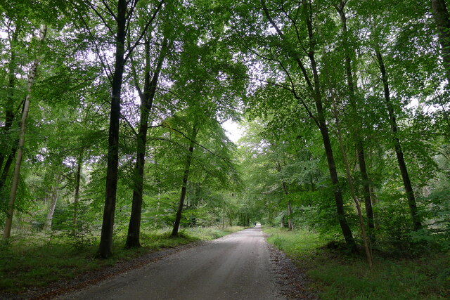
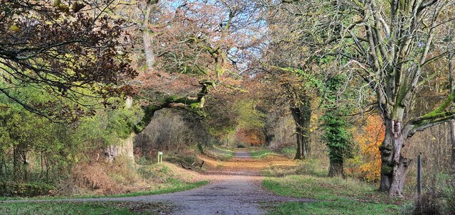
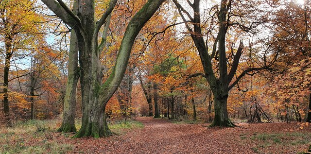
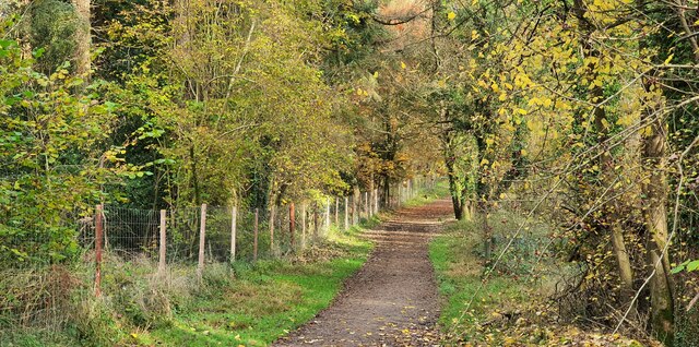
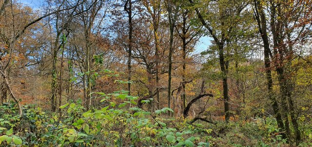
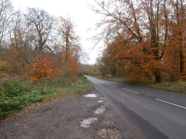
Red Vein Bottom is a picturesque valley located in the county of Wiltshire, England. Nestled within the rolling hills of the South West, this idyllic area offers visitors a tranquil escape from the hustle and bustle of city life. The valley is characterized by its distinct red soil, which gives it its name and adds to its unique charm.

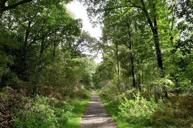
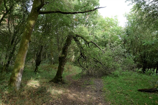
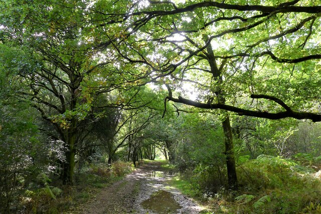
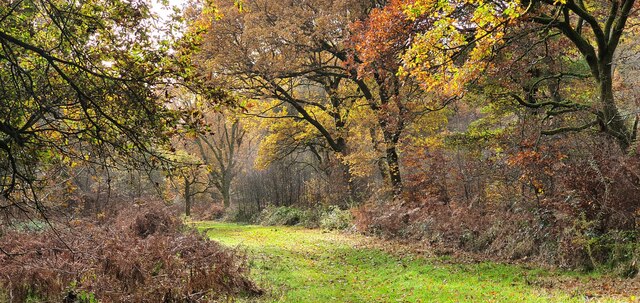
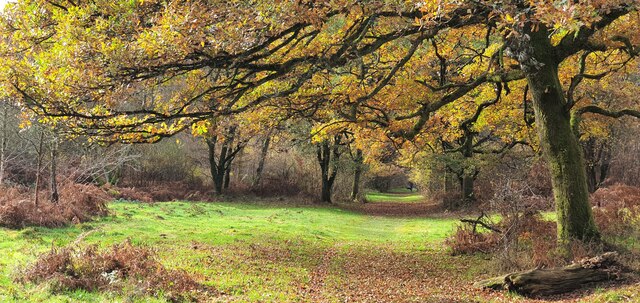
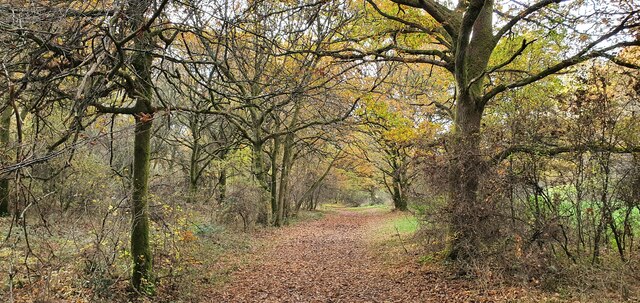
Surrounded by lush greenery, Red Vein Bottom is a haven for nature enthusiasts and outdoor adventurers. The valley is home to a diverse range of flora and fauna, making it a popular spot for birdwatching, hiking, and exploring the countryside. With its meandering streams and babbling brooks, it is also an ideal location for fishing and picnicking.

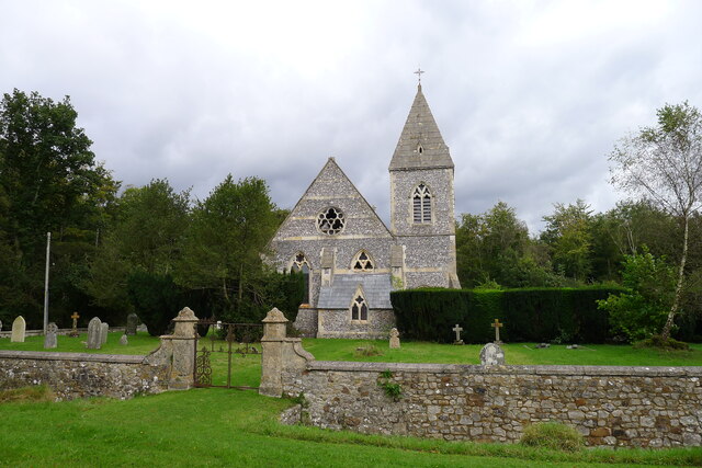
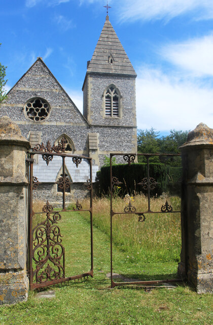
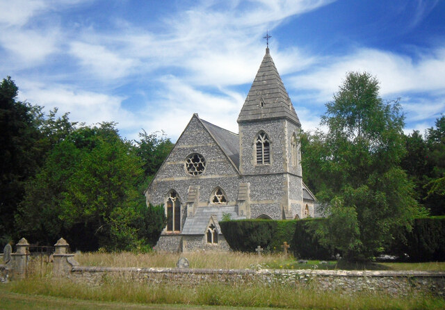
In addition to its natural beauty, Red Vein Bottom boasts a rich history. Archaeological evidence suggests that the area has been inhabited since prehistoric times, with remnants of ancient settlements and burial sites discovered in the vicinity. The valley is also dotted with historic landmarks, including a medieval church and a charming old mill, which provide a glimpse into the region's past.

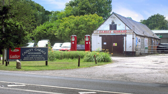
Visitors to Red Vein Bottom can enjoy a range of amenities, including walking trails, picnic areas, and a visitor center offering information about the valley's history and wildlife. The area is easily accessible by car and is a short distance from the nearby village, where visitors can find quaint pubs and shops.

Overall, Red Vein Bottom is a hidden gem in Wiltshire, offering a peaceful retreat and an opportunity to connect with nature and history.

If you have any feedback on the listing, please let us know in the comments section below.

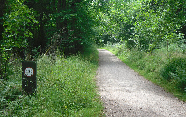
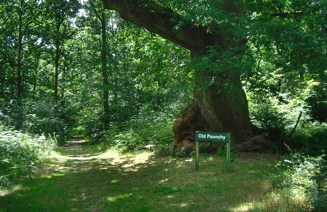
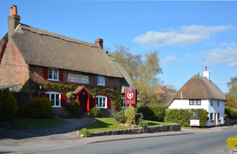
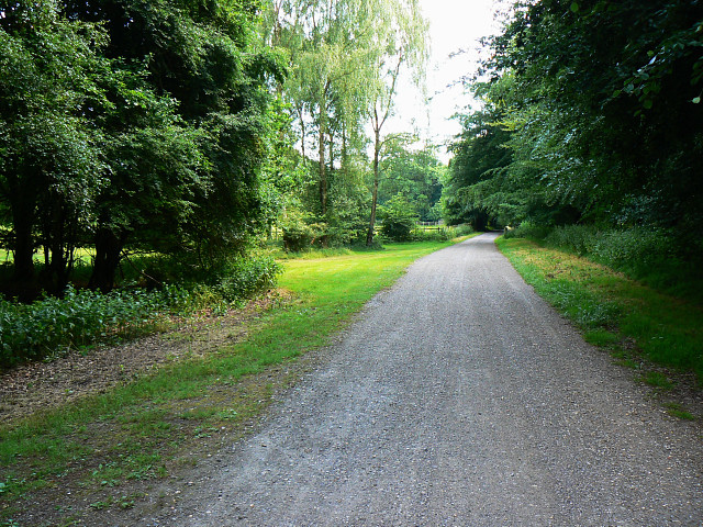
Red Vein Bottom Images

Images are sourced within 2km of 51.408142/-1.6808759 or Grid Reference SU2267. Thanks to Geograph Open Source API. All images are credited.

'Grey Road' through Savernake Forest Savernake Forest is a 4,500 acre estate believed to hold the highest concentration of 'veteran' oak and beech trees in Europe. First mentioned as 'Safernoc' in the 10th century (and therefore older than the 'New Forest'), the area came under Norman ownership after the Conquest of 1066, and subsequently passed down an unbroken line of family ownership. It is the only forest in Britain still in private hands, but the family trustees administering the estate allow extensive, free public access (closed on only one day in the year), and the estate is managed by the Forestry Commission on a 999 year lease. <span class="nowrap"><a title="https://www.savernakeestate.co.uk/" rel="nofollow ugc noopener" href="https://www.savernakeestate.co.uk/">Link</a><img style="margin-left:2px;" alt="External link" title="External link - shift click to open in new window" src="https://s1.geograph.org.uk/img/external.png" width="10" height="10"/></span>
'Grey Road' through Savernake Forest
Savernake Forest is a 4,500 acre estate believed to hold the highest concentration of 'veteran' oak and beech trees in Europe. First mentioned as 'Safernoc' in the 10th century (and therefore older than the 'New Forest'), the area came under Norman ownership after the Conquest of 1066, and subsequently passed down an unbroken line of family ownership. It is the only forest in Britain still in private hands, but the family trustees administering the estate allow extensive, free public access (closed on only one day in the year), and the estate is managed by the Forestry Commission on a 999 year lease. LinkExternal link
Christchurch, Cadley, Savernake Forest Flint and limestone building of 1851. Now a private house <span class="nowrap"><a title="https://historicengland.org.uk/listing/the-list/list-entry/1193137" rel="nofollow ugc noopener" href="https://historicengland.org.uk/listing/the-list/list-entry/1193137">Link</a><img style="margin-left:2px;" alt="External link" title="External link - shift click to open in new window" src="https://s1.geograph.org.uk/img/external.png" width="10" height="10"/></span>
Christchurch, Cadley, Savernake Forest
Flint and limestone building of 1851. Now a private house LinkExternal link
Broken ash, Great Lodge Bottom, Savernake Forest Savernake Forest is a 4,500 acre estate believed to hold the highest concentration of 'veteran' oak and beech trees in Europe. First mentioned as 'Safernoc' in the 10th century (and therefore older than the 'New Forest'), the area came under Norman ownership after the Conquest of 1066, and subsequently passed down an unbroken line of family ownership. It is the only forest in Britain still in private hands, but the family trustees administering the estate allow extensive, free public access (closed on only one day in the year), and the estate is managed by the Forestry Commission on a 999 year lease. <span class="nowrap"><a title="https://www.savernakeestate.co.uk/" rel="nofollow ugc noopener" href="https://www.savernakeestate.co.uk/">Link</a><img style="margin-left:2px;" alt="External link" title="External link - shift click to open in new window" src="https://s1.geograph.org.uk/img/external.png" width="10" height="10"/></span>
Broken ash, Great Lodge Bottom, Savernake Forest
Savernake Forest is a 4,500 acre estate believed to hold the highest concentration of 'veteran' oak and beech trees in Europe. First mentioned as 'Safernoc' in the 10th century (and therefore older than the 'New Forest'), the area came under Norman ownership after the Conquest of 1066, and subsequently passed down an unbroken line of family ownership. It is the only forest in Britain still in private hands, but the family trustees administering the estate allow extensive, free public access (closed on only one day in the year), and the estate is managed by the Forestry Commission on a 999 year lease. LinkExternal link
Great Lodge Bottom, Savernake Forest The track follows a shallow chalk valley heading towards Great Lodge Farm on the edge of the forest.
Great Lodge Bottom, Savernake Forest
The track follows a shallow chalk valley heading towards Great Lodge Farm on the edge of the forest.
Grand Avenue, Savernake Forest "Running right through the middle of the Forest is Capability Brown's 'Grand Avenue'. This avenue of beech trees - now a Private Road - was laid out in the late 1790's, and at just over 4 miles long it stands in the Guinness Book of Records as the longest Avenue in Britain." <span class="nowrap"><a title="https://www.savernakeestate.co.uk/" rel="nofollow ugc noopener" href="https://www.savernakeestate.co.uk/">Link</a><img style="margin-left:2px;" alt="External link" title="External link - shift click to open in new window" src="https://s1.geograph.org.uk/img/external.png" width="10" height="10"/></span>
Grand Avenue, Savernake Forest
"Running right through the middle of the Forest is Capability Brown's 'Grand Avenue'. This avenue of beech trees - now a Private Road - was laid out in the late 1790's, and at just over 4 miles long it stands in the Guinness Book of Records as the longest Avenue in Britain." LinkExternal link
Savernake Forest Looking northwest along an autumnal track in Savernake Forest.
Savernake Forest
Looking northwest along an autumnal track in Savernake Forest.
Savernake Forest, Wiltshire White road within Savernake Forest.
Savernake Forest, Wiltshire
White road within Savernake Forest.
Savernake Forest, Wiltshire Looking southeast along a track in Savernake Forest in the vicinity of Furze Coppice.
Savernake Forest, Wiltshire
Looking southeast along a track in Savernake Forest in the vicinity of Furze Coppice.
Savernake Forest, Wiltshire Looking south within Savernake Forest in the vicinity of Furze Coppice.
Savernake Forest, Wiltshire
Looking south within Savernake Forest in the vicinity of Furze Coppice.
Savernake Forest, Wiltshire A track within Savernake Forest, in the vicinity of Great Lodge Bottom.
Savernake Forest, Wiltshire
A track within Savernake Forest, in the vicinity of Great Lodge Bottom.
Savernake Forest, Wiltshire A view along Great Lodge Bottom within Savernake Forest.
Savernake Forest, Wiltshire
A view along Great Lodge Bottom within Savernake Forest.
Savernake Forest, Wiltshire A view along Great Lodge Bottom in the vicinity of Cadley, within Savernake Forest.
Savernake Forest, Wiltshire
A view along Great Lodge Bottom in the vicinity of Cadley, within Savernake Forest.
The A4 passes through Savernake Forest Laybys on stretches of road passing through privately-owned woodland tend to be few and far between, and poorly maintained.  This short and narrow layby beside the eastbound A4 in Savernake Forest was covered in deep puddles.  However the reward for stopping was the sight of magnificent autumn colour on the beech trees.
The A4 passes through Savernake Forest
Laybys on stretches of road passing through privately-owned woodland tend to be few and far between, and poorly maintained. This short and narrow layby beside the eastbound A4 in Savernake Forest was covered in deep puddles. However the reward for stopping was the sight of magnificent autumn colour on the beech trees.
Broken Gates at Cadley Church There were once two churches on the edge of Savernake Forest serving a scattered settlement of farms and isolated cottages. About 5 kms away St Katharines Church is still open but Christ Church, Cadley is closed and is now residential.
Someone still keeps the churchyard in a reasonable condition but these gates are now definitely past their best.
Broken Gates at Cadley Church
There were once two churches on the edge of Savernake Forest serving a scattered settlement of farms and isolated cottages. About 5 kms away St Katharines Church is still open but Christ Church, Cadley is closed and is now residential. Someone still keeps the churchyard in a reasonable condition but these gates are now definitely past their best.
Former Church at Cadley There were once two churches on the edge of Savernake Forest serving a scattered settlement of farms and isolated cottages. About 5 kms away St Katharines Church is still open but Christ Church at Cadley is closed and is now residential.
The civil parish of Savernake still covers this area.
Former Church at Cadley
There were once two churches on the edge of Savernake Forest serving a scattered settlement of farms and isolated cottages. About 5 kms away St Katharines Church is still open but Christ Church at Cadley is closed and is now residential. The civil parish of Savernake still covers this area.
Cadley Garage One of the few buildings in the small hamlet of Cadley is this motor engineering works.
A close view of the old fuel pumps is on <a href="https://www.geograph.org.uk/photo/5611161">SU2066 : Old petrol pumps at Cadley</a>
Cadley Garage
One of the few buildings in the small hamlet of Cadley is this motor engineering works. A close view of the old fuel pumps is on SU2066 : Old petrol pumps at Cadley
Speed Limit on the Bridleway Church Walk, Savernake Forest, a public bridleway. Not sure who the speed limit is there for. Can you do 20 mph on a horse. Maybe.
Speed Limit on the Bridleway
Church Walk, Savernake Forest, a public bridleway. Not sure who the speed limit is there for. Can you do 20 mph on a horse. Maybe.
Old Paunchy beside Church Walk A specially named old oak tree with a strange bulge on one side.
Church Walk heads towards the now closed Christ Church at Cadley. It is the only marked public bridleway in the forest, although this is now a bit of a technicality as the forest is access land and all the tracks are available.
Old Paunchy beside Church Walk
A specially named old oak tree with a strange bulge on one side. Church Walk heads towards the now closed Christ Church at Cadley. It is the only marked public bridleway in the forest, although this is now a bit of a technicality as the forest is access land and all the tracks are available.
Show me another place!

Red Vein Bottom is located at Grid Ref: SU2267 (Lat: 51.408142, Lng: -1.6808759)

Unitary Authority: Wiltshire

Police Authority: Wiltshire

What 3 Words

///spinning.elbowed.marathons. Near Mildenhall, Wiltshire

Related Wikis

Cunetio Hoard

The Cunetio Hoard, also known as the Mildenhall Hoard, is the largest hoard of Roman coins found in Britain. It was discovered in 1978 at the site of the...

Cunetio

Cunetio was a large walled town in a valley of the River Kennet in modern-day Wiltshire, England. The settlement was occupied from the 2nd century CE by...

Mildenhall, Wiltshire

Mildenhall ( MY-nəl) is a village and civil parish in the Kennet Valley in Wiltshire, England, immediately east of the market town of Marlborough. The...

Savernake, Wiltshire

Savernake is a civil parish immediately south and southeast of Marlborough in Wiltshire, England. The settlements in the parish are the hamlets of Cadley...

Nearby Amenities

Located within 500m of 51.408142,-1.6808759
Historic: milestone
Lat/Long: 51.4104522/-1.6790285
Red Vein Bottom
Place: locality
Lat/Long: 51.4082376/-1.6809417
Ashlade Firs
Place: locality
Lat/Long: 51.4071198/-1.6763701
The data included in this document is from www.openstreetmap.org. The data is made available under ODbL.

Have you been to Red Vein Bottom?

Leave your review of Red Vein Bottom below (or comments, questions and feedback).