Square Copse

Wood, Forest in Wiltshire

England

Square Copse

Burbage Wharf - wooden crane This wharf on the Kennet & Avon Canal summit pound was constructed in 1831 by the Savernake estate. It handled local timber, stone, agricultural products and bricks. A timber fixed jib slewing crane handled cargoes. The canal ceased use in 1950 and the crane fell into disrepair. It was restored from 1973 to 1977 and then again in 2010 when it was largely renewed but using the original ironwork.
Burbage Wharf - wooden crane Credit: Chris Allen

Square Copse is a small woodland located in the county of Wiltshire, England. Situated near the village of Ramsbury, it covers an area of approximately 20 acres and is a designated Site of Special Scientific Interest (SSSI). The copse is known for its diverse range of flora and fauna, making it a popular destination for nature enthusiasts.

The woodland is predominantly made up of deciduous trees, including oak, beech, and ash. These towering trees create a dense canopy overhead, providing a habitat for a variety of bird species such as woodpeckers and owls. The forest floor is covered in a thick layer of leaf litter, which supports a rich ecosystem of insects, fungi, and small mammals.

Square Copse is crisscrossed by a network of footpaths, allowing visitors to explore its natural beauty. These paths wind through the woodland, offering glimpses of wildflowers, ferns, and mosses that thrive in the damp and shaded environment. The copse is also home to a small stream, which meanders through the trees, adding to the sense of tranquility.

The woodland is managed by the local conservation authority, who work to preserve its unique characteristics. They undertake regular maintenance activities such as tree planting and coppicing to ensure the health and vitality of the forest.

Overall, Square Copse is a charming woodland in Wiltshire, providing a peaceful haven for both wildlife and humans alike. Its natural beauty and diverse ecosystem make it a cherished natural asset in the local community.

If you have any feedback on the listing, please let us know in the comments section below.

Square Copse Images

Images are sourced within 2km of 51.372096/-1.6881082 or Grid Reference SU2163. Thanks to Geograph Open Source API. All images are credited.

Burbage Wharf - wooden crane This wharf on the Kennet & Avon Canal summit pound was constructed in 1831 by the Savernake estate. It handled local timber, stone, agricultural products and bricks. A timber fixed jib slewing crane handled cargoes. The canal ceased use in 1950 and the crane fell into disrepair. It was restored from 1973 to 1977 and then again in 2010 when it was largely renewed but using the original ironwork.
Burbage Wharf - wooden crane
This wharf on the Kennet & Avon Canal summit pound was constructed in 1831 by the Savernake estate. It handled local timber, stone, agricultural products and bricks. A timber fixed jib slewing crane handled cargoes. The canal ceased use in 1950 and the crane fell into disrepair. It was restored from 1973 to 1977 and then again in 2010 when it was largely renewed but using the original ironwork.
Kennet and Avon Canal - Burbage Wharf and crane This wharf on the Kennet & Avon Canal summit pound was constructed in 1831 by the Savernake estate. It handled local timber, stone, agricultural products and bricks. A timber fixed jib slewing crane handled cargoes. The canal ceased use in 1950 and the crane fell into disrepair. It was restored from 1973 to 1977 and then again in 2010 when it was largely renewed but using the original ironwork.
Kennet and Avon Canal - Burbage Wharf and crane
This wharf on the Kennet & Avon Canal summit pound was constructed in 1831 by the Savernake estate. It handled local timber, stone, agricultural products and bricks. A timber fixed jib slewing crane handled cargoes. The canal ceased use in 1950 and the crane fell into disrepair. It was restored from 1973 to 1977 and then again in 2010 when it was largely renewed but using the original ironwork.
Kennet and Avon Canal at Burbage The bridge carries the A346 over the canal near Burbage Wharf.
Kennet and Avon Canal at Burbage
The bridge carries the A346 over the canal near Burbage Wharf.
Burbage Wharf - wooden crane This wharf on the Kennet & Avon Canal summit pound was constructed in 1831 by the Savernake estate. It handled local timber, stone, agricultural products and bricks. A timber fixed jib slewing crane handled cargoes. The canal ceased use in 1950 and the crane fell into disrepair. It was restored from 1973 to 1977 and then again in 2010 when it was largely renewed but using the original ironwork.
Burbage Wharf - wooden crane
This wharf on the Kennet & Avon Canal summit pound was constructed in 1831 by the Savernake estate. It handled local timber, stone, agricultural products and bricks. A timber fixed jib slewing crane handled cargoes. The canal ceased use in 1950 and the crane fell into disrepair. It was restored from 1973 to 1977 and then again in 2010 when it was largely renewed but using the original ironwork.
Stibb Green Road junction in Burbage.
Stibb Green
Road junction in Burbage.
Big Belly Oak The 'Big Belly Oak' by the A346 road on the edge of Savernake Forest.
Big Belly Oak
The 'Big Belly Oak' by the A346 road on the edge of Savernake Forest.
Leigh Hill, Savernake Forest
A346, Savernake Forest The southwestern corner of the forest.
A346, Savernake Forest
The southwestern corner of the forest.
Field edge beside Cock Lane
Sunlight filtering through trees onto Cock Lane Shown on the Wiltshire definitive map as a by-way open to all traffic - indeed, we met a motorcyclist, although this is really not suitable for a standard car.
Sunlight filtering through trees onto Cock Lane
Shown on the Wiltshire definitive map as a by-way open to all traffic - indeed, we met a motorcyclist, although this is really not suitable for a standard car.
Narrowboats and restored crane at Burbage Wharf
Burbage Wharf, seen from the road bridge This is such a photogenic spot - although the heavy traffic on the narrow road overbridge is rather at odds with the peaceful scene.
Burbage Wharf, seen from the road bridge
This is such a photogenic spot - although the heavy traffic on the narrow road overbridge is rather at odds with the peaceful scene.
Railway towards Pewsey, just south of Burbage Wharf The other side of the hedge on the right is <a href="https://www.geograph.org.uk/photo/7315591">SU2263 : Burbage Wharf, seen from the road bridge</a>
Railway towards Pewsey, just south of Burbage Wharf
The other side of the hedge on the right is SU2263 : Burbage Wharf, seen from the road bridge
Early autumnal reflections, Kennet and Avon Canal Just to the west of Burbage Wharf.
Early autumnal reflections, Kennet and Avon Canal
Just to the west of Burbage Wharf.
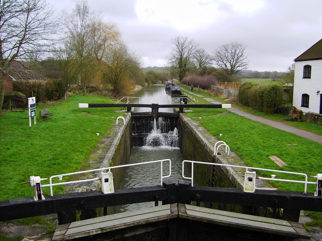
Kennet and Avon canal west of Burbage Wharf
Footbridge south of Burbage Wharf One of two footbridges on a rather overgrown footpath which comes out adjacent to the railway overbridge on the A346.
Footbridge south of Burbage Wharf
One of two footbridges on a rather overgrown footpath which comes out adjacent to the railway overbridge on the A346.
One of the last remaining sunflowers Could perhaps be titled "keeping your head when all around are losing theirs"
One of the last remaining sunflowers
Could perhaps be titled "keeping your head when all around are losing theirs"
Remains of sunflower field On the footpath between Ram Alley and Burbage Wharf.
Remains of sunflower field
On the footpath between Ram Alley and Burbage Wharf.
Show me another place!

Square Copse is located at Grid Ref: SU2163 (Lat: 51.372096, Lng: -1.6881082)

Unitary Authority: Wiltshire

Police Authority: Wiltshire

What 3 Words

///overpower.material.volcano. Near Burbage, Wiltshire

Related Wikis

Cadley Lock

Wootton Top Lock (previously known as Cadley Lock) is a lock on the Kennet and Avon Canal at Wootton Rivers, Wiltshire, England, built c.1810. The lock...

Brimslade House

Brimslade House is a former farmhouse in Brimslade, Wootton Rivers, Wiltshire, England. The house is from the 16th or 17th century, with later additions...

Brimslade Lock

Brimslade Lock is on the Kennet and Avon Canal at Wootton Rivers, Wiltshire, England. The lock has a rise/fall of 8 ft 0 in (2.43 m) and was built c.1810...

Savernake Forest

Savernake Forest stands on a Cretaceous chalk plateau between Marlborough and Great Bedwyn in Wiltshire, England. Its area is approximately 4,500 acres...

Nearby Amenities

Located within 500m of 51.372096,-1.6881082
Ram Alley
Railway: crossing
Lat/Long: 51.3695665/-1.6901556
Ram Alley
Railway: crossing
Lat/Long: 51.3696011/-1.690174
The data included in this document is from www.openstreetmap.org. The data is made available under ODbL.

Have you been to Square Copse?

Leave your review of Square Copse below (or comments, questions and feedback).