Crooks Copse

Wood, Forest in Wiltshire

England

Crooks Copse

Burbage Wharf - wooden crane This wharf on the Kennet & Avon Canal summit pound was constructed in 1831 by the Savernake estate. It handled local timber, stone, agricultural products and bricks. A timber fixed jib slewing crane handled cargoes. The canal ceased use in 1950 and the crane fell into disrepair. It was restored from 1973 to 1977 and then again in 2010 when it was largely renewed but using the original ironwork.
Burbage Wharf - wooden crane Credit: Chris Allen

Crooks Copse is a serene and enchanting woodland located in the picturesque county of Wiltshire, England. Nestled in a rural area, this dense forest is a haven for nature lovers and hikers alike. Spanning over 100 acres, Crooks Copse boasts a diverse range of trees, including oak, beech, and birch, creating a rich tapestry of colors throughout the seasons.

The forest floor is adorned with a lush carpet of moss, ferns, and wildflowers, providing a sanctuary for a myriad of wildlife. Bird enthusiasts will be delighted by the harmonious melodies of songbirds such as thrushes and blackbirds, while lucky visitors might catch a glimpse of the elusive tawny owl or the graceful deer that roam the woodland.

Tranquility envelops visitors as they wander along the winding trails, their senses captivated by the fresh scent of pine and the gentle rustling of leaves. The dappled sunlight filters through the canopy, casting ethereal patterns on the forest floor, creating an idyllic atmosphere for relaxation and contemplation.

Crooks Copse is not only a place of natural beauty but also a site of historical significance. The woodland is said to have ancient origins, dating back centuries, and has been carefully preserved to maintain its authenticity. Visitors can discover remnants of an old Roman road that once traversed the area, adding an additional layer of intrigue to this enchanting woodland.

Whether seeking solace in nature, embarking on a leisurely stroll, or immersing oneself in the rich history of the land, Crooks Copse offers a captivating experience for all who venture into its leafy embrace.

If you have any feedback on the listing, please let us know in the comments section below.
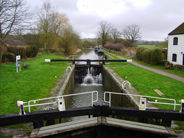
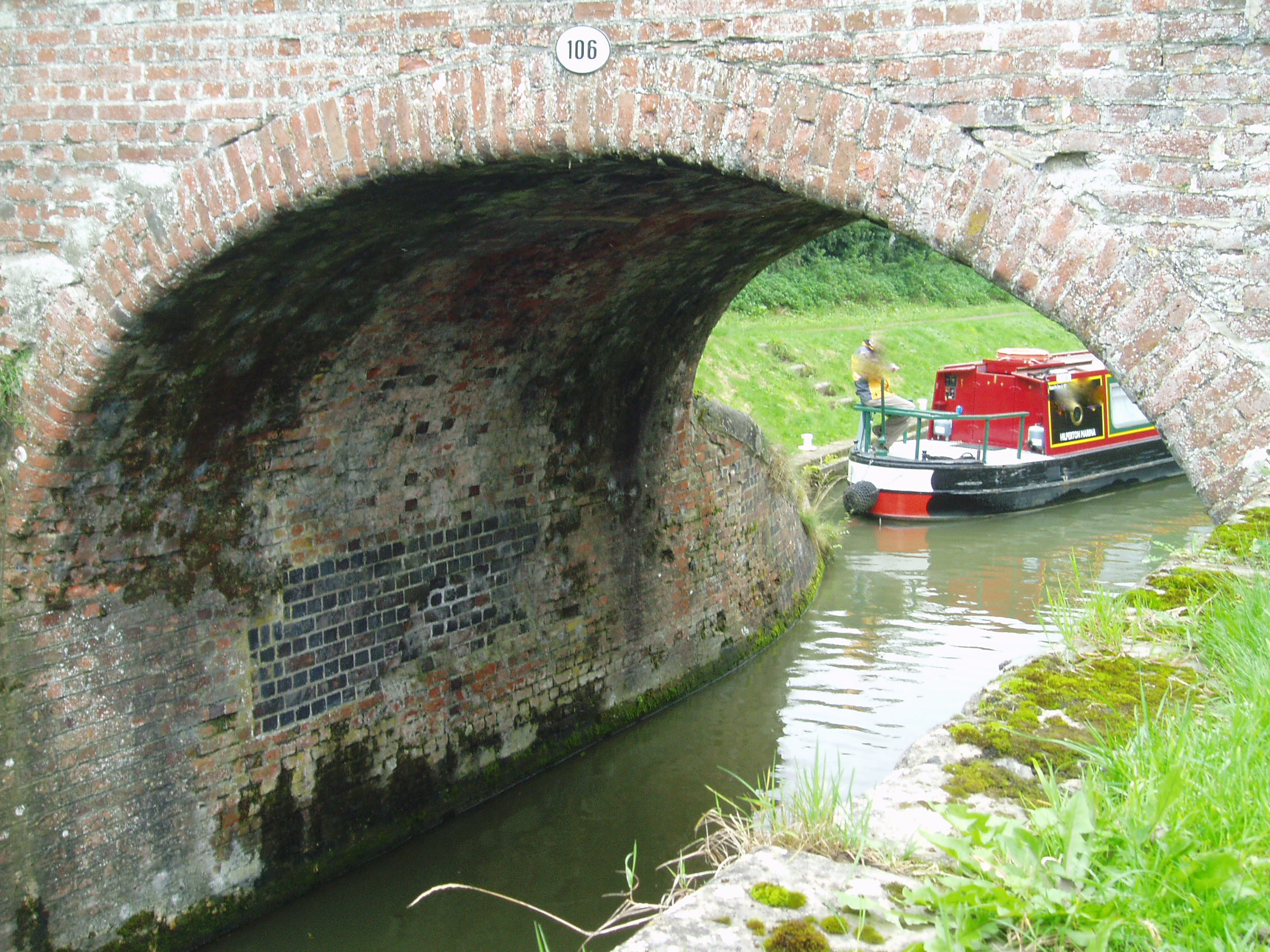
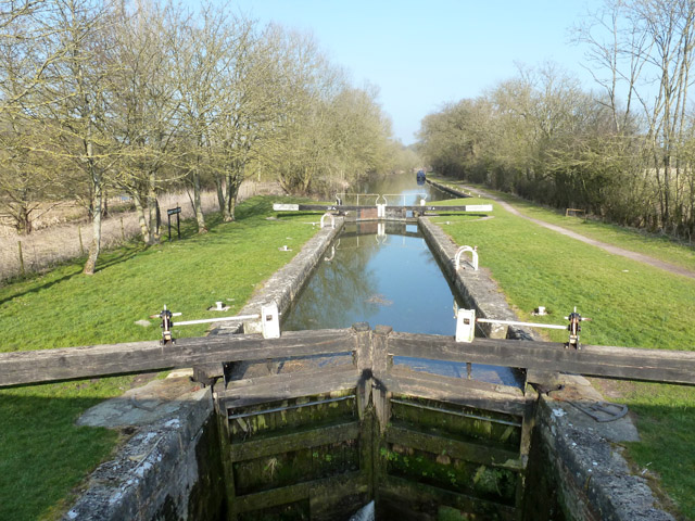
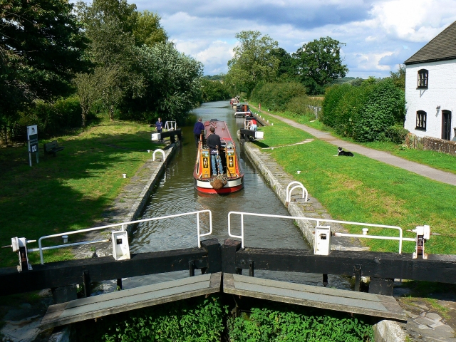
Crooks Copse Images

Images are sourced within 2km of 51.373923/-1.6954371 or Grid Reference SU2163. Thanks to Geograph Open Source API. All images are credited.

Burbage Wharf - wooden crane This wharf on the Kennet & Avon Canal summit pound was constructed in 1831 by the Savernake estate. It handled local timber, stone, agricultural products and bricks. A timber fixed jib slewing crane handled cargoes. The canal ceased use in 1950 and the crane fell into disrepair. It was restored from 1973 to 1977 and then again in 2010 when it was largely renewed but using the original ironwork.
Burbage Wharf - wooden crane
This wharf on the Kennet & Avon Canal summit pound was constructed in 1831 by the Savernake estate. It handled local timber, stone, agricultural products and bricks. A timber fixed jib slewing crane handled cargoes. The canal ceased use in 1950 and the crane fell into disrepair. It was restored from 1973 to 1977 and then again in 2010 when it was largely renewed but using the original ironwork.
Kennet and Avon Canal - Burbage Wharf and crane This wharf on the Kennet & Avon Canal summit pound was constructed in 1831 by the Savernake estate. It handled local timber, stone, agricultural products and bricks. A timber fixed jib slewing crane handled cargoes. The canal ceased use in 1950 and the crane fell into disrepair. It was restored from 1973 to 1977 and then again in 2010 when it was largely renewed but using the original ironwork.
Kennet and Avon Canal - Burbage Wharf and crane
This wharf on the Kennet & Avon Canal summit pound was constructed in 1831 by the Savernake estate. It handled local timber, stone, agricultural products and bricks. A timber fixed jib slewing crane handled cargoes. The canal ceased use in 1950 and the crane fell into disrepair. It was restored from 1973 to 1977 and then again in 2010 when it was largely renewed but using the original ironwork.
Kennet and Avon Canal at Burbage The bridge carries the A346 over the canal near Burbage Wharf.
Kennet and Avon Canal at Burbage
The bridge carries the A346 over the canal near Burbage Wharf.
Burbage Wharf - wooden crane This wharf on the Kennet & Avon Canal summit pound was constructed in 1831 by the Savernake estate. It handled local timber, stone, agricultural products and bricks. A timber fixed jib slewing crane handled cargoes. The canal ceased use in 1950 and the crane fell into disrepair. It was restored from 1973 to 1977 and then again in 2010 when it was largely renewed but using the original ironwork.
Burbage Wharf - wooden crane
This wharf on the Kennet & Avon Canal summit pound was constructed in 1831 by the Savernake estate. It handled local timber, stone, agricultural products and bricks. A timber fixed jib slewing crane handled cargoes. The canal ceased use in 1950 and the crane fell into disrepair. It was restored from 1973 to 1977 and then again in 2010 when it was largely renewed but using the original ironwork.
Roadside forestry work in Savernake Forest Removal of diseased ash trees and scrub along the A346.
Roadside forestry work in Savernake Forest
Removal of diseased ash trees and scrub along the A346.
Big Belly Oak The 'Big Belly Oak' by the A346 road on the edge of Savernake Forest.
Big Belly Oak
The 'Big Belly Oak' by the A346 road on the edge of Savernake Forest.
Leigh Hill, Savernake Forest
A346, Savernake Forest The southwestern corner of the forest.
A346, Savernake Forest
The southwestern corner of the forest.
Field edge beside Cock Lane
Sunlight filtering through trees onto Cock Lane Shown on the Wiltshire definitive map as a by-way open to all traffic - indeed, we met a motorcyclist, although this is really not suitable for a standard car.
Sunlight filtering through trees onto Cock Lane
Shown on the Wiltshire definitive map as a by-way open to all traffic - indeed, we met a motorcyclist, although this is really not suitable for a standard car.
Narrowboats and restored crane at Burbage Wharf
Burbage Wharf, seen from the road bridge This is such a photogenic spot - although the heavy traffic on the narrow road overbridge is rather at odds with the peaceful scene.
Burbage Wharf, seen from the road bridge
This is such a photogenic spot - although the heavy traffic on the narrow road overbridge is rather at odds with the peaceful scene.
Railway towards Pewsey, just south of Burbage Wharf The other side of the hedge on the right is <a href="https://www.geograph.org.uk/photo/7315591">SU2263 : Burbage Wharf, seen from the road bridge</a>
Railway towards Pewsey, just south of Burbage Wharf
The other side of the hedge on the right is SU2263 : Burbage Wharf, seen from the road bridge
Early autumnal reflections, Kennet and Avon Canal Just to the west of Burbage Wharf.
Early autumnal reflections, Kennet and Avon Canal
Just to the west of Burbage Wharf.
Kennet and Avon canal west of Burbage Wharf
Footbridge south of Burbage Wharf One of two footbridges on a rather overgrown footpath which comes out adjacent to the railway overbridge on the A346.
Footbridge south of Burbage Wharf
One of two footbridges on a rather overgrown footpath which comes out adjacent to the railway overbridge on the A346.
One of the last remaining sunflowers Could perhaps be titled "keeping your head when all around are losing theirs"
One of the last remaining sunflowers
Could perhaps be titled "keeping your head when all around are losing theirs"
Remains of sunflower field On the footpath between Ram Alley and Burbage Wharf.
Remains of sunflower field
On the footpath between Ram Alley and Burbage Wharf.
Show me another place!

Crooks Copse is located at Grid Ref: SU2163 (Lat: 51.373923, Lng: -1.6954371)

Unitary Authority: Wiltshire

Police Authority: Wiltshire

What 3 Words

///pockets.health.recapture. Near Burbage, Wiltshire

Related Wikis

Cadley Lock

Wootton Top Lock (previously known as Cadley Lock) is a lock on the Kennet and Avon Canal at Wootton Rivers, Wiltshire, England, built c.1810. The lock...

Brimslade Lock

Brimslade Lock is on the Kennet and Avon Canal at Wootton Rivers, Wiltshire, England. The lock has a rise/fall of 8 ft 0 in (2.43 m) and was built c.1810...

Brimslade House

Brimslade House is a former farmhouse in Brimslade, Wootton Rivers, Wiltshire, England.The house is from the 16th or 17th century, with later additions...

Savernake Forest

Savernake Forest stands on a Cretaceous chalk plateau between Marlborough and Great Bedwyn in Wiltshire, England. Its area is approximately 4,500 acres...

Heathy Close Lock

Heathy Close Lock is a canal lock on the Kennet and Avon Canal, at Wootton Rivers, Wiltshire, England. The lock has a rise/fall of 8 ft 1 in (2.46 m)....

Wootton Rivers

Wootton Rivers is a small village and civil parish in the Vale of Pewsey, Wiltshire, England. The village lies about 3 miles (5 km) northeast of Pewsey...

Wootton Rivers Lock

Wootton Rivers Lock, also called Wootton Rivers Bottom Lock, is a lock on the Kennet and Avon Canal at Wootton Rivers, Wiltshire, England. Wootton Rivers...

Wootton Rivers Halt railway station

Wootton Rivers Halt railway station is a former railway station in Wootton Rivers, Wiltshire, England, on the Reading to Taunton line. The station opened...

Nearby Amenities

Located within 500m of 51.373923,-1.6954371
Seamark Type: gate
Waterway: lock_gate
Lat/Long: 51.3696035/-1.69656
Seamark Type: gate
Waterway: lock_gate
Lat/Long: 51.369597/-1.6969414
The data included in this document is from www.openstreetmap.org. The data is made available under ODbL.

Have you been to Crooks Copse?

Leave your review of Crooks Copse below (or comments, questions and feedback).