Long Copse
Wood, Forest in Wiltshire
England
Long Copse

Long Copse is a picturesque woodland located in the county of Wiltshire, England. Situated near the village of Brinkworth, it covers an area of approximately 150 acres and is renowned for its natural beauty and diverse range of flora and fauna.
The woodland is predominantly made up of mixed deciduous trees, including oak, beech, and ash, which create a dense canopy and provide a peaceful and tranquil atmosphere. The forest floor is covered with a carpet of bluebells in spring, creating a breathtaking scene that attracts nature enthusiasts and photographers from near and far.
Long Copse is home to a rich variety of wildlife, making it an important conservation site. Visitors can spot an array of bird species, including woodpeckers, owls, and thrushes, as well as small mammals such as badgers, foxes, and deer. The woodland also boasts a diverse range of insects, including butterflies and beetles, which thrive in its diverse habitats.
The woodland is crisscrossed with a network of well-maintained footpaths and trails, allowing visitors to explore its beauty at their own pace. There are also several picnic areas and benches strategically placed throughout the forest, providing the perfect spot to relax and soak in the natural surroundings.
Long Copse offers a range of recreational activities, including walking, bird watching, and nature photography. It is a popular destination for families, couples, and individuals seeking a peaceful retreat in the heart of nature. With its stunning landscapes and abundant wildlife, Long Copse truly is a gem in the Wiltshire countryside.
If you have any feedback on the listing, please let us know in the comments section below.
Long Copse Images
Images are sourced within 2km of 51.373422/-1.689737 or Grid Reference SU2163. Thanks to Geograph Open Source API. All images are credited.


Long Copse is located at Grid Ref: SU2163 (Lat: 51.373422, Lng: -1.689737)
Unitary Authority: Wiltshire
Police Authority: Wiltshire
What 3 Words
///cringes.hotspot.stapled. Near Burbage, Wiltshire
Nearby Locations
Related Wikis
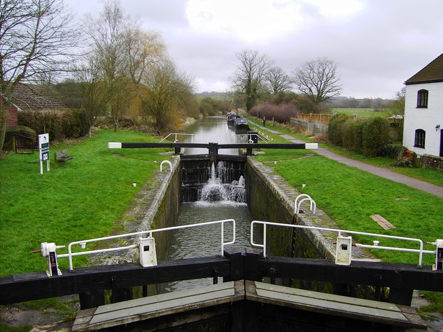
Cadley Lock
Wootton Top Lock (previously known as Cadley Lock) is a lock on the Kennet and Avon Canal at Wootton Rivers, Wiltshire, England, built c.1810. The lock...

Brimslade House
Brimslade House is a former farmhouse in Brimslade, Wootton Rivers, Wiltshire, England.The house is from the 16th or 17th century, with later additions...
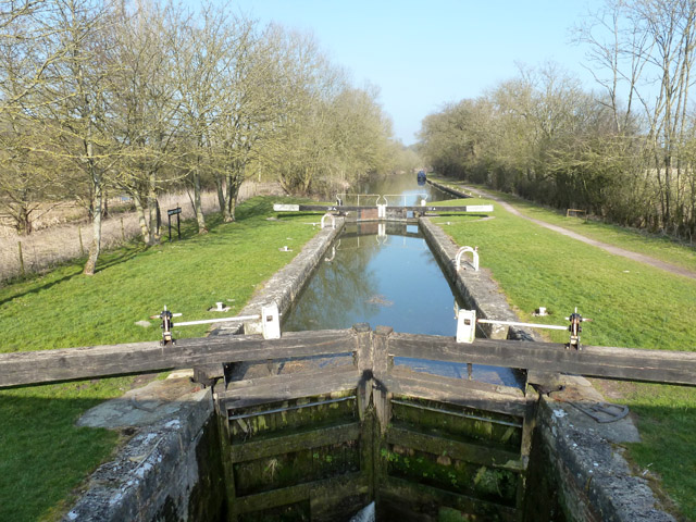
Brimslade Lock
Brimslade Lock is on the Kennet and Avon Canal at Wootton Rivers, Wiltshire, England. The lock has a rise/fall of 8 ft 0 in (2.43 m) and was built c.1810...

Savernake Forest
Savernake Forest stands on a Cretaceous chalk plateau between Marlborough and Great Bedwyn in Wiltshire, England. Its area is approximately 4,500 acres...
Heathy Close Lock
Heathy Close Lock is a canal lock on the Kennet and Avon Canal, at Wootton Rivers, Wiltshire, England. The lock has a rise/fall of 8 ft 1 in (2.46 m)....
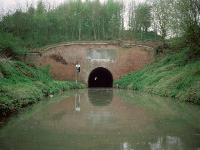
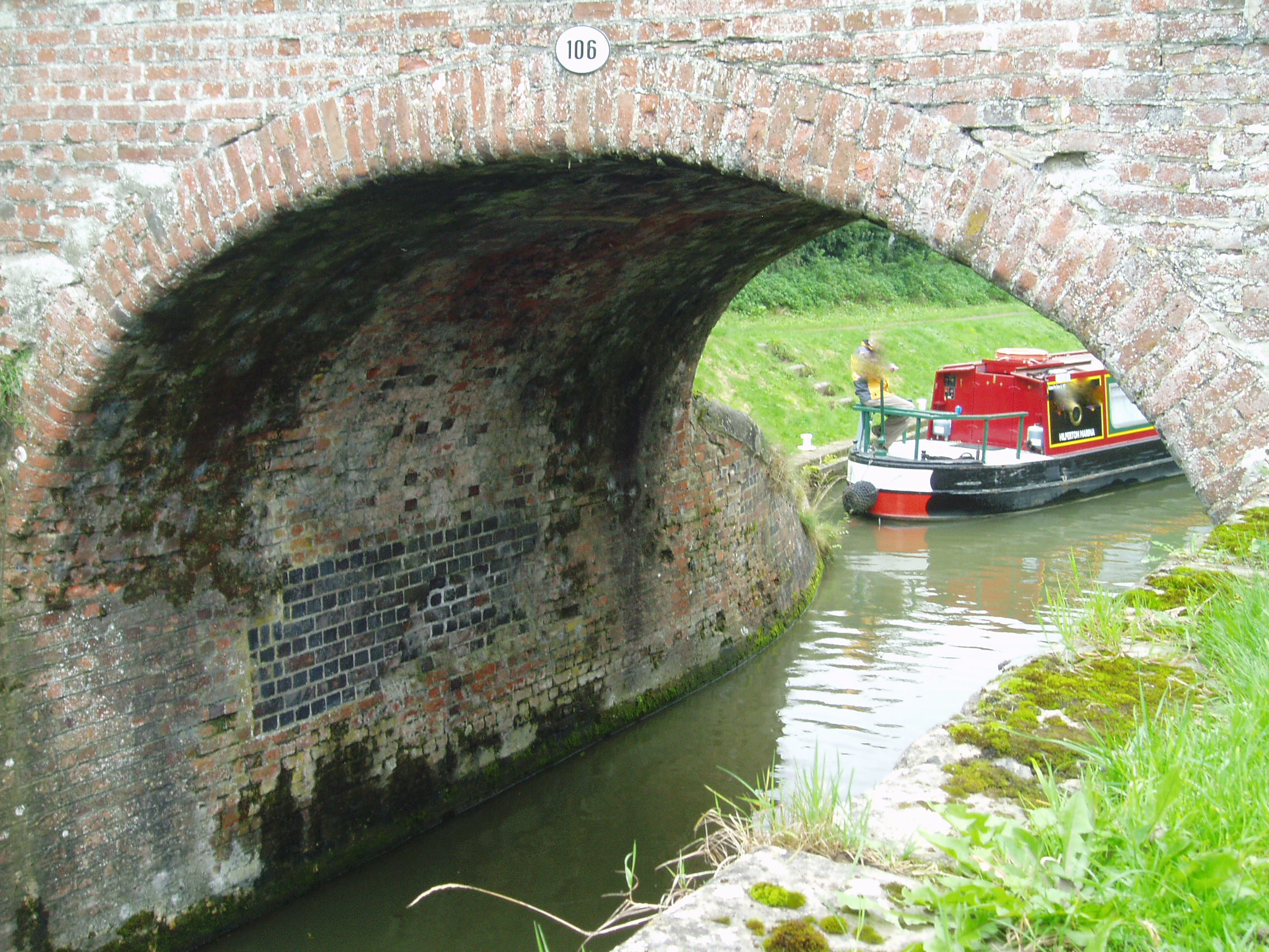
Bruce Tunnel
The Bruce Tunnel is on the summit pound of the Kennet and Avon Canal between Wootton Top Lock and Crofton Locks in Wiltshire, England. The tunnel is 502...

Savernake Low Level railway station
Savernake Low Level railway station was a station on the Berks and Hants Extension Railway, near the village of Burbage in Wiltshire, England. It was open...

Wootton Rivers
Wootton Rivers is a small village and civil parish in the Vale of Pewsey, Wiltshire, England. The village lies about 3 miles (5 km) northeast of Pewsey...
Nearby Amenities
Located within 500m of 51.373422,-1.689737Have you been to Long Copse?
Leave your review of Long Copse below (or comments, questions and feedback).