Birds's Wood

Wood, Forest in Derbyshire Derbyshire Dales

England

Birds's Wood

Bretton Clough The trees planted about 8 years ago have naturally grown. See an older photo by Peter Barr <a href="https://www.geograph.org.uk/photo/3791331">SK2078 : Bretton Clough</a>. The tree guards were left in place but hundreds were unofficially removed by volunteers taking Covid lockdown exercise in 2020/21. The plastic was removed and disposed of responsibly.
Bretton Clough Credit: Graham Cole

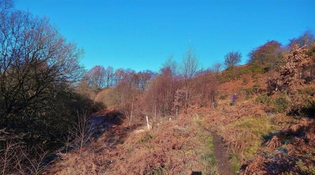
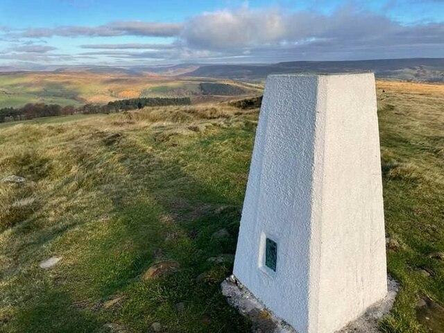
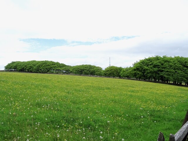
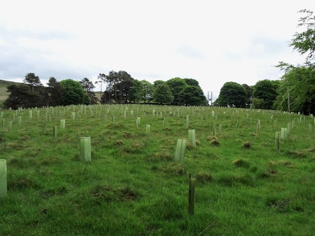
Birds Wood is a picturesque woodland located in Derbyshire, England. Covering an area of approximately 200 acres, it is a popular destination for nature lovers and outdoor enthusiasts. The wood is situated on the eastern edge of the Peak District National Park, making it easily accessible for visitors.

Birds Wood is characterized by its diverse range of tree species, including oak, ash, beech, and birch, which create a vibrant and lush environment. The wood is also home to a wide variety of wildlife, including numerous bird species such as woodpeckers, owls, and songbirds. Visitors often enjoy birdwatching and can spot rare and migratory birds throughout the year.

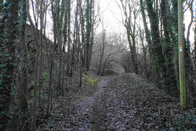
The wood offers several well-maintained walking trails, allowing visitors to explore its tranquil surroundings. These trails vary in difficulty, catering to both casual strollers and experienced hikers. Along the way, visitors can admire the beautiful wildflowers, ferns, and mosses that dot the forest floor.

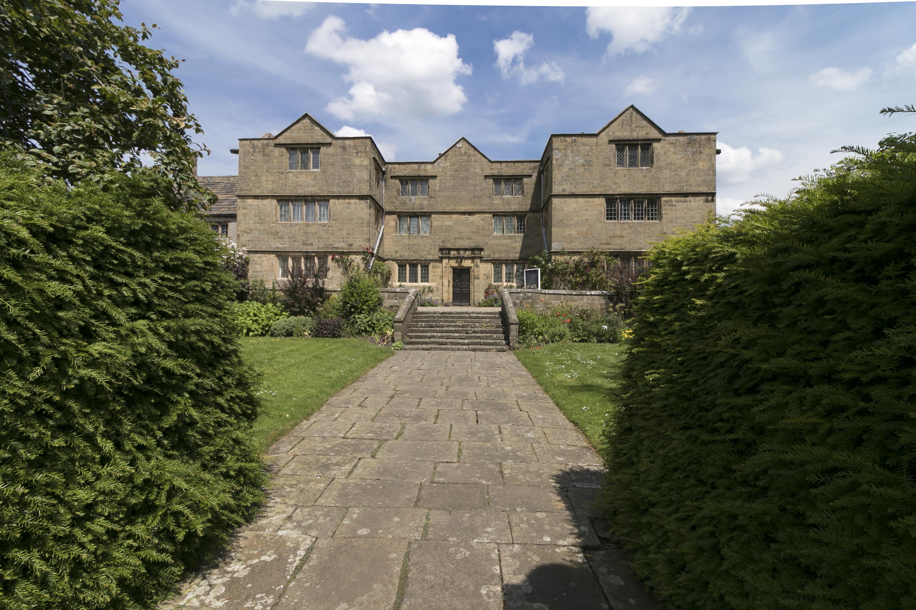
For those interested in history, Birds Wood has cultural significance as well. It is believed that the wood has been in existence since medieval times, and remnants of old stone walls and ruins can still be found within its boundaries. The wood is also adjacent to a small, picturesque village, which adds to its charm and allows visitors to further immerse themselves in the local culture.

Overall, Birds Wood offers a serene and enchanting experience for nature enthusiasts, providing a peaceful retreat from the hustle and bustle of everyday life. Whether it is for birdwatching, hiking, or simply enjoying the beauty of the natural surroundings, visitors are sure to find solace and tranquility in this hidden gem of Derbyshire.

If you have any feedback on the listing, please let us know in the comments section below.

Birds's Wood Images

Images are sourced within 2km of 53.292619/-1.6867479 or Grid Reference SK2077. Thanks to Geograph Open Source API. All images are credited.

Bretton Clough The trees planted about 8 years ago have naturally grown. See an older photo by Peter Barr <a href="https://www.geograph.org.uk/photo/3791331">SK2078 : Bretton Clough</a>. The tree guards were left in place but hundreds were unofficially removed by volunteers taking Covid lockdown exercise in 2020/21. The plastic was removed and disposed of responsibly.
Bretton Clough
The trees planted about 8 years ago have naturally grown. See an older photo by Peter Barr SK2078 : Bretton Clough. The tree guards were left in place but hundreds were unofficially removed by volunteers taking Covid lockdown exercise in 2020/21. The plastic was removed and disposed of responsibly.
Sir William Hill trig
Black Harry Lane A steep climb out of Middleton Dale.
Black Harry Lane
A steep climb out of Middleton Dale.
Darlton Quarry One of several disused quarries in Middleton Dale. The quarry is shaded from the low winter sun but White Edge above Froggatt Edge is glowing in the distance.
Darlton Quarry
One of several disused quarries in Middleton Dale. The quarry is shaded from the low winter sun but White Edge above Froggatt Edge is glowing in the distance.
Turn  right  for  Eyam.  Junction  on  A623
Turn right for Eyam. Junction on A623
Eyam  Post  Office
Eyam Post Office
St  Lawrence  Parish  Church  and  War  Memorial
St Lawrence Parish Church and War Memorial
Saxon  Cross  in  Eyam  Churchyard. Early  9th Century Pevsner states that it is notable for the survival of the cross head, unfortunately the top two feet or so of the shaft are missing
Saxon Cross in Eyam Churchyard. Early 9th Century
Pevsner states that it is notable for the survival of the cross head, unfortunately the top two feet or so of the shaft are missing
Church of St Lawrence Grade II* listed parish church dating from the 13th century. 
The church contains several items relating to the plague of 1665-6 for which the village of Eyam is famous, notably the Plague Register listing the 260 people who died during the 14 months of the plague.
Church of St Lawrence
Grade II* listed parish church dating from the 13th century. The church contains several items relating to the plague of 1665-6 for which the village of Eyam is famous, notably the Plague Register listing the 260 people who died during the 14 months of the plague.
Celtic Cross in Eyam churchyard The cross is believed to date from the 8th century
Celtic Cross in Eyam churchyard
The cross is believed to date from the 8th century
Highfield Belt Highfield Belt is a narrow belt of woodland which has been here since at least 1842, when the Ordnance Survey First Series map was surveyed. It partially encircles the remains of Broadlow Lead Mine.
Highfield Belt
Highfield Belt is a narrow belt of woodland which has been here since at least 1842, when the Ordnance Survey First Series map was surveyed. It partially encircles the remains of Broadlow Lead Mine.
Top Twelve Meers' Mine The remains of one of many former lead mines in the area. Marked on some maps as "Twelve Meers' Mine" but known as "Top" to distinguish it from "Old Twelve Meers' Mine", which was nearby. A meer was a unit of length of 29, 31 or 32 yards, depending on the time and place, used in the Derbyshire lead mining industry.
Top Twelve Meers' Mine
The remains of one of many former lead mines in the area. Marked on some maps as "Twelve Meers' Mine" but known as "Top" to distinguish it from "Old Twelve Meers' Mine", which was nearby. A meer was a unit of length of 29, 31 or 32 yards, depending on the time and place, used in the Derbyshire lead mining industry.
Replanting Big Moor Plantation Until recently, "Big Moor Plantation" was a meaningless label for a largely empty field. This has now been rectified with the planting of new saplings.
Replanting Big Moor Plantation
Until recently, "Big Moor Plantation" was a meaningless label for a largely empty field. This has now been rectified with the planting of new saplings.
Eyam Mechanics Institute and Village Hall Built as the Mechanics Institute to provide a range of adult education opportunities and now as the Village Hall caters for a wide range of community events
Eyam Mechanics Institute and Village Hall
Built as the Mechanics Institute to provide a range of adult education opportunities and now as the Village Hall caters for a wide range of community events
Eyam, St Lawrence
Eyam, St Lawrence
Aspen trees and suckers This valley has a surprising concentration of aspen trees in a few places. There are very many suckers (clone shoots on tree roots) in the foreground which possibly owe their survival to a reduction in sheep grazing in recent years. The three tall trees are all aspens and perhaps grew up from suckers of a much older tree.
Aspen trees and suckers
This valley has a surprising concentration of aspen trees in a few places. There are very many suckers (clone shoots on tree roots) in the foreground which possibly owe their survival to a reduction in sheep grazing in recent years. The three tall trees are all aspens and perhaps grew up from suckers of a much older tree.
Eyam Post Office Eyam is a village in the Peak District National Park. The village is noted for an outbreak of bubonic plague which occurred there in 1665, in which the villagers chose to isolate themselves rather than let the infection spread. The present village was founded and named by Anglo-Saxons, although lead had been mined in the area by the Romans. Formerly industrial, its economy now relies on the tourist trade and it is promoted as 'the plague village'.
Wikipedia: <span class="nowrap"><a title="https://en.wikipedia.org/wiki/Eyam" rel="nofollow ugc noopener" href="https://en.wikipedia.org/wiki/Eyam">Link</a><img style="margin-left:2px;" alt="External link" title="External link - shift click to open in new window" src="https://s1.geograph.org.uk/img/external.png" width="10" height="10"/></span>
Eyam Post Office
Eyam is a village in the Peak District National Park. The village is noted for an outbreak of bubonic plague which occurred there in 1665, in which the villagers chose to isolate themselves rather than let the infection spread. The present village was founded and named by Anglo-Saxons, although lead had been mined in the area by the Romans. Formerly industrial, its economy now relies on the tourist trade and it is promoted as 'the plague village'. Wikipedia: LinkExternal link
The "Plague Museum", Eyam Eyam Museum, or as it is locally known "Eyam Plague Museum",  opened in April 1994. Its galleries present the history of Eyam since prehistoric times, with a special emphasis on the Plague that struck Eyam, known as the Eyam Plague, in 1665.
The "Plague Museum", Eyam
Eyam Museum, or as it is locally known "Eyam Plague Museum", opened in April 1994. Its galleries present the history of Eyam since prehistoric times, with a special emphasis on the Plague that struck Eyam, known as the Eyam Plague, in 1665.
Show me another place!

Birds's Wood is located at Grid Ref: SK2077 (Lat: 53.292619, Lng: -1.6867479)

Administrative County: Derbyshire

District: Derbyshire Dales

Police Authority: Derbyshire

What 3 Words

///reception.gravel.scooters. Near Hathersage, Derbyshire

Related Wikis

Jumber Brook

Jumber Brook is a stream in Eyam in the Derbyshire Peak District. The stream originates to the north of the village at Highcliffe. The brook flows south...

Eyam Museum

Eyam Museum or as it is locally known Eyam Plague museum is a local museum in the village of Eyam, located in the Peak District, Derbyshire, England....

St Lawrence's Church, Eyam

St Lawrence’s Church, Eyam is a Grade II* listed parish church in the Church of England in Eyam, Derbyshire. == History == The church is medieval with...

Eyam Hall

Eyam Hall is a country house within the civil parish of Eyam, Derbyshire, located to the west of St Lawrence's Church, Eyam. It is recorded in the National...

Mompesson's Well

Mompesson's Well is a 17th-century grade II listed water well in Eyam, Derbyshire. == History == The well is named for Church of England priest William...

Eyam

Eyam ( ) is an English village and civil parish in the Derbyshire Dales that lies within the Peak District National Park. There is evidence of early occupation...

Middleton Dale

Middleton Dale is a steep-sided, carboniferous limestone valley in the Derbyshire Peak District of England. The village of Stoney Middleton lies at the...

Bretton, Derbyshire

Bretton, Derbyshire is a hamlet in Derbyshire, England. Set on a ridge with a panoramic view, it has few inhabitants but boasts a pub called the Barrel...

Nearby Amenities

Located within 500m of 53.292619,-1.6867479
Ford: yes
Lat/Long: 53.2927109/-1.6798779
Barrier: stile
Foot: yes
Lat/Long: 53.292658/-1.6796344
Waterway: waterfall
Lat/Long: 53.292687/-1.679869
Parking
Access: yes
Capacity: 8
Ele: 397
Fee: no
Lat/Long: 53.2957961/-1.6862206
Barrier: stile
Material: stone
Source: survey;gps
Stile: squeezer
Lat/Long: 53.2931582/-1.6849398
Barrier: stile
Material: wood
Source: survey;gps
Stile: stepover
Lat/Long: 53.2936618/-1.6851404
Barrier: entrance
Source: survey;gps
Lat/Long: 53.2923376/-1.6927949
Bus Stop
Eyam (Town Head)
Bench: no
Bin: no
Bus: yes
Lit: no
Naptan AtcoCode: 1000DEFR3067
Naptan NaptanCode: dbsgatmg
Public Transport: platform
Shelter: no
Tactile Paving: no
Lat/Long: 53.2888288/-1.6876736
Bus Stop
Eyam (Town Head)
Bench: no
Bin: no
Bus: yes
Lit: no
Naptan AtcoCode: 1000DEFR3066
Naptan NaptanCode: dbsgatmd
Public Transport: platform
Shelter: no
Tactile Paving: no
Lat/Long: 53.2888815/-1.6877069
Eyam (Town Head)
Bus: yes
Public Transport: stop_position
Lat/Long: 53.2888658/-1.6877107
Eyam (Town Head)
Bus: yes
Public Transport: stop_position
Lat/Long: 53.2888564/-1.6876602
Watering Place
Lat/Long: 53.2936408/-1.6805922
Bench
Backrest: no
Lat/Long: 53.2931121/-1.6844939
Direction: 157
Tourism: viewpoint
Lat/Long: 53.2931099/-1.6844533
Bench
Backrest: no
Lat/Long: 53.2926523/-1.6879332
Man Made: mineshaft
Lat/Long: 53.2923259/-1.6905065
Man Made: mineshaft
Lat/Long: 53.2926632/-1.6871664
The data included in this document is from www.openstreetmap.org. The data is made available under ODbL.

Have you been to Birds's Wood?

Leave your review of Birds's Wood below (or comments, questions and feedback).