Fishpond Wood

Wood, Forest in Derbyshire Derbyshire Dales

England

Fishpond Wood

Middleton-By-Youlgrave This is a quiet unspoilt village on an unclassified loop road near Youlgrave.
Middleton-By-Youlgrave Credit: Garth Newton

Fishpond Wood is a picturesque woodland located in the county of Derbyshire, England. Situated near the town of Matlock, it covers an area of approximately 15 hectares and is part of the larger Peak District National Park. The wood is renowned for its diverse flora and fauna, making it a popular destination for nature enthusiasts and hikers.

The woodland is characterized by its dense canopy of ancient oak and beech trees, which provide a haven for a wide variety of wildlife. Visitors to Fishpond Wood can expect to encounter a rich array of bird species, including woodpeckers, nuthatches, and jays, as well as small mammals such as squirrels and hedgehogs. The wood is also home to several rare plant species, including the delicate wood anemone and the vibrant bluebell.

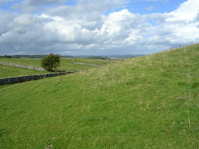
Tranquil walking trails wind their way through the wood, allowing visitors to explore its natural beauty at their own pace. These paths offer breathtaking views of the surrounding countryside, with glimpses of nearby rivers and valleys. The wood is also intersected by a small stream, adding to its idyllic charm.

In addition to its natural beauty, Fishpond Wood has a rich historical significance. It is believed that the wood was once part of a medieval deer park, and remnants of its past can still be seen in the form of earthworks and boundary ditches.

Overall, Fishpond Wood offers a tranquil escape from the hustle and bustle of everyday life, providing visitors with the opportunity to connect with nature and immerse themselves in the stunning landscape of Derbyshire.

If you have any feedback on the listing, please let us know in the comments section below.

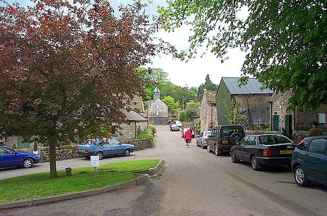
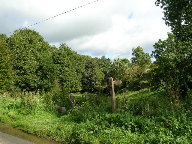
Fishpond Wood Images

Images are sourced within 2km of 53.155903/-1.7023536 or Grid Reference SK2062. Thanks to Geograph Open Source API. All images are credited.

Middleton-By-Youlgrave This is a quiet unspoilt village on an unclassified loop road near Youlgrave.
Middleton-By-Youlgrave
This is a quiet unspoilt village on an unclassified loop road near Youlgrave.
On road approaching Middleton - Derbyshire The start point of a very pleasant circular walk with three geocaches en route.
On road approaching Middleton - Derbyshire
The start point of a very pleasant circular walk with three geocaches en route.
Rising out of Long Dale - Peak District National Park
Gratton Moor - Peak District National Park Walking roughly north in the far distance is the village of Youlgreave
Gratton Moor - Peak District National Park
Walking roughly north in the far distance is the village of Youlgreave
Gratton Moor Looking NW
Gratton Moor
Looking NW
Remains of a limekiln. Limestone when burnt with coal or other fuel in one of these limekilns produces quicklime. This then has several uses including a soil conditioner for use on acid farmland, tanning leather and for making mortar for the building industry.
Remains of a limekiln.
Limestone when burnt with coal or other fuel in one of these limekilns produces quicklime. This then has several uses including a soil conditioner for use on acid farmland, tanning leather and for making mortar for the building industry.
Near Middleton By Youlgreave. A view looking along Rake Lane.
Near Middleton By Youlgreave.
A view looking along Rake Lane.
Kenslow Knoll This good agricultural land is cattle rearing territory.  The trees to the left are on the top of Kenslow Knoll and in the mid background is a spoil heap from a disused quarry.
Kenslow Knoll
This good agricultural land is cattle rearing territory. The trees to the left are on the top of Kenslow Knoll and in the mid background is a spoil heap from a disused quarry.
Derelict Barn A typical limestone and slate barn which has seen better days.
Derelict Barn
A typical limestone and slate barn which has seen better days.
Weaddow Lane, near Middleton
Carved Stone Markers The small enclosure is at the start of Long Dale.
Carved Stone Markers
The small enclosure is at the start of Long Dale.
Long Dale View
Long Dale View
Middleton-by-Youlgreave - Chapel
Middleton-by-Youlgreave - Church
Middleton-by-Youlgreave - Trabants 'R' Us
Lane - Heading towards Middleton
Rake Lane - Approaching Rake Wood and Middleton
Rake Lane - Entering Middleton
Show me another place!

Fishpond Wood is located at Grid Ref: SK2062 (Lat: 53.155903, Lng: -1.7023536)

Administrative County: Derbyshire

District: Derbyshire Dales

Police Authority: Derbyshire

What 3 Words

///unclaimed.canny.herring. Near Youlgreave, Derbyshire

Related Wikis

Gratton, Derbyshire

Gratton is a civil parish in the Derbyshire Dales district of central Derbyshire, half a mile west of the neighbouring village, Elton. == See also... ==

Middleton-by-Youlgreave

Middleton, often known as Middleton-by-Youlgreave or Middleton-by-Youlgrave to distinguish it from nearby Middleton-by-Wirksworth, is a village in the...

Dale End, Derbyshire

Dale End is a hamlet in Derbyshire, England to the west of Elton. == References ==

Harthill Moor

Harthill Moor is a small upland area in the Derbyshire Peak District of central and northern England, lying between Matlock and Bakewell near the villages...

Middleton and Smerrill

Middleton and Smerrill is a civil parish within the Derbyshire Dales district, in the county of Derbyshire, England. Largely rural except for the village...

Long Dale

Long Dale is a carboniferous limestone valley near the village of Elton, Derbyshire, in the Peak District of England. The dale is cut into the plateau...

Youlgreave

Youlgreave or Youlgrave is a village and civil parish in the Peak District of Derbyshire, England, on the River Bradford 2+1⁄2 miles (4.0 km) south of...
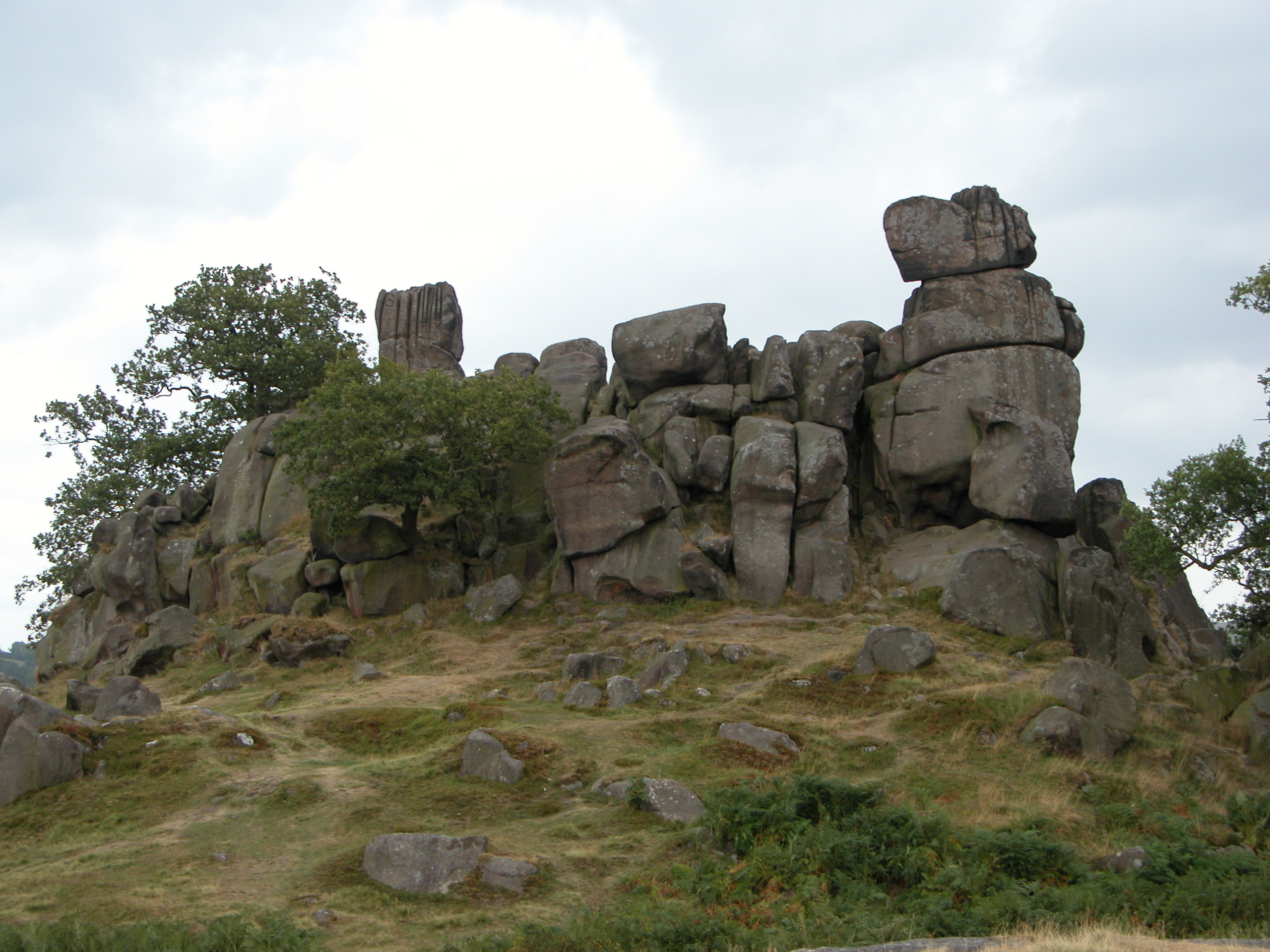
Robin Hood's Stride

Robin Hood's Stride (also known as Mock Beggar's Mansion) is a rock formation on the Limestone Way in Derbyshire close to the village of Elton. The nearest...

Nearby Amenities

Located within 500m of 53.155903,-1.7023536
Barrier: stile
Material: wood
Source: survey;bing;gps
Stile: stepover
Lat/Long: 53.156978/-1.7071695
Barrier: stile
Material: stone
Source: survey;bing;gps
Stile: stepover
Lat/Long: 53.1576876/-1.7063257
Barrier: stile
Material: stone
Source: survey;bing
Stile: squeezer
Lat/Long: 53.1588954/-1.7024122
Barrier: stile
Stile: squeezer
Lat/Long: 53.1559434/-1.7069667
Barrier: stile
Stile: squeezer
Lat/Long: 53.155002/-1.7063717
Barrier: stile
Steps: 2
Stile: stepover
Lat/Long: 53.15551/-1.7095772
Barrier: stile
Steps: 2
Stile: stepover
Lat/Long: 53.1556803/-1.7088907
Barrier: stile
Lat/Long: 53.1590306/-1.702649
Barrier: stile
Lat/Long: 53.1571531/-1.706367
Barrier: stile
Material: wood
Source: survey;gps
Stile: stepover
Lat/Long: 53.1546194/-1.6954508
Barrier: cattle_grid
Bicycle: yes
Foot: yes
Lat/Long: 53.1599483/-1.6991612
The data included in this document is from www.openstreetmap.org. The data is made available under ODbL.

Have you been to Fishpond Wood?

Leave your review of Fishpond Wood below (or comments, questions and feedback).