Beech Wood

Wood, Forest in Derbyshire Derbyshire Dales

England

Beech Wood

Grave of John Millington, railway navvy, Youlgreave Churchyard During the construction of the Midland Railway near Haddon Hall in 1861 a tunnel was insisted upon by the Duke of Rutland so that the line could not be seen from the hall. A part of this tunnel collapsed during construction on 2nd July 1861 killing five workers. The grave of one of these can be found in the churchyard. The inscription reads: "In memory of John Millington of Stanton, killed by the falling of an arch on the railway near Haddon Hall, July 2nd 1861 aged 46 years". Reference to his 6 year old daughter is also on the stone whose body rests in Warrick churchyard, Ruthin, North Wales.
Grave of John Millington, railway navvy, Youlgreave Churchyard Credit: Richard Bird

Beech Wood is a picturesque forest located in Derbyshire, England. Spread across an area of approximately 200 acres, it is known for its abundant beech trees and diverse wildlife. The wood is situated on the outskirts of the village of Beech, offering a peaceful and serene environment for nature enthusiasts and visitors alike.

The forest boasts a rich history, with records dating back to the medieval period. It has been mentioned in various historical documents, highlighting its importance as a source of timber and fuel. Today, it serves as a popular destination for recreational activities such as hiking, birdwatching, and nature walks.

Beech Wood is characterized by its dense canopy of towering beech trees, which provide shade and shelter for a wide variety of flora and fauna. The forest floor is adorned with an array of wildflowers, ferns, and mosses, creating a vibrant and colorful landscape. Additionally, the wood is home to numerous species of birds, mammals, and insects, making it a haven for wildlife enthusiasts and photographers.

Visitors to Beech Wood can explore its well-maintained trails, which meander through the forest, offering stunning views and opportunities to observe the local wildlife. Interpretive signs along the paths provide information about the flora and fauna, enhancing the educational experience for visitors.

Overall, Beech Wood in Derbyshire offers a tranquil escape into nature, where visitors can immerse themselves in the beauty of the forest and appreciate the diversity of its ecosystem.

If you have any feedback on the listing, please let us know in the comments section below.
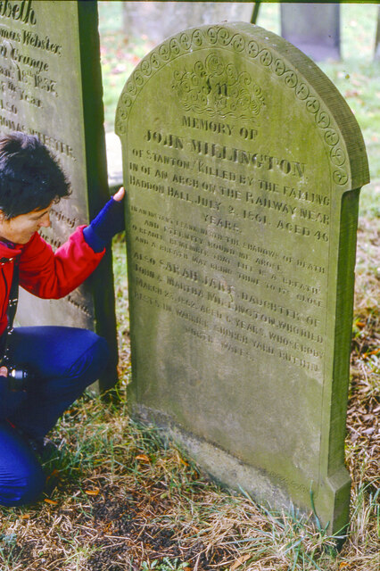
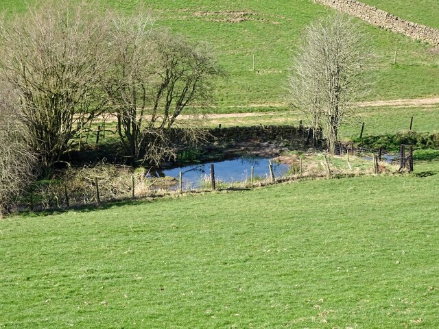
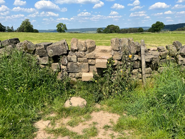
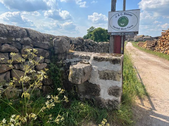
Beech Wood Images

Images are sourced within 2km of 53.160199/-1.6950105 or Grid Reference SK2062. Thanks to Geograph Open Source API. All images are credited.

Grave of John Millington, railway navvy, Youlgreave Churchyard During the construction of the Midland Railway near Haddon Hall in 1861 a tunnel was insisted upon by the Duke of Rutland so that the line could not be seen from the hall. A part of this tunnel collapsed during construction on 2nd July 1861 killing five workers. The grave of one of these can be found in the churchyard. The inscription reads: "In memory of John Millington of Stanton, killed by the falling of an arch on the railway near Haddon Hall, July 2nd 1861 aged 46 years". Reference to his 6 year old daughter is also on the stone whose body rests in Warrick churchyard, Ruthin, North Wales.
Grave of John Millington, railway navvy, Youlgreave Churchyard
During the construction of the Midland Railway near Haddon Hall in 1861 a tunnel was insisted upon by the Duke of Rutland so that the line could not be seen from the hall. A part of this tunnel collapsed during construction on 2nd July 1861 killing five workers. The grave of one of these can be found in the churchyard. The inscription reads: "In memory of John Millington of Stanton, killed by the falling of an arch on the railway near Haddon Hall, July 2nd 1861 aged 46 years". Reference to his 6 year old daughter is also on the stone whose body rests in Warrick churchyard, Ruthin, North Wales.
Old reservoir Now just a pond but marked on old maps as a reservoir, possibly for the hydraulic ram sited a short distance downstream.
Old reservoir
Now just a pond but marked on old maps as a reservoir, possibly for the hydraulic ram sited a short distance downstream.
Robin Hood's Stride near Birchover
Stone Stile, Elton On the Limestone Way (Derbyshire footpath Harthill FP 1)  North of Elton village looking SW. The view NE is <a href="https://www.geograph.org.uk/photo/7519184">SK2262 : Stone Stile, Elton</a>.
Stone Stile, Elton
On the Limestone Way (Derbyshire footpath Harthill FP 1) North of Elton village looking SW. The view NE is SK2262 : Stone Stile, Elton.
Stone Stile, Elton On the Limestone Way (Derbyshire footpath Harthill FP 1)  North of Elton village looking NE. The view SW is <a href="https://www.geograph.org.uk/photo/7519182">SK2262 : Stone Stile, Elton</a>.
Stone Stile, Elton
On the Limestone Way (Derbyshire footpath Harthill FP 1) North of Elton village looking NE. The view SW is SK2262 : Stone Stile, Elton.
Stone Stile, Elton Off Cliff Lane on Derbyshire footpath Harthill FP 1 looking to the road. The view SE is <a href="https://www.geograph.org.uk/photo/7520350">SK2262 : Stone Stile, Elton</a>
Stone Stile, Elton
Off Cliff Lane on Derbyshire footpath Harthill FP 1 looking to the road. The view SE is SK2262 : Stone Stile, Elton
Stone Stile, Elton Off Cliff Lane on Derbyshire footpath Harthill FP 1 looking from the road. The view NW is <a href="https://www.geograph.org.uk/photo/7520349">SK2262 : Stone Stile, Elton</a>.
Stone Stile, Elton
Off Cliff Lane on Derbyshire footpath Harthill FP 1 looking from the road. The view NW is SK2262 : Stone Stile, Elton.
Stone Stile, Elton Off Cliff Lane on Derbyshire footpath Harthill FP 1 looking from the road. The view SE is <a href="https://www.geograph.org.uk/photo/7520369">SK2262 : Stone Stile, Elton</a>
Stone Stile, Elton
Off Cliff Lane on Derbyshire footpath Harthill FP 1 looking from the road. The view SE is SK2262 : Stone Stile, Elton
Stone Stile, Elton Off Cliff Lane on Derbyshire footpath Harthill FP 1 looking to the road. The view NW is <a href="https://www.geograph.org.uk/photo/7520368">SK2262 : Stone Stile, Elton</a>
Stone Stile, Elton
Off Cliff Lane on Derbyshire footpath Harthill FP 1 looking to the road. The view NW is SK2262 : Stone Stile, Elton
Unusual Font With Stoup Attached C12th, Youlgreave 12th Century Font with attached stoup  at the side. This would have held holy water or oil for people to cross themselves with.  Stoups are normally found in the entrance of the church.  

This font was originally in Elton church which was a chapelries of Youlgrave, It was moved here after Elton spire fell in and was rebuilt in the early 1800's
Unusual Font With Stoup Attached C12th, Youlgreave
12th Century Font with attached stoup at the side. This would have held holy water or oil for people to cross themselves with. Stoups are normally found in the entrance of the church. This font was originally in Elton church which was a chapelries of Youlgrave, It was moved here after Elton spire fell in and was rebuilt in the early 1800's
Stone Effigy of a Knight Holding His Heart C14th, Youlgreave Thought to be Sir John Rossington. He lies cross-legged, his head on a pillow and his feet on a dog. He his holding his hearts in his hands over his chest.
Stone Effigy of a Knight Holding His Heart C14th, Youlgreave
Thought to be Sir John Rossington. He lies cross-legged, his head on a pillow and his feet on a dog. He his holding his hearts in his hands over his chest.
Thomas Cokayne Alabaster Tomb C15th, Youlgreave Thomas (Cockayne) Cokayne (1451 - 1488) died at the age of 37 in Polesworth, Warwickshire after a quarrel with Thomas Burdett on their way to Polesworth Church. 

His tomb is small in size because he died before his father, and it was restored in 1870 by members of his family. 

<span class="nowrap"><a title="https://www.wikitree.com/wiki/Cockayne-168" rel="nofollow ugc noopener" href="https://www.wikitree.com/wiki/Cockayne-168">Link</a><img style="margin-left:2px;" alt="External link" title="External link - shift click to open in new window" src="https://s1.geograph.org.uk/img/external.png" width="10" height="10"/></span>
Thomas Cokayne Alabaster Tomb C15th, Youlgreave
Thomas (Cockayne) Cokayne (1451 - 1488) died at the age of 37 in Polesworth, Warwickshire after a quarrel with Thomas Burdett on their way to Polesworth Church. His tomb is small in size because he died before his father, and it was restored in 1870 by members of his family. LinkExternal link
Carved Stone Pilgrim C12th, Youlgreave May represent a pilgrim with a Staff and Bag or Wallet
Carved Stone Pilgrim C12th, Youlgreave
May represent a pilgrim with a Staff and Bag or Wallet
Alabaster Reredos, Robert & Joan Gilbert C15th, Youlgreave Robert had the memorial panel made after Joan died in November 1492, depicting a Virgin and Child in the centre, Robert and seven sons on the left and Joan with ten daughters on the right.

<span class="nowrap"><a title="https://www.wikitree.com/wiki/Gilbert-9839" rel="nofollow ugc noopener" href="https://www.wikitree.com/wiki/Gilbert-9839">Link</a><img style="margin-left:2px;" alt="External link" title="External link - shift click to open in new window" src="https://s1.geograph.org.uk/img/external.png" width="10" height="10"/></span>
Alabaster Reredos, Robert & Joan Gilbert C15th, Youlgreave
Robert had the memorial panel made after Joan died in November 1492, depicting a Virgin and Child in the centre, Robert and seven sons on the left and Joan with ten daughters on the right. LinkExternal link
Alabaster Wall Memorial Roger Rooe 1613, Youlgreave Roger Rooe of Alport, who died 30th April 1613. The Panel shows Roger and his wife Catherine kneeling at a prayer desk facing each other. Roger is in armour and a ruffled collar, Catherine is in a dress and tall hat.  Below them are their eight daughters in a line.

HIC JACET RODERVS
ROOE DE ALPORT AR:
QVI OBIIT 30. APRIL IS
AN. DNI: 1613
Alabaster Wall Memorial Roger Rooe 1613, Youlgreave
Roger Rooe of Alport, who died 30th April 1613. The Panel shows Roger and his wife Catherine kneeling at a prayer desk facing each other. Roger is in armour and a ruffled collar, Catherine is in a dress and tall hat. Below them are their eight daughters in a line. HIC JACET RODERVS ROOE DE ALPORT AR: QVI OBIIT 30. APRIL IS AN. DNI: 1613
Mawstone Barn The door is ace.. Not much holding it on.
Mawstone Barn
The door is ace.. Not much holding it on.
Stone Slab Footbridge Over The River Bradford
Pommie Plaque, Youlgreave Interesting mosaic on the village hall..

<span class="nowrap"><a title="http://www.pommieplaque.org.uk/" rel="nofollow ugc noopener" href="http://www.pommieplaque.org.uk/">Link</a><img style="margin-left:2px;" alt="External link" title="External link - shift click to open in new window" src="https://s1.geograph.org.uk/img/external.png" width="10" height="10"/></span>
Pommie Plaque, Youlgreave
Interesting mosaic on the village hall.. LinkExternal link
Show me another place!

Beech Wood is located at Grid Ref: SK2062 (Lat: 53.160199, Lng: -1.6950105)

Administrative County: Derbyshire

District: Derbyshire Dales

Police Authority: Derbyshire

What 3 Words

///voter.dame.arise. Near Youlgreave, Derbyshire

Related Wikis

Middleton-by-Youlgreave

Middleton, often known as Middleton-by-Youlgreave or Middleton-by-Youlgrave to distinguish it from nearby Middleton-by-Wirksworth, is a village in the...

Harthill Moor

Harthill Moor is a small upland area in the Derbyshire Peak District of central and northern England, lying between Matlock and Bakewell near the villages...

Gratton, Derbyshire

Gratton is a civil parish in the Derbyshire Dales district of central Derbyshire, half a mile west of the neighbouring village, Elton. == See also... ==

Dale End, Derbyshire

Dale End is a hamlet in Derbyshire, England to the west of Elton. == References ==

Youlgreave

Youlgreave or Youlgrave is a village and civil parish in the Peak District of Derbyshire, England, on the River Bradford 2+1⁄2 miles (4.0 km) south of...

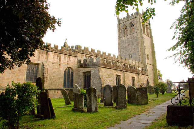
All Saints' Church, Youlgreave

All Saints’ Church, Youlgreave is a Grade I listed parish church in the Church of England in Youlgreave, Derbyshire. == History == The church dates from...
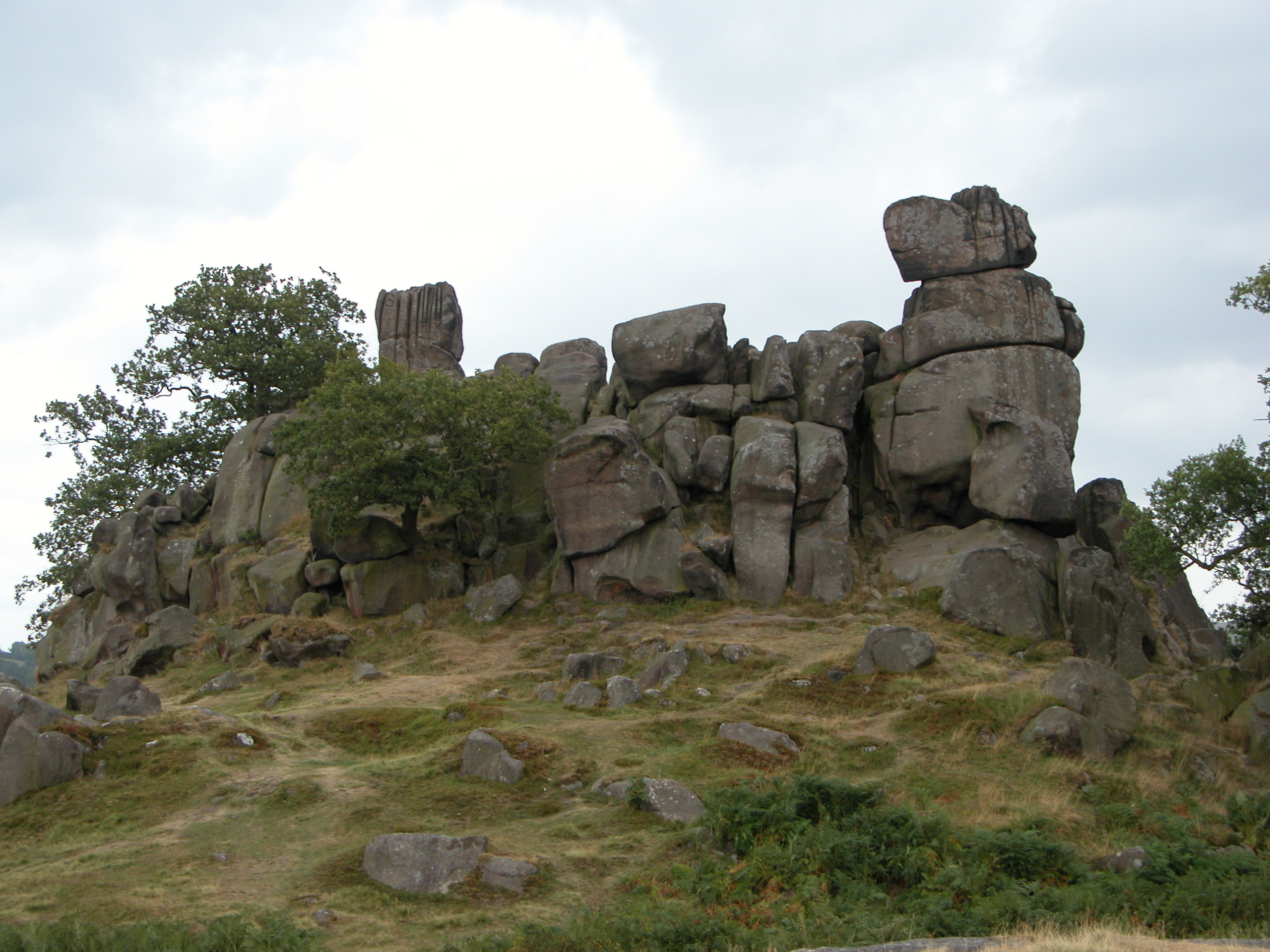
Robin Hood's Stride

Robin Hood's Stride (also known as Mock Beggar's Mansion) is a rock formation on the Limestone Way in Derbyshire close to the village of Elton. The nearest...

Nine Stones Close

Nine Stones Close, also known as the Grey Ladies, is a stone circle on Harthill Moor in Derbyshire in the English East Midlands. It is part of a tradition...

Nearby Amenities

Located within 500m of 53.160199,-1.6950105
Barrier: stile
Material: stone
Source: survey;bing;gps
Stile: stepover
Lat/Long: 53.1620255/-1.6991687
Barrier: stile
Foot: yes
Lat/Long: 53.1574422/-1.6927053
Barrier: stile
Foot: yes
Lat/Long: 53.1596889/-1.6969945
Barrier: stile
Foot: yes
Lat/Long: 53.1600149/-1.6991045
Barrier: cattle_grid
Lat/Long: 53.1599875/-1.6991876
Barrier: stile
Foot: yes
Material: stone
Source: survey;gps
Stile: stepover
Lat/Long: 53.1602686/-1.6994901
Barrier: stile
Lat/Long: 53.1588921/-1.6900227
Barrier: stile
Lat/Long: 53.1626789/-1.6993128
Barrier: stile
Material: stone
Stile: squeezer
Lat/Long: 53.1639703/-1.6915646
Power: pole
Lat/Long: 53.1562805/-1.6914715
Power: pole
Lat/Long: 53.1569989/-1.6925871
Power: pole
Lat/Long: 53.1577047/-1.6936378
Power: pole
Lat/Long: 53.1584092/-1.6946816
Power: pole
Lat/Long: 53.1594783/-1.6955582
Power: pole
Lat/Long: 53.1606127/-1.6964384
Power: pole
Lat/Long: 53.1613194/-1.6970196
Power: pole
Lat/Long: 53.162071/-1.6976399
Power: pole
Lat/Long: 53.1631653/-1.6984931
Barrier: cattle_grid
Bicycle: yes
Foot: yes
Lat/Long: 53.1599483/-1.6991612
Barrier: stile
Material: stone
Source: survey;gps
Stile: squeezer
Lat/Long: 53.1640388/-1.6913427
Bench
Backrest: yes
Colour: brown
Material: wood
Lat/Long: 53.1617025/-1.6908612
Access: no
Foot: yes
Ford: yes
Lat/Long: 53.1593324/-1.7011929
The data included in this document is from www.openstreetmap.org. The data is made available under ODbL.

Have you been to Beech Wood?

Leave your review of Beech Wood below (or comments, questions and feedback).