Black Nursery Plantation

Wood, Forest in Derbyshire Derbyshire Dales

England

Black Nursery Plantation

Hungerhill Lane, Elton Old trackway leading towards Gratton Dale
Hungerhill Lane, Elton Credit: Richard Bird

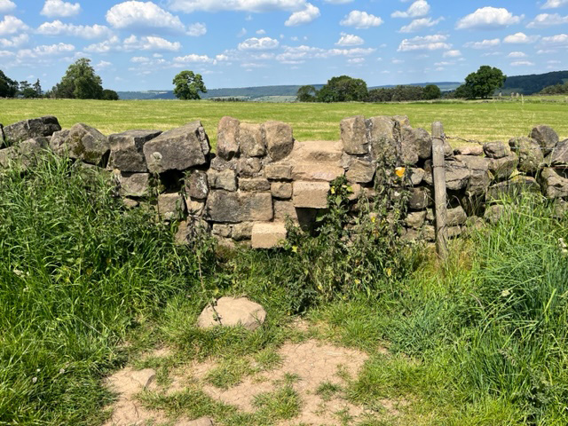
Black Nursery Plantation is a charming woodland located in Derbyshire, England. Situated near the town of Wood, this plantation spans over a vast area and is known for its beautiful array of trees and foliage. The plantation is also commonly referred to as Black Nursery Wood or Black Nursery Forest.

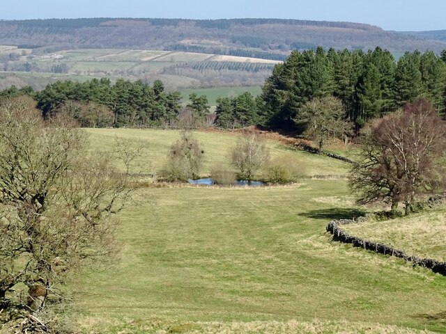
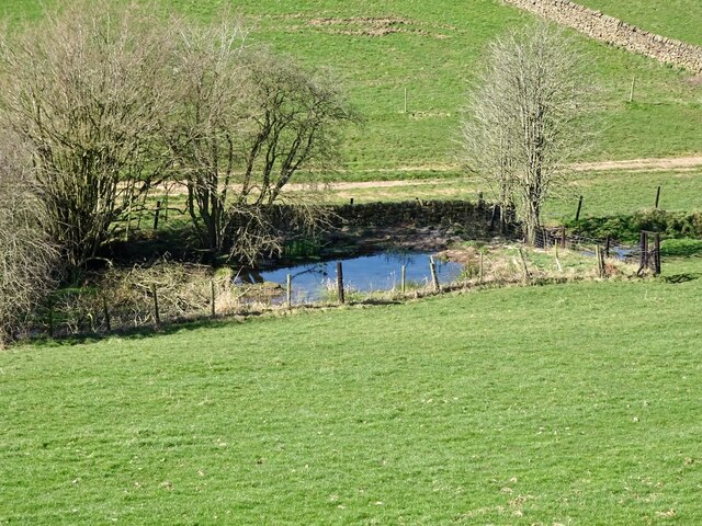
The woodland is well-preserved and maintained, providing a tranquil and picturesque environment for visitors. It boasts a diverse range of tree species, including oak, beech, birch, and pine, among others. The tall, majestic trees create a dense canopy, offering shade and shelter to various wildlife that call this woodland home.

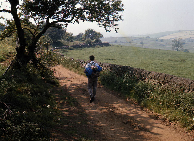
Black Nursery Plantation is a nature lover's paradise, with numerous walking trails that allow visitors to explore its natural beauty. These trails wind through the woodland, offering stunning views of the surrounding landscape. The plantation is also home to a variety of birds, making it a popular spot for birdwatching enthusiasts.

The management of Black Nursery Plantation ensures the protection and conservation of its natural habitat. They regularly conduct tree maintenance and forest management activities to preserve the health and biodiversity of the woodland. The plantation is also open to the public, with designated picnic areas and benches for visitors to relax and enjoy the serene surroundings.

In summary, Black Nursery Plantation is a captivating woodland in Derbyshire, offering a peaceful retreat for nature enthusiasts. With its diverse range of trees, picturesque trails, and abundant wildlife, it is a must-visit destination for those seeking solace in the beauty of nature.

If you have any feedback on the listing, please let us know in the comments section below.

Black Nursery Plantation Images

Images are sourced within 2km of 53.15888/-1.6891423 or Grid Reference SK2062. Thanks to Geograph Open Source API. All images are credited.

Hungerhill Lane, Elton Old trackway leading towards Gratton Dale
Hungerhill Lane, Elton
Old trackway leading towards Gratton Dale
Grave of John Millington, railway navvy, Youlgreave Churchyard During the construction of the Midland Railway near Haddon Hall in 1861 a tunnel was insisted upon by the Duke of Rutland so that the line could not be seen from the hall. A part of this tunnel collapsed during construction on 2nd July 1861 killing five workers. The grave of one of these can be found in the churchyard. The inscription reads: "In memory of John Millington of Stanton, killed by the falling of an arch on the railway near Haddon Hall, July 2nd 1861 aged 46 years". Reference to his 6 year old daughter is also on the stone whose body rests in Warrick churchyard, Ruthin, North Wales.
Grave of John Millington, railway navvy, Youlgreave Churchyard
During the construction of the Midland Railway near Haddon Hall in 1861 a tunnel was insisted upon by the Duke of Rutland so that the line could not be seen from the hall. A part of this tunnel collapsed during construction on 2nd July 1861 killing five workers. The grave of one of these can be found in the churchyard. The inscription reads: "In memory of John Millington of Stanton, killed by the falling of an arch on the railway near Haddon Hall, July 2nd 1861 aged 46 years". Reference to his 6 year old daughter is also on the stone whose body rests in Warrick churchyard, Ruthin, North Wales.
The hermit's cave The hermit's cave is thought to be 14th century in origin but may be older. There would have been a wooden lean-to structure on the outside. It contains the crucifixion carving, pictured in <a href="https://www.geograph.org.uk/photo/53753">SK2262 : Hermit's cave</a>.
The hermit's cave
The hermit's cave is thought to be 14th century in origin but may be older. There would have been a wooden lean-to structure on the outside. It contains the crucifixion carving, pictured in SK2262 : Hermit's cave.
Pond on Harthill Moor
Old reservoir Now just a pond but marked on old maps as a reservoir, possibly for the hydraulic ram sited a short distance downstream.
Old reservoir
Now just a pond but marked on old maps as a reservoir, possibly for the hydraulic ram sited a short distance downstream.
Robin Hood's Stride near Birchover
Stone Stile, Elton Just off the Limestone Way (Derbyshire footpath Harthill FP 1) allowing private access past the gate, when there had been one. This is looking South, the alternative view North is <a href="https://www.geograph.org.uk/photo/7519024">SK2262 : Stone Stile, Elton</a>.
Stone Stile, Elton
Just off the Limestone Way (Derbyshire footpath Harthill FP 1) allowing private access past the gate, when there had been one. This is looking South, the alternative view North is SK2262 : Stone Stile, Elton.
Stone Stile, Elton Just off the Limestone Way (Derbyshire footpath Harthill FP 1) allowing private access past the gate, when there had been one. This is looking North, the alternative view South is <a href="https://www.geograph.org.uk/photo/7519022">SK2262 : Stone Stile, Elton</a>.
Stone Stile, Elton
Just off the Limestone Way (Derbyshire footpath Harthill FP 1) allowing private access past the gate, when there had been one. This is looking North, the alternative view South is SK2262 : Stone Stile, Elton.
Stone Stile, Elton On the Limestone Way (Derbyshire footpath, Harthill FP 1)  due North of Elton village looking NW. The view East is <a href="https://www.geograph.org.uk/photo/7519093">SK2262 : Stone Stile, Elton</a>.
Stone Stile, Elton
On the Limestone Way (Derbyshire footpath, Harthill FP 1) due North of Elton village looking NW. The view East is SK2262 : Stone Stile, Elton.
Stone Stile, Elton On the Limestone Way (Derbyshire footpath Harthill FP 1), North of Elton village looking East. The view NW is <a href="https://www.geograph.org.uk/photo/7519091">SK2262 : Stone Stile, Elton</a>.
Stone Stile, Elton
On the Limestone Way (Derbyshire footpath Harthill FP 1), North of Elton village looking East. The view NW is SK2262 : Stone Stile, Elton.
Stone Stile, Elton Looking South from Derbyshire footpath Harthill FP 18, onto Limestone Way  (footpath Harthill FP 1). The view looking North is <a href="https://www.geograph.org.uk/photo/7519109">SK2262 : Stone Stile, Elton</a>.
Stone Stile, Elton
Looking South from Derbyshire footpath Harthill FP 18, onto Limestone Way (footpath Harthill FP 1). The view looking North is SK2262 : Stone Stile, Elton.
Stone Stile, Elton Leading North to Derbyshire footpath Harthill FP 18 off Limestone Way  (footpath Harthill FP 1)  looking North. The view looking South is <a href="https://www.geograph.org.uk/photo/7519108">SK2262 : Stone Stile, Elton</a>.
Stone Stile, Elton
Leading North to Derbyshire footpath Harthill FP 18 off Limestone Way (footpath Harthill FP 1) looking North. The view looking South is SK2262 : Stone Stile, Elton.
Stone Stile, Elton On the Limestone Way (Derbyshire footpath Winster FP 13)  North of Elton village looking North.
The view South is <a href="https://www.geograph.org.uk/photo/7519168">SK2262 : Stone Stile, Elton</a>.
Stone Stile, Elton
On the Limestone Way (Derbyshire footpath Winster FP 13) North of Elton village looking North. The view South is SK2262 : Stone Stile, Elton.
Stone Stile, Elton On the Limestone Way (Derbyshire footpath Winster FP 13)  North of Elton village looking South. The view North is <a href="https://www.geograph.org.uk/photo/7519167">SK2262 : Stone Stile, Elton</a>.
Stone Stile, Elton
On the Limestone Way (Derbyshire footpath Winster FP 13) North of Elton village looking South. The view North is SK2262 : Stone Stile, Elton.
Stone Stile, Elton On the Limestone Way (Derbyshire footpath Harthill FP 1)  North of Elton village looking SW. The view NE is <a href="https://www.geograph.org.uk/photo/7519184">SK2262 : Stone Stile, Elton</a>.
Stone Stile, Elton
On the Limestone Way (Derbyshire footpath Harthill FP 1) North of Elton village looking SW. The view NE is SK2262 : Stone Stile, Elton.
Stone Stile, Elton On the Limestone Way (Derbyshire footpath Harthill FP 1)  North of Elton village looking NE. The view SW is <a href="https://www.geograph.org.uk/photo/7519182">SK2262 : Stone Stile, Elton</a>.
Stone Stile, Elton
On the Limestone Way (Derbyshire footpath Harthill FP 1) North of Elton village looking NE. The view SW is SK2262 : Stone Stile, Elton.
Stone Stile, Elton Off Cliff Lane on Derbyshire footpath Harthill FP 1 looking to the road. The view SE is <a href="https://www.geograph.org.uk/photo/7520350">SK2262 : Stone Stile, Elton</a>
Stone Stile, Elton
Off Cliff Lane on Derbyshire footpath Harthill FP 1 looking to the road. The view SE is SK2262 : Stone Stile, Elton
Stone Stile, Elton Off Cliff Lane on Derbyshire footpath Harthill FP 1 looking from the road. The view NW is <a href="https://www.geograph.org.uk/photo/7520349">SK2262 : Stone Stile, Elton</a>.
Stone Stile, Elton
Off Cliff Lane on Derbyshire footpath Harthill FP 1 looking from the road. The view NW is SK2262 : Stone Stile, Elton.
Show me another place!

Black Nursery Plantation is located at Grid Ref: SK2062 (Lat: 53.15888, Lng: -1.6891423)

Administrative County: Derbyshire

District: Derbyshire Dales

Police Authority: Derbyshire

What 3 Words

///supple.quieter.hardback. Near Youlgreave, Derbyshire

Related Wikis

Harthill Moor

Harthill Moor is a small upland area in the Derbyshire Peak District of central and northern England, lying between Matlock and Bakewell near the villages...

Dale End, Derbyshire

Dale End is a hamlet in Derbyshire, England to the west of Elton. == References ==

Gratton, Derbyshire

Gratton is a civil parish in the Derbyshire Dales district of central Derbyshire, half a mile west of the neighbouring village, Elton. == See also... ==

Middleton-by-Youlgreave

Middleton, often known as Middleton-by-Youlgreave or Middleton-by-Youlgrave to distinguish it from nearby Middleton-by-Wirksworth, is a village in the...
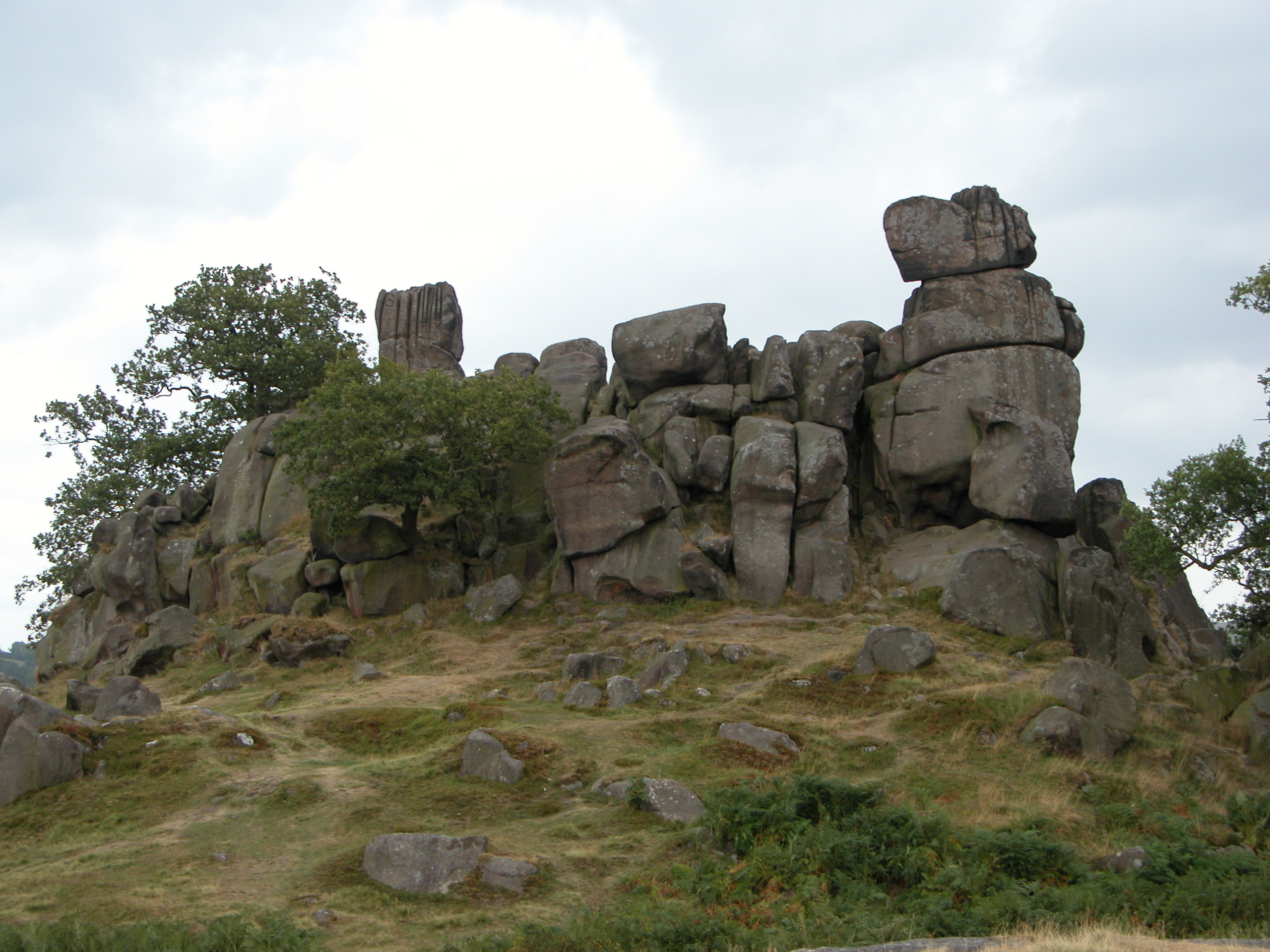
Robin Hood's Stride

Robin Hood's Stride (also known as Mock Beggar's Mansion) is a rock formation on the Limestone Way in Derbyshire close to the village of Elton. The nearest...

Nine Stones Close

Nine Stones Close, also known as the Grey Ladies, is a stone circle on Harthill Moor in Derbyshire in the English East Midlands. It is part of a tradition...

Youlgreave

Youlgreave or Youlgrave is a village and civil parish in the Peak District of Derbyshire, England, on the River Bradford 2+1⁄2 miles (4.0 km) south of...

Harthill, Derbyshire

Harthill is a civil parish within the Derbyshire Dales district, in the county of Derbyshire, England. Largely rural, along with parts of the neighbouring...

Nearby Amenities

Located within 500m of 53.15888,-1.6891423
Barrier: stile
Foot: yes
Steps: 0
Stile: stepover
Lat/Long: 53.1619447/-1.6849722
Barrier: stile
Foot: yes
Steps: 1
Stile: wall
Lat/Long: 53.1600626/-1.6839751
Barrier: stile
Foot: yes
Steps: 1
Stile: wall
Lat/Long: 53.1598837/-1.6839691
Barrier: stile
Foot: yes
Steps: 1
Stile: stepover
Lat/Long: 53.158189/-1.683673
Barrier: stile
Foot: yes
Material: stone
Stile: squeezer
Lat/Long: 53.1546258/-1.6889781
Barrier: stile
Foot: yes
Lat/Long: 53.156088/-1.6916259
Barrier: stile
Foot: yes
Lat/Long: 53.1574422/-1.6927053
Barrier: stile
Material: stone
Source: survey;gps
Stile: squeezer
Lat/Long: 53.1628967/-1.6859869
Barrier: stile
Lat/Long: 53.1588921/-1.6900227
Barrier: stile
Steps: 1
Stile: stepover
Lat/Long: 53.1546956/-1.6871593
Power: pole
Lat/Long: 53.1550515/-1.6896319
Power: pole
Lat/Long: 53.155703/-1.6905993
Power: pole
Lat/Long: 53.1562805/-1.6914715
Power: pole
Lat/Long: 53.1569989/-1.6925871
Power: pole
Lat/Long: 53.1577047/-1.6936378
Power: pole
Lat/Long: 53.1584092/-1.6946816
Power: pole
Lat/Long: 53.1594783/-1.6955582
Barrier: stile
Material: stone
Source: survey;gps
Stile: squeezer
Lat/Long: 53.162328/-1.6847907
Bench
Backrest: yes
Colour: brown
Material: wood
Lat/Long: 53.1617025/-1.6908612
Harthill Moor
Ele: 272
Natural: peak
Lat/Long: 53.1611828/-1.6876716
The data included in this document is from www.openstreetmap.org. The data is made available under ODbL.

Have you been to Black Nursery Plantation?

Leave your review of Black Nursery Plantation below (or comments, questions and feedback).