Borough Wood

Wood, Forest in Northumberland

England

Borough Wood

Old Sign board by the B1337 in Morpeth Sign board by the B1337 (was A1 and then A197), in parish of Morpeth (Castle Morpeth District), junction with St Mary's Road, in flower beds behind footpath. See also Link.

Inscription reads:- MORPETH ¾ / ALNWICK 20½ / BERWICK 50 / EDINBURGH 110 
The reverse reads:- NEWCASTLE 14 / DARLINGTON 46½ / YORK 95 / LONDON 289

Northumberland HER listed:-
Reference number: N16766 <span class="nowrap"><a title="https://www.heritagegateway.org.uk/Gateway/Results_Single.aspx?uid=N16766&resourceID=110" rel="nofollow ugc noopener" href="https://www.heritagegateway.org.uk/Gateway/Results_Single.aspx?uid=N16766&resourceID=110">Link</a><img style="margin-left:2px;" alt="External link" title="External link - shift click to open in new window" src="https://s1.geograph.org.uk/img/external.png" width="10" height="10"/></span>

Surveyed

Milestone Society National ID: NB_NCMP14
Old Sign board by the B1337 in Morpeth Credit: Simon Douglas

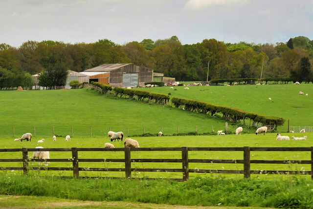
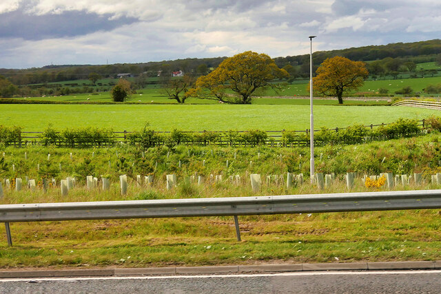
Borough Wood, located in Northumberland, is a captivating woodland area known for its natural beauty and rich biodiversity. Spanning over a vast expanse of land, the wood is nestled within the scenic Northumberland countryside, offering visitors a serene and peaceful retreat from the hustle and bustle of everyday life.

Comprising diverse tree species such as oak, beech, and birch, Borough Wood boasts a lush and verdant landscape throughout the year. The towering trees create a dense canopy, allowing only dappled sunlight to filter through to the forest floor. This creates an enchanting atmosphere, perfect for leisurely walks and exploration.

The wood is home to a wide range of wildlife, including various bird species, mammals, and invertebrates. Visitors may be lucky enough to catch a glimpse of woodland birds such as the great spotted woodpecker or the charming nuthatch. Mammals such as red squirrels, roe deer, and badgers also call Borough Wood their home.

Tranquil pathways wind their way through the wood, leading visitors on a journey through the heart of nature. As they meander along the well-maintained trails, visitors can enjoy the serene ambiance and immerse themselves in the sights and sounds of the wood. Interpretative signs dotted throughout the woodland provide valuable information about the local flora and fauna, enhancing the educational aspect of the visit.

Borough Wood is not only a haven for nature enthusiasts but also a popular spot for picnickers, photographers, and artists who find inspiration in its natural beauty. With its picturesque scenery and abundant wildlife, Borough Wood truly offers a breathtaking experience for all who visit.

If you have any feedback on the listing, please let us know in the comments section below.
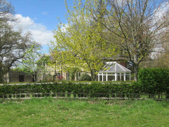
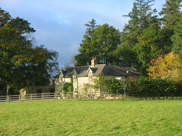
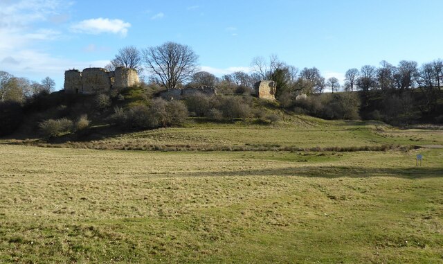
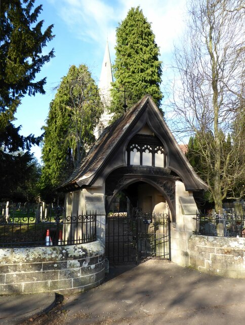
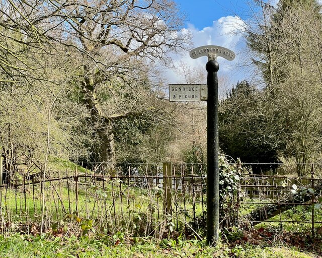
Borough Wood Images

Images are sourced within 2km of 55.164416/-1.720369 or Grid Reference NZ1785. Thanks to Geograph Open Source API. All images are credited.

Old Sign board by the B1337 in Morpeth Sign board by the B1337 (was A1 and then A197), in parish of Morpeth (Castle Morpeth District), junction with St Mary's Road, in flower beds behind footpath. See also Link.

Inscription reads:- MORPETH ¾ / ALNWICK 20½ / BERWICK 50 / EDINBURGH 110 
The reverse reads:- NEWCASTLE 14 / DARLINGTON 46½ / YORK 95 / LONDON 289

Northumberland HER listed:-
Reference number: N16766 <span class="nowrap"><a title="https://www.heritagegateway.org.uk/Gateway/Results_Single.aspx?uid=N16766&resourceID=110" rel="nofollow ugc noopener" href="https://www.heritagegateway.org.uk/Gateway/Results_Single.aspx?uid=N16766&resourceID=110">Link</a><img style="margin-left:2px;" alt="External link" title="External link - shift click to open in new window" src="https://s1.geograph.org.uk/img/external.png" width="10" height="10"/></span>

Surveyed

Milestone Society National ID: NB_NCMP14
Old Sign board by the B1337 in Morpeth
Sign board by the B1337 (was A1 and then A197), in parish of Morpeth (Castle Morpeth District), junction with St Mary's Road, in flower beds behind footpath. See also Link. Inscription reads:- MORPETH ¾ / ALNWICK 20½ / BERWICK 50 / EDINBURGH 110 The reverse reads:- NEWCASTLE 14 / DARLINGTON 46½ / YORK 95 / LONDON 289 Northumberland HER listed:- Reference number: N16766 LinkExternal link Surveyed Milestone Society National ID: NB_NCMP14
Farmland, High Church
Saplings at St Leonard's Junction Newly planted saplings alongside the A1 at St Leonard's Junction (A1/A197 Morpeth Bypass).
Saplings at St Leonard's Junction
Newly planted saplings alongside the A1 at St Leonard's Junction (A1/A197 Morpeth Bypass).
Farmland next to the A1 near to Mitford Looking towards East Benridge Farm.
Farmland next to the A1 near to Mitford
Looking towards East Benridge Farm.
Hiding in plain sight The sundial on the south wall of the Church of St. Mary the Virgin is a large one but is easily missed.  See also <a href="https://www.geograph.org.uk/photo/7004976">NZ1985 : Sundial on the Church of St. Mary the Virgin</a>
Hiding in plain sight
The sundial on the south wall of the Church of St. Mary the Virgin is a large one but is easily missed. See also NZ1985 : Sundial on the Church of St. Mary the Virgin
Sundial on the Church of St. Mary the Virgin This elegant sundial is carved into the stonework, high on the south side of the chancel wall.  The long slender gnomon provides high precision.  Not sure what the 'T W' stands for, or the lower 'j W'. See also <a href="https://www.geograph.org.uk/photo/7004966">NZ1985 : Hiding in plain sight</a>
Sundial on the Church of St. Mary the Virgin
This elegant sundial is carved into the stonework, high on the south side of the chancel wall. The long slender gnomon provides high precision. Not sure what the 'T W' stands for, or the lower 'j W'. See also NZ1985 : Hiding in plain sight
Old signpost beside the old A1 Such precision! The base bearing the letters and numbers is quite badly cracked but still legible.  See <a href="https://www.geograph.org.uk/photo/7004999">NZ1985 : Old signpost beside the old A1</a> for the reverse side.
Old signpost beside the old A1
Such precision! The base bearing the letters and numbers is quite badly cracked but still legible. See NZ1985 : Old signpost beside the old A1 for the reverse side.
Old signpost beside the old A1 The reverse side of <a href="https://www.geograph.org.uk/photo/7004991">NZ1985 : Old signpost beside the old A1</a>  Looking quite well maintained, see <a href="https://www.geograph.org.uk/photo/6048069">NZ1985 : Old Sign board by the B1337 in Morpeth</a>
Old signpost beside the old A1
The reverse side of NZ1985 : Old signpost beside the old A1 Looking quite well maintained, see NZ1985 : Old Sign board by the B1337 in Morpeth
Giant 'comb' in action Collecting logs and debris in the aftermath of Storm Arwen this structure on the Wansbeck, designed to protect Morpeth bridges etc., appears to be doing its job effectively.
Giant 'comb' in action
Collecting logs and debris in the aftermath of Storm Arwen this structure on the Wansbeck, designed to protect Morpeth bridges etc., appears to be doing its job effectively.
Gate House to Mitford Hall
Mitford Cricket Ground
Newton Crook
Newton Crook
Newton Crook
Newton Crook
Mitford Castle The Norman motte and bailey castle stands on a small prominence, a somewhat elliptical mound, above the River Wansbeck. The selected building site allowed for the natural hill to be scarped and ditched, producing the motte. Wikipedia.
Mitford Castle
The Norman motte and bailey castle stands on a small prominence, a somewhat elliptical mound, above the River Wansbeck. The selected building site allowed for the natural hill to be scarped and ditched, producing the motte. Wikipedia.
Lych Gate of the Church of St. Mary Magdalene, Mitford  The parish church of Mitford, although locally prominent in the landscape through its lofty spire, lies low on the south bank of the Wansbeck, and is overlooked on the south east by the prominent knoll that carries the ruins of Mitford
Castle.
Lych Gate of the Church of St. Mary Magdalene, Mitford
The parish church of Mitford, although locally prominent in the landscape through its lofty spire, lies low on the south bank of the Wansbeck, and is overlooked on the south east by the prominent knoll that carries the ruins of Mitford Castle.
Direction Sign – Signpost on St Leonards Lane, Mitford Located on the northeast side of the junction of the B6343 and St Leonards Lane in Mitford parish. 1 arm and fan finial. See also <a title="https://www.geograph.org.uk/photo/6527519" href="https://www.geograph.org.uk/photo/6527519">Link</a> and <a title="https://www.geograph.org.uk/photo/1767673" href="https://www.geograph.org.uk/photo/1767673">Link</a>.

Milestone Society National ID: NB_NZ1785
Direction Sign – Signpost on St Leonards Lane, Mitford
Located on the northeast side of the junction of the B6343 and St Leonards Lane in Mitford parish. 1 arm and fan finial. See also Link and Link. Milestone Society National ID: NB_NZ1785
River Wansbeck at Highford Bridge
Show me another place!

Borough Wood is located at Grid Ref: NZ1785 (Lat: 55.164416, Lng: -1.720369)

Unitary Authority: Northumberland

Police Authority: Northumbria

What 3 Words

///invoices.shaped.samples. Near Morpeth, Northumberland

Related Wikis

Mitford, Northumberland

Mitford is a village in Northumberland, England, located 2 miles (3 km) west of Morpeth. == History == Although the foundation of Mitford is unknown, it...
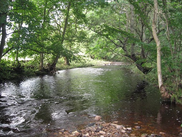
River Font

The River Font is a river that flows through Northumberland, England. The river is a tributary of the River Wansbeck which it joins at Mitford. == References... ==
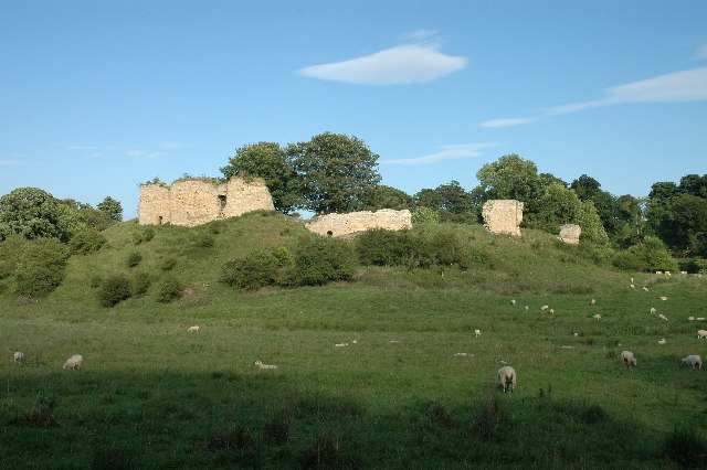
Mitford Castle

Mitford Castle is an English castle dating from the end of the 11th century and located at Mitford, Northumberland. It is a Scheduled Ancient Monument...

Newminster Abbey

Newminster Abbey was a Cistercian abbey in Northumberland in the north of England. The site is protected by Grade II listed building and Scheduled Ancient...

Mitford Old Manor House

Mitford Old Manor House is an historic English manor house at Mitford, Northumberland, and is a Grade II* listed building. The Manor of Mitford was held...

Morpeth Town A.F.C.

Morpeth Town Association Football Club is a football club based in Morpeth, Northumberland, England. They are currently members of the Northern Premier...

Mitford Hall

Mitford Hall is a Georgian mansion house and Grade II* listed building standing in its own 85-acre (34 ha) park overlooking the River Wansbeck at Mitford...

Bullers Green

Bullers Green is a part of the town of Morpeth and former civil parish, Northumberland, England. In 1881 the parish had a population of 346. == Governance... ==

Nearby Amenities

Located within 500m of 55.164416,-1.720369
Waterway: weir
Lat/Long: 55.1657665/-1.7268925
Highford Bridge
Place: locality
Lat/Long: 55.1665328/-1.7194278
Athey's Dean
Natural: wood
Lat/Long: 55.1622686/-1.7141651
Borough Wood
Place: locality
Lat/Long: 55.1646097/-1.7166756
Generator Method: photovoltaic
Generator Output Electricity: yes
Generator Source: solar
Generator Type: solar_photovoltaic_panel
Power: generator
Lat/Long: 55.1654597/-1.720299
The data included in this document is from www.openstreetmap.org. The data is made available under ODbL.

Have you been to Borough Wood?

Leave your review of Borough Wood below (or comments, questions and feedback).