Castle Plantation

Wood, Forest in Northumberland

England

Castle Plantation

Farmland, High Church
Farmland, High Church Credit: David Dixon

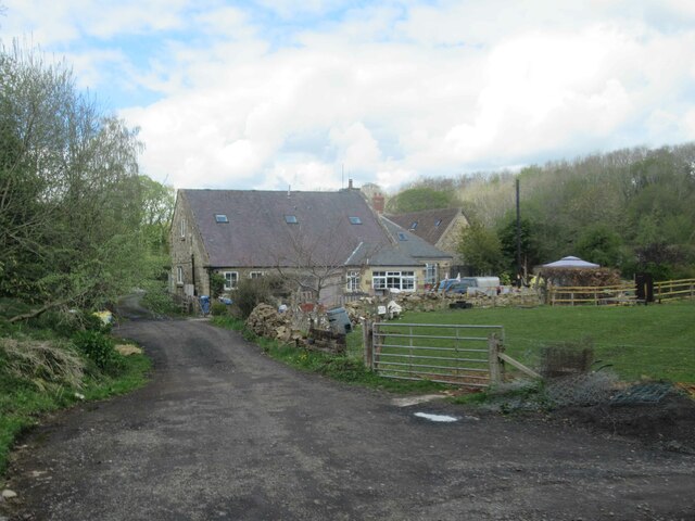
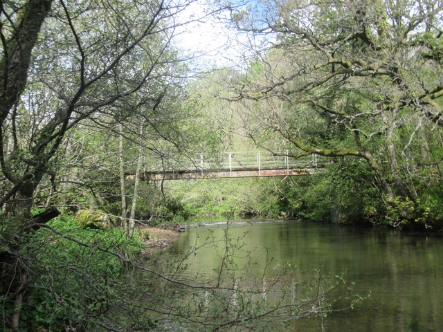
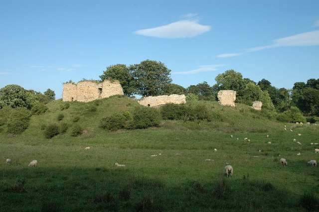
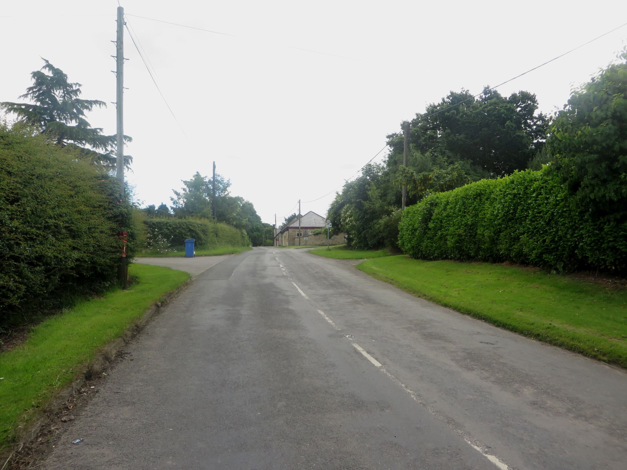
Castle Plantation is a picturesque woodland located in the county of Northumberland, England. Situated near the small village of Wood, the plantation spans an area of approximately 100 acres and is known for its dense forest and historic ruins.

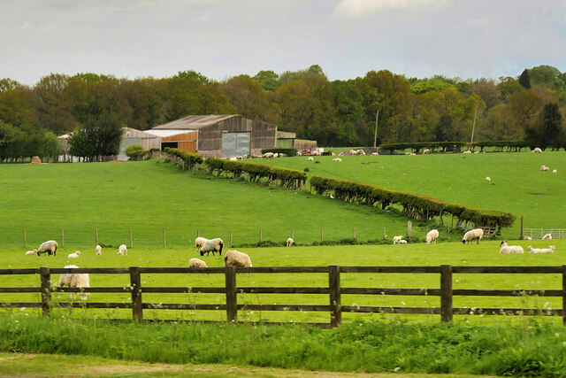
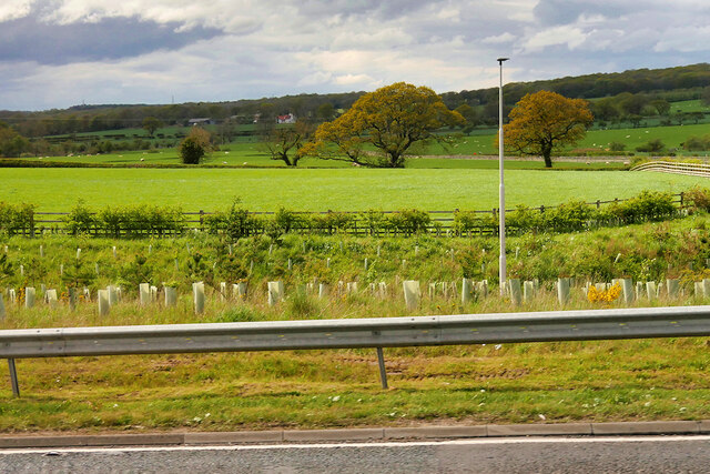
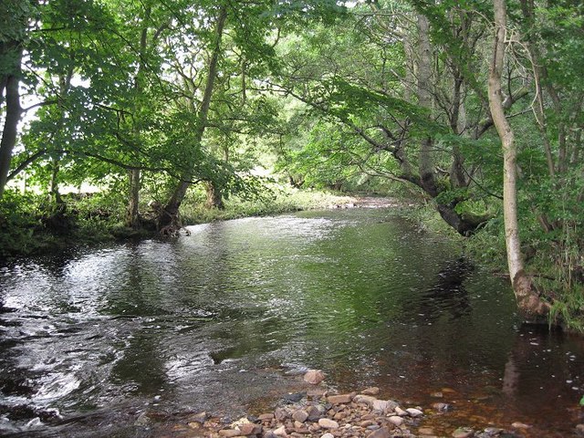
The woodland is characterized by its diverse range of tree species, including oak, beech, ash, and pine, which create a vibrant and enchanting atmosphere. The dense canopy provides a habitat for a variety of wildlife, including deer, foxes, and a wide array of bird species, making it a popular spot for nature enthusiasts and birdwatchers.

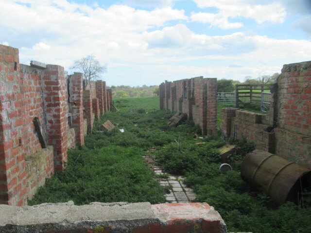
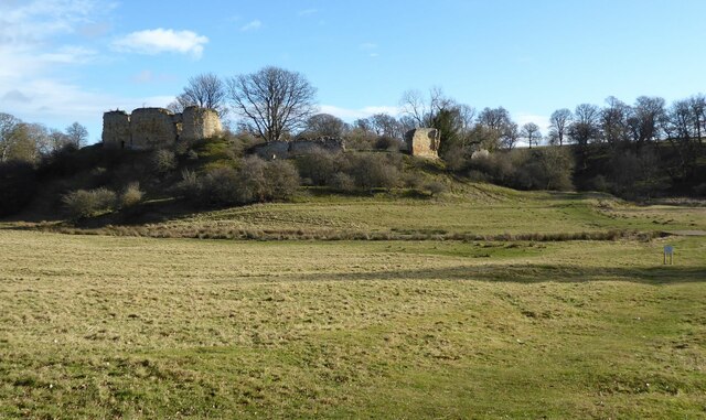
At the heart of Castle Plantation lies the remnants of a medieval castle, adding an air of mystery and intrigue to the site. The ruins, believed to date back to the 13th century, offer visitors a glimpse into the region's rich history. The castle's stone walls and crumbling towers are testament to its former grandeur and provide a fascinating backdrop for exploration and photography.

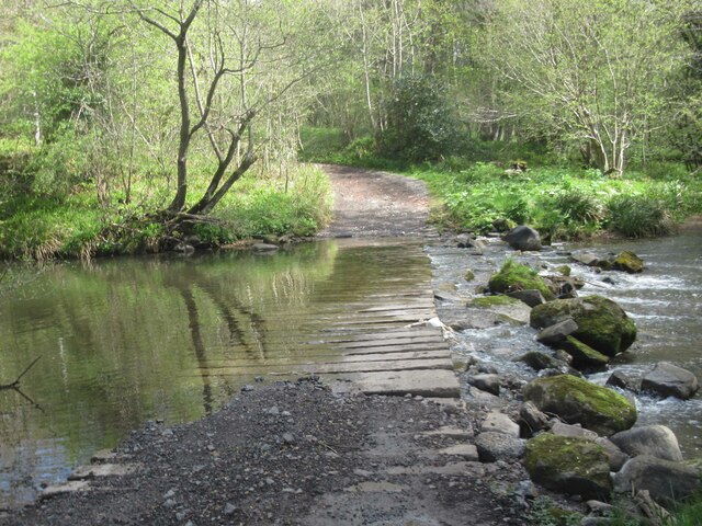
The plantation is also a haven for outdoor activities, with well-maintained trails winding through the woods, offering opportunities for walking, hiking, and cycling. Several picnic spots and seating areas are scattered throughout the plantation, providing visitors with a chance to relax and enjoy the peaceful surroundings.

Castle Plantation is easily accessible, with ample parking available nearby. The site is open to the public year-round, and there is no admission fee. Whether one is seeking a tranquil escape into nature, a glimpse into history, or an adventure-filled day out, Castle Plantation in Northumberland is a must-visit destination.

If you have any feedback on the listing, please let us know in the comments section below.

Castle Plantation Images

Images are sourced within 2km of 55.162793/-1.7299235 or Grid Reference NZ1785. Thanks to Geograph Open Source API. All images are credited.

Farmland, High Church
Saplings at St Leonard's Junction Newly planted saplings alongside the A1 at St Leonard's Junction (A1/A197 Morpeth Bypass).
Saplings at St Leonard's Junction
Newly planted saplings alongside the A1 at St Leonard's Junction (A1/A197 Morpeth Bypass).
Giant 'comb' in action Collecting logs and debris in the aftermath of Storm Arwen this structure on the Wansbeck, designed to protect Morpeth bridges etc., appears to be doing its job effectively.
Giant 'comb' in action
Collecting logs and debris in the aftermath of Storm Arwen this structure on the Wansbeck, designed to protect Morpeth bridges etc., appears to be doing its job effectively.
Storm Arwen trees and debris at Mitford dam The dam is part of the flood defences for Morpeth and marks a point where storm generated tree trunks and other debris are sieved out of the Wansbeck before it flows into the town.
Storm Arwen trees and debris at Mitford dam
The dam is part of the flood defences for Morpeth and marks a point where storm generated tree trunks and other debris are sieved out of the Wansbeck before it flows into the town.
Gate House to Mitford Hall
Mitford Cricket Ground
Newton Crook
Newton Crook
Derelict Farm Buildings near Newton Mill
Newton Mill
Newton Mill
Newton Mill A porch has been added since our last visit in 2006
Newton Mill
A porch has been added since our last visit in 2006
Ford through the River Font
Footbridge across the River Font
Newton Crook
Newton Crook
Mitford Castle The Norman motte and bailey castle stands on a small prominence, a somewhat elliptical mound, above the River Wansbeck. The selected building site allowed for the natural hill to be scarped and ditched, producing the motte. Wikipedia.
Mitford Castle
The Norman motte and bailey castle stands on a small prominence, a somewhat elliptical mound, above the River Wansbeck. The selected building site allowed for the natural hill to be scarped and ditched, producing the motte. Wikipedia.
Lych Gate of the Church of St. Mary Magdalene, Mitford  The parish church of Mitford, although locally prominent in the landscape through its lofty spire, lies low on the south bank of the Wansbeck, and is overlooked on the south east by the prominent knoll that carries the ruins of Mitford
Castle.
Lych Gate of the Church of St. Mary Magdalene, Mitford
The parish church of Mitford, although locally prominent in the landscape through its lofty spire, lies low on the south bank of the Wansbeck, and is overlooked on the south east by the prominent knoll that carries the ruins of Mitford Castle.
Direction Sign – Signpost on St Leonards Lane, Mitford Located on the northeast side of the junction of the B6343 and St Leonards Lane in Mitford parish. 1 arm and fan finial. See also <a title="https://www.geograph.org.uk/photo/6527519" href="https://www.geograph.org.uk/photo/6527519">Link</a> and <a title="https://www.geograph.org.uk/photo/1767673" href="https://www.geograph.org.uk/photo/1767673">Link</a>.

Milestone Society National ID: NB_NZ1785
Direction Sign – Signpost on St Leonards Lane, Mitford
Located on the northeast side of the junction of the B6343 and St Leonards Lane in Mitford parish. 1 arm and fan finial. See also Link and Link. Milestone Society National ID: NB_NZ1785
River Wansbeck at Highford Bridge
Sundial on Saint Mary Magdalene Church A relatively recent sundial installed in 1991, the inscription reads
MCMXCI
S & L SIMPSON
FACTA NON VERBA
Sundial on Saint Mary Magdalene Church
A relatively recent sundial installed in 1991, the inscription reads MCMXCI S & L SIMPSON FACTA NON VERBA
Show me another place!

Castle Plantation is located at Grid Ref: NZ1785 (Lat: 55.162793, Lng: -1.7299235)

Unitary Authority: Northumberland

Police Authority: Northumbria

What 3 Words

///distanced.river.streetcar. Near Morpeth, Northumberland

Related Wikis

Mitford Castle

Mitford Castle is an English castle dating from the end of the 11th century and located at Mitford, Northumberland. It is a Scheduled Ancient Monument...

River Font

The River Font is a river that flows through Northumberland, England. The river is a tributary of the River Wansbeck which it joins at Mitford. == References... ==

Mitford Old Manor House

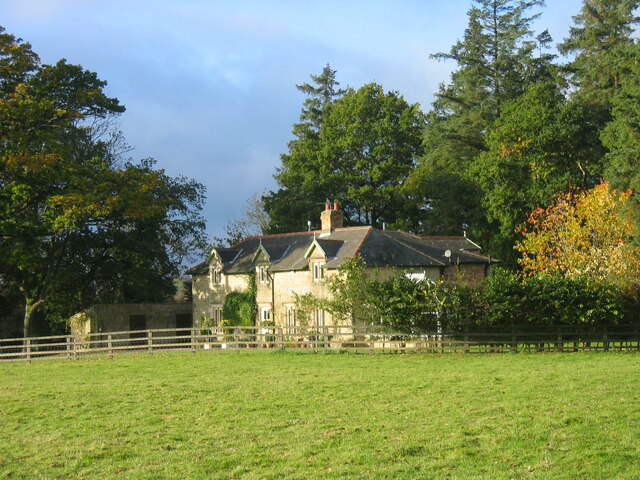
Mitford Old Manor House is an historic English manor house at Mitford, Northumberland, and is a Grade II* listed building. The Manor of Mitford was held...

Mitford, Northumberland

Mitford is a village in Northumberland, England, located 2 miles (3 km) west of Morpeth. == History == Although the foundation of Mitford is unknown, it...

Mitford Hall

Mitford Hall is a Georgian mansion house and Grade II* listed building standing in its own 85-acre (34 ha) park overlooking the River Wansbeck at Mitford...

Morpeth Town A.F.C.

Morpeth Town Association Football Club is a football club based in Morpeth, Northumberland, England. They are currently members of the Northern Premier...

Newminster Abbey

Newminster Abbey was a Cistercian abbey in Northumberland in the north of England. The site is protected by Grade II listed building and Scheduled Ancient...

Tranwell

Tranwell is a small village and former civil parish, now in the parish of Mitford, in the county of Northumberland, England, about 1 mile (2 km) south...

Nearby Amenities

Located within 500m of 55.162793,-1.7299235
Waterway: weir
Lat/Long: 55.1657665/-1.7268925
Adders Haugh
Place: locality
Lat/Long: 55.1659078/-1.7308197
The data included in this document is from www.openstreetmap.org. The data is made available under ODbL.

Have you been to Castle Plantation?

Leave your review of Castle Plantation below (or comments, questions and feedback).