Arlesey

Settlement in Bedfordshire

England

Arlesey

Footbridge between the railway and the River Hiz On a permissive path, forming part of the Hicca Way.
Footbridge between the railway and the River Hiz Credit: David Martin

Arlesey is a small town located in the county of Bedfordshire, in the East of England. Situated approximately 8 miles north of the town of Hitchin and 7 miles south of Biggleswade, Arlesey is conveniently positioned for easy access to major transportation routes.

The town is home to a population of around 6,500 residents, and it offers a peaceful and friendly atmosphere. Arlesey boasts a rich history, with evidence of settlement dating back to the Roman era. The town's name is derived from the Old English words "earl" and "leah," meaning "a clearing of the nobles."

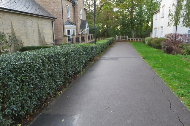
Despite its small size, Arlesey offers a range of amenities and facilities to cater to the needs of its residents. These include several local shops, a supermarket, a post office, and a selection of pubs and restaurants. The town also has its own primary school, Arlesey St. Peter's Academy, providing education for children aged 3 to 11.

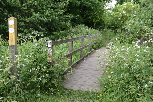
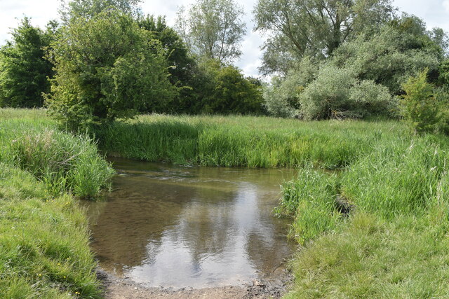
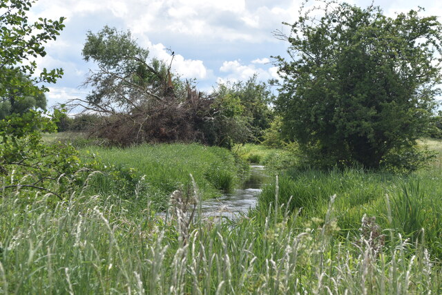
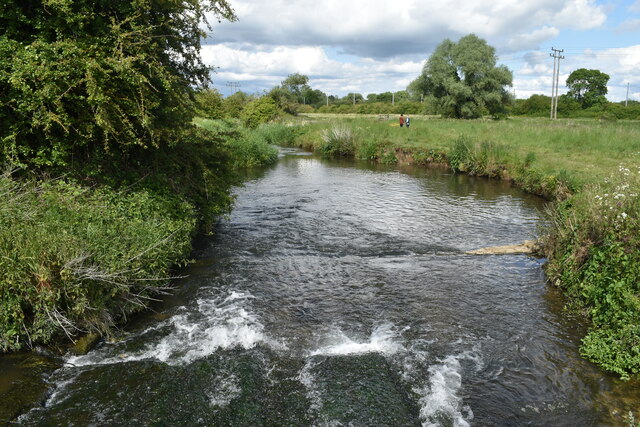
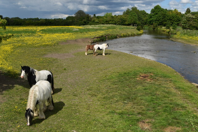
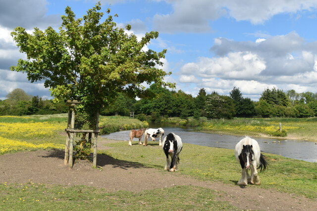
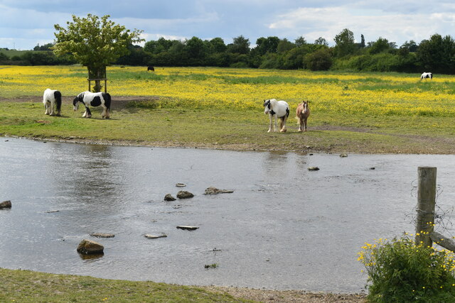
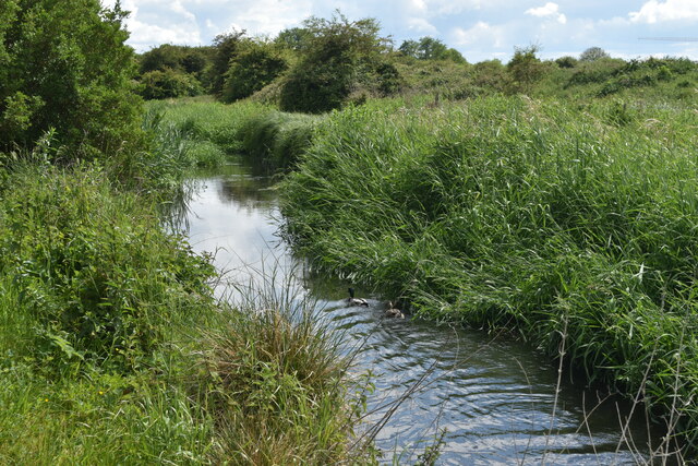
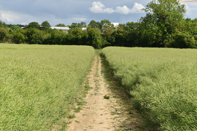
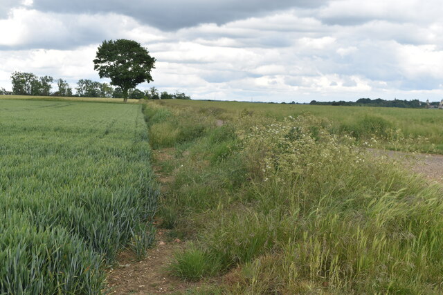
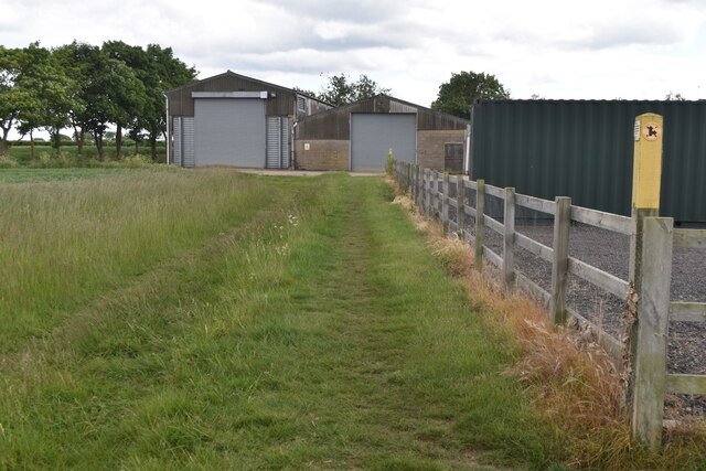
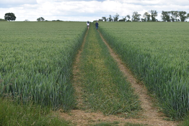
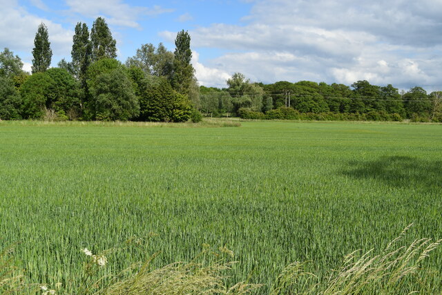
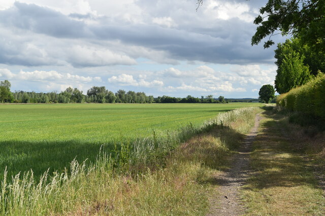
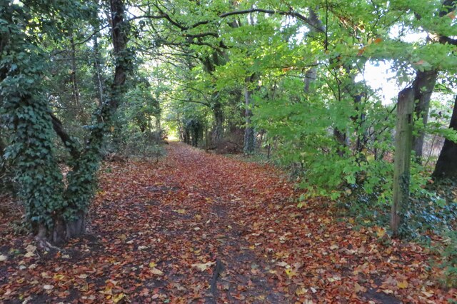
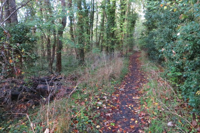
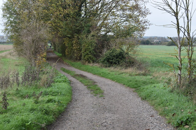
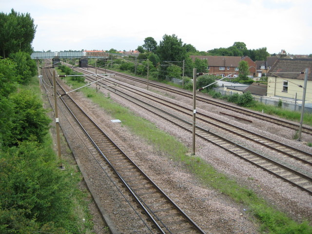
Arlesey benefits from its rural location, with beautiful countryside and green spaces surrounding the town. The nearby Arlesey Heath provides ample opportunities for outdoor activities such as walking, jogging, and cycling. The town is also well-connected, with a railway station offering regular services to London, making it an ideal location for commuters.

In summary, Arlesey is a charming town in Bedfordshire with a rich history, a range of amenities, and convenient transportation links. Its peaceful atmosphere and beautiful surroundings make it an attractive place to live.

If you have any feedback on the listing, please let us know in the comments section below.

Arlesey Images

Images are sourced within 2km of 52.006984/-0.265475 or Grid Reference TL1935. Thanks to Geograph Open Source API. All images are credited.

Footbridge between the railway and the River Hiz On a permissive path, forming part of the Hicca Way.
Footbridge between the railway and the River Hiz
On a permissive path, forming part of the Hicca Way.
River Hiz west of Arlesey
Weir on River Hiz west of Arlesey View from the footbridge.
Weir on River Hiz west of Arlesey
View from the footbridge.
Ponies grazing beside the River Hiz The high vantage point is the end of the footbridge.
Ponies grazing beside the River Hiz
The high vantage point is the end of the footbridge.
Ponies grazing beside the River Hiz
River Hiz, ponies and buttercups
River Hiz west of Arlesey This is a river with frequent changes of channel width and appearance - compare with <a href="https://www.geograph.org.uk/photo/7188064">TL1835 : Ponies grazing beside the River Hiz</a> just 500m downstream!
River Hiz west of Arlesey
This is a river with frequent changes of channel width and appearance - compare with TL1835 : Ponies grazing beside the River Hiz just 500m downstream!
Footpath through crops towards Arlesey The crop is oilseed rape after the yellow flowers.
Footpath through crops towards Arlesey
The crop is oilseed rape after the yellow flowers.
Field edge east of Oldfield Farm
Footpath alongside Oldfield Farm Footpaths converge on the farm from five different directions.
Footpath alongside Oldfield Farm
Footpaths converge on the farm from five different directions.
Path across fields east of RAF Henlow
View across field towards the River Hiz
Footpath on track past Cityfield Farm
Footpath out of Fairfield into the woods
Footpath through the woods to Arlesey
Path by the Green Lagoon
Bend in path between Fairfield and Arlesey
Show me another place!

Arlesey is located at Grid Ref: TL1935 (Lat: 52.006984, Lng: -0.265475)

Unitary Authority: Central Bedfordshire

Police Authority: Bedfordshire

What 3 Words

///searches.bumpy.jammy. Near Arlesey, Bedfordshire

Nearby Locations

Arlesey Arlesey

Related Wikis

Arlesey

Arlesey ( ARL-zee) is a town and civil parish in the Central Bedfordshire district of Bedfordshire, England. It is near the border with Hertfordshire,...

Three Counties railway station

Three Counties railway station is a disused railway station near Arlesey in Bedfordshire, England. It served the southern environs of Arlesey. These included...

Baldock Town F.C.

Baldock Town Football Club is a football club based in Baldock, Hertfordshire, England. Having originally been established in 1905, the current version...

Arlesey Town F.C.

Arlesey Town Football Club is a football club based in Arlesey, Bedfordshire, England. Affiliated to the Bedfordshire County Football Association, they...

Nearby Amenities

Located within 500m of 52.006984,-0.265475
Arlesey
Is In: Bedfordshire
Note: Population from 2007 estimate
Place: town
Population: 5690
Wikidata: Q777460
Lat/Long: 52.0076781/-0.2617753
Pub
The True Briton
Addr City: Arlesey
Addr Country: GB
Addr Housenumber: 27
Addr Postcode: SG15 6RL
Addr Street: Hospital Road
Fhrs Authority: Central Bedfordshire
Fhrs Id: 450302
Fhrs Local Authority Id: 1691
Lat/Long: 52.0058019/-0.2670025
Mini Roundabout
Direction: clockwise
Lat/Long: 52.0045211/-0.2655681
Barrier: kissing_gate
Lat/Long: 52.008449/-0.2696962
Barrier: kissing_gate
Lat/Long: 52.0063664/-0.2715812
Turning Circle
Turning Circle: kn'
Lat/Long: 52.0089392/-0.2627673
Leisure: playground
Source: visual_estimate
Lat/Long: 52.0072608/-0.2634199
Pharmacy
Arlesey Pharmacy
Addr City: Arlesey
Addr Country: GB
Addr Housenumber: 31
Addr Postcode: SG15 6RA
Addr Street: High Street
Fhrs Authority: Central Bedfordshire
Fhrs Id: 1173399
Fhrs Local Authority Id: 22000
Lat/Long: 52.006962/-0.2656814
Restaurant
Raj Villa
Addr City: Arlesey
Addr Country: GB
Addr Housenumber: 27
Addr Postcode: SG15 6RA
Addr Street: High Street
Cuisine: indian
Fhrs Authority: Central Bedfordshire
Fhrs Id: 450251
Fhrs Local Authority Id: 1600
Phone: +44 1462 835145
Source: survey
Lat/Long: 52.0067374/-0.2657186
Ambitions
Phone: +44 1462 735588
Shop: hairdresser
Lat/Long: 52.0061815/-0.2657285
Fast Food
Arlesey Fish & Chips
Addr City: Arlesey
Addr Country: GB
Addr Housenumber: 9
Addr Postcode: SG15 6RA
Addr Street: High Street
Cuisine: fish_and_chips
Fhrs Authority: Central Bedfordshire
Fhrs Id: 450114
Fhrs Local Authority Id: 11068
Takeaway: yes
Lat/Long: 52.0059866/-0.2657015
Fast Food
New Hong Kong
Addr City: Arlesey
Addr Country: GB
Addr Housenumber: 7
Addr Postcode: SG15 6RA
Addr Street: High Street
Cuisine: oriental
Fhrs Authority: Central Bedfordshire
Fhrs Id: 451031
Fhrs Local Authority Id: 78320
Takeaway: yes
Lat/Long: 52.0059239/-0.2657103
Grimes Bookmakers
Shop: bookmaker
Lat/Long: 52.0057477/-0.2657671
Traffic Calming: island
Lat/Long: 52.0044304/-0.2655669
Leisure: playground
Source: visual_estimate
Lat/Long: 52.0039835/-0.2668851
Leisure: playground
Source: visual_estimate
Lat/Long: 52.0034221/-0.2679796
Addr Postcode: SG15 6ZA
Source: knowledge
Lat/Long: 52.0041644/-0.2679956
Post Box
Collection Plate: CP8
Collection Times: Mo-Fr 16:00; Sa 12:00
Post Box Design: type_g
Post Box Type: pillar
Ref: SG15 2
Royal Cypher: EIIR
Royal Cypher Wikidata: Q33102113
Source: Walking GPS
Lat/Long: 52.0056298/-0.2657514
Post Office
Location: Inside the Londis shop
Lat/Long: 52.0056415/-0.2658169
Post Box
Collection Times: Mo-Fr 16:00; Sa 09:45
Post Box Type: lamp
Ref: SG15 1
Royal Cypher: EIIR
Royal Cypher Wikidata: Q33102113
Source: Walking GPS
Lat/Long: 52.0100956/-0.262801
Bench
Lat/Long: 52.00299/-0.2660242
Power: pole
Lat/Long: 52.0040107/-0.2626754
Location Transition: yes
Power: pole
Lat/Long: 52.0050435/-0.2632628
Power: pole
Lat/Long: 52.0040858/-0.2623764
Power: pole
Lat/Long: 52.0032454/-0.2617809
Location Transition: yes
Power: pole
Lat/Long: 52.0050451/-0.2633876
Power: pole
Lat/Long: 52.0050418/-0.2630764
Traffic Calming: island
Lat/Long: 52.0070849/-0.265998
Barrier: kissing_gate
Lat/Long: 52.0051125/-0.26914
Fast Food
Pizza La La
Addr City: Arlesey
Addr Country: GB
Addr Housenumber: 35
Addr Postcode: SG15 6SW
Addr Street: High Street
Fhrs Authority: Central Bedfordshire
Fhrs Id: 450906
Fhrs Local Authority Id: 71841
Lat/Long: 52.0073369/-0.2653992
Fast Food
Millennium Takeaway
Addr City: Arlesey
Addr Country: GB
Addr Housenumber: 52
Addr Postcode: SG15 6SL
Addr Street: High Street
Cuisine: chinese;fish_and_chips
Drive Through: no
Fhrs Authority: Central Bedfordshire
Fhrs Id: 450333
Fhrs Local Authority Id: 1767
Opening Hours: Mo-Sa 17:00-23:00; Su 17:00-22:30
Phone: +44 1462 731293
Source: local knowledge
Website: https://www.millenniumtakeaway.uk/
Lat/Long: 52.0077728/-0.2645409
Car Wash
Iceberg Hand Car Wash
Lat/Long: 52.0072263/-0.2656084
Social Facility
Parsonage Lodge
Addr City: Arlesey
Addr Country: GB
Addr Housenumber: 1
Addr Postcode: SG15 6RW
Addr Street: West Drive
Fhrs Authority: Central Bedfordshire
Fhrs Id: 582679
Fhrs Local Authority Id: 98785
Social Facility: assisted_living
Social Facility For: senior
Lat/Long: 52.0055488/-0.2595225
Cafe
A Bite to Eat
Addr City: Arlesey
Addr Country: GB
Addr Housenumber: 2
Addr Postcode: SG15 6RP
Addr Street: Hitchin Road
Fhrs Authority: Central Bedfordshire
Fhrs Id: 622075
Fhrs Local Authority Id: 152857
Lat/Long: 52.0055059/-0.265764
Kindergarten
Acre Wood Day Nursery
Addr City: Arlesey
Addr Country: GB
Addr Housenumber: 47
Addr Postcode: SG15 6RH
Addr Street: Hospital Road
Fhrs Authority: Central Bedfordshire
Fhrs Id: 450556
Fhrs Local Authority Id: 61284
Lat/Long: 52.0054398/-0.2683523
Power: pole
Lat/Long: 52.0102831/-0.269039
Location Transition: yes
Power: pole
Lat/Long: 52.0085455/-0.2688056
Power: pole
Lat/Long: 52.009399/-0.2689558
Location Transition: yes
Power: pole
Lat/Long: 52.008543/-0.2689344
Fixme: solar panel?
Lat/Long: 52.0036484/-0.2666072
Direction: 285
Generator Method: photovoltaic
Generator Output Electricity: yes
Generator Solar Modules: 6
Generator Source: solar
Generator Type: solar_photovoltaic_panel
Location: roof
Power: generator
Lat/Long: 52.0035731/-0.2657308
Direction: 105
Generator Method: photovoltaic
Generator Output Electricity: yes
Generator Solar Modules: 6
Generator Source: solar
Generator Type: solar_photovoltaic_panel
Location: roof
Power: generator
Lat/Long: 52.0035716/-0.2656658
Direction: 105
Generator Method: photovoltaic
Generator Output Electricity: yes
Generator Solar Modules: 8
Generator Source: solar
Generator Type: solar_photovoltaic_panel
Location: roof
Power: generator
Lat/Long: 52.0031309/-0.2658485
Direction: 285
Generator Method: photovoltaic
Generator Output Electricity: yes
Generator Solar Modules: 12
Generator Source: solar
Generator Type: solar_photovoltaic_panel
Location: roof
Power: generator
Lat/Long: 52.0031403/-0.2659096
Direction: 190
Generator Method: photovoltaic
Generator Output Electricity: yes
Generator Solar Modules: 12
Generator Source: solar
Generator Type: solar_photovoltaic_panel
Location: roof
Power: generator
Lat/Long: 52.0036264/-0.2674503
Direction: 170
Fixme: survey for panel count
Generator Method: photovoltaic
Generator Output Electricity: yes
Generator Solar Modules: 8
Generator Source: solar
Generator Type: solar_photovoltaic_panel
Location: roof
Power: generator
Lat/Long: 52.004908/-0.26781
Direction: backward
Traffic Calming: chicane
Lat/Long: 52.0057023/-0.2673464
Fixme: solar panel?
Lat/Long: 52.0060088/-0.267428
Traffic Calming: island
Lat/Long: 52.0070825/-0.2656142
Direction: 175
Generator Method: photovoltaic
Generator Output Electricity: yes
Generator Solar Modules: 17
Generator Source: solar
Generator Type: solar_photovoltaic_panel
Location: roof
Power: generator
Lat/Long: 52.0061167/-0.2640807
Direction: 170
Generator Method: photovoltaic
Generator Output Electricity: yes
Generator Solar Modules: 16
Generator Source: solar
Generator Type: solar_photovoltaic_panel
Location: roof
Power: generator
Lat/Long: 52.0066157/-0.2633896
Direction: 180
Generator Method: photovoltaic
Generator Output Electricity: yes
Generator Solar Modules: 18
Generator Source: solar
Generator Type: solar_photovoltaic_panel
Location: roof
Power: generator
Lat/Long: 52.0079035/-0.2633513
Direction: 200
Generator Method: photovoltaic
Generator Output Electricity: yes
Generator Solar Modules: 6
Generator Source: solar
Generator Type: solar_photovoltaic_panel
Location: roof
Power: generator
Lat/Long: 52.0092338/-0.2640421
Bus Stop
Bus: yes
Naptan AtcoCode: 021022088
Naptan NaptanCode: ahlagtdj
Public Transport: platform
Shelter: no
Lat/Long: 52.0093101/-0.2635366
Bus Stop
Bus: yes
Naptan AtcoCode: 021022087
Naptan NaptanCode: ahlagtdg
Public Transport: platform
Shelter: yes
Lat/Long: 52.0092679/-0.2634599
Direction: 110
Generator Method: photovoltaic
Generator Output Electricity: yes
Generator Solar Modules: 8
Generator Source: solar
Generator Type: solar_photovoltaic_panel
Location: roof
Power: generator
Lat/Long: 52.0087919/-0.2648234
Turning Circle
Turning Circle: knuckle
Lat/Long: 52.0096049/-0.2644221
Direction: 110
Generator Method: photovoltaic
Generator Output Electricity: yes
Generator Solar Modules: 12
Generator Source: solar
Generator Type: solar_photovoltaic_panel
Location: roof
Power: generator
Lat/Long: 52.0088379/-0.2652661
Direction: 180
Generator Method: photovoltaic
Generator Output Electricity: yes
Generator Solar Modules: 12
Generator Source: solar
Generator Type: solar_photovoltaic_panel
Location: roof
Power: generator
Lat/Long: 52.0075808/-0.2679752
Turning Circle
Turning Circle: knuckle
Lat/Long: 52.0096526/-0.265359
The data included in this document is from www.openstreetmap.org. The data is made available under ODbL.

Have you been to Arlesey?

Leave your review of Arlesey below (or comments, questions and feedback).