Harefield Plantation
Wood, Forest in Yorkshire Harrogate
England
Harefield Plantation
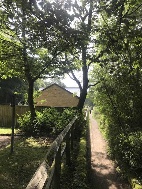
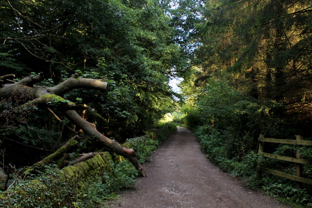
Harefield Plantation is a picturesque woodland located in the county of Yorkshire, England. Situated near the town of Harefield, the plantation is renowned for its natural beauty and rich history. Spanning over a vast area, the woodland is an integral part of the local ecosystem and is home to a diverse range of flora and fauna.
The plantation is predominantly composed of various species of trees, including oak, beech, and birch, which create a dense canopy cover. This provides a habitat for numerous wildlife species, such as deer, foxes, and various bird species. The woodland floor is covered with a lush carpet of mosses, ferns, and wildflowers, adding to its enchanting atmosphere.
Harefield Plantation is not only a haven for nature enthusiasts but also holds historical significance. It is believed to have been established in the 17th century, with remnants of an old manor house still visible within its boundaries. The plantation played a crucial role in the timber industry during the Victorian era, supplying wood for various purposes, including shipbuilding and construction.
Visitors to Harefield Plantation can enjoy a range of recreational activities, including hiking, birdwatching, and photography. The woodland is crisscrossed with well-maintained footpaths, allowing visitors to explore its beauty while respecting its natural environment.
Overall, Harefield Plantation is a captivating woodland in Yorkshire, offering a perfect blend of natural splendor and historical significance. It remains a cherished destination for both locals and tourists seeking tranquility and an opportunity to connect with nature.
If you have any feedback on the listing, please let us know in the comments section below.
Harefield Plantation Images
Images are sourced within 2km of 54.082475/-1.7536705 or Grid Reference SE1665. Thanks to Geograph Open Source API. All images are credited.
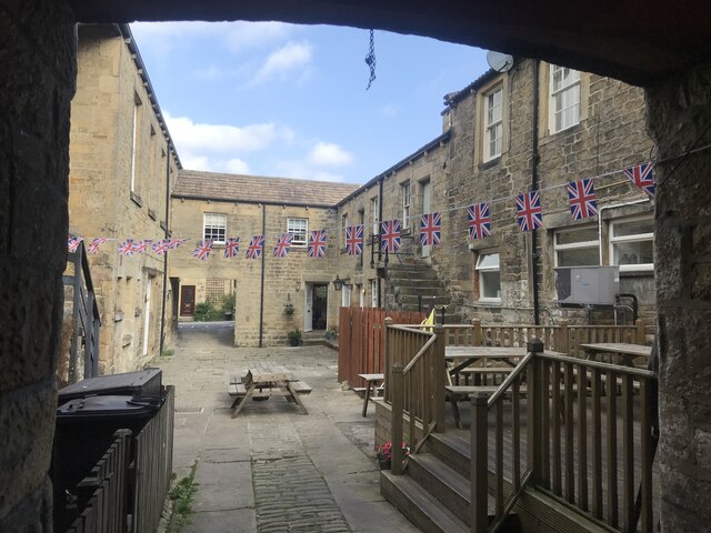
![Pateley Bridge buildings [1] Numbers 9 and 11 High Street are two shops with flats above. Built in the mid 18th century of squared, coursed stone under a stone slate roof. The left shopfront is late 19th century, the right shopfront is 20th century. Listed, grade II, with details at: <span class="nowrap"><a title="https://historicengland.org.uk/listing/the-list/list-entry/1173791" rel="nofollow ugc noopener" href="https://historicengland.org.uk/listing/the-list/list-entry/1173791">Link</a><img style="margin-left:2px;" alt="External link" title="External link - shift click to open in new window" src="https://s1.geograph.org.uk/img/external.png" width="10" height="10"/></span>
Pateley Bridge is a small market town, the market charter being granted in 1320. Located on the banks of the River Nidd, the town is some 11 miles northwest of Harrogate, some 10 miles southwest of Ripon and is within the Nidderdale Area of Outstanding Natural Beauty. The town is popular with tourists exploring the Yorkshire Dales.](https://s3.geograph.org.uk/geophotos/07/03/08/7030879_515f579a.jpg)
![Pateley Bridge buildings [2] The Crown Hotel, number 19 High Street, was built in the early 19th century. Constructed of squared, coursed stone with ashlar dressings under a tile roof. Listed, grade II, with details at: <span class="nowrap"><a title="https://historicengland.org.uk/listing/the-list/list-entry/1296065" rel="nofollow ugc noopener" href="https://historicengland.org.uk/listing/the-list/list-entry/1296065">Link</a><img style="margin-left:2px;" alt="External link" title="External link - shift click to open in new window" src="https://s1.geograph.org.uk/img/external.png" width="10" height="10"/></span>
Pateley Bridge is a small market town, the market charter being granted in 1320. Located on the banks of the River Nidd, the town is some 11 miles northwest of Harrogate, some 10 miles southwest of Ripon and is within the Nidderdale Area of Outstanding Natural Beauty. The town is popular with tourists exploring the Yorkshire Dales.](https://s1.geograph.org.uk/geophotos/07/03/08/7030881_f8067ef2.jpg)
![Pateley Bridge buildings [3] Formerly a coaching inn with stabling for 15 horses, Talbot House now offers tearooms and bed and breakfast accommodation. Built in the early 18th century of squared, coursed stone with freestone dressings, all under a stone slate roof. Listed, grade II, with details at: <span class="nowrap"><a title="https://historicengland.org.uk/listing/the-list/list-entry/1150504" rel="nofollow ugc noopener" href="https://historicengland.org.uk/listing/the-list/list-entry/1150504">Link</a><img style="margin-left:2px;" alt="External link" title="External link - shift click to open in new window" src="https://s1.geograph.org.uk/img/external.png" width="10" height="10"/></span>
Pateley Bridge is a small market town, the market charter being granted in 1320. Located on the banks of the River Nidd, the town is some 11 miles northwest of Harrogate, some 10 miles southwest of Ripon and is within the Nidderdale Area of Outstanding Natural Beauty. The town is popular with tourists exploring the Yorkshire Dales.](https://s0.geograph.org.uk/geophotos/07/03/08/7030884_c80db19b.jpg)
![Pateley Bridge buildings [4] Originally one house, this is now three shops, numbers 35, 37 and 39 High Street.
Built in the 17th century with alterations in the 18th century and later. Constructed of squared, coursed stone with freestone dressings, under a stone slate roof. The bay window on the left is 20th century, as is the shopfront on the right. Listed, grade II, with details at: <span class="nowrap"><a title="https://historicengland.org.uk/listing/the-list/list-entry/1173812" rel="nofollow ugc noopener" href="https://historicengland.org.uk/listing/the-list/list-entry/1173812">Link</a><img style="margin-left:2px;" alt="External link" title="External link - shift click to open in new window" src="https://s1.geograph.org.uk/img/external.png" width="10" height="10"/></span>
Pateley Bridge is a small market town, the market charter being granted in 1320. Located on the banks of the River Nidd, the town is some 11 miles northwest of Harrogate, some 10 miles southwest of Ripon and is within the Nidderdale Area of Outstanding Natural Beauty. The town is popular with tourists exploring the Yorkshire Dales.](https://s2.geograph.org.uk/geophotos/07/03/08/7030886_6e99aeba.jpg)
![Pateley Bridge buildings [5] Numbers 45 and 47 High Street are a shop and house, now in separate occupations. Built in the mid 18th century with 20th century alterations. Constructed of squared, coursed stone with ashlar dressings, under a stone slate roof. The shopfront is early 20th century. Listed, grade II, with details at: <span class="nowrap"><a title="https://historicengland.org.uk/listing/the-list/list-entry/1173825" rel="nofollow ugc noopener" href="https://historicengland.org.uk/listing/the-list/list-entry/1173825">Link</a><img style="margin-left:2px;" alt="External link" title="External link - shift click to open in new window" src="https://s1.geograph.org.uk/img/external.png" width="10" height="10"/></span>
Pateley Bridge is a small market town, the market charter being granted in 1320. Located on the banks of the River Nidd, the town is some 11 miles northwest of Harrogate, some 10 miles southwest of Ripon and is within the Nidderdale Area of Outstanding Natural Beauty. The town is popular with tourists exploring the Yorkshire Dales.](https://s3.geograph.org.uk/geophotos/07/03/08/7030891_9e040dfd.jpg)
![Pateley Bridge buildings [6] The Pateley Club, number 42 High Street, was built as the George and Dragon public house and is dated 1664 with 18th and 19th century alterations. Ale was brewed on the site in 1777 the building became the brewery manager&#039;s house. After a time as the Conservative Club, it is now the Pateley Club. Constructed of squared, coursed stone with freestone dressings under a stone slate roof. The canted bay windows are 19th century. Listed, grade II, with details at: <span class="nowrap"><a title="https://historicengland.org.uk/listing/the-list/list-entry/1150507" rel="nofollow ugc noopener" href="https://historicengland.org.uk/listing/the-list/list-entry/1150507">Link</a><img style="margin-left:2px;" alt="External link" title="External link - shift click to open in new window" src="https://s1.geograph.org.uk/img/external.png" width="10" height="10"/></span>
Pateley Bridge is a small market town, the market charter being granted in 1320. Located on the banks of the River Nidd, the town is some 11 miles northwest of Harrogate, some 10 miles southwest of Ripon and is within the Nidderdale Area of Outstanding Natural Beauty. The town is popular with tourists exploring the Yorkshire Dales.](https://s3.geograph.org.uk/geophotos/07/03/09/7030907_f5ca343e.jpg)
![Pateley Bridge buildings [7] This house and shop at number 8 High Street was built in the early 19th century. Constructed of ashlar under a Welsh slate roof. Listed, grade II, with details at: <span class="nowrap"><a title="https://historicengland.org.uk/listing/the-list/list-entry/1173881" rel="nofollow ugc noopener" href="https://historicengland.org.uk/listing/the-list/list-entry/1173881">Link</a><img style="margin-left:2px;" alt="External link" title="External link - shift click to open in new window" src="https://s1.geograph.org.uk/img/external.png" width="10" height="10"/></span>
Pateley Bridge is a small market town, the market charter being granted in 1320. Located on the banks of the River Nidd, the town is some 11 miles northwest of Harrogate, some 10 miles southwest of Ripon and is within the Nidderdale Area of Outstanding Natural Beauty. The town is popular with tourists exploring the Yorkshire Dales.](https://s0.geograph.org.uk/geophotos/07/03/09/7030936_f8852da6.jpg)
![Pateley Bridge features [1] This well was originally erected in 1852 on Ripon Road and was known as Souter Well. Moved to its present position in the 1970s and now known as Fox&#039;s Head Well.
Built of stone with a stone trough with cast-iron fox&#039;s head spout above. Listed, grade II, with details at: <span class="nowrap"><a title="https://historicengland.org.uk/listing/the-list/list-entry/1150506" rel="nofollow ugc noopener" href="https://historicengland.org.uk/listing/the-list/list-entry/1150506">Link</a><img style="margin-left:2px;" alt="External link" title="External link - shift click to open in new window" src="https://s1.geograph.org.uk/img/external.png" width="10" height="10"/></span>
Pateley Bridge is a small market town, the market charter being granted in 1320. Located on the banks of the River Nidd, the town is some 11 miles northwest of Harrogate, some 10 miles southwest of Ripon and is within the Nidderdale Area of Outstanding Natural Beauty. The town is popular with tourists exploring the Yorkshire Dales.](https://s2.geograph.org.uk/geophotos/07/03/09/7030942_6b139019.jpg)
![Pateley Bridge buildings [8] This building which is now the Playhouse began life as a Primitive Methodist Chapel in 1859. When the Methodists united in the mid 1930s the Salvation Army bought the building and used it as their citadel until the late 1950s. Purchased by the Pateley Bridge Dramatic Society it has since been converted into a 73 seat theatre.
Pateley Bridge is a small market town, the market charter being granted in 1320. Located on the banks of the River Nidd, the town is some 11 miles northwest of Harrogate, some 10 miles southwest of Ripon and is within the Nidderdale Area of Outstanding Natural Beauty. The town is popular with tourists exploring the Yorkshire Dales.](https://s2.geograph.org.uk/geophotos/07/03/09/7030950_2eb93448.jpg)
![Pateley Bridge buildings [9] A plaque on the front of The Playhouse, seen at <a href="https://www.geograph.org.uk/photo/7030950">SE1565 : Pateley Bridge buildings [8]</a>.
Pateley Bridge is a small market town, the market charter being granted in 1320. Located on the banks of the River Nidd, the town is some 11 miles northwest of Harrogate, some 10 miles southwest of Ripon and is within the Nidderdale Area of Outstanding Natural Beauty. The town is popular with tourists exploring the Yorkshire Dales.](https://s0.geograph.org.uk/geophotos/07/03/09/7030952_5992e5cf.jpg)
![Pateley Bridge buildings [10] This delightful building in Church Street, now a private residence, was Oddfellows Hall. Built in 1859 for the Friendly Society who provided insurances.
Pateley Bridge is a small market town, the market charter being granted in 1320. Located on the banks of the River Nidd, the town is some 11 miles northwest of Harrogate, some 10 miles southwest of Ripon and is within the Nidderdale Area of Outstanding Natural Beauty. The town is popular with tourists exploring the Yorkshire Dales.](https://s0.geograph.org.uk/geophotos/07/03/09/7030968_b4a0b5a3.jpg)
Harefield Plantation is located at Grid Ref: SE1665 (Lat: 54.082475, Lng: -1.7536705)
Division: West Riding
Administrative County: North Yorkshire
District: Harrogate
Police Authority: North Yorkshire
What 3 Words
///afterglow.dice.jigsaw. Near Pateley Bridge, North Yorkshire
Nearby Locations
Related Wikis

Pateley Bridge railway station
Pateley Bridge railway station is a disused railway station in North Yorkshire, England. The station was the terminating station on the North Eastern Railway...

Nidderdale AONB
The Nidderdale AONB is an Area of Outstanding Natural Beauty in North Yorkshire, England, bordering the Yorkshire Dales National Park to the east and south...

Nidderdale
Nidderdale, historically also known as Netherdale, is one of the Yorkshire Dales (although outside the Yorkshire Dales National Park) in North Yorkshire...

Bewerley
Bewerley is a village and civil parish in the Harrogate district of North Yorkshire, England, about twelve miles west of Ripon. The parish includes the...

Pateley Playhouse
The Pateley Playhouse is a small amateur-run theatre in the town of Pateley Bridge in Nidderdale, North Yorkshire, England. The building was initially...

Pateley Bridge
Pateley Bridge (known locally as Pateley) is a market town in Nidderdale in the county and district of North Yorkshire, England. Historically part of the...

Nidderdale Museum
Nidderdale Museum is a local and social history museum in the market town of Pateley Bridge in Nidderdale, one of the Yorkshire Dales, in North Yorkshire...
Pateley Bridge railway station (Nidd Valley Light Railway)
Pateley Bridge railway station (NVLR) was a railway station serving the southern terminus of the Nidd Valley Light Railway, in Pateley Bridge, North Yorkshire...
Nearby Amenities
Located within 500m of 54.082475,-1.7536705Have you been to Harefield Plantation?
Leave your review of Harefield Plantation below (or comments, questions and feedback).