Bedlam

Settlement in Yorkshire Harrogate

England

Bedlam

Pateley Bridge High Street In Nidderdale
Pateley Bridge High Street Credit: Paul Baxter

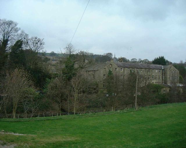
Bedlam, Yorkshire is a small village located in the northern region of England. Situated amidst the picturesque countryside, it is known for its serene and idyllic surroundings. The village is nestled in the heart of the Yorkshire Dales, a national park renowned for its stunning landscapes and rich cultural heritage.

With a population of around 500 residents, Bedlam exudes a warm and close-knit community atmosphere. The village is characterized by charming stone cottages, meandering narrow streets, and lush green fields. It offers a peaceful escape from the hustle and bustle of city life, attracting visitors who seek tranquility and a chance to connect with nature.

The village is blessed with natural beauty, boasting an array of walking trails that wind through the rolling hills and woodland areas. The nearby Bedlam Beck River offers a peaceful spot for fishing and picnicking. Bedlam is also home to a number of historic landmarks, including the picturesque St. Mary's Church, which dates back to the 12th century.

Despite its small size, Bedlam offers a range of amenities to its residents and visitors. The village has a charming local pub, The Bedlam Arms, serving traditional British cuisine and offering a cozy atmosphere for socializing. Additionally, a few small shops and businesses cater to the daily needs of the community.

Overall, Bedlam, Yorkshire is a hidden gem that showcases the beauty of rural England. Its natural splendor, rich history, and tight-knit community make it an enchanting destination for those seeking a tranquil and authentic English countryside experience.

If you have any feedback on the listing, please let us know in the comments section below.

Bedlam Images

Images are sourced within 2km of 54.086682/-1.7544405 or Grid Reference SE1665. Thanks to Geograph Open Source API. All images are credited.

Pateley Bridge High Street In Nidderdale
Pateley Bridge High Street
In Nidderdale
Glasshouses Glasshouse mill is the large building over the river Nidd.  The mill is now a winery and tea rooms.
Glasshouses
Glasshouse mill is the large building over the river Nidd. The mill is now a winery and tea rooms.
Pateley Bridge High Street
Foster Beck Watermill, Pateley Bridge A breastshot wheel originally used to power a woollen mill.
Foster Beck Watermill, Pateley Bridge
A breastshot wheel originally used to power a woollen mill.
Wooden stile View over Pateley Bridge
Wooden stile
View over Pateley Bridge
Castlestead
Castlestead
Moorland and Fields in the distance is RAF Menwith Hill
Moorland and Fields
in the distance is RAF Menwith Hill
St Mary's Church (ruins) This ancient church fell closed in the early 19th century, the church of St Cuthbert being only a mile or so away. The tower, walls and graveyard still exist and the place is well worth a visit.
St Mary's Church (ruins)
This ancient church fell closed in the early 19th century, the church of St Cuthbert being only a mile or so away. The tower, walls and graveyard still exist and the place is well worth a visit.
Blazefield Road leading to Kings Farm
Blazefield
Road leading to Kings Farm
High Wild Carr
High Wild Carr
High Bishopside Moor Not much here besides sheep, wind, rough grass and tumbled down walls
High Bishopside Moor
Not much here besides sheep, wind, rough grass and tumbled down walls
Scot Gate Ash Quarries High quality stone was quarried here until the First World War. The stone was used for building railway stations and platforms. An inclined railway was built from the quarries to take the stone down to the station at Pateley Bridge.
Scot Gate Ash Quarries
High quality stone was quarried here until the First World War. The stone was used for building railway stations and platforms. An inclined railway was built from the quarries to take the stone down to the station at Pateley Bridge.
Track to Yeadon A house way out on the moor.
Track to Yeadon
A house way out on the moor.
Road at Madge Hill Farm The road that leads from Blazefield on the B6265, crossing Dallowgill Moor to Kirkby Malzeard.
Road at Madge Hill Farm
The road that leads from Blazefield on the B6265, crossing Dallowgill Moor to Kirkby Malzeard.
Bandstand, Pately Bridge
Shack With A View. It may look ramshackle, but this humble abode has a view to die for. Perched on the Nidderdale Way footpath near Riggs House.
Shack With A View.
It may look ramshackle, but this humble abode has a view to die for. Perched on the Nidderdale Way footpath near Riggs House.
Oldest Sweet Shop in England, Pateley Bridge That is the claim on the shop which is on the Main Street in this town in Nidderdale
Oldest Sweet Shop in England, Pateley Bridge
That is the claim on the shop which is on the Main Street in this town in Nidderdale
Ruins of St. Mary's Church, Pateley Bridge Highly atmospheric remains of the old church, situated to the east above this Nidderdale town
Ruins of St. Mary's Church, Pateley Bridge
Highly atmospheric remains of the old church, situated to the east above this Nidderdale town
Show me another place!

Bedlam is located at Grid Ref: SE1665 (Lat: 54.086682, Lng: -1.7544405)

Division: West Riding

Administrative County: North Yorkshire

District: Harrogate

Police Authority: North Yorkshire

What 3 Words

///exhaled.dictation.moods. Near Pateley Bridge, North Yorkshire

Related Wikis

Nidderdale National Landscape

The Nidderdale National Landscape is an Area of Outstanding Natural Beauty in North Yorkshire, England, bordering the Yorkshire Dales National Park to...

Nidderdale

Nidderdale, historically also known as Netherdale, is one of the Yorkshire Dales (although outside the Yorkshire Dales National Park) in North Yorkshire...

Pateley Playhouse

The Pateley Playhouse is a small amateur-run theatre in the town of Pateley Bridge in Nidderdale, North Yorkshire, England. The building was initially...

Nidderdale Museum

Nidderdale Museum is a local and social history museum in the market town of Pateley Bridge in Nidderdale, one of the Yorkshire Dales, in North Yorkshire...

Nearby Amenities

Located within 500m of 54.086682,-1.7544405
Pateley Bridge
Is In: UK, England, Yorkshire,North Yorkshire, Nidderdale, Yorkshire Dales
Place: town
Wikidata: Q1617126
Wikipedia: en:Pateley Bridge
Lat/Long: 54.0870914/-1.7596404
Turning Circle
Lat/Long: 54.086154/-1.7567945
Information: office
Tourism: information
Lat/Long: 54.0861397/-1.7595809
Turning Circle
Source: Bing
Lat/Long: 54.0891447/-1.7599669
Toilets
Source: survey
Lat/Long: 54.0853326/-1.7614611
Source: Bing
Lat/Long: 54.0843198/-1.7534077
Fast Food
Bengal Cuisine
Addr Housenumber: 1a
Addr Street: High Street
Cuisine: indian
Lat/Long: 54.0860242/-1.760627
Spar
Brand: Spar
Brand Wikidata: Q610492
Shop: convenience
Source: photo
Website: https://www.spar.co.uk/store-locator/hal27949-spar-chandler/
Lat/Long: 54.0860645/-1.7605103
Cafe
Wildings
Cuisine: tea_room
Lat/Long: 54.08549/-1.7602838
Fast Food
High Street Fisheries
Addr Housenumber: 16
Addr Street: High Street
Cuisine: fish_and_chips
Source: photo
Lat/Long: 54.0861256/-1.7596533
Pub
The Crown
Source: photo
Lat/Long: 54.0862403/-1.7598601
Cafe
The Old Granary Tea Shop
Addr City: Harrogate
Addr Housenumber: 17
Addr Postcode: HG3 5AP
Addr Street: High Street
Addr Suburb: Pateley Bridge
Gluten Free: yes
Source: photo
Website: www.oldgranary.net
Lat/Long: 54.0861854/-1.7600368
Fast Food
Pateley Pizza
Cuisine: pizza;burger;kebab
Drive Through: no
Source: photo
Lat/Long: 54.0860023/-1.7602442
The Old Bakehouse
Shop: bakery
Source: photo
Lat/Long: 54.0860877/-1.7598493
Sypeland Outdoors
Shop: outdoor
Source: photo
Website: www.sypeland.com
Lat/Long: 54.0861426/-1.7602254
Talbot House
Source: photo
Tourism: guest_house
Wikidata: Q26443335
Lat/Long: 54.086393/-1.7592968
Bench
Source: photo
Lat/Long: 54.0862246/-1.7591679
Pharmacy
Pateley Bridge Pharmacy
Source: photo
Lat/Long: 54.086371/-1.7594065
Restaurant
The Willow
Addr City: Pateley Bridge
Addr County: North Yorkshire
Addr Street: Park Road
Source: photo
Lat/Long: 54.0865173/-1.7596133
Restaurant
Chinese Japanese Restaurant
Addr City: Pateley Bridge
Addr County: North Yorkshire
Addr Street: High Street
Cuisine: asian
Source: photo
Lat/Long: 54.0866085/-1.7583044
Save the Children
Shop: charity
Source: photo
Lat/Long: 54.0863269/-1.7587443
Bench
Source: photo
Lat/Long: 54.0878782/-1.7592134
Roslyn House
Source: photo
Tourism: guest_house
Lat/Long: 54.0870867/-1.7609007
Barrier: entrance
Source: photo
Lat/Long: 54.0878909/-1.7593019
Bench
Source: photo
Lat/Long: 54.0876422/-1.7588809
Bus Stop
Pateley Bridge King Street
Bench: yes
Bin: yes
Bus: yes
Check Date Shelter: 2021-12-04
Departures Board: timetable
Network: DalesBus
Operator: Harrogate & District
Public Transport: platform
Route Ref: 24
Shelter: yes
Tactile Paving: yes
Lat/Long: 54.0863411/-1.7609061
Fast Food
The Sandwich Box
Cuisine: sandwich
Source: photo
Lat/Long: 54.08636/-1.760474
Tourist Information and Library
Addr City: Harrogate
Addr Housename: Station Square
Addr Postcode: HG3 5AT
Addr Street: King Street
Addr Suburb: Pateley Bridge
Information: office
Operator: Nidderdale Plus
Phone: +44 1423 714953
Source: photo
Tourism: information
Lat/Long: 54.0865236/-1.7613701
Crossing
Crossing: marked
Crossing Island: no
Source: Bing
Tactile Paving: yes
Lat/Long: 54.0850338/-1.761376
Fountain
Lat/Long: 54.085023/-1.7531962
Building: yes
Lat/Long: 54.0832883/-1.7552092
Building: yes
Lat/Long: 54.0825708/-1.7562606
Building: yes
Lat/Long: 54.0864913/-1.748763
Building: yes
Lat/Long: 54.0851698/-1.7500719
Building: yes
Lat/Long: 54.0857865/-1.7514881
Building: yes
Lat/Long: 54.0866801/-1.7526898
Building: yes
Lat/Long: 54.0874353/-1.7532906
Building: yes
Lat/Long: 54.0873724/-1.7533335
Building: yes
Lat/Long: 54.0864662/-1.7487201
Building: yes
Lat/Long: 54.0878506/-1.7524966
The Oldest Sweet Shop in England
Addr City: Harrogate
Addr Housenumber: 39
Addr Postcode: HG3 5JZ
Addr Street: High Street
Addr Suburb: Pateley Bridge
Opening Hours: We-Sa 10:00-17:00; Su 11:00-17:00
Shop: confectionery
Website: https://www.oldestsweetshop.co.uk/
Lat/Long: 54.0864942/-1.7587462
Post Box
Note: is very low
Post Box Type: wall
Ref: HG3 152
Royal Cypher: GR
Royal Cypher Wikidata: Q33102273
Lat/Long: 54.0862386/-1.7597033
Bench
Lat/Long: 54.0862027/-1.7594737
Power: pole
Lat/Long: 54.0864628/-1.7472647
Power: pole
Lat/Long: 54.0866972/-1.7484368
Power: pole
Lat/Long: 54.0866366/-1.7497082
Power: pole
Lat/Long: 54.0865603/-1.7510882
Power: pole
Lat/Long: 54.086528/-1.7518017
Power: pole
Lat/Long: 54.0865115/-1.7521262
Cafe
The Pancake House
Cuisine: pancake;milshakes;ice_creams;breakfast
Lat/Long: 54.0860068/-1.7607079
Kendall's Butchers
Shop: butcher
Lat/Long: 54.0863878/-1.7585878
H. Weatherhead & Sons
Shop: butcher
Lat/Long: 54.0860836/-1.7604197
Sue's
Shop: hairdresser
Lat/Long: 54.0860437/-1.760575
Barrier: stile
Lat/Long: 54.0878699/-1.747728
Generator Method: photovoltaic
Generator Output Electricity: yes
Generator Source: solar
Generator Type: solar_photovoltaic_panel
Power: generator
Lat/Long: 54.0863925/-1.7545395
Generator Method: photovoltaic
Generator Output Electricity: yes
Generator Source: solar
Generator Type: solar_photovoltaic_panel
Power: generator
Lat/Long: 54.0870964/-1.7553976
Generator Method: photovoltaic
Generator Output Electricity: yes
Generator Source: solar
Generator Type: solar_photovoltaic_panel
Power: generator
Lat/Long: 54.0877372/-1.755441
Bus Stop
Panorama Walk (Southbound)
Bench: no
Bus: yes
Departures Board: timetable
Naptan AtcoCode: 3200YND24450
Naptan NaptanCode: 32024450
Network: DalesBus
Operator: Harrogate Bus Company
Public Transport: platform
Shelter: no
Tactile Paving: no
Lat/Long: 54.0855241/-1.7568124
Bus Stop
Panorama Walk (Northbound)
Bench: no
Bus: yes
Departures Board: timetable
Naptan AtcoCode: 3200YND24410
Naptan NaptanCode: 32024410
Network: DalesBus
Operator: Harrogate Bus Company
Public Transport: platform
Shelter: no
Tactile Paving: no
Lat/Long: 54.0855789/-1.7569281
Bus Stop
Panorama Way (Southeastbound)
Bench: no
Bin: yes
Bus: yes
Departures Board: timetable
Network: DalesBus
Operator: Harrogate Bus Company
Public Transport: platform
Shelter: no
Tactile Paving: no
Lat/Long: 54.0825903/-1.7526669
Bus Stop
Panorama Way (Northwestbound)
Bench: no
Bin: no
Bus: yes
Departures Board: timetable
Network: DalesBus
Operator: Harrogate Bus Company
Public Transport: platform
Shelter: no
Tactile Paving: no
Lat/Long: 54.0825715/-1.7526799
Parking
Nidd Walk
Lat/Long: 54.0844565/-1.7578253
Pateley Bridge
Historic Railway: station
Railway: site
Wikidata: Q20127984
Wikipedia: en:Pateley Bridge railway station
Lat/Long: 54.0853646/-1.7596609
Barrier: stile
Lat/Long: 54.0833421/-1.7511414
Power: pole
Lat/Long: 54.089761/-1.756914
Power: pole
Lat/Long: 54.0904077/-1.7571655
The data included in this document is from www.openstreetmap.org. The data is made available under ODbL.

Have you been to Bedlam?

Leave your review of Bedlam below (or comments, questions and feedback).