Rawroyd Wood

Wood, Forest in Yorkshire

England

Rawroyd Wood

The 643, Lindley Moor Road
The 643, Lindley Moor Road Credit: Ian S

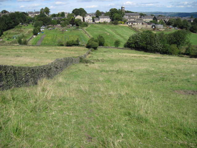
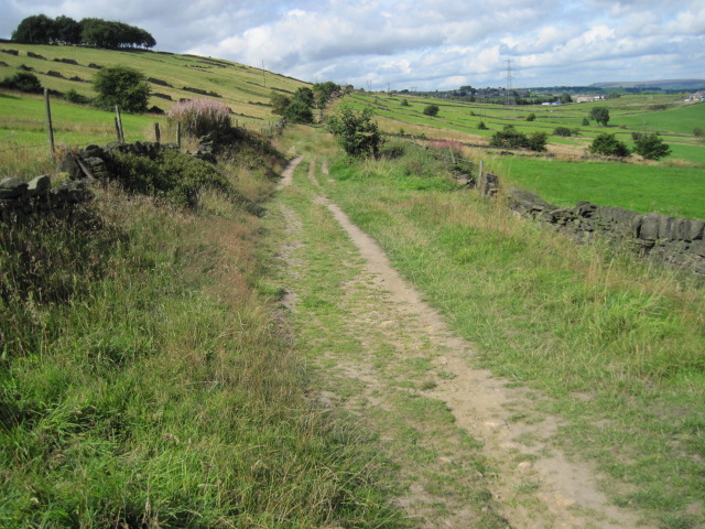
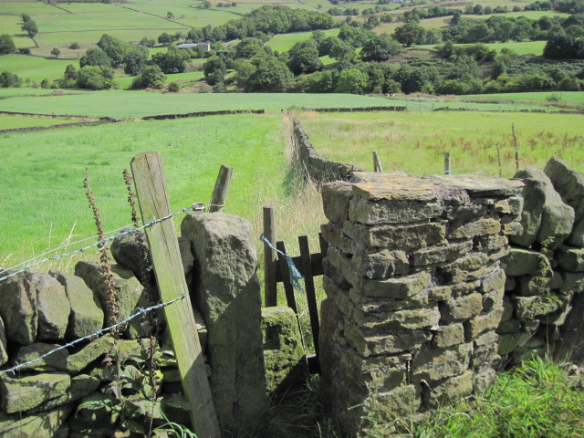
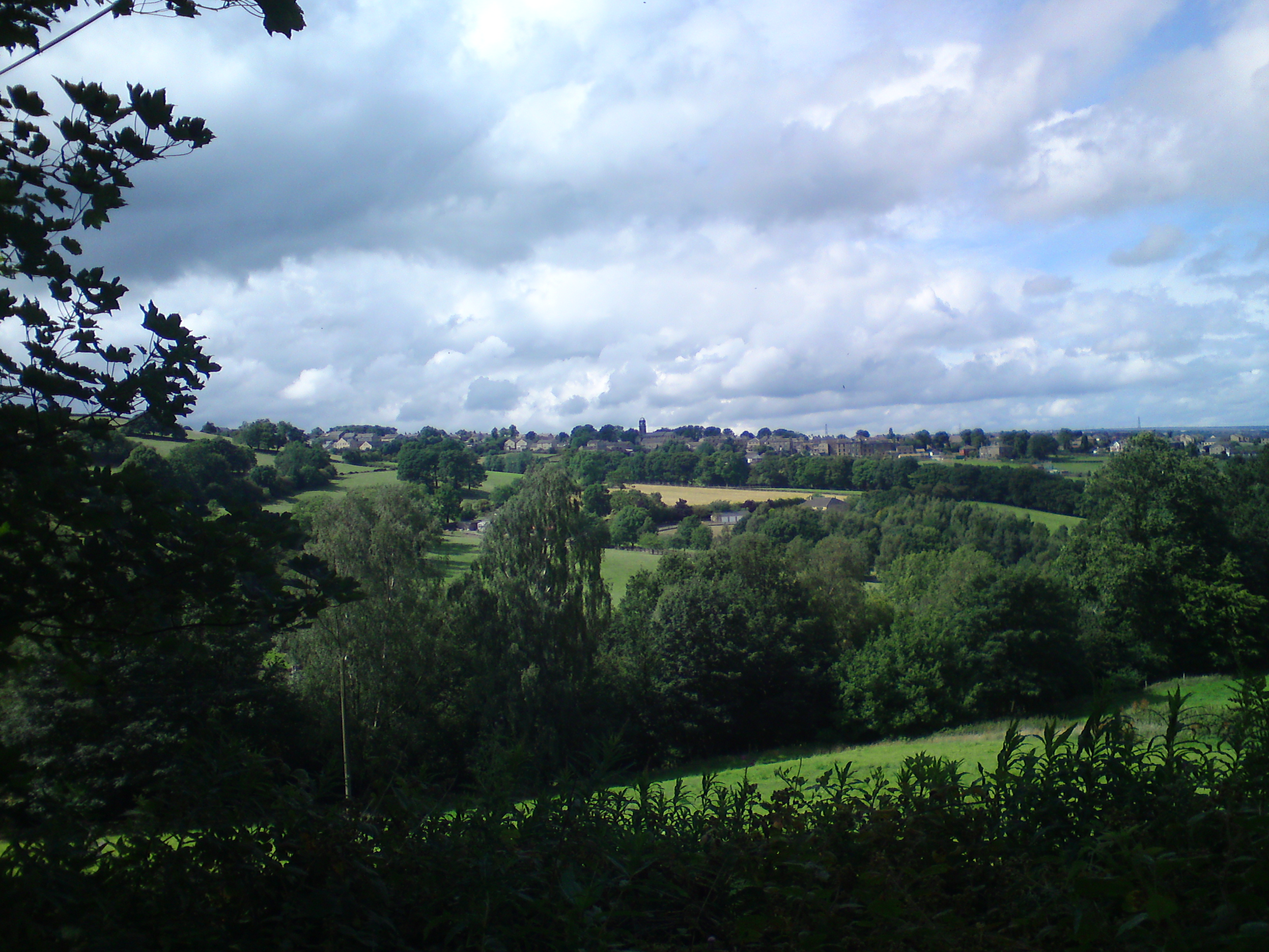
Rawroyd Wood is a serene and picturesque woodland located in Yorkshire, England. Situated in the heart of the county, this woodland covers an area of approximately 50 acres and is a haven of natural beauty and tranquility. Rawroyd Wood is part of the larger Calderdale Valley, known for its lush green landscapes and stunning vistas.

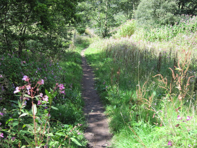
The woodland is predominantly composed of native tree species such as oak, birch, and beech, which create a dense canopy and provide a habitat for a diverse range of wildlife. Walking through Rawroyd Wood, visitors can admire the vibrant colors of the changing seasons, from the lush greens of spring and summer to the golden hues of autumn.

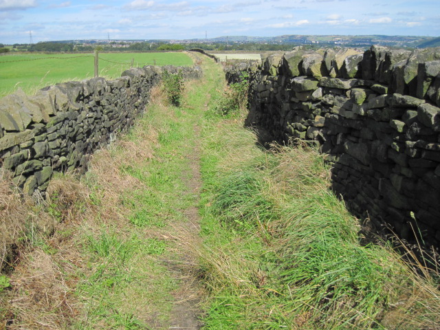
The wood offers a network of well-maintained walking paths, allowing visitors to explore and immerse themselves in the natural surroundings. As they meander through the woodland, visitors may encounter a variety of wildlife, including deer, squirrels, and a wide array of bird species.

Rawroyd Wood is a popular destination for nature enthusiasts, hikers, and families seeking a peaceful escape from the bustle of everyday life. The woodland provides ample opportunities for outdoor activities such as picnicking, birdwatching, and photography. Visitors can also find benches strategically placed throughout the wood, offering a perfect spot to relax and take in the stunning views.

Overall, Rawroyd Wood is a true gem of Yorkshire, providing a tranquil retreat and a chance to connect with the beauty of nature.

If you have any feedback on the listing, please let us know in the comments section below.
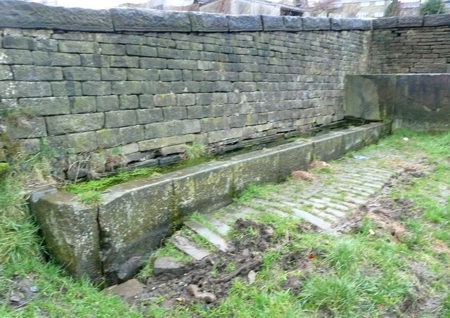
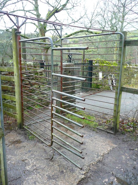
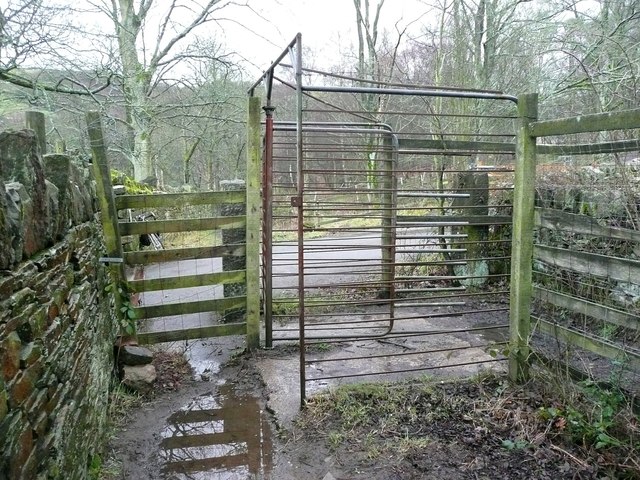
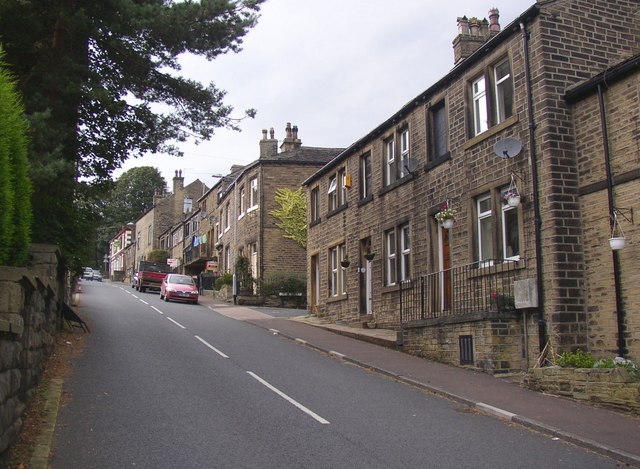
Rawroyd Wood Images

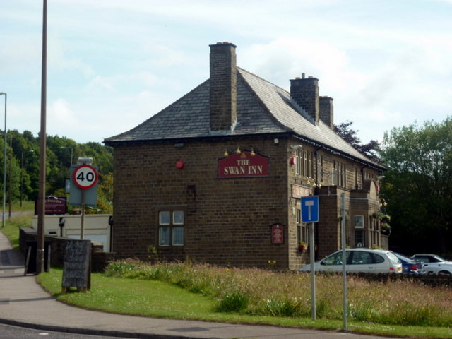
Images are sourced within 2km of 53.676514/-1.8621151 or Grid Reference SE0920. Thanks to Geograph Open Source API. All images are credited.

The 643, Lindley Moor Road
The A640, New Hey Road, goes over the M62
The Swan Inn on New Hey Road, Outlane
Drury Lane footpath, Stainland
Footpath towards Stainland
Turley Cote Lane
Turley Cote Lane
Footpath towards Shavey Clough
Shaw Park Gateway This mock castle style gateway forms one of the entrances to Shaw Park
Shaw Park Gateway
This mock castle style gateway forms one of the entrances to Shaw Park
Shaw Park Aviary Built originally as an Aviary around 1870, now disused.
Shaw Park Aviary
Built originally as an Aviary around 1870, now disused.
Shaw Park Folly The first of 3 follies linked by a wall in Shaw Park
Shaw Park Folly
The first of 3 follies linked by a wall in Shaw Park
Shaw Park Folly The second of 3 follies linked by a wall in Shaw Park
Shaw Park Folly
The second of 3 follies linked by a wall in Shaw Park
Shaw Park Folly The third of 3 follies linked by a wall in Shaw Park. The round tower housed a dovecote.
Shaw Park Folly
The third of 3 follies linked by a wall in Shaw Park. The round tower housed a dovecote.
Shaw Park Arches This small folly is formed with 3 arches in a curved wall
Shaw Park Arches
This small folly is formed with 3 arches in a curved wall
Water trough, Carr Hall Lane, Stainland This is the inlet end of a long trough, and the walls around it, formed of large stone flags, are presumably to keep animals away from the part used by people collecting water for domestic consumption in the days before piped water supplies.
Water trough, Carr Hall Lane, Stainland
This is the inlet end of a long trough, and the walls around it, formed of large stone flags, are presumably to keep animals away from the part used by people collecting water for domestic consumption in the days before piped water supplies.
Water trough, Carr Hall Lane, Stainland A long trough with a compartment at the inlet end, presumably to keep animals away from the part used by people collecting water for domestic consumption.
Water trough, Carr Hall Lane, Stainland
A long trough with a compartment at the inlet end, presumably to keep animals away from the part used by people collecting water for domestic consumption.
Bridleway rotary gate, Carr Hall Lane, Stainland A large version of the traditional 'kissing' gate, presumably intended to prevent motorcycles from passing through as a normal bridle gate would be sufficient to stop cars.
Bridleway rotary gate, Carr Hall Lane, Stainland
A large version of the traditional 'kissing' gate, presumably intended to prevent motorcycles from passing through as a normal bridle gate would be sufficient to stop cars.
Show me another place!

Rawroyd Wood is located at Grid Ref: SE0920 (Lat: 53.676514, Lng: -1.8621151)

Division: West Riding

Unitary Authority: Calderdale

Police Authority: West Yorkshire

What 3 Words

///voice.vest.point. Near Holywell Green, West Yorkshire

Related Wikis

Holywell Green

Holywell Green is a village in the civil parish of Stainland and District, in the Calderdale, district, in the county of West Yorkshire, England. The village...

Stainland and Holywell Green railway station

Stainland and Holywell Green railway station served the villages of Stainland and Holywell Green in West Yorkshire, England from 1875 until 1929. Goods...

West Vale railway station

West Vale railway station served on the Stainland Branch from 1875 to 1929. == History == The station was opened on New years day 1875, along with the...

The Brooksbank School

The Brooksbank School is a secondary school with academy status in Elland, near Halifax in West Yorkshire, England. It is a sports college, as well as...

Old Lindley

Old Lindley or Over Lindley is a hamlet in the civil parish of Stainland and District, in the Calderdale district, in the county of West Yorkshire, England...

Stainland and District

Stainland and District is a civil parish in the Metropolitan Borough of Calderdale in West Yorkshire, England. The main settlements in the parish are Stainland...

Stainland

Stainland is a village in the civil parish of Stainland and District, in Calderdale, West Yorkshire, England. The village is part of the Greetland and...

Blackley, West Yorkshire

Blackley is a hamlet in the Calderdale district, in the county of West Yorkshire, England. It is near the town of Elland, the A629 road and the M62 motorway...

Nearby Amenities

Located within 500m of 53.676514,-1.8621151
Holywell Green
Is In: Stainland
Place: village
Source: npe
Wikidata: Q2550393
Lat/Long: 53.6753101/-1.8667308
St. Helen's Well
Historic: monument
Lat/Long: 53.6742419/-1.8657779
Post Box
Operator: Royal Mail
Post Box Type: pillar
Ref: HX4 159
Royal Cypher: EIIR
Lat/Long: 53.6753811/-1.8672183
Bus Stop
Stainland Road Chapel Street
Local Ref: 45022200
Naptan AtcoCode: 450022200
Naptan Bearing: S
Naptan CommonName: Stainland Road Chapel Street
Naptan Crossing: Chapel Street
Naptan Indicator: Stop 45022200
Naptan Landmark: Post Office
Naptan Notes: OSR taken place 091205
Naptan PlusbusZoneRef: LEEDS
Naptan ShortCommonName: Chapel Street
Naptan Street: Stainland Road
Naptan Verified: no
Source: naptan_import
Lat/Long: 53.6753097/-1.8672557
Bus Stop
Stainland Road Station Road
Local Ref: 45021528
Naptan AtcoCode: 450021528
Naptan Bearing: NE
Naptan CommonName: Stainland Road Station Road
Naptan Crossing: Station Road
Naptan Indicator: Stop 45021528
Naptan Landmark: Holywell Inn PH
Naptan Notes: OSR taken place 091205
Naptan PlusbusZoneRef: LEEDS
Naptan ShortCommonName: Station Road
Naptan Street: Stainland Road
Naptan Verified: no
Source: naptan_import
Lat/Long: 53.6745042/-1.8679315
Bus Stop
Stainland Road Station Road
Local Ref: 45021529
Naptan AtcoCode: 450021529
Naptan Bearing: SW
Naptan CommonName: Stainland Road Station Road
Naptan Crossing: Station Road
Naptan Indicator: Stop 45021529
Naptan Landmark: Holywell Inn PH
Naptan Notes: L/C 92
Naptan PlusbusZoneRef: LEEDS
Naptan ShortCommonName: Station Road
Naptan Street: Stainland Road
Naptan Verified: no
Source: naptan_import
Lat/Long: 53.6745693/-1.8676364
Bus Stop
Station Road Stainland Road
Local Ref: 45021530
Naptan AtcoCode: 450021530
Naptan Bearing: W
Naptan CommonName: Station Road Stainland Road
Naptan Crossing: Stainland Road
Naptan Indicator: Stop 45021530
Naptan Landmark: Holywell Inn PH
Naptan Notes: OSR taken place 091205L/C No Number
Naptan PlusbusZoneRef: LEEDS
Naptan ShortCommonName: Stainland Road
Naptan Street: Station Road
Naptan Verified: no
Source: naptan_import
Lat/Long: 53.6743897/-1.8677303
Bus Stop
Station Road Shaw Street
Local Ref: 45021531
Naptan AtcoCode: 450021531
Naptan Bearing: E
Naptan CommonName: Station Road Shaw Street
Naptan Crossing: Shaw Street
Naptan Indicator: Stop 45021531
Naptan PlusbusZoneRef: LEEDS
Naptan ShortCommonName: Shaw Street
Naptan Street: Station Road
Naptan Verified: no
Source: naptan_import
Lat/Long: 53.6743739/-1.8648953
Bus Stop
Station Road Jagger Green Lane
Local Ref: 45021532
Naptan AtcoCode: 450021532
Naptan Bearing: W
Naptan CommonName: Station Road Jagger Green Lane
Naptan Crossing: Jagger Green Lane
Naptan Indicator: Stop 45021532
Naptan Notes: L./C 13
Naptan PlusbusZoneRef: LEEDS
Naptan ShortCommonName: Jagger Green Lane
Naptan Street: Station Road
Naptan Verified: no
Source: naptan_import
Lat/Long: 53.6747106/-1.8614219
Bus Stop
Station Road Rawroyds
Local Ref: 45021533
Naptan AtcoCode: 450021533
Naptan Bearing: E
Naptan CommonName: Station Road Rawroyds
Naptan Crossing: Rawroyds
Naptan Indicator: Stop 45021533
Naptan Notes: L/C 23
Naptan PlusbusZoneRef: LEEDS
Naptan ShortCommonName: Rawroyds
Naptan Street: Station Road
Naptan Verified: no
Source: naptan_import
Lat/Long: 53.6747996/-1.8611859
Bus Stop
Broad Carr Lane Old Dan Lane
Bus: yes
Departures Board: no
Local Ref: 45021534
Naptan AtcoCode: 450021534
Naptan Bearing: NE
Naptan CommonName: Broad Carr Lane Old Dan Lane
Naptan Crossing: Old Dan Lane
Naptan Indicator: Stop 45021534
Naptan Landmark: Unknown
Naptan PlusbusZoneRef: LEEDS
Naptan ShortCommonName: Old Dean Lane
Naptan Street: Broad Carr Lane
Naptan Verified: no
Public Transport: platform
Ref: 45021534
Shelter: no
Source: naptan_import
Lat/Long: 53.6760829/-1.8582656
Bus Stop
Hammerstone Leach Lane
Local Ref: 45021535
Naptan AtcoCode: 450021535
Naptan Bearing: N
Naptan CommonName: Hammerstone Leach Lane
Naptan Crossing: Broad Carr Terrace
Naptan Indicator: Stop 45021535
Naptan Landmark: Elland Golf Course
Naptan Notes: L/C 15
Naptan PlusbusZoneRef: LEEDS
Naptan ShortCommonName: Broad Carr Lane
Naptan Street: Hammerstone Leach Lane
Naptan Verified: no
Source: naptan_import
Lat/Long: 53.6769903/-1.8548504
Bus Stop
Stainland Road Chapel Close
Local Ref: 45021554
Naptan AtcoCode: 450021554
Naptan Bearing: N
Naptan CommonName: Stainland Road Chapel Close
Naptan Crossing: Chapel Close
Naptan Indicator: Stop 45021554
Naptan Landmark: Church
Naptan PlusbusZoneRef: LEEDS
Naptan ShortCommonName: Chapel Close
Naptan Street: Stainland Road
Naptan Verified: no
Source: naptan_import
Lat/Long: 53.675672/-1.8672288
Bus Stop
Stainland Road
Bus: yes
Local Ref: 45021555
Naptan AtcoCode: 450021555
Naptan Bearing: N
Naptan CommonName: Stainland Road
Naptan Crossing: Burrwood Terrace
Naptan Indicator: Stop 45021555
Naptan Landmark: Brookswood Industrial Estate
Naptan PlusbusZoneRef: LEEDS
Naptan ShortCommonName: Burnwood Way
Naptan Street: Stainland Road
Naptan Verified: no
Public Transport: platform
Source: naptan_import
Lat/Long: 53.6778434/-1.8677478
Bus Stop
Stainland Road Burwood Terrace
Local Ref: 45021556
Naptan AtcoCode: 450021556
Naptan Bearing: S
Naptan CommonName: Stainland Road Burwood Terrace
Naptan Crossing: Burrwood Terrace
Naptan Indicator: Stop 45021556
Naptan Landmark: Brookswood Industrial Estate
Naptan PlusbusZoneRef: LEEDS
Naptan ShortCommonName: Burnwood Way
Naptan Street: Stainland Road
Naptan Verified: no
Source: naptan_import
Lat/Long: 53.6780138/-1.8676525
Bus Stop
Stainland Road Station Road
Local Ref: 45024256
Naptan AtcoCode: 450024256
Naptan Bearing: E
Naptan CommonName: Stainland Road Station Road
Naptan Crossing: Station Road
Naptan Indicator: Stop 45024256
Naptan Landmark: Holywell Inn PH
Naptan Notes: OSR taken place 091205
Naptan PlusbusZoneRef: LEEDS
Naptan ShortCommonName: Station Road
Naptan Street: Stainland Road
Naptan Verified: no
Source: naptan_import
Lat/Long: 53.6744596/-1.867615
Bus Stop
Station Road Shaw Street
Local Ref: 45051107
Naptan AtcoCode: 450051107
Naptan Bearing: W
Naptan BusStopType: CUS
Naptan CommonName: Station Road Shaw Street
Naptan Indicator: Stop 45051107
Naptan PlusbusZoneRef: LEEDS
Naptan ShortCommonName: Shaw Street
Naptan Street: Station Road
Naptan Verified: no
Source: naptan_import
Lat/Long: 53.6742675/-1.8650482
Bus Stop
Broad Carr Lane Old Dan Lane
Bus: yes
Departures Board: no
Local Ref: 45051108
Naptan AtcoCode: 450051108
Naptan Bearing: S
Naptan BusStopType: CUS
Naptan CommonName: Broad Carr Lane Old Dan Lane
Naptan Indicator: Stop 45051108
Naptan PlusbusZoneRef: LEEDS
Naptan ShortCommonName: Broad Carr Farm
Naptan Street: Broad Carr Lane
Naptan Verified: no
Public Transport: platform
Ref: 45051108
Shelter: no
Source: naptan_import
Lat/Long: 53.6759852/-1.8582506
Hammerstone Leach Lane
Local Ref: 45051109
Naptan AtcoCode: 450051109
Naptan Bearing: S
Naptan BusStopType: CUS
Naptan CommonName: Hammerstone Leach Lane
Naptan Indicator: Stop 45051109
Naptan PlusbusZoneRef: LEEDS
Naptan ShortCommonName: Broad Carr Lane
Naptan Street: Hammerstone Leach Lane
Naptan Verified: no
Source: naptan_import
Lat/Long: 53.6769722/-1.8547597
Turning Circle
Lat/Long: 53.6806527/-1.8600882
Bench
Lat/Long: 53.676428/-1.8597137
Post Box
Operator: Royal Mail
Post Box Type: wall
Ref: HX4 130
Royal Cypher: EIIR
Royal Cypher Wikidata: Q33102113
Lat/Long: 53.6747116/-1.8611353
Noexit: yes
Lat/Long: 53.674786/-1.8654874
Man Made: water_well
Lat/Long: 53.6734466/-1.8662609
Noexit: yes
Lat/Long: 53.6745754/-1.8652352
Broad Carr
Place: hamlet
Lat/Long: 53.6757072/-1.8570691
Post Office
Holywell Green Post Office
Addr City: Halifax
Addr Country: GB
Addr Housenumber: 235
Addr Postcode: HX4 9AJ
Addr Street: Stainland Road
Brand: Post Office
Brand Wikidata: Q1783168
Contact Website: https://www.postoffice.co.uk/branch-finder/2963205/holywell-green
Opening Hours: Mo-Fr 08:30-17:30; Sa 08:30-13:00
Ref Pol Id: 11886
Lat/Long: 53.6753451/-1.867128
Barrier: bollard
Lat/Long: 53.674835/-1.8662758
Barrier: bollard
Lat/Long: 53.6749102/-1.8660179
Barrier: bollard
Lat/Long: 53.6747707/-1.86584
Barrier: bollard
Lat/Long: 53.6746959/-1.866105
Bench
Backrest: yes
Lat/Long: 53.6747599/-1.8662067
Bench
Backrest: yes
Lat/Long: 53.6747259/-1.8659557
Bench
Backrest: yes
Lat/Long: 53.6748442/-1.8659115
Bench
Backrest: yes
Lat/Long: 53.6748797/-1.8661569
Power: pole
Lat/Long: 53.679518/-1.8666836
Location Transition: yes
Material: wood
Power: pole
Lat/Long: 53.6789772/-1.866342
Waste Basket
Lat/Long: 53.6761269/-1.8581864
Stainland and Holywell Green
Historic Railway: station
Railway: site
Wikidata: Q7597049
Wikipedia: en:Stainland and Holywell Green railway station
Lat/Long: 53.6738421/-1.8636702
Defibrillator
Access: yes
Defibrillator Location: outside Holywell Green Post Office
Emergency: defibrillator
Indoor: no
Lat/Long: 53.6752878/-1.8672162
The data included in this document is from www.openstreetmap.org. The data is made available under ODbL.

Have you been to Rawroyd Wood?

Leave your review of Rawroyd Wood below (or comments, questions and feedback).