Ravenstone Wood

Wood, Forest in Yorkshire

England

Ravenstone Wood

Drury Lane footpath, Stainland
Drury Lane footpath, Stainland Credit: Chris Wimbush

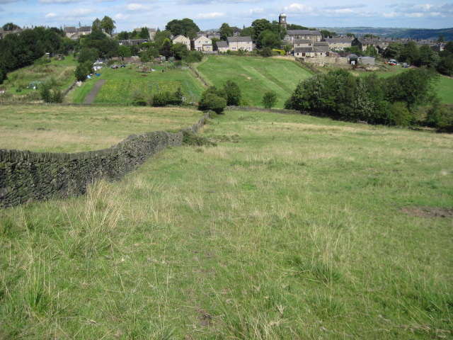
Ravenstone Wood is a picturesque forest located in Yorkshire, England. Covering an area of approximately 200 acres, it is a popular destination for nature enthusiasts and those seeking tranquility amidst the beauty of the natural world.

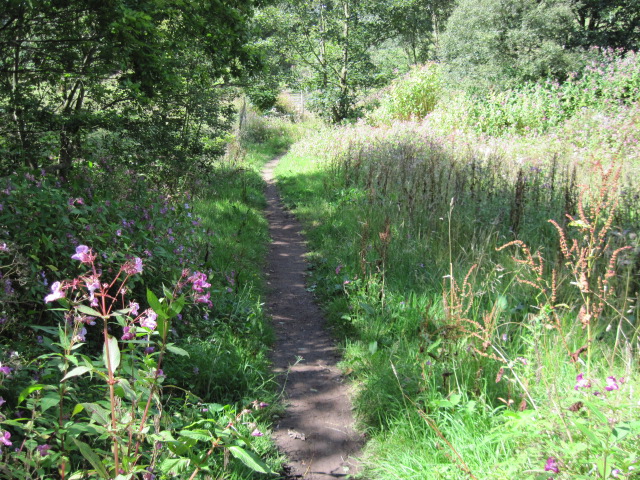
The wood is characterized by its dense canopy of oak, beech, and birch trees, which provide a rich habitat for a diverse range of flora and fauna. The forest floor is carpeted with a variety of wildflowers, including bluebells, primroses, and wood anemones, creating a vibrant display of color during the spring months.

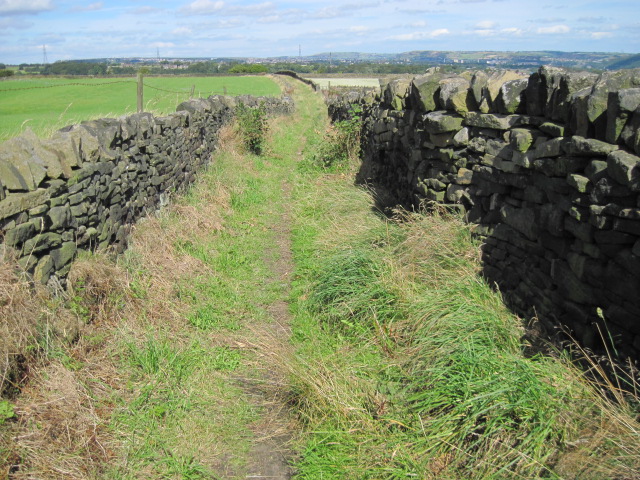
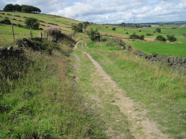
Visitors to Ravenstone Wood can explore the well-maintained network of walking trails that wind through the forest, offering opportunities to observe the local wildlife. The area is home to a multitude of bird species, such as great spotted woodpeckers, tawny owls, and chaffinches, making it a haven for birdwatchers.

In addition to its natural beauty, Ravenstone Wood also has historical significance. The remains of an ancient Iron Age settlement can be found within the forest, providing insight into the area's past. Archaeological excavations have uncovered artifacts such as pottery and tools, shedding light on the lives of the people who once inhabited the wood.

Ravenstone Wood is a true gem of Yorkshire, offering visitors a chance to immerse themselves in the serenity of nature while also delving into the region's rich history. Whether it's a leisurely walk, birdwatching, or a desire to connect with the past, this woodland paradise has something for everyone.

If you have any feedback on the listing, please let us know in the comments section below.

Ravenstone Wood Images

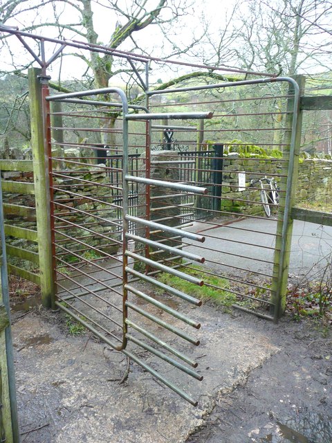
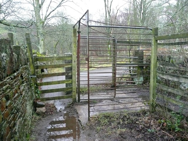
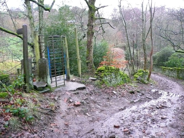
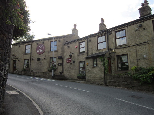
Images are sourced within 2km of 53.68139/-1.8585414 or Grid Reference SE0920. Thanks to Geograph Open Source API. All images are credited.

Drury Lane footpath, Stainland
Footpath towards Stainland
Turley Cote Lane
Turley Cote Lane
Footpath towards Shavey Clough
Shaw Park Gateway This mock castle style gateway forms one of the entrances to Shaw Park
Shaw Park Gateway
This mock castle style gateway forms one of the entrances to Shaw Park
Shaw Park Aviary Built originally as an Aviary around 1870, now disused.
Shaw Park Aviary
Built originally as an Aviary around 1870, now disused.
Shaw Park Folly The first of 3 follies linked by a wall in Shaw Park
Shaw Park Folly
The first of 3 follies linked by a wall in Shaw Park
Shaw Park Folly The second of 3 follies linked by a wall in Shaw Park
Shaw Park Folly
The second of 3 follies linked by a wall in Shaw Park
Shaw Park Folly The third of 3 follies linked by a wall in Shaw Park. The round tower housed a dovecote.
Shaw Park Folly
The third of 3 follies linked by a wall in Shaw Park. The round tower housed a dovecote.
Shaw Park Arches This small folly is formed with 3 arches in a curved wall
Shaw Park Arches
This small folly is formed with 3 arches in a curved wall
Water trough, Carr Hall Lane, Stainland This is the inlet end of a long trough, and the walls around it, formed of large stone flags, are presumably to keep animals away from the part used by people collecting water for domestic consumption in the days before piped water supplies.
Water trough, Carr Hall Lane, Stainland
This is the inlet end of a long trough, and the walls around it, formed of large stone flags, are presumably to keep animals away from the part used by people collecting water for domestic consumption in the days before piped water supplies.
Water trough, Carr Hall Lane, Stainland A long trough with a compartment at the inlet end, presumably to keep animals away from the part used by people collecting water for domestic consumption.
Water trough, Carr Hall Lane, Stainland
A long trough with a compartment at the inlet end, presumably to keep animals away from the part used by people collecting water for domestic consumption.
Bridleway rotary gate, Carr Hall Lane, Stainland A large version of the traditional 'kissing' gate, presumably intended to prevent motorcycles from passing through as a normal bridle gate would be sufficient to stop cars.
Bridleway rotary gate, Carr Hall Lane, Stainland
A large version of the traditional 'kissing' gate, presumably intended to prevent motorcycles from passing through as a normal bridle gate would be sufficient to stop cars.
Footpath gate off Carr Hall Lane, Old Lindley Similar in style to the bridleway gate in <a href="https://www.geograph.org.uk/photo/2912976">SE0819 : Bridleway rotary gate, Carr Hall Lane, Stainland</a> and <a href="https://www.geograph.org.uk/photo/2912984">SE0819 : Bridleway rotary gate, Carr Hall Lane, Stainland</a> (at SE085190).
Footpath gate off Carr Hall Lane, Old Lindley
The Rock public house, Holywell Green
Show me another place!

Ravenstone Wood is located at Grid Ref: SE0920 (Lat: 53.68139, Lng: -1.8585414)

Division: West Riding

Unitary Authority: Calderdale

Police Authority: West Yorkshire

What 3 Words

///coach.salads.united. Near Holywell Green, West Yorkshire

Related Wikis

West Vale railway station

West Vale railway station served on the Stainland Branch from 1875 to 1929. == History == The station was opened on New years day 1875, along with the...

The Brooksbank School

The Brooksbank School is a secondary school with academy status in Elland, near Halifax in West Yorkshire, England. It is a sports college, as well as...

West Vale

West Vale is a village in Calderdale, West Yorkshire, England. The village falls within the Greetland and Stainland parish of the Calderdale Council....

Rochdale Road Halt railway station

Rochdale Road Halt served the village of Greetland, West Yorkshire, England, on the Stainland Branch from 1907 to 1929. == Location == The halt was located...

Nearby Amenities

Located within 500m of 53.68139,-1.8585414
Bus Stop
Hammerstone Leach Lane Elland Golf Course
Local Ref: 45021536
Naptan AtcoCode: 450021536
Naptan Bearing: N
Naptan CommonName: Hammerstone Leach Lane Elland Golf Course
Naptan Crossing: Nr-At Braod Carr Lane
Naptan Indicator: Stop 45021536
Naptan Landmark: Elland Golf Course
Naptan PlusbusZoneRef: LEEDS
Naptan ShortCommonName: Elland Golf Course
Naptan Street: Hammerstone Leach Lane
Naptan Verified: no
Source: naptan_import
Lat/Long: 53.6779787/-1.8545442
Bus Stop
Victoria Road Blackley Road
Local Ref: 45021537
Naptan AtcoCode: 450021537
Naptan Bearing: SW
Naptan CommonName: Victoria Road Blackley Road
Naptan Crossing: Blackley Road
Naptan Indicator: Stop 45021537
Naptan PlusbusZoneRef: LEEDS
Naptan ShortCommonName: Blackley Road
Naptan Street: Victoria Road
Naptan Verified: no
Source: naptan_import
Lat/Long: 53.680699/-1.8519459
Bus Stop
Victoria Road Hammerstone Leach Lane
Local Ref: 45021538
Naptan AtcoCode: 450021538
Naptan Bearing: NE
Naptan CommonName: Victoria Road Hammerstone Leach Lane
Naptan Crossing: Hammerstone Leach Lane
Naptan Indicator: Stop 45021538
Naptan Landmark: Brooksbank School
Naptan Notes: L/C 40
Naptan PlusbusZoneRef: LEEDS
Naptan ShortCommonName: Leach Lane
Naptan Street: Victoria Road
Naptan Verified: no
Source: naptan_import
Lat/Long: 53.6807979/-1.8519607
Bus Stop
Stainland Road Bradley Lane
Local Ref: 45021557
Naptan AtcoCode: 450021557
Naptan Bearing: SW
Naptan CommonName: Stainland Road Bradley Lane
Naptan Crossing: Bradley Lane
Naptan Indicator: Stop 45021557
Naptan PlusbusZoneRef: LEEDS
Naptan ShortCommonName: Bradley Lane
Naptan Street: Stainland Road
Naptan Verified: no
Source: naptan_import
Lat/Long: 53.6812542/-1.8654036
Bus Stop
Stainland Road
Local Ref: 45021559
Naptan AtcoCode: 450021559
Naptan Bearing: SW
Naptan CommonName: Stainland Road
Naptan Crossing: Long Heys-Green Lane
Naptan Indicator: Stop 45021559
Naptan PlusbusZoneRef: LEEDS
Naptan ShortCommonName: Long Heys
Naptan Street: Stainland Road
Naptan Verified: no
Source: naptan_import
Lat/Long: 53.6828603/-1.862976
Bus Stop
Stainland Road Little Bradley
Local Ref: 45021560
Naptan AtcoCode: 450021560
Naptan Bearing: SE
Naptan CommonName: Stainland Road Little Bradley
Naptan Crossing: Little Bradley
Naptan Indicator: Stop 45021560
Naptan PlusbusZoneRef: LEEDS
Naptan ShortCommonName: Little Bradley
Naptan Street: Stainland Road
Naptan Verified: no
Shelter: yes
Source: naptan_import
Lat/Long: 53.6832465/-1.8626719
Bus Stop
Stainland Road Queen Street
Local Ref: 45021561
Naptan AtcoCode: 450021561
Naptan Bearing: SW
Naptan CommonName: Stainland Road Queen Street
Naptan Crossing: Queen Street
Naptan Indicator: Stop 45021561
Naptan Landmark: The Queen PH
Naptan PlusbusZoneRef: LEEDS
Naptan ShortCommonName: Queen Street
Naptan Street: Stainland Road
Naptan Verified: no
Source: naptan_import
Lat/Long: 53.6851475/-1.8587441
Bus Stop
Stainland Road Queen Street
Local Ref: 45021600
Naptan AtcoCode: 450021600
Naptan Bearing: NE
Naptan CommonName: Stainland Road Queen Street
Naptan Crossing: Queen Street
Naptan Indicator: Stop 45021600
Naptan Landmark: The Queen PH
Naptan PlusbusZoneRef: LEEDS
Naptan ShortCommonName: Queen Street
Naptan Street: Stainland Road
Naptan Verified: no
Source: naptan_import
Lat/Long: 53.6854527/-1.8584553
Hammerstones Road
Local Ref: 45024336
Naptan AtcoCode: 450024336
Naptan Bearing: NW
Naptan BusStopType: CUS
Naptan CommonName: Hammerstones Road
Naptan Crossing: Nr-At Hammerstones Leach Lane
Naptan Indicator: Stop 45024336
Naptan PlusbusZoneRef: LEEDS
Naptan ShortCommonName: Hullenedge Lane
Naptan Street: Hammerstones Road
Naptan Verified: no
Source: naptan_import
Lat/Long: 53.6814826/-1.8532301
Bus Stop
Hammerstone Leach Lane Elland Golf Course
Local Ref: 45024816
Naptan AtcoCode: 450024816
Naptan Bearing: S
Naptan CommonName: Hammerstone Leach Lane Elland Golf Course
Naptan Crossing: Twixt Blackley Road & Mucky Lane
Naptan Indicator: Stop 45024816
Naptan Landmark: Elland Golf Course
Naptan PlusbusZoneRef: LEEDS
Naptan ShortCommonName: Elland Golf Course
Naptan Street: Hammerstone Leach Lane
Naptan Verified: no
Source: naptan_import
Lat/Long: 53.6780055/-1.8543928
Bus Stop
Stainland Road Health Centre
Local Ref: 45028208
Naptan AtcoCode: 450028208
Naptan Bearing: NE
Naptan CommonName: Stainland Road Health Centre
Naptan Crossing: Black Brook Way
Naptan Indicator: Stop 45028208
Naptan Landmark: Health Centre
Naptan PlusbusZoneRef: LEEDS
Naptan ShortCommonName: Stainland Road
Naptan Street: Stainland Road
Naptan Verified: no
Source: naptan_import
Lat/Long: 53.6837219/-1.8618527
Bus Stop
Stainland Road Health Centre
Local Ref: 45028210
Naptan AtcoCode: 450028210
Naptan Bearing: SW
Naptan CommonName: Stainland Road Health Centre
Naptan Crossing: Nr-At Green Lane
Naptan Indicator: Stop 45028210
Naptan Landmark: Health Centre
Naptan PlusbusZoneRef: LEEDS
Naptan ShortCommonName: Stainland Road
Naptan Street: Stainland Road
Naptan Verified: no
Source: naptan_import
Lat/Long: 53.683587/-1.8617321
Stainland Road Bradley Lane
Local Ref: 45051111
Naptan AtcoCode: 450051111
Naptan Bearing: NE
Naptan BusStopType: CUS
Naptan CommonName: Stainland Road Bradley Lane
Naptan Indicator: Stop 45051111
Naptan PlusbusZoneRef: LEEDS
Naptan ShortCommonName: Bradley Lane
Naptan Street: Stainland Road
Naptan Verified: no
Source: naptan_import
Lat/Long: 53.6813262/-1.8655397
Post Box
Operator: Royal Mail
Ref: HX4 246
Lat/Long: 53.6847131/-1.8556855
Post Box
Operator: Royal Mail
Ref: HX4 103
Lat/Long: 53.6831769/-1.8628153
Turning Circle
Lat/Long: 53.6806527/-1.8600882
Turning Loop
Ravenstone Drive
Lat/Long: 53.6810728/-1.8606837
Turning Circle
Ravenstone Drive
Lat/Long: 53.6820769/-1.8602043
Elland Cricket, Athletic and Bowling Club
Leisure: pitch
Sport: cricket;bowls;tennis;football
Surface: unpaved
Lat/Long: 53.6825043/-1.8517034
Turning Circle
Lat/Long: 53.683986/-1.8566038
Hullenedge
Is In: Elland
Place: neighbourhood
Source: npe
Lat/Long: 53.6835868/-1.8524256
Little Bradley
Place: hamlet
Source: npe
Lat/Long: 53.6827043/-1.861404
Parcel Locker
Amazon Hub Locker
Brand: Amazon Hub
Brand Wikidata: Q16974764
Operator: Amazon
Lat/Long: 53.683797/-1.8617052
Barrier: bollard
Lat/Long: 53.6849804/-1.8562381
Power: substation
Substation: minor_distribution
Lat/Long: 53.6829514/-1.8612437
Barrier: bollard
Bicycle: yes
Foot: yes
Horse: yes
Lat/Long: 53.6840458/-1.85919
West Vale
Historic Railway: station
Railway: site
Wikidata: Q16248745
Wikipedia: en:West Vale railway station
Lat/Long: 53.6835614/-1.8593965
The data included in this document is from www.openstreetmap.org. The data is made available under ODbL.

Have you been to Ravenstone Wood?

Leave your review of Ravenstone Wood below (or comments, questions and feedback).