Ardwell

Settlement in Wigtownshire

Scotland

Ardwell

Ardwell bay, Rhins of Galloway about 10 miles South of Stranraer Seals lazing on the rocks during a lovely Winter afternoon.
Ardwell bay, Rhins of Galloway about 10 miles South of Stranraer Credit: Colin McDonald

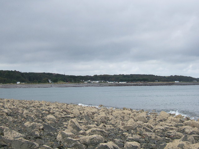
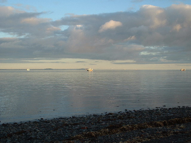
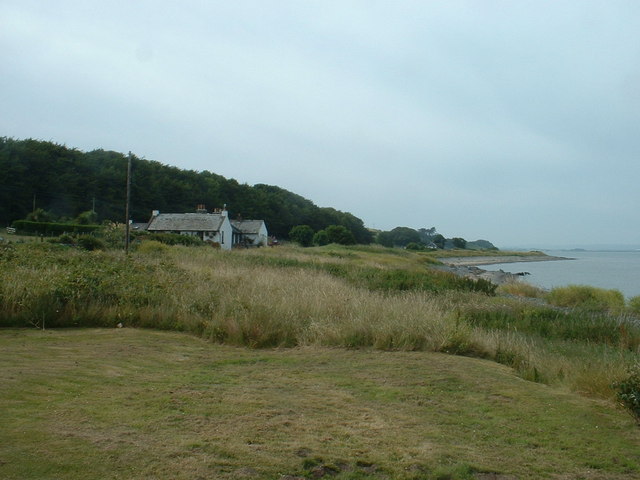
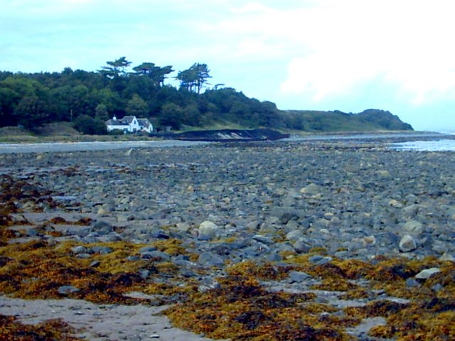
Ardwell is a small village located in the historical county of Wigtownshire, Scotland. Situated on the western coast, it lies on the eastern shore of Luce Bay, overlooking the Irish Sea. With a population of around 150 residents, Ardwell offers a peaceful and scenic environment for those seeking a quiet retreat.

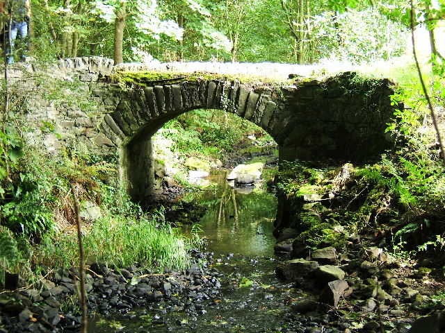
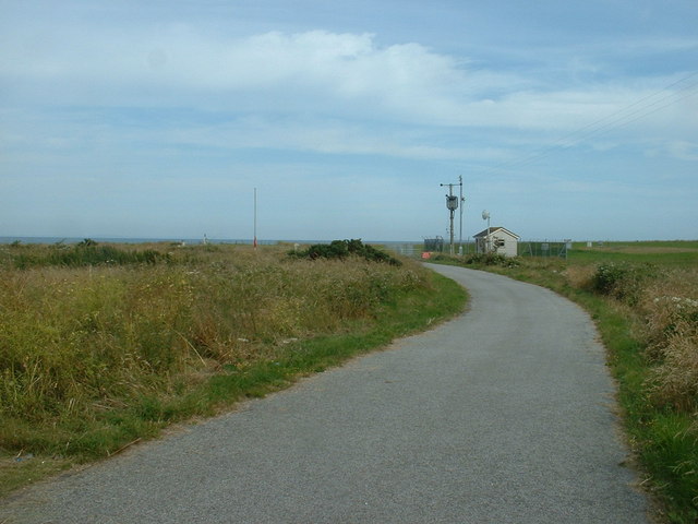
The village is surrounded by lush green fields and rolling hills, giving it a picturesque countryside charm. Its coastal location provides stunning views of the sea, and its proximity to the Galloway Forest Park makes it an ideal base for outdoor enthusiasts.

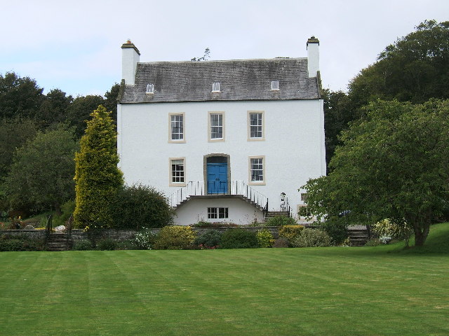
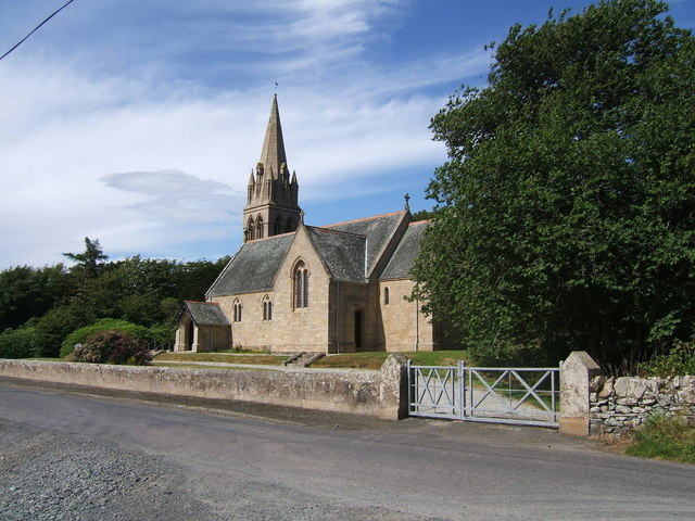
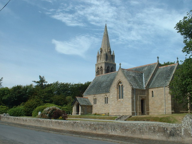
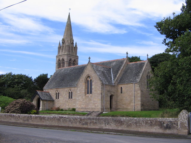
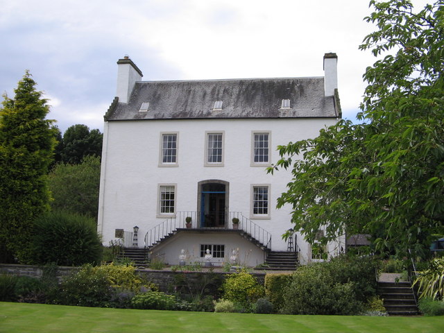
The village is home to several historic buildings, including Ardwell House, a grand mansion dating back to the 19th century. This Georgian-style house is set within beautifully landscaped gardens, which are open to the public during certain times of the year. Ardwell Parish Church, a small but charming place of worship, is also a notable landmark in the village.

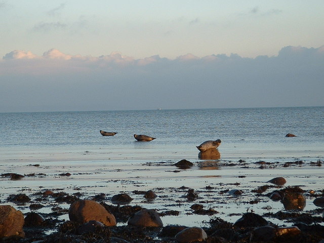
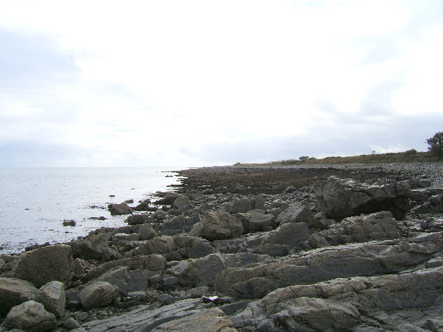
For nature lovers, Ardwell offers opportunities for coastal walks along the bay, where one can spot a variety of bird species and marine life. The nearby RSPB reserve at Crook of Baldoon is a popular spot for birdwatching, particularly for its resident population of barnacle geese.

Ardwell is well-connected to the surrounding areas by road, making it easily accessible for visitors. While it may be a small village, Ardwell's natural beauty, rich history, and tranquil atmosphere make it an appealing destination for those seeking relaxation and immersion in Scotland's rural charm.

If you have any feedback on the listing, please let us know in the comments section below.
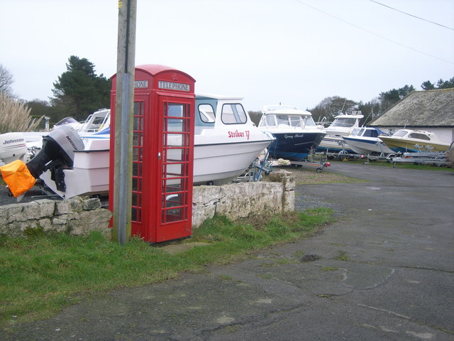
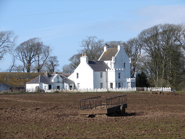
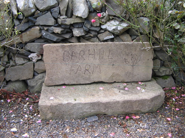
Ardwell Images

Images are sourced within 2km of 54.770731/-4.9411158 or Grid Reference NX1045. Thanks to Geograph Open Source API. All images are credited.

Ardwell bay, Rhins of Galloway about 10 miles South of Stranraer Seals lazing on the rocks during a lovely Winter afternoon.
Ardwell bay, Rhins of Galloway about 10 miles South of Stranraer
Seals lazing on the rocks during a lovely Winter afternoon.
Ardwell House, Ardwell, Wigtownshire The estate house at Ardwell owned by and occupied by the Brewis family.
Ardwell House, Ardwell, Wigtownshire
The estate house at Ardwell owned by and occupied by the Brewis family.
An old cartpath and bridge within Ardwell Estate This old bridge is close to Ardwell houses, Ardwell, about 10 miles South of Stranraer.
An old cartpath and bridge within Ardwell Estate
This old bridge is close to Ardwell houses, Ardwell, about 10 miles South of Stranraer.
The rocky shore between Longrigg and Logan Mill Photograph taken around the point from Longrigg near Ardwell.
The rocky shore between Longrigg and Logan Mill
Photograph taken around the point from Longrigg near Ardwell.
The remains of a Motte and Bailey castle, Ardwell, Stranraer These are all that remain of a Motte and Bailey castle within the grounds of Ardwell House, Ardwell, Stranraer. The modern OS maps have it marked as Ardwell Motte and the shape is unmistakable. When closer, the ditch around the Motte is still noticeable and in fact, the estate have built two wooden bridges over the ditch, one at either side of a marked walk.
The remains of a Motte and Bailey castle, Ardwell, Stranraer
These are all that remain of a Motte and Bailey castle within the grounds of Ardwell House, Ardwell, Stranraer. The modern OS maps have it marked as Ardwell Motte and the shape is unmistakable. When closer, the ditch around the Motte is still noticeable and in fact, the estate have built two wooden bridges over the ditch, one at either side of a marked walk.
Chapel Rossan Bay looking across to Ardwell village and caravan site. Chapel Rossan Bay taken from Chapel Rossan and looking across to Ardwell village, about 10 miles South of Stranraer.
Chapel Rossan Bay looking across to Ardwell village and caravan site.
Chapel Rossan Bay taken from Chapel Rossan and looking across to Ardwell village, about 10 miles South of Stranraer.
A fleet of fishing boats in Luce Bay off Ardwell. A fleet of scallop trawlers from the Isle of Man destroying the seabed in Luce Bay off Ardwell in December 2004. On that afternoon about 22 trawlers were seen dredging the seabed for scallops. They remained there for several weeks causing great damage to the ecology of the area. This picture was taken on a lovely Winter afternoon just as the sun was going down.
A fleet of fishing boats in Luce Bay off Ardwell.
A fleet of scallop trawlers from the Isle of Man destroying the seabed in Luce Bay off Ardwell in December 2004. On that afternoon about 22 trawlers were seen dredging the seabed for scallops. They remained there for several weeks causing great damage to the ecology of the area. This picture was taken on a lovely Winter afternoon just as the sun was going down.
Ardwell Church, Ardwell, Stranraer Ardwell Church, Ardwell, Stranraer built in 1902.
Ardwell Church, Ardwell, Stranraer
Ardwell Church, Ardwell, Stranraer built in 1902.
Ardwell Church
Ardwell Church
Lane near Ardwell Church On the opposite side of the road, running south.
Lane near Ardwell Church
On the opposite side of the road, running south.
MoD Lookout on Luce Bay There is a barrier here, restricting access to the shore when military activities are underway.
MoD Lookout on Luce Bay
There is a barrier here, restricting access to the shore when military activities are underway.
Drumantrae On the shore of Luce Bay, looking north.
Drumantrae
On the shore of Luce Bay, looking north.
The Dyemill, Near Sandhead Now a private dwelling, the Dye Mill was once powered by the Alwhibbie Burn to mill seaweed and obtain a brown dye.  Seaweed was one of Scotland's most valuable natural resources.
The Dyemill, Near Sandhead
Now a private dwelling, the Dye Mill was once powered by the Alwhibbie Burn to mill seaweed and obtain a brown dye. Seaweed was one of Scotland's most valuable natural resources.
Ardwell Telephone Box
Auchness Tower, Ardwell The 16 century altered 3-storey tower was formerly known as Auchness Castle; it now forms part of a modern farmhouse. <span class="nowrap"><a title="http://canmore.org.uk/site/61124/auchness-farmhouse" rel="nofollow ugc noopener" href="http://canmore.org.uk/site/61124/auchness-farmhouse">Link</a><img style="margin-left:2px;" alt="External link" title="External link - shift click to open in new window" src="https://s1.geograph.org.uk/img/external.png" width="10" height="10"/></span>
Auchness Tower, Ardwell
The 16 century altered 3-storey tower was formerly known as Auchness Castle; it now forms part of a modern farmhouse. LinkExternal link
Ardwell Church
Ardwell Church
Carved farm sign for Barhill farm
Ardwell House The house was built in the early 18th century. It has been in the McTaggart family since before 1800.
Ardwell House
The house was built in the early 18th century. It has been in the McTaggart family since before 1800.
Show me another place!

Ardwell is located at Grid Ref: NX1045 (Lat: 54.770731, Lng: -4.9411158)

Unitary Authority: Dumfries and Galloway

Police Authority: Dumfries and Galloway

What 3 Words

///ambition.leap.uplifting. Near Drummore, Dumfries & Galloway

Related Wikis

Ardwell

Ardwell (from Gaelic Àrd Bhaile meaning "high town", pronounced as "Ardwell") is a village in the Scottish unitary council area of Dumfries and Galloway...

Clachanmore

Clachanmore is a village in the South Rhins of Galloway near Ardwell in the south west of Scotland. It has also been known as Low Ardwell.The name of the...

Logan Botanic Garden

Logan Botanic Garden is a botanical garden near Port Logan on the Rhins of Galloway, at the south-western tip of Scotland. The Botanic Garden was established...

Sandhead

Sandhead is a small village in Dumfries and Galloway, south west Scotland. It overlooks Luce Bay, 7 miles south of Stranraer. The old main road, named...
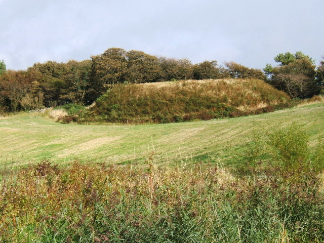
Doon Castle Broch

Doon Castle Broch is an iron-age broch located in Dumfries and Galloway, Scotland (grid reference NX 06702 44683). == Location == The Broch is located...

Port Logan

Port Logan, formerly Port Nessock, is a small village in the parish of Kirkmaiden in the Rhins of Galloway in Wigtownshire. The Gaelic name is Port Neasaig...

Stoneykirk

Stoneykirk (Scottish Gaelic: Eaglais Steafain) is an area and a village in the heart of the Rhins of Galloway, Wigtownshire, in the administrative council...

RAF West Freugh

RAF West Freugh is a former Royal Air Force station located in Wigtownshire, 5 miles (8 km) south east of Stranraer, Dumfries and Galloway, Scotland. It...

Nearby Amenities

Located within 500m of 54.770731,-4.9411158
Source: PGS
Lat/Long: 54.7666182/-4.9398557
Source: PGS
Lat/Long: 54.7671532/-4.9395898
Source: PGS
Lat/Long: 54.7682816/-4.9388497
Source: PGS
Lat/Long: 54.7693207/-4.9385776
Source: PGS
Lat/Long: 54.7721688/-4.9394311
Source: PGS
Lat/Long: 54.7730352/-4.9392492
Source: PGS
Lat/Long: 54.7743352/-4.9389479
Ardwell
Name En: Ardwell
Name Gd: Àrd Bhaile
Place: village
Wikidata: Q4788328
Wikipedia: en:Ardwell
Lat/Long: 54.7695912/-4.9408861
Bus Stop
Village
Naptan AtcoCode: 680000280111
Naptan Bearing: N
Naptan CommonName: Village
Naptan Indicator: Post Office
Naptan Landmark: Post Office
Naptan NaptanCode: 34234937
Naptan Notes: none
Naptan Street: Main Street
Naptan Verified: no
Source: naptan_import
Lat/Long: 54.7693559/-4.9411934
Bus Stop
Village
Naptan AtcoCode: 680000280222
Naptan Bearing: S
Naptan CommonName: Village
Naptan Indicator: opp PO
Naptan Landmark: Post Office
Naptan NaptanCode: 34234938
Naptan Notes: none
Naptan Street: Main Street
Naptan Verified: no
Source: naptan_import
Lat/Long: 54.7696609/-4.9409044
Turning Circle
Lat/Long: 54.7682509/-4.9404589
Toilets
Lat/Long: 54.7675714/-4.940326
Power: pole
Lat/Long: 54.7711067/-4.9419969
Power: pole
Lat/Long: 54.7713543/-4.9428445
Power: pole
Lat/Long: 54.7716606/-4.9439845
Power: pole
Lat/Long: 54.7719004/-4.9446765
Power: pole
Lat/Long: 54.7719994/-4.9463636
Power: pole
Lat/Long: 54.7720118/-4.947423
Power: pole
Lat/Long: 54.7720443/-4.9485201
Telephone
Booth: K6
Covered: booth
Lat/Long: 54.7694856/-4.9412078
Ardwell Marine
Addr City: Ardwell
Addr Housename: Ardwell Marine
Addr Postcode: DG9 9LS
Email: tomcase@ardwellmarine.co.uk
Phone: +44 1776 860698
Shop: boat
Website: http://www.ardwellmarine.co.uk/CONTACTS.htm
Lat/Long: 54.7693525/-4.9415846
Leisure: slipway
Lat/Long: 54.7671569/-4.939475
Defibrillator
Emergency: defibrillator
Indoor: no
Lat/Long: 54.7694132/-4.9411224
The data included in this document is from www.openstreetmap.org. The data is made available under ODbL.

Have you been to Ardwell?

Leave your review of Ardwell below (or comments, questions and feedback).