Hall Wood

Wood, Forest in Northumberland

England

Hall Wood

Footpath to Standing Stone
Footpath to Standing Stone Credit: Jeff Buck

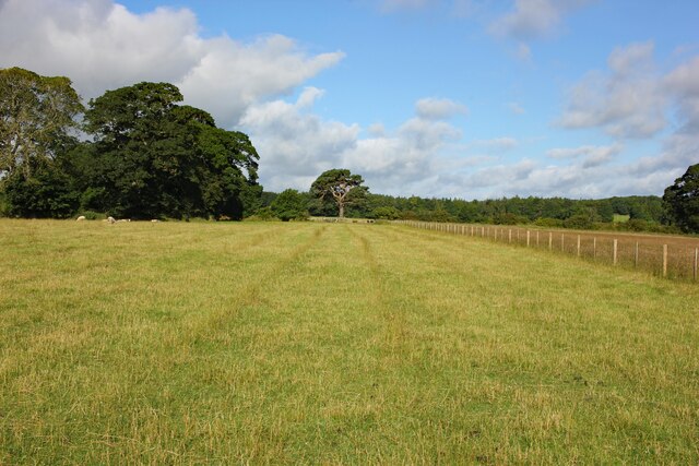
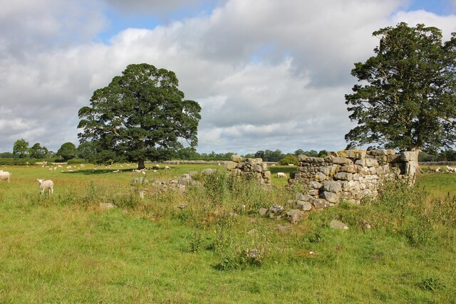
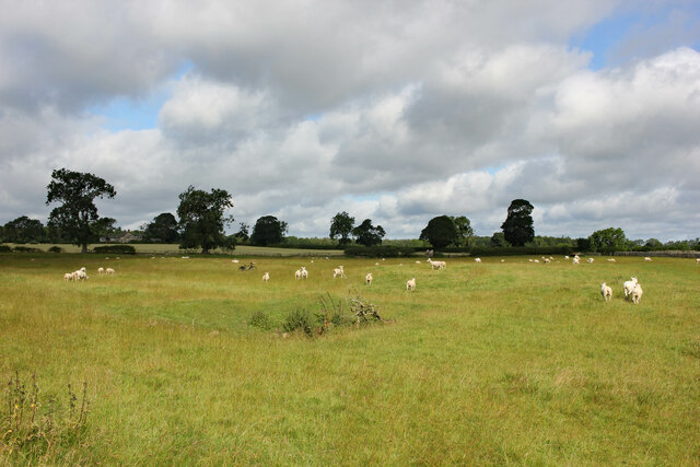
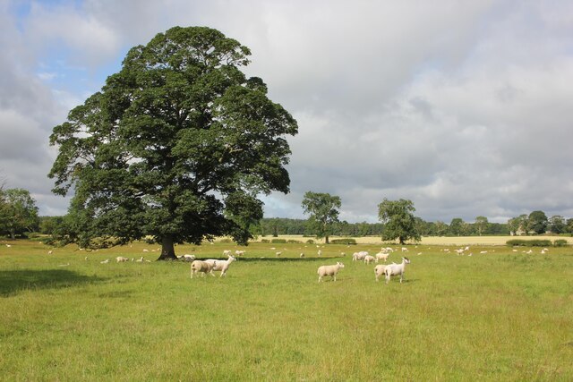
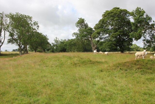
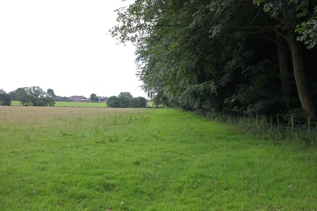
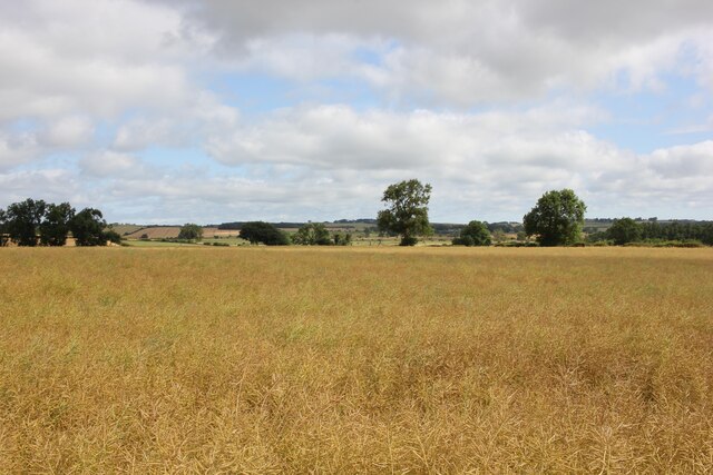
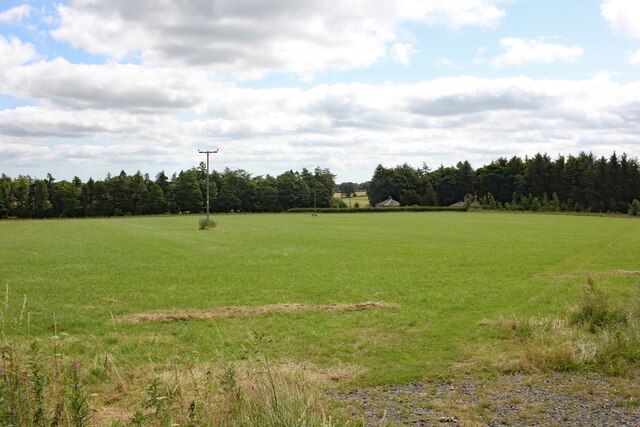
Hall Wood is a picturesque forest located in the county of Northumberland, in the northeast of England. Covering an area of approximately 100 hectares, it is a popular destination for nature enthusiasts and outdoor lovers alike. The wood is situated near the village of Hallington, nestled within the beautiful landscape of the North Pennines Area of Outstanding Natural Beauty.

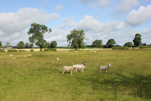
Dominated by a mix of native deciduous and coniferous trees, Hall Wood offers a diverse ecosystem that supports a wide array of wildlife. Visitors can expect to encounter a variety of bird species, including woodpeckers, owls, and thrushes. The forest floor is also teeming with smaller creatures such as rabbits, voles, and squirrels.

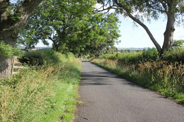
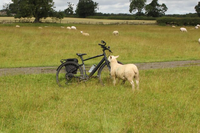
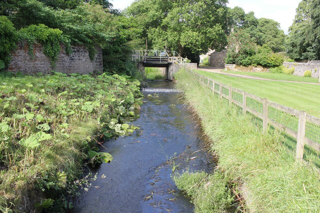
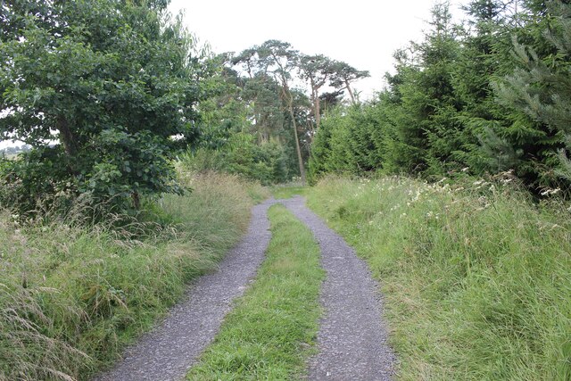
The wood boasts a network of well-maintained footpaths and trails, making it an ideal location for walking, hiking, and cycling. These paths wind through the enchanting woodland, offering stunning vistas and opportunities for exploration. In spring, the forest comes alive with a riot of colors as the vibrant bluebells carpet the forest floor.

Within the wood, there are several designated picnic areas where visitors can relax and enjoy the tranquil surroundings. Additionally, there are ample opportunities for birdwatching and photography, with designated hides and viewpoints strategically placed throughout the wood.

Hall Wood provides a serene escape from the hustle and bustle of everyday life, offering visitors a chance to immerse themselves in nature's beauty. Whether it's a leisurely stroll, a family picnic, or a birdwatching adventure, Hall Wood is a hidden gem waiting to be discovered in the heart of Northumberland.

If you have any feedback on the listing, please let us know in the comments section below.

Hall Wood Images

Images are sourced within 2km of 55.040296/-1.9498028 or Grid Reference NZ0371. Thanks to Geograph Open Source API. All images are credited.

Footpath to Standing Stone
Lane to East Matfen Village
East Matfen medieval village and open field system (site of) Ruin on the site of East Matfen medieval village and open field system. The following detailed information is from Historic England.

The monument includes the deserted remains of the medieval village of East Matfen and part of its surviving open field system, situated on the right bank of the now canalised River Pont. It is divided into two separate areas by a later trackway. In the 13th century the manor of East Matfen was held by the Fenwick family and a document records that in 1296 14 individuals from the village were eligible to pay taxes. Part of the manor was subsequently granted to the priory at Hexham, and later documents record a fall in the village population. After the Dissolution of the Monasteries, the manor was regained by the Fenwicks. During the mid- to late 17th century the estate was acquired by John Douglas of Newcastle who depopulated the village and dispersed the farms to other parts of the estate. Maps of a similar date indicate that the northern half of the village became incorporated into a formal park which was established in the area at this time. The plan of the medieval village is a type well known in this part of Northumberland in which two parallel lines of houses face onto a broad rectangular village green, with crofts, or garden areas to the rear. This type of village is thought to be the result of deliberate planning by Norman rulers attempting to exert control over a rebellious region during the 11th and 12th centuries. The two rows of houses are oriented east to west, and each is visible as a series of rectangular enclosures or tofts containing the foundations of timber long houses. The house foundations stand to an average height of 0.3m. The ruined remains of Pead House at the centre of the south row of the village indicate that at least one of the original medieval plots continued in use into the post-medieval period. To the rear of each street, there are the well defined remains of linear crofts, each bounded from its neighbour by a bank on average 0.5m high. Some of the crofts, particularly on the north row of the village, contain the remains of rig and furrow cultivation. The two streets face onto a broad rectangular open space containing the remains of banks and hollows. This was formerly the village green. Subsequent to its desertion, part of the village green was ploughed up, and the remains of rig and furrow are visible at its north eastern end. A well defined hollow way crosses the green and opens out at its eastern end to form a funnelled access or driftway across the surrounding open fields to the pasture beyond. At the eastern end of the village, part of the open fields which once surrounded the village on all sides, survive in the form of a large medieval furlong or field bounded on some of its sides by intact headland. The remains of two smaller furlongs beyond it to the south east. Each furlong contains rig and furrow cultivation which survives well and stands to a maximum height of 1m. All stone walls and fences which cross the monument are excluded from the scheduling as are the line of telegraph poles and the metalled surface of the road, although the ground beneath all of these features is included.

Historic England East Matfen <span class="nowrap"><a title="https://historicengland.org.uk/listing/the-list/list-entry/1016351" rel="nofollow ugc noopener" href="https://historicengland.org.uk/listing/the-list/list-entry/1016351">Link</a><img style="margin-left:2px;" alt="External link" title="External link - shift click to open in new window" src="https://s1.geograph.org.uk/img/external.png" width="10" height="10"/></span>
East Matfen medieval village and open field system (site of)
Ruin on the site of East Matfen medieval village and open field system. The following detailed information is from Historic England. The monument includes the deserted remains of the medieval village of East Matfen and part of its surviving open field system, situated on the right bank of the now canalised River Pont. It is divided into two separate areas by a later trackway. In the 13th century the manor of East Matfen was held by the Fenwick family and a document records that in 1296 14 individuals from the village were eligible to pay taxes. Part of the manor was subsequently granted to the priory at Hexham, and later documents record a fall in the village population. After the Dissolution of the Monasteries, the manor was regained by the Fenwicks. During the mid- to late 17th century the estate was acquired by John Douglas of Newcastle who depopulated the village and dispersed the farms to other parts of the estate. Maps of a similar date indicate that the northern half of the village became incorporated into a formal park which was established in the area at this time. The plan of the medieval village is a type well known in this part of Northumberland in which two parallel lines of houses face onto a broad rectangular village green, with crofts, or garden areas to the rear. This type of village is thought to be the result of deliberate planning by Norman rulers attempting to exert control over a rebellious region during the 11th and 12th centuries. The two rows of houses are oriented east to west, and each is visible as a series of rectangular enclosures or tofts containing the foundations of timber long houses. The house foundations stand to an average height of 0.3m. The ruined remains of Pead House at the centre of the south row of the village indicate that at least one of the original medieval plots continued in use into the post-medieval period. To the rear of each street, there are the well defined remains of linear crofts, each bounded from its neighbour by a bank on average 0.5m high. Some of the crofts, particularly on the north row of the village, contain the remains of rig and furrow cultivation. The two streets face onto a broad rectangular open space containing the remains of banks and hollows. This was formerly the village green. Subsequent to its desertion, part of the village green was ploughed up, and the remains of rig and furrow are visible at its north eastern end. A well defined hollow way crosses the green and opens out at its eastern end to form a funnelled access or driftway across the surrounding open fields to the pasture beyond. At the eastern end of the village, part of the open fields which once surrounded the village on all sides, survive in the form of a large medieval furlong or field bounded on some of its sides by intact headland. The remains of two smaller furlongs beyond it to the south east. Each furlong contains rig and furrow cultivation which survives well and stands to a maximum height of 1m. All stone walls and fences which cross the monument are excluded from the scheduling as are the line of telegraph poles and the metalled surface of the road, although the ground beneath all of these features is included. Historic England East Matfen LinkExternal link
East Matfen medieval village and open field system (site of) The following detailed information is from Historic England.

The monument includes the deserted remains of the medieval village of East Matfen and part of its surviving open field system, situated on the right bank of the now canalised River Pont. It is divided into two separate areas by a later trackway. In the 13th century the manor of East Matfen was held by the Fenwick family and a document records that in 1296 14 individuals from the village were eligible to pay taxes. Part of the manor was subsequently granted to the priory at Hexham, and later documents record a fall in the village population. After the Dissolution of the Monasteries, the manor was regained by the Fenwicks. During the mid- to late 17th century the estate was acquired by John Douglas of Newcastle who depopulated the village and dispersed the farms to other parts of the estate. Maps of a similar date indicate that the northern half of the village became incorporated into a formal park which was established in the area at this time. The plan of the medieval village is a type well known in this part of Northumberland in which two parallel lines of houses face onto a broad rectangular village green, with crofts, or garden areas to the rear. This type of village is thought to be the result of deliberate planning by Norman rulers attempting to exert control over a rebellious region during the 11th and 12th centuries. The two rows of houses are oriented east to west, and each is visible as a series of rectangular enclosures or tofts containing the foundations of timber long houses. The house foundations stand to an average height of 0.3m. The ruined remains of Pead House at the centre of the south row of the village indicate that at least one of the original medieval plots continued in use into the post-medieval period. To the rear of each street, there are the well defined remains of linear crofts, each bounded from its neighbour by a bank on average 0.5m high. Some of the crofts, particularly on the north row of the village, contain the remains of rig and furrow cultivation. The two streets face onto a broad rectangular open space containing the remains of banks and hollows. This was formerly the village green. Subsequent to its desertion, part of the village green was ploughed up, and the remains of rig and furrow are visible at its north eastern end. A well defined hollow way crosses the green and opens out at its eastern end to form a funnelled access or driftway across the surrounding open fields to the pasture beyond. At the eastern end of the village, part of the open fields which once surrounded the village on all sides, survive in the form of a large medieval furlong or field bounded on some of its sides by intact headland. The remains of two smaller furlongs beyond it to the south east. Each furlong contains rig and furrow cultivation which survives well and stands to a maximum height of 1m. All stone walls and fences which cross the monument are excluded from the scheduling as are the line of telegraph poles and the metalled surface of the road, although the ground beneath all of these features is included.

Historic England East Matfen <span class="nowrap"><a title="https://historicengland.org.uk/listing/the-list/list-entry/1016351" rel="nofollow ugc noopener" href="https://historicengland.org.uk/listing/the-list/list-entry/1016351">Link</a><img style="margin-left:2px;" alt="External link" title="External link - shift click to open in new window" src="https://s1.geograph.org.uk/img/external.png" width="10" height="10"/></span>
East Matfen medieval village and open field system (site of)
The following detailed information is from Historic England. The monument includes the deserted remains of the medieval village of East Matfen and part of its surviving open field system, situated on the right bank of the now canalised River Pont. It is divided into two separate areas by a later trackway. In the 13th century the manor of East Matfen was held by the Fenwick family and a document records that in 1296 14 individuals from the village were eligible to pay taxes. Part of the manor was subsequently granted to the priory at Hexham, and later documents record a fall in the village population. After the Dissolution of the Monasteries, the manor was regained by the Fenwicks. During the mid- to late 17th century the estate was acquired by John Douglas of Newcastle who depopulated the village and dispersed the farms to other parts of the estate. Maps of a similar date indicate that the northern half of the village became incorporated into a formal park which was established in the area at this time. The plan of the medieval village is a type well known in this part of Northumberland in which two parallel lines of houses face onto a broad rectangular village green, with crofts, or garden areas to the rear. This type of village is thought to be the result of deliberate planning by Norman rulers attempting to exert control over a rebellious region during the 11th and 12th centuries. The two rows of houses are oriented east to west, and each is visible as a series of rectangular enclosures or tofts containing the foundations of timber long houses. The house foundations stand to an average height of 0.3m. The ruined remains of Pead House at the centre of the south row of the village indicate that at least one of the original medieval plots continued in use into the post-medieval period. To the rear of each street, there are the well defined remains of linear crofts, each bounded from its neighbour by a bank on average 0.5m high. Some of the crofts, particularly on the north row of the village, contain the remains of rig and furrow cultivation. The two streets face onto a broad rectangular open space containing the remains of banks and hollows. This was formerly the village green. Subsequent to its desertion, part of the village green was ploughed up, and the remains of rig and furrow are visible at its north eastern end. A well defined hollow way crosses the green and opens out at its eastern end to form a funnelled access or driftway across the surrounding open fields to the pasture beyond. At the eastern end of the village, part of the open fields which once surrounded the village on all sides, survive in the form of a large medieval furlong or field bounded on some of its sides by intact headland. The remains of two smaller furlongs beyond it to the south east. Each furlong contains rig and furrow cultivation which survives well and stands to a maximum height of 1m. All stone walls and fences which cross the monument are excluded from the scheduling as are the line of telegraph poles and the metalled surface of the road, although the ground beneath all of these features is included. Historic England East Matfen LinkExternal link
East Matfen medieval village and open field system (site of) Earthworks on the site of East Matfen medieval village and open field system. The following detailed information is from Historic England.

The monument includes the deserted remains of the medieval village of East Matfen and part of its surviving open field system, situated on the right bank of the now canalised River Pont. It is divided into two separate areas by a later trackway. In the 13th century the manor of East Matfen was held by the Fenwick family and a document records that in 1296 14 individuals from the village were eligible to pay taxes. Part of the manor was subsequently granted to the priory at Hexham, and later documents record a fall in the village population. After the Dissolution of the Monasteries, the manor was regained by the Fenwicks. During the mid- to late 17th century the estate was acquired by John Douglas of Newcastle who depopulated the village and dispersed the farms to other parts of the estate. Maps of a similar date indicate that the northern half of the village became incorporated into a formal park which was established in the area at this time. The plan of the medieval village is a type well known in this part of Northumberland in which two parallel lines of houses face onto a broad rectangular village green, with crofts, or garden areas to the rear. This type of village is thought to be the result of deliberate planning by Norman rulers attempting to exert control over a rebellious region during the 11th and 12th centuries. The two rows of houses are oriented east to west, and each is visible as a series of rectangular enclosures or tofts containing the foundations of timber long houses. The house foundations stand to an average height of 0.3m. The ruined remains of Pead House at the centre of the south row of the village indicate that at least one of the original medieval plots continued in use into the post-medieval period. To the rear of each street, there are the well defined remains of linear crofts, each bounded from its neighbour by a bank on average 0.5m high. Some of the crofts, particularly on the north row of the village, contain the remains of rig and furrow cultivation. The two streets face onto a broad rectangular open space containing the remains of banks and hollows. This was formerly the village green. Subsequent to its desertion, part of the village green was ploughed up, and the remains of rig and furrow are visible at its north eastern end. A well defined hollow way crosses the green and opens out at its eastern end to form a funnelled access or driftway across the surrounding open fields to the pasture beyond. At the eastern end of the village, part of the open fields which once surrounded the village on all sides, survive in the form of a large medieval furlong or field bounded on some of its sides by intact headland. The remains of two smaller furlongs beyond it to the south east. Each furlong contains rig and furrow cultivation which survives well and stands to a maximum height of 1m. All stone walls and fences which cross the monument are excluded from the scheduling as are the line of telegraph poles and the metalled surface of the road, although the ground beneath all of these features is included.

Historic England East Matfen <span class="nowrap"><a title="https://historicengland.org.uk/listing/the-list/list-entry/1016351" rel="nofollow ugc noopener" href="https://historicengland.org.uk/listing/the-list/list-entry/1016351">Link</a><img style="margin-left:2px;" alt="External link" title="External link - shift click to open in new window" src="https://s1.geograph.org.uk/img/external.png" width="10" height="10"/></span>
East Matfen medieval village and open field system (site of)
Earthworks on the site of East Matfen medieval village and open field system. The following detailed information is from Historic England. The monument includes the deserted remains of the medieval village of East Matfen and part of its surviving open field system, situated on the right bank of the now canalised River Pont. It is divided into two separate areas by a later trackway. In the 13th century the manor of East Matfen was held by the Fenwick family and a document records that in 1296 14 individuals from the village were eligible to pay taxes. Part of the manor was subsequently granted to the priory at Hexham, and later documents record a fall in the village population. After the Dissolution of the Monasteries, the manor was regained by the Fenwicks. During the mid- to late 17th century the estate was acquired by John Douglas of Newcastle who depopulated the village and dispersed the farms to other parts of the estate. Maps of a similar date indicate that the northern half of the village became incorporated into a formal park which was established in the area at this time. The plan of the medieval village is a type well known in this part of Northumberland in which two parallel lines of houses face onto a broad rectangular village green, with crofts, or garden areas to the rear. This type of village is thought to be the result of deliberate planning by Norman rulers attempting to exert control over a rebellious region during the 11th and 12th centuries. The two rows of houses are oriented east to west, and each is visible as a series of rectangular enclosures or tofts containing the foundations of timber long houses. The house foundations stand to an average height of 0.3m. The ruined remains of Pead House at the centre of the south row of the village indicate that at least one of the original medieval plots continued in use into the post-medieval period. To the rear of each street, there are the well defined remains of linear crofts, each bounded from its neighbour by a bank on average 0.5m high. Some of the crofts, particularly on the north row of the village, contain the remains of rig and furrow cultivation. The two streets face onto a broad rectangular open space containing the remains of banks and hollows. This was formerly the village green. Subsequent to its desertion, part of the village green was ploughed up, and the remains of rig and furrow are visible at its north eastern end. A well defined hollow way crosses the green and opens out at its eastern end to form a funnelled access or driftway across the surrounding open fields to the pasture beyond. At the eastern end of the village, part of the open fields which once surrounded the village on all sides, survive in the form of a large medieval furlong or field bounded on some of its sides by intact headland. The remains of two smaller furlongs beyond it to the south east. Each furlong contains rig and furrow cultivation which survives well and stands to a maximum height of 1m. All stone walls and fences which cross the monument are excluded from the scheduling as are the line of telegraph poles and the metalled surface of the road, although the ground beneath all of these features is included. Historic England East Matfen LinkExternal link
Sheep casing a bike at East Matfen You can't leave your bicycle anywhere these days. A sheep giving my bike the onceover at East Matfen.
Sheep casing a bike at East Matfen
You can't leave your bicycle anywhere these days. A sheep giving my bike the onceover at East Matfen.
Footpath to East Matfen from Jingling Gate Footpath from Jingling Gate next to East Lodge Wood heading to East Matfen.
Footpath to East Matfen from Jingling Gate
Footpath from Jingling Gate next to East Lodge Wood heading to East Matfen.
Whittle Dene Watercourse, Matfen The Whittle Dean Watercourse at Matfen.

Wikipedia Matfen <span class="nowrap"><a title="https://en.wikipedia.org/wiki/Matfen" rel="nofollow ugc noopener" href="https://en.wikipedia.org/wiki/Matfen">Link</a><img style="margin-left:2px;" alt="External link" title="External link - shift click to open in new window" src="https://s1.geograph.org.uk/img/external.png" width="10" height="10"/></span>

Wikipedia Whittle Dene <span class="nowrap"><a title="https://en.wikipedia.org/wiki/Whittle_Dene" rel="nofollow ugc noopener" href="https://en.wikipedia.org/wiki/Whittle_Dene">Link</a><img style="margin-left:2px;" alt="External link" title="External link - shift click to open in new window" src="https://s1.geograph.org.uk/img/external.png" width="10" height="10"/></span>
Whittle Dene Watercourse, Matfen
The Whittle Dean Watercourse at Matfen. Wikipedia Matfen LinkExternal link Wikipedia Whittle Dene LinkExternal link
The Black Bull, Matfen The Black Bull opposite The Green in Matfen.

Wikipedia Matfen <span class="nowrap"><a title="https://en.wikipedia.org/wiki/Matfen" rel="nofollow ugc noopener" href="https://en.wikipedia.org/wiki/Matfen">Link</a><img style="margin-left:2px;" alt="External link" title="External link - shift click to open in new window" src="https://s1.geograph.org.uk/img/external.png" width="10" height="10"/></span>
The Black Bull, Matfen
The Black Bull opposite The Green in Matfen. Wikipedia Matfen LinkExternal link
View west of Matfen View across farmland to the west of Matfen.
View west of Matfen
View across farmland to the west of Matfen.
Track to the Woods A track leading to woodland from a lane between Matfen and Great Whittington.
Track to the Woods
A track leading to woodland from a lane between Matfen and Great Whittington.
Towards Great Whittington Heading west between Matfen and Great Whittington.
Towards Great Whittington
Heading west between Matfen and Great Whittington.
Parish boundary and hedge row remains What appears to be the remains of an old hedge row near Whittington White House on which also lies a civil parish boundary.
Parish boundary and hedge row remains
What appears to be the remains of an old hedge row near Whittington White House on which also lies a civil parish boundary.
Ridge and furrow at Grizzly Hill Ridge and furrow system at Grizzly Hill just north of Matfen. The footpath here heads northwest to Ryal.

Wikipedia ridge and furrow <span class="nowrap"><a title="https://en.wikipedia.org/wiki/Ridge_and_furrow" rel="nofollow ugc noopener" href="https://en.wikipedia.org/wiki/Ridge_and_furrow">Link</a><img style="margin-left:2px;" alt="External link" title="External link - shift click to open in new window" src="https://s1.geograph.org.uk/img/external.png" width="10" height="10"/></span>
Ridge and furrow at Grizzly Hill
Ridge and furrow system at Grizzly Hill just north of Matfen. The footpath here heads northwest to Ryal. Wikipedia ridge and furrow LinkExternal link
Matfen Standing Stone A standing stone with cup markings. The following description is from the Ancient Monuments website.

The monument includes the remains of a standing stone of Bronze Age date
situated near the top of a prominent rise. The standing stone is 2m high and
0.5m square at the base and 1m wide at the top. It has been fashioned from a
massive freestone block, the upper parts of which are weathered and deeply
grooved and it leans slightly to the south. The eastern face of the standing
stone displays at least four cup marks or shallow, circular prehistoric motifs
pecked out of the surface of the stone. The standing stone is known locally as
'The Warrior Stone'.

Ancient Monuments <span class="nowrap"><a title="https://ancientmonuments.uk/112284-standing-stone-with-cup-markings-230m-south-of-sandyway-heads-matfen" rel="nofollow ugc noopener" href="https://ancientmonuments.uk/112284-standing-stone-with-cup-markings-230m-south-of-sandyway-heads-matfen">Link</a><img style="margin-left:2px;" alt="External link" title="External link - shift click to open in new window" src="https://s1.geograph.org.uk/img/external.png" width="10" height="10"/></span>
Matfen Standing Stone
A standing stone with cup markings. The following description is from the Ancient Monuments website. The monument includes the remains of a standing stone of Bronze Age date situated near the top of a prominent rise. The standing stone is 2m high and 0.5m square at the base and 1m wide at the top. It has been fashioned from a massive freestone block, the upper parts of which are weathered and deeply grooved and it leans slightly to the south. The eastern face of the standing stone displays at least four cup marks or shallow, circular prehistoric motifs pecked out of the surface of the stone. The standing stone is known locally as 'The Warrior Stone'. Ancient Monuments LinkExternal link
Footpath to West Moorhouses Public footpath at Standing Stone near Matfen heading towards West Moorhouses.
Footpath to West Moorhouses
Public footpath at Standing Stone near Matfen heading towards West Moorhouses.
Show me another place!

Hall Wood is located at Grid Ref: NZ0371 (Lat: 55.040296, Lng: -1.9498028)

Unitary Authority: Northumberland

Police Authority: Northumbria

What 3 Words

///buckling.defensive.prelude. Near Corbridge, Northumberland

Related Wikis

Matfen Hall

Matfen Hall is a 19th-century country mansion in Matfen, Northumberland, England, the seat of the Blackett baronets and now also a hotel and country golf...

Matfen

Matfen is a village and a civil parish in Northumberland, England, near the town of Hexham and the city of Newcastle upon Tyne. It is an example of a 19th...

Fenwick Tower, Northumberland

Fenwick Tower was a 12th-century tower house at Fenwick, Matfen, Northumberland, England. The house was the home of the Fenwick family from the 12th century...

Great Whittington

Great Whittington is a village and former civil parish, now in the parish of Whittington, in Northumberland, England, 7 miles NE of Hexham. In 1951 the...

Ryal, Northumberland

Ryal or Ryall is a village and former civil parish about 13 miles from Hexham, now in the parish of Matfen, in the county of Northumberland, England. In...

Milecastle 19

Milecastle 19 (Matfen Piers) was a milecastle of the Roman Hadrian's Wall. Sited just to the east of the hamlet of Matfen Piers, the milecastle is today...

Milecastle 20

Milecastle 20 (Halton Shields) was one of the milecastles on Hadrian's Wall (grid reference NZ01886868). It is situated in the hamlet of Halton Shields...

Milecastle 18

Milecastle 18 (East Wallhouses) was a milecastle of the Roman Hadrian's Wall. It is located to the west of the settlement of East Wallhouses in Northumberland...

Nearby Amenities

Located within 500m of 55.040296,-1.9498028
Post Box
Post Box Type: wall
Ref: NE20 405
Lat/Long: 55.0408598/-1.9543557
Public Bookcase
Booth: K6
Disused Amenity: telephone
Man Made: telephone_box
Public Bookcase Type: phone_box
Lat/Long: 55.0408677/-1.9541998
Give Way
Direction: backward
Lat/Long: 55.0395127/-1.9564068
Toilets
Drinking Water: no
Lat/Long: 55.0412283/-1.9559234
Bus Stop
Matfen, Black Bull
Bus: yes
Departures Board: timetable
Naptan AtcoCode: 3100Z030718
Naptan NaptanCode: nldgdmtw
Public Transport: platform
Shelter: yes
Lat/Long: 55.0413547/-1.9537955
Bench
Lat/Long: 55.0409763/-1.954054
Bench
Lat/Long: 55.0412237/-1.9534961
Historic: memorial
Memorial: war_memorial
Lat/Long: 55.0410948/-1.9532805
Cafe
Matfen Village Cafe
Internet Access: wlan
Website: https://matfenvillagestore.wordpress.com/
Lat/Long: 55.0409012/-1.9542832
The data included in this document is from www.openstreetmap.org. The data is made available under ODbL.

Have you been to Hall Wood?

Leave your review of Hall Wood below (or comments, questions and feedback).