The Wilderness

Wood, Forest in Dorset

England

The Wilderness

Rolling farmland near Hinton Parva Farmland to the east of the hamlet of Hinton Parva.
Rolling farmland near Hinton Parva Credit: Peter Kazmierczak

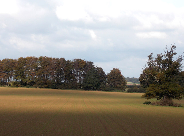
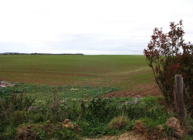
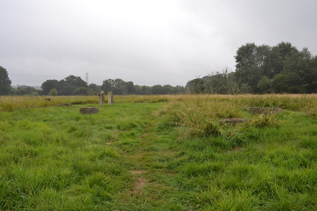
The Wilderness, located in Dorset, England, is a picturesque wood and forest area that offers a serene and immersive natural experience. Spanning over a vast expanse of land, this enchanting wilderness is a haven for nature lovers and outdoor enthusiasts.

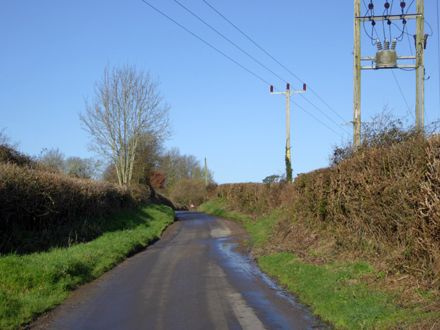
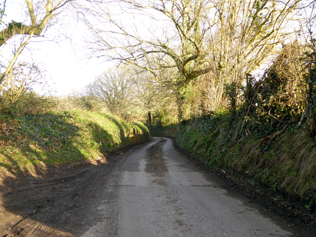
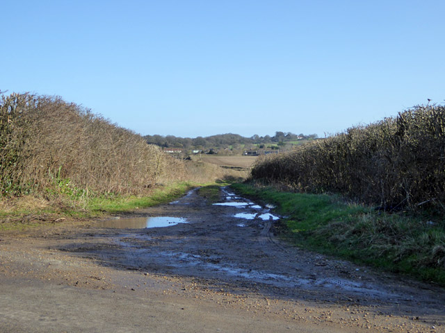
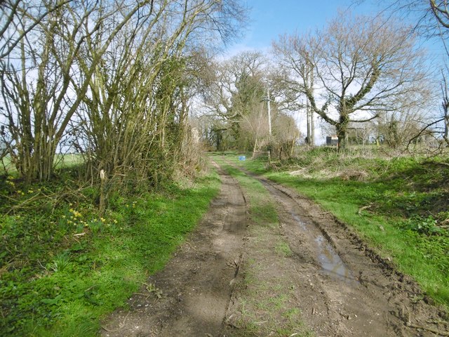
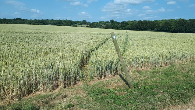
The landscape of The Wilderness is characterized by a dense canopy of trees, consisting mainly of native species such as oak, ash, and beech. These towering giants create a captivating ambiance, providing shade and shelter for a diverse range of flora and fauna. Walking through the forest, visitors can expect to encounter a plethora of wildflowers, moss-covered rocks, and babbling brooks, enhancing the tranquility of the surroundings.

The wildlife in The Wilderness is abundant and varied. Birdwatchers can delight in spotting species like woodpeckers, nightingales, and owls, while the lucky ones might even catch a glimpse of roe deer or foxes that inhabit the area. The forest also houses a rich biodiversity of insects, including butterflies and dragonflies, adding an additional layer of charm to this natural wonderland.

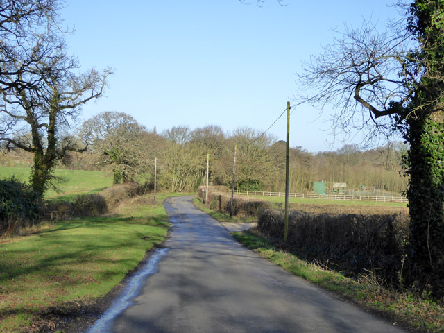
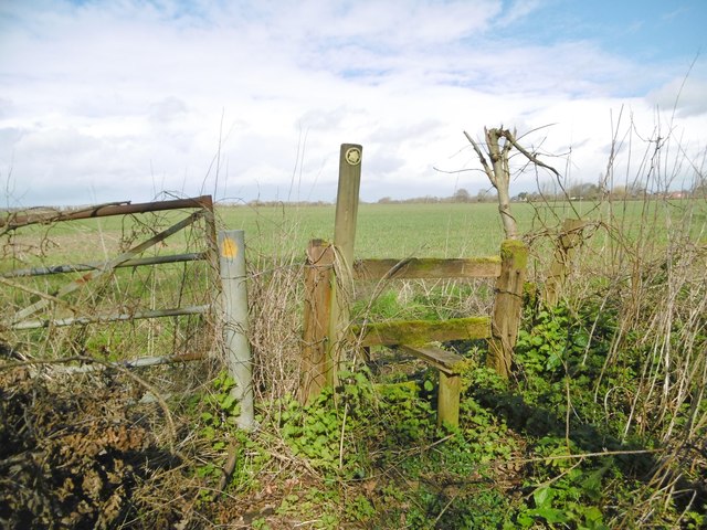
Various walking trails and paths crisscross The Wilderness, making it an ideal location for hikers and those seeking to explore the outdoors. The wood is well-maintained, with clear signage and information boards at key points, ensuring that visitors can navigate their way through the forest with ease.

Overall, The Wilderness in Dorset is a captivating wood and forest area that provides a peaceful retreat from the hustle and bustle of daily life. With its stunning scenery, diverse wildlife, and well-maintained trails, it is a must-visit destination for anyone seeking solace in nature.

If you have any feedback on the listing, please let us know in the comments section below.

The Wilderness Images

Images are sourced within 2km of 50.838415/-1.9758768 or Grid Reference SU0104. Thanks to Geograph Open Source API. All images are credited.

Rolling farmland near Hinton Parva Farmland to the east of the hamlet of Hinton Parva.
Rolling farmland near Hinton Parva
Farmland to the east of the hamlet of Hinton Parva.
Farmland north of Hinton Parva The open landscape north of Hinton Parva.
Farmland north of Hinton Parva
The open landscape north of Hinton Parva.
Lodge Road Heading towards Gaunt's Common.
Lodge Road
Heading towards Gaunt's Common.
Houses on Petersham Lane, Gaunt's Common The last houses going south.
Houses on Petersham Lane, Gaunt's Common
The last houses going south.
Woodcutts Lane Heading towards Witchampton.
Woodcutts Lane
Heading towards Witchampton.
Woodcutts Lane Heading towards Witchampton.
Woodcutts Lane
Heading towards Witchampton.
Track towards Hinton Martell The Woodcutts Lane end. It is mapped with some sort of public rights.
Track towards Hinton Martell
The Woodcutts Lane end. It is mapped with some sort of public rights.
Hinton Martell, St John the Evangelist
The Baker's Dozen A modern stone circle that has been constructed on Honeybrook Farm Park
The Baker's Dozen
A modern stone circle that has been constructed on Honeybrook Farm Park
Old Direction Sign - Signpost in Holt, East Dorset Annulus & bar finial - 3 arms; Dorset halo with NGR by the UC road, in parish of Holt (East Dorset District), Holt, North corner of village green opposite village hall. Holt Lane junction with Hart's Lane.

Surveyed

Milestone Society National ID: DO_SU0203.
Old Direction Sign - Signpost in Holt, East Dorset
Annulus & bar finial - 3 arms; Dorset halo with NGR by the UC road, in parish of Holt (East Dorset District), Holt, North corner of village green opposite village hall. Holt Lane junction with Hart's Lane. Surveyed Milestone Society National ID: DO_SU0203.
Old Direction Sign - Signpost by Hart's Lane, God's Blessing Green Annulus and bar finial - 3 arms; Dorset halo with NGR by the UC road, in parish of Holt (East Dorset District), God's Blessing Green, junction of UC road to Pig Oak, on green opposite garden centre.

Surveyed

Milestone Society National ID: DO_SU0303
Old Direction Sign - Signpost by Hart's Lane, God's Blessing Green
Annulus and bar finial - 3 arms; Dorset halo with NGR by the UC road, in parish of Holt (East Dorset District), God's Blessing Green, junction of UC road to Pig Oak, on green opposite garden centre. Surveyed Milestone Society National ID: DO_SU0303
Church of St John the Evangelist, Hinton Martell
Fountain, Hinton Martell
Hinton Martell, stile At the beginning of a path from Woodcutts Lane across farmland to Gaunt's Common.
Hinton Martell, stile
At the beginning of a path from Woodcutts Lane across farmland to Gaunt's Common.
Hinton Martell, path Path and farmtrack from Woodcutts to Hinton Martell and Chalbury.
Hinton Martell, path
Path and farmtrack from Woodcutts to Hinton Martell and Chalbury.
Footpath through crops near Cutler's Farm
St James' Church of England First School, Gaunt's Common Apostrophe placement as per school website.
St James' Church of England First School, Gaunt's Common
Apostrophe placement as per school website.
Lane south of Holt Wood
Show me another place!

The Wilderness is located at Grid Ref: SU0104 (Lat: 50.838415, Lng: -1.9758768)

Unitary Authority: Dorset

Police Authority: Dorset

What 3 Words

///venturing.item.hologram. Near Wimborne Minster, Dorset
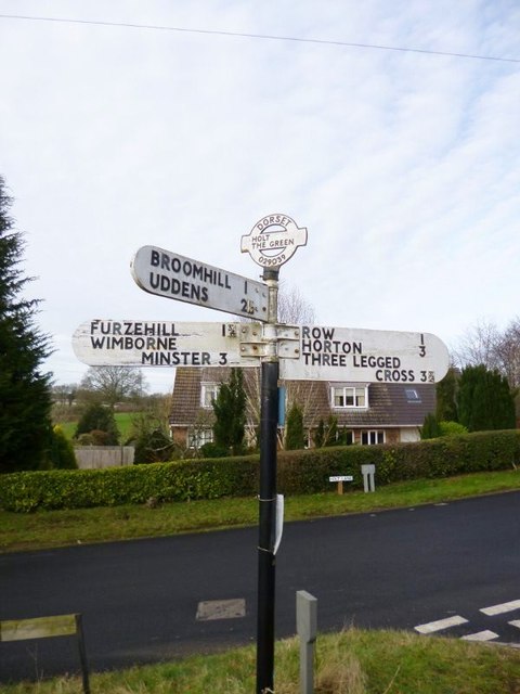
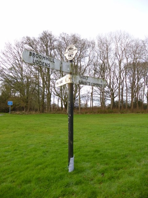
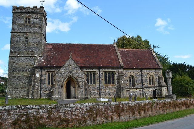
Related Wikis

Holt, Dorset

Holt is a village in east Dorset, England, 2 miles (3.2 km) north of Wimborne Minster. The village had a population of 1,265 in 2001. The electoral ward...

Hinton Martell

Hinton Martell (also known as Hinton Martel) is a village and former civil parish, now in the civil parish of Hinton, in the county of Dorset in southern...

Hinton Parva

Hinton Parva is a hamlet and former civil parish, now in the civil parish of Hinton, in east Dorset, England, three miles north of Wimborne Minster. The...

Badbury Hundred

Badbury Hundred was a hundred in the county of Dorset, England, which took its name from the earthwork of Badbury Rings. It contained the following parishes...

East Dorset

East Dorset was a local government district in Dorset, England. Its council met in Wimborne Minster between 2016 and 2019.The district (as Wimborne) was...

Chalbury

Chalbury is a village in the English county of Dorset. It lies on the southern edge of Cranborne Chase within the East Dorset administrative district of...

All Saints' Church, Chalbury

All Saints' Church is a Church of England church in Chalbury, Dorset, England. It has 13th-century origins, with later alterations and additions, and many...

Furzehill Wood

Furzehill Wood is a woodland near Colehill in Dorset, England. It covers a total area of 0.84 hectares (2.08 acres). It is owned and managed by the Woodland...

Nearby Amenities

Located within 500m of 50.838415,-1.9758768
Post Box
Description: By entrance to Gaunts House.
Post Box Type: wall
Ref: BH21 40
Ref GB Uprn: 10015372718
Royal Cypher: GR
Royal Cypher Wikidata: Q33102273
Lat/Long: 50.838467/-1.974363
Power: tower
Source: Bing
Lat/Long: 50.8360966/-1.9701251
Holt United FC
Leisure: pitch
Sport: soccer
Lat/Long: 50.8414834/-1.973095
Poles: bipole
Power: pole
Source: bing
Lat/Long: 50.8421648/-1.9779957
Power: pole
Source: bing
Lat/Long: 50.842255/-1.978329
Power: pole
Source: bing
Lat/Long: 50.8416563/-1.9772226
Poles: bipole
Power: pole
Source: bing
Lat/Long: 50.84105/-1.9761309
Power: pole
Source: bing
Lat/Long: 50.8403801/-1.9741166
Power: pole
Source: bing
Lat/Long: 50.8416428/-1.9770442
Power: pole
Source: bing
Lat/Long: 50.8410838/-1.9760236
Power: pole
Source: bing
Lat/Long: 50.8404732/-1.9742024
Power: pole
Source: bing
Lat/Long: 50.8398457/-1.9725113
Power: pole
Source: bing
Lat/Long: 50.8401667/-1.9732891
Power: pole
Source: bing
Lat/Long: 50.8398609/-1.9723651
Location Transition: yes
Power: pole
Source: bing
Lat/Long: 50.8395501/-1.9714451
Poles: bipole
Power: pole
Source: bing
Lat/Long: 50.8395044/-1.9714867
Power: pole
Source: bing
Lat/Long: 50.8388557/-1.9701576
The data included in this document is from www.openstreetmap.org. The data is made available under ODbL.

Have you been to The Wilderness?

Leave your review of The Wilderness below (or comments, questions and feedback).