Rud Clough Wood

Wood, Forest in Yorkshire

England

Rud Clough Wood

Old Boundary Stone on Erringden Moor There are plenty of these stones forming a line across the moor
Old Boundary Stone on Erringden Moor Credit: Chris Heaton

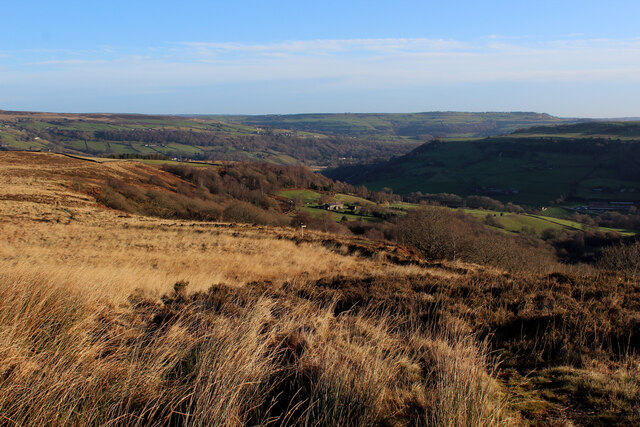
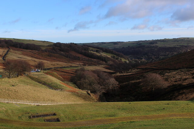
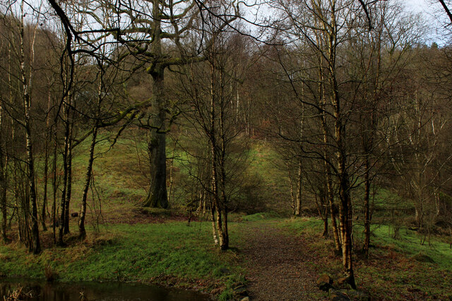
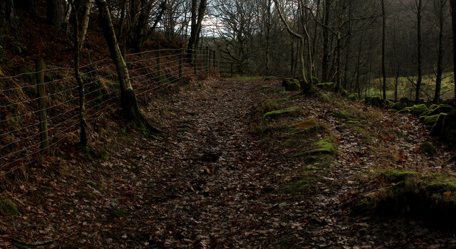
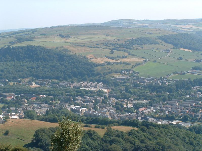
Rud Clough Wood, located in Yorkshire, England, is a picturesque woodland area known for its natural beauty and rich biodiversity. Spanning over a vast expanse, the forest covers an area of approximately 500 hectares, making it a significant green space in the region.

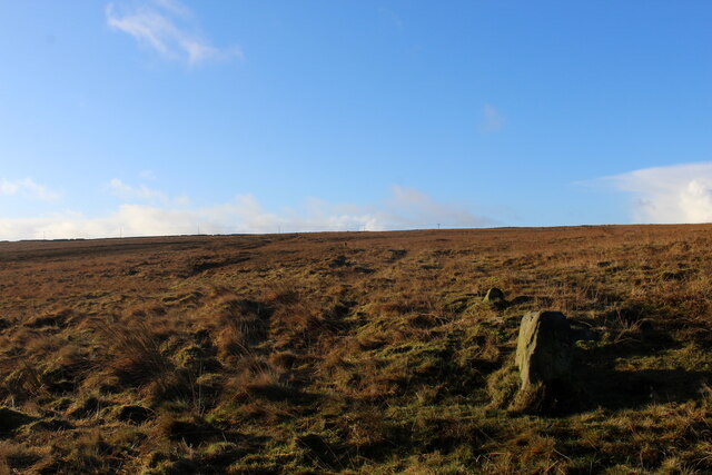
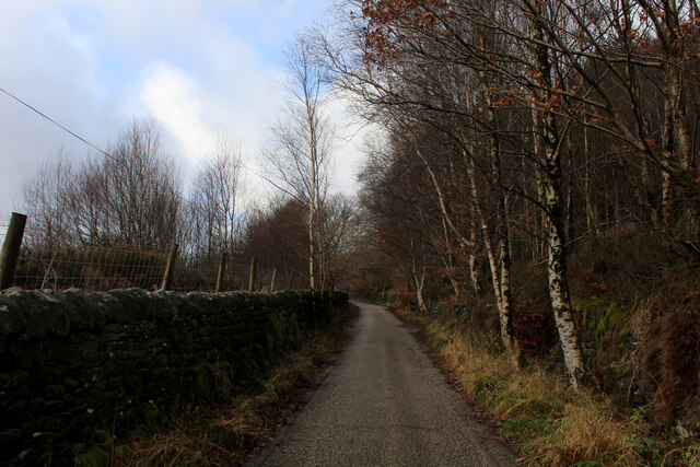
The woodland is characterized by its dense canopy of trees, predominantly consisting of native species such as oak, beech, and birch. These towering trees provide a home to a diverse range of flora and fauna, including rare and protected species. Rud Clough Wood is especially renowned for its vibrant spring displays of bluebells, which carpet the forest floor in a sea of purple hues.

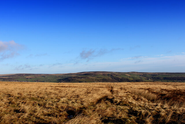
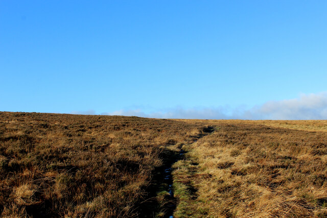
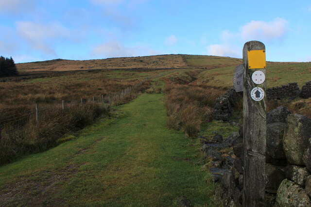
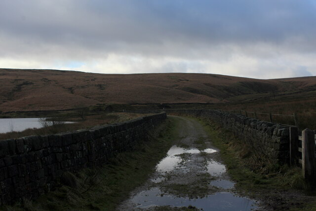
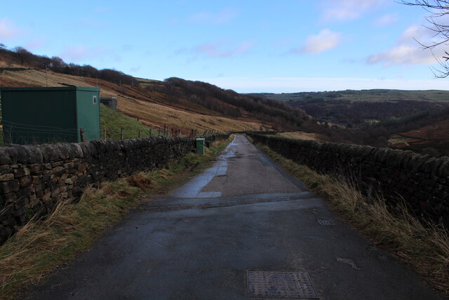
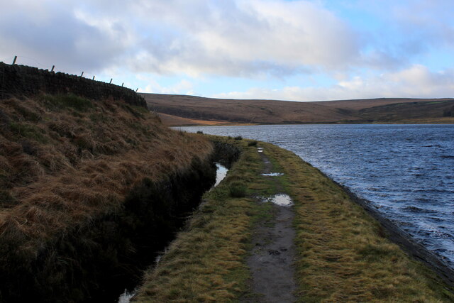
The forest is a popular destination for nature enthusiasts, offering a network of well-maintained walking trails that wind through the woodlands. Visitors can explore the various paths, immersing themselves in the tranquil atmosphere and enjoying the sights and sounds of nature. Birdwatchers can also indulge in their passion, as the woodland is home to a plethora of bird species, including woodpeckers, warblers, and owls.

Rud Clough Wood is not only a haven for wildlife but also serves as an important ecological site. The forest acts as a carbon sink, absorbing and storing carbon dioxide, thus contributing to mitigating climate change.

Overall, Rud Clough Wood is a captivating forest that offers a serene escape from the hustle and bustle of urban life. With its breathtaking scenery, abundant wildlife, and ecological significance, it is a true gem in the heart of Yorkshire.

If you have any feedback on the listing, please let us know in the comments section below.

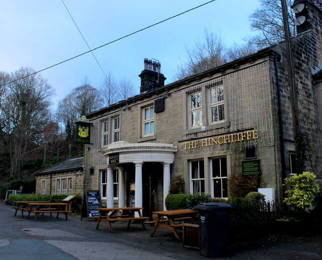
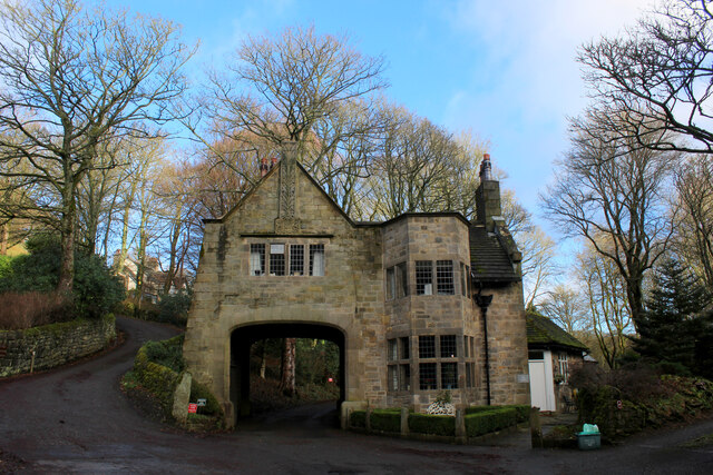
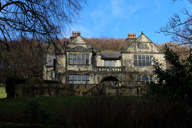
Rud Clough Wood Images

Images are sourced within 2km of 53.707027/-2.0056131 or Grid Reference SD9923. Thanks to Geograph Open Source API. All images are credited.

Old Boundary Stone on Erringden Moor There are plenty of these stones forming a line across the moor
Old Boundary Stone on Erringden Moor
There are plenty of these stones forming a line across the moor
Footpath on Erringden Moor Narrow but distinct footpath crossing Erringden Moor
Footpath on Erringden Moor
Narrow but distinct footpath crossing Erringden Moor
On the Edge of Erringden Moor Great view of Cragg Vale and Calderdale from here.
On the Edge of Erringden Moor
Great view of Cragg Vale and Calderdale from here.
On Erringden Moor One of many footpaths that can be found on this stretch of moorland
On Erringden Moor
One of many footpaths that can be found on this stretch of moorland
View towards Stoodley Pike Monument from Dick's Lane
Calderdale Way ascending away from Withens Clough Reservoir The long distance footpath initially heading north, before swinging west towards Withens Gate on the Pennine Way
Calderdale Way ascending away from Withens Clough Reservoir
The long distance footpath initially heading north, before swinging west towards Withens Gate on the Pennine Way
Withens New Road Track beside the western end of Withens Clough Reservoir as darkness closes in.
Withens New Road
Track beside the western end of Withens Clough Reservoir as darkness closes in.
Large Outbuilding beside Pasture House The outbuilding is larger than the farmhouse itself, which is concealed from view behind this bulky edifice.
The complex is located beside Withens Clough Reservoir, and seems to be the only sign of habitation in the vicinity.
The outbuilding appears to be a converted barn in need of some repair.
Passed by on the Calderdale Way long distance footpath.
Large Outbuilding beside Pasture House
The outbuilding is larger than the farmhouse itself, which is concealed from view behind this bulky edifice. The complex is located beside Withens Clough Reservoir, and seems to be the only sign of habitation in the vicinity. The outbuilding appears to be a converted barn in need of some repair. Passed by on the Calderdale Way long distance footpath.
Flooded New Withens Road Approaching Pasture House on the Calderdale Way long distance footpath beside Withens Clough Reservoir
Flooded New Withens Road
Approaching Pasture House on the Calderdale Way long distance footpath beside Withens Clough Reservoir
View from Atop the Dam Wall of Withens Clough Reservoir Looking down Withens Clough towards Cragg Vale
View from Atop the Dam Wall of Withens Clough Reservoir
Looking down Withens Clough towards Cragg Vale
Rudd Lane Access lane heading away from Withens Clough Reservoir towards Cragg Vale.
Adopted by the Calderdale Way long distance footpath.
Rudd Lane
Access lane heading away from Withens Clough Reservoir towards Cragg Vale. Adopted by the Calderdale Way long distance footpath.
Beside Withens Clough Reservoir
On Rudd Lane Heading up towards Withens Clough Reservoir from Cragg Vale, adopted by the Calderdale Way.
On Rudd Lane
Heading up towards Withens Clough Reservoir from Cragg Vale, adopted by the Calderdale Way.
The Hinchliffe Arms Local watering hole in Cragg Vale, passed by on the Calderdale Way
The Hinchliffe Arms
Local watering hole in Cragg Vale, passed by on the Calderdale Way
The Lodge, Cragg Vale Former gatehouse for Cragg Hall, and Grade II Listed Building
The Lodge, Cragg Vale
Former gatehouse for Cragg Hall, and Grade II Listed Building
Old Cragg Hall
Old Cragg Hall
Footpath beside Round Hill Wood (1) Heading towards Cragg Vale
Footpath beside Round Hill Wood (1)
Heading towards Cragg Vale
Footpath beside Round Hill Wood (2) Heading away from Cragg Vale
Footpath beside Round Hill Wood (2)
Heading away from Cragg Vale
Show me another place!

Rud Clough Wood is located at Grid Ref: SD9923 (Lat: 53.707027, Lng: -2.0056131)

Division: West Riding

Unitary Authority: Calderdale

Police Authority: West Yorkshire

What 3 Words

///agreeable.liability.drum. Near Mytholmroyd, West Yorkshire

Related Wikis

Cragg Vale

Cragg Vale is a village in Calderdale, West Yorkshire, England, located south of Mytholmroyd on the B6138 road which joins the A58 and the A646. The village...

Upper Calder Valley

The Upper Calder Valley lies in West Yorkshire, in northern England, and covers the towns of Todmorden, Hebden Bridge, Mytholmroyd, Luddendenfoot, and...

Stoodley Pike

Stoodley Pike is a 1,300-foot (400 m) hill in the south Pennines in West Yorkshire in northern England. It is noted for the 121-foot (37 m) Stoodley Pike...

Calderdale

Calderdale is a metropolitan borough of West Yorkshire, England, which had a population of 211,439. It takes its name from the River Calder, and dale,...

Scout Rock

Scout Rock (known locally as Scout Rocks), is a rock face, once a quarry, cut into a hill called Hathershelf Scout and is on the south side of the Upper...

Mytholmroyd railway station

Mytholmroyd railway station serves the communities of Mytholmroyd, Luddendenfoot, Midgley, Cragg Vale, and surrounding areas in West Yorkshire, England...

Erringden

Erringden is a civil parish in the Metropolitan Borough of Calderdale in West Yorkshire, England. Previously it was a township within the chapelry of Heptonstall...

Mytholmroyd

Mytholmroyd (pronounced ) is a large village and former civil parish, now in the parish of Hebden Royd, in the Calderdale district, in West Yorkshire,...

Nearby Amenities

Located within 500m of 53.707027,-2.0056131
Bus Stop
Cragg Road
Local Ref: 45019555
Naptan AtcoCode: 450019555
Naptan Bearing: NE
Naptan CommonName: Cragg Road
Naptan Crossing: Twixt Church Bank Lane & Castle Gate
Naptan Indicator: Stop 45019555
Naptan PlusbusZoneRef: LEEDS
Naptan ShortCommonName: Bank Bottom
Naptan Street: Cragg Road
Naptan Verified: no
Source: naptan_import
Lat/Long: 53.706677/-1.9982881
Bus Stop
Cragg Vale
Local Ref: 45019556
Naptan AtcoCode: 450019556
Naptan Bearing: N
Naptan CommonName: Cragg Vale
Naptan Crossing: Church Bank Lane
Naptan Indicator: Stop 45019556
Naptan Landmark: Cragg Vale Jun & Inf School
Naptan PlusbusZoneRef: LEEDS
Naptan ShortCommonName: Cragg Vale
Naptan Street: Blackstone Edge Road
Naptan Verified: no
Source: naptan_import
Lat/Long: 53.7051849/-1.9994243
Bus Stop
Cragg Vale
Local Ref: 45019557
Naptan AtcoCode: 450019557
Naptan Bearing: S
Naptan CommonName: Cragg Vale
Naptan Crossing: Church Bank Lane
Naptan Indicator: Stop 45019557
Naptan Landmark: Nr-At Cragg Vale Jun & Inf School
Naptan PlusbusZoneRef: LEEDS
Naptan ShortCommonName: Cragg Vale
Naptan Street: Blackstone Edge Road
Naptan Verified: no
Source: naptan_import
Lat/Long: 53.705095/-1.9992729
Bus Stop
Blackstone Edge Road
Local Ref: 45019558
Naptan AtcoCode: 450019558
Naptan Bearing: S
Naptan CommonName: Blackstone Edge Road
Naptan Crossing: Nr-Opp Church Bank Lane
Naptan Indicator: Stop 45019558
Naptan Landmark: Cragg Vale Jun & Inf School
Naptan PlusbusZoneRef: LEEDS
Naptan ShortCommonName: Blackstone Edge Rd
Naptan Street: Blackstone Edge Road
Naptan Verified: no
Source: naptan_import
Lat/Long: 53.7045827/-1.9993183
Bus Stop
Cragg Road
Local Ref: 45027990
Naptan AtcoCode: 450027990
Naptan Bearing: SW
Naptan CommonName: Cragg Road
Naptan Crossing: New Lane
Naptan Indicator: Stop 45027990
Naptan Landmark: Castle Hall
Naptan PlusbusZoneRef: LEEDS
Naptan ShortCommonName: Marshaw Bank Farm
Naptan Street: Cragg Road
Naptan Verified: no
Source: naptan_import
Lat/Long: 53.706641/-1.998076
Barrier: stile
Lat/Long: 53.704635/-2.0090488
Post Box
Collection Times: Mo-Fr 09:00; Sa 07:00
Operator: Royal Mail
Post Box Type: lamp
Ref: HX7 322
Lat/Long: 53.7050222/-2.0008153
Power: pole
Lat/Long: 53.7085785/-2.0120461
Power: pole
Lat/Long: 53.709275/-2.0108689
Power: pole
Lat/Long: 53.7098712/-2.010801
The data included in this document is from www.openstreetmap.org. The data is made available under ODbL.

Have you been to Rud Clough Wood?

Leave your review of Rud Clough Wood below (or comments, questions and feedback).