Ashton Wood

Wood, Forest in Gloucestershire Wychavon

England

Ashton Wood

Bredon Hill crest path, 13 Gradual descent south-east towards Ashton.
The distinctive outline of Dumbleton/Alderton Hill can be seen clearly as well as the Cotswold crest beyond.
This picture represents the completion of Hectad SO93 by the photographer, ie. a Geograph in every one of the 100 squares.
Bredon Hill crest path, 13 Credit: Jonathan Billinger

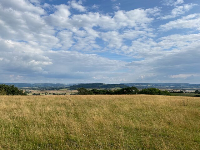
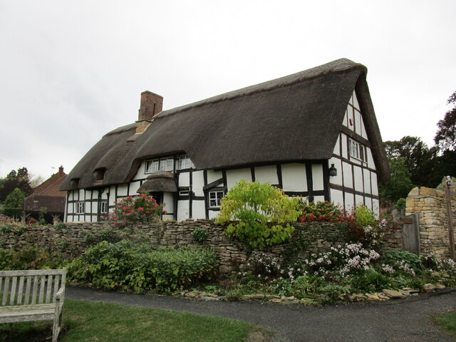
Ashton Wood is a picturesque woodland located in the county of Gloucestershire, England. It is situated in the Forest of Dean, a designated Area of Outstanding Natural Beauty. Covering an area of approximately 200 acres, Ashton Wood is known for its diverse range of flora and fauna, making it a popular destination for nature enthusiasts and hikers.

The woodland is predominantly composed of broadleaf trees, including oak, beech, and ash, which provide a stunning canopy during the summer months. The forest floor is covered in a rich carpet of bluebells, wild garlic, and ferns, creating a vibrant and enchanting atmosphere.

Ashton Wood is home to a variety of wildlife, including deer, badgers, foxes, and a wide range of bird species. It is also known for its population of rare butterflies, such as the silver-washed fritillary and white admiral. Nature lovers can often be spotted with binoculars and cameras in hand, exploring the woodland in search of these elusive creatures.

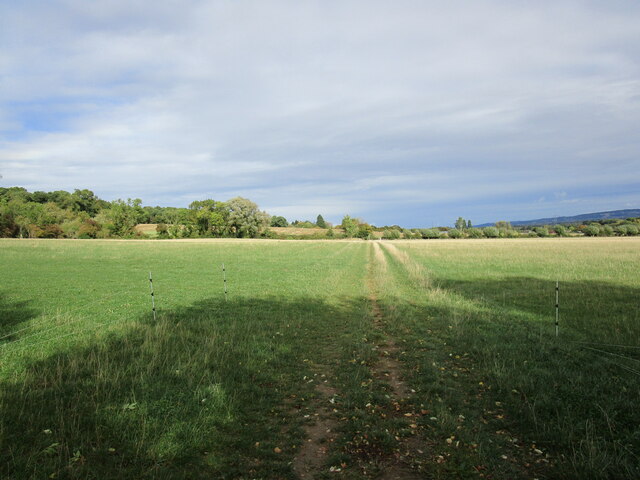
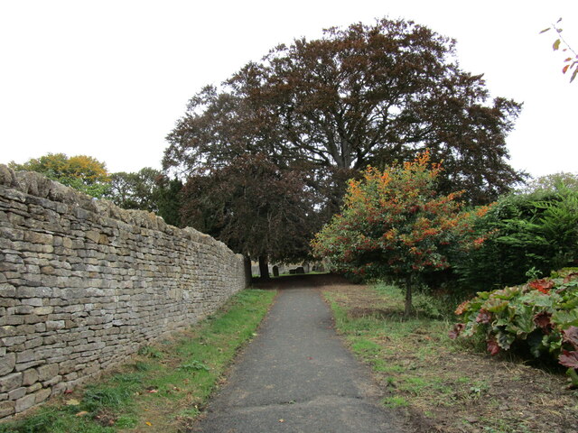
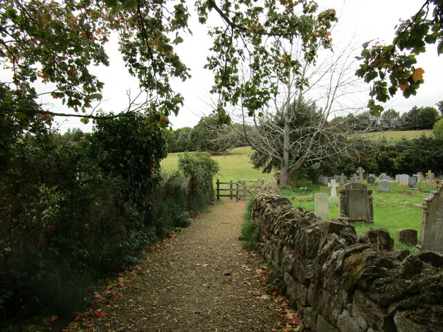
The woodland is crisscrossed with a network of well-maintained trails and footpaths, allowing visitors to explore its beauty at their own pace. These paths lead to picturesque viewpoints and tranquil spots, perfect for picnicking or simply immersing oneself in the peaceful surroundings.

Overall, Ashton Wood is a natural gem within the Forest of Dean, offering visitors the chance to experience the beauty of a traditional English woodland and encounter its diverse wildlife. Whether it's a leisurely stroll or a more adventurous hike, Ashton Wood is the ideal destination for those seeking a connection with nature in an idyllic setting.

If you have any feedback on the listing, please let us know in the comments section below.
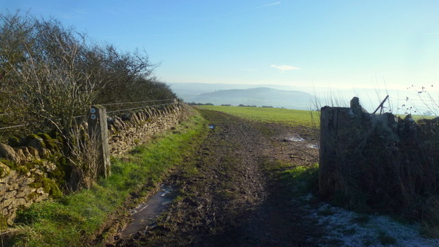
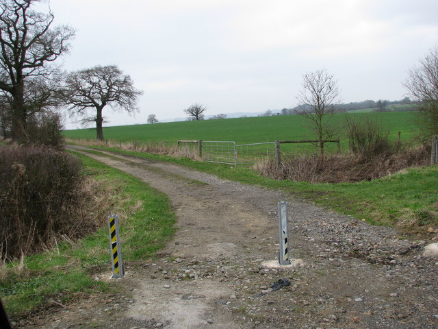
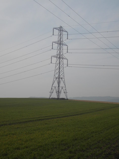
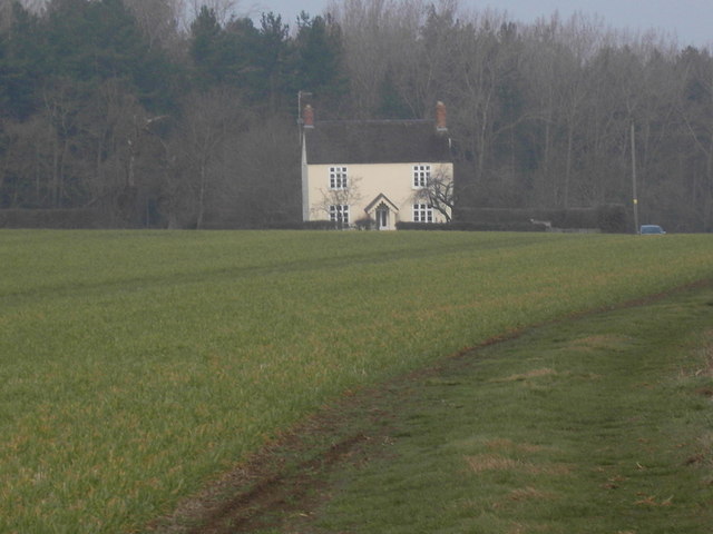
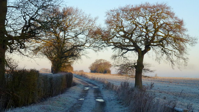
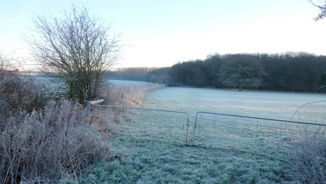
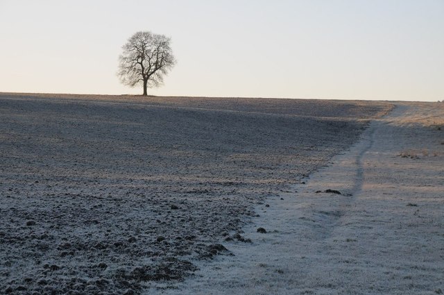
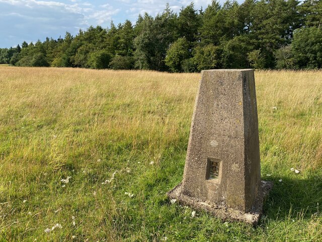
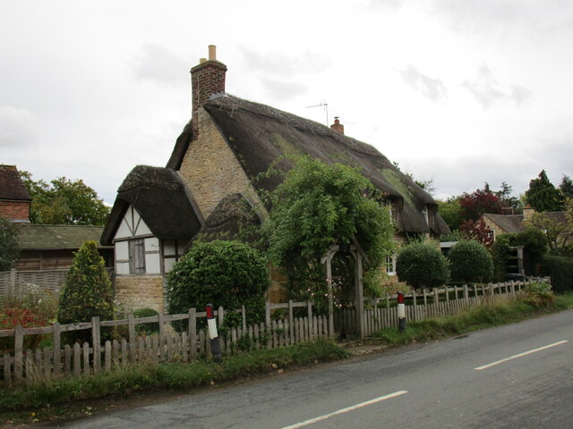
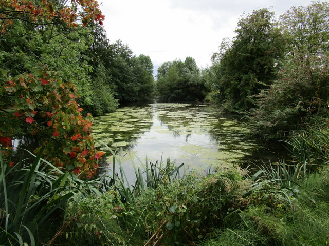
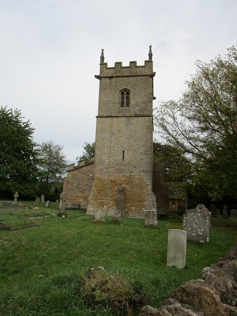
Ashton Wood Images

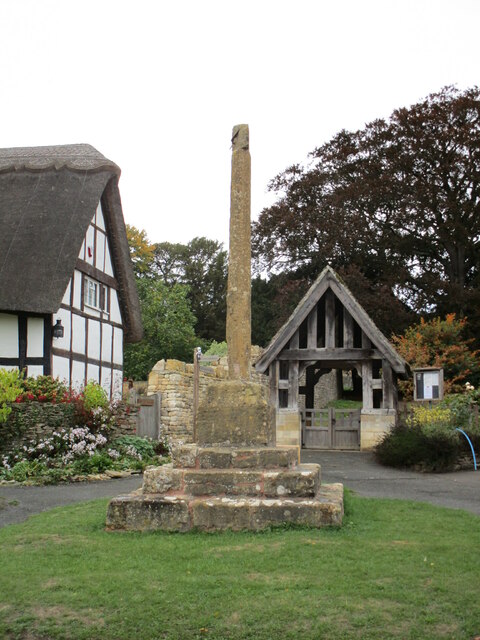
Images are sourced within 2km of 52.05037/-2.0106576 or Grid Reference SO9939. Thanks to Geograph Open Source API. All images are credited.

Bredon Hill crest path, 13 Gradual descent south-east towards Ashton.
The distinctive outline of Dumbleton/Alderton Hill can be seen clearly as well as the Cotswold crest beyond.
This picture represents the completion of Hectad SO93 by the photographer, ie. a Geograph in every one of the 100 squares.
Bredon Hill crest path, 13
Gradual descent south-east towards Ashton. The distinctive outline of Dumbleton/Alderton Hill can be seen clearly as well as the Cotswold crest beyond. This picture represents the completion of Hectad SO93 by the photographer, ie. a Geograph in every one of the 100 squares.
Track to Furzehill Farm
Pylon on Furze Hill The pylon dominates the east slope of Furze Hill one of the lower tops around Bredon Hill
Pylon on Furze Hill
The pylon dominates the east slope of Furze Hill one of the lower tops around Bredon Hill
Furzehill Farm farmhouse
The Salt Way A bridleway section north from the winding lane between Elmley Castle and Ashton.
These ancient routes centred upon Droitwich and radiate out to ports and centres of population, in this case to Lechlade where it could be transported to London on the Thames.
The Salt Way
A bridleway section north from the winding lane between Elmley Castle and Ashton. These ancient routes centred upon Droitwich and radiate out to ports and centres of population, in this case to Lechlade where it could be transported to London on the Thames.
Edge of Furzehill Brake Looking across frosty fields from the Elmley to Ashton road.
Edge of Furzehill Brake
Looking across frosty fields from the Elmley to Ashton road.
Tree in a frozen landscape A tree on the horizon in a frosted landscape near the hamlet of Kersoe.
Tree in a frozen landscape
A tree on the horizon in a frosted landscape near the hamlet of Kersoe.
Holcomb Nap Trig Point Flush Bracket S3790
View from Holcomb Nap Trig Point Flush Bracket S3790
Cross Cottage, Ashton under Hill Dates from the seventeenth century <span class="nowrap"><a title="https://historicengland.org.uk/listing/the-list/list-entry/1349961?section=official-list-entry" rel="nofollow ugc noopener" href="https://historicengland.org.uk/listing/the-list/list-entry/1349961?section=official-list-entry">Link</a><img style="margin-left:2px;" alt="External link" title="External link - shift click to open in new window" src="https://s1.geograph.org.uk/img/external.png" width="10" height="10"/></span>
Cross Cottage, Ashton under Hill
Dates from the seventeenth century LinkExternal link
Footpath to Ashton under Hill
Village cross, Ashton under Hill Dates from the fifteenth century <span class="nowrap"><a title="https://historicengland.org.uk/listing/the-list/list-entry/1167161?section=official-list-entry" rel="nofollow ugc noopener" href="https://historicengland.org.uk/listing/the-list/list-entry/1167161?section=official-list-entry">Link</a><img style="margin-left:2px;" alt="External link" title="External link - shift click to open in new window" src="https://s1.geograph.org.uk/img/external.png" width="10" height="10"/></span>
Village cross, Ashton under Hill
Dates from the fifteenth century LinkExternal link
Walnut Thatch, Ashton under Hill Dates from the sixteenth century <span class="nowrap"><a title="https://historicengland.org.uk/listing/the-list/list-entry/1349960?section=official-list-entry" rel="nofollow ugc noopener" href="https://historicengland.org.uk/listing/the-list/list-entry/1349960?section=official-list-entry">Link</a><img style="margin-left:2px;" alt="External link" title="External link - shift click to open in new window" src="https://s1.geograph.org.uk/img/external.png" width="10" height="10"/></span>
Walnut Thatch, Ashton under Hill
Dates from the sixteenth century LinkExternal link
Footpath to the church, Ashton under Hill
St Barbara's church, Ashton under Hill Has twelfth century origins though most of what is visible in this picture dates from the early sixteenth and seventeenth centuries <span class="nowrap"><a title="https://historicengland.org.uk/listing/the-list/list-entry/1081663?section=official-list-entry" rel="nofollow ugc noopener" href="https://historicengland.org.uk/listing/the-list/list-entry/1081663?section=official-list-entry">Link</a><img style="margin-left:2px;" alt="External link" title="External link - shift click to open in new window" src="https://s1.geograph.org.uk/img/external.png" width="10" height="10"/></span>
St Barbara's church, Ashton under Hill
Has twelfth century origins though most of what is visible in this picture dates from the early sixteenth and seventeenth centuries LinkExternal link
Footpath alongside the churchyard, Ashton under Hill
Reservoir at Ashton under Hill
St Barbara's church, Ashton under Hill The west tower dates from the thirteenth century with an upper stage of about 1500 <span class="nowrap"><a title="https://historicengland.org.uk/listing/the-list/list-entry/1081663?section=official-list-entry" rel="nofollow ugc noopener" href="https://historicengland.org.uk/listing/the-list/list-entry/1081663?section=official-list-entry">Link</a><img style="margin-left:2px;" alt="External link" title="External link - shift click to open in new window" src="https://s1.geograph.org.uk/img/external.png" width="10" height="10"/></span>
St Barbara's church, Ashton under Hill
The west tower dates from the thirteenth century with an upper stage of about 1500 LinkExternal link
Show me another place!

Ashton Wood is located at Grid Ref: SO9939 (Lat: 52.05037, Lng: -2.0106576)

Administrative County: Worcestershire

District: Wychavon

Police Authority: West Mercia

What 3 Words

///optimally.reassured.forgets. Near Evesham, Worcestershire

Nearby Locations

Ashton Wood Kersoe

Related Wikis

Kersoe

Kersoe is a hamlet in Worcestershire, England. It is at the foot of Bredon Hill an area of outstanding natural beauty.

Ashton under Hill

Ashton under Hill is a village and civil parish in the Wychavon district of Worcestershire in England. It is situated at the foot of Bredon Hill. According...

Ashton-under-Hill railway station

Ashton-under-Hill railway station was a station on the Midland Railway between Great Malvern and Evesham. It served Ashton under Hill in Worcestershire...

Elmley Castle (castle)

Elmley Castle was a late 11th-century earthwork and timber castle which received stone additions in the 12th and possibly 13th centuries, located 0.5 miles...

Grafton, Worcestershire

Grafton is a hamlet in Worcestershire, England, situated between the villages of Beckford and Ashton under Hill, south-east of Bredon Hill. The name Grafton...

Netherton, Worcestershire

Netherton is a hamlet with population of 50 living in 20 households. It is part of the civil parish of Elmley Castle, Bricklehampton & Netherton in...

Elmley Castle

Elmley Castle is a village and civil parish in Worcestershire, in England, United Kingdom. It is located on the north side of Bredon Hill 3 miles south...

Hinton railway station (England)

Hinton railway station was a station on the Midland Railway between Tewkesbury and Evesham, England. It opened 1 October 1864 by the Midland Railway. The...

Nearby Amenities

Located within 500m of 52.05037,-2.0106576
Barrier: stile
Lat/Long: 52.0484025/-2.0059742
Barrier: stile
Lat/Long: 52.0540755/-2.0103598
Barrier: stile
Lat/Long: 52.0513411/-2.0077597
Barrier: stile
Lat/Long: 52.0501433/-2.0073069
Fixme: Does the Public Bridleway just end here?
Lat/Long: 52.0499921/-2.0132336
Barrier: stile
Lat/Long: 52.0474154/-2.0081604
Barrier: stile
Lat/Long: 52.054659/-2.0101999
Barrier: stile
Lat/Long: 52.0547468/-2.0101524
Ashton Wood House
Power: pole
Transformer: distribution
Voltage Primary: 11000
Lat/Long: 52.0520237/-2.0125211
Power: pole
Lat/Long: 52.0523123/-2.0114891
Power: pole
Lat/Long: 52.0525362/-2.0105383
Power: pole
Lat/Long: 52.0524163/-2.0091603
Power: pole
Lat/Long: 52.0523173/-2.0080049
Power: pole
Lat/Long: 52.0522311/-2.0069207
Power: pole
Lat/Long: 52.052079/-2.0052604
Power: pole
Lat/Long: 52.0516262/-2.0040312
Power: pole
Lat/Long: 52.0504274/-2.0034003
Power: pole
Lat/Long: 52.0495578/-2.0040473
Power: pole
Lat/Long: 52.0486769/-2.0046817
Power: pole
Lat/Long: 52.0479301/-2.0059256
Power: pole
Lat/Long: 52.0472513/-2.0059302
The data included in this document is from www.openstreetmap.org. The data is made available under ODbL.

Have you been to Ashton Wood?

Leave your review of Ashton Wood below (or comments, questions and feedback).