Kersoe

Settlement in Worcestershire Wychavon

England

Kersoe

Bredon Hill crest path, 13 Gradual descent south-east towards Ashton.
The distinctive outline of Dumbleton/Alderton Hill can be seen clearly as well as the Cotswold crest beyond.
This picture represents the completion of Hectad SO93 by the photographer, ie. a Geograph in every one of the 100 squares.
Bredon Hill crest path, 13 Credit: Jonathan Billinger

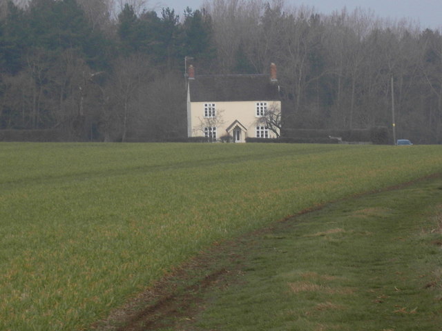
Kersoe is a small village located in the county of Worcestershire, England. Situated approximately 3 miles south of the town of Pershore, Kersoe is nestled amidst the scenic countryside of the county. The village is home to a close-knit community that enjoys the tranquility and charm of rural living.

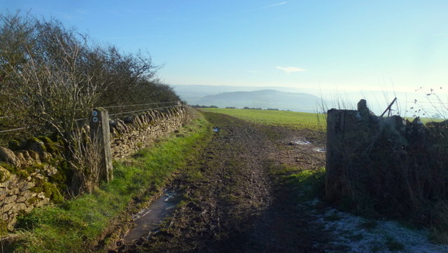
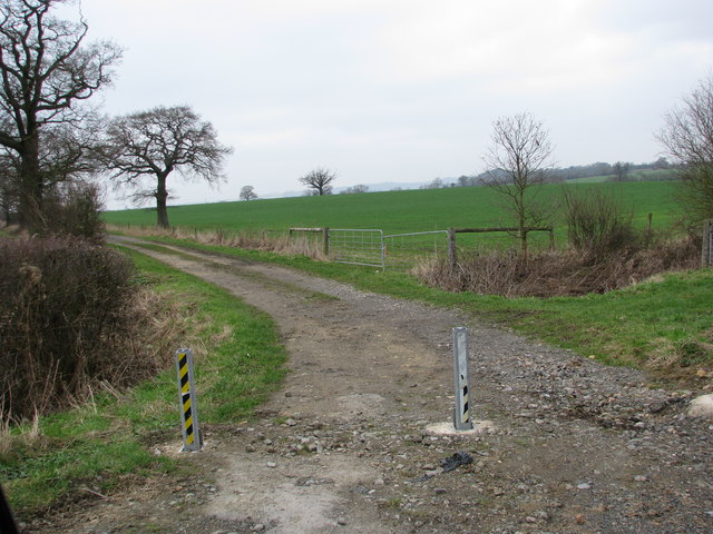
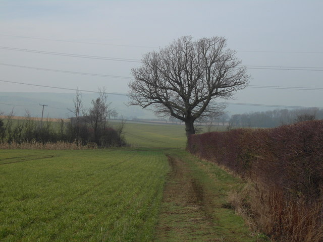
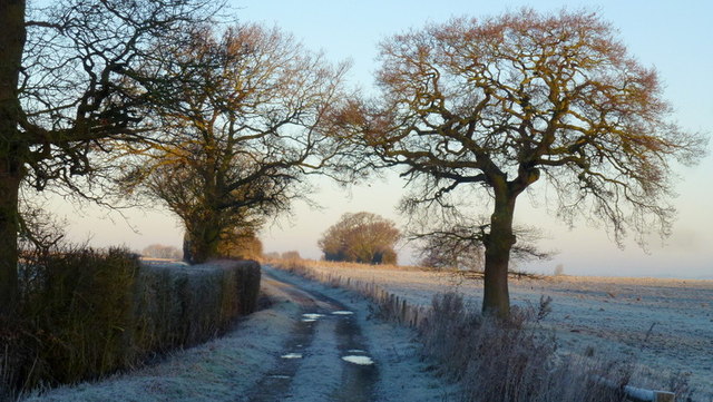
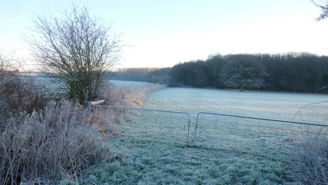
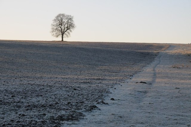
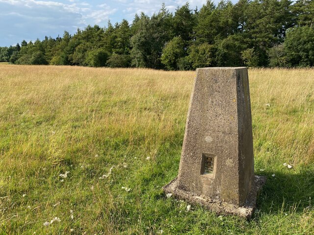
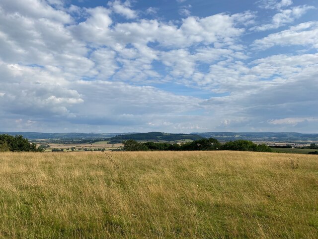
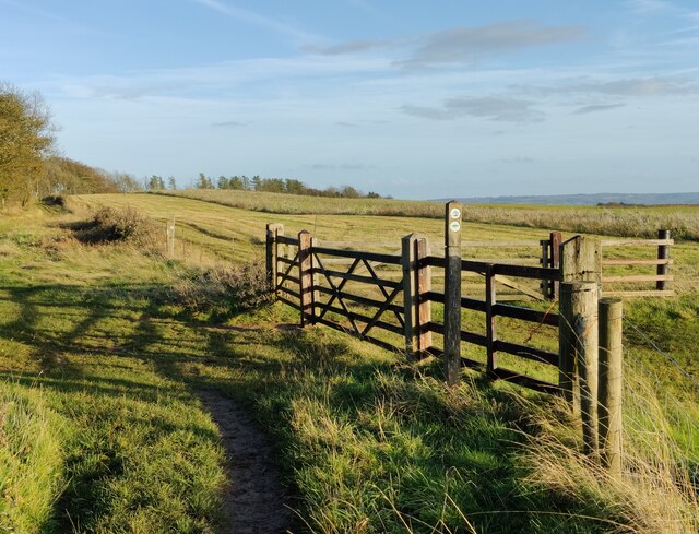
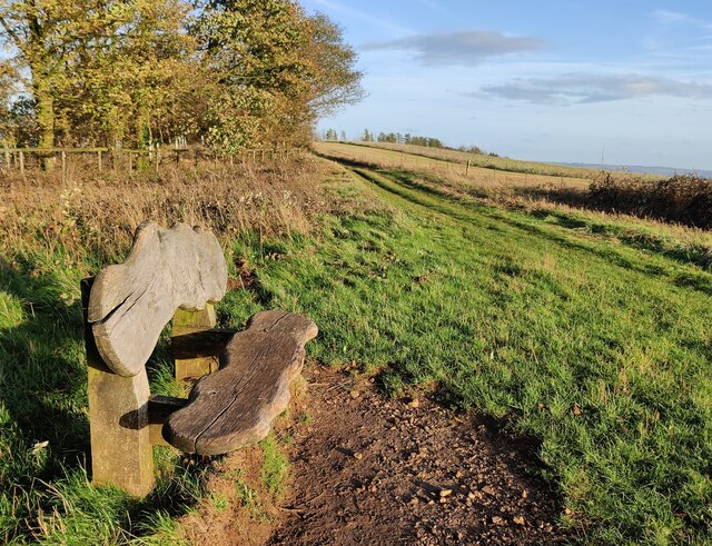
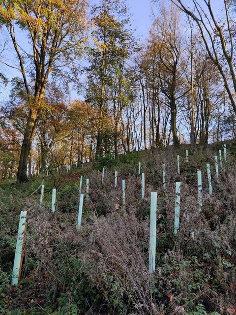
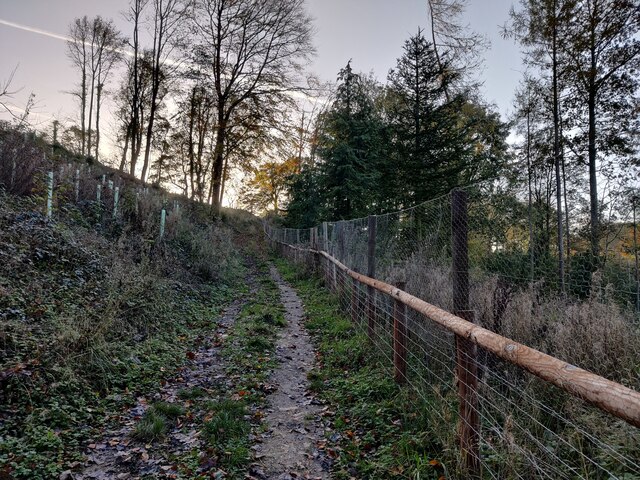
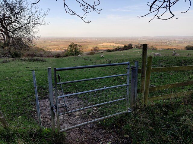
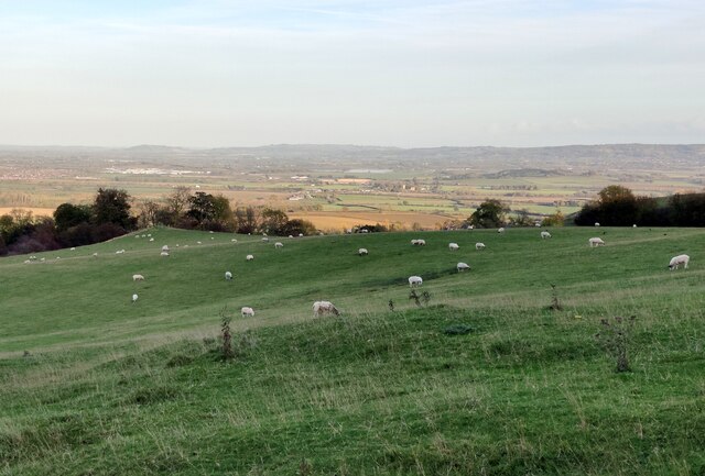
One of the notable features of Kersoe is its picturesque surroundings. The village is surrounded by lush green fields, rolling hills, and meandering streams, making it an ideal location for nature lovers and outdoor enthusiasts. The idyllic countryside provides ample opportunities for walking, cycling, and exploring the beauty of the Worcestershire landscape.

Kersoe is also known for its rich agricultural heritage. The village is dotted with traditional farmhouses and barns, testament to its historical ties to farming. Agriculture continues to be an integral part of the local economy, with many residents involved in farming activities.

Despite its small size, Kersoe boasts a strong sense of community. The village has a close community spirit, with various social events and gatherings organized throughout the year. The local village hall serves as a focal point for these activities, hosting events such as fairs, concerts, and community meetings.

In terms of amenities, Kersoe has limited facilities within the village itself. However, the nearby town of Pershore provides access to a range of services including shops, supermarkets, schools, and healthcare facilities.

Overall, Kersoe offers a peaceful and picturesque setting, making it an attractive place to live for those seeking a rural lifestyle in the heart of Worcestershire.

If you have any feedback on the listing, please let us know in the comments section below.

Kersoe Images

Images are sourced within 2km of 52.057443/-2.013095 or Grid Reference SO9939. Thanks to Geograph Open Source API. All images are credited.

Bredon Hill crest path, 13 Gradual descent south-east towards Ashton.
The distinctive outline of Dumbleton/Alderton Hill can be seen clearly as well as the Cotswold crest beyond.
This picture represents the completion of Hectad SO93 by the photographer, ie. a Geograph in every one of the 100 squares.
Bredon Hill crest path, 13
Gradual descent south-east towards Ashton. The distinctive outline of Dumbleton/Alderton Hill can be seen clearly as well as the Cotswold crest beyond. This picture represents the completion of Hectad SO93 by the photographer, ie. a Geograph in every one of the 100 squares.
Track to Furzehill Farm
Late winter on Ballard's Farm This isolated tree will soon be clothed in fresh greenery
Late winter on Ballard's Farm
This isolated tree will soon be clothed in fresh greenery
Pylon on Furze Hill The pylon dominates the east slope of Furze Hill one of the lower tops around Bredon Hill
Pylon on Furze Hill
The pylon dominates the east slope of Furze Hill one of the lower tops around Bredon Hill
Furzehill Farm farmhouse
The Salt Way A bridleway section north from the winding lane between Elmley Castle and Ashton.
These ancient routes centred upon Droitwich and radiate out to ports and centres of population, in this case to Lechlade where it could be transported to London on the Thames.
The Salt Way
A bridleway section north from the winding lane between Elmley Castle and Ashton. These ancient routes centred upon Droitwich and radiate out to ports and centres of population, in this case to Lechlade where it could be transported to London on the Thames.
Edge of Furzehill Brake Looking across frosty fields from the Elmley to Ashton road.
Edge of Furzehill Brake
Looking across frosty fields from the Elmley to Ashton road.
Tree in a frozen landscape A tree on the horizon in a frosted landscape near the hamlet of Kersoe.
Tree in a frozen landscape
A tree on the horizon in a frosted landscape near the hamlet of Kersoe.
Cereal crop near Upper Haselor
National Cycle Route 442 Towards Elmley Castle.
National Cycle Route 442
Towards Elmley Castle.
Holcomb Nap Trig Point Flush Bracket S3790
View from Holcomb Nap Trig Point Flush Bracket S3790
Wychavon Way on Bredon Hill The Wychavon Way begins in the Worcestershire town of Droitwich Spa and ends in the Cotswold village of Broadway. The trail is about 40 miles (64 km) in length and was created in 1977 to celebrate the Queen's Silver Jubilee.
Wychavon Way on Bredon Hill
The Wychavon Way begins in the Worcestershire town of Droitwich Spa and ends in the Cotswold village of Broadway. The trail is about 40 miles (64 km) in length and was created in 1977 to celebrate the Queen's Silver Jubilee.
Seat along the Wychavon Way on Bredon Hill Bredon Hill, 299 m (981 ft), is in South Worcestershire, it is geologically part of the Cotswolds but stands isolated in the Vale of Evesham.
There is a small stone tower on the summit called Parsons Folly, along with the remains of an Iron Age hill fort known as Kemerton Camp, abandoned in the 1st century AD.
Seat along the Wychavon Way on Bredon Hill
Bredon Hill, 299 m (981 ft), is in South Worcestershire, it is geologically part of the Cotswolds but stands isolated in the Vale of Evesham. There is a small stone tower on the summit called Parsons Folly, along with the remains of an Iron Age hill fort known as Kemerton Camp, abandoned in the 1st century AD.
Long Plantation on Bredon Hill Bredon Hill, 299 m (981 ft), is in South Worcestershire, it is geologically part of the Cotswolds but stands isolated in the Vale of Evesham.
There is a small stone tower on the summit called Parsons Folly, along with the remains of an Iron Age hill fort known as Kemerton Camp, abandoned in the 1st century AD.
Long Plantation on Bredon Hill
Bredon Hill, 299 m (981 ft), is in South Worcestershire, it is geologically part of the Cotswolds but stands isolated in the Vale of Evesham. There is a small stone tower on the summit called Parsons Folly, along with the remains of an Iron Age hill fort known as Kemerton Camp, abandoned in the 1st century AD.
Bridleway in Long Plantation on Bredon Hill Bredon Hill, 299 m (981 ft), is in South Worcestershire, it is geologically part of the Cotswolds but stands isolated in the Vale of Evesham.
There is a small stone tower on the summit called Parsons Folly, along with the remains of an Iron Age hill fort known as Kemerton Camp, abandoned in the 1st century AD.
Bridleway in Long Plantation on Bredon Hill
Bredon Hill, 299 m (981 ft), is in South Worcestershire, it is geologically part of the Cotswolds but stands isolated in the Vale of Evesham. There is a small stone tower on the summit called Parsons Folly, along with the remains of an Iron Age hill fort known as Kemerton Camp, abandoned in the 1st century AD.
Gate along a bridleway on Bredon Hill Bredon Hill, 299 m (981 ft), is in South Worcestershire, it is geologically part of the Cotswolds but stands isolated in the Vale of Evesham.
There is a small stone tower on the summit called Parsons Folly, along with the remains of an Iron Age hill fort known as Kemerton Camp, abandoned in the 1st century AD.
Gate along a bridleway on Bredon Hill
Bredon Hill, 299 m (981 ft), is in South Worcestershire, it is geologically part of the Cotswolds but stands isolated in the Vale of Evesham. There is a small stone tower on the summit called Parsons Folly, along with the remains of an Iron Age hill fort known as Kemerton Camp, abandoned in the 1st century AD.
Sheep at Fiddler's Knap on Bredon Hill Bredon Hill, 299 m (981 ft), is in South Worcestershire, it is geologically part of the Cotswolds but stands isolated in the Vale of Evesham.
There is a small stone tower on the summit called Parsons Folly, along with the remains of an Iron Age hill fort known as Kemerton Camp, abandoned in the 1st century AD.
Sheep at Fiddler's Knap on Bredon Hill
Bredon Hill, 299 m (981 ft), is in South Worcestershire, it is geologically part of the Cotswolds but stands isolated in the Vale of Evesham. There is a small stone tower on the summit called Parsons Folly, along with the remains of an Iron Age hill fort known as Kemerton Camp, abandoned in the 1st century AD.
Show me another place!

Kersoe is located at Grid Ref: SO9939 (Lat: 52.057443, Lng: -2.013095)

Administrative County: Worcestershire

District: Wychavon

Police Authority: West Mercia

What 3 Words

///fired.highlight.overlooks. Near Evesham, Worcestershire

Nearby Locations

Ashton Wood Kersoe

Related Wikis

Kersoe

Kersoe is a hamlet in Worcestershire, England. It is at the foot of Bredon Hill an area of outstanding natural beauty.

Elmley Castle (castle)

Elmley Castle was a late 11th-century earthwork and timber castle which received stone additions in the 12th and possibly 13th centuries, located 0.5 miles...

Netherton, Worcestershire

Netherton is a hamlet with population of 50 living in 20 households. It is part of the civil parish of Elmley Castle, Bricklehampton & Netherton in...

Elmley Castle

Elmley Castle is a village and civil parish in Worcestershire, in England, United Kingdom. It is located on the north side of Bredon Hill 3 miles south...

Ashton under Hill

Ashton under Hill is a village and civil parish in the Wychavon district of Worcestershire in England. It is situated at the foot of Bredon Hill. According...

Ashton-under-Hill railway station

Ashton-under-Hill railway station was a station on the Midland Railway between Great Malvern and Evesham. It served Ashton under Hill in Worcestershire...

Hinton railway station (England)

Hinton railway station was a station on the Midland Railway between Tewkesbury and Evesham, England. It opened 1 October 1864 by the Midland Railway. The...

Grafton, Worcestershire

Grafton is a hamlet in Worcestershire, England, situated between the villages of Beckford and Ashton under Hill, south-east of Bredon Hill. The name Grafton...

Nearby Amenities

Located within 500m of 52.057443,-2.013095
Little Orchard
Naptan AtcoCode: 2000G073200
Naptan Bearing: N
Naptan BusStopType: CUS
Naptan CommonName: Little Orchard
Naptan Indicator: Adj
Naptan Landmark: Little Orchard
Naptan NaptanCode: wocgmwad
Naptan Street: Main Street
Naptan Verified: no
Source: naptan_import
Lat/Long: 52.0583254/-2.009816
Barrier: stile
Lat/Long: 52.0540755/-2.0103598
Post Box
Collection Times: Mo-Fr 16:00; Sa 09:00
Post Box Type: lamp
Ref: WR10 229
Royal Cypher: EIIR
Royal Cypher Wikidata: Q33102113
Source: GPS Survey
Source Ref: survey
Lat/Long: 52.0581611/-2.0098517
Kersoe
Place: hamlet
Wikidata: Q6394752
Lat/Long: 52.0575458/-2.010372
Barrier: stile
Lat/Long: 52.055704/-2.0107813
Barrier: stile
Lat/Long: 52.0572354/-2.0118925
Barrier: stile
Lat/Long: 52.0573012/-2.0119452
Barrier: stile
Lat/Long: 52.057755/-2.0124983
Barrier: stile
Lat/Long: 52.0582903/-2.0128129
Barrier: stile
Lat/Long: 52.0583409/-2.0125124
Barrier: stile
Lat/Long: 52.058941/-2.0136529
Barrier: stile
Lat/Long: 52.0587164/-2.011806
Barrier: stile
Lat/Long: 52.054659/-2.0101999
Barrier: stile
Lat/Long: 52.0547468/-2.0101524
Bench
Lat/Long: 52.0582518/-2.009852
Barrier: stile
Lat/Long: 52.05945/-2.0141475
Barrier: stile
Lat/Long: 52.0615144/-2.0155105
Kersoe
Power: pole
Transformer: distribution
Voltage Primary: 11000
Lat/Long: 52.057513/-2.0130757
Power: pole
Lat/Long: 52.0579303/-2.0128061
Power: pole
Lat/Long: 52.0583331/-2.0125546
Manor Farm Kersoe
Power: pole
Transformer: distribution
Voltage Primary: 11000
Lat/Long: 52.0591074/-2.0120913
Power: pole
Lat/Long: 52.0598515/-2.011632
Gladwins Barn
Power: pole
Transformer: distribution
Voltage Primary: 11000
Lat/Long: 52.0601867/-2.0114174
Power: pole
Lat/Long: 52.0609597/-2.0109446
The data included in this document is from www.openstreetmap.org. The data is made available under ODbL.

Have you been to Kersoe?

Leave your review of Kersoe below (or comments, questions and feedback).