Pardy's Copse

Wood, Forest in Dorset

England

Pardy's Copse

Ford At Corfe Mullen The ford at Corfe Mullen is secured by a locked pair of gates.
Ford At Corfe Mullen Credit: John Walton

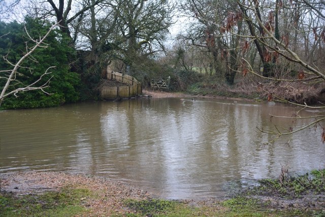
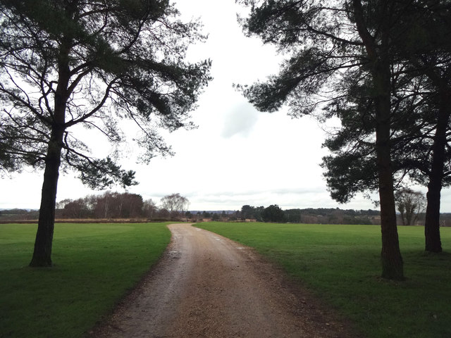
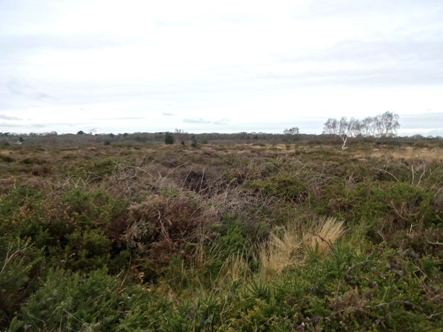
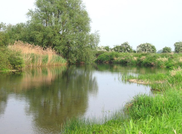
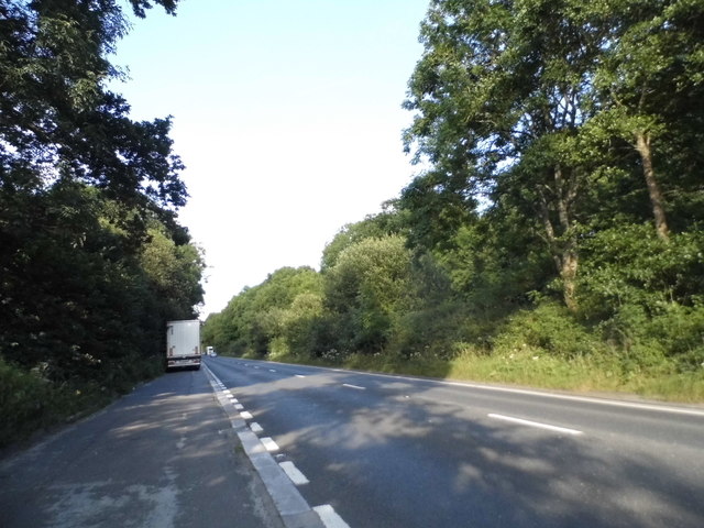
Pardy's Copse is a charming wood located in the county of Dorset, England. Situated near the village of Pardy, the copse covers an area of approximately 20 acres and is a popular destination for nature enthusiasts and hikers alike.

The copse is predominantly composed of deciduous trees, including oak, beech, and ash, which create a picturesque and serene environment throughout the year. In spring, the copse comes alive with a vibrant display of bluebells and wildflowers, creating a stunning carpet of color.

The wood is home to a diverse range of wildlife, providing a haven for various bird species, such as woodpeckers, thrushes, and owls. Additionally, small mammals like squirrels and rabbits can often be spotted darting between the trees.

Pardy's Copse offers several well-maintained trails, allowing visitors to explore its natural beauty at their own pace. The paths wind through the wood, leading to hidden clearings and tranquil spots, perfect for picnics or quiet contemplation.

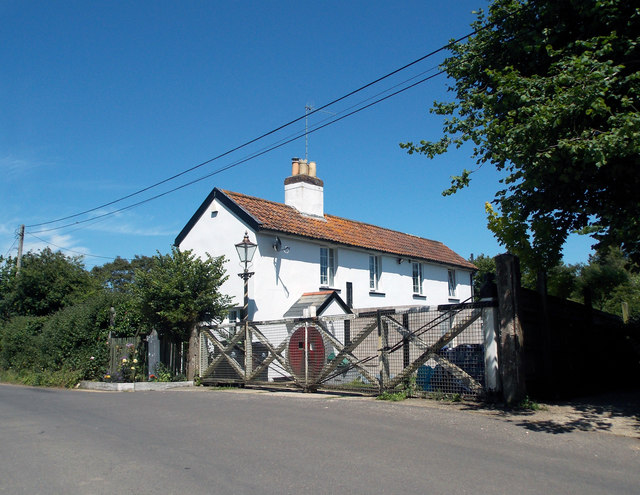
The copse is managed by the local council, ensuring its preservation and protection. It is open to the public throughout the year, with free admission, and provides ample parking facilities for visitors.

Overall, Pardy's Copse offers a peaceful and enchanting escape from the hustle and bustle of everyday life. Its natural beauty, diverse wildlife, and well-maintained trails make it an ideal destination for nature lovers and those seeking tranquility in the heart of Dorset.

If you have any feedback on the listing, please let us know in the comments section below.

Pardy's Copse Images

Images are sourced within 2km of 50.778704/-2.0254499 or Grid Reference SY9897. Thanks to Geograph Open Source API. All images are credited.

Ford At Corfe Mullen The ford at Corfe Mullen is secured by a locked pair of gates.
Ford At Corfe Mullen
The ford at Corfe Mullen is secured by a locked pair of gates.
Footpath across golf course fairway A public right-of-way across one of the fairways at Broadstone Golf Course, at Corfe Hills.
Footpath across golf course fairway
A public right-of-way across one of the fairways at Broadstone Golf Course, at Corfe Hills.
Corfe and Barrow Hills Nature Reserve Looking towards Rushcombe Bottom, from the footpath across the Corfe and Barrow Hills Nature Reserve.
Corfe and Barrow Hills Nature Reserve
Looking towards Rushcombe Bottom, from the footpath across the Corfe and Barrow Hills Nature Reserve.
Remains of the Somerset & Dorset Joint Railway The site of Corfe Mullen Junction, with some old crossing gates and an (extended) crossing keeper / signalman's house.
Remains of the Somerset & Dorset Joint Railway
The site of Corfe Mullen Junction, with some old crossing gates and an (extended) crossing keeper / signalman's house.
Beautiful stretch of the Dorset Stour Taken on the South side of the river, on the Bear Mead nature reserve, near Cowgrove.
Beautiful stretch of the Dorset Stour
Taken on the South side of the river, on the Bear Mead nature reserve, near Cowgrove.
Cutting the hay at Bear Mead nature reserve, near Cowgrove
Hay cutting at Bear Mead nature reserve One of the amazing machines that cut the hay and gather it into long piles to be subsequently picked up and baled.
Hay cutting at Bear Mead nature reserve
One of the amazing machines that cut the hay and gather it into long piles to be subsequently picked up and baled.
Loading the baled and wrapped hay, ready for removal Mid-summer hay cutting at Bear Mead nature reserve
Loading the baled and wrapped hay, ready for removal
Mid-summer hay cutting at Bear Mead nature reserve
The incredible baling machine at Bear Mead nature reserve The machine scoops up the pre-cut silage and forms it into bales, then wraps it in plastic before disgorging it onto the field to await collection.
The incredible baling machine at Bear Mead nature reserve
The machine scoops up the pre-cut silage and forms it into bales, then wraps it in plastic before disgorging it onto the field to await collection.
Hay cutting at Bear Mead nature reserve One machine still cutting the grass whilst another carries away the wrapped bales to be loaded and transported.
Hay cutting at Bear Mead nature reserve
One machine still cutting the grass whilst another carries away the wrapped bales to be loaded and transported.
Hay cutting at Bear Mead nature reserve Continuous operation. Cutting of the grass and forming long lines ready for the next machine to scoop it up, form it into round bales and wrap it in plastic. It then dumps it out of the back end ready for the third machine to collect and lift it onto the flat bed trailer for subsequent transportation.
Hay cutting at Bear Mead nature reserve
Continuous operation. Cutting of the grass and forming long lines ready for the next machine to scoop it up, form it into round bales and wrap it in plastic. It then dumps it out of the back end ready for the third machine to collect and lift it onto the flat bed trailer for subsequent transportation.
Corfe Mullen, plantation Stony Down Plantation - conifers with patches of hardwood.
Corfe Mullen, plantation
Stony Down Plantation - conifers with patches of hardwood.
Corfe Mullen, track junction From camera and ahead, the bridleway to Old Market Road; left and right, tracks belonging to a local camping business. Upgrading of the tracks seems to have caused local controversy: <span class="nowrap"><a title="https://susanjefferies.mycouncillor.org.uk/2015/10/16/stoney-down-plantation/" rel="nofollow ugc noopener" href="https://susanjefferies.mycouncillor.org.uk/2015/10/16/stoney-down-plantation/">Link</a><img style="margin-left:2px;" alt="External link" title="External link - shift click to open in new window" src="https://s1.geograph.org.uk/img/external.png" width="10" height="10"/></span>
Corfe Mullen, track junction
From camera and ahead, the bridleway to Old Market Road; left and right, tracks belonging to a local camping business. Upgrading of the tracks seems to have caused local controversy: LinkExternal link
Corfe Mullen, power lines Crossing Stony Down Plantation.
Corfe Mullen, power lines
Crossing Stony Down Plantation.
Corfe Mullen, bridleway Through Stony Down Plantation, from Rushall Lane to Old Market Road.
Corfe Mullen, bridleway
Through Stony Down Plantation, from Rushall Lane to Old Market Road.
Roundabout on the A31, Lambs Green This was my first digital photo in SY
Roundabout on the A31, Lambs Green
This was my first digital photo in SY
Layby on the A31, Sleight
Bale carrier on the A31, Sleight
Show me another place!

Pardy's Copse is located at Grid Ref: SY9897 (Lat: 50.778704, Lng: -2.0254499)

Unitary Authority: Dorset

Police Authority: Dorset

What 3 Words

///punks.eventful.zoos. Near Wimborne Minster, Dorset

Related Wikis

Castle Court School

Castle Court School is a co-educational, preparatory school located near the village of Corfe Mullen in the county of Dorset, England. == Location == Castle...

St. Hubert's Church, Corfe Mullen

St Hubert's Church is a 13th-century Church of England parish church in Corfe Mullen, a district of Wimborne, in the ceremonial county of Dorset, on the...

Corfe Mullen

Corfe Mullen is a village in Dorset, England, on the north-western urban fringe of the South East Dorset conurbation. The community had a population of...

Corfe Mullen Halt railway station

Corfe Mullen Halt was a station in the English county of Dorset. It was located between Bailey Gate and Broadstone stations on the Somerset and Dorset...

Corfe Barrows Nature Park

Corfe Barrows Nature Park comprises around nine natural areas, covering an area of 90 hectares, within the Borough of Poole that are being managed for...

Corfe Hills School

Corfe Hills School is a co-educational upper school in Broadstone, Poole, Dorset, England, in the urban fringe between Poole and Wimborne. The school became...

Ashington, Dorset

Ashington is a hamlet in Dorset, England. It lies within the unitary authority of Bournemouth, Christchurch and Poole, between the villages of Corfe Mullen...

Stoney Down

Stoney Down or Stony Down is both a hill and an area of forested countryside in the county of Dorset, England, that has been designated an "Area of Great...

Nearby Amenities

Located within 500m of 50.778704,-2.0254499
Barrier: bollard
Bicycle: yes
Foot: yes
Lat/Long: 50.781716/-2.0208829
Post Box
Post Box Mounting: brick_pillar
Post Box Type: wall
Ref: BH21 119
Ref GB Uprn: 10015301621
Royal Cypher: GR
Royal Cypher Wikidata: Q33102273
Lat/Long: 50.7802118/-2.0194874
Waste Basket
Waste: dog_excrement
Lat/Long: 50.7810533/-2.0195148
Waste Basket
Waste: dog_excrement
Lat/Long: 50.7817715/-2.0204647
Milestone
Lat/Long: 50.7798742/-2.0191321
Bus Stop
Corfe Mullen, Lockyers School
Bus: yes
Naptan AtcoCode: 1200POA10417
Naptan Bearing: E
Naptan CommonName: Lockyers School
Naptan Indicator: E-bound
Naptan NaptanCode: dordajtw
Naptan PlusbusZoneRef: BOMO
Naptan Verified: no
Public Transport: platform
Lat/Long: 50.7800479/-2.0191568
Telephone
Booth: KX100
Covered: booth
Ref GB Uprn: 10024749145
Lat/Long: 50.7799357/-2.0192268
Bench
Backrest: yes
Lat/Long: 50.7798891/-2.0203137
Knoll Farm
Place: farm
Source Name: OS_OpenData_StreetView
Lat/Long: 50.7774042/-2.0311359
Meadow Farm
Place: farm
Source Name: OS_OpenData_StreetView
Lat/Long: 50.7786607/-2.0210197
Sleight
Place: locality
Source Name: OS_OpenData_StreetView
Lat/Long: 50.7820897/-2.0256272
Generator Method: photovoltaic
Generator Output Electricity: yes
Generator Source: solar
Generator Type: solar_photovoltaic_panel
Location: roof
Power: generator
Lat/Long: 50.7803494/-2.020877
The data included in this document is from www.openstreetmap.org. The data is made available under ODbL.

Have you been to Pardy's Copse?

Leave your review of Pardy's Copse below (or comments, questions and feedback).