Corfe Mullen

Settlement in Dorset

England

Corfe Mullen

Footpath across golf course fairway A public right-of-way across one of the fairways at Broadstone Golf Course, at Corfe Hills.
Footpath across golf course fairway Credit: Peter Kazmierczak

Corfe Mullen is a village located in the county of Dorset, in the south-west of England. Situated on the outskirts of the bustling town of Poole, Corfe Mullen offers a tranquil and picturesque setting amidst the rolling hills and beautiful countryside of the region.

The village has a population of around 11,000 residents and is known for its strong community spirit and friendly atmosphere. It has a range of amenities, including several local shops, a post office, a library, and a community center, providing residents with convenient access to everyday necessities.

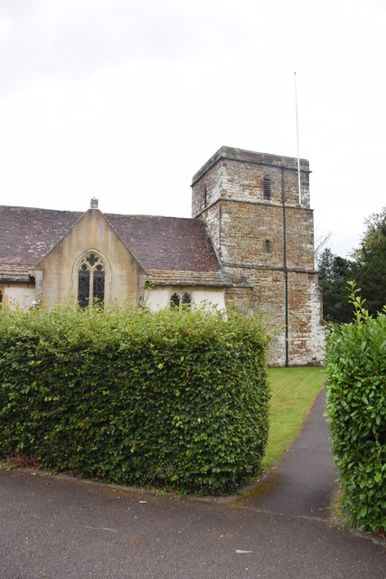
Corfe Mullen is also home to a number of historic landmarks, such as the ruins of Corfe Castle, which dates back to the 11th century. The castle offers visitors a glimpse into the region's rich history and offers stunning views of the surrounding countryside.

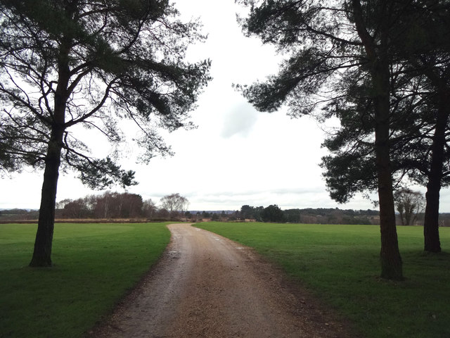
Nature lovers can enjoy the nearby Upton Country Park, which features beautiful gardens, woodlands, and a variety of wildlife. The park is a popular spot for walking, cycling, and picnicking, providing a peaceful escape from the hustle and bustle of everyday life.

The village is well-connected to nearby towns and cities, with easy access to major road networks and public transportation. It is within close proximity to the vibrant coastal town of Bournemouth and the stunning Jurassic Coast, making it an ideal base for exploring the wider Dorset region.

Overall, Corfe Mullen is a charming village that offers a blend of history, natural beauty, and a close-knit community, making it a desirable place to live or visit in Dorset.

If you have any feedback on the listing, please let us know in the comments section below.
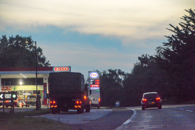
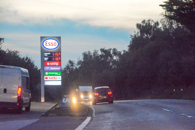
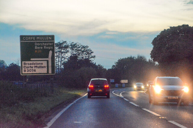
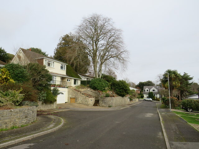
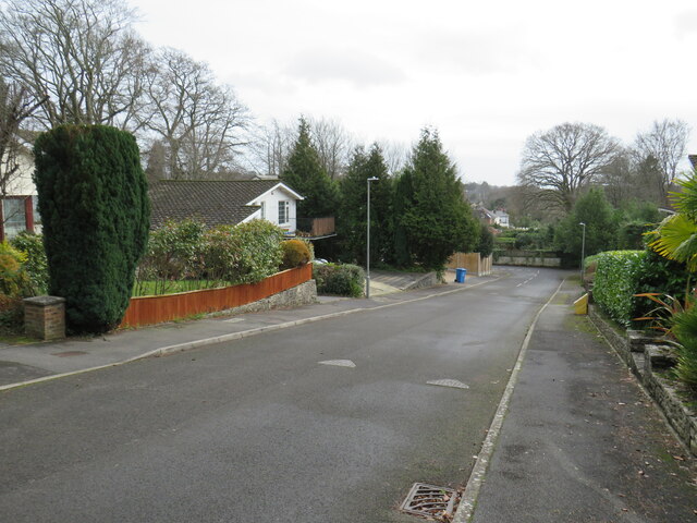
Corfe Mullen Images

Images are sourced within 2km of 50.773913/-2.0167111 or Grid Reference SY9897. Thanks to Geograph Open Source API. All images are credited.

Footpath across golf course fairway A public right-of-way across one of the fairways at Broadstone Golf Course, at Corfe Hills.
Footpath across golf course fairway
A public right-of-way across one of the fairways at Broadstone Golf Course, at Corfe Hills.
Corfe and Barrow Hills Nature Reserve Looking towards Rushcombe Bottom, from the footpath across the Corfe and Barrow Hills Nature Reserve.
Corfe and Barrow Hills Nature Reserve
Looking towards Rushcombe Bottom, from the footpath across the Corfe and Barrow Hills Nature Reserve.
Lambs Green Lane Not sure what's turning the water orange, with this field run-off.
Lambs Green Lane
Not sure what's turning the water orange, with this field run-off.
Remains of the Somerset & Dorset Joint Railway The site of Corfe Mullen Junction, with some old crossing gates and an (extended) crossing keeper / signalman's house.
Remains of the Somerset & Dorset Joint Railway
The site of Corfe Mullen Junction, with some old crossing gates and an (extended) crossing keeper / signalman's house.
Layby on the A31, Sleight
Bale carrier on the A31, Sleight
Old Milestone by the A31, north west of Sleight Stone post (plate lost) by the A31, in parish of CORFE MULLEN (EAST DORSET District), grass area opposite St Huberts church, just inside safety barrier, on South side of road. Dorset 2 (limestone), erected by the Puddletown & Wimborne turnpike trust in the 19th century. 

Inscription reads:-
DORCHESTER
20
WIMBORNE
2  

Milestone Society National ID: DO_DOWB20
Old Milestone by the A31, north west of Sleight
Stone post (plate lost) by the A31, in parish of CORFE MULLEN (EAST DORSET District), grass area opposite St Huberts church, just inside safety barrier, on South side of road. Dorset 2 (limestone), erected by the Puddletown & Wimborne turnpike trust in the 19th century. Inscription reads:- DORCHESTER 20 WIMBORNE 2 Milestone Society National ID: DO_DOWB20
Old Milestone by the A31, west of Lambs Green Stone post (plate lost) by the A31, in parish of CORFE MULLEN (EAST DORSET District), opposite Eastern end of Little Chef car park, on wide verge 2.5m back from road, on North side of road. Dorset 2 (limestone), erected by the Puddletown & Wimborne turnpike trust in the 19th century. 

Inscription reads:-
DORCHESTER
21
WIMBORNE
1
Carved benchmark on front face beneath lettering.

Milestone Society National ID: DO_DOWB21
Old Milestone by the A31, west of Lambs Green
Stone post (plate lost) by the A31, in parish of CORFE MULLEN (EAST DORSET District), opposite Eastern end of Little Chef car park, on wide verge 2.5m back from road, on North side of road. Dorset 2 (limestone), erected by the Puddletown & Wimborne turnpike trust in the 19th century. Inscription reads:- DORCHESTER 21 WIMBORNE 1 Carved benchmark on front face beneath lettering. Milestone Society National ID: DO_DOWB21
Old Milestone by the B3074, Corfe Mullen Carved stone post by the B3074, in parish of CORFE MULLEN (EAST DORSET District), Blandford Road, Corfe Mullen, at junction of Wimborne Rd and B3074 by Lockyers Middle School, on East side of road. Dorset 2 (limestone), erected by the Blandford & Poole turnpike trust in the 19th century. 

Inscription reads:-
POOLE
5   
Carved benchmark front lower centre.  

Milestone Society National ID: DO_POBFA05
Old Milestone by the B3074, Corfe Mullen
Carved stone post by the B3074, in parish of CORFE MULLEN (EAST DORSET District), Blandford Road, Corfe Mullen, at junction of Wimborne Rd and B3074 by Lockyers Middle School, on East side of road. Dorset 2 (limestone), erected by the Blandford & Poole turnpike trust in the 19th century. Inscription reads:- POOLE 5 Carved benchmark front lower centre. Milestone Society National ID: DO_POBFA05
St Hubert's Church, Corfe Mullen, Dorset
Old Direction Sign - Signpost by Wimborne Elms, Corfe Mullen parish Annulus and bar finial - 3 arms; Dorset halo with NGR by the UC road, in parish of Corfe Mullen (East Dorset District), Cogdean Elms, junction of Wimborne Road with Higher Merley Lane.

Surveyed

Milestone Society National ID: DO_SY9997
Old Direction Sign - Signpost by Wimborne Elms, Corfe Mullen parish
Annulus and bar finial - 3 arms; Dorset halo with NGR by the UC road, in parish of Corfe Mullen (East Dorset District), Cogdean Elms, junction of Wimborne Road with Higher Merley Lane. Surveyed Milestone Society National ID: DO_SY9997
Corfe Mullen : The A31 Passing an Esso and Spar on the A31.
Corfe Mullen : The A31
Passing an Esso and Spar on the A31.
Corfe Mullen : The A31 Looking along the A31.
Corfe Mullen : The A31
Looking along the A31.
Corfe Mullen : The A31 Heading along the A31.
Corfe Mullen : The A31
Heading along the A31.
St Hubert's, Corfe Mullen
Cotton Close, Broadstone Cotton Close is a residential cul-de-sac in Broadstone, in the outskirts of Poole.

This image was taken in February.  Deciduous trees were bare for the winter months, while the evergreens still had their leaves.
Cotton Close, Broadstone
Cotton Close is a residential cul-de-sac in Broadstone, in the outskirts of Poole. This image was taken in February. Deciduous trees were bare for the winter months, while the evergreens still had their leaves.
Cotton Close, Broadstone Cotton Close is a residential cul-de-sac in Broadstone, in the outskirts of Poole.
Cotton Close, Broadstone
Cotton Close is a residential cul-de-sac in Broadstone, in the outskirts of Poole.
Show me another place!

Corfe Mullen is located at Grid Ref: SY9897 (Lat: 50.773913, Lng: -2.0167111)

Unitary Authority: Dorset

Police Authority: Dorset

What 3 Words

///send.reapply.joys. Near Broadstone, Dorset

Related Wikis

Corfe Mullen

Corfe Mullen is a village in Dorset, England, on the north-western urban fringe of the South East Dorset conurbation. The community had a population of...

Corfe Hills School

Corfe Hills School is a co-educational upper school in Broadstone, Poole, Dorset, England, in the urban fringe between Poole and Wimborne. The school became...

Castle Court School

Castle Court School is a co-educational, preparatory school located near the village of Corfe Mullen in the county of Dorset, England. == Location == Castle...

Corfe Barrows Nature Park

Corfe Barrows Nature Park comprises around nine natural areas, covering an area of 90 hectares, within the Borough of Poole that are being managed for...

Corfe Mullen Halt railway station

Corfe Mullen Halt was a station in the English county of Dorset. It was located between Bailey Gate and Broadstone stations on the Somerset and Dorset...

Cogdean Hundred

Cogdean Hundred was a hundred in the county of Dorset, England, containing the following parishes: Canford Magna Charlton Marshall Corfe Mullen Hamworthy...

Corfe & Barrow Hills

Corfe & Barrow Hills is a 102.8 hectare biological Site of Special Scientific Interest in Dorset, notified in 1986. One part of it is a Local Nature Reserve...

Ashington, Dorset

Ashington is a hamlet in Dorset, England. It lies within the unitary authority of Bournemouth, Christchurch and Poole, between the villages of Corfe Mullen...

Nearby Amenities

Located within 500m of 50.773913,-2.0167111
Fuel
Esso Windgreen
Addr Housenumber: 2
Addr Postcode: BH21 3LE
Addr Street: Wareham Road
Car Wash: yes
Fhrs Id: 340427
Operator: Esso
Shop: kiosk
Surveillance: outdoor;public
Lat/Long: 50.7770231/-2.0158381
Turning Circle
Lat/Long: 50.7752478/-2.0144157
Turning Circle
Lat/Long: 50.7745702/-2.0121934
Turning Circle
Lat/Long: 50.7727059/-2.0113614
Turning Circle
Lat/Long: 50.7731707/-2.0156959
Turning Circle
Lat/Long: 50.7714777/-2.0109633
Turning Circle
Lat/Long: 50.7708857/-2.0201012
Turning Circle
Lat/Long: 50.7709883/-2.0214495
BHLive Corfe Mullen
Access: customers
Addr Housenumber: 14
Addr Postcode: BH21 3LE
Addr Street: Wareham Road
Building: yes
Fhrs Id: 950896
Leisure: fitness_centre
Operator: BHLive
Source Addr: FHRS Open Data
Sport: swimming
Lat/Long: 50.7762266/-2.0164407
Turning Circle
Lat/Long: 50.7738403/-2.0114261
Turning Circle
Lat/Long: 50.7735941/-2.0107776
Turning Circle
Lat/Long: 50.7752549/-2.0133117
Turning Circle
Lat/Long: 50.7739099/-2.0124695
Fire Hydrant
Emergency: fire_hydrant
Fire Hydrant Diameter: 150
Fire Hydrant Type: underground
Ref: 9673
Source: GPS
Lat/Long: 50.7770047/-2.0145643
Note: There's another path running in parallel with the footpath here
Lat/Long: 50.7727704/-2.0204213
Fire Hydrant
Emergency: fire_hydrant
Fire Hydrant Diameter: 4 inch
Fire Hydrant Type: underground
Ref: 6410
Source: GPS+GLONASS
Lat/Long: 50.773427/-2.018844
Fire Hydrant
Emergency: fire_hydrant
Fire Hydrant Diameter: 150
Fire Hydrant Type: underground
Ref: 2027
Source: GPS+GLONASS
Lat/Long: 50.7740489/-2.0165583
Crossing
Crossing: traffic_signals
Crossing Island: no
Lat/Long: 50.7742447/-2.0165811
Crossing
Crossing: uncontrolled
Crossing Island: no
Crossing Ref: zebra
Source: bing
Tactile Paving: yes
Lat/Long: 50.7771058/-2.0145171
Man Made: surveillance
Surveillance: outdoor;public
Surveillance Type: camera
Lat/Long: 50.7771912/-2.0156796
Car Wash
Wind Green
Lat/Long: 50.7772283/-2.0157389
Crossing
Crossing: unmarked
Crossing Island: yes
Crossing Markings: no
Kerb: lowered
Tactile Paving: yes
Lat/Long: 50.7767621/-2.0146815
Post Box
Ref: BH21 188
Ref GB Uprn: 10015439088
Lat/Long: 50.7721135/-2.0120463
Post Box
Ref: BH21 204
Lat/Long: 50.7744203/-2.0211872
Post Box
Ref: BH21 49
Lat/Long: 50.7768988/-2.0160106
Bus Stop
Corfe Mullen Co-op
Bench: no
Bin: no
Bus: yes
Naptan AtcoCode: 1200POA11340
Naptan Bearing: S
Naptan CommonName: Co-op Store
Naptan Indicator: opp
Naptan NaptanCode: dordamdj
Naptan PlusbusZoneRef: BOMO
Naptan Street: Wareham Road
Naptan Verified: no
Public Transport: platform
Shelter: no
Tactile Paving: no
Lat/Long: 50.7745919/-2.0164161
Crossing
Crossing: unmarked
Crossing Island: no
Crossing Markings: no
Kerb: lowered
Tactile Paving: no
Lat/Long: 50.777494/-2.0138578
Man Made: street_cabinet
Note: FTTC cab ... possibly ECI given http://www.kitz.co.uk/adsl/fttc-cabinets.htm
Street Cabinet: telecom
Lat/Long: 50.7770689/-2.0148541
Man Made: street_cabinet
Ref: 11
Street Cabinet: telecom
Lat/Long: 50.7771391/-2.0151595
Man Made: street_cabinet
Note: FTTC cab ... possibly Huawei given http://www.kitz.co.uk/adsl/fttc-cabinets.htm
Street Cabinet: telecom
Lat/Long: 50.7773525/-2.0140899
Man Made: street_cabinet
Ref: 51
Street Cabinet: telecom
Lat/Long: 50.7773749/-2.0140545
Crossing
Crossing: unmarked
Crossing Island: no
Crossing Markings: no
Kerb: lowered
Tactile Paving: no
Lat/Long: 50.7761808/-2.0157669
Bus Stop
Windgreen
Bin: no
Bus: yes
Naptan AtcoCode: 1200POA11341
Naptan Bearing: SW
Naptan CommonName: Windgreen
Naptan Indicator: SW-bound
Naptan NaptanCode: dordamga
Naptan PlusbusZoneRef: BOMO
Naptan Verified: no
Public Transport: platform
Shelter: yes
Lat/Long: 50.7765481/-2.0153606
Bus Stop
Windgreen
Bench: no
Bin: no
Bus: yes
Naptan AtcoCode: 1200POA11342
Naptan Bearing: NE
Naptan CommonName: Windgreen
Naptan Indicator: NE-bound
Naptan NaptanCode: dordamdw
Naptan PlusbusZoneRef: BOMO
Naptan Verified: no
Public Transport: platform
Shelter: no
Tactile Paving: no
Lat/Long: 50.7766248/-2.0154525
Fast Food
Subway
Addr Housenumber: 2
Addr Postcode: BH21 3LE
Addr Street: Wareham Road
Brand: Subway
Brand Wikidata: Q244457
Brand Wikipedia: en:Subway (restaurant)
Contact Website: https://restaurants.subway.com/united-kingdom/en/dorset/3-wareham-road-wimborne
Cuisine: sandwich
Delivery: no
Drive Through: no
Fhrs Id: 1105338
Operator: Subway
Outdoor Seating: no
Smoking: no
Source Addr: FHRS Open Data
Takeaway: yes
Lat/Long: 50.776984/-2.0157855
Newtown
Place: locality
Source: OS OpenData StreetView
Lat/Long: 50.7772598/-2.0176347
Generator Method: photovoltaic
Generator Output Electricity: yes
Generator Source: solar
Generator Type: solar_photovoltaic_panel
Location: roof
Power: generator
Lat/Long: 50.7712778/-2.0159408
Generator Method: photovoltaic
Generator Output Electricity: yes
Generator Source: solar
Generator Type: solar_photovoltaic_panel
Location: roof
Power: generator
Lat/Long: 50.7725523/-2.016251
Generator Method: photovoltaic
Generator Output Electricity: yes
Generator Source: solar
Generator Type: solar_photovoltaic_panel
Location: roof
Power: generator
Lat/Long: 50.7735441/-2.0145671
Generator Method: photovoltaic
Generator Output Electricity: yes
Generator Source: solar
Generator Type: solar_photovoltaic_panel
Location: roof
Power: generator
Lat/Long: 50.773902/-2.0137705
Generator Method: photovoltaic
Generator Output Electricity: yes
Generator Source: solar
Generator Type: solar_photovoltaic_panel
Location: roof
Power: generator
Lat/Long: 50.7738206/-2.0135022
Generator Method: photovoltaic
Generator Output Electricity: yes
Generator Source: solar
Generator Type: solar_photovoltaic_panel
Location: roof
Power: generator
Lat/Long: 50.7740835/-2.0143015
Generator Method: photovoltaic
Generator Output Electricity: yes
Generator Source: solar
Generator Type: solar_photovoltaic_panel
Location: roof
Power: generator
Lat/Long: 50.7740632/-2.0141889
Generator Method: photovoltaic
Generator Output Electricity: yes
Generator Source: solar
Generator Type: solar_photovoltaic_panel
Location: roof
Power: generator
Lat/Long: 50.7749757/-2.0152215
Generator Method: photovoltaic
Generator Output Electricity: yes
Generator Source: solar
Generator Type: solar_photovoltaic_panel
Location: roof
Power: generator
Lat/Long: 50.7746195/-2.0134406
Generator Method: photovoltaic
Generator Output Electricity: yes
Generator Source: solar
Generator Type: solar_photovoltaic_panel
Location: roof
Power: generator
Lat/Long: 50.7760493/-2.014095
Generator Method: photovoltaic
Generator Output Electricity: yes
Generator Source: solar
Generator Type: solar_photovoltaic_panel
Location: roof
Power: generator
Lat/Long: 50.7754387/-2.0132716
Generator Method: photovoltaic
Generator Output Electricity: yes
Generator Source: solar
Generator Type: solar_photovoltaic_panel
Location: roof
Power: generator
Lat/Long: 50.7749231/-2.012534
Generator Method: photovoltaic
Generator Output Electricity: yes
Generator Source: solar
Generator Type: solar_photovoltaic_panel
Location: roof
Power: generator
Lat/Long: 50.7748739/-2.0124776
Generator Method: photovoltaic
Generator Output Electricity: yes
Generator Source: solar
Generator Type: solar_photovoltaic_panel
Location: roof
Power: generator
Lat/Long: 50.7744923/-2.0114423
Generator Method: photovoltaic
Generator Output Electricity: yes
Generator Source: solar
Generator Type: solar_photovoltaic_panel
Location: roof
Power: generator
Lat/Long: 50.7734305/-2.0132072
Generator Method: photovoltaic
Generator Output Electricity: yes
Generator Source: solar
Generator Type: solar_photovoltaic_panel
Location: roof
Power: generator
Lat/Long: 50.772774/-2.0134593
Generator Method: photovoltaic
Generator Output Electricity: yes
Generator Source: solar
Generator Type: solar_photovoltaic_panel
Location: roof
Power: generator
Lat/Long: 50.7728812/-2.010518
Generator Method: photovoltaic
Generator Output Electricity: yes
Generator Source: solar
Generator Type: solar_photovoltaic_panel
Location: roof
Power: generator
Lat/Long: 50.7728897/-2.0105904
Generator Method: photovoltaic
Generator Output Electricity: yes
Generator Source: solar
Generator Type: solar_photovoltaic_panel
Location: roof
Power: generator
Lat/Long: 50.7735342/-2.0115372
Generator Method: photovoltaic
Generator Output Electricity: yes
Generator Source: solar
Generator Type: solar_photovoltaic_panel
Location: roof
Power: generator
Lat/Long: 50.7735359/-2.0114461
Generator Method: photovoltaic
Generator Output Electricity: yes
Generator Source: solar
Generator Type: solar_photovoltaic_panel
Location: roof
Power: generator
Lat/Long: 50.7739617/-2.0110142
Generator Method: photovoltaic
Generator Output Electricity: yes
Generator Source: solar
Generator Type: solar_photovoltaic_panel
Location: roof
Power: generator
Lat/Long: 50.7695813/-2.0156399
Generator Method: photovoltaic
Generator Output Electricity: yes
Generator Source: solar
Generator Type: solar_photovoltaic_panel
Location: roof
Power: generator
Lat/Long: 50.7695983/-2.0150284
Generator Method: photovoltaic
Generator Output Electricity: yes
Generator Source: solar
Generator Type: solar_photovoltaic_panel
Location: roof
Power: generator
Lat/Long: 50.7697849/-2.0145322
Generator Method: photovoltaic
Generator Output Electricity: yes
Generator Source: solar
Generator Type: solar_photovoltaic_panel
Location: roof
Power: generator
Lat/Long: 50.7696/-2.0157365
Generator Method: photovoltaic
Generator Output Electricity: yes
Generator Source: solar
Generator Type: solar_photovoltaic_panel
Location: roof
Power: generator
Lat/Long: 50.7699715/-2.0141942
Generator Method: photovoltaic
Generator Output Electricity: yes
Generator Source: solar
Generator Type: solar_photovoltaic_panel
Location: roof
Power: generator
Lat/Long: 50.7700105/-2.0139904
Generator Method: photovoltaic
Generator Output Electricity: yes
Generator Source: solar
Generator Type: solar_photovoltaic_panel
Location: roof
Power: generator
Lat/Long: 50.7700699/-2.0148165
Generator Method: photovoltaic
Generator Output Electricity: yes
Generator Source: solar
Generator Type: solar_photovoltaic_panel
Location: roof
Power: generator
Lat/Long: 50.7702802/-2.0143981
Bus Stop
Corfe Mullen Co-op
Bench: no
Bin: no
Bus: yes
Lit: yes
Naptan AtcoCode: 1200POA11339
Naptan Bearing: N
Naptan CommonName: Co-op Store
Naptan Indicator: N-bound
Naptan NaptanCode: dordamaw
Naptan PlusbusZoneRef: BOMO
Naptan Street: Wareham Road
Naptan Verified: no
Public Transport: platform
Shelter: no
Tactile Paving: no
Lat/Long: 50.7736351/-2.0168602
Bus Stop
South Road
Bench: no
Bin: no
Bus: yes
Lit: yes
Naptan AtcoCode: 1200POA11338
Naptan Bearing: SW
Naptan CommonName: South Road
Naptan Indicator: SW-bound
Naptan NaptanCode: dordamam
Naptan PlusbusZoneRef: BOMO
Naptan Street: Wareham Road
Naptan Verified: no
Public Transport: platform
Shelter: no
Tactile Paving: no
Lat/Long: 50.7722426/-2.0171928
Bus Stop
South Road
Bench: no
Bin: no
Bus: yes
Lit: yes
Naptan AtcoCode: 1200POA11337
Naptan Bearing: N
Naptan CommonName: South Road
Naptan Indicator: N-bound
Naptan NaptanCode: dordamad
Naptan PlusbusZoneRef: BOMO
Naptan Street: Wareham Road
Naptan Verified: no
Public Transport: platform
Shelter: no
Tactile Paving: no
Lat/Long: 50.7719576/-2.0174664
Power: pole
Source: bing
Lat/Long: 50.7738523/-2.0234209
Generator Method: photovoltaic
Generator Output Electricity: 4kW
Generator Plant: output
Generator Source: solar
Generator Type: solar_photovoltaic_panel
Power: generator
Lat/Long: 50.7704914/-2.0192253
Generator Method: photovoltaic
Generator Output Electricity: 4kW
Generator Plant: output
Generator Source: solar
Generator Type: solar_photovoltaic_panel
Power: generator
Lat/Long: 50.7707165/-2.0191708
Generator Method: photovoltaic
Generator Output Electricity: 4kW
Generator Plant: output
Generator Source: solar
Generator Type: solar_photovoltaic_panel
Power: generator
Lat/Long: 50.770752/-2.0194482
Generator Method: photovoltaic
Generator Output Electricity: 4kW
Generator Plant: output
Generator Source: solar
Generator Type: solar_photovoltaic_panel
Power: generator
Lat/Long: 50.7708037/-2.0198506
Generator Method: photovoltaic
Generator Output Electricity: 4kW
Generator Plant: output
Generator Source: solar
Generator Type: solar_photovoltaic_panel
Power: generator
Lat/Long: 50.7705096/-2.0197608
Generator Method: photovoltaic
Generator Output Electricity: 4kW
Generator Plant: output
Generator Source: solar
Generator Type: solar_photovoltaic_panel
Power: generator
Lat/Long: 50.7706293/-2.0201984
Asda Express
Addr City: Wimborne
Addr Country: GB
Addr Housenumber: 2
Addr Postcode: BH21 3LE
Addr Street: Wareham Road
Branch: Windgreen
Brand: Asda Express
Brand Wikidata: Q114826023
Fhrs Id: 1606418
Shop: convenience
Website: https://storelocator.asda.com/south-west/wimborne/2-wareham-road
Lat/Long: 50.7770397/-2.0160154
The data included in this document is from www.openstreetmap.org. The data is made available under ODbL.

Have you been to Corfe Mullen?

Leave your review of Corfe Mullen below (or comments, questions and feedback).