Thrift Wood

Wood, Forest in Gloucestershire Tewkesbury

England

Thrift Wood

Trig pillar on Cleeve Hill Watch out for low-flying golf balls!
Trig pillar on Cleeve Hill Credit: steven ruffles

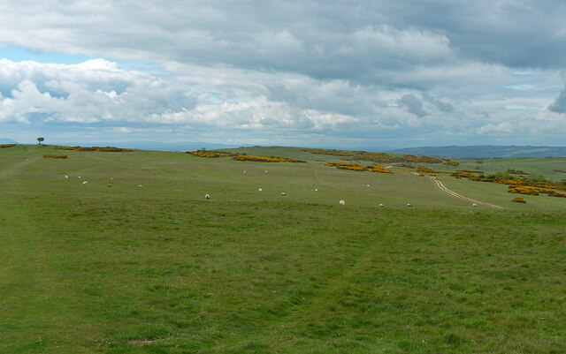
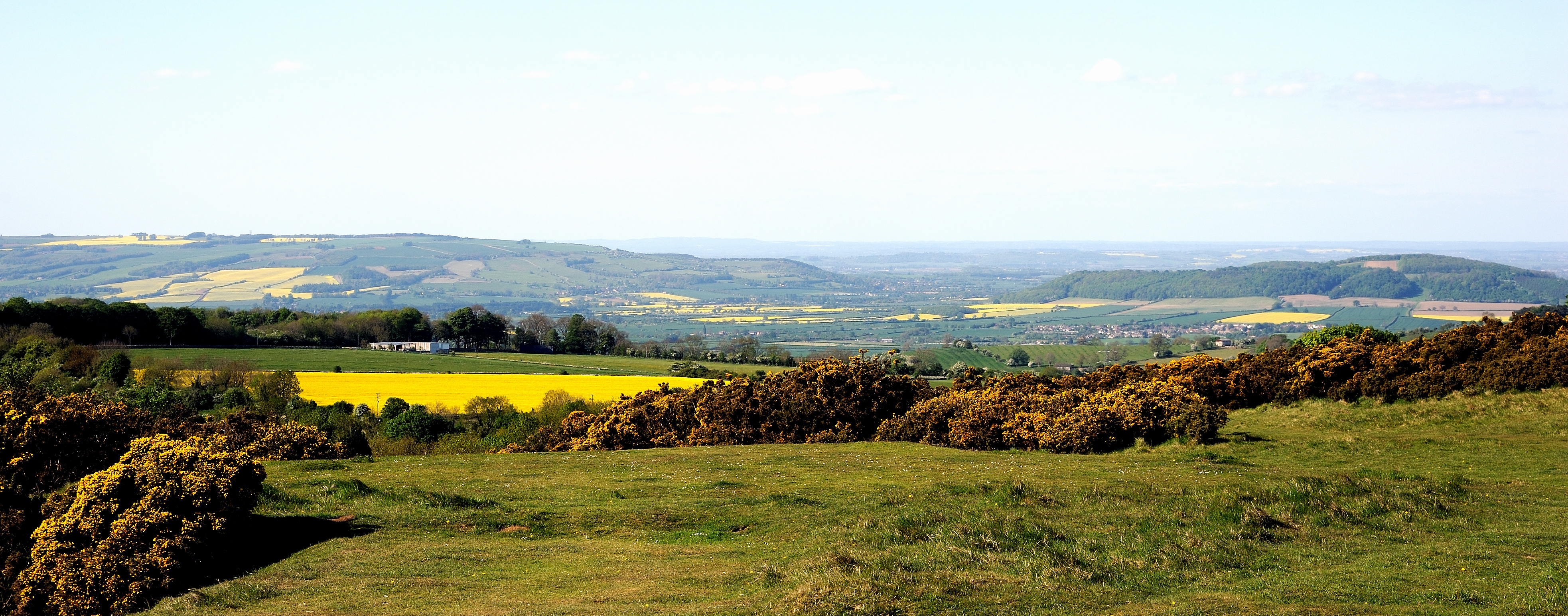
Thrift Wood is a picturesque forest located in Gloucestershire, England. Covering an area of approximately 200 acres, it is an idyllic destination for nature enthusiasts and hikers alike. The wood is situated in the heart of the beautiful Cotswolds region, renowned for its rolling hills and charming villages.

This ancient woodland is characterized by its diverse range of tree species, including oak, beech, and ash. The dense canopy formed by these towering trees creates a tranquil and shaded atmosphere, making it a delightful retreat during the hot summer months. The forest floor is carpeted with a vibrant array of wildflowers and ferns, adding to its enchanting appeal.

Thriving with wildlife, Thrift Wood is home to a variety of bird species, such as woodpeckers, nuthatches, and tawny owls. It also provides a habitat for mammals like deer, badgers, and foxes. The wood is a designated Site of Special Scientific Interest (SSSI), recognizing its ecological importance and the need for its protection.

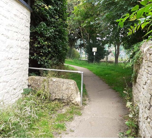
The wood offers several well-marked trails and pathways, making it accessible to visitors of all abilities. These trails wind through the forest, providing an opportunity to explore its natural beauty and discover hidden gems along the way. Additionally, there are picnic areas and benches scattered throughout the wood, allowing visitors to relax and soak in the serene surroundings.

Thrift Wood is a true haven for nature lovers, offering a peaceful and immersive experience in the heart of Gloucestershire. Whether it's a leisurely stroll or an adventurous hike, this forest promises a memorable and rejuvenating escape from the hustle and bustle of everyday life.

If you have any feedback on the listing, please let us know in the comments section below.

Thrift Wood Images

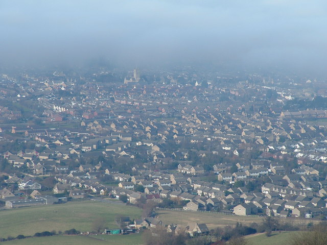
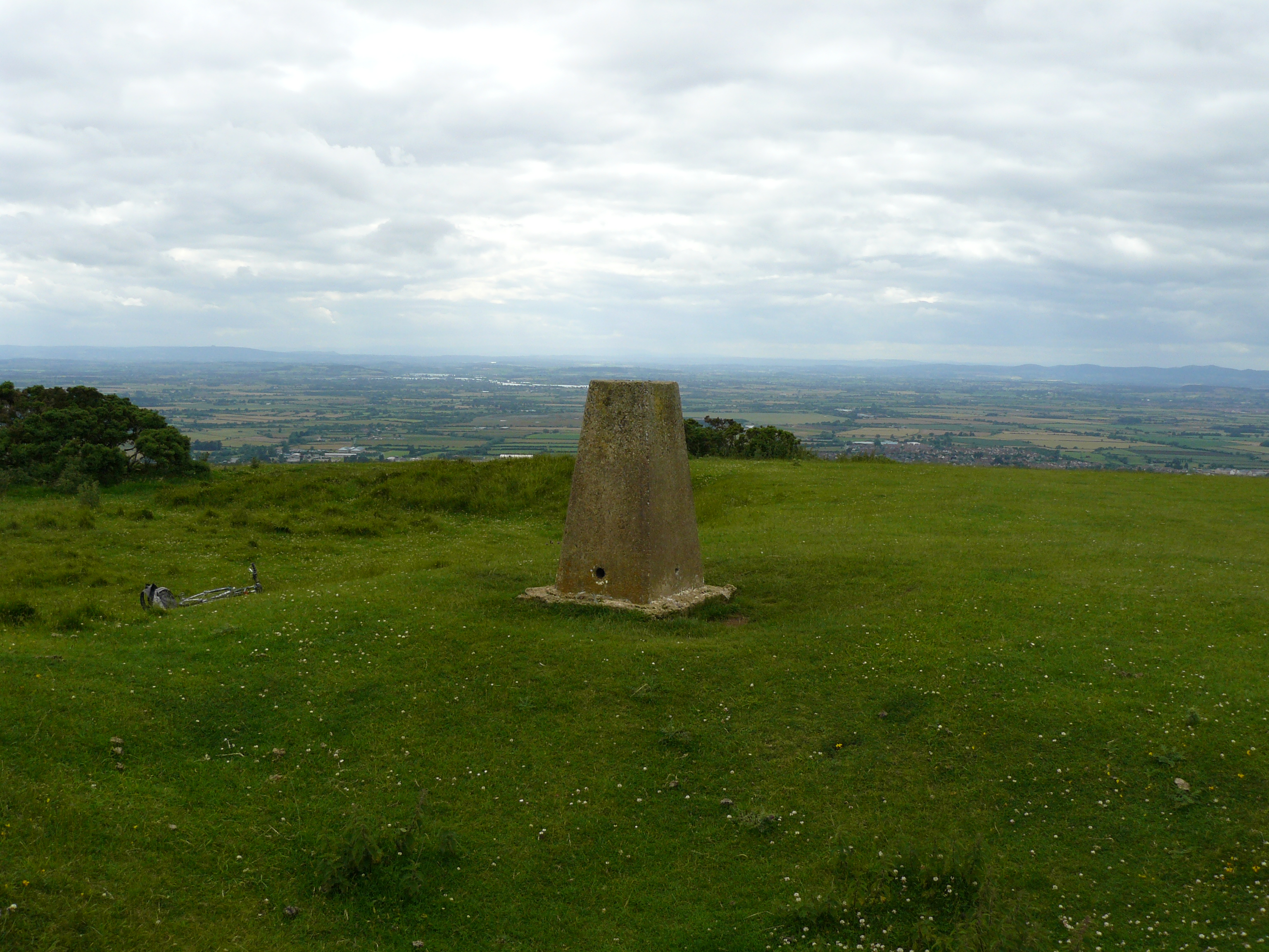
Images are sourced within 2km of 51.93258/-2.0280239 or Grid Reference SO9826. Thanks to Geograph Open Source API. All images are credited.

Trig pillar on Cleeve Hill Watch out for low-flying golf balls!
Trig pillar on Cleeve Hill
Watch out for low-flying golf balls!
Memorial tree on Cleeve Common A walk in Gloucestershire.
Memorial tree on Cleeve Common
A walk in Gloucestershire.
Cleeve Common
Cleeve Common
View of Cleeve Common From a path just east of Cheltenham.
View of Cleeve Common
From a path just east of Cheltenham.
Old Milestone, B4632 Southam On the SE verge of the road that by-passes Southam, NE of the village. 392.2 ft ASL in 1901 (BM not visible nor in OS database). Carved stone post, Winchcombe stone design, erected by the Winchcomb District turnpike trust in the 19th century. 

Inscription (was): Winchcomb 4 // Cheltenham 3

Milestone Society National ID: GL_CMWC03
Old Milestone, B4632 Southam
On the SE verge of the road that by-passes Southam, NE of the village. 392.2 ft ASL in 1901 (BM not visible nor in OS database). Carved stone post, Winchcombe stone design, erected by the Winchcomb District turnpike trust in the 19th century. Inscription (was): Winchcomb 4 // Cheltenham 3 Milestone Society National ID: GL_CMWC03
Stone Stile, Cleeve Hill In the parish of Woodmancote, off Buscombe Lane on Gloucestershire footpath AWO28, looking South to Cleeve Hill. The view looking from the field is <a href="https://www.geograph.org.uk/photo/7078272">SO9827 : Stone Stile, Cleeve Hill</a>. Opposite a step stile into Slades Farm see <a title="https://www.geograph.org.uk/photo/7078279" href="https://www.geograph.org.uk/photo/7078279">Link</a> & <a title="https://www.geograph.org.uk/photo/7078284" href="https://www.geograph.org.uk/photo/7078284">Link</a> .
Stone Stile, Cleeve Hill
In the parish of Woodmancote, off Buscombe Lane on Gloucestershire footpath AWO28, looking South to Cleeve Hill. The view looking from the field is SO9827 : Stone Stile, Cleeve Hill. Opposite a step stile into Slades Farm see Link & Link .
Stone Stile, Cleeve Hill In the parish of Woodmancote, off Buscombe Lane on Gloucestershire footpath AWO28, looking North. The view looking to the field is <a href="https://www.geograph.org.uk/photo/7078269">SO9827 : Stone Stile, Cleeve Hill</a>. Opposite a step stile into Slades Farm see <a title="https://www.geograph.org.uk/photo/7078279" href="https://www.geograph.org.uk/photo/7078279">Link</a> & <a title="https://www.geograph.org.uk/photo/7078284" href="https://www.geograph.org.uk/photo/7078284">Link</a> .
Stone Stile, Cleeve Hill
In the parish of Woodmancote, off Buscombe Lane on Gloucestershire footpath AWO28, looking North. The view looking to the field is SO9827 : Stone Stile, Cleeve Hill. Opposite a step stile into Slades Farm see Link & Link .
Stone Stile, Cleeve Hill Looking South on Gloucestershire footpath AWO28 to the road on Slades Farms. The view looking from the road is <a href="https://www.geograph.org.uk/photo/7078284">SO9827 : Stone Stile, Cleeve Hill</a>. Opposite a slab stone stile see <a title="https://www.geograph.org.uk/photo/7078269" href="https://www.geograph.org.uk/photo/7078269">Link</a> & <a title="https://www.geograph.org.uk/photo/7078272" href="https://www.geograph.org.uk/photo/7078272">Link</a> .
Stone Stile, Cleeve Hill
Looking South on Gloucestershire footpath AWO28 to the road on Slades Farms. The view looking from the road is SO9827 : Stone Stile, Cleeve Hill. Opposite a slab stone stile see Link & Link .
Stone Stile, Cleeve Hill Looking North on Gloucestershire footpath AWO28 from the road on Slades Farms. The view looking to the road is <a href="https://www.geograph.org.uk/photo/7078279">SO9827 : Stone Stile, Cleeve Hill</a>. Opposite a slab stone stile see <a title="https://www.geograph.org.uk/photo/7078269" href="https://www.geograph.org.uk/photo/7078269">Link</a> & <a title="https://www.geograph.org.uk/photo/7078272" href="https://www.geograph.org.uk/photo/7078272">Link</a> .
Stone Stile, Cleeve Hill
Looking North on Gloucestershire footpath AWO28 from the road on Slades Farms. The view looking to the road is SO9827 : Stone Stile, Cleeve Hill. Opposite a slab stone stile see Link & Link .
Stone Stile, Woodmancote Off Boscombe Lane looking from Gloucestershire footpath AWO30 to the road. The view from the road is <a href="https://www.geograph.org.uk/photo/7078293">SO9727 : Stone Stile, Woodmancote</a>.
Stone Stile, Woodmancote
Off Boscombe Lane looking from Gloucestershire footpath AWO30 to the road. The view from the road is SO9727 : Stone Stile, Woodmancote.
Stone Stile, Woodmancote Looking from  Boscombe Lane to Gloucestershire footpath AWO30. The view from the footpath is <a href="https://www.geograph.org.uk/photo/7078291">SO9727 : Stone Stile, Woodmancote</a>.
Stone Stile, Woodmancote
Looking from Boscombe Lane to Gloucestershire footpath AWO30. The view from the footpath is SO9727 : Stone Stile, Woodmancote.
Stone Stile, Southam Gloucestershire footpath ASM8 leads to Southam Tithe Barn and the Church of the Ascension. This view looks East, the view West is <a href="https://www.geograph.org.uk/photo/7078351">SO9625 : Stone Stile, Southam</a>. An earlier view with less ivy see <a title="https://www.geograph.org.uk/photo/3542508" href="https://www.geograph.org.uk/photo/3542508">Link</a>.
Stone Stile, Southam
Gloucestershire footpath ASM8 leads to Southam Tithe Barn and the Church of the Ascension. This view looks East, the view West is SO9625 : Stone Stile, Southam. An earlier view with less ivy see Link.
Stone Stile, Southam Gloucestershire footpath ASM8 leads to Southam Tithe Barn and the Church of the Ascension. This view looks West, the view East is <a href="https://www.geograph.org.uk/photo/7078349">SO9625 : Stone Stile, Southam</a>. An earlier view with less ivy see <a title="https://www.geograph.org.uk/photo/3542508" href="https://www.geograph.org.uk/photo/3542508">Link</a> .
Stone Stile, Southam
Gloucestershire footpath ASM8 leads to Southam Tithe Barn and the Church of the Ascension. This view looks West, the view East is SO9625 : Stone Stile, Southam. An earlier view with less ivy see Link .
Views from Cleeve Common - Cheltenham, Gloucestershire A tea break for these walkers at the view indicator on Cleeve Hill, to the north-east of Cheltenham. The occasion of this photo was an eight day Cotswold Way guided walk, led by Cotswold Voluntary Wardens including myself, which started in Bath on 15th July 1989 and ended in Chipping Campden (silent p) on the 22nd July. Was it really that long ago during my happy years on Cotswold, sadly now only bittersweet memories? Time photo taken not available.

<a href="https://www.geograph.org.uk/photo/6707916">ST7572 : Grade 1 Manor - Cold Ashton, South Gloucestershire</a> <a href="https://www.geograph.org.uk/photo/5916463">ST7787 : View from the top - Hawkesbury Upton, South Gloucestershire</a> <a href="https://www.geograph.org.uk/photo/6820068">ST7598 : On Long Street - Dursley, Gloucestershire</a> <a href="https://www.geograph.org.uk/photo/6702880">ST7899 : After the climb from Hodgecombe - Uley, Gloucestershire</a> <a href="https://www.geograph.org.uk/photo/6694669">SP0629 : Cromwell's Seat on the Cotswold Way - Farmcote, Gloucestershire</a> <a href="https://www.geograph.org.uk/photo/6703819">SP0937 : Seats on steps - Broadway, Worcestershire</a>
Views from Cleeve Common - Cheltenham, Gloucestershire
A tea break for these walkers at the view indicator on Cleeve Hill, to the north-east of Cheltenham. The occasion of this photo was an eight day Cotswold Way guided walk, led by Cotswold Voluntary Wardens including myself, which started in Bath on 15th July 1989 and ended in Chipping Campden (silent p) on the 22nd July. Was it really that long ago during my happy years on Cotswold, sadly now only bittersweet memories? Time photo taken not available. ST7572 : Grade 1 Manor - Cold Ashton, South Gloucestershire ST7787 : View from the top - Hawkesbury Upton, South Gloucestershire ST7598 : On Long Street - Dursley, Gloucestershire ST7899 : After the climb from Hodgecombe - Uley, Gloucestershire SP0629 : Cromwell's Seat on the Cotswold Way - Farmcote, Gloucestershire SP0937 : Seats on steps - Broadway, Worcestershire
Stone Stile, Bishops Cleeve On Gloucestershire footpath AWO14 looking towards the recreation ground and cricket pitch. The view facing in the direction of Station Road is <a href="https://www.geograph.org.uk/photo/7219096">SO9727 : Stone Stile, Bishops Cleeve</a>.
Stone Stile, Bishops Cleeve
On Gloucestershire footpath AWO14 looking towards the recreation ground and cricket pitch. The view facing in the direction of Station Road is SO9727 : Stone Stile, Bishops Cleeve.
Stone Stile, Bishops Cleeve On Gloucestershire footpath AWO14 looking in the direction of Station Road. The view facing towards the recreation ground and cricket pitch is <a href="https://www.geograph.org.uk/photo/7219092">SO9727 : Stone Stile, Bishops Cleeve</a>.
Stone Stile, Bishops Cleeve
On Gloucestershire footpath AWO14 looking in the direction of Station Road. The view facing towards the recreation ground and cricket pitch is SO9727 : Stone Stile, Bishops Cleeve.
Stone Stile, Woodmancote A "Fallen Idle" on Gloucestershire footpath AWO28 North of Stockwell Lane and Whistling Down Cottage. The  view from the other direction is <a href="https://www.geograph.org.uk/photo/7219430">SO9827 : Stone Stile, Woodmancote</a>.
Stone Stile, Woodmancote
A "Fallen Idle" on Gloucestershire footpath AWO28 North of Stockwell Lane and Whistling Down Cottage. The view from the other direction is SO9827 : Stone Stile, Woodmancote.
Stone Stile, Woodmancote A "Fallen Idle" on Gloucestershire footpath AWO28 North of Stockwell Lane and Whistling Down Cottage. The  view from the other direction is <a href="https://www.geograph.org.uk/photo/7219428">SO9827 : Stone Stile, Woodmancote</a>.
Stone Stile, Woodmancote
A "Fallen Idle" on Gloucestershire footpath AWO28 North of Stockwell Lane and Whistling Down Cottage. The view from the other direction is SO9827 : Stone Stile, Woodmancote.
Show me another place!

Thrift Wood is located at Grid Ref: SO9826 (Lat: 51.93258, Lng: -2.0280239)

Administrative County: Gloucestershire

District: Tewkesbury

Police Authority: Gloucestershire

What 3 Words

///ripe.masks.hairpin. Near Bishops Cleeve, Gloucestershire

Related Wikis

Cleeve Common

Cleeve Common (grid reference SO990260) is a 455-hectare (1,120-acre) biological and geological Site of Special Scientific Interest in Gloucestershire...

Southam, Gloucestershire

Southam is a village in Gloucestershire, England, located on the outskirts of Cheltenham. Its main features are a Manor House, which has now been converted...

Woodmancote, Tewkesbury Borough

Woodmancote is a village and civil parish in Gloucestershire, England. The parish lies immediately east of Bishop's Cleeve; the village is about 3+1⁄2...

Cleeve Hill, Gloucestershire

Cleeve Hill (also known as Cleeve Cloud) is the highest point both of the Cotswolds hill range and of the county of Gloucestershire, at 330 m (1,080 ft...

Nearby Amenities

Located within 500m of 51.93258,-2.0280239
Bench
Lat/Long: 51.9336277/-2.0248605
Nutterswood
Place: hamlet
Lat/Long: 51.9289982/-2.026999
Bench
Lat/Long: 51.9303346/-2.0248961
Bench
Lat/Long: 51.9308274/-2.024813
Bench
Lat/Long: 51.9327806/-2.0246816
Entrance: main
Lat/Long: 51.9290055/-2.0276477
Power: pole
Lat/Long: 51.9281001/-2.028157
Nutterswood
Power: pole
Transformer: distribution
Voltage Primary: 11000
Lat/Long: 51.9285012/-2.0278962
The data included in this document is from www.openstreetmap.org. The data is made available under ODbL.

Have you been to Thrift Wood?

Leave your review of Thrift Wood below (or comments, questions and feedback).