Broadmoor Wood

Wood, Forest in Worcestershire Bromsgrove

England

Broadmoor Wood

The M5 skirts a hillock Seen from the lane that leads to Chadwich Grange.
The M5 skirts a hillock Credit: Adrian Bailey

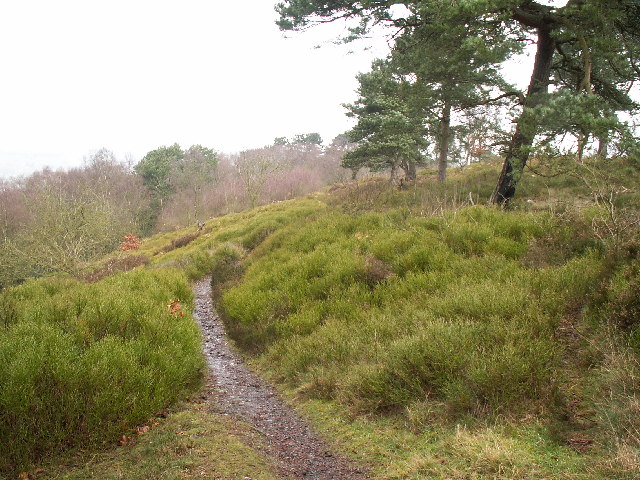
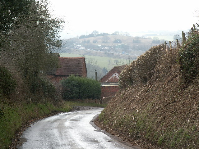
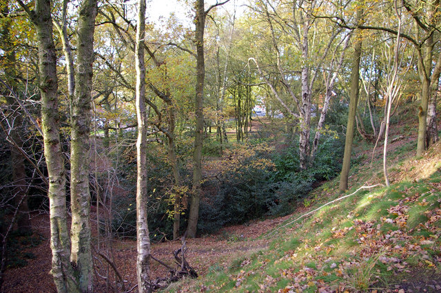
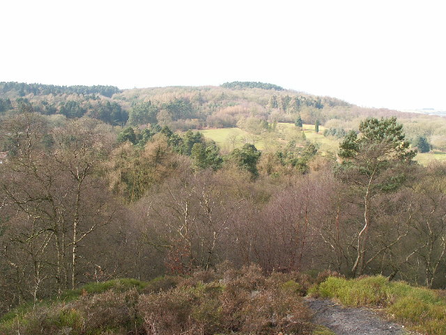
Broadmoor Wood is a picturesque forest located in Worcestershire, England. It covers a vast area of approximately 500 acres and is surrounded by stunning natural beauty. The wood is known for its diverse range of trees, including oak, beech, and pine, which create a rich and vibrant canopy overhead.

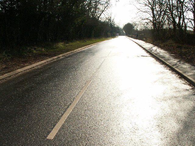
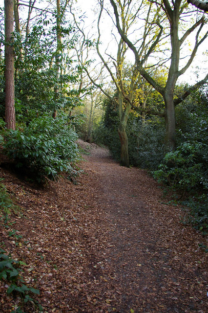
The forest is a popular destination for nature enthusiasts and outdoor adventurers alike. It offers a variety of walking trails, ranging from easy strolls to more challenging hikes, allowing visitors to explore the wood at their own pace. These trails are well-maintained and provide an opportunity to immerse oneself in the tranquility of the woodland, away from the hustle and bustle of everyday life.

Broadmoor Wood is also home to a wide array of wildlife. Birdwatchers will delight in the chance to spot various species, such as woodpeckers, owls, and songbirds, while animal lovers may encounter deer, foxes, and rabbits. The forest is a haven for biodiversity, providing a valuable habitat for many creatures.

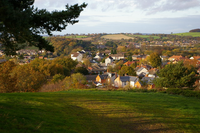
For those seeking a family-friendly outing, the wood offers picnic areas and designated spaces for children to play, making it an ideal spot for a day out in nature. Additionally, the forest is equipped with well-placed benches and viewpoints, allowing visitors to rest and take in the breathtaking views.

Overall, Broadmoor Wood is a cherished natural gem in Worcestershire, offering a tranquil escape and a chance to connect with the beauty of the British countryside.

If you have any feedback on the listing, please let us know in the comments section below.

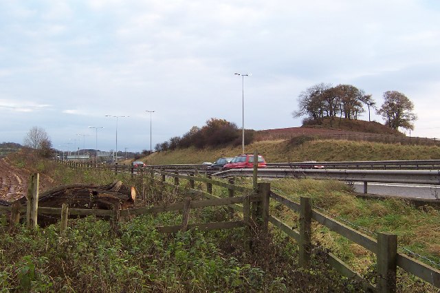
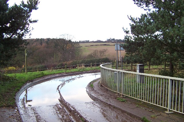
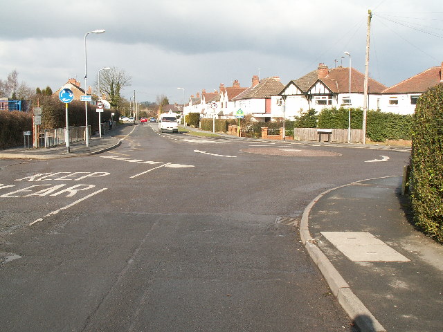
Broadmoor Wood Images

Images are sourced within 2km of 52.38683/-2.0332943 or Grid Reference SO9776. Thanks to Geograph Open Source API. All images are credited.

The M5 skirts a hillock Seen from the lane that leads to Chadwich Grange.
The M5 skirts a hillock
Seen from the lane that leads to Chadwich Grange.
From Chapman's Hill The view towards Romsley Hill from the farm bridge over the M5.
From Chapman's Hill
The view towards Romsley Hill from the farm bridge over the M5.
Rednal Hill Rednal Hill was presented to the City of Birmingham in 1888 by the Birmingham Association for the Preservation of Open Spaces. Together with land donated by the Cadbury family it forms the Lickey Hills Country Park.
Rednal Hill
Rednal Hill was presented to the City of Birmingham in 1888 by the Birmingham Association for the Preservation of Open Spaces. Together with land donated by the Cadbury family it forms the Lickey Hills Country Park.
Toposcope, Beacon Hill The toposcope on Beacon Hill (298m) was constructed in 1923 after Beacon Hill was donated to the City of Birmingham by the Cadbury family. The toposcope was restored in 1988. From this viewpoint on a good day 13 old counties can be seen. Going east from the summit there is no higher land at the same latitude until you reach the Ural Mountains in Russia (I've checked this using Google Earth).
Toposcope, Beacon Hill
The toposcope on Beacon Hill (298m) was constructed in 1923 after Beacon Hill was donated to the City of Birmingham by the Cadbury family. The toposcope was restored in 1988. From this viewpoint on a good day 13 old counties can be seen. Going east from the summit there is no higher land at the same latitude until you reach the Ural Mountains in Russia (I've checked this using Google Earth).
Beacon Hill Looking south-west towards the car park from near the toposcope.
Beacon Hill
Looking south-west towards the car park from near the toposcope.
Road junction , Rubery The junction of School Road, Gannow Road and Gunner Lane in the south west corner of the square, looking north east. Waseley Hills High School and Holywell Junior School are just to the left of the picture.
Road junction , Rubery
The junction of School Road, Gannow Road and Gunner Lane in the south west corner of the square, looking north east. Waseley Hills High School and Holywell Junior School are just to the left of the picture.
Redhill Lane Looking south west towards Redhill Farm. The M5 motorway can be seen climbing up towards junction 4.
Redhill Lane
Looking south west towards Redhill Farm. The M5 motorway can be seen climbing up towards junction 4.
Birmingham Road, Lydiate Ash This road was formerly the A38 - however this section has been bypassed as the A38 now runs via junction 4 of the M5, several hundred metres west. Birmingham, Road is now little more than a quiet country lane, albeit a very wide, straight and well surfaced one.
Birmingham Road, Lydiate Ash
This road was formerly the A38 - however this section has been bypassed as the A38 now runs via junction 4 of the M5, several hundred metres west. Birmingham, Road is now little more than a quiet country lane, albeit a very wide, straight and well surfaced one.
Marlbrook Tip Photo taken from Marlbrook Lane. The owners of this former landfill site have plans to restore the area, and develop and nine hole golf course.
Marlbrook Tip
Photo taken from Marlbrook Lane. The owners of this former landfill site have plans to restore the area, and develop and nine hole golf course.
View south west from Windmill Hill, Waseley Hills Country Park Looking down a small valley from the footpath below the summit of the hill, late on a winter afternoon
View south west from Windmill Hill, Waseley Hills Country Park
Looking down a small valley from the footpath below the summit of the hill, late on a winter afternoon
Life in the slow lane Monday morning rush hour on the M5 just past junction 4 heading north
Life in the slow lane
Monday morning rush hour on the M5 just past junction 4 heading north
Rednal Hill, looking towards Rubery Looking out across leafy suburbia
Rednal Hill, looking towards Rubery
Looking out across leafy suburbia
Woodland on north west end of Rednal Hill
Bridleway below south western slope of Rednal Hill
Sandy Lane (A461) looking NW
Beacon Hill Toposcope - Lickey Hills Country Park
Beverley Road with Cock Hill in the background
Leach Heath Medical Centre
Show me another place!

Broadmoor Wood is located at Grid Ref: SO9776 (Lat: 52.38683, Lng: -2.0332943)

Administrative County: Worcestershire

District: Bromsgrove

Police Authority: West Mercia

What 3 Words

///loose.tiger.going. Near Barnt Green, Worcestershire

Related Wikis

Waseley Hills High School and Sixth Form Centre

Waseley Hills High School and Sixth Form Centre is a mixed secondary school and sixth form with academy status in the town of Rubery, on the border of...

Rubery

Rubery is a village in the Bromsgrove District and a suburb of Birmingham in the counties of Worcestershire and West Midlands, England. It is 9 miles...

St Chad's Church, Rubery

St Chad’s Church, Rubery is a Church of England parish church in Rubery, Worcestershire. == History == The church evolved in 1895 as a mission church from...

Lydiate Ash

Lydiate Ash is a hamlet in North Worcestershire, England, consisting of a few houses, the road gritting and works depot for Worcestershire County Council...

Waseley Hills Country Park

Waseley Hills Country Park is 150 acres (0.61 km2) a Country Park and Local Nature Reserve owned and managed by Worcestershire County Council's Countryside...

Rubery Hill Hospital

Rubery Hill Hospital was a mental health facility in Birmingham, England. The Chapel, which still survives, is a Grade II listed building. == History... ==

Lickey Hills Country Park

Lickey Hills Country Park is a country park in England. It is 10 miles (16 kilometres) south west of Birmingham and 24 miles (39 kilometres) north east...

Lickey Hills

The Lickey Hills (known locally as simply The Lickeys) are a range of hills in Worcestershire, England, 11 miles (18 km) to the south-west of the centre...

Related Videos

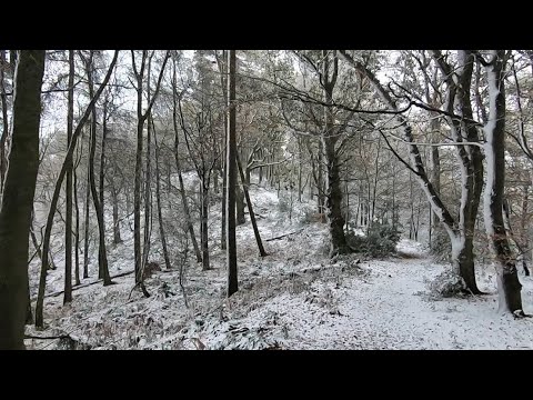
Heavy Snow Falling UK November 2021! Walking Into Snowy Woods Near Birmingham

After Storm Arwen it's still snowing for this virtual morning walk through countryside & forest in central England. With the strong ...

Early Morning Forest Walk - Virtual Scenery For Treadmill Workout - Walking Through English Woods

Walking in the woods early on a peaceful summer morning in central England - 45 minute video by Chris PT for home cardio ...

Walking In Rain In The Woods With Umbrella - Virtual Forest Walk Video - 1 Hour 45 Minutes

Virtual rain walk video - peaceful hike through a misty forest in the summer rain on scenic hill trails. Beautiful rainy day hiking ...

Walking Barnt Green to Withybed Circular 19/3/23

Starting at Barnt Green village we cross the railway and walk up to the top of the Licky Hills where we admire the view of ...

Nearby Amenities

Located within 500m of 52.38683,-2.0332943
Source Maxspeed: survey
Lat/Long: 52.3897447/-2.0312251
Barrier: stile
Source: survey
Lat/Long: 52.3857025/-2.0399224
Redhill Farm
Landuse: farmyard
Lat/Long: 52.386225/-2.0366996
Three Acres
Building: yes
Source: estimate
Lat/Long: 52.3880768/-2.0355336
Highfield Cottage
Landuse: farmyard
Lat/Long: 52.3894233/-2.0348313
Barrier: cattle_grid
Bicycle: yes
Foot: yes
Lat/Long: 52.3860065/-2.0395497
Natural: spring
Lat/Long: 52.3880019/-2.034072
Barrier: kissing_gate
Source: survey
Lat/Long: 52.3902886/-2.0344878
Barrier: kissing_gate
Source: survey
Lat/Long: 52.3894639/-2.0385719
Grit Bin
Source: survey
Lat/Long: 52.3895232/-2.0318622
St Oswald's Camp
Source: survey
Lat/Long: 52.3889133/-2.0318769
Fire Hydrant
Emergency: fire_hydrant
Fire Hydrant Type: underground
Source: survey
Lat/Long: 52.3898983/-2.0305771
Barrier: kissing_gate
Lat/Long: 52.3906143/-2.0347084
Bench
Backrest: yes
Material: wood
Lat/Long: 52.3896274/-2.0384555
Bench
Backrest: yes
Material: wood
Lat/Long: 52.3906925/-2.0358707
Generator Method: photovoltaic
Generator Output Electricity: yes
Generator Source: solar
Generator Type: solar_photovoltaic_panel
Location: roof
Power: generator
Lat/Long: 52.3908452/-2.0306803
Generator Method: photovoltaic
Generator Output Electricity: yes
Generator Source: solar
Generator Type: solar_photovoltaic_panel
Location: roof
Power: generator
Lat/Long: 52.3903091/-2.0292681
Traffic Calming: table
Lat/Long: 52.3901834/-2.0307521
The data included in this document is from www.openstreetmap.org. The data is made available under ODbL.

Have you been to Broadmoor Wood?

Leave your review of Broadmoor Wood below (or comments, questions and feedback).