Red Hill

Hill, Mountain in Worcestershire Bromsgrove

England

Red Hill

The M5 skirts a hillock Seen from the lane that leads to Chadwich Grange.
The M5 skirts a hillock Credit: Adrian Bailey

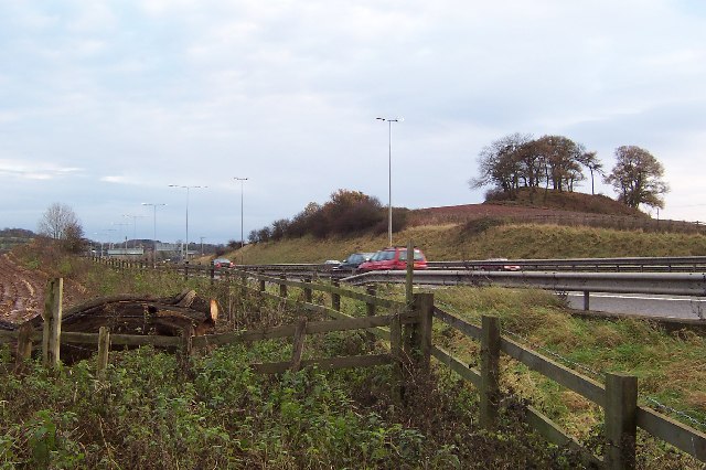
Red Hill is a prominent hill located in Worcestershire, England. Rising to an elevation of 264 meters (866 feet), it is considered one of the highest points in the county. Situated near the village of Redditch, the hill is part of the wider Malvern Hills range and offers stunning panoramic views of the surrounding landscape.

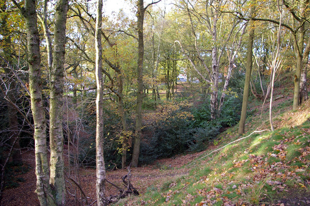
The hill is characterized by its distinctive red soil, which gives it its name. This iron-rich soil, combined with the diverse flora and fauna, contributes to the hill's ecological significance. Red Hill is home to a variety of plant species, including heather, gorse, and bracken, which create a colorful tapestry throughout the seasons. The hill also supports a range of wildlife, such as badgers, foxes, and numerous bird species, making it a popular spot for nature enthusiasts.

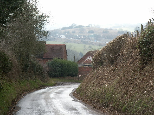
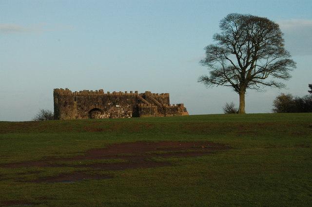
Apart from its natural beauty, Red Hill has historical and cultural importance. It is believed to have been used as a settlement in ancient times, with evidence of Iron Age and Roman occupation found in the vicinity. Today, remnants of these early settlements can still be observed. The hill has also witnessed several archaeological discoveries, including the uncovering of a Roman fortlet in the 1950s.

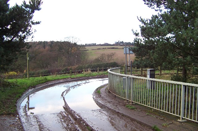
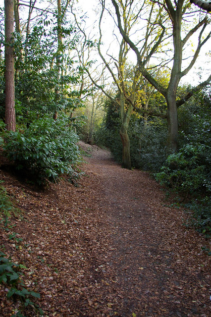
Red Hill offers recreational opportunities for visitors, with numerous walking trails and footpaths crisscrossing its slopes. The hill attracts hikers, dog walkers, and nature lovers all year round, providing a peaceful retreat in the heart of Worcestershire. Additionally, the hill is a hotspot for paragliding enthusiasts, who take advantage of the favorable wind conditions and breathtaking views.

In summary, Red Hill in Worcestershire is a scenic and historically rich hill that showcases the natural beauty and cultural heritage of the region.

If you have any feedback on the listing, please let us know in the comments section below.
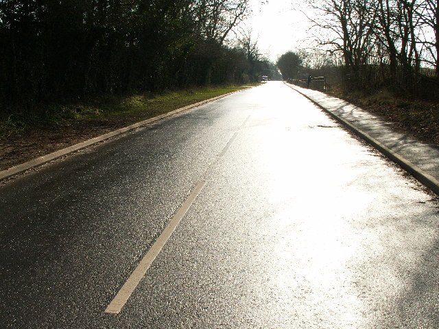
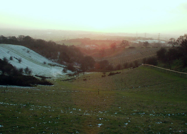
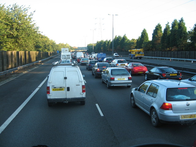
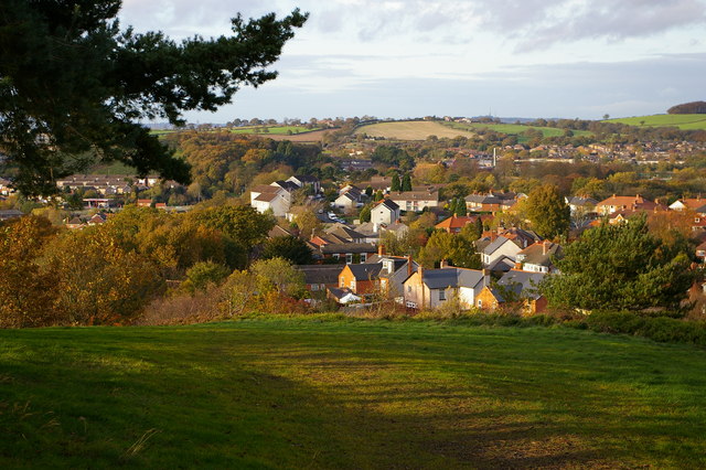
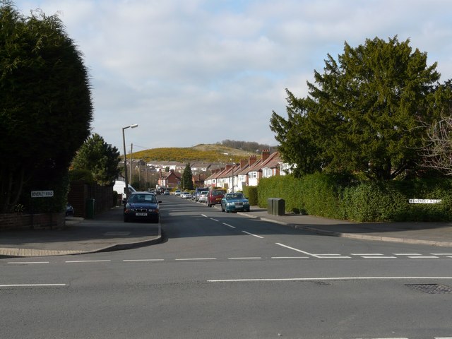
Red Hill Images

Images are sourced within 2km of 52.38851/-2.035867 or Grid Reference SO9776. Thanks to Geograph Open Source API. All images are credited.

The M5 skirts a hillock Seen from the lane that leads to Chadwich Grange.
The M5 skirts a hillock
Seen from the lane that leads to Chadwich Grange.
From Chapman's Hill The view towards Romsley Hill from the farm bridge over the M5.
From Chapman's Hill
The view towards Romsley Hill from the farm bridge over the M5.
Toposcope, Beacon Hill The toposcope on Beacon Hill (298m) was constructed in 1923 after Beacon Hill was donated to the City of Birmingham by the Cadbury family. The toposcope was restored in 1988. From this viewpoint on a good day 13 old counties can be seen. Going east from the summit there is no higher land at the same latitude until you reach the Ural Mountains in Russia (I've checked this using Google Earth).
Toposcope, Beacon Hill
The toposcope on Beacon Hill (298m) was constructed in 1923 after Beacon Hill was donated to the City of Birmingham by the Cadbury family. The toposcope was restored in 1988. From this viewpoint on a good day 13 old counties can be seen. Going east from the summit there is no higher land at the same latitude until you reach the Ural Mountains in Russia (I've checked this using Google Earth).
Beacon Hill Looking south-west towards the car park from near the toposcope.
Beacon Hill
Looking south-west towards the car park from near the toposcope.
Road junction , Rubery The junction of School Road, Gannow Road and Gunner Lane in the south west corner of the square, looking north east. Waseley Hills High School and Holywell Junior School are just to the left of the picture.
Road junction , Rubery
The junction of School Road, Gannow Road and Gunner Lane in the south west corner of the square, looking north east. Waseley Hills High School and Holywell Junior School are just to the left of the picture.
Redhill Lane Looking south west towards Redhill Farm. The M5 motorway can be seen climbing up towards junction 4.
Redhill Lane
Looking south west towards Redhill Farm. The M5 motorway can be seen climbing up towards junction 4.
Birmingham Road, Lydiate Ash This road was formerly the A38 - however this section has been bypassed as the A38 now runs via junction 4 of the M5, several hundred metres west. Birmingham, Road is now little more than a quiet country lane, albeit a very wide, straight and well surfaced one.
Birmingham Road, Lydiate Ash
This road was formerly the A38 - however this section has been bypassed as the A38 now runs via junction 4 of the M5, several hundred metres west. Birmingham, Road is now little more than a quiet country lane, albeit a very wide, straight and well surfaced one.
Marlbrook Tip Photo taken from Marlbrook Lane. The owners of this former landfill site have plans to restore the area, and develop and nine hole golf course.
Marlbrook Tip
Photo taken from Marlbrook Lane. The owners of this former landfill site have plans to restore the area, and develop and nine hole golf course.
View south west from Windmill Hill, Waseley Hills Country Park Looking down a small valley from the footpath below the summit of the hill, late on a winter afternoon
View south west from Windmill Hill, Waseley Hills Country Park
Looking down a small valley from the footpath below the summit of the hill, late on a winter afternoon
Life in the slow lane Monday morning rush hour on the M5 just past junction 4 heading north
Life in the slow lane
Monday morning rush hour on the M5 just past junction 4 heading north
Rednal Hill, looking towards Rubery Looking out across leafy suburbia
Rednal Hill, looking towards Rubery
Looking out across leafy suburbia
Woodland on north west end of Rednal Hill
Bridleway below south western slope of Rednal Hill
Dayhouse Bank Turning for Frankley from B4551
Dayhouse Bank
Turning for Frankley from B4551
Manchester Inn on B4551
Sandy Lane (A461) looking NW
Beacon Hill Toposcope - Lickey Hills Country Park
Beverley Road with Cock Hill in the background
Show me another place!

Red Hill is located at Grid Ref: SO9776 (Lat: 52.38851, Lng: -2.035867)

Administrative County: Worcestershire

District: Bromsgrove

Police Authority: West Mercia

What 3 Words

///unrealistic.soft.popped. Near Barnt Green, Worcestershire

Related Wikis

Waseley Hills High School and Sixth Form Centre

Waseley Hills High School and Sixth Form Centre is a mixed secondary school and sixth form with academy status in the town of Rubery, on the border of...

Rubery

Rubery is a village in the Bromsgrove District and a suburb of Birmingham in the counties of Worcestershire and West Midlands, England. It is 9 miles...

St Chad's Church, Rubery

St Chad’s Church, Rubery is a Church of England parish church in Rubery, Worcestershire. == History == The church evolved in 1895 as a mission church from...

Lydiate Ash

Lydiate Ash is a hamlet in North Worcestershire, England, consisting of a few houses, the road gritting and works depot for Worcestershire County Council...

Waseley Hills Country Park

Waseley Hills Country Park is 150 acres (0.61 km2) a Country Park and Local Nature Reserve owned and managed by Worcestershire County Council's Countryside...

Rubery Hill Hospital

Rubery Hill Hospital was a mental health facility in Birmingham, England. The Chapel, which still survives, is a Grade II listed building. == History... ==

New Frankley

New Frankley in Birmingham is a civil parish in Birmingham, England. As such, it has its own parish council. == History == It was established in 2000 in...

Rubery railway station

Rubery railway station was a railway station in Rubery, Birmingham, England, on the Great Western Railway and Midland Railway's joint Halesowen Railway...

Nearby Amenities

Located within 500m of 52.38851,-2.035867
Source Maxspeed: survey
Lat/Long: 52.3897447/-2.0312251
Barrier: stile
Source: survey
Lat/Long: 52.3857025/-2.0399224
Barrier: cattle_grid
Bicycle: yes
Foot: yes
Lat/Long: 52.3883949/-2.0420283
Fixme: continue
Lat/Long: 52.3885385/-2.0418002
Redhill Farm
Landuse: farmyard
Lat/Long: 52.386225/-2.0366996
Three Acres
Building: yes
Source: estimate
Lat/Long: 52.3880768/-2.0355336
Highfield Cottage
Landuse: farmyard
Lat/Long: 52.3894233/-2.0348313
Bus Stop
School Rd / Waseley Hills School
Bus: yes
Naptan AtcoCode: 43000391902
Naptan Bearing: S
Naptan BusStopType: MKD
Naptan CommonName: Waseley Hills School
Naptan Indicator: adj
Naptan NaptanCode: nwmtpdgd
Naptan Status: ACT
Naptan StopType: BCT
Naptan Street: SCHOOL RD
Naptan Towards: Rubery
Naptan Verified: no
Public Transport: platform
Route Ref: 202
Source: WMCA
Lat/Long: 52.3911182/-2.0300952
Barrier: cattle_grid
Bicycle: yes
Foot: yes
Lat/Long: 52.3860065/-2.0395497
Natural: spring
Lat/Long: 52.3880019/-2.034072
Barrier: kissing_gate
Source: survey
Lat/Long: 52.3902886/-2.0344878
Barrier: stile
Lat/Long: 52.3927449/-2.0377547
Barrier: kissing_gate
Source: survey
Lat/Long: 52.3894639/-2.0385719
Grit Bin
Source: survey
Lat/Long: 52.3895232/-2.0318622
St Oswald's Camp
Source: survey
Lat/Long: 52.3889133/-2.0318769
Man Made: pipeline_marker
Source: survey
Lat/Long: 52.3924201/-2.0373468
Holywell Hill
Natural: peak
Lat/Long: 52.3907919/-2.0370488
Bus Stop
School Rd / Waseley Hills School
Bus: yes
Naptan AtcoCode: 43000391901
Naptan Bearing: N
Naptan BusStopType: CUS
Naptan CommonName: Waseley Hills School
Naptan NaptanCode: nwmtpdga
Naptan Status: ACT
Naptan StopType: BCT
Naptan Street: SCHOOL RD
Naptan Towards: Frankley
Public Transport: platform
Route Ref: 202
Source: WMCA
Lat/Long: 52.3910666/-2.0303733
Fire Hydrant
Emergency: fire_hydrant
Fire Hydrant Type: underground
Source: survey
Lat/Long: 52.3898983/-2.0305771
Barrier: kissing_gate
Lat/Long: 52.3925308/-2.0381737
Barrier: kissing_gate
Lat/Long: 52.3906143/-2.0347084
Bench
Backrest: yes
Material: wood
Lat/Long: 52.3896274/-2.0384555
Bench
Backrest: yes
Material: wood
Lat/Long: 52.3906925/-2.0358707
Generator Method: photovoltaic
Generator Output Electricity: yes
Generator Source: solar
Generator Type: solar_photovoltaic_panel
Location: roof
Power: generator
Lat/Long: 52.3908452/-2.0306803
Generator Method: photovoltaic
Generator Output Electricity: yes
Generator Source: solar
Generator Type: solar_photovoltaic_panel
Location: roof
Power: generator
Lat/Long: 52.3903091/-2.0292681
Barrier: kissing_gate
Lat/Long: 52.3923838/-2.0360641
Traffic Calming: table
Lat/Long: 52.3901834/-2.0307521
Traffic Calming: hump
Lat/Long: 52.3909985/-2.0302706
The data included in this document is from www.openstreetmap.org. The data is made available under ODbL.

Have you been to Red Hill?

Leave your review of Red Hill below (or comments, questions and feedback).