Spur Copse

Wood, Forest in Dorset

England

Spur Copse

Ford At Corfe Mullen The ford at Corfe Mullen is secured by a locked pair of gates.
Ford At Corfe Mullen Credit: John Walton

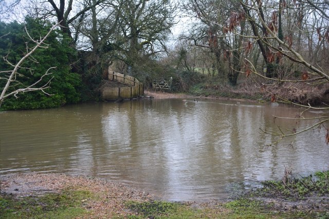
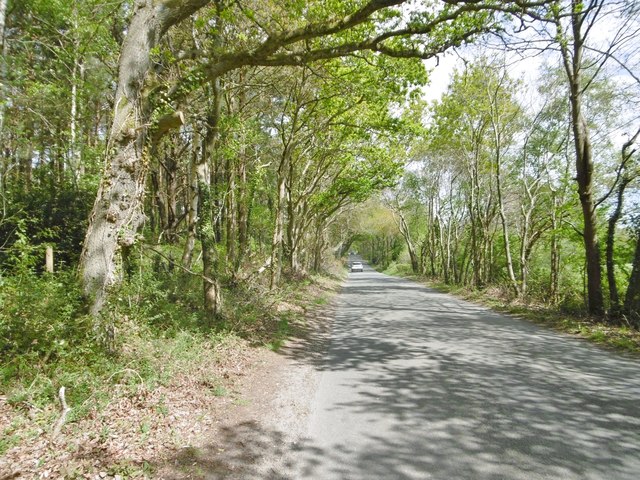
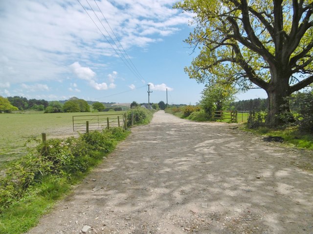
Spur Copse is a picturesque woodland located in the county of Dorset, England. Situated near the village of Spurminster, the copse covers an area of approximately 50 acres, making it a delightful destination for nature enthusiasts and hikers alike.

The copse is characterized by its dense canopy of trees, predominantly consisting of oak, beech, and ash. These towering trees provide ample shade and create a peaceful atmosphere, making it an ideal spot for a leisurely stroll or a picnic. The forest floor is adorned with a plethora of wildflowers, ferns, and mosses, adding to its natural beauty.

The wood is home to a diverse range of wildlife, including various species of birds such as woodpeckers, owls, and thrushes. Small mammals like squirrels, rabbits, and hedgehogs can also be spotted scurrying through the undergrowth. With its rich biodiversity, Spur Copse offers a unique opportunity for visitors to observe and appreciate the wonders of nature up close.

Trails wind their way through the copse, allowing visitors to explore its hidden corners and enjoy the tranquility of the surroundings. The paths are well-maintained, making them accessible to all, including families with young children or individuals with mobility challenges.

Overall, Spur Copse in Dorset is a captivating woodland that offers a serene escape from the hustle and bustle of everyday life. With its lush vegetation, abundant wildlife, and well-marked trails, it provides an enchanting experience for those seeking solace in nature's embrace.

If you have any feedback on the listing, please let us know in the comments section below.

Spur Copse Images

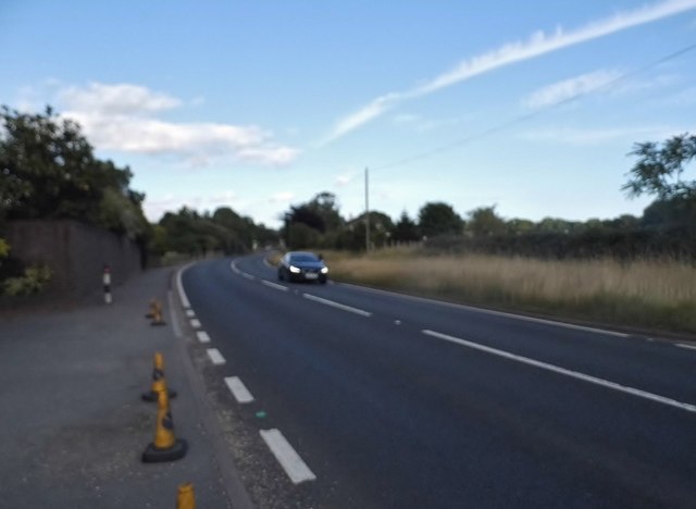
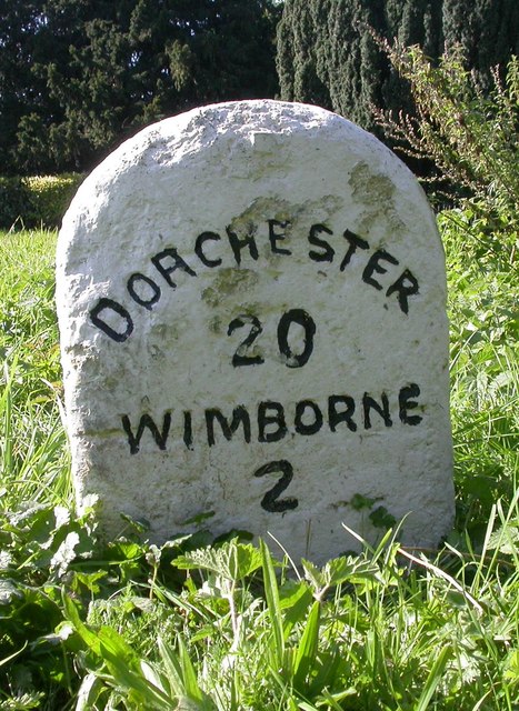
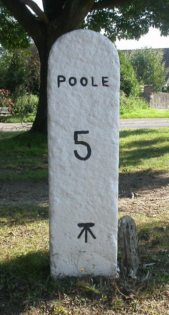
Images are sourced within 2km of 50.770635/-2.0368895 or Grid Reference SY9796. Thanks to Geograph Open Source API. All images are credited.

Ford At Corfe Mullen The ford at Corfe Mullen is secured by a locked pair of gates.
Ford At Corfe Mullen
The ford at Corfe Mullen is secured by a locked pair of gates.
Remains of the Somerset & Dorset Joint Railway The site of Corfe Mullen Junction, with some old crossing gates and an (extended) crossing keeper / signalman's house.
Remains of the Somerset & Dorset Joint Railway
The site of Corfe Mullen Junction, with some old crossing gates and an (extended) crossing keeper / signalman's house.
Holme Bush Inn
Holme Bush Inn
Corfe Mullen, Rushall Lane Lane from Blandford Road North to Corfe Mullen; plantation, left, and properties and grazing land, right.
Corfe Mullen, Rushall Lane
Lane from Blandford Road North to Corfe Mullen; plantation, left, and properties and grazing land, right.
Corfe Mullen, plantation Stony Down Plantation - conifers with a little hardwood.
Corfe Mullen, plantation
Stony Down Plantation - conifers with a little hardwood.
Corfe Mullen, bridleway Bridleway and access road, from Rushall Lane to Upton Heath.
Corfe Mullen, bridleway
Bridleway and access road, from Rushall Lane to Upton Heath.
Corfe Mullen, crossroads Jubilee Cross - looking from Rushall Lane to Wimborne Road; left and right, Blandford Road North.
Corfe Mullen, crossroads
Jubilee Cross - looking from Rushall Lane to Wimborne Road; left and right, Blandford Road North.
Corfe Mullen, timber Softwood logs awaiting collection in Stony Down Plantation.
Corfe Mullen, timber
Softwood logs awaiting collection in Stony Down Plantation.
Corfe Mullen, bridleway Across Stony Down Plantation, from Rushall Lane to Old Market Road.
Corfe Mullen, bridleway
Across Stony Down Plantation, from Rushall Lane to Old Market Road.
Corfe Mullen, plantation Stony Down Plantation - conifers with patches of hardwood.
Corfe Mullen, plantation
Stony Down Plantation - conifers with patches of hardwood.
Corfe Mullen, track junction From camera and ahead, the bridleway to Old Market Road; left and right, tracks belonging to a local camping business. Upgrading of the tracks seems to have caused local controversy: <span class="nowrap"><a title="https://susanjefferies.mycouncillor.org.uk/2015/10/16/stoney-down-plantation/" rel="nofollow ugc noopener" href="https://susanjefferies.mycouncillor.org.uk/2015/10/16/stoney-down-plantation/">Link</a><img style="margin-left:2px;" alt="External link" title="External link - shift click to open in new window" src="https://s1.geograph.org.uk/img/external.png" width="10" height="10"/></span>
Corfe Mullen, track junction
From camera and ahead, the bridleway to Old Market Road; left and right, tracks belonging to a local camping business. Upgrading of the tracks seems to have caused local controversy: LinkExternal link
Corfe Mullen, power lines Crossing Stony Down Plantation.
Corfe Mullen, power lines
Crossing Stony Down Plantation.
Corfe Mullen, bridleway Through Stony Down Plantation, from Rushall Lane to Old Market Road.
Corfe Mullen, bridleway
Through Stony Down Plantation, from Rushall Lane to Old Market Road.
Layby on the A31, Sleight
Mill Street, Corfe Mullen
Old Milestone by the A31, north west of Sleight Stone post (plate lost) by the A31, in parish of CORFE MULLEN (EAST DORSET District), grass area opposite St Huberts church, just inside safety barrier, on South side of road. Dorset 2 (limestone), erected by the Puddletown & Wimborne turnpike trust in the 19th century. 

Inscription reads:-
DORCHESTER
20
WIMBORNE
2  

Milestone Society National ID: DO_DOWB20
Old Milestone by the A31, north west of Sleight
Stone post (plate lost) by the A31, in parish of CORFE MULLEN (EAST DORSET District), grass area opposite St Huberts church, just inside safety barrier, on South side of road. Dorset 2 (limestone), erected by the Puddletown & Wimborne turnpike trust in the 19th century. Inscription reads:- DORCHESTER 20 WIMBORNE 2 Milestone Society National ID: DO_DOWB20
Old Milestone by the B3074, Corfe Mullen Carved stone post by the B3074, in parish of CORFE MULLEN (EAST DORSET District), Blandford Road, Corfe Mullen, at junction of Wimborne Rd and B3074 by Lockyers Middle School, on East side of road. Dorset 2 (limestone), erected by the Blandford & Poole turnpike trust in the 19th century. 

Inscription reads:-
POOLE
5   
Carved benchmark front lower centre.  

Milestone Society National ID: DO_POBFA05
Old Milestone by the B3074, Corfe Mullen
Carved stone post by the B3074, in parish of CORFE MULLEN (EAST DORSET District), Blandford Road, Corfe Mullen, at junction of Wimborne Rd and B3074 by Lockyers Middle School, on East side of road. Dorset 2 (limestone), erected by the Blandford & Poole turnpike trust in the 19th century. Inscription reads:- POOLE 5 Carved benchmark front lower centre. Milestone Society National ID: DO_POBFA05
Show me another place!

Spur Copse is located at Grid Ref: SY9796 (Lat: 50.770635, Lng: -2.0368895)

Unitary Authority: Dorset

Police Authority: Dorset

What 3 Words

///messaging.rinsed.passion. Near Broadstone, Dorset

Related Wikis

Castle Court School

Castle Court School is a co-educational, preparatory school located near the village of Corfe Mullen in the county of Dorset, England. == Location == Castle...

Stoney Down

Stoney Down or Stony Down is both a hill and an area of forested countryside in the county of Dorset, England, that has been designated an "Area of Great...

Corfe Mullen

Corfe Mullen is a village in Dorset, England, on the north-western urban fringe of the South East Dorset conurbation. The community had a population of...

St. Hubert's Church, Corfe Mullen

St Hubert's Church is a 13th-century Church of England parish church in Corfe Mullen, a district of Wimborne, in the ceremonial county of Dorset, on the...

Nearby Amenities

Located within 500m of 50.770635,-2.0368895
Power: tower
Source: bing
Lat/Long: 50.7670865/-2.0406568
Power: tower
Source: bing
Lat/Long: 50.7687687/-2.0413312
Power: tower
Source: bing
Lat/Long: 50.7703129/-2.0420045
Power: tower
Source: bing
Lat/Long: 50.7712363/-2.0424009
Power: tower
Source: bing
Lat/Long: 50.7728012/-2.0430442
Material: wood
Power: pole
Ref: 5
Source: bing
Source Ref: interpolation
Lat/Long: 50.7669581/-2.034108
Material: wood
Power: pole
Source: bing
Lat/Long: 50.7670119/-2.0409309
Material: wood
Power: pole
Source: bing
Lat/Long: 50.7670045/-2.0331664
Material: wood
Power: pole
Source: bing
Lat/Long: 50.7670938/-2.0399246
Material: wood
Poles: bipole
Power: pole
Ref: 7
Source: survey
Source Ref: survey
Lat/Long: 50.7671461/-2.0374941
Material: wood
Power: pole
Ref: 6
Source: bing
Source Ref: interpolation
Lat/Long: 50.7672066/-2.0352717
Material: wood
Power: pole
Source: bing
Lat/Long: 50.7672651/-2.0404476
Material: wood
Power: pole
Source: bing
Lat/Long: 50.7673865/-2.0405054
Material: wood
Power: pole
Source: bing
Lat/Long: 50.7677846/-2.0335958
Material: wood
Power: pole
Source: bing
Lat/Long: 50.7681701/-2.0425385
Material: wood
Power: pole
Source: bing
Lat/Long: 50.7681812/-2.0423534
Material: wood
Power: pole
Source: bing
Lat/Long: 50.7683977/-2.0430006
Material: wood
Power: pole
Source: bing
Lat/Long: 50.7685754/-2.0340055
Material: wood
Power: pole
Source: bing
Lat/Long: 50.7690862/-2.0342802
Material: wood
Power: pole
Source: bing
Lat/Long: 50.7691401/-2.0389187
Material: wood
Power: pole
Source: bing
Lat/Long: 50.7694968/-2.0380089
Material: wood
Power: pole
Source: bing
Lat/Long: 50.76983/-2.0370299
Material: wood
Power: pole
Source: survey
Lat/Long: 50.7698608/-2.0346918
Material: wood
Power: pole
Source: survey
Lat/Long: 50.7705936/-2.0350906
Material: wood
Power: pole
Source: bing
Lat/Long: 50.7709389/-2.033933
Material: wood
Power: pole
Source: bing
Lat/Long: 50.7713454/-2.0354998
Material: wood
Power: pole
Source: bing
Lat/Long: 50.7720687/-2.0358986
Material: wood
Power: pole
Source: bing
Lat/Long: 50.7728019/-2.0362839
Material: wood
Power: pole
Source: bing
Lat/Long: 50.7742471/-2.0379626
Material: wood
Power: pole
Source: bing
Lat/Long: 50.7746677/-2.0384521
Power: pole
Lat/Long: 50.7677134/-2.0414668
Power: pole
Lat/Long: 50.7677744/-2.0413676
Camera Direction: 124
Camera Mount: wall
Camera Type: fixed
Height: 3
Man Made: surveillance
Surveillance: public
Surveillance Type: camera
Lat/Long: 50.770259/-2.0311287
Camera Direction: 335
Camera Mount: wall
Camera Type: fixed
Height: 3
Man Made: surveillance
Surveillance: public
Surveillance Type: camera
Lat/Long: 50.7702126/-2.0310727
Atkins Cross
Information: guidepost
Ref: 978968
Source: survey
Tourism: information
Lat/Long: 50.7710577/-2.0320322
Power: pole
Source: bing
Lat/Long: 50.7733722/-2.0369098
Power: pole
Source: bing
Lat/Long: 50.7738065/-2.0374368
Power: pole
Source: bing
Lat/Long: 50.7733197/-2.0324841
Power: pole
Source: bing
Lat/Long: 50.7730991/-2.0341605
Power: pole
Source: survey
Transformer: distribution
Voltage Primary: 11000
Voltage Secondary: 460
Voltage Tertiary: 230
Lat/Long: 50.7712825/-2.032814
Power: pole
Source: survey
Transformer: distribution
Lat/Long: 50.7668456/-2.0359308
The data included in this document is from www.openstreetmap.org. The data is made available under ODbL.

Have you been to Spur Copse?

Leave your review of Spur Copse below (or comments, questions and feedback).