Cherrett's Clump

Wood, Forest in Dorset

England

Cherrett's Clump

Holme Bush Inn
Holme Bush Inn Credit: Barry Shimmon

Cherrett's Clump is a scenic woodland area situated in the county of Dorset, England. Located near the village of Sturminster Marshall, this charming forest is a haven for nature enthusiasts and those seeking tranquility amidst the picturesque countryside.

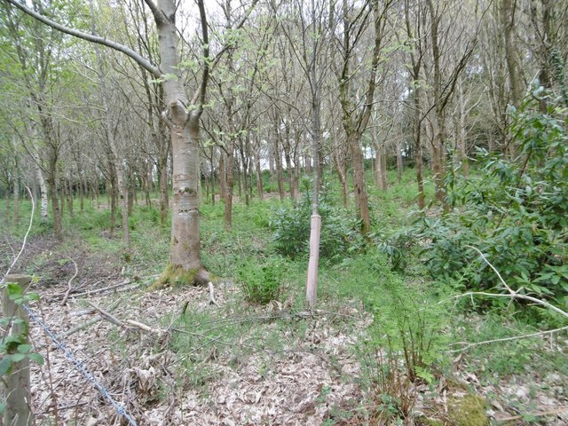
Covering an area of approximately 15 hectares, Cherrett's Clump is predominantly composed of mature broadleaf trees, including oak, beech, and ash. These trees create a dense canopy, providing shade and shelter for a wide variety of flora and fauna. The forest floor is adorned with a rich carpet of bluebells during the springtime, adding to the beauty of the landscape.

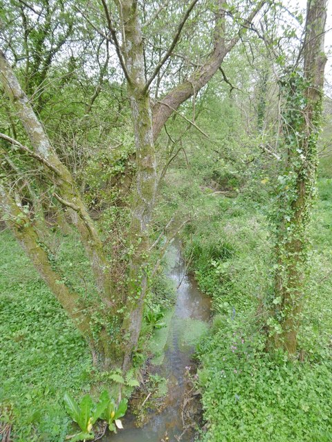
The clump is intersected by several well-maintained footpaths, allowing visitors to explore the woodland at their leisure. These paths lead to secluded clearings, where visitors can relax and enjoy a picnic surrounded by the sounds of nature. There is also a small stream that meanders through the forest, enhancing the tranquility of the area.

Cherrett's Clump is not only home to a diverse range of plant life but also provides a habitat for numerous animal species. Birdwatchers can spot various woodland birds such as woodpeckers, jays, and buzzards, while lucky visitors might even catch a glimpse of deer or foxes.

Managed by a local conservation group, the woodland is well-preserved and cared for. The group organizes regular events, including guided walks and educational programs, to promote the appreciation and understanding of this natural gem.

Overall, Cherrett's Clump offers a serene and enchanting escape from the hustle and bustle of modern life, inviting visitors to immerse themselves in the beauty of Dorset's woodlands.

If you have any feedback on the listing, please let us know in the comments section below.

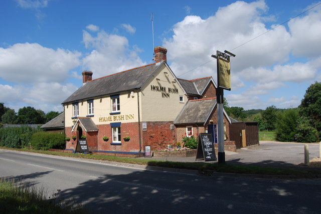
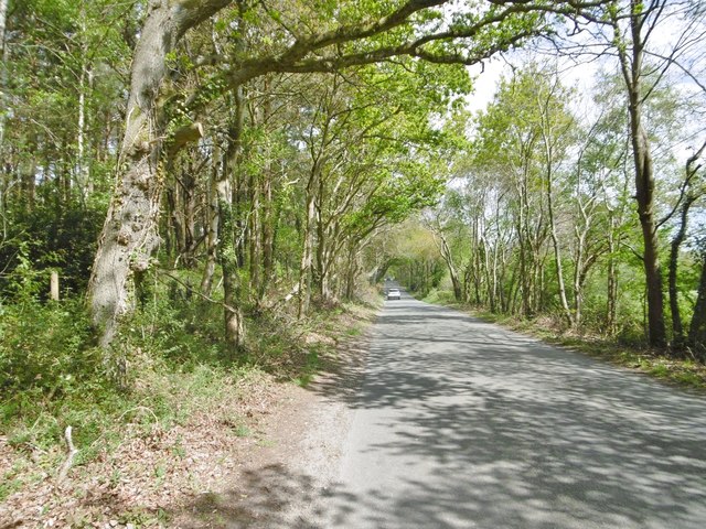
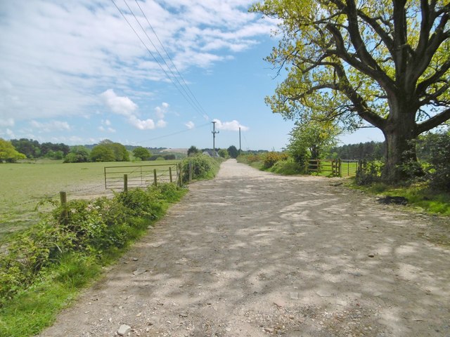
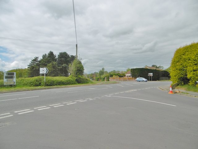
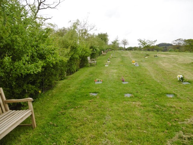
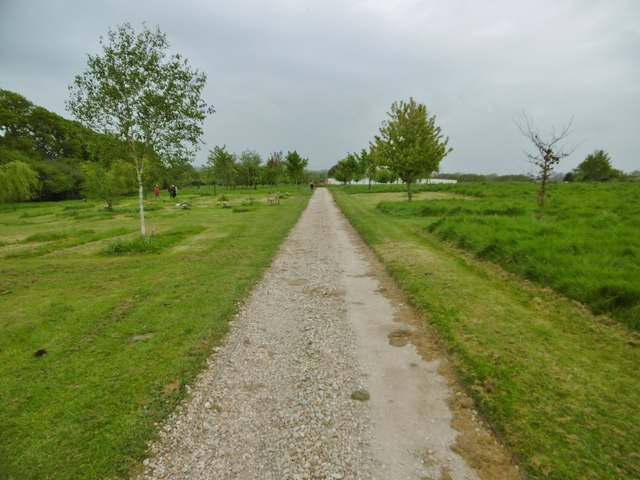
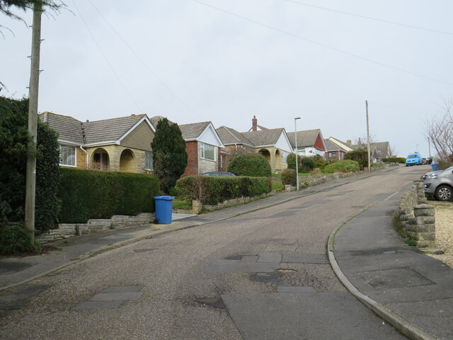
Cherrett's Clump Images

Images are sourced within 2km of 50.764268/-2.037012 or Grid Reference SY9796. Thanks to Geograph Open Source API. All images are credited.

Holme Bush Inn
Holme Bush Inn
Corfe Mullen, Rushall Lane Lane from Blandford Road North to Corfe Mullen; plantation, left, and properties and grazing land, right.
Corfe Mullen, Rushall Lane
Lane from Blandford Road North to Corfe Mullen; plantation, left, and properties and grazing land, right.
Corfe Mullen, plantation Stony Down Plantation - conifers with a little hardwood.
Corfe Mullen, plantation
Stony Down Plantation - conifers with a little hardwood.
Corfe Mullen, bridleway Bridleway and access road, from Rushall Lane to Upton Heath.
Corfe Mullen, bridleway
Bridleway and access road, from Rushall Lane to Upton Heath.
Corfe Mullen, crossroads Jubilee Cross - looking from Rushall Lane to Wimborne Road; left and right, Blandford Road North.
Corfe Mullen, crossroads
Jubilee Cross - looking from Rushall Lane to Wimborne Road; left and right, Blandford Road North.
Corfe Mullen, timber Softwood logs awaiting collection in Stony Down Plantation.
Corfe Mullen, timber
Softwood logs awaiting collection in Stony Down Plantation.
Corfe Mullen, bridleway Across Stony Down Plantation, from Rushall Lane to Old Market Road.
Corfe Mullen, bridleway
Across Stony Down Plantation, from Rushall Lane to Old Market Road.
Corfe Mullen, plantation Stony Down Plantation - conifers with patches of hardwood.
Corfe Mullen, plantation
Stony Down Plantation - conifers with patches of hardwood.
Corfe Mullen, track junction From camera and ahead, the bridleway to Old Market Road; left and right, tracks belonging to a local camping business. Upgrading of the tracks seems to have caused local controversy: <span class="nowrap"><a title="https://susanjefferies.mycouncillor.org.uk/2015/10/16/stoney-down-plantation/" rel="nofollow ugc noopener" href="https://susanjefferies.mycouncillor.org.uk/2015/10/16/stoney-down-plantation/">Link</a><img style="margin-left:2px;" alt="External link" title="External link - shift click to open in new window" src="https://s1.geograph.org.uk/img/external.png" width="10" height="10"/></span>
Corfe Mullen, track junction
From camera and ahead, the bridleway to Old Market Road; left and right, tracks belonging to a local camping business. Upgrading of the tracks seems to have caused local controversy: LinkExternal link
Corfe Mullen, power lines Crossing Stony Down Plantation.
Corfe Mullen, power lines
Crossing Stony Down Plantation.
Corfe Mullen, bridleway Through Stony Down Plantation, from Rushall Lane to Old Market Road.
Corfe Mullen, bridleway
Through Stony Down Plantation, from Rushall Lane to Old Market Road.
Lytchett Heath, St. Aldhelm's Late C19 church, now apparently disused - there is no church board, though the churchyard appears tended.
Lytchett Heath, St. Aldhelm's
Late C19 church, now apparently disused - there is no church board, though the churchyard appears tended.
Lytchett Heath, lych gate At the entrance to <a href="https://www.geograph.org.uk/photo/5370269">SY9694 : Lytchett Heath, St. Aldhelm's</a>.
Lytchett Heath, lych gate
Lytchett Heath, spinney Immature trees on the lane to Huntinck Road.
Lytchett Heath, spinney
Immature trees on the lane to Huntinck Road.
Lytchett Minster, Pit Bottom A shallow valley with stream that drains into Sherford River; looking downstream.
Lytchett Minster, Pit Bottom
A shallow valley with stream that drains into Sherford River; looking downstream.
Lytchett Minster, burial ground Harbour View Woodland Burial Ground, on Randalls Hill on the site of Randall's Farm: <span class="nowrap"><a title="http://www.tapperfuneralservice.co.uk/harbour-view/" rel="nofollow ugc noopener" href="http://www.tapperfuneralservice.co.uk/harbour-view/">Link</a><img style="margin-left:2px;" alt="External link" title="External link - shift click to open in new window" src="https://s1.geograph.org.uk/img/external.png" width="10" height="10"/></span>
Lytchett Minster, burial ground
Harbour View Woodland Burial Ground, on Randalls Hill on the site of Randall's Farm: LinkExternal link
Lytchett Minster, path At Harbour View Burial Ground: <span class="nowrap"><a title="http://www.tapperfuneralservice.co.uk/harbour-view/" rel="nofollow ugc noopener" href="http://www.tapperfuneralservice.co.uk/harbour-view/">Link</a><img style="margin-left:2px;" alt="External link" title="External link - shift click to open in new window" src="https://s1.geograph.org.uk/img/external.png" width="10" height="10"/></span>
Lytchett Minster, path
At Harbour View Burial Ground: LinkExternal link
Sutherland Avenue, Broadstone Sutherland Avenue is a residential road in Broadstone, on the outskirts of Poole.
Sutherland Avenue, Broadstone
Sutherland Avenue is a residential road in Broadstone, on the outskirts of Poole.
Show me another place!

Cherrett's Clump is located at Grid Ref: SY9796 (Lat: 50.764268, Lng: -2.037012)

Unitary Authority: Dorset

Police Authority: Dorset

What 3 Words

///taken.braced.meaty. Near Broadstone, Dorset

Related Wikis

Stoney Down

Stoney Down or Stony Down is both a hill and an area of forested countryside in the county of Dorset, England, that has been designated an "Area of Great...

Castle Court School

Castle Court School is a co-educational, preparatory school located near the village of Corfe Mullen in the county of Dorset, England. == Location == Castle...

Beacon Hill, Dorset

Beacon Hill is one of the highest viewpoints in the hinterland of Poole Harbour, Dorset. Its tree-covered summit reaches 84 metres (276 ft) above sea level...

Corfe Mullen

Corfe Mullen is a village in Dorset, England, on the north-western urban fringe of the South East Dorset conurbation. The community had a population of...

Cogdean Hundred

Cogdean Hundred was a hundred in the county of Dorset, England, containing the following parishes: Canford Magna Charlton Marshall Corfe Mullen Hamworthy...

Lytchett Heath

Lytchett Heath is an area of woods and farmland on the Dorset Heaths between the villages of Lytchett Matravers, Lytchett Minster and the hamlet of Beacon...

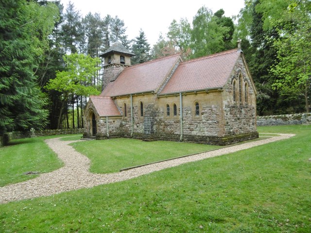
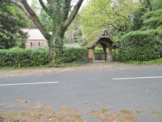
St Aldhelm's Church, Lytchett Heath

St Aldhelm's Church is a private church in Lytchett Heath, Dorset, England. It was designed by George Crickmay for Lord Eustace Cecil and built in 1898...

Upton Heath

Upton Heath is one of the largest remaining fragments of a heath that once stretched across central southern England from Dorchester to Christchurch and...

Nearby Amenities

Located within 500m of 50.764268,-2.037012
Material: wood
Power: pole
Source: bing
Lat/Long: 50.7645709/-2.0425426
Power: tower
Source: bing
Lat/Long: 50.7620503/-2.0350887
Material: wood
Power: pole
Ref: 12
Source: bing
Source Ref: interpolation
Lat/Long: 50.7622007/-2.042272
Material: wood
Poles: bipole
Power: pole
Ref: 13
Source: survey
Source Ref: survey
Lat/Long: 50.7638761/-2.0424457
Power: tower
Source: bing
Lat/Long: 50.7640766/-2.0376914
Fixme: Check how this is connected
Power: tower
Source: bing
Lat/Long: 50.7660333/-2.0401781
Material: wood
Power: pole
Source: bing
Lat/Long: 50.7661858/-2.0406947
Power: tower
Source: bing
Lat/Long: 50.7670865/-2.0406568
Material: wood
Power: pole
Source: bing
Lat/Long: 50.7626928/-2.0317267
Material: wood
Power: pole
Source: bing
Lat/Long: 50.7627946/-2.0323136
Material: wood
Power: pole
Source: bing
Lat/Long: 50.7634812/-2.0323482
Material: wood
Power: pole
Source: bing
Lat/Long: 50.7642031/-2.0323961
Material: wood
Power: pole
Source: bing
Lat/Long: 50.7649988/-2.0324452
Material: wood
Power: pole
Source: bing
Lat/Long: 50.7652382/-2.0313297
Material: wood
Power: pole
Source: bing
Lat/Long: 50.7654774/-2.0302405
Material: wood
Power: pole
Source: bing
Lat/Long: 50.7657721/-2.0324962
Material: wood
Power: pole
Source: bing
Lat/Long: 50.766362/-2.0328353
Material: wood
Power: pole
Ref: 4
Source: bing
Source Ref: interpolation
Lat/Long: 50.7664751/-2.031527
Material: wood
Power: pole
Source: bing
Lat/Long: 50.7669718/-2.0410513
Material: wood
Power: pole
Ref: 5
Source: bing
Source Ref: interpolation
Lat/Long: 50.7669581/-2.034108
Material: wood
Power: pole
Source: bing
Lat/Long: 50.7670119/-2.0409309
Material: wood
Power: pole
Source: bing
Lat/Long: 50.7670045/-2.0331664
Material: wood
Power: pole
Source: bing
Lat/Long: 50.7670938/-2.0399246
Material: wood
Poles: bipole
Power: pole
Ref: 7
Source: survey
Source Ref: survey
Lat/Long: 50.7671461/-2.0374941
Material: wood
Power: pole
Ref: 6
Source: bing
Source Ref: interpolation
Lat/Long: 50.7672066/-2.0352717
Material: wood
Power: pole
Source: bing
Lat/Long: 50.7672651/-2.0404476
Material: wood
Power: pole
Source: bing
Lat/Long: 50.7673865/-2.0405054
Material: wood
Power: pole
Source: bing
Lat/Long: 50.7677846/-2.0335958
Power: pole
Lat/Long: 50.7677134/-2.0414668
Power: pole
Lat/Long: 50.7677744/-2.0413676
Material: wood
Power: pole
Lat/Long: 50.7604233/-2.0352602
Material: wood
Power: pole
Lat/Long: 50.7598668/-2.0371002
Power: pole
Source: survey
Transformer: distribution
Lat/Long: 50.7668456/-2.0359308
The data included in this document is from www.openstreetmap.org. The data is made available under ODbL.

Have you been to Cherrett's Clump?

Leave your review of Cherrett's Clump below (or comments, questions and feedback).