Atwell's Copse

Wood, Forest in Dorset

England

Atwell's Copse

Ford At Corfe Mullen The ford at Corfe Mullen is secured by a locked pair of gates.
Ford At Corfe Mullen Credit: John Walton

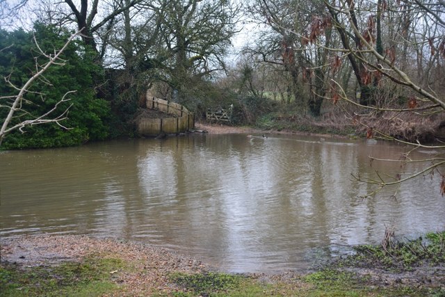
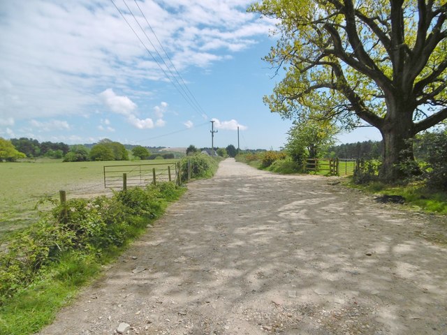
Atwell's Copse is a picturesque woodland located in the county of Dorset, England. Covering an area of approximately 20 acres, the copse is situated in the small village of Atwell, near the town of Wareham. It is known for its natural beauty and tranquil atmosphere, making it a popular destination for nature lovers and hikers.

The copse is predominantly composed of broadleaf trees, such as oak, beech, and ash, which create a dense canopy, providing shade and shelter to the diverse flora and fauna that inhabit the area. Bluebells, primroses, and wild garlic carpet the forest floor during the spring months, creating a stunning display of colors.

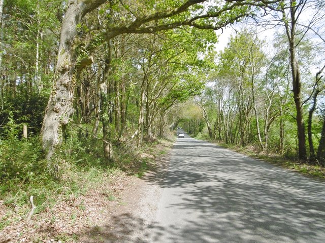
Several footpaths meander through the copse, allowing visitors to explore its enchanting landscapes. These paths are well-maintained and offer varying levels of difficulty, catering to both casual strollers and more experienced hikers. Along the routes, one can discover ancient trees, moss-covered rocks, and babbling brooks, adding to the overall charm of the woodland.

Atwell's Copse is also home to a rich array of wildlife. Birdwatchers can spot species such as woodpeckers, tawny owls, and song thrushes, while lucky visitors may even catch a glimpse of deer, foxes, and badgers.

The copse is open to the public year-round, and there is no entry fee. It is advised to wear appropriate footwear and bring a camera to capture the natural beauty of Atwell's Copse. Whether seeking solace in nature or embarking on an outdoor adventure, this woodland sanctuary offers a delightful experience for all who visit.

If you have any feedback on the listing, please let us know in the comments section below.

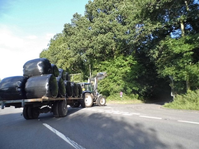
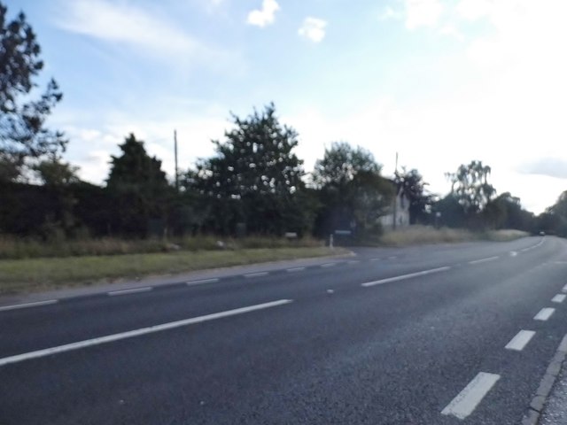
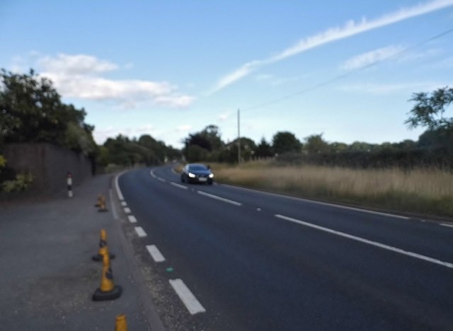
Atwell's Copse Images

Images are sourced within 2km of 50.772272/-2.0345792 or Grid Reference SY9796. Thanks to Geograph Open Source API. All images are credited.

Ford At Corfe Mullen The ford at Corfe Mullen is secured by a locked pair of gates.
Ford At Corfe Mullen
The ford at Corfe Mullen is secured by a locked pair of gates.
Remains of the Somerset & Dorset Joint Railway The site of Corfe Mullen Junction, with some old crossing gates and an (extended) crossing keeper / signalman's house.
Remains of the Somerset & Dorset Joint Railway
The site of Corfe Mullen Junction, with some old crossing gates and an (extended) crossing keeper / signalman's house.
Holme Bush Inn
Holme Bush Inn
Corfe Mullen, Rushall Lane Lane from Blandford Road North to Corfe Mullen; plantation, left, and properties and grazing land, right.
Corfe Mullen, Rushall Lane
Lane from Blandford Road North to Corfe Mullen; plantation, left, and properties and grazing land, right.
Corfe Mullen, plantation Stony Down Plantation - conifers with a little hardwood.
Corfe Mullen, plantation
Stony Down Plantation - conifers with a little hardwood.
Corfe Mullen, bridleway Bridleway and access road, from Rushall Lane to Upton Heath.
Corfe Mullen, bridleway
Bridleway and access road, from Rushall Lane to Upton Heath.
Corfe Mullen, crossroads Jubilee Cross - looking from Rushall Lane to Wimborne Road; left and right, Blandford Road North.
Corfe Mullen, crossroads
Jubilee Cross - looking from Rushall Lane to Wimborne Road; left and right, Blandford Road North.
Corfe Mullen, timber Softwood logs awaiting collection in Stony Down Plantation.
Corfe Mullen, timber
Softwood logs awaiting collection in Stony Down Plantation.
Corfe Mullen, bridleway Across Stony Down Plantation, from Rushall Lane to Old Market Road.
Corfe Mullen, bridleway
Across Stony Down Plantation, from Rushall Lane to Old Market Road.
Corfe Mullen, plantation Stony Down Plantation - conifers with patches of hardwood.
Corfe Mullen, plantation
Stony Down Plantation - conifers with patches of hardwood.
Corfe Mullen, track junction From camera and ahead, the bridleway to Old Market Road; left and right, tracks belonging to a local camping business. Upgrading of the tracks seems to have caused local controversy: <span class="nowrap"><a title="https://susanjefferies.mycouncillor.org.uk/2015/10/16/stoney-down-plantation/" rel="nofollow ugc noopener" href="https://susanjefferies.mycouncillor.org.uk/2015/10/16/stoney-down-plantation/">Link</a><img style="margin-left:2px;" alt="External link" title="External link - shift click to open in new window" src="https://s1.geograph.org.uk/img/external.png" width="10" height="10"/></span>
Corfe Mullen, track junction
From camera and ahead, the bridleway to Old Market Road; left and right, tracks belonging to a local camping business. Upgrading of the tracks seems to have caused local controversy: LinkExternal link
Corfe Mullen, power lines Crossing Stony Down Plantation.
Corfe Mullen, power lines
Crossing Stony Down Plantation.
Corfe Mullen, bridleway Through Stony Down Plantation, from Rushall Lane to Old Market Road.
Corfe Mullen, bridleway
Through Stony Down Plantation, from Rushall Lane to Old Market Road.
Layby on the A31, Sleight
Bale carrier on the A31, Sleight
Mill Street, Corfe Mullen
Show me another place!

Atwell's Copse is located at Grid Ref: SY9796 (Lat: 50.772272, Lng: -2.0345792)

Unitary Authority: Dorset

Police Authority: Dorset

What 3 Words

///remember.signed.lends. Near Broadstone, Dorset

Related Wikis

Castle Court School

Castle Court School is a co-educational, preparatory school located near the village of Corfe Mullen in the county of Dorset, England. == Location == Castle...

Stoney Down

Stoney Down or Stony Down is both a hill and an area of forested countryside in the county of Dorset, England, that has been designated an "Area of Great...

Corfe Mullen

Corfe Mullen is a village in Dorset, England, on the north-western urban fringe of the South East Dorset conurbation. The community had a population of...

St. Hubert's Church, Corfe Mullen

St Hubert's Church is a 13th-century Church of England parish church in Corfe Mullen, a district of Wimborne, in the ceremonial county of Dorset, on the...

Cogdean Hundred

Cogdean Hundred was a hundred in the county of Dorset, England, containing the following parishes: Canford Magna Charlton Marshall Corfe Mullen Hamworthy...

Corfe Hills School

Corfe Hills School is a co-educational upper school in Broadstone, Poole, Dorset, England, in the urban fringe between Poole and Wimborne. The school became...

Beacon Hill, Dorset

Beacon Hill is one of the highest viewpoints in the hinterland of Poole Harbour, Dorset. Its tree-covered summit reaches 84 metres (276 ft) above sea level...

Henbury, Dorset

Henbury is a hamlet in the civil parish of Sturminster Marshall in Dorset, England. It lies on the A31 road. Henbury House is a classical Georgian house...

Nearby Amenities

Located within 500m of 50.772272,-2.0345792
Material: wood
Power: pole
Source: bing
Lat/Long: 50.7685754/-2.0340055
Material: wood
Power: pole
Source: bing
Lat/Long: 50.7690862/-2.0342802
Material: wood
Power: pole
Source: bing
Lat/Long: 50.7691401/-2.0389187
Material: wood
Power: pole
Source: bing
Lat/Long: 50.7694968/-2.0380089
Material: wood
Power: pole
Source: bing
Lat/Long: 50.76983/-2.0370299
Material: wood
Power: pole
Source: survey
Lat/Long: 50.7698608/-2.0346918
Material: wood
Power: pole
Source: survey
Lat/Long: 50.7705936/-2.0350906
Material: wood
Power: pole
Source: bing
Lat/Long: 50.7709389/-2.033933
Material: wood
Power: pole
Source: bing
Lat/Long: 50.7713454/-2.0354998
Material: wood
Power: pole
Source: bing
Lat/Long: 50.7720687/-2.0358986
Material: wood
Power: pole
Source: bing
Lat/Long: 50.7728019/-2.0362839
Material: wood
Power: pole
Source: bing
Lat/Long: 50.7742471/-2.0379626
Material: wood
Power: pole
Source: bing
Lat/Long: 50.7746677/-2.0384521
Material: wood
Power: pole
Source: bing
Lat/Long: 50.7753104/-2.039197
Camera Direction: 124
Camera Mount: wall
Camera Type: fixed
Height: 3
Man Made: surveillance
Surveillance: public
Surveillance Type: camera
Lat/Long: 50.770259/-2.0311287
Camera Direction: 335
Camera Mount: wall
Camera Type: fixed
Height: 3
Man Made: surveillance
Surveillance: public
Surveillance Type: camera
Lat/Long: 50.7702126/-2.0310727
Atkins Cross
Information: guidepost
Ref: 978968
Source: survey
Tourism: information
Lat/Long: 50.7710577/-2.0320322
Poles: bipole
Power: pole
Source: bing
Transformer: distribution
Lat/Long: 50.7745884/-2.0327899
Power: pole
Source: bing
Lat/Long: 50.7733722/-2.0369098
Power: pole
Source: bing
Lat/Long: 50.7738065/-2.0374368
Power: pole
Source: bing
Lat/Long: 50.7739065/-2.0311672
Power: pole
Source: bing
Lat/Long: 50.7745494/-2.0286244
Power: pole
Source: bing
Lat/Long: 50.7745443/-2.0298636
Power: pole
Source: bing
Lat/Long: 50.7733197/-2.0324841
Power: pole
Source: bing
Lat/Long: 50.7730991/-2.0341605
Power: pole
Source: survey
Transformer: distribution
Voltage Primary: 11000
Voltage Secondary: 460
Voltage Tertiary: 230
Lat/Long: 50.7712825/-2.032814
The data included in this document is from www.openstreetmap.org. The data is made available under ODbL.

Have you been to Atwell's Copse?

Leave your review of Atwell's Copse below (or comments, questions and feedback).