Round Wood

Wood, Forest in Northumberland

England

Round Wood

Heffers and steers Beside the path to Lee. Tynedale in the distance.
Heffers and steers Credit: Oliver Dixon

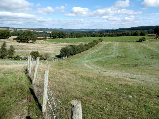
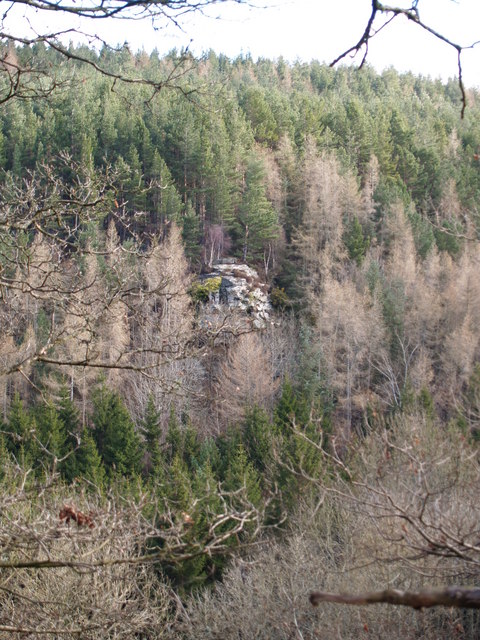
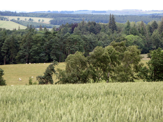
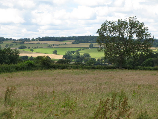
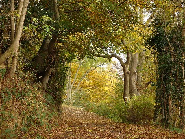
Round Wood is a picturesque forest located in Northumberland, England. Spread over a vast area, this woodland is renowned for its natural beauty and diverse wildlife. It is situated near the small village of Wood, which adds to its charm and tranquility.

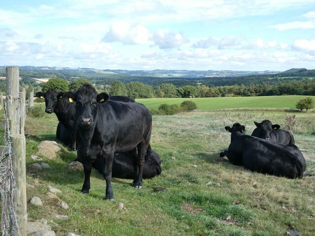
The forest is predominantly composed of native tree species such as oak, beech, and birch, creating a rich and vibrant ecosystem. The towering trees provide a haven for a wide variety of birds, including woodpeckers, songbirds, and owls. The forest floor is covered with a thick carpet of mosses, ferns, and wildflowers, adding to the enchanting atmosphere.

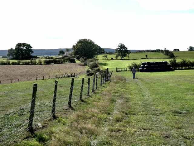
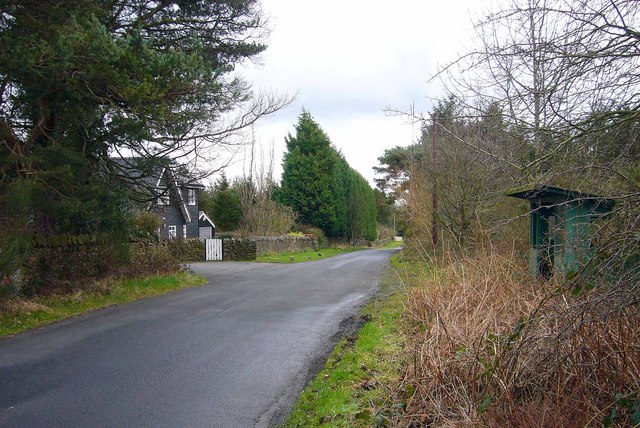
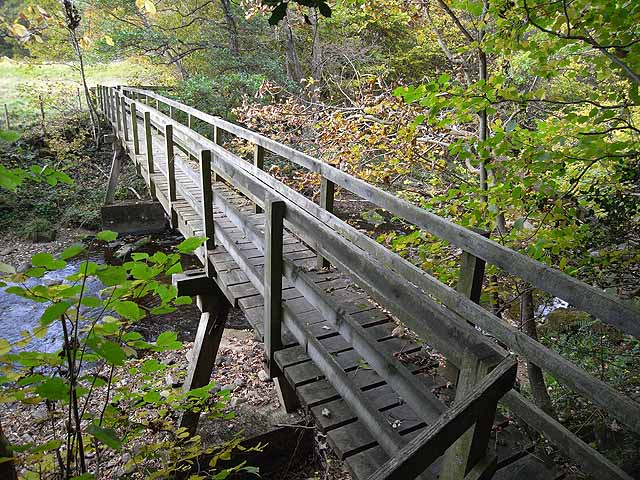
Round Wood is a popular destination for nature enthusiasts and outdoor adventurers. The forest offers numerous walking trails that meander through its dense foliage, allowing visitors to explore and immerse themselves in the natural surroundings. These trails range in difficulty, catering to both casual strollers and avid hikers.

The forest also houses a diverse range of wildlife, making it a haven for animal lovers. Deer, foxes, and rabbits can often be spotted roaming freely among the trees, while squirrels and hedgehogs scuttle about in search of food. The forest's peaceful ambiance and abundance of wildlife make it an ideal spot for photography and birdwatching.

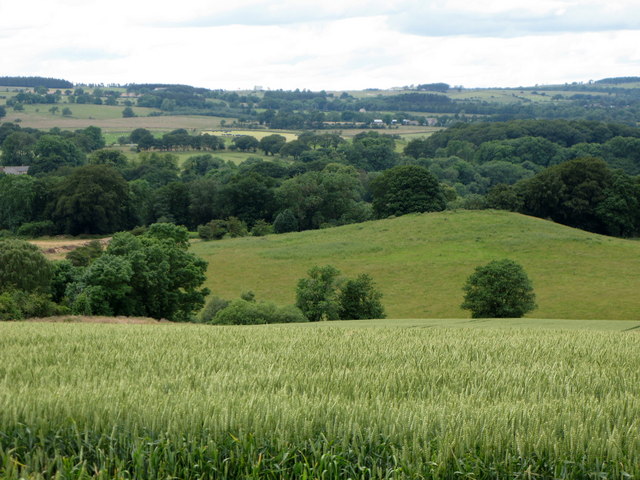
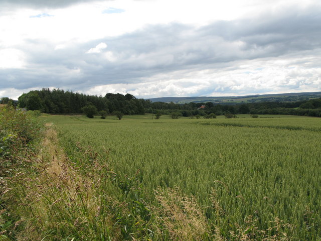
Round Wood is a cherished natural gem in Northumberland, offering visitors a chance to escape the hustle and bustle of city life and connect with nature. Its serene atmosphere, stunning landscapes, and diverse wildlife make it a must-visit destination for anyone seeking solace and tranquility in the heart of the English countryside.

If you have any feedback on the listing, please let us know in the comments section below.
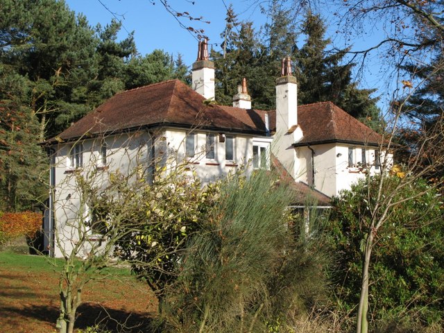
Round Wood Images

Images are sourced within 2km of 54.943029/-2.0696061 or Grid Reference NY9560. Thanks to Geograph Open Source API. All images are credited.

Heffers and steers Beside the path to Lee. Tynedale in the distance.
Heffers and steers
Beside the path to Lee. Tynedale in the distance.
The path to Lee
The path to Lee
Fields beside the path from Lee to Newbigin House Farm
Old Milestone by UC road, Ordley The Milestone is located on grass verge on the East side of the road.  Parish of Hexhamshire (Tynedale District). Metal post with attached metal plate, Smith Patterson iron shield design, erected by the Hexham turnpike trust in the 19th Century. Half of shield missing. An earlier photograph can be found here: <a title="https://www.geograph.org.uk/photo/6055942" href="https://www.geograph.org.uk/photo/6055942">Link</a> 

Inscription reads:-  
WHITLEY / CHAPEL / (2½) {arrow} / (HEXHAM) / (3) / ({arrow}) SMITH PATTERSON / BLAYDON /

Grade II listed. 
List Entry Number: 1045329 <span class="nowrap"><a title="https://historicengland.org.uk/listing/the-list/list-entry/1045329" rel="nofollow ugc noopener" href="https://historicengland.org.uk/listing/the-list/list-entry/1045329">Link</a><img style="margin-left:2px;" alt="External link" title="External link - shift click to open in new window" src="https://s1.geograph.org.uk/img/external.png" width="10" height="10"/></span> 

Milestone Society National ID: NB_HXWC03
Old Milestone by UC road, Ordley
The Milestone is located on grass verge on the East side of the road.  Parish of Hexhamshire (Tynedale District). Metal post with attached metal plate, Smith Patterson iron shield design, erected by the Hexham turnpike trust in the 19th Century. Half of shield missing. An earlier photograph can be found here: Link  Inscription reads:- WHITLEY / CHAPEL / (2½) {arrow} / (HEXHAM) / (3) / ({arrow}) SMITH PATTERSON / BLAYDON / Grade II listed. List Entry Number: 1045329 LinkExternal link Milestone Society National ID: NB_HXWC03
Dipton Crags Dipton Crags from Wooley Grange
Dipton Crags
Dipton Crags from Wooley Grange
Wooley, near Slaley This was once the site of a hospital built in 1916 for first world war gas victims, and later became a sanatorium, until its closure in 1976.
Some of the characteristic darkwood timberlap buildings survive and have been converted for residential use.
Wooley, near Slaley
This was once the site of a hospital built in 1916 for first world war gas victims, and later became a sanatorium, until its closure in 1976. Some of the characteristic darkwood timberlap buildings survive and have been converted for residential use.
Arable land, hill 150 and Wooley Wood
Arable land and woods near Hirst Hill
Arable land and woods near Linnel Hill
Fields and woods around Linnel Hill Taken from the track to The Linnel Stud in <a href="https://www.geograph.org.uk/gridref/NY9560">NY9560</a>.
Fields and woods around Linnel Hill
Taken from the track to The Linnel Stud in NY9560.
Wooley House
Wooley House
Victorian postbox in Wooley
Bus shelter and Victorian postbox in Wooley Shows the general location of <a href="https://www.geograph.org.uk/photo/738748">NY9659 : Victorian postbox in Wooley</a>. The photo was taken from the opposite side of the bus shelter from <a href="https://www.geograph.org.uk/photo/343218">NY9659 : Wooley, near Slaley</a> - the postbox can just be seen through the undergrowth on the left hand edge of this image.
Bus shelter and Victorian postbox in Wooley
Shows the general location of NY9659 : Victorian postbox in Wooley. The photo was taken from the opposite side of the bus shelter from NY9659 : Wooley, near Slaley - the postbox can just be seen through the undergrowth on the left hand edge of this image.
Ordley, near Juniper village A cluster of barn conversions.
Ordley, near Juniper village
A cluster of barn conversions.
Wooley House (2)
Wooley House (2)
Driveway to Nunsbrough House Hidden deep in the valley of the Devil's Water, this lovely driveway reminds me of a Samuel Palmer painting.
Driveway to Nunsbrough House
Hidden deep in the valley of the Devil's Water, this lovely driveway reminds me of a Samuel Palmer painting.
Linnelswood Bridge A very substantial footbridge carrying the footpath from Ordley to Dipton Wood over the Devil's Water.
Linnelswood Bridge
A very substantial footbridge carrying the footpath from Ordley to Dipton Wood over the Devil's Water.
Wooley Wood Wooley Wood in autumn colouration, seen from the far side of the Devil's Water.
Wooley Wood
Wooley Wood in autumn colouration, seen from the far side of the Devil's Water.
Show me another place!

Round Wood is located at Grid Ref: NY9560 (Lat: 54.943029, Lng: -2.0696061)

Unitary Authority: Northumberland

Police Authority: Northumbria

What 3 Words

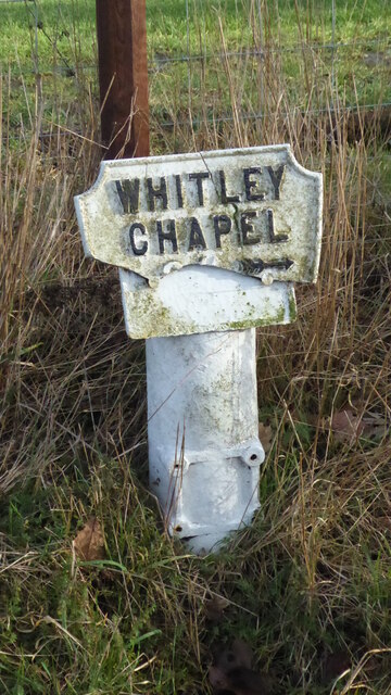
///shipwreck.cookery.families. Near Hexham, Northumberland

Related Wikis

Rowley Burn (Northumberland)

Rowley Burn (also known as Rowley Brook and Ham Burn, NY 9358) is a stream in Northumberland, running around three miles south of Hexham before joining...

Cambian Dilston College

Cambian Dilston College is a private further education college for those with special educational needs. It is located at Dilston Hall in Corbridge in...

Dilston Castle

Dilston Castle is an unglazed 15th-century uninhabited tower house (and inactive Catholic chapel built for one family's services) at Dilston in the parish...

Hexhamshire Low Quarter

Hexhamshire Low Quarter is a former civil parish, now in the parish of Hexhamshire, in Northumberland, England. It was situated to the south of Hexham...

Juniper, Northumberland

Juniper is a hamlet in the English county of Northumberland. It is about 5 miles (8 km) due south of Hexham in the area known as Hexhamshire. There is...

Hexham General Hospital

Hexham General Hospital is an acute general hospital in Hexham, Northumberland, England. It is managed by the Northumbria Healthcare NHS Foundation Trust...

Battle of Hexham

The Battle of Hexham, 15 May 1464, marked the end of significant Lancastrian resistance in the north of England during the early part of the reign of Edward...

St Mary's Church, Hexham

St Mary's Church is a Roman Catholic Parish church in Hexham, Northumberland. It was built from 1828 to 1830 in the Gothic Revival style. It is located...
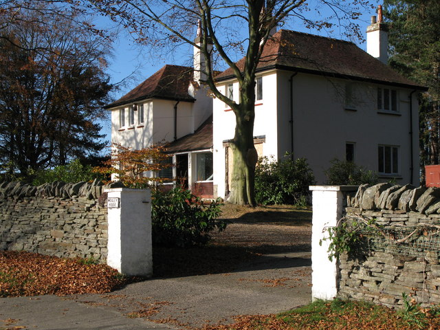
Nearby Amenities

Located within 500m of 54.943029,-2.0696061
Battle of Hexham (AD 1464)
Date: 1463
Historic: battlefield
Source: NPE
Lat/Long: 54.9430429/-2.0745867
Cafe
Hollybush Nursery
Addr City: Hexham
Addr County: Northumberland
Addr Postcode: NE46 1UD
Cuisine: coffee_shop
Fhrs Id: 285748
Lat/Long: 54.9439367/-2.0630846
The data included in this document is from www.openstreetmap.org. The data is made available under ODbL.

Have you been to Round Wood?

Leave your review of Round Wood below (or comments, questions and feedback).