Tollard Clump

Wood, Forest in Wiltshire

England

Tollard Clump

Parkland east of Oakley Lane Part of Rushmore Park.
Parkland east of Oakley Lane Credit: Robin Webster

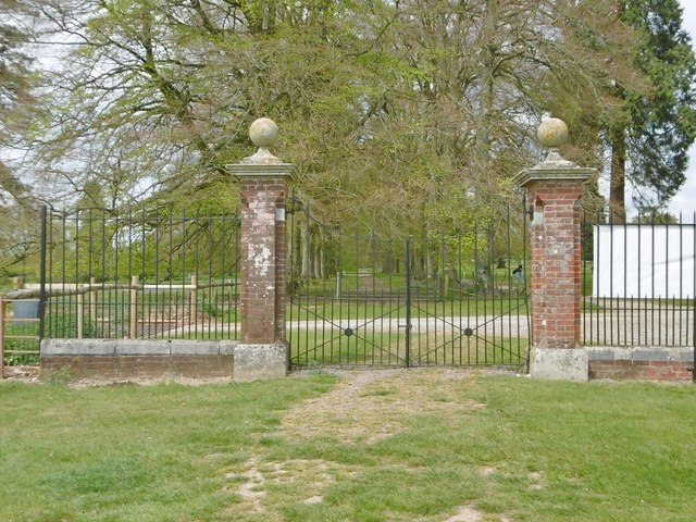
Tollard Clump, located in the county of Wiltshire, England, is a small woodland area known for its natural beauty and tranquility. Situated near the village of Tollard Royal, the clump is part of the Cranborne Chase and West Wiltshire Downs Area of Outstanding Natural Beauty.

Covering an area of approximately 20 hectares, Tollard Clump consists mainly of mixed broadleaf trees, including oak, beech, and ash. The woodland is characterized by its dense vegetation and a well-established canopy, which provides a sheltered and shaded environment for a variety of wildlife.

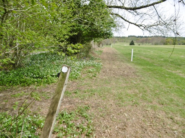
The clump offers several walking trails that wind through the forest, allowing visitors to explore the diverse flora and fauna. The paths are well-maintained and suitable for all abilities, making it a popular destination for families, nature enthusiasts, and dog walkers.

At the highest point of Tollard Clump stands a distinctive clump of beech trees, which can be seen from miles around. This iconic landmark offers breathtaking panoramic views of the surrounding countryside, including the Cranborne Chase and the distant Salisbury Plain.

Tollard Clump is also home to an array of bird species, including woodpeckers, finches, and owls, making it a haven for birdwatchers. Additionally, the woodland provides habitats for various mammals and insects, such as deer, squirrels, and butterflies.

With its peaceful atmosphere and picturesque landscapes, Tollard Clump is an idyllic spot for those seeking solace in nature or a scenic spot for a leisurely countryside walk.

If you have any feedback on the listing, please let us know in the comments section below.

Tollard Clump Images

Images are sourced within 2km of 50.961084/-2.0770666 or Grid Reference ST9417. Thanks to Geograph Open Source API. All images are credited.

Parkland east of Oakley Lane Part of Rushmore Park.
Parkland east of Oakley Lane
Part of Rushmore Park.
B3081 looking east Heading towards Sixpenny Handley.
B3081 looking east
Heading towards Sixpenny Handley.
Rushmore Park, avenue The remains of a once fine avenue of beech trees, at the southern entrance to the estate.
Rushmore Park, avenue
The remains of a once fine avenue of beech trees, at the southern entrance to the estate.
Rushmore Park, timber Beech trunks, awaiting collection by the roadside.
Rushmore Park, timber
Beech trunks, awaiting collection by the roadside.
Rushmore Park, footpath Skirting woodland, towards Shermel Gate.
Rushmore Park, footpath
Skirting woodland, towards Shermel Gate.
Rushmore Park, avenue A once fine avenue of beech trees leading from South Lodge. Several have disappeared or are in poor condition.
Rushmore Park, avenue
A once fine avenue of beech trees leading from South Lodge. Several have disappeared or are in poor condition.
Rushmore Park, platform Possibly used for watching equestrian events.
Rushmore Park, platform
Possibly used for watching equestrian events.
Rushmore Park, gate Entering Pollards Wood, on the path to Shermel Gate.
Rushmore Park, gate
Entering Pollards Wood, on the path to Shermel Gate.
Rushmore Park, footpath Through Pollards Wood, on the way to Shermel Gate; part of Hardy Way.
Rushmore Park, footpath
Through Pollards Wood, on the way to Shermel Gate; part of Hardy Way.
Rushmore Park, bluebells Wild bluebells under, unusually, a screen of conifers in Uddens Coppice.
Rushmore Park, bluebells
Wild bluebells under, unusually, a screen of conifers in Uddens Coppice.
Rushmore Park, marker On the path through Uddens Coppice towards Shermel Gate; on Hardy Way.
Rushmore Park, marker
On the path through Uddens Coppice towards Shermel Gate; on Hardy Way.
Rushmore Park, bluebell wood Wild bluebells in Brookes Coppice.
Rushmore Park, bluebell wood
Wild bluebells in Brookes Coppice.
Rushmore Park, golf course Part of an extensive 18-hole course: <span class="nowrap"><a title="http://www.rushmoregolfclub.co.uk/cms/" rel="nofollow ugc noopener" href="http://www.rushmoregolfclub.co.uk/cms/">Link</a><img style="margin-left:2px;" alt="External link" title="External link - shift click to open in new window" src="https://s1.geograph.org.uk/img/external.png" width="10" height="10"/></span>
Rushmore Park, golf course
Part of an extensive 18-hole course: LinkExternal link
Rushmore Park, dewpond Used by the local sheep.
Rushmore Park, dewpond
Used by the local sheep.
Rushmore Park, bluebells Wild bluebells next to the golf course.
Rushmore Park, bluebells
Wild bluebells next to the golf course.
Rushmore Park, golf course An extensive 18-hole course: <span class="nowrap"><a title="http://www.rushmoregolfclub.co.uk/cms/" rel="nofollow ugc noopener" href="http://www.rushmoregolfclub.co.uk/cms/">Link</a><img style="margin-left:2px;" alt="External link" title="External link - shift click to open in new window" src="https://s1.geograph.org.uk/img/external.png" width="10" height="10"/></span>
Rushmore Park, golf course
An extensive 18-hole course: LinkExternal link
Rushmore Park, gateway Also on the Wiltshire/Dorset boundary.
Rushmore Park, gateway
Also on the Wiltshire/Dorset boundary.
Rushmore Park, marker On the footpath to Shermel Gate, part of Hardy Way. Beware golf balls from the right!
Rushmore Park, marker
On the footpath to Shermel Gate, part of Hardy Way. Beware golf balls from the right!
Show me another place!

Tollard Clump is located at Grid Ref: ST9417 (Lat: 50.961084, Lng: -2.0770666)

Unitary Authority: Wiltshire

Police Authority: Wiltshire

What 3 Words

///repelled.reactions.deck. Near Ansty, Wiltshire

Related Wikis

Tollard Royal

Tollard Royal is a village and civil parish on Cranborne Chase, Wiltshire, England. The parish is on Wiltshire's southern boundary with Dorset and the...

King John's House, Tollard Royal

King John's House is a former manor house in the south Wiltshire village of Tollard Royal, England. Just south of the church, the building has at its core...

Sandroyd School

Sandroyd School is an independent co-educational preparatory school for day and boarding pupils aged 2 to 13 in the south of Wiltshire, England. The school...

South Lodge Camp

South Lodge Camp is an archaeological site of the Bronze Age, about 0.6 miles (1.0 km) south-east of the village of Tollard Royal, in Wiltshire, England...

Larmer Tree Festival

Larmer Tree Festival was a three-day music, comedy and arts festival held annually from 1990 until 2019 at the Larmer Tree Gardens, near Tollard Royal...

Larmer Tree Gardens

The Larmer Tree Gardens near Tollard Royal in south Wiltshire, England, were created by landowner Augustus Pitt Rivers in 1880 as pleasure grounds for...

Rotherley Down Settlement

Rotherley Down Settlement is an archaeological site of the late Iron Age and Romano-British period on Cranborne Chase, England. It is about 1.5 miles...

Rotherley Downs

Rotherley Downs (grid reference ST946196) is a 120.05 hectare biological Site of Special Scientific Interest in Wiltshire, England, notified in 1989. The...

Nearby Amenities

Located within 500m of 50.961084,-2.0770666
Tollard Royal
Place: village
Lat/Long: 50.9594291/-2.07987
Barrier: kissing_gate
Lat/Long: 50.9616538/-2.0810033
Crossing
Lat/Long: 50.9589478/-2.0803908
Crossing
Lat/Long: 50.9589899/-2.0792593
Material: wood
Poles: bipole
Power: pole
Source: bing
Lat/Long: 50.9611553/-2.0825506
Material: wood
Power: pole
Source: bing
Lat/Long: 50.9619113/-2.0790798
Material: wood
Power: pole
Source: bing
Lat/Long: 50.9624587/-2.0768214
Material: wood
Poles: bipole
Power: pole
Source: bing
Lat/Long: 50.9624714/-2.0822904
Material: wood
Power: pole
Source: bing
Lat/Long: 50.9627999/-2.0756654
Material: wood
Power: pole
Source: bing
Lat/Long: 50.9631547/-2.0744959
Material: wood
Power: pole
Source: bing
Lat/Long: 50.9636232/-2.0822517
Material: wood
Power: pole
Source: bing
Lat/Long: 50.9637493/-2.0738978
Material: wood
Power: pole
Source: bing
Lat/Long: 50.9643879/-2.0732728
Material: wood
Power: pole
Source: bing
Lat/Long: 50.9609714/-2.0833057
Corner Farm
Source: OS_OpenData_StreetView
Lat/Long: 50.960854/-2.0812109
Historic: memorial
Memorial: war_memorial
Lat/Long: 50.9596013/-2.0805706
Public Bookcase
Tollard Tardis
Defibrillator
Access: yes
Booth: K6
Covered: booth
Defibrillator Location: inside old red phone box in Tollard Royal
Disused Amenity: telephone
Emergency: defibrillator
Man Made: telephone_box
Public Bookcase Type: phone_box
Lat/Long: 50.9597026/-2.0807114
Post Box
Post Box Mounting: brick_pillar
Post Box Type: wall
Royal Cypher: GVIR
Royal Cypher Wikidata: Q33102169
Lat/Long: 50.9597778/-2.0805941
Bench
Lat/Long: 50.9597892/-2.0805699
The data included in this document is from www.openstreetmap.org. The data is made available under ODbL.

Have you been to Tollard Clump?

Leave your review of Tollard Clump below (or comments, questions and feedback).