The Orchard

Wood, Forest in Lancashire

England

The Orchard

Inscribed stone on the south side of Twirl Hill Road, Hartshead Inscribed stone on the south side of Twirl Hill Road. In the former Ashton under Lyne parish to 1894 and Hartshead parish from 1894 to 1974. This stone is thought to be the collection place for the northern part of the ancient parish of Ashton-under-Lyne and is situated at a place called Twirl Hill between the hamlets of Alt Hill and Hartshead, just below the local viewpoint of Hartshead Pike. The practice of paying tithes was abandoned in the 1830’s. The “Tythe Stone” inscription is thought to have been made by local man John Coulthard in 1840 to ensure its preservation. See also <span class="nowrap"><a title="http://www.marland.org/places/marlandplaces-twarlhill.htm" rel="nofollow ugc noopener" href="http://www.marland.org/places/marlandplaces-twarlhill.htm">Link</a><img style="margin-left:2px;" alt="External link" title="External link - shift click to open in new window" src="https://s1.geograph.org.uk/img/external.png" width="10" height="10"/></span>

Milestone Society National ID: LA_HARTS01cm
Inscribed stone on the south side of Twirl Hill Road, Hartshead Credit: D Garside

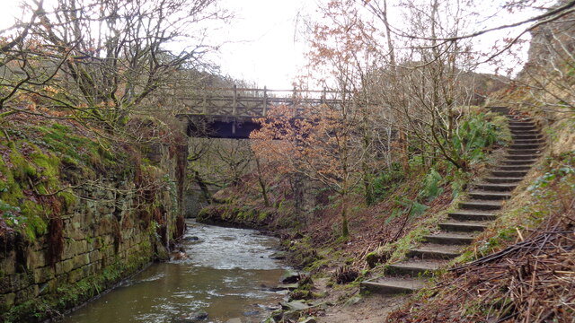
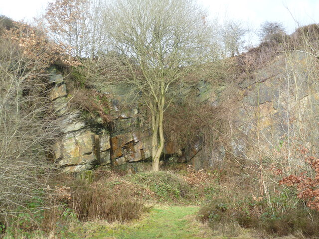
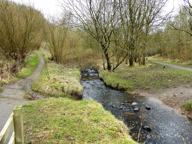
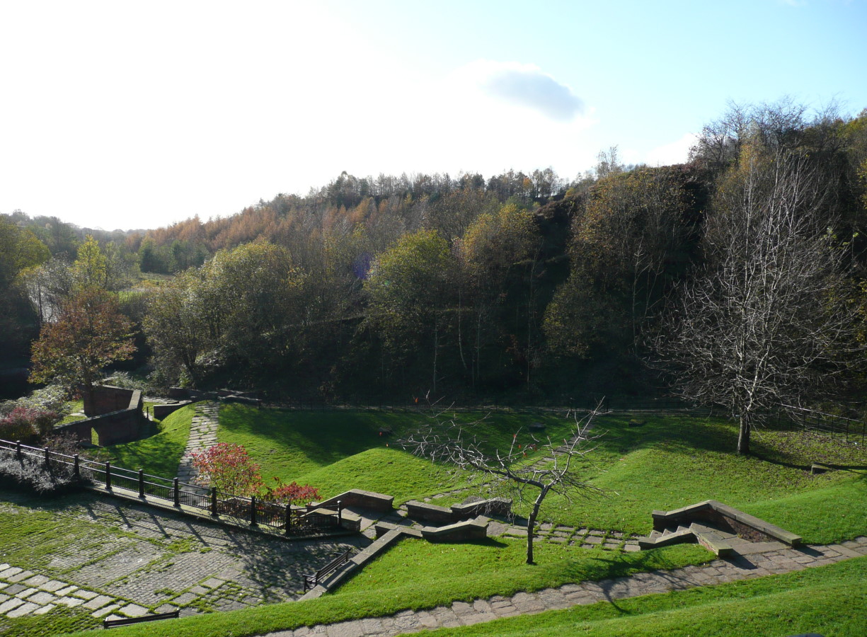
The Orchard in Lancashire is a picturesque wood located in the heart of the county. Spread across a vast area, it is a beautiful and serene forest that offers a tranquil escape from the bustling city life. The Orchard is known for its rich biodiversity and is home to a wide variety of flora and fauna.

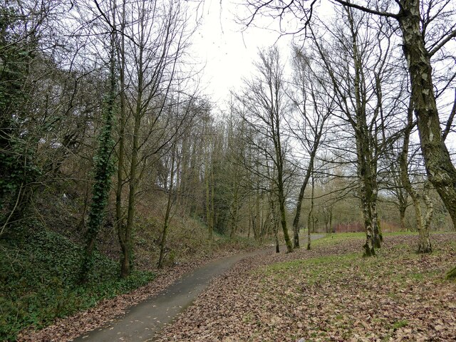
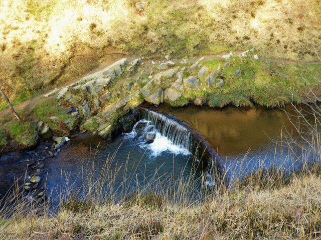
The wood is characterized by its dense canopy of towering trees, predominantly consisting of oak, beech, and birch. The lush greenery provides a soothing ambiance and is a favorite spot for nature enthusiasts and bird watchers. The Orchard is also home to several species of wildlife, including deer, squirrels, and a variety of birds.

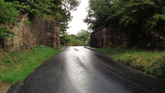
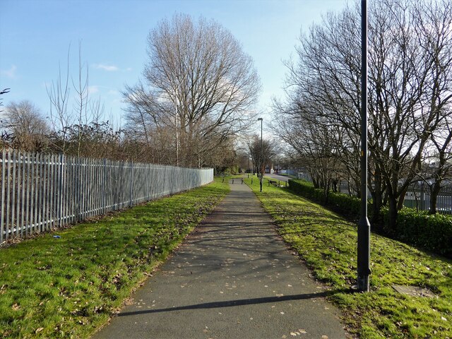
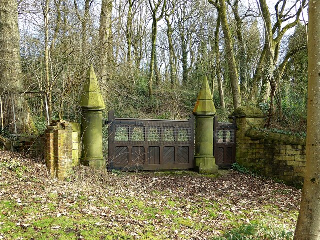
The forest is crisscrossed with well-maintained walking trails, allowing visitors to explore its natural beauty at their own pace. There are also designated picnic areas and benches, providing the perfect opportunity to relax and soak in the peaceful surroundings.

The Orchard is not only a haven for nature lovers but also offers educational opportunities. It hosts workshops and guided tours on topics such as forestry and conservation, aimed at raising awareness about the importance of preserving our natural habitats.

Furthermore, The Orchard is committed to sustainable practices, implementing initiatives such as tree planting and wildlife conservation programs. It actively collaborates with local organizations and volunteers to maintain the ecosystem and ensure the longevity of the wood.

In conclusion, The Orchard in Lancashire is a breathtaking forest that offers a peaceful retreat for individuals seeking solace in nature. With its diverse range of flora and fauna, well-maintained trails, and commitment to conservation, it is a must-visit destination for both locals and tourists alike.

If you have any feedback on the listing, please let us know in the comments section below.
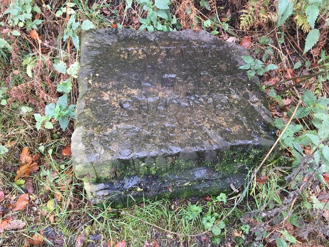
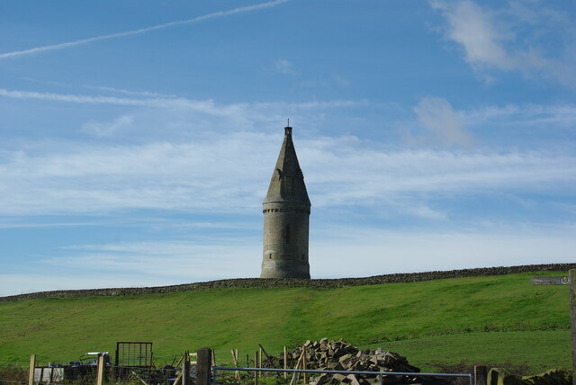
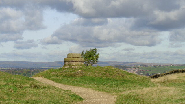
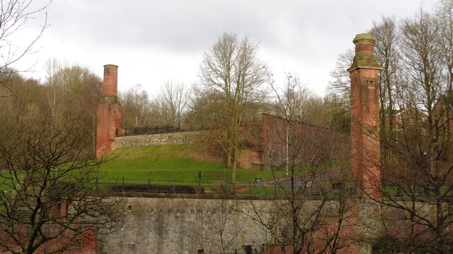
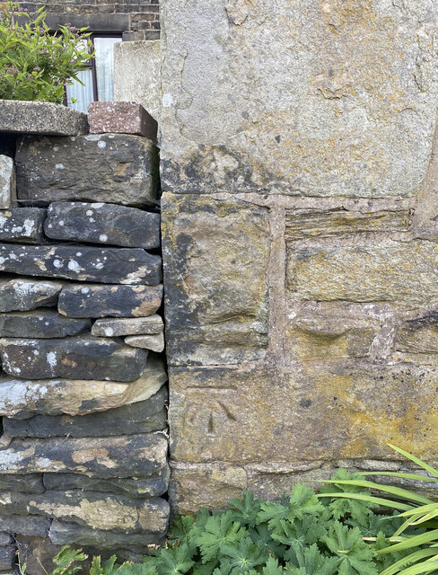
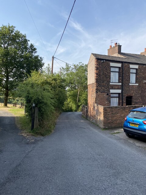
The Orchard Images

Images are sourced within 2km of 53.526791/-2.0851596 or Grid Reference SD9403. Thanks to Geograph Open Source API. All images are credited.

Inscribed stone on the south side of Twirl Hill Road, Hartshead Inscribed stone on the south side of Twirl Hill Road. In the former Ashton under Lyne parish to 1894 and Hartshead parish from 1894 to 1974. This stone is thought to be the collection place for the northern part of the ancient parish of Ashton-under-Lyne and is situated at a place called Twirl Hill between the hamlets of Alt Hill and Hartshead, just below the local viewpoint of Hartshead Pike. The practice of paying tithes was abandoned in the 1830’s. The “Tythe Stone” inscription is thought to have been made by local man John Coulthard in 1840 to ensure its preservation. See also <span class="nowrap"><a title="http://www.marland.org/places/marlandplaces-twarlhill.htm" rel="nofollow ugc noopener" href="http://www.marland.org/places/marlandplaces-twarlhill.htm">Link</a><img style="margin-left:2px;" alt="External link" title="External link - shift click to open in new window" src="https://s1.geograph.org.uk/img/external.png" width="10" height="10"/></span>

Milestone Society National ID: LA_HARTS01cm
Inscribed stone on the south side of Twirl Hill Road, Hartshead
Inscribed stone on the south side of Twirl Hill Road. In the former Ashton under Lyne parish to 1894 and Hartshead parish from 1894 to 1974. This stone is thought to be the collection place for the northern part of the ancient parish of Ashton-under-Lyne and is situated at a place called Twirl Hill between the hamlets of Alt Hill and Hartshead, just below the local viewpoint of Hartshead Pike. The practice of paying tithes was abandoned in the 1830’s. The “Tythe Stone” inscription is thought to have been made by local man John Coulthard in 1840 to ensure its preservation. See also LinkExternal link Milestone Society National ID: LA_HARTS01cm
Hartshead Pike Rebuilt to commemorate the marriage of Edward, Prince of Wales in 1863
Hartshead Pike
Rebuilt to commemorate the marriage of Edward, Prince of Wales in 1863
Hartshead Pike Well Often marked as a well on maps is this the site of the original tower on the summit of the hill?
Hartshead Pike Well
Often marked as a well on maps is this the site of the original tower on the summit of the hill?
Park Bridge Heritage Centre View from Alt Hill Road of the chimneys of the ironworks roller shop to the left and cotton mill to the right
Park Bridge Heritage Centre
View from Alt Hill Road of the chimneys of the ironworks roller shop to the left and cotton mill to the right
Old Tramway Bridge Over the River Medlock at the Park Bridge industrial heritage site
Old Tramway Bridge
Over the River Medlock at the Park Bridge industrial heritage site
Old Quarry On the Park Bridge industrial heritage site
Old Quarry
On the Park Bridge industrial heritage site
Views towards Hartshead Pike Tower
The Rock Trig Point Flush Bracket S2786
OS Cut Mark - Park Bridge, Keverlow Farm <span class="nowrap"><a title="https://www.bench-marks.org.uk/bm60764" rel="nofollow ugc noopener" href="https://www.bench-marks.org.uk/bm60764">Link</a><img style="margin-left:2px;" alt="External link" title="External link - shift click to open in new window" src="https://s1.geograph.org.uk/img/external.png" width="10" height="10"/></span>
OS Cut Mark - Park Bridge, Keverlow Farm
Mill Brow
Mill Brow
Railway Bridge Abutments On Alt Hill Lane for the former Oldham and Ashton railway route
Railway Bridge Abutments
On Alt Hill Lane for the former Oldham and Ashton railway route
Cycle path following route of former railway The path goes from Oldham to Grotton following the Oldham to Greenfield railway line. Much of the route is on infill such as here looking east from Glodwick Road, Oldham
Cycle path following route of former railway
The path goes from Oldham to Grotton following the Oldham to Greenfield railway line. Much of the route is on infill such as here looking east from Glodwick Road, Oldham
Cycle route following line of former railway This view across Cranbrook Street just off the path shows the route is on the top of infill, since only the bridge parapet is visible of the former railway bridge. The path is on the  former Oldham to Greenfield line.
Cycle route following line of former railway
This view across Cranbrook Street just off the path shows the route is on the top of infill, since only the bridge parapet is visible of the former railway bridge. The path is on the former Oldham to Greenfield line.
Cycle path following route of former railway The path is approaching the former railway bridge at St. John Street which is one of the few not infilled on the route. The path runs from Oldham to Grotton along the former line to Greenfield.
Cycle path following route of former railway
The path is approaching the former railway bridge at St. John Street which is one of the few not infilled on the route. The path runs from Oldham to Grotton along the former line to Greenfield.
River Medlock at Lees View on the Medlock Valley Way from a footbridge
River Medlock at Lees
View on the Medlock Valley Way from a footbridge
Cycle route following line of former railway This is the route from Ashton to Oldham and is here close to Alexandra Park, Oldham
Cycle route following line of former railway
This is the route from Ashton to Oldham and is here close to Alexandra Park, Oldham
Carriage drive gates to Dean House At Park Bridge
Carriage drive gates to Dean House
At Park Bridge
Weir on River Medlock This had a mill race that served the industrial complex at Park Bridge. The Medlock is in a narrow steep sided valley at this point.
Weir on River Medlock
This had a mill race that served the industrial complex at Park Bridge. The Medlock is in a narrow steep sided valley at this point.
Show me another place!

The Orchard is located at Grid Ref: SD9403 (Lat: 53.526791, Lng: -2.0851596)

Unitary Authority: Oldham

Police Authority: Greater Manchester

What 3 Words

///prep.foam.tricks. Near Oldham, Manchester

Related Wikis

Alt, Greater Manchester

Alt is a semi-rural and suburban area lying on the borders of the towns of Oldham and Ashton-under-Lyne in Greater Manchester. Alt was formerly a civil...

Abbey Hills

Abbey Hills (archaically Wabbow Hills) is an area of Oldham in Greater Manchester. It is contiguous with Glodwick and Alt. Lying on the eastern border...

Park Bridge

Park Bridge is an area of Ashton-under-Lyne, in the Metropolitan Borough of Tameside, in Greater Manchester, England. It is situated in the Medlock Valley...

Breeze Hill School

Breeze Hill School was a mixed-sex comprehensive secondary school for 11- to 16-year-olds in Oldham, Greater Manchester, England. It was a specialist Humanities...

Nearby Amenities

Located within 500m of 53.526791,-2.0851596
Alt
Is In: Oldham, Greater Manchester, England, UK
Place: suburb
Source: npe
Wikidata: Q27973423
Lat/Long: 53.5272401/-2.0849357
Bus Stop
Roundthorn Road/Byland Avenue
Bus: yes
Naptan AtcoCode: 1800ED03451
Naptan Bearing: SE
Naptan CommonName: Roundthorn Road/Byland Avenue
Naptan Indicator: House 525
Naptan Landmark: HOUSE 525
Naptan NaptanCode: manajwtj
Naptan PlusbusZoneRef: MNCRPIC
Naptan ShortCommonName: Byland Avenue
Naptan Street: Roundthorn Road
Naptan Verified: no
Network: TfGM
Public Transport: platform
Source: naptan_import
Lat/Long: 53.5296642/-2.0840747
Bus Stop
Roundthorn Road/Byland Avenue
Bench: no
Bin: no
Bus: yes
Lit: no
Naptan AtcoCode: 1800ED03511
Naptan Bearing: NW
Naptan CommonName: Roundthorn Road/Byland Avenue
Naptan Indicator: Op Freshwinds
Naptan Landmark: HOUSE 556
Naptan NaptanCode: manajwtm
Naptan PlusbusZoneRef: MNCRPIC
Naptan ShortCommonName: Byland Avenue
Naptan Street: Roundthorn Road
Naptan Verified: no
Network: TfGM
Public Transport: platform
Shelter: no
Source: naptan_import
Tactile Paving: no
Lat/Long: 53.529278/-2.0836968
Bus Stop
Pitses, Alt Lane / adjacent Abbeyhills Road
Bus: yes
Naptan AtcoCode: 1800ED08421
Naptan Bearing: N
Naptan CommonName: Alt Lane/Abbeyhills Road
Naptan Indicator: O/s House 10
Naptan Landmark: O/S HOUSE 13
Naptan NaptanCode: mantgmpg
Naptan PlusbusZoneRef: MNCRPIC
Naptan ShortCommonName: Abbeyhills Road
Naptan Street: ALT LANE
Naptan Verified: no
Network: TfGM
Operator: TfGM
Public Transport: platform
Source: naptan_import
Lat/Long: 53.5277147/-2.0826528
Bus Stop
Low Side, Abbeyhills Road / opposite Vant Street
Bus: yes
Naptan AtcoCode: 1800ED08741
Naptan Bearing: SE
Naptan CommonName: Abbeyhills Road/Vant Street
Naptan Indicator: O/s House 279
Naptan Landmark: HOUSE 279
Naptan NaptanCode: manamdwp
Naptan PlusbusZoneRef: MNCRPIC
Naptan ShortCommonName: Vant Street
Naptan Street: ABBEYHILLS ROAD
Naptan Verified: no
Network: TfGM
Operator: TfGM
Public Transport: platform
Source: naptan_import
Lat/Long: 53.5305506/-2.0888739
Bus Stop
Low Side, Abbeyhills Road / near Manor Road
Bus: yes
Naptan AtcoCode: 1800ED08751
Naptan Bearing: SE
Naptan CommonName: Abbeyhills Road/Manor Road
Naptan Indicator: O/s House 307
Naptan Landmark: HOUSE 307
Naptan NaptanCode: manamdwt
Naptan PlusbusZoneRef: MNCRPIC
Naptan ShortCommonName: Manor Road
Naptan Street: ABBEYHILLS ROAD
Naptan Verified: no
Network: TfGM
Operator: TfGM
Public Transport: platform
Source: naptan_import
Lat/Long: 53.530048/-2.0878772
Bus Stop
Abbey Hills, Abbeyhills Road / opposite Manor Road
Bus: yes
Naptan AtcoCode: 1800ED08761
Naptan Bearing: NW
Naptan CommonName: Abbeyhills Road/Manor Road
Naptan Indicator: Flats
Naptan Landmark: FLATS
Naptan NaptanCode: manamgad
Naptan PlusbusZoneRef: MNCRPIC
Naptan ShortCommonName: Manor Road
Naptan Street: ABBEYHILLS ROAD
Naptan Verified: no
Network: TfGM
Operator: TfGM
Public Transport: platform
Source: naptan_import
Lat/Long: 53.5294465/-2.0867747
Bus Stop
Abbeyhills Road/Roundthorn Road
Bus: yes
Naptan AtcoCode: 1800ED08771
Naptan Bearing: W
Naptan CommonName: Abbeyhills Road/Roundthorn Road
Naptan Indicator: Library
Naptan Landmark: COMMUNITY Centre
Naptan NaptanCode: manamgag
Naptan PlusbusZoneRef: MNCRPIC
Naptan ShortCommonName: Roundthorn Road
Naptan Street: ABBEYHILLS ROAD
Naptan Verified: no
Network: TfGM
Public Transport: platform
Source: naptan_import
Lat/Long: 53.5286397/-2.0837559
Bus Stop
Pitses, Abbeyhills Road / near Holts Lane
Bus: yes
Naptan AtcoCode: 1800ED08781
Naptan Bearing: SE
Naptan CommonName: Abbeyhills Road/Holts Lane
Naptan Indicator: Nr Grass Land
Naptan Landmark: NR GRASS LAND
Naptan NaptanCode: manamgaj
Naptan PlusbusZoneRef: MNCRPIC
Naptan ShortCommonName: Holts Lane
Naptan Street: ABBEYHILLS ROAD
Naptan Verified: no
Network: TfGM
Operator: TfGM
Public Transport: platform
Source: naptan_import
Lat/Long: 53.5282459/-2.0813716
Bus Stop
Pitses, Alt Lane / near Abbeyhills Road
Bus: yes
Naptan AtcoCode: 1800ED08791
Naptan Bearing: S
Naptan CommonName: Alt Lane/Abbeyhills Road
Naptan Indicator: O/s House 10
Naptan Landmark: HOUSE 10
Naptan NaptanCode: manamgap
Naptan PlusbusZoneRef: MNCRPIC
Naptan ShortCommonName: Abbeyhills Road
Naptan Street: ALT LANE
Naptan Verified: no
Network: TfGM
Operator: TfGM
Public Transport: platform
Source: naptan_import
Lat/Long: 53.5277238/-2.0824567
Bus Stop
Alt, Furness Avenue / opposite Cherry Avenue
Bus: yes
Naptan AtcoCode: 1800ED08801
Naptan Bearing: E
Naptan CommonName: Furness Avenue/Cherry Avenue
Naptan Indicator: Bungalow
Naptan Landmark: HOUSE 143
Naptan NaptanCode: manamgat
Naptan Notes: NAME AMENDED
Naptan PlusbusZoneRef: MNCRPIC
Naptan ShortCommonName: Cherry Avenue
Naptan Street: FURNESS AVENUE
Naptan Verified: no
Network: TfGM
Operator: TfGM
Public Transport: platform
Source: naptan_import
Lat/Long: 53.5274254/-2.0849151
Bus Stop
Alt, Furness Avenue / near Cherry Avenue
Bus: yes
Naptan AtcoCode: 1800ED08811
Naptan Bearing: W
Naptan CommonName: Furness Avenue/Cherry Avenue
Naptan Indicator: O/s House 144
Naptan Landmark: HOUSE 144
Naptan NaptanCode: manamgaw
Naptan PlusbusZoneRef: MNCRPIC
Naptan ShortCommonName: Cherry Avenue
Naptan Street: FURNESS AVENUE
Naptan Verified: no
Network: TfGM
Operator: TfGM
Public Transport: platform
Source: naptan_import
Lat/Long: 53.5273427/-2.0852635
Bus Stop
Alt, Abbeyhills Road / opposite Lees New Road
Bus: yes
Naptan AtcoCode: 1800ED08821
Naptan Bearing: NW
Naptan CommonName: Abbeyhills Road/Lees New Road
Naptan Indicator: Grassland
Naptan Landmark: GRASSLAND
Naptan NaptanCode: manamgda
Naptan PlusbusZoneRef: MNCRPIC
Naptan ShortCommonName: Lees New Road
Naptan Street: ABBEYHILLS ROAD
Naptan Verified: no
Network: TfGM
Operator: TfGM
Public Transport: platform
Source: naptan_import
Lat/Long: 53.5254975/-2.0781382
Bus Stop
Alt, Abbeyhills Road / near Lees New Road
Bus: yes
Naptan AtcoCode: 1800ED08831
Naptan Bearing: SE
Naptan CommonName: Abbeyhills Road/Lees New Road
Naptan Indicator: Nr Grass Land
Naptan Landmark: NR GRASS LAND
Naptan NaptanCode: manamgdg
Naptan PlusbusZoneRef: MNCRPIC
Naptan ShortCommonName: Lees New Road
Naptan Street: ABBEYHILLS ROAD
Naptan Verified: no
Network: TfGM
Operator: TfGM
Public Transport: platform
Source: naptan_import
Lat/Long: 53.5256503/-2.0781988
Bus Stop
Alt, Whitby Road / near April Close
Bus: yes
Naptan AtcoCode: 1800ED10301
Naptan Bearing: N
Naptan CommonName: Whitby Road/April Close
Naptan Indicator: Opp House 7
Naptan Landmark: HOUSE 2
Naptan NaptanCode: manamjga
Naptan PlusbusZoneRef: MNCRPIC
Naptan ShortCommonName: April Close
Naptan Street: WHITBY ROAD
Naptan Verified: no
Network: TfGM
Operator: TfGM
Public Transport: platform
Source: naptan_import
Lat/Long: 53.5285211/-2.0862599
Bus Stop
Alt, Whitby Road / opposite April Close
Bus: yes
Naptan AtcoCode: 1800ED10311
Naptan Bearing: S
Naptan CommonName: Whitby Road/April Close
Naptan Indicator: O/s House 7
Naptan Landmark: HOUSE 7
Naptan NaptanCode: manamjgd
Naptan PlusbusZoneRef: MNCRPIC
Naptan ShortCommonName: April Close
Naptan Street: WHITBY ROAD
Naptan Verified: no
Network: TfGM
Operator: TfGM
Public Transport: platform
Source: naptan_import
Lat/Long: 53.5285122/-2.0860939
Noexit: yes
Lat/Long: 53.5242832/-2.0847507
Man Made: surveillance
Surveillance: maxspeed
Surveillance Type: camera
Lat/Long: 53.5278543/-2.080774
Crossing
Crossing: marked
Lat/Long: 53.5284609/-2.0825397
Generator Method: photovoltaic
Generator Output Electricity: yes
Generator Source: solar
Generator Type: solar_photovoltaic_panel
Location: roof
Power: generator
Lat/Long: 53.5281514/-2.081989
Generator Method: photovoltaic
Generator Output Electricity: yes
Generator Source: solar
Generator Type: solar_photovoltaic_panel
Location: roof
Power: generator
Lat/Long: 53.5296292/-2.0884007
Generator Method: photovoltaic
Generator Output Electricity: yes
Generator Source: solar
Generator Type: solar_photovoltaic_panel
Location: roof
Power: generator
Lat/Long: 53.5296563/-2.0894601
Generator Method: photovoltaic
Generator Output Electricity: yes
Generator Source: solar
Generator Type: solar_photovoltaic_panel
Location: roof
Power: generator
Lat/Long: 53.5292577/-2.0895218
Generator Method: photovoltaic
Generator Output Electricity: yes
Generator Source: solar
Generator Type: solar_photovoltaic_panel
Location: roof
Power: generator
Lat/Long: 53.5293917/-2.0886072
Generator Method: photovoltaic
Generator Output Electricity: yes
Generator Source: solar
Generator Type: solar_photovoltaic_panel
Location: roof
Power: generator
Lat/Long: 53.5288352/-2.0909407
Generator Method: photovoltaic
Generator Output Electricity: yes
Generator Source: solar
Generator Type: solar_photovoltaic_panel
Location: roof
Power: generator
Lat/Long: 53.5288161/-2.0911204
Generator Method: photovoltaic
Generator Output Electricity: yes
Generator Source: solar
Generator Type: solar_photovoltaic_panel
Location: roof
Power: generator
Lat/Long: 53.5297153/-2.0905625
Generator Method: photovoltaic
Generator Output Electricity: yes
Generator Source: solar
Generator Type: solar_photovoltaic_panel
Location: roof
Power: generator
Lat/Long: 53.5300788/-2.0893126
Generator Method: photovoltaic
Generator Output Electricity: yes
Generator Source: solar
Generator Type: solar_photovoltaic_panel
Location: roof
Power: generator
Lat/Long: 53.5287754/-2.0918929
Barrier: bollard
Lat/Long: 53.5291171/-2.0876086
Generator Method: photovoltaic
Generator Output Electricity: yes
Generator Source: solar
Generator Type: solar_photovoltaic_panel
Power: generator
Lat/Long: 53.5249573/-2.0863526
Generator Method: photovoltaic
Generator Output Electricity: yes
Generator Source: solar
Generator Type: solar_photovoltaic_panel
Power: generator
Lat/Long: 53.5249715/-2.0862543
Generator Method: photovoltaic
Generator Output Electricity: yes
Generator Source: solar
Generator Type: solar_photovoltaic_panel
Power: generator
Lat/Long: 53.52488/-2.0868914
Generator Method: photovoltaic
Generator Output Electricity: yes
Generator Source: solar
Generator Type: solar_photovoltaic_panel
Power: generator
Lat/Long: 53.5249042/-2.0867056
Generator Method: photovoltaic
Generator Output Electricity: yes
Generator Source: solar
Generator Type: solar_photovoltaic_panel
Power: generator
Lat/Long: 53.5250497/-2.0856544
Generator Method: photovoltaic
Generator Output Electricity: yes
Generator Source: solar
Generator Type: solar_photovoltaic_panel
Power: generator
Lat/Long: 53.5248084/-2.087424
Generator Method: photovoltaic
Generator Output Electricity: yes
Generator Source: solar
Generator Type: solar_photovoltaic_panel
Power: generator
Lat/Long: 53.5250753/-2.0850172
Barrier: bollard
Lat/Long: 53.5287607/-2.0888303
Barrier: stile
Material: wood
Stile: stepover
Lat/Long: 53.5245362/-2.0815872
Noexit: yes
Lat/Long: 53.5248229/-2.0827793
The data included in this document is from www.openstreetmap.org. The data is made available under ODbL.

Have you been to The Orchard?

Leave your review of The Orchard below (or comments, questions and feedback).