Great Wood

Wood, Forest in Yorkshire Craven

England

Great Wood

Narrow stile by Flasby Beck In the trees you can just see the bridge carrying the access track to Flasby Moor Side Farm.
Narrow stile by Flasby Beck Credit: Bill Boaden

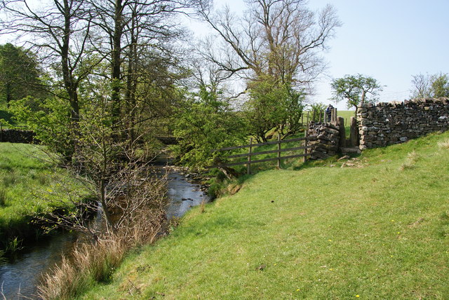
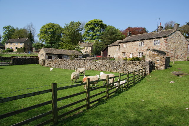
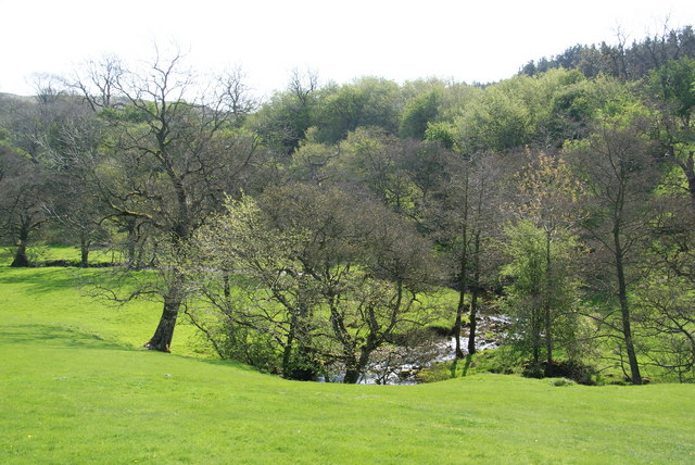
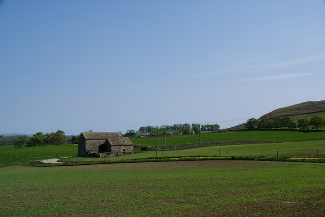
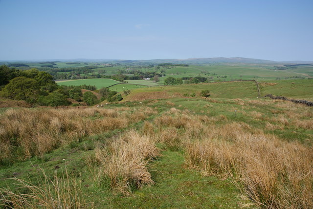
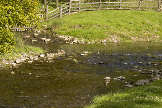
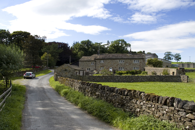
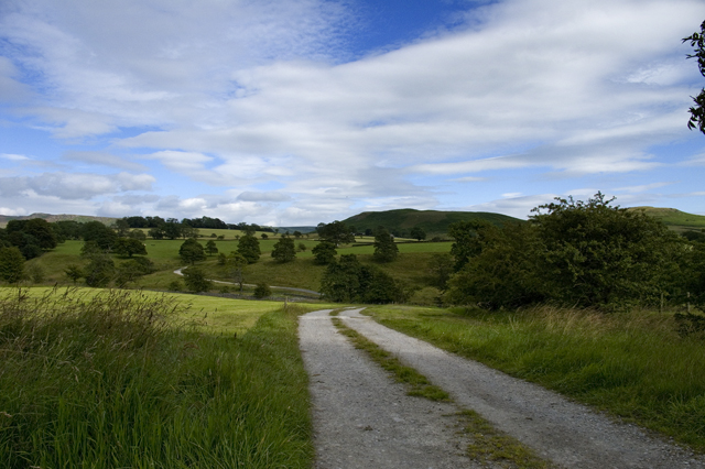
Great Wood is a picturesque forest located in Yorkshire, England. Spanning over a vast area, it is renowned for its breathtaking natural beauty and diverse flora and fauna. The woodland is primarily composed of deciduous trees, including oak, beech, and birch, which create a rich and vibrant tapestry of colors throughout the changing seasons.

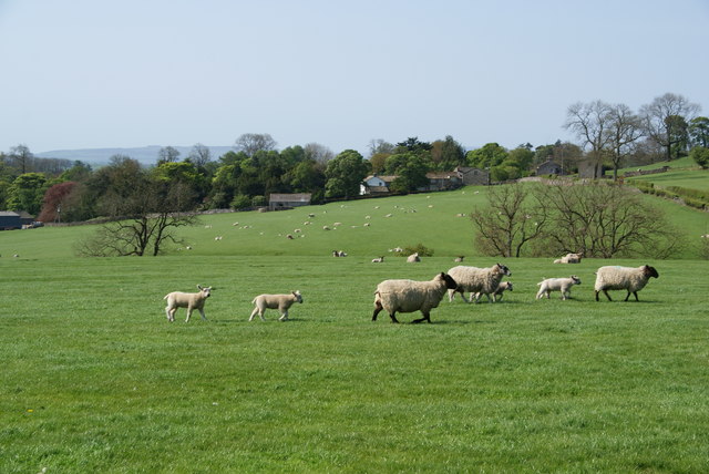
The forest provides a haven for a wide range of wildlife species. Visitors may catch glimpses of elusive creatures such as deer, foxes, and badgers, as well as a variety of bird species, including woodpeckers and owls. The tranquil atmosphere and abundance of wildlife make Great Wood a popular destination for nature enthusiasts and birdwatchers.

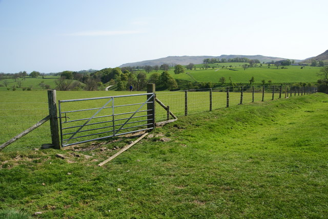
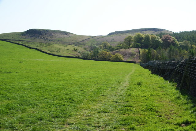
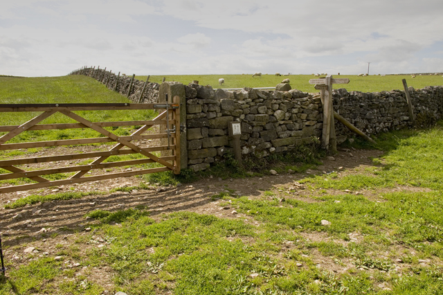
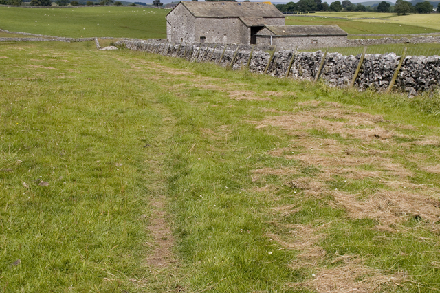
Numerous walking trails wind their way through the forest, offering visitors the opportunity to explore its beauty at their own pace. The well-maintained paths provide easy access for both casual strollers and more avid hikers. Along the way, walkers can enjoy the soothing sounds of rustling leaves, the scent of wildflowers, and the gentle babbling of nearby streams.

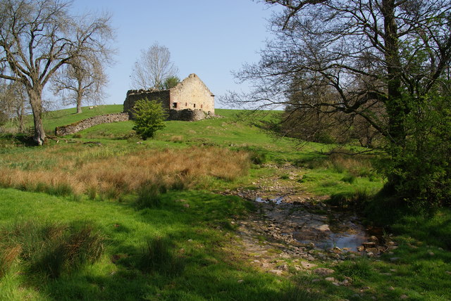
Great Wood also holds historical significance, with evidence suggesting human occupation in the area dating back to the Iron Age. A visit to the forest may uncover ancient relics such as burial mounds or remnants of old settlements, offering a glimpse into the region's past.

Overall, Great Wood, Yorkshire is a natural treasure, offering a tranquil escape from the bustle of everyday life. Its stunning landscapes, abundant wildlife, and historical significance make it a must-visit destination for those seeking a connection with nature and a sense of serenity.

If you have any feedback on the listing, please let us know in the comments section below.

Great Wood Images

Images are sourced within 2km of 54.003318/-2.096827 or Grid Reference SD9356. Thanks to Geograph Open Source API. All images are credited.

Narrow stile by Flasby Beck In the trees you can just see the bridge carrying the access track to Flasby Moor Side Farm.
Narrow stile by Flasby Beck
In the trees you can just see the bridge carrying the access track to Flasby Moor Side Farm.
Gate between fields above Flasby Flasby is out of sight in the dip ahead. We had inadvertently wandered away from the path which is nearer to Flasby Beck.
Gate between fields above Flasby
Flasby is out of sight in the dip ahead. We had inadvertently wandered away from the path which is nearer to Flasby Beck.
Sheep near Flasby Flasby is in the trees ahead.
Sheep near Flasby
Flasby is in the trees ahead.
Holme Laithe
Holme Laithe
Flasby As seen from the footpath alongside Flasby Beck.
Flasby
As seen from the footpath alongside Flasby Beck.
Flasby Beck Viewed from the side of Holme Laithe.
Flasby Beck
Viewed from the side of Holme Laithe.
Oldfield Laithe On the western lower slopes of Flasby Fell.
Oldfield Laithe
On the western lower slopes of Flasby Fell.
Path heading for Flasby Fell The access land begins at the next wall. On the map, the path strikes further left to the gap in the wall, but most current usage keeps by the wall till later.
Path heading for Flasby Fell
The access land begins at the next wall. On the map, the path strikes further left to the gap in the wall, but most current usage keeps by the wall till later.
The lower slopes of Flasby Fell A small beck runs down here, with the potential for making the ground boggy. In the distance are the Bowland hills.
The lower slopes of Flasby Fell
A small beck runs down here, with the potential for making the ground boggy. In the distance are the Bowland hills.
New Laithe Barn, Eshton
Entrance Drive to Seat House
Friars Head Hall. Winterburn
Confluence of Eshton Beck and Flasby Beck Flasby beck is joining up here with the larger Eshton Beck
Confluence of Eshton Beck and Flasby Beck
Flasby beck is joining up here with the larger Eshton Beck
Footpath to Friars Head
Footpath and Bridleway near Scarnber Laithe
Track to Flasby Moor Side
Lock 31 on the Leeds and Liverpool Canal This is by the Eshton Road bridge on the north side of Gargrave.
Lock 31 on the Leeds and Liverpool Canal
This is by the Eshton Road bridge on the north side of Gargrave.
Show me another place!

Great Wood is located at Grid Ref: SD9356 (Lat: 54.003318, Lng: -2.096827)

Division: West Riding

Administrative County: North Yorkshire

District: Craven

Police Authority: North Yorkshire

What 3 Words

///nourished.slowly.passage. Near Gargrave, North Yorkshire
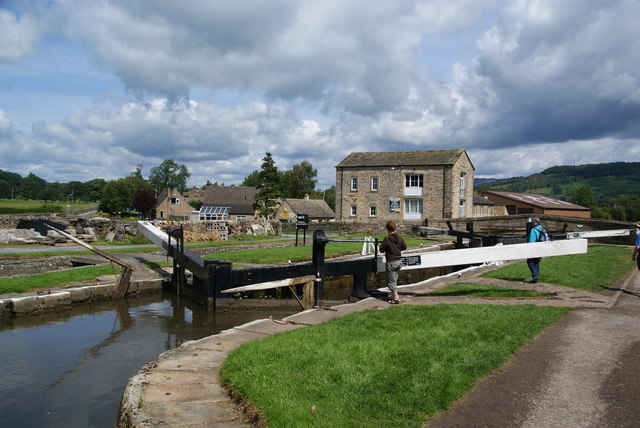
Related Wikis

Flasby

Flasby is a hamlet in the Yorkshire Dales in North Yorkshire, England. It is one of the two settlements, with Winterburn, in the civil parish of Flasby...

Gargrave

Gargrave is a large village and civil parish in the Craven district located along the A65, 4 miles (6 km) north-west of Skipton in North Yorkshire, England...

Eshton

Eshton is a small village and civil parish in the Craven district of North Yorkshire, England. At the 2011 Census the population was less than 100 and...

Winterburn

Winterburn is a village in the Craven district of North Yorkshire, England. It is about 5 miles (8 km) south west of Grassington. Winterburn Reservoir...
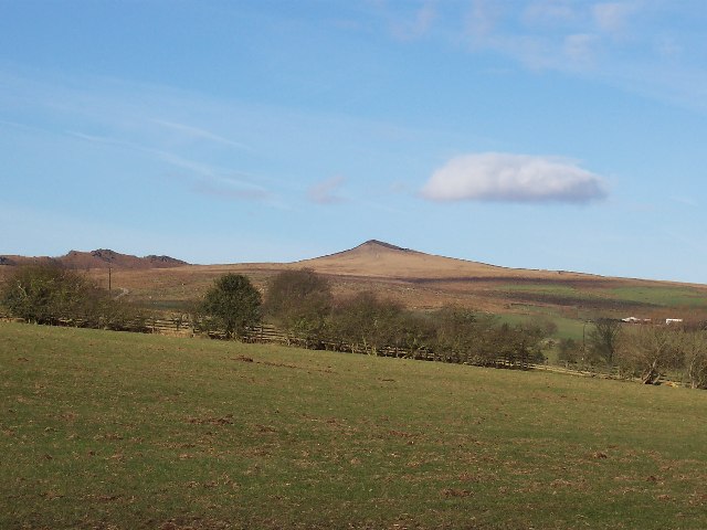
Sharp Haw

Sharp Haw is a hill on the southern edge of the Yorkshire Dales, located just within the National Park. Being the last outpost of the hills before the...

Gargrave railway station

Gargrave is a railway station on the Bentham Line, which runs between Leeds and Morecambe via Skipton. The station, situated 30 miles (48 km) north-west...

Newfield Hall

Newfield Hall is a former country house located 1 mile (1.6 km) to the southeast of the village of Airton, North Yorkshire, England. It is now a hotel...

Hetton, North Yorkshire

Hetton is a small Dales village in the civil parish of Hetton-cum-Bordley, in the North Yorkshire district of North Yorkshire, England, situated 5.75 miles...

Nearby Amenities

Located within 500m of 54.003318,-2.096827
Eshton
Is In: UK, Yorkshire, North Yorkshire, Airedale
Is In Country Code: GB
Is In County: North Yorkshire
Is In Historical County: Yorkshire
Is In Municipality: Craven District
Place: hamlet
Wikidata: Q5397942
Wikipedia: en:Eshton
Lat/Long: 54.001049/-2.09879
Bark Hill
Ele Ft: 575
Natural: peak
Source: OS 1:25k
Source Ele: OS sheet 150, publ. 1853
Lat/Long: 54.0059746/-2.0967562
Barrier: cattle_grid
Lat/Long: 54.0037778/-2.091556
Source: Bing
Lat/Long: 54.003835/-2.0916482
Source: Bing
Lat/Long: 54.0041902/-2.0922119
Barrier: cattle_grid
Source: Bing
Lat/Long: 54.004356/-2.0925881
Source: Bing
Lat/Long: 54.0052655/-2.0933756
Source: Bing
Lat/Long: 54.0057121/-2.0935202
Source: Bing
Lat/Long: 54.0059618/-2.0937862
Source: Bing
Lat/Long: 54.0064552/-2.0940559
Source: Bing
Lat/Long: 54.0068091/-2.0942253
Source: Bing
Lat/Long: 54.0070648/-2.0940974
Source: Bing
Lat/Long: 54.007021/-2.0947275
Source: Bing
Lat/Long: 54.0071099/-2.0939653
Source: Bing
Lat/Long: 54.007099/-2.0945196
Source: Bing
Lat/Long: 54.0070778/-2.0947892
Source: Bing
Lat/Long: 54.0071336/-2.0946411
Source: Bing
Lat/Long: 54.007156/-2.0945816
Source: Bing
Lat/Long: 54.0071568/-2.0946664
Source: Bing
Lat/Long: 54.0071861/-2.094217
Source: Bing
Lat/Long: 54.0072112/-2.0943157
Source: Bing
Lat/Long: 54.0072311/-2.0940849
Source: Bing
Lat/Long: 54.0073345/-2.0939654
Source: Bing
Lat/Long: 54.0073184/-2.094425
Source: Bing
Lat/Long: 54.0074417/-2.0940747
Place: farm
Lat/Long: 54.0037632/-2.1036805
lime kiln
Archaeological Site: lime_kiln
Historic: archaeological_site
Mineral: limestone
Output: lime
Source: OS sheet 150,publ 1853
Lat/Long: 54.0064934/-2.1008214
Fortem People
Addr City: Skipton
Addr Housename: The Barn
Addr Postcode: BD23 3QD
Addr Street: Bark Hill
Addr Suburb: Flasby
Office: recruitment
Website: https://fortempeople.co.uk/
Lat/Long: 54.0071882/-2.0941164
Power: pole
Source: Bing
Lat/Long: 54.001384/-2.1037349
Power: pole
Source: Bing
Lat/Long: 54.0013886/-2.1027025
Power: pole
Source: Bing
Lat/Long: 54.0013856/-2.1013978
Power: pole
Source: Bing
Lat/Long: 54.0013932/-2.1001371
Power: pole
Source: Bing
Lat/Long: 54.0013886/-2.0998129
Power: pole
Source: Bing
Lat/Long: 54.007787/-2.0966859
Power: pole
Source: Bing
Lat/Long: 54.0077321/-2.0954668
The data included in this document is from www.openstreetmap.org. The data is made available under ODbL.

Have you been to Great Wood?

Leave your review of Great Wood below (or comments, questions and feedback).