Bank Wood

Wood, Forest in Lancashire

England

Bank Wood

Longlees Lock, Rochdale Canal Lock no 36 and the start of the summit pound.
Longlees Lock, Rochdale Canal Credit: michael ely

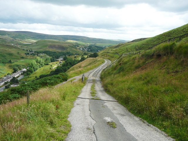
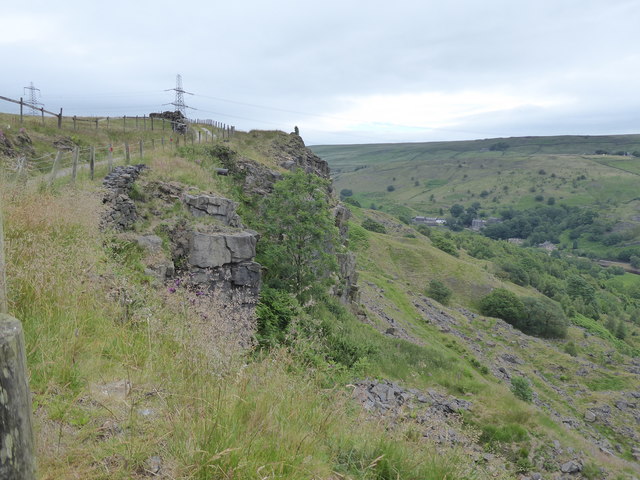
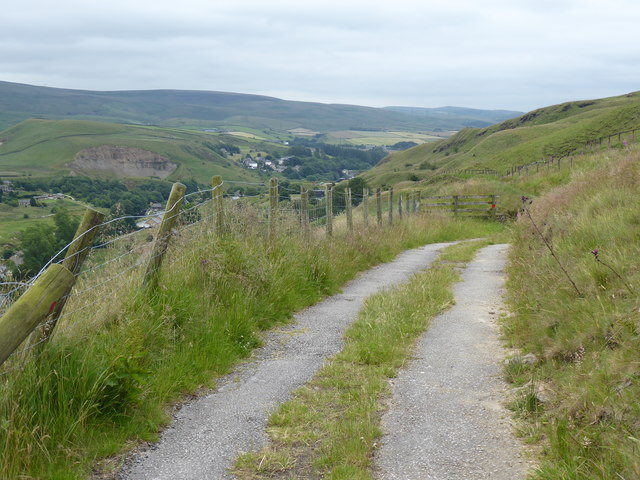
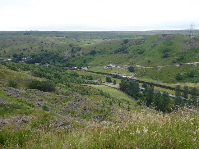
Bank Wood is a picturesque forest located in the county of Lancashire, England. Spanning over a vast area, this wood is a haven for nature enthusiasts and offers a tranquil escape from the bustling city life. Nestled amidst rolling hills and lush greenery, Bank Wood is a popular destination for locals and visitors alike.

The wood is predominantly comprised of various species of trees, including oak, beech, and birch, which create a diverse and vibrant ecosystem. The dense canopy provides a sheltered habitat for a wide range of wildlife, such as squirrels, foxes, and various bird species. Exploring the wood, visitors can expect to encounter an array of flora and fauna, adding to the enchanting atmosphere.

Numerous walking trails crisscross through Bank Wood, providing ample opportunities for leisurely strolls, hiking, or jogging. These well-maintained paths wind through the forest, offering breathtaking views of the surrounding countryside and allowing visitors to immerse themselves in the serenity of nature. The wood also boasts several picnic spots, where families and friends can enjoy a peaceful meal surrounded by the beauty of their surroundings.

Bank Wood is easily accessible, located just a short drive away from nearby towns and villages. Its proximity to residential areas makes it a popular destination for locals seeking a peaceful retreat or a place to engage in outdoor activities. Additionally, the wood is well-maintained by local authorities, ensuring a clean and safe environment for all visitors.

Overall, Bank Wood in Lancashire is a hidden gem, offering a serene and natural escape for those seeking solace in the beauty of the outdoors. Its diverse ecosystem, well-maintained trails, and peaceful atmosphere make it a must-visit destination for nature lovers.

If you have any feedback on the listing, please let us know in the comments section below.
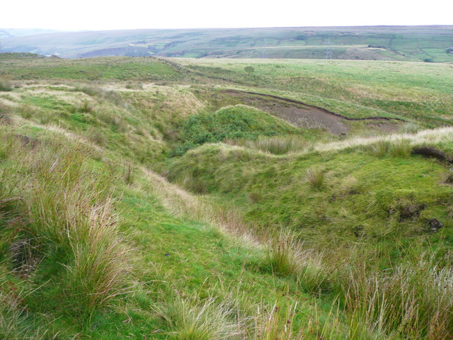
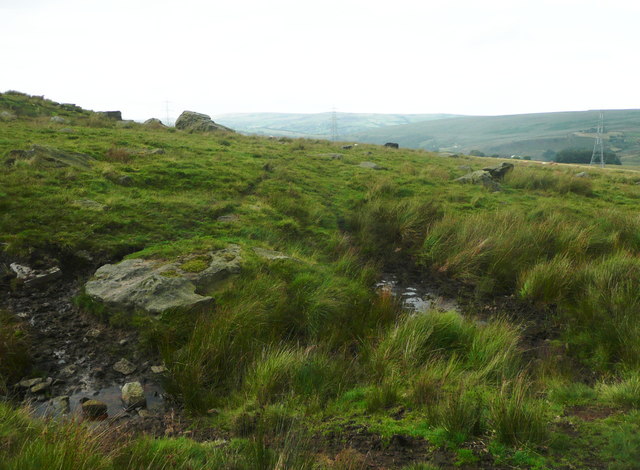
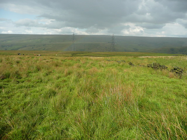
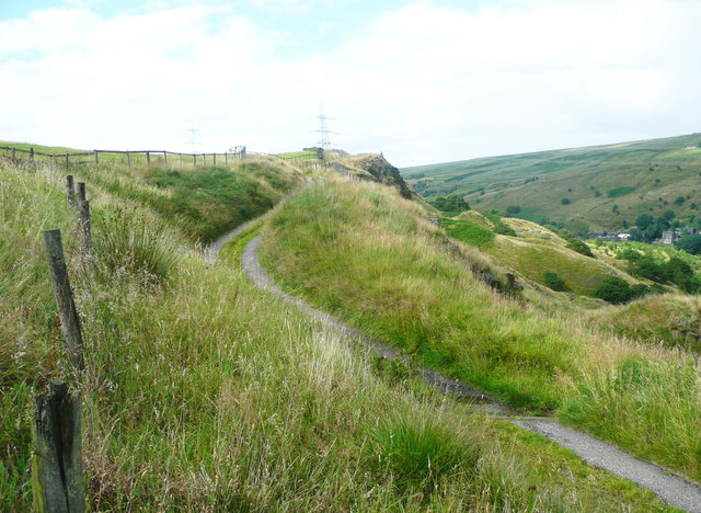
Bank Wood Images

Images are sourced within 2km of 53.689074/-2.0966478 or Grid Reference SD9321. Thanks to Geograph Open Source API. All images are credited.

Longlees Lock, Rochdale Canal Lock no 36 and the start of the summit pound.
Longlees Lock, Rochdale Canal
Lock no 36 and the start of the summit pound.
A6033 at Steanor Bottom Toll House
View from Todmorden Road near Summit The hillside is 'access land', and also a footpath goes across the view, climbing towards the right. There are spoil heaps from quarries on the skyline. It looks to be a nice area to explore some time.
View from Todmorden Road near Summit
The hillside is 'access land', and also a footpath goes across the view, climbing towards the right. There are spoil heaps from quarries on the skyline. It looks to be a nice area to explore some time.
The infant Owler Clough, next to the Rochdale Way
The Rochdale Way crossing a stream near Ferny Hill This is where the rain started, banishing thoughts of taking photographs of the rocks.
The Rochdale Way crossing a stream near Ferny Hill
This is where the rain started, banishing thoughts of taking photographs of the rocks.
Not quite on the Rochdale Way, Walsden After passing the Ferny Hill rocks I lost the footpath, so headed for the intake wall and picked my way through the rushes. The shower of rain has finished here and is crossing the valley in the distance.
Not quite on the Rochdale Way, Walsden
After passing the Ferny Hill rocks I lost the footpath, so headed for the intake wall and picked my way through the rushes. The shower of rain has finished here and is crossing the valley in the distance.
The Pennine Bridleway and Reddyshaw Scout, Walsden A 'scout' is the top of a very steep hillside, giving a view over the valley. The lumpy hills below might be spoil from the construction of the railway tunnel.
The Pennine Bridleway and Reddyshaw Scout, Walsden
A 'scout' is the top of a very steep hillside, giving a view over the valley. The lumpy hills below might be spoil from the construction of the railway tunnel.
The Pennine Bridleway joining the driveway to Reddyshore Farm, Walsden The bridleway on Reddyshaw Scout Gate comes in from the left, and from the junction the driveway is an adopted highway, at least as far as the Rochdale boundary.
The Pennine Bridleway joining the driveway to Reddyshore Farm, Walsden
The bridleway on Reddyshaw Scout Gate comes in from the left, and from the junction the driveway is an adopted highway, at least as far as the Rochdale boundary.
Road subsidence, Calderbrook Road, Walsden There is more subsidence in the Littleborough part of the road.
Road subsidence, Calderbrook Road, Walsden
There is more subsidence in the Littleborough part of the road.
Long Lees Lock Long Lees Lock on the Rochdale Canal.
Long Lees Lock
Long Lees Lock on the Rochdale Canal.
Calderbrook Road Calderbrook Road, which is in a state of collapse and now closed.
Calderbrook Road
Calderbrook Road, which is in a state of collapse and now closed.
A6033 towards Todmorden Looking north.
A6033 towards Todmorden
Looking north.
Boundary stone on Rochdale Road (A6033) Between the districts of Littleborough and Todmorden.
Boundary stone on Rochdale Road (A6033)
Between the districts of Littleborough and Todmorden.
Entering West Yorkshire Looking north on the A6033.
Entering West Yorkshire
Looking north on the A6033.
Grazing west of Rochdale Road A narrow strip of flattish land.
Grazing west of Rochdale Road
A narrow strip of flattish land.
The Pennine Bridleway Mary Towneley loop near Reddyshore
View from the Pennine Bridleway Mary Towneley loop near Reddyshore
Show me another place!

Bank Wood is located at Grid Ref: SD9321 (Lat: 53.689074, Lng: -2.0966478)

Unitary Authority: Calderdale

Police Authority: West Yorkshire

What 3 Words

///sweetly.reject.stated. Near Walsden, West Yorkshire

Related Wikis

Summit Tunnel

Summit Tunnel in England is one of the world's oldest railway tunnels. It was constructed between 1838 and 1841 by the Manchester and Leeds Railway Company...

Walsden

Walsden (; WOLZ-dən) is a large village in the civil parish of Todmorden in the Metropolitan Borough of Calderdale, West Yorkshire, England. It was historically...

Walsden railway station

Walsden railway station (; WOLZ-dən) serves the village of Walsden, Todmorden in West Yorkshire, England, on the edge of the Pennines. It is served by...

Summit Tunnel fire

The Summit Tunnel fire occurred on 20 December 1984, when a dangerous goods train caught fire while passing through the Summit Tunnel on the railway line...

Nearby Amenities

Located within 500m of 53.689074,-2.0966478
Waterway: turning_point
Lat/Long: 53.6915405/-2.1000772
Seamark Type: gate
Waterway: lock_gate
Lat/Long: 53.6924008/-2.099506
Seamark Type: gate
Waterway: lock_gate
Lat/Long: 53.6921792/-2.0995575
Seamark Type: gate
Waterway: lock_gate
Lat/Long: 53.690511/-2.0996436
Seamark Type: gate
Waterway: lock_gate
Lat/Long: 53.6907123/-2.0998229
Seamark Type: gate
Waterway: lock_gate
Lat/Long: 53.6879495/-2.0954143
Seamark Type: gate
Waterway: lock_gate
Lat/Long: 53.6880971/-2.095692
Seamark Type: gate
Waterway: lock_gate
Lat/Long: 53.6854151/-2.0931567
Seamark Type: gate
Waterway: lock_gate
Lat/Long: 53.6852598/-2.0928806
Bus Stop
Rochdale Road
Bus: yes
Local Ref: 45018942
Naptan AtcoCode: 450018942
Naptan Bearing: NE
Naptan CommonName: Rochdale Road
Naptan Crossing: Scott Street
Naptan Indicator: Stop 45018942
Naptan PlusbusZoneRef: LEEDS
Naptan ShortCommonName: Skew Bridge Walsden
Naptan Street: Rochdale Road
Naptan Verified: no
Public Transport: platform
Source: naptan_import
Lat/Long: 53.691498/-2.1009793
Bus Stop
Walsden Scott Street
Bus: yes
Local Ref: 45018943
Naptan AtcoCode: 450018943
Naptan Bearing: SW
Naptan CommonName: Walsden Scott Street
Naptan Crossing: Scott Street
Naptan Indicator: Stop 45018943
Naptan Landmark: Garden Centre
Naptan PlusbusZoneRef: LEEDS
Naptan ShortCommonName: Scott Street
Naptan Street: Rochdale Road
Naptan Verified: no
Public Transport: platform
Source: naptan_import
Lat/Long: 53.6911114/-2.1011299
Bus Stop
Walsden Cricket Ground
Bench: yes
Bin: yes
Bus: yes
Local Ref: 45018944
Naptan AtcoCode: 450018944
Naptan Bearing: N
Naptan CommonName: Walsden Cricket Ground
Naptan Crossing: Adj Strines Street
Naptan Indicator: Stop 45018944
Naptan Landmark: Cricket Ground
Naptan Notes: Shelter removed to be replaced by TF. New TF shelter installed on 31/10/07. Awaiting survey.
Naptan PlusbusZoneRef: LEEDS
Naptan ShortCommonName: Strines Street
Naptan Street: Rochdale Road
Naptan Verified: no
Public Transport: platform
Shelter: yes
Source: naptan_import
Lat/Long: 53.6902338/-2.1019996
Bus Stop
Rochdale Road Strines Street
Bus: yes
Local Ref: 45018945
Naptan AtcoCode: 450018945
Naptan Bearing: S
Naptan CommonName: Rochdale Road Strines Street
Naptan Crossing: Strines Street
Naptan Indicator: Stop 45018945
Naptan Landmark: Gordon Rigg Garden Centre
Naptan PlusbusZoneRef: LEEDS
Naptan ShortCommonName: Strines Street
Naptan Street: Rochdale Road
Naptan Verified: no
Public Transport: platform
Shelter: yes
Source: naptan_import
Lat/Long: 53.6899334/-2.1017025
Bus Stop
Walsden Wagon & Horses
Bus: yes
Local Ref: 45018946
Naptan AtcoCode: 450018946
Naptan Bearing: NW
Naptan CommonName: Walsden Wagon & Horses
Naptan Crossing: Ramsden Wood Road
Naptan Indicator: Stop 45018946
Naptan Landmark: Waggon & Horses PH
Naptan PlusbusZoneRef: LEEDS
Naptan ShortCommonName: Ramsden Wood Road
Naptan Street: Rochdale Road
Naptan Verified: no
Public Transport: platform
Source: naptan_import
Lat/Long: 53.6882894/-2.1006688
Bus Stop
Rochdale Road
Bus: yes
Local Ref: 45018947
Naptan AtcoCode: 450018947
Naptan Bearing: SE
Naptan CommonName: Rochdale Road
Naptan Crossing: Beswick Street
Naptan Indicator: Stop 45018947
Naptan Landmark: Waggon & Horses PH
Naptan Notes: Shelter removed to be replaced by TF
Naptan PlusbusZoneRef: LEEDS
Naptan ShortCommonName: Beswick Street
Naptan Street: Rochdale Road
Naptan Verified: no
Public Transport: platform
Source: naptan_import
Lat/Long: 53.6883435/-2.1005629
Bus Stop
Rochdale Road
Bench: no
Bin: no
Bus: yes
Local Ref: 45018948
Naptan AtcoCode: 450018948
Naptan Bearing: NW
Naptan CommonName: Rochdale Road
Naptan Crossing: Allescholes Road
Naptan Indicator: Stop 45018948
Naptan PlusbusZoneRef: LEEDS
Naptan ShortCommonName: Allescholes Road
Naptan Street: Rochdale Road
Naptan Verified: no
Public Transport: platform
Shelter: no
Source: naptan_import
Tactile Paving: no
Lat/Long: 53.6869257/-2.0976522
Bus Stop
Rochdale Road Allescholes Road
Bus: yes
Local Ref: 45018949
Naptan AtcoCode: 450018949
Naptan Bearing: SE
Naptan CommonName: Rochdale Road Allescholes Road
Naptan Crossing: Allescholes Road
Naptan Indicator: Stop 45018949
Naptan PlusbusZoneRef: LEEDS
Naptan ShortCommonName: Allescholes Road
Naptan Street: Rochdale Road
Naptan Verified: no
Public Transport: platform
Source: naptan_import
Lat/Long: 53.6868633/-2.0969858
Man Made: chimney
Source: Bing
Lat/Long: 53.6890992/-2.1021977
Man Made: chimney
Source: Bing
Lat/Long: 53.6890167/-2.1024096
Turning Circle
Lat/Long: 53.6908554/-2.0961686
Man Made: tower
Tower Type: communication
Lat/Long: 53.690662/-2.0965301
Post Box
Lat/Long: 53.6883523/-2.1003157
Pub
The Waggon & Horses
Lat/Long: 53.6881209/-2.1006821
Cottage Antiques
Shop: antiques
Lat/Long: 53.6880138/-2.1005193
Pub
Border Rose Inn
Lat/Long: 53.6887148/-2.1011811
Crossing
Crossing: zebra
Crossing Island: no
Lat/Long: 53.6892333/-2.1014337
Turning Circle
Lat/Long: 53.6925232/-2.0925118
Railway: crossing
Lat/Long: 53.6871061/-2.0963833
Railway: crossing
Lat/Long: 53.6871269/-2.096334
The data included in this document is from www.openstreetmap.org. The data is made available under ODbL.

Have you been to Bank Wood?

Leave your review of Bank Wood below (or comments, questions and feedback).