Hollingworth Clough

Valley in Lancashire

England

Hollingworth Clough

Longlees Lock, Rochdale Canal Lock no 36 and the start of the summit pound.
Longlees Lock, Rochdale Canal Credit: michael ely

Hollingworth Clough is a picturesque valley located in the county of Lancashire, England. Situated in the northern part of the country, this hidden gem is a haven of natural beauty and tranquility. The Clough is nestled within the larger Tameside Valley, surrounded by rolling hills and dense woodlands.

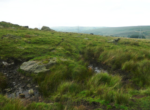
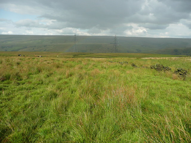
The valley is known for its pristine landscape, with a meandering stream running through the heart of it. Lush greenery blankets the slopes, creating a vibrant and inviting atmosphere for visitors. The area is rich in biodiversity, with a variety of flora and fauna calling it home.

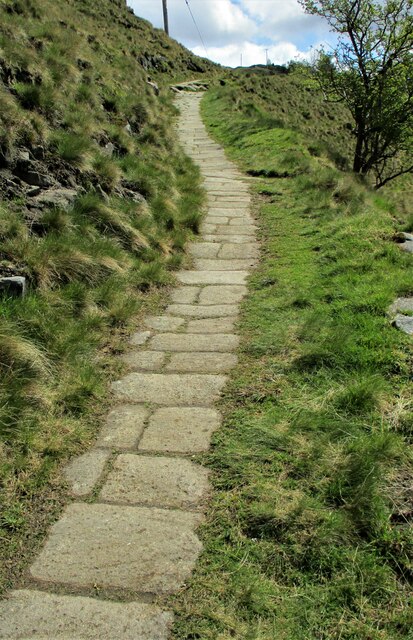
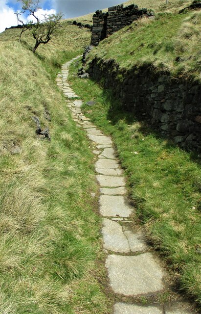
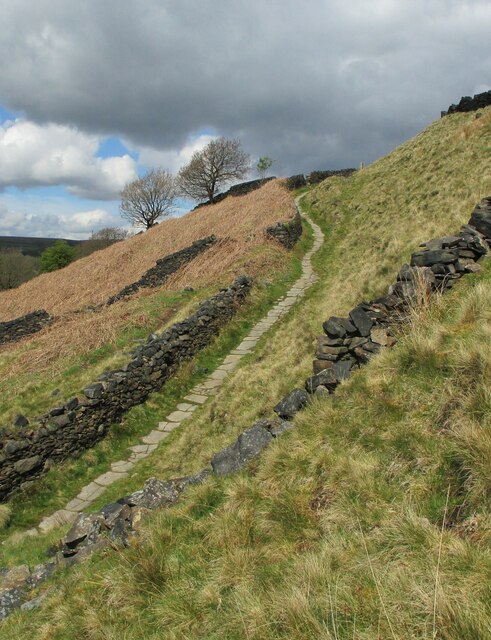
One of the key attractions of Hollingworth Clough is its network of footpaths and walking trails. These well-maintained paths provide an opportunity for hikers and nature enthusiasts to explore the valley and its surroundings. The trails offer stunning views of the surrounding countryside, and visitors can often spot wildlife such as deer, rabbits, and a variety of bird species.

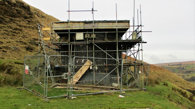
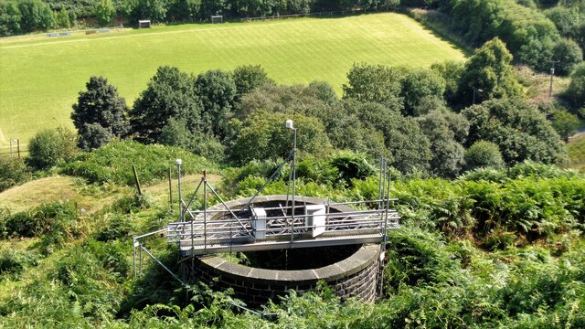
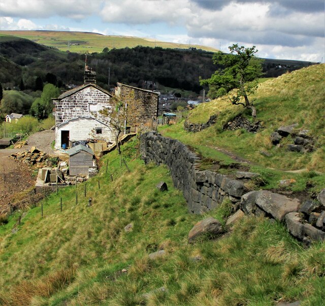
In addition to its natural beauty, Hollingworth Clough has a rich history. The valley was once home to several mills, which played a significant role in the region's industrial past. Today, remnants of these mills can still be seen, adding a touch of historical charm to the area.

Overall, Hollingworth Clough is a hidden paradise in Lancashire, offering a peaceful retreat for those seeking solace in nature. With its stunning landscape, diverse wildlife, and historical significance, this valley is a must-visit destination for anyone exploring the region.

If you have any feedback on the listing, please let us know in the comments section below.

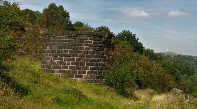
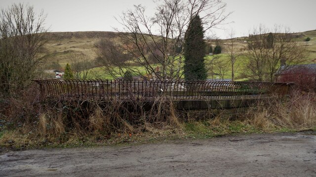
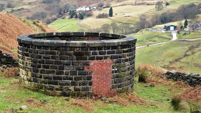
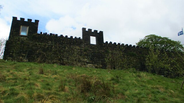
Hollingworth Clough Images

Images are sourced within 2km of 53.691665/-2.0944882 or Grid Reference SD9321. Thanks to Geograph Open Source API. All images are credited.

Longlees Lock, Rochdale Canal Lock no 36 and the start of the summit pound.
Longlees Lock, Rochdale Canal
Lock no 36 and the start of the summit pound.
A6033 at Steanor Bottom Toll House
The Rochdale Way crossing a stream near Ferny Hill This is where the rain started, banishing thoughts of taking photographs of the rocks.
The Rochdale Way crossing a stream near Ferny Hill
This is where the rain started, banishing thoughts of taking photographs of the rocks.
Not quite on the Rochdale Way, Walsden After passing the Ferny Hill rocks I lost the footpath, so headed for the intake wall and picked my way through the rushes. The shower of rain has finished here and is crossing the valley in the distance.
Not quite on the Rochdale Way, Walsden
After passing the Ferny Hill rocks I lost the footpath, so headed for the intake wall and picked my way through the rushes. The shower of rain has finished here and is crossing the valley in the distance.
Long Lees Lock Long Lees Lock on the Rochdale Canal.
Long Lees Lock
Long Lees Lock on the Rochdale Canal.
Long Lees Lock and Lockkeeper's House
Rochdale Canal, Longlees Lock
Rochdale Canal at Gauxholme View from Rochdale to Leeds railway
Rochdale Canal at Gauxholme
View from Rochdale to Leeds railway
Summit Railway Tunnel Air Shaft No.10 North of Moor Bank Clough
Summit Railway Tunnel Air Shaft No.10
North of Moor Bank Clough
Summit Railway Tunnel Air Shaft No.11 Shaft above Bellholme Sports Ground
Summit Railway Tunnel Air Shaft No.11
Shaft above Bellholme Sports Ground
Summit Railway Tunnel Air Shaft No.12 Shaft South East of Rough Stones
Summit Railway Tunnel Air Shaft No.12
Shaft South East of Rough Stones
Summit Railway Tunnel Air Shaft, Bottomley Large Oval Shaft off Bottomley Road
Summit Railway Tunnel Air Shaft, Bottomley
Large Oval Shaft off Bottomley Road
Summit Railway Tunnel Air Shaft No.11 The Shaft with the monitoring equipment removed
Summit Railway Tunnel Air Shaft No.11
The Shaft with the monitoring equipment removed
Eyecatcher Wall of Warland Farm The farm yard boundary wall is conspicuous in the landscape of the Summit pass
Eyecatcher Wall of Warland Farm
The farm yard boundary wall is conspicuous in the landscape of the Summit pass
Causey Stones on Packhorse Track The climb up after Dean Royd Farm towards Bottomley
Causey Stones on Packhorse Track
The climb up after Dean Royd Farm towards Bottomley
Packhorse Track behind Dean Royd Farm The track at this point has a substantial embankment
Packhorse Track behind Dean Royd Farm
The track at this point has a substantial embankment
Causey Stones on Packhorse Track The climb up after Dean Royd Farm to Hollingworth Gate
Causey Stones on Packhorse Track
The climb up after Dean Royd Farm to Hollingworth Gate
Causey Stones on Packhorse Track Final climb of track before flatter section to Hollingworth Gate
Causey Stones on Packhorse Track
Final climb of track before flatter section to Hollingworth Gate
Show me another place!

Hollingworth Clough is located at Grid Ref: SD9321 (Lat: 53.691665, Lng: -2.0944882)

Unitary Authority: Calderdale

Police Authority: West Yorkshire

What 3 Words

///shin.wedding.reckoned. Near Walsden, West Yorkshire

Related Wikis

Walsden

Walsden (; WOLZ-dən) is a large village in the civil parish of Todmorden in the Metropolitan Borough of Calderdale, West Yorkshire, England. It was historically...

Walsden railway station

Walsden railway station (; WOLZ-dən) serves the village of Walsden, Todmorden in West Yorkshire, England, on the edge of the Pennines. It is served by...

Summit Tunnel

Summit Tunnel in England is one of the world's oldest railway tunnels. It was constructed between 1838 and 1841 by the Manchester and Leeds Railway Company...

Summit Tunnel fire

The Summit Tunnel fire occurred on 20 December 1984, when a dangerous goods train caught fire while passing through the Summit Tunnel on the railway line...

Todmorden Unitarian Church

Todmorden Unitarian Church is a Unitarian church located in Honey Hole Road, Todmorden, West Yorkshire, England (grid reference SD935239). Built in honour...

Dobroyd Castle

Dobroyd Castle is an important historic building above the town of Todmorden, West Yorkshire, England. It was built for John Fielden, local mill owner...

Todmorden

Todmorden ( TOD-mər-dən; locally ) is a market town and civil parish in the Upper Calder Valley in Calderdale, West Yorkshire, England. It is 17 miles...

Todmorden Town Hall

Todmorden Town Hall is a municipal building in Halifax Road, Todmorden, West Yorkshire, England. The town hall, which is the meeting place of Todmorden...

Nearby Amenities

Located within 500m of 53.691665,-2.0944882
Waterway: turning_point
Lat/Long: 53.6915405/-2.1000772
Seamark Type: gate
Waterway: lock_gate
Lat/Long: 53.6924008/-2.099506
Seamark Type: gate
Waterway: lock_gate
Lat/Long: 53.6940578/-2.0995734
Seamark Type: gate
Waterway: lock_gate
Lat/Long: 53.6942956/-2.0995911
Seamark Type: gate
Waterway: lock_gate
Lat/Long: 53.6921792/-2.0995575
Seamark Type: gate
Waterway: lock_gate
Lat/Long: 53.690511/-2.0996436
Seamark Type: gate
Waterway: lock_gate
Lat/Long: 53.6907123/-2.0998229
Seamark Type: gate
Waterway: lock_gate
Lat/Long: 53.6879495/-2.0954143
Seamark Type: gate
Waterway: lock_gate
Lat/Long: 53.6880971/-2.095692
Bus Stop
Rochdale Road Nelson Street
Bus: yes
Local Ref: 45018940
Naptan AtcoCode: 450018940
Naptan Bearing: S
Naptan CommonName: Rochdale Road Nelson Street
Naptan Crossing: Nelson Street
Naptan Indicator: Stop 45018940
Naptan Landmark: Cross Keys PH
Naptan PlusbusZoneRef: LEEDS
Naptan ShortCommonName: Nelson Street
Naptan Street: Rochdale Road
Naptan Verified: no
Public Transport: platform
Source: naptan_import
Lat/Long: 53.693755/-2.09997
Bus Stop
Rochdale Road Unity Street
Bus: yes
Local Ref: 45018941
Naptan AtcoCode: 450018941
Naptan Bearing: N
Naptan CommonName: Rochdale Road Unity Street
Naptan Crossing: Unity Street
Naptan Indicator: Stop 45018941
Naptan Landmark: Cross Keys PH
Naptan PlusbusZoneRef: LEEDS
Naptan ShortCommonName: Unity Street
Naptan Street: Rochdale Road
Naptan Verified: no
Public Transport: platform
Source: naptan_import
Lat/Long: 53.6933953/-2.1000752
Bus Stop
Rochdale Road
Bus: yes
Local Ref: 45018942
Naptan AtcoCode: 450018942
Naptan Bearing: NE
Naptan CommonName: Rochdale Road
Naptan Crossing: Scott Street
Naptan Indicator: Stop 45018942
Naptan PlusbusZoneRef: LEEDS
Naptan ShortCommonName: Skew Bridge Walsden
Naptan Street: Rochdale Road
Naptan Verified: no
Public Transport: platform
Source: naptan_import
Lat/Long: 53.691498/-2.1009793
Bus Stop
Walsden Scott Street
Bus: yes
Local Ref: 45018943
Naptan AtcoCode: 450018943
Naptan Bearing: SW
Naptan CommonName: Walsden Scott Street
Naptan Crossing: Scott Street
Naptan Indicator: Stop 45018943
Naptan Landmark: Garden Centre
Naptan PlusbusZoneRef: LEEDS
Naptan ShortCommonName: Scott Street
Naptan Street: Rochdale Road
Naptan Verified: no
Public Transport: platform
Source: naptan_import
Lat/Long: 53.6911114/-2.1011299
Post Office
Walsden Post Office
Addr City: Todmorden
Addr Postcode: OL14 7SN
Branch: Walsden
Brand: Post Office
Brand Wikidata: Q1783168
Check Date: 2020-02-20
Contact Website: https://www.postoffice.co.uk/branch-finder/2804247/walsden
Ref Pol Id: 11237
Lat/Long: 53.694151/-2.1000499
Pub
Cross Keys
Lat/Long: 53.693612/-2.099862
Noexit: yes
Lat/Long: 53.6946419/-2.0999042
Turning Circle
Lat/Long: 53.6908554/-2.0961686
Man Made: tower
Tower Type: communication
Lat/Long: 53.690662/-2.0965301
Turning Circle
Lat/Long: 53.6925232/-2.0925118
The data included in this document is from www.openstreetmap.org. The data is made available under ODbL.

Have you been to Hollingworth Clough?

Leave your review of Hollingworth Clough below (or comments, questions and feedback).