Rhodes Plantation

Wood, Forest in Northumberland

England

Rhodes Plantation

Round bales, Berryhill
Round bales, Berryhill Credit: Richard Webb

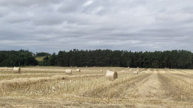
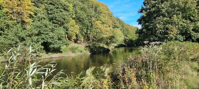
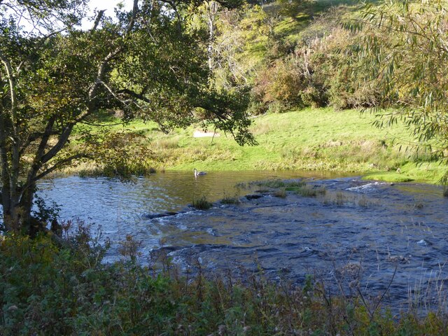
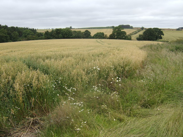
Rhodes Plantation, located in Northumberland, is a sprawling woodland area renowned for its natural beauty and diverse ecosystem. Covering an area of approximately 200 acres, this plantation is a haven for nature enthusiasts and conservationists alike.

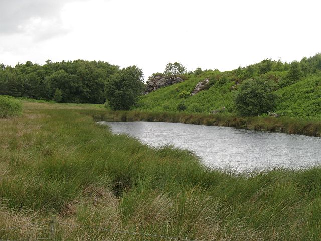
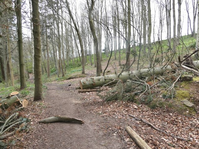
The woodland is primarily composed of various species of deciduous and evergreen trees, including oak, beech, and pine. These trees provide a rich habitat for a wide range of wildlife, making it a popular destination for birdwatchers and animal lovers. Visitors can spot species such as red squirrels, deer, and a plethora of bird species, including owls and woodpeckers.

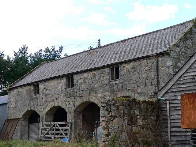
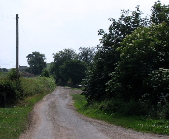
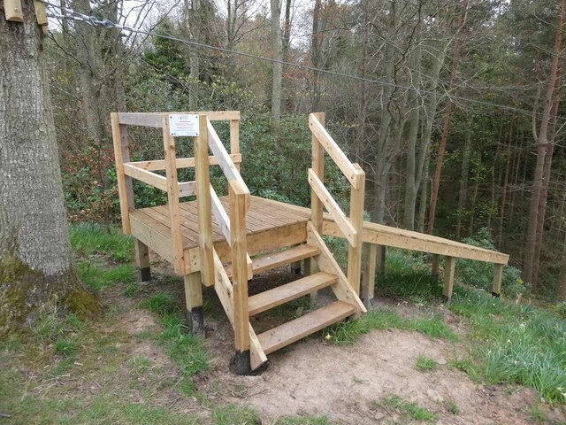
Rhodes Plantation offers a network of well-maintained walking trails that meander through the woodlands, providing visitors with opportunities to explore and immerse themselves in the natural surroundings. These trails are suitable for all ages and fitness levels, making it an ideal location for families and individuals seeking a peaceful retreat.

The plantation is also home to a diverse range of plant life, including wildflowers, ferns, and mosses. During the spring and summer months, the woodland is transformed into a colorful tapestry as these plants bloom and flourish.

In addition to its natural beauty, Rhodes Plantation plays a crucial role in conservation efforts. The management of the woodland focuses on sustainable practices, ensuring the long-term preservation of the ecosystem. This includes controlled logging and reforestation initiatives to maintain a healthy balance between human activities and the natural environment.

Overall, Rhodes Plantation in Northumberland is a captivating destination for nature lovers, offering a scenic landscape, diverse wildlife, and a commitment to conservation.

If you have any feedback on the listing, please let us know in the comments section below.

Rhodes Plantation Images

Images are sourced within 2km of 55.6486/-2.1027472 or Grid Reference NT9339. Thanks to Geograph Open Source API. All images are credited.

Round bales, Berryhill
B6354, Berryhill
B6354, Berryhill
Barleymill Covert, Northumberland Looking northeast along the southern bank of the River Till in the vicinity of Barleymill Covert.
Barleymill Covert, Northumberland
Looking northeast along the southern bank of the River Till in the vicinity of Barleymill Covert.
View of the River Till View much improved by Storm Arwen blowing down the now logged tree beside the path.
View of the River Till
View much improved by Storm Arwen blowing down the now logged tree beside the path.
Young swan on the River Till By Barleymill Bank.
Young swan on the River Till
By Barleymill Bank.
Remains of Etal Barley Mill There are records of a mill here since at least the late 18th century.
Remains of Etal Barley Mill
There are records of a mill here since at least the late 18th century.
Rhodes Hill trig
Rhodes Hill trig
Climbing at Berry Hill Superb Northumberland sandstone provides great climbing in the area. The rock is weathered into strange flutings and arches - a friend said it's like climbing on a cathedral. The tracks below are from the sheep & cattle in the field
Climbing at Berry Hill
Superb Northumberland sandstone provides great climbing in the area. The rock is weathered into strange flutings and arches - a friend said it's like climbing on a cathedral. The tracks below are from the sheep & cattle in the field
View towards Duddo Hill Oats, barley and wheat all in view.
View towards Duddo Hill
Oats, barley and wheat all in view.
Berryhill Crag A south facing sandstone crag with some good climbing potential
Berryhill Crag
A south facing sandstone crag with some good climbing potential
Tindal House Farm Despite appearing to be derelict these cart sheds are still in use.
Tindal House Farm
Despite appearing to be derelict these cart sheds are still in use.
Pond and crag, Etal Moor Fell sandstone outcrops.
Pond and crag, Etal Moor
Fell sandstone outcrops.
Lane to Berryhill farm and crags
For the intrepid visitor End station of a zip wire over the deep gorge of Grove Dene on the Ford and Etal estate.
For the intrepid visitor
End station of a zip wire over the deep gorge of Grove Dene on the Ford and Etal estate.
Footpath in Castle Dene On the Ford Village and Castle Dene signed walk.
Footpath in Castle Dene
On the Ford Village and Castle Dene signed walk.
The Castle Gatehouse
Station buildings at Hetherslaw The smoke is from the locomotive being fired for the day's trains.
Station buildings at Hetherslaw
The smoke is from the locomotive being fired for the day's trains.
Coal and water Looking towards the coal, wood and water supplies at Heatherslaw.
Coal and water
Looking towards the coal, wood and water supplies at Heatherslaw.
Show me another place!

Rhodes Plantation is located at Grid Ref: NT9339 (Lat: 55.6486, Lng: -2.1027472)

Unitary Authority: Northumberland

Police Authority: Northumbria

What 3 Words

///cubed.approve.harps. Near Ford, Northumberland

Related Wikis

Etal, Northumberland

Etal ( EE-təl) is a small village in the far north of the county of Northumberland, England, in the civil parish of Ford. It lies on a bridging point of...

Heatherslaw Mill

Heatherslaw Mill is a water mill situated on the Ford and Etal Estate, 7 miles north of the town of Wooler in the English county of Northumberland. It...
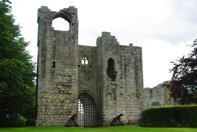
Etal Castle

Etal Castle is a ruined medieval fortification in the village of Etal, Northumberland, England. It was built around 1341 by Robert Manners, and comprised...

Ford Forge

Ford Forge (Ford Mill), Northumberland, England is located on the River Till between the villages of Ford and Etal. Buildings housing a water-powered forge...

Ford Castle

Ford Castle is a Grade I listed building situated at a shallow crossing point on the River Till, Ford, Northumberland, England. The castle dates from about...

Lady Waterford Hall

Lady Waterford Hall is the former village school of the estate village of Ford, Northumberland. It is now used as the village hall and is a Grade II* listed...

Ford, Northumberland

Ford is a small village and civil parish in Northumberland, England, about 13 miles (21 km) from Berwick-upon-Tweed. The parish also includes Etal. �...

Crookham, Northumberland

Crookham is a village on the River Till in Northumberland, in England. It is situated approximately 8 km (5.0 mi) to the east of Coldstream and 14 km...

Nearby Amenities

Located within 500m of 55.6486,-2.1027472
Power: pole
Lat/Long: 55.6444638/-2.1030734
Power: pole
Lat/Long: 55.6447548/-2.1031931
Power: pole
Lat/Long: 55.644916/-2.1032556
Power: pole
Lat/Long: 55.6450399/-2.1026446
Power: pole
Lat/Long: 55.6451843/-2.1033293
Power: pole
Lat/Long: 55.645615/-2.1034654
Power: pole
Lat/Long: 55.6456322/-2.1022037
Power: pole
Lat/Long: 55.6459384/-2.1010445
Power: pole
Lat/Long: 55.6460835/-2.1036082
Power: pole
Lat/Long: 55.6463677/-2.1001092
Power: pole
Lat/Long: 55.6465407/-2.1037555
Power: pole
Lat/Long: 55.6466562/-2.0995237
Power: pole
Lat/Long: 55.6469022/-2.1038537
Power: pole
Lat/Long: 55.6470723/-2.1000161
Power: pole
Lat/Long: 55.6471212/-2.0985574
Power: pole
Lat/Long: 55.6475941/-2.0975509
Power: pole
Lat/Long: 55.6477446/-2.0964842
Power: pole
Lat/Long: 55.6479109/-2.0953975
Noexit: yes
Lat/Long: 55.6445209/-2.1041716
Noexit: yes
Lat/Long: 55.6446374/-2.1035574
Direction: 145
Generator Method: photovoltaic
Generator Output Electricity: yes
Generator Solar Modules: 20
Generator Source: solar
Generator Type: solar_photovoltaic_panel
Location: roof
Power: generator
Lat/Long: 55.6456318/-2.1014531
Direction: 145
Generator Method: photovoltaic
Generator Output Electricity: yes
Generator Solar Modules: 20
Generator Source: solar
Generator Type: solar_photovoltaic_panel
Location: roof
Power: generator
Lat/Long: 55.6457574/-2.1014638
Communication Mobile Phone: yes
Man Made: tower
Tower Type: communication
Lat/Long: 55.6456462/-2.1022423
Noexit: yes
Lat/Long: 55.6456999/-2.1010843
Power: pole
Lat/Long: 55.6447127/-2.1028881
Power: pole
Lat/Long: 55.6471567/-2.101213
Power: pole
Lat/Long: 55.6471779/-2.1003802
The data included in this document is from www.openstreetmap.org. The data is made available under ODbL.

Have you been to Rhodes Plantation?

Leave your review of Rhodes Plantation below (or comments, questions and feedback).