Eighteen Acre Plantation

Wood, Forest in Wiltshire

England

Eighteen Acre Plantation

The Boot Sale at Seend As elsewhere, the farmer letting his land for a boot sale is common. This one is a weekly event in the summer season.
The Boot Sale at Seend Credit: Rog Frost

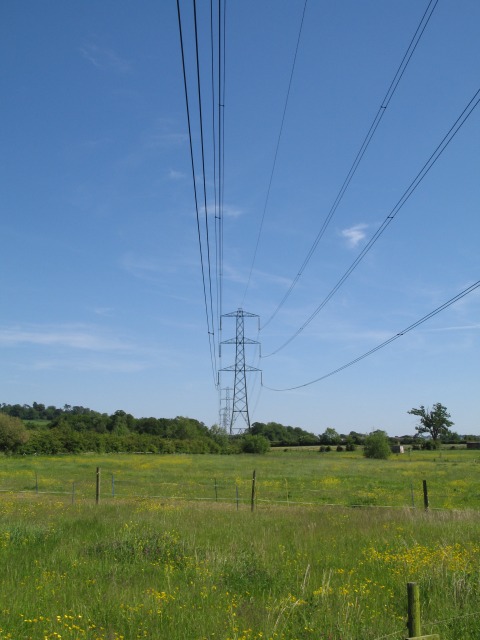
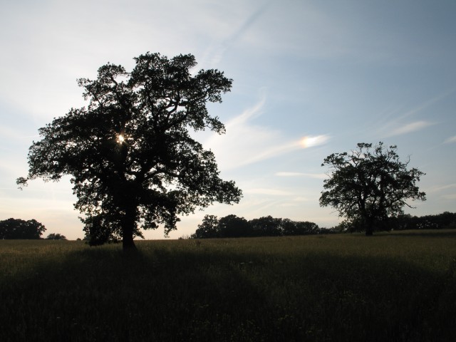
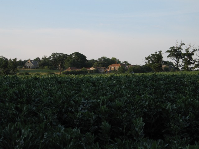
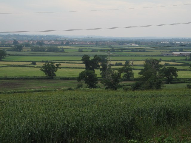
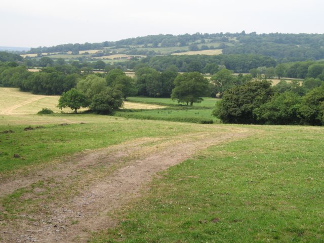
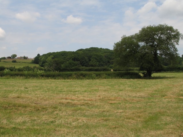
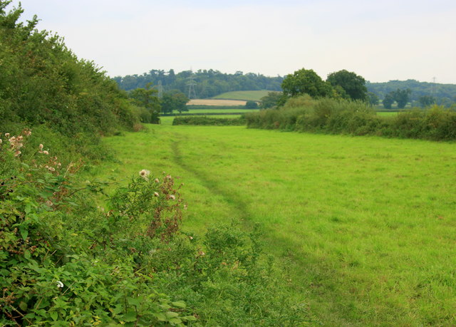
Eighteen Acre Plantation, located in Wiltshire, England, is a picturesque woodland area that spans across eighteen acres of land. Situated in the heart of the county, the plantation is known for its lush greenery, diverse flora, and tranquil ambiance. It is a popular destination for nature enthusiasts, hikers, and those seeking a peaceful retreat from the bustling city life.

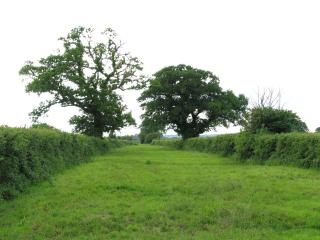
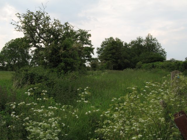
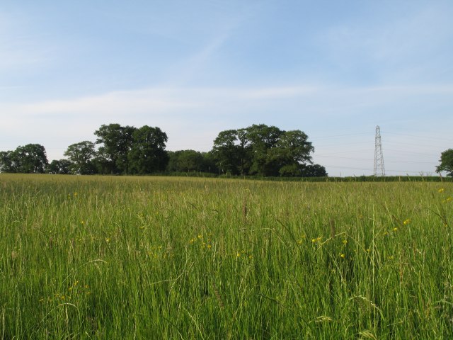
The plantation primarily consists of a dense forest, characterized by a mix of deciduous and evergreen trees. The towering oak, beech, and ash trees dominate the landscape, creating a majestic canopy that provides shade and habitat for a variety of wildlife species. The forest floor is covered with a carpet of ferns, wildflowers, and moss, enhancing the enchanting atmosphere of the plantation.

Eighteen Acre Plantation offers a network of well-maintained walking trails, allowing visitors to explore the woodland at their own pace. These paths wind through the forest, offering glimpses of charming streams, small ponds, and occasional clearings that provide scenic spots for picnics or photography.

The plantation is also home to a diverse range of wildlife, including birds, squirrels, rabbits, and deer. Birdwatchers can spot species such as woodpeckers, owls, and various songbirds. The peaceful environment and abundance of food sources make it an ideal habitat for these creatures.

Visitors to Eighteen Acre Plantation can expect a serene and rejuvenating experience amidst nature's beauty. The plantation provides an opportunity to immerse oneself in the tranquility of the woodlands, enjoy the fresh air, and appreciate the wonders of the natural world.

If you have any feedback on the listing, please let us know in the comments section below.

Eighteen Acre Plantation Images

Images are sourced within 2km of 51.375486/-2.0928912 or Grid Reference ST9364. Thanks to Geograph Open Source API. All images are credited.

The Boot Sale at Seend As elsewhere, the farmer letting his land for a boot sale is common. This one is a weekly event in the summer season.
The Boot Sale at Seend
As elsewhere, the farmer letting his land for a boot sale is common. This one is a weekly event in the summer season.
Pylons over open countryside View southeast at the junction of Woodrow Road (National Cycle Route 4) and New Road
Pylons over open countryside
View southeast at the junction of Woodrow Road (National Cycle Route 4) and New Road
Snarlton Farm
Snarlton Farm
Bridleway - possible old drove road This rather impressive bridle way is presumably an old drove road.  It runs from Snarlton Farm <a href="https://www.geograph.org.uk/gridref/ST9263">ST9263</a> to the Redstocks <a href="https://www.geograph.org.uk/gridref/ST9362">ST9362</a> although just south of this position it becomes somewhat overgrown
Bridleway - possible old drove road
This rather impressive bridle way is presumably an old drove road. It runs from Snarlton Farm ST9263 to the Redstocks ST9362 although just south of this position it becomes somewhat overgrown
Overgrown bridleway/old drove road
Pylons near Rowde Croft Farm
Grassy field near  Broad Lane Farm
Grassy field near Broad Lane Farm
Trees near Broad Lane Farm Although this image was originally taken to record the spectrum resulting from sunlight reflected off the high level cloud to the upper left of the rightmost tree, this image does show the mature trees which can be found in this area.
Trees near Broad Lane Farm
Although this image was originally taken to record the spectrum resulting from sunlight reflected off the high level cloud to the upper left of the rightmost tree, this image does show the mature trees which can be found in this area.
Sandridge Farm
Sandridge Farm
Hack Farm
Hack Farm
Field near Blackmore Farm
View over crops towards Bowerhill
View from the end of Sandridge Lane
Open fields and woodland west of Bromham
2008 : The A3102 eastbound About to climb Sandridge Hill heading for Calne. Melksham is about 3km behind.
2008 : The A3102 eastbound
About to climb Sandridge Hill heading for Calne. Melksham is about 3km behind.
2008 : Pasture and footpath near Little Snarlton Farm Sandridge Park is to the left on the far hill.
2008 : Pasture and footpath near Little Snarlton Farm
Sandridge Park is to the left on the far hill.
2008 : New Road Farm The idea of adding the word "new" to something to make it seem more attractive is not new by any means.
2008 : New Road Farm
The idea of adding the word "new" to something to make it seem more attractive is not new by any means.
2008 : Harvested field near Sandridge Park Was lucky enough to meet the farmer here, he told me the crop was oilseed rape.
2008 : Harvested field near Sandridge Park
Was lucky enough to meet the farmer here, he told me the crop was oilseed rape.
Show me another place!

Eighteen Acre Plantation is located at Grid Ref: ST9364 (Lat: 51.375486, Lng: -2.0928912)

Unitary Authority: Wiltshire

Police Authority: Wiltshire

What 3 Words

///downs.embedded.galaxy. Near Seend, Wiltshire

Related Wikis

Sandridge, Wiltshire

Sandridge is a dispersed rural community to the east of Melksham, Wiltshire, England. It is part of the civil parish of Melksham Without. An Ordnance...

Melksham Without

Melksham Without is a civil parish in the county of Wiltshire, England. It surrounds, but does not include, the town of Melksham and is the largest rural...

Redstocks

Redstocks is a hamlet in Wiltshire, England; it is in the civil parish of Melksham Without and is 1.7 miles (2.7 km) east of Melksham. From 1886 to 1950...

Melksham Town F.C.

Melksham Town Football Club is a football club based in Melksham, Wiltshire, England. Affiliated to the Wiltshire Football Association, they are currently...

Seend railway station

Seend railway station was near the village of Seend in Wiltshire, England. The station was a stop on the Devizes Branch Line, between Semington and Bromham...

Melksham Oak Community School

Melksham Oak Community School is a mixed secondary school and sixth form located in the southeast outskirts of Melksham, Wiltshire, England, for students...

Bromham and Rowde Halt railway station

Bromham and Rowde Halt was the railway station serving Bromham and Rowde in Wiltshire, England between 1909 and 1966. The station was a stop on the Devizes...

Seend Locks

Seend Locks (grid reference ST933613) are at Seend Cleeve, Wiltshire on the Kennet and Avon Canal, England. They have a combined rise/fall of 38 ft 4ins...

Nearby Amenities

Located within 500m of 51.375486,-2.0928912
Power: tower
Source: Bing
Lat/Long: 51.3735272/-2.0908051
Power: tower
Source: Bing
Lat/Long: 51.3759381/-2.0970524
Power: tower
Source: Bing
Lat/Long: 51.3747997/-2.0939509
Colour: grey
Height: 46.99
Material: metal
Operator: National Grid
Operator Wikidata: Q1465461
Power: tower
Ref: YYM016
Source: Bing
Start Date: 1957
Structure: lattice
Lat/Long: 51.3758128/-2.0911801
Power: tower
Source: Bing
Lat/Long: 51.372391/-2.0877576
Colour: grey
Height: 46.94
Material: metal
Operator: National Grid
Operator Wikidata: Q1465461
Power: tower
Ref: YYM017
Source: Bing
Start Date: 1957
Structure: lattice
Lat/Long: 51.373978/-2.0868384
Colour: grey
Height: 53.08
Material: metal
Operator: National Grid
Operator Wikidata: Q1465461
Power: tower
Ref: YYM015
Start Date: 1957
Structure: lattice
Lat/Long: 51.3774663/-2.0955302
The data included in this document is from www.openstreetmap.org. The data is made available under ODbL.

Have you been to Eighteen Acre Plantation?

Leave your review of Eighteen Acre Plantation below (or comments, questions and feedback).