Peak Plantation

Wood, Forest in Gloucestershire Cotswold

England

Peak Plantation

Crickley Hill Car Park
Crickley Hill Car Park Credit: Matthew Chadwick

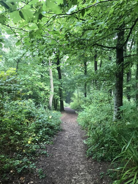
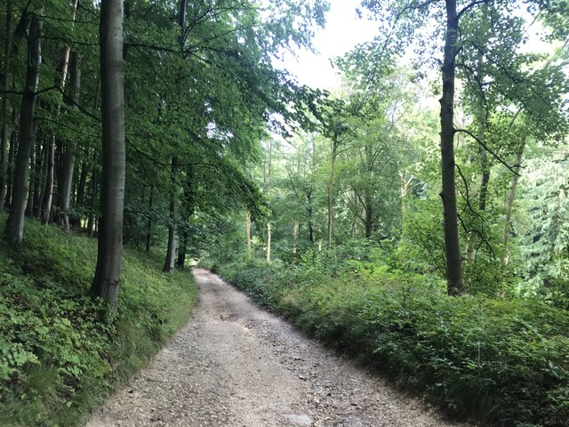
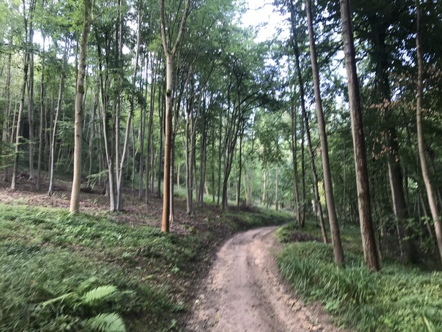
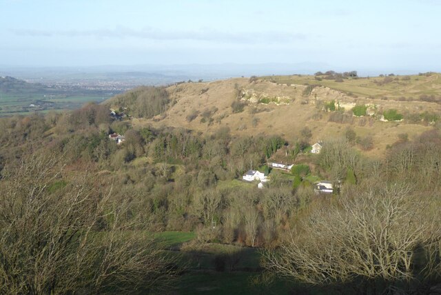
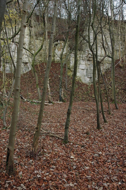
Peak Plantation is a charming woodland located in the county of Gloucestershire, England. Situated in the heart of the picturesque Forest of Dean, it covers an area of approximately 50 hectares. The plantation is characterized by its dense canopy of mature trees, which mostly consists of oak, beech, and ash, providing a serene and tranquil atmosphere.

The woodlands of Peak Plantation have a rich history, dating back several centuries. It was originally part of the royal hunting forest and has been managed by the Forestry Commission since the early 20th century. Today, it serves as an important recreational space for both locals and visitors alike.

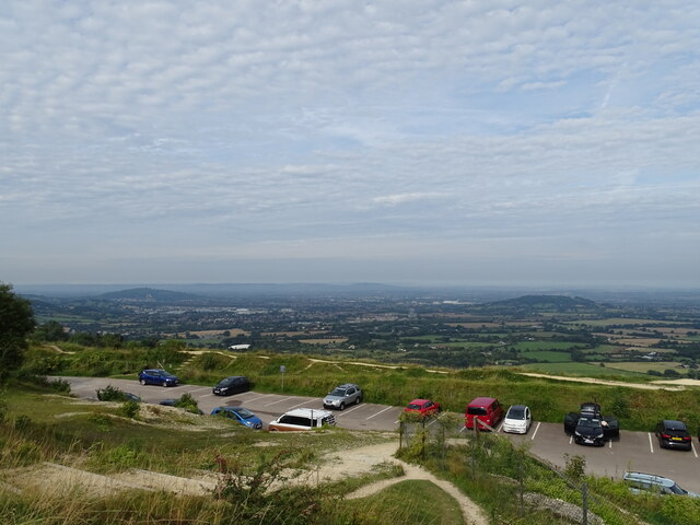
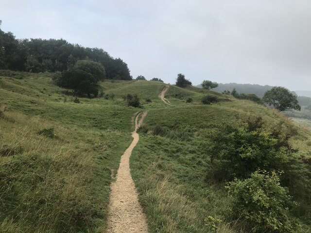
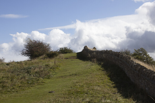
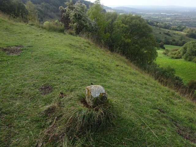
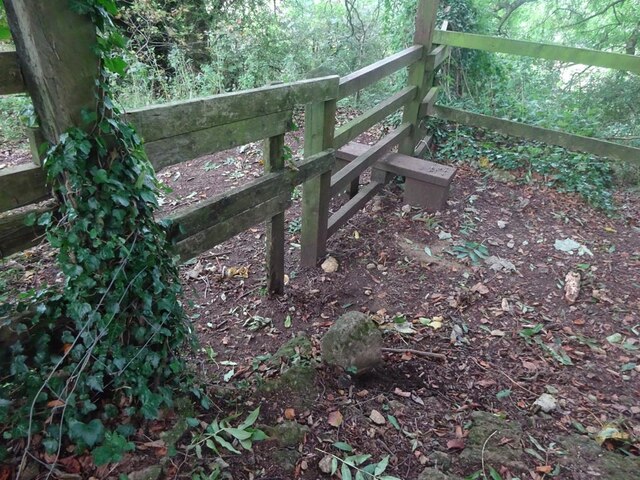
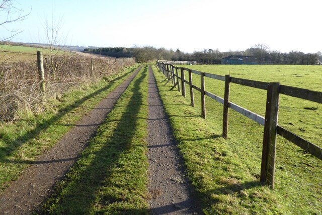
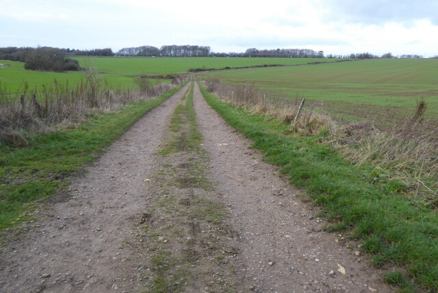
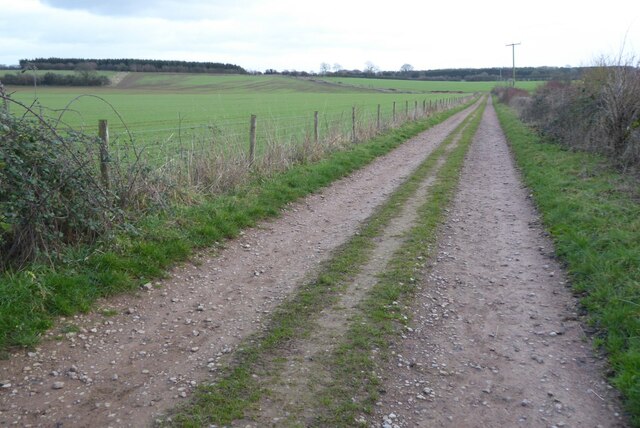
The woodland offers a network of well-maintained footpaths and trails, making it an ideal destination for walking, hiking, and exploring nature. The diverse flora and fauna found within Peak Plantation are a testament to its ecological significance. Wildflowers and ferns can be spotted in the understory, while a variety of bird species, including woodpeckers and nightingales, can be heard singing from the treetops.

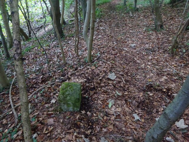
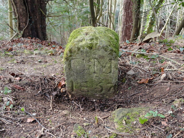
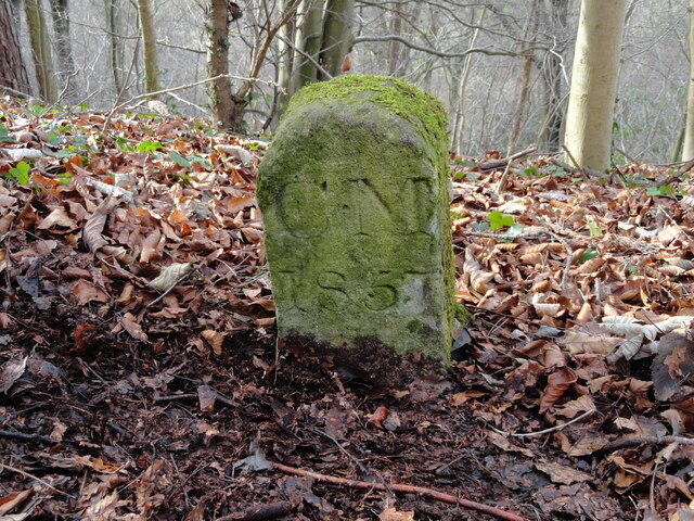
In addition to its natural beauty, Peak Plantation also has historical landmarks that add to its allure. The remains of ancient iron mines and quarries can be found, serving as reminders of the area's industrial past.

Overall, Peak Plantation in Gloucestershire is a captivating woodland that offers a delightful escape into nature. Its combination of stunning landscapes, remarkable biodiversity, and historical interest make it a popular destination for nature enthusiasts and history buffs alike.

If you have any feedback on the listing, please let us know in the comments section below.

Peak Plantation Images

Images are sourced within 2km of 51.832661/-2.1097802 or Grid Reference SO9214. Thanks to Geograph Open Source API. All images are credited.

Crickley Hill Car Park
Rough land by the Cotswold Way
Deciduous woodland by the Cotswold Way
The Cotswold Way track
Track bend
Track bend
Crickley Hill
Crickley Hill
Boundary Stone, Barrow Wake, Birdlip The boundary between Cowley Parish to the SE (including Birdlip) and Badgeworth (NE) runs along the lip of a very steep escarpment. The inscription would have been C M 1857 like others along the same ridge. See <a title="https://www.geograph.org.uk/discuss/index.php?&action=vthread&forum=11&topic=32582" href="https://www.geograph.org.uk/discuss/index.php?&action=vthread&forum=11&topic=32582">Link</a>

Inscription: ?85?

Milestone Society National ID: GL_BADCOW03pb
Boundary Stone, Barrow Wake, Birdlip
The boundary between Cowley Parish to the SE (including Birdlip) and Badgeworth (NE) runs along the lip of a very steep escarpment. The inscription would have been C M 1857 like others along the same ridge. See Link Inscription: ?85? Milestone Society National ID: GL_BADCOW03pb
Boundary Stone, Peak Plantation, Birdlip At the top of the escarpment that delineates the boundary between Badgeworth (West) and Cowley (inc Birdlip) to the East. See other stones along the ridge <a title="https://www.geograph.org.uk/discuss/index.php?&action=vthread&forum=11&topic=32582" href="https://www.geograph.org.uk/discuss/index.php?&action=vthread&forum=11&topic=32582">Link</a>

Inscription: C M / 1857

Milestone Society National ID: GL_BADCOW04pb
Boundary Stone, Peak Plantation, Birdlip
At the top of the escarpment that delineates the boundary between Badgeworth (West) and Cowley (inc Birdlip) to the East. See other stones along the ridge Link Inscription: C M / 1857 Milestone Society National ID: GL_BADCOW04pb
Boundary Stone, Peak Plantation, Birdlip At the stile and apex of the boundary. Cowley (inc Birdlip) is to the SE, Badgeworth is N, S & W. There is no visible inscription but other Boundary Stones along the ridge bear the letters C M & 1857. See other stones along the ridge <a title="https://www.geograph.org.uk/discuss/index.php?&action=vthread&forum=11&topic=32582" href="https://www.geograph.org.uk/discuss/index.php?&action=vthread&forum=11&topic=32582">Link</a>

Milestone Society National ID: GL_BADCOW05pb
Boundary Stone, Peak Plantation, Birdlip
At the stile and apex of the boundary. Cowley (inc Birdlip) is to the SE, Badgeworth is N, S & W. There is no visible inscription but other Boundary Stones along the ridge bear the letters C M & 1857. See other stones along the ridge Link Milestone Society National ID: GL_BADCOW05pb
Crickley Hill Crickley Hill viewed from the Wake Barrow viewpoint. The Malvern Hills are on the distant horizon.
Crickley Hill
Crickley Hill viewed from the Wake Barrow viewpoint. The Malvern Hills are on the distant horizon.
The A417 The A417 viewed from the Barrow Wake viewpoint.
The A417
The A417 viewed from the Barrow Wake viewpoint.
Minor country road No through road to Birdlip Radio Station.
Minor country road
No through road to Birdlip Radio Station.
Beech trees Beech trees near Birdlip Radio Station.
Beech trees
Beech trees near Birdlip Radio Station.
The Gloucestershire Way The Gloucestershire Way from a track approaching Rushwood Kennels.
The Gloucestershire Way
The Gloucestershire Way from a track approaching Rushwood Kennels.
Track and footpath Track and footpath to Barrow Wake.
Track and footpath
Track and footpath to Barrow Wake.
Track and footpath Track and footpath on Shab Hill.
Track and footpath
Track and footpath on Shab Hill.
Old Boundary Marker in Peak Plantation Parish Boundary Marker on the cliff edge in Peak Plantation. On the boundary of Badgeworth and Cowley parishes. Inscribed C M / 1857.

Milestone Society National ID: GL_BADCOW06pb
Old Boundary Marker in Peak Plantation
Parish Boundary Marker on the cliff edge in Peak Plantation. On the boundary of Badgeworth and Cowley parishes. Inscribed C M / 1857. Milestone Society National ID: GL_BADCOW06pb
Old Boundary Marker in Peak Plantation Parish Boundary Marker on the cliff edge in Peak Plantation. On the boundary of Badgeworth and Cowley parishes. Inscribed C M / 1857. See also <a title="https://www.geograph.org.uk/photo/6989229" href="https://www.geograph.org.uk/photo/6989229">Link</a>.

Milestone Society National ID: GL_BADCOW04pb
Old Boundary Marker in Peak Plantation
Parish Boundary Marker on the cliff edge in Peak Plantation. On the boundary of Badgeworth and Cowley parishes. Inscribed C M / 1857. See also Link. Milestone Society National ID: GL_BADCOW04pb
Show me another place!

Peak Plantation is located at Grid Ref: SO9214 (Lat: 51.832661, Lng: -2.1097802)

Administrative County: Gloucestershire

District: Cotswold

Police Authority: Gloucestershire

What 3 Words

///crouch.junior.pursue. Near Shurdington, Gloucestershire

Related Wikis

Knap House Quarry, Birdlip

Knap House Quarry, Birdlip (grid reference SO925147) is a 1.80-hectare (4.4-acre) geological Site of Special Scientific Interest in Gloucestershire, notified...
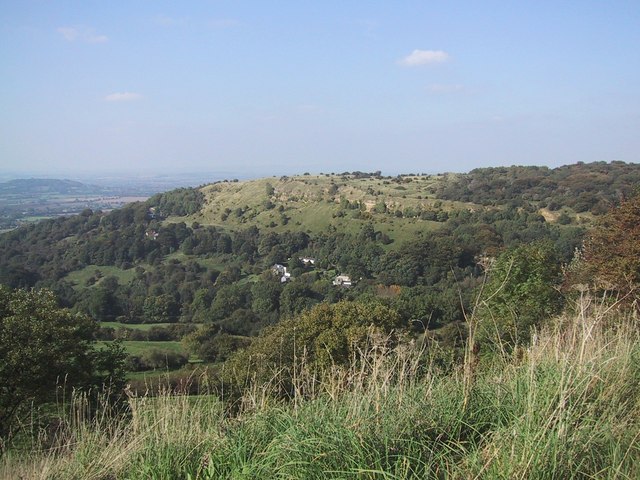
Barrow Wake

Barrow Wake is a scenic view in Gloucestershire, near Birdlip, England. Barrow Wake was used as the location for the music video "Wytches" by Pagan Rock...
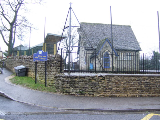
Birdlip

Birdlip is a village and civil parish, in the Cotswold district, in the county of Gloucestershire, England. It is in the Cotswolds Area of Outstanding...

Crickley Hill and Barrow Wake

Crickley Hill and Barrow Wake (grid reference SO929161 & grid reference SO931154) is a 56.8-hectare (140-acre) biological and geological Site of Special...

The Air Balloon, Birdlip

The Air Balloon is a road junction and former pub Birdlip, Gloucestershire, England. The junction is on the A417 at a significant congestion point. The...

Great Witcombe

Great Witcombe is a village and civil parish 5 miles (8 km) south east of Gloucester, in the Tewkesbury district, in the county of Gloucestershire, England...

Bushley Muzzard, Brimpsfield

Bushley Muzzard, Brimpsfield (grid reference SO944133) is a 1.13-hectare (2.8-acre) biological Site of Special Scientific Interest in Gloucestershire,...

Brimpsfield Priory

Brimpsfield Priory was a Benedictine monastic foundation in Brimpsfield, Gloucestershire, England, a cell or grange of the Abbey of Saint-Wandrille in...

Nearby Amenities

Located within 500m of 51.832661,-2.1097802
Birdlip Peak
Ele: 254
Natural: peak
Source: NLS-OS-1st_Series
Lat/Long: 51.8344138/-2.1132727
Hill Farm
Fixme: Still a farm?
Landuse: farm
Note Retag: CS #48756035
Source: OS OpenData StreetView
Lat/Long: 51.8339808/-2.1152651
Fixme: incomplete
Lat/Long: 51.8305558/-2.1065844
Barrier: stile
Bicycle: yes
Foot: yes
Lat/Long: 51.8338514/-2.1084005
Barrier: stile
Bicycle: yes
Foot: yes
Lat/Long: 51.8345163/-2.1137466
Daniel Paul Mathews
Historic: memorial
Source: GPS
Lat/Long: 51.8341576/-2.114418
Barrier: stile
Foot: designated
Lat/Long: 51.8306839/-2.1068348
Barrier: kissing_gate
Foot: designated
Lat/Long: 51.830729/-2.111819
Give Way
Direction: forward
Lat/Long: 51.8317699/-2.1026636
Give Way
Direction: forward
Lat/Long: 51.8316446/-2.102754
Give Way
Direction: backward
Lat/Long: 51.8314498/-2.1054861
Give Way
Direction: forward
Lat/Long: 51.8283611/-2.1084827
Addr Housename: Knapp House
Lat/Long: 51.8320715/-2.1120029
Access: customers
Leisure: picnic_table
Lat/Long: 51.8285025/-2.110694
Noexit: yes
Lat/Long: 51.828365/-2.1105161
Entrance: yes
Lat/Long: 51.828329/-2.1097788
Barrow Wake
Ele: 302
Natural: peak
Lat/Long: 51.8332091/-2.1032489
Birdlip Hill
Power: pole
Transformer: distribution
Voltage Primary: 11000
Lat/Long: 51.832872/-2.1152933
Knapp House
Power: pole
Transformer: distribution
Voltage Primary: 11000
Lat/Long: 51.8325244/-2.1129604
Power: pole
Lat/Long: 51.8324452/-2.1135452
Power: pole
Lat/Long: 51.8324477/-2.114439
Power: pole
Lat/Long: 51.8324539/-2.1153858
Power: pole
Lat/Long: 51.8318937/-2.1155226
Power: pole
Lat/Long: 51.8310363/-2.1157318
Birdlip Cheltenham Road
Power: transformer
Transformer: distribution
Voltage Primary: 11000
Lat/Long: 51.8282855/-2.108677
The data included in this document is from www.openstreetmap.org. The data is made available under ODbL.

Have you been to Peak Plantation?

Leave your review of Peak Plantation below (or comments, questions and feedback).