The Dingle

Wood, Forest in Worcestershire

England

The Dingle

Railway Yards at Stourbridge junction The railway yards to the north of Stourbridge Junction station. At this date the main traffic in the yard was railway infrastructure materials and the trains were prepared here prior to engineering work in the locality. The locomotives are 45003, 45014, 45062 and 47364.
Railway Yards at Stourbridge junction Credit: Rob Newman

The Dingle is a picturesque wooded area located in Worcestershire, England. Situated within the expansive Wyre Forest, it covers an area of approximately 20 hectares and is renowned for its natural beauty and tranquility. The Dingle is characterized by its dense forest vegetation, with a rich variety of deciduous and coniferous trees, including oak, beech, birch, and pine.

The woodland is crisscrossed by a network of footpaths and trails, providing visitors with the opportunity to explore and immerse themselves in the serene surroundings. The paths wind through the trees, over babbling brooks, and past enchanting ponds, creating a magical atmosphere that is perfect for a leisurely stroll or a peaceful picnic.

The Dingle is also known for its diverse wildlife. The dense vegetation provides a haven for numerous bird species such as woodpeckers, owls, and thrushes, making it a popular spot for birdwatchers. Additionally, the area is home to a variety of small mammals, including foxes, badgers, and squirrels.

Managed by the Forestry Commission, The Dingle is meticulously maintained to preserve its natural beauty. Visitors can enjoy the woodland throughout the year, with each season offering a unique experience. In spring, the forest bursts into life with vibrant displays of bluebells and wildflowers, while autumn paints the trees in a tapestry of red, orange, and gold.

Overall, The Dingle in Worcestershire is a haven of tranquility and natural beauty, offering visitors the opportunity to escape the hustle and bustle of everyday life and immerse themselves in the peacefulness of the forest.

If you have any feedback on the listing, please let us know in the comments section below.

The Dingle Images

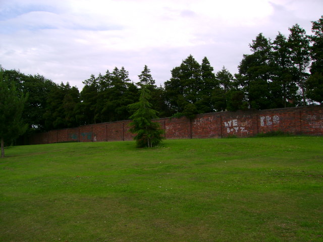
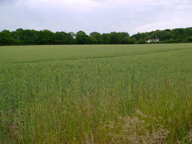
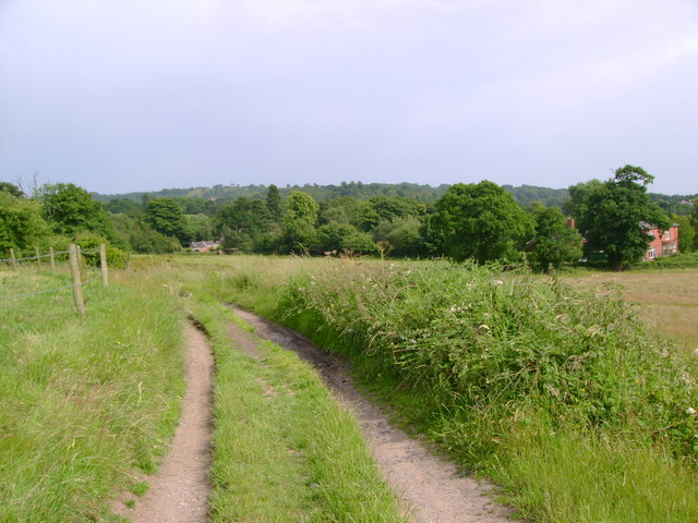
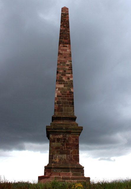
Images are sourced within 2km of 52.445979/-2.1134355 or Grid Reference SO9283. Thanks to Geograph Open Source API. All images are credited.

Railway Yards at Stourbridge junction The railway yards to the north of Stourbridge Junction station. At this date the main traffic in the yard was railway infrastructure materials and the trains were prepared here prior to engineering work in the locality. The locomotives are 45003, 45014, 45062 and 47364.
Railway Yards at Stourbridge junction
The railway yards to the north of Stourbridge Junction station. At this date the main traffic in the yard was railway infrastructure materials and the trains were prepared here prior to engineering work in the locality. The locomotives are 45003, 45014, 45062 and 47364.
Clock at Stourbridge Junction
Stourbridge Junction Signal Box The ex-GWR signal box at Stourbridge Junction with "Sprinter" train No 150002 passing with a northbound service
Stourbridge Junction Signal Box
The ex-GWR signal box at Stourbridge Junction with "Sprinter" train No 150002 passing with a northbound service
Stourbridge Town Branch Line The Parry 'People Mover' vehicle No 139002 working the Stourbridge Town branch line approaching Stourbridge Junction station
Stourbridge Town Branch Line
The Parry 'People Mover' vehicle No 139002 working the Stourbridge Town branch line approaching Stourbridge Junction station
"Sprinter" in the Snow at Stourbridge Junction A heavy snow fall is under way as 'Sprinter' Class 150 diesel multiple unit No 150005 arrives at Stourbridge Junction Station with a service from the south
"Sprinter" in the Snow at Stourbridge Junction
A heavy snow fall is under way as 'Sprinter' Class 150 diesel multiple unit No 150005 arrives at Stourbridge Junction Station with a service from the south
Mural, Claycroft Place, Lye
Summer Street, Lye
Summer Street, Lye
Union Street, Lye
Union Street, Lye
The Crabmill, Old Swinford
The Cross, Old Swinford
The Bird in Hand, Old Swinford
Up freight passing Stourbridge Junction station View northward, towards Dudley and Wolverhampton, also Old Hill and Birmingham (Snow Hill); ex-GWR Worcester - Wolverhampton main line and main branch Stourbridge Junction - Birmingham Snow Hill. The Class C freight is headed by 4-6-0 No. 5959 'Mawley Hall' (built 1/36, withdrawn 9/62).
Up freight passing Stourbridge Junction station
View northward, towards Dudley and Wolverhampton, also Old Hill and Birmingham (Snow Hill); ex-GWR Worcester - Wolverhampton main line and main branch Stourbridge Junction - Birmingham Snow Hill. The Class C freight is headed by 4-6-0 No. 5959 'Mawley Hall' (built 1/36, withdrawn 9/62).
Crown Inn, Old Swinford
'Halls' meet at Stourbridge Junction View northward, towards Birmingham Snow Hill (straight on), Dudley and Wolverhampton (left). No. 6936 'Breccles Hall' (built 7/42, named 2/47, withdrawn 11/64) on a Birmingham - Hereford train is arriving; No. 6984 'Owsden Hall' on the left on a Cardiff - Birmingham train is a Hawksworth '6959' or 'Modified Hall' (built 2/48, withdrawn 12/65 but saved from scrap and currently (2011) under restoration on the Gloucestershire & Warwickshire Railway).
'Halls' meet at Stourbridge Junction
View northward, towards Birmingham Snow Hill (straight on), Dudley and Wolverhampton (left). No. 6936 'Breccles Hall' (built 7/42, named 2/47, withdrawn 11/64) on a Birmingham - Hereford train is arriving; No. 6984 'Owsden Hall' on the left on a Cardiff - Birmingham train is a Hawksworth '6959' or 'Modified Hall' (built 2/48, withdrawn 12/65 but saved from scrap and currently (2011) under restoration on the Gloucestershire & Warwickshire Railway).
Stevens Park The highest ground in Stevens Park, formerly home to swing sets.  A new playground has been constructed elsewhere in the park.
Stevens Park
The highest ground in Stevens Park, formerly home to swing sets. A new playground has been constructed elsewhere in the park.
Wheat field Wheat growing in a clay soil northeast of Wychbury Hill.
Wheat field
Wheat growing in a clay soil northeast of Wychbury Hill.
Reservoir access track Looking down a track leading away from the reservoir higher up on Wychbury Hill.
Reservoir access track
Looking down a track leading away from the reservoir higher up on Wychbury Hill.
Wychbury Hill Obelisk This has only recently been restored after years behind scaffolding. Photographed against a very dark sky!
Wychbury Hill Obelisk
This has only recently been restored after years behind scaffolding. Photographed against a very dark sky!
Show me another place!

The Dingle is located at Grid Ref: SO9283 (Lat: 52.445979, Lng: -2.1134355)

Unitary Authority: Dudley

Police Authority: West Midlands

What 3 Words

///driver.rinse.assume. Near Stourbridge, West Midlands

Nearby Locations

The Dingle Wollescote

Related Wikis

Wollescote

Wollescote is a residential area of Stourbridge, West Midlands, England . It is administered by the Metropolitan Borough of Dudley. It falls within the...

Pedmore High School

The Pedmore High School is a mixed secondary school located in the Pedmore area of Stourbridge, West Midlands, England.The school opened in September 1939...

Stourbridge (UK Parliament constituency)

Stourbridge is a constituency in West Midlands represented in the House of Commons of the UK Parliament since 2019 by Suzanne Webb, a member of the Conservative...

Lye Town F.C.

Lye Town Football Club is a football club based in the Black Country town of Lye, Stourbridge, West Midlands, England. They are currently members of the...

Nearby Amenities

Located within 500m of 52.445979,-2.1134355
Bus Stop
Oakfield Rd / Chalfont Place
Bus: yes
Naptan AtcoCode: 43000820001
Naptan Bearing: NE
Naptan BusStopType: MKD
Naptan CommonName: Chalfont Place
Naptan Indicator: adj
Naptan NaptanCode: nwmtjpgd
Naptan PlusbusZoneRef: BHAMNWS
Naptan Status: ACT
Naptan StopType: BCT
Naptan Street: OAKFIELD RD
Naptan Towards: Lye
Naptan Verified: no
Public Transport: platform
Route Ref: 142;276;299
Source: WMCA
Lat/Long: 52.441838/-2.1112064
Bus Stop
Oakfield Rd / Coppice Avenue
NaPTANAreaCode: 43000814501
Bus: yes
Naptan AtcoCode: 43000814501
Naptan Bearing: NE
Naptan BusStopType: MKD
Naptan CommonName: Coppice Avenue
Naptan Indicator: adj
Naptan NaptanCode: nwmjtdag
Naptan PlusbusZoneRef: BHAMNWS
Naptan Status: ACT
Naptan StopType: BCT
Naptan Street: OAKFIELD RD
Naptan Towards: Lye
Naptan Verified: no
Public Transport: platform
Route Ref: 142;276;299
Shelter: yes
Shelter Ref: 408406
Source: WMCA
Lat/Long: 52.4450862/-2.1082426
Bus Stop
Oakfield Rd / Coppice Avenue
NaPTANAreaCode: 43000814502
Bus: yes
Naptan AtcoCode: 43000814502
Naptan Bearing: SW
Naptan BusStopType: MKD
Naptan CommonName: Coppice Avenue
Naptan Indicator: opp
Naptan NaptanCode: nwmjtdaj
Naptan PlusbusZoneRef: BHAMNWS
Naptan Status: ACT
Naptan StopType: BCT
Naptan Street: OAKFIELD RD
Naptan Towards: Stourbridge
Naptan Verified: no
Public Transport: platform
Route Ref: 142;276;298
Shelter: yes
Shelter Ref: 408405
Source: WMCA
Lat/Long: 52.4448101/-2.1084177
Bus Stop
Oakfield Rd / Amos Rd
NaPTANAreaCode: 43000814601
Bus: yes
Naptan AtcoCode: 43000814601
Naptan Bearing: NE
Naptan BusStopType: MKD
Naptan CommonName: Amos Rd
Naptan Indicator: adj
Naptan NaptanCode: nwmjtdam
Naptan PlusbusZoneRef: BHAMNWS
Naptan Status: ACT
Naptan StopType: BCT
Naptan Street: OAKFIELD RD
Naptan Towards: Lye
Naptan Verified: no
Public Transport: platform
Route Ref: 142;276;299
Shelter: yes
Shelter Ref: 408404
Source: WMCA
Lat/Long: 52.443862/-2.109961
Bus Stop
Oakfield Rd / Woodfield Avenue
Bus: yes
Naptan AtcoCode: 43000814701
Naptan Bearing: S
Naptan BusStopType: MKD
Naptan CommonName: Woodfield Avenue
Naptan Indicator: adj
Naptan NaptanCode: nwmjtdap
Naptan PlusbusZoneRef: BHAMNWS
Naptan Status: ACT
Naptan StopType: BCT
Naptan Street: OAKFIELD RD
Naptan Towards: Stourbridge
Naptan Verified: no
Public Transport: platform
Route Ref: 142;276;298
Source: WMCA
Lat/Long: 52.4427284/-2.1108409
Bus Stop
Oakfield Rd / Woodfield Avenue
Bus: yes
Naptan AtcoCode: 43000814702
Naptan Bearing: N
Naptan BusStopType: MKD
Naptan CommonName: Woodfield Avenue
Naptan Indicator: opp
Naptan NaptanCode: nwmjtdat
Naptan PlusbusZoneRef: BHAMNWS
Naptan Status: ACT
Naptan StopType: BCT
Naptan Street: OAKFIELD RD
Naptan Towards: Lye
Naptan Verified: no
Public Transport: platform
Route Ref: 142;276;299
Source: WMCA
Lat/Long: 52.4426923/-2.1109732
Bus Stop
Springfield Ave / Stevens Park
Bus: yes
Naptan AtcoCode: 43000815101
Naptan Bearing: S
Naptan BusStopType: MKD
Naptan CommonName: Stevens Park
Naptan Indicator: adj
Naptan NaptanCode: nwmjtdaw
Naptan PlusbusZoneRef: BHAMNWS
Naptan Status: ACT
Naptan StopType: BCT
Naptan Street: SPRINGFIELD AVE
Naptan Towards: Stourbridge
Naptan Verified: no
Public Transport: platform
Route Ref: 298
Source: WMCA
Lat/Long: 52.4500063/-2.1124686
Bus Stop
Springfield Ave / Stevens Park
NaPTANAreaCode: 43000815102
Bus: yes
Naptan AtcoCode: 43000815102
Naptan Bearing: N
Naptan BusStopType: MKD
Naptan CommonName: Stevens Park
Naptan Indicator: opp
Naptan NaptanCode: nwmjtdga
Naptan PlusbusZoneRef: BHAMNWS
Naptan Status: ACT
Naptan StopType: BCT
Naptan Street: SPRINGFIELD AVE
Naptan Towards: Lye
Naptan Verified: no
Public Transport: platform
Route Ref: 299
Shelter: yes
Shelter Ref: 408410
Source: WMCA
Lat/Long: 52.4499434/-2.1125617
Bus Stop
Walker Ave / Wollescote Rd
Bus: yes
Naptan AtcoCode: 43000815301
Naptan Bearing: N
Naptan BusStopType: MKD
Naptan CommonName: Wollescote Rd
Naptan Indicator: before
Naptan NaptanCode: nwmjtdgm
Naptan PlusbusZoneRef: BHAMNWS
Naptan Status: ACT
Naptan StopType: BCT
Naptan Street: WALKER AVE
Naptan Towards: Stourbridge
Naptan Verified: no
Public Transport: platform
Route Ref: 142
Source: WMCA
Lat/Long: 52.4472778/-2.1196952
Bus Stop
Queensway / Walker Avenue
NaPTANAreaCode: 43000816201
Bus: yes
Naptan AtcoCode: 43000816201
Naptan Bearing: SE
Naptan BusStopType: MKD
Naptan CommonName: Walker Avenue
Naptan Indicator: adj
Naptan NaptanCode: nwmjtdjm
Naptan PlusbusZoneRef: BHAMNWS
Naptan Status: ACT
Naptan StopType: BCT
Naptan Street: QUEENSWAY
Naptan Towards: Wollescote
Public Transport: platform
Route Ref: 142;276;299
Shelter: yes
Shelter Ref: 408402
Source: WMCA
Lat/Long: 52.4422922/-2.1167207
Bus Stop
Queensway / Walker Avenue
NaPTANAreaCode: 43000816202
Bus: yes
Naptan AtcoCode: 43000816202
Naptan Bearing: NW
Naptan BusStopType: MKD
Naptan CommonName: Walker Avenue
Naptan Indicator: adj
Naptan NaptanCode: nwmjtdjp
Naptan PlusbusZoneRef: BHAMNWS
Naptan Status: ACT
Naptan StopType: BCT
Naptan Street: QUEENSWAY
Naptan Towards: Stourbridge
Public Transport: platform
Route Ref: 142;276;298
Shelter: yes
Shelter Ref: 408403
Source: WMCA
Lat/Long: 52.4420286/-2.1163227
Bus Stop
Walker Ave / Rye Croft
Bus: yes
Naptan AtcoCode: 43000816501
Naptan Bearing: S
Naptan BusStopType: MKD
Naptan CommonName: Rye Croft
Naptan Indicator: adj
Naptan NaptanCode: nwmjtdmg
Naptan PlusbusZoneRef: BHAMNWS
Naptan Status: ACT
Naptan StopType: BCT
Naptan Street: WALKER AVE
Naptan Towards: Wollescote
Naptan Verified: no
Public Transport: platform
Route Ref: 142
Source: WMCA
Lat/Long: 52.4449864/-2.1186002
Bus Stop
Walker Ave / Rye Croft
Bus: yes
Naptan AtcoCode: 43000816502
Naptan Bearing: N
Naptan BusStopType: MKD
Naptan CommonName: Rye Croft
Naptan Indicator: opp
Naptan NaptanCode: nwmjtdmj
Naptan PlusbusZoneRef: BHAMNWS
Naptan Status: ACT
Naptan StopType: BCT
Naptan Street: WALKER AVE
Naptan Towards: Stourbridge
Naptan Verified: no
Public Transport: platform
Route Ref: 142
Source: WMCA
Lat/Long: 52.4449896/-2.1187726
Post Office
Queensway Post Office
Addr Postcode: DY9 9HJ
Fixme Addr 1: 49 Queensway
Fixme Addr City: Stourbridge
Opening Hours: Mo,Tu,Th,Fr 06:00-18:00; We,Sa 06:00-18:30; Su 07:00-13:00
Ref Pol Id: 8260
Source: OS OpenData StreetView
Lat/Long: 52.4421208/-2.1170354
Turning Circle
Source: bing
Lat/Long: 52.4486239/-2.1084619
Wynall
Is In: Dudley
Place: suburb
Lat/Long: 52.4470944/-2.107375
Crossing
Crossing: uncontrolled
Lat/Long: 52.4477493/-2.1192925
Toilets
Access: yes
Addr City: Dudley
Addr Postcode: DY9 7JG
Addr Street: Wollescote Park
Addr Suburb: Wollescote
Automatic Public Convenience: no
Changing Table: no
Fee: no
Female: yes
Male: yes
Opening Hours: Mo-Su 09:00-16:00
Operator: Parks Development, Directorate of Place, Dudley MBC
Radar Key Needed: yes
Source: Dudley MBC
Source Extractdate: 30/09/2016
Supervised: no
Uprn: 90214313
Wheelchair: yes
Lat/Long: 52.4489786/-2.1176355
Generator Method: photovoltaic
Generator Output Electricity: yes
Generator Source: solar
Generator Type: solar_photovoltaic_panel
Location: roof
Power: generator
Lat/Long: 52.4451332/-2.1178213
Generator Method: photovoltaic
Generator Output Electricity: yes
Generator Source: solar
Generator Type: solar_photovoltaic_panel
Location: roof
Power: generator
Lat/Long: 52.4457732/-2.1166143
Generator Method: photovoltaic
Generator Output Electricity: yes
Generator Source: solar
Generator Type: solar_photovoltaic_panel
Location: roof
Power: generator
Lat/Long: 52.4456245/-2.107653
Generator Method: photovoltaic
Generator Output Electricity: yes
Generator Source: solar
Generator Type: solar_photovoltaic_panel
Location: roof
Power: generator
Lat/Long: 52.4459923/-2.1104988
Generator Method: photovoltaic
Generator Output Electricity: yes
Generator Source: solar
Generator Type: solar_photovoltaic_panel
Location: roof
Power: generator
Lat/Long: 52.4432849/-2.1141171
Generator Method: photovoltaic
Generator Output Electricity: yes
Generator Source: solar
Generator Type: solar_photovoltaic_panel
Location: roof
Power: generator
Lat/Long: 52.4433029/-2.1140528
Generator Method: photovoltaic
Generator Output Electricity: yes
Generator Source: solar
Generator Type: solar_photovoltaic_panel
Location: roof
Power: generator
Lat/Long: 52.4448626/-2.1153456
Generator Method: photovoltaic
Generator Output Electricity: yes
Generator Source: solar
Generator Type: solar_photovoltaic_panel
Location: roof
Power: generator
Lat/Long: 52.4448397/-2.1167377
Generator Method: photovoltaic
Generator Output Electricity: yes
Generator Source: solar
Generator Type: solar_photovoltaic_panel
Location: roof
Power: generator
Lat/Long: 52.4448038/-2.1167886
Generator Method: photovoltaic
Generator Output Electricity: yes
Generator Source: solar
Generator Type: solar_photovoltaic_panel
Location: roof
Power: generator
Lat/Long: 52.4428386/-2.1159062
Generator Method: photovoltaic
Generator Output Electricity: yes
Generator Source: solar
Generator Type: solar_photovoltaic_panel
Location: roof
Power: generator
Lat/Long: 52.4463765/-2.1202594
Generator Method: photovoltaic
Generator Output Electricity: yes
Generator Source: solar
Generator Type: solar_photovoltaic_panel
Location: roof
Power: generator
Lat/Long: 52.445904/-2.1205464
Generator Method: photovoltaic
Generator Output Electricity: yes
Generator Source: solar
Generator Type: solar_photovoltaic_panel
Location: roof
Power: generator
Lat/Long: 52.444431/-2.1198222
Generator Method: photovoltaic
Generator Output Electricity: yes
Generator Source: solar
Generator Type: solar_photovoltaic_panel
Location: roof
Power: generator
Lat/Long: 52.4444375/-2.1197417
Bicycle Parking
Bicycle Parking: stands
Capacity: 6
Covered: no
Fee: no
Lat/Long: 52.4495723/-2.1171509
Prince Rupert
Artwork Type: statue
Material: wood
Source: survey
Tourism: artwork
Lat/Long: 52.4486175/-2.116732
Communication Mobile Phone: yes
Man Made: mast
Tower Construction: tube
Tower Type: communication
Lat/Long: 52.4478659/-2.1184608
The data included in this document is from www.openstreetmap.org. The data is made available under ODbL.

Have you been to The Dingle?

Leave your review of The Dingle below (or comments, questions and feedback).