Ley Plantation

Wood, Forest in Durham

England

Ley Plantation

Notice Board, Westgate Details of a tour of the archaeological excavations at Westgate Castle on Saturday 14th May 2011.
Notice Board, Westgate Credit: Andrew Curtis

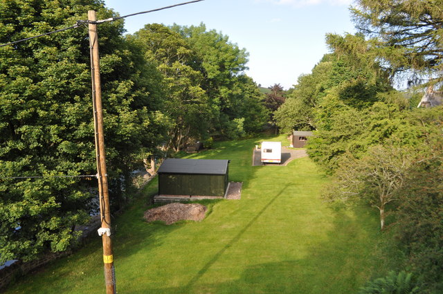
Ley Plantation, located in Durham, England, is a sprawling woodland area known for its natural beauty and diverse flora and fauna. Covering an expansive area, the plantation is a popular destination for nature enthusiasts, hikers, and those seeking a tranquil escape from the bustling city life.

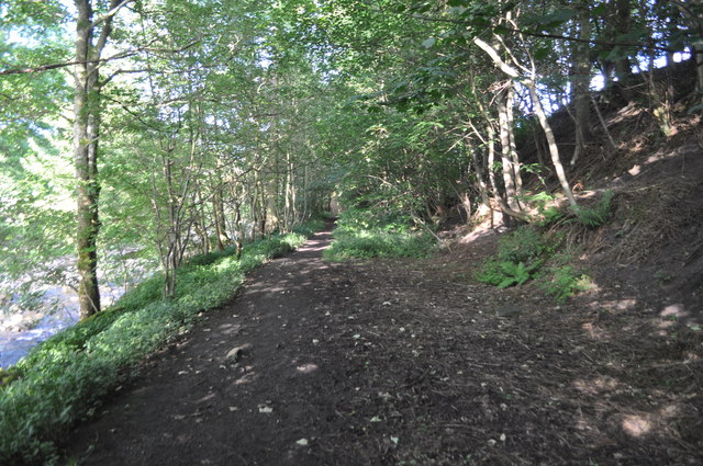
The woodland is primarily composed of a mix of deciduous and coniferous trees, including oak, beech, birch, and pine, creating a rich and vibrant tapestry of colors throughout the seasons. The forest floor is adorned with a variety of wildflowers, ferns, and mosses, adding to the enchanting atmosphere.

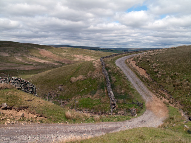
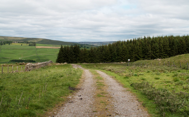
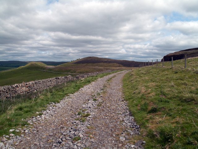
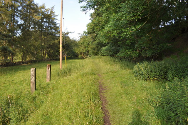
Ley Plantation boasts an extensive network of well-maintained trails, allowing visitors to explore the area at their own pace. The paths wind through the woodlands, offering picturesque views of ancient trees, babbling brooks, and charming wildlife habitats. Birdwatchers can delight in the diverse avian population, with species such as woodpeckers, owls, and various songbirds frequently spotted in the canopy.

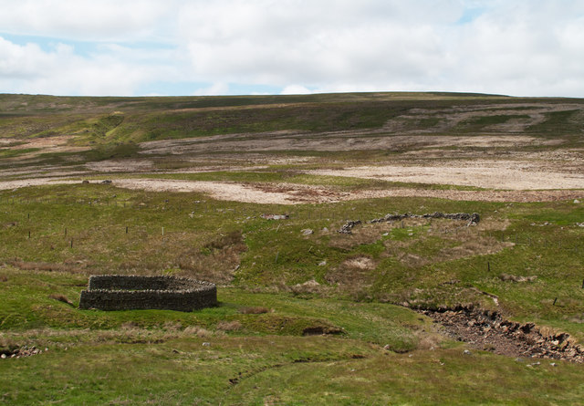
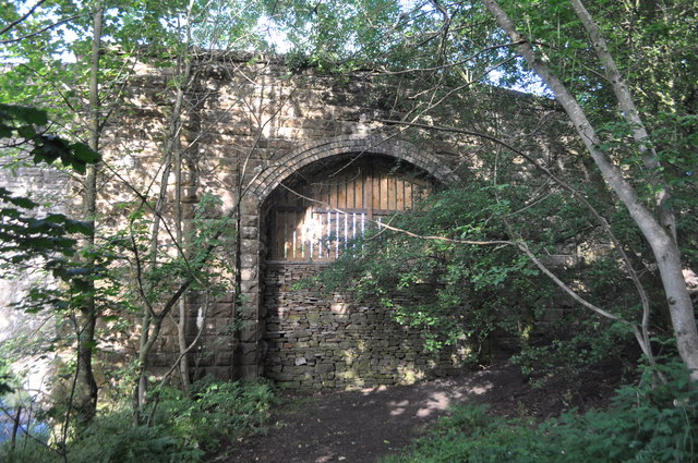
For history enthusiasts, Ley Plantation holds significant cultural value. The woodland was once part of the larger Hetton Estate, which dates back to the medieval period. Remnants of the estate's past can still be seen in the form of old boundary walls and the occasional ruins of former structures.

Ley Plantation is a true haven for nature lovers and offers a peaceful and rejuvenating experience for all who visit. Whether one seeks a leisurely stroll, a challenging hike, or simply a moment of tranquility amidst nature, this Durham woodland provides a captivating and memorable experience.

If you have any feedback on the listing, please let us know in the comments section below.

Ley Plantation Images

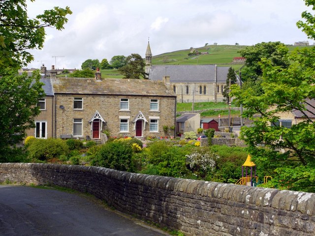
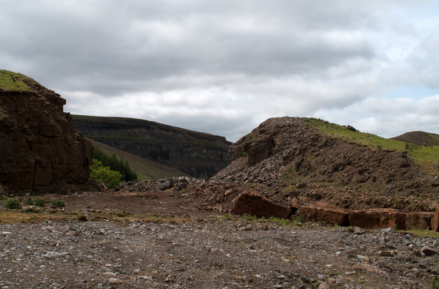
Images are sourced within 2km of 54.727784/-2.1196524 or Grid Reference NY9236. Thanks to Geograph Open Source API. All images are credited.

Notice Board, Westgate Details of a tour of the archaeological excavations at Westgate Castle on Saturday 14th May 2011.
Notice Board, Westgate
Details of a tour of the archaeological excavations at Westgate Castle on Saturday 14th May 2011.
Cottage opposite road junction, Front Street, Westgate Part of the wall near the entrance to the cottage (8 Front Street) has been lowered, possibly to create a milk-stand.
Keys to the Past: <span class="nowrap"><a title="http://www.keystothepast.info/article/10339/Site-Details?PRN=D8717" rel="nofollow ugc noopener" href="http://www.keystothepast.info/article/10339/Site-Details?PRN=D8717">Link</a><img style="margin-left:2px;" alt="External link" title="External link - shift click to open in new window" src="https://s1.geograph.org.uk/img/external.png" width="10" height="10"/></span>
Cottage opposite road junction, Front Street, Westgate
Part of the wall near the entrance to the cottage (8 Front Street) has been lowered, possibly to create a milk-stand. Keys to the Past: LinkExternal link
Front Street, Westgate Undated old photo in the Beamish Collection <span class="nowrap"><a title="http://collections.beamish.org.uk/search-detail?item=NEG30521" rel="nofollow ugc noopener" href="http://collections.beamish.org.uk/search-detail?item=NEG30521">Link</a><img style="margin-left:2px;" alt="External link" title="External link - shift click to open in new window" src="https://s1.geograph.org.uk/img/external.png" width="10" height="10"/></span>
Historic village survey - Westgate: <span class="nowrap"><a title="http://www.keystothepast.info/article/10339/Site-Details?PRN=D8517" rel="nofollow ugc noopener" href="http://www.keystothepast.info/article/10339/Site-Details?PRN=D8517">Link</a><img style="margin-left:2px;" alt="External link" title="External link - shift click to open in new window" src="https://s1.geograph.org.uk/img/external.png" width="10" height="10"/></span>
Front Street, Westgate
Undated old photo in the Beamish Collection LinkExternal link Historic village survey - Westgate: LinkExternal link
Village Hall, Westgate The village institute, renamed as the village hall started as a single-storey cottage in the square. A building has been marked on maps here since the first edition Ordnance Survey maps of 1856-65 (1). The building contains a number of features dedicated as war memorials including a plaque and clock on the exterior of the building.
Keys to the Past: <span class="nowrap"><a title="http://www.keystothepast.info/article/10339/Site-Details?PRN=D8733" rel="nofollow ugc noopener" href="http://www.keystothepast.info/article/10339/Site-Details?PRN=D8733">Link</a><img style="margin-left:2px;" alt="External link" title="External link - shift click to open in new window" src="https://s1.geograph.org.uk/img/external.png" width="10" height="10"/></span>
Village Hall, Westgate
The village institute, renamed as the village hall started as a single-storey cottage in the square. A building has been marked on maps here since the first edition Ordnance Survey maps of 1856-65 (1). The building contains a number of features dedicated as war memorials including a plaque and clock on the exterior of the building. Keys to the Past: LinkExternal link
War Memorial plaque, Westgate Village Hall
Hare & Hounds, Front Street, Westgate
Children's playground, Westgate Photo taken from the road approaching Haswick's Bridge on the north side of the River Wear. View of the rear of houses on Front Street.
Children's playground, Westgate
Photo taken from the road approaching Haswick's Bridge on the north side of the River Wear. View of the rear of houses on Front Street.
Westgate Bales Out A companion photo to Andy Waddington's <a href="https://www.geograph.org.uk/photo/1584777">NY9038 : Westgate Bales up</a>
The number of bales has clearly reduced over the winter as they have been used for animal fodder.

Les Hull, though, had a bale-free view of St Andrew's Church in July 2006 <a href="https://www.geograph.org.uk/photo/205320">NY9038 : St. Andrews Church, Westgate</a>
Westgate Bales Out
A companion photo to Andy Waddington's NY9038 : Westgate Bales up The number of bales has clearly reduced over the winter as they have been used for animal fodder. Les Hull, though, had a bale-free view of St Andrew's Church in July 2006 NY9038 : St. Andrews Church, Westgate
Westgate from Haswick's Bridge Looking over the playground to the rear of the houses on Front Street and St Andrew's Church in Westgate below Scutter Hill.
Another from a similar viewpoint here <a href="https://www.geograph.org.uk/photo/1391310">NY9038 : Westgate</a>
Westgate from Haswick's Bridge
Looking over the playground to the rear of the houses on Front Street and St Andrew's Church in Westgate below Scutter Hill. Another from a similar viewpoint here NY9038 : Westgate
Quarry of 'Weardale Works' Weardale has seen massive amounts of rock quarried from its sides and no larger working exists in the valley than the old Blue Circle, later Lafarge operation on the south side which supplied limestone by conveyor to the cement works at Eastgate; OS mapping names the area as 'Weardale Works'.
Soon after the Lafarge purchase quarrying and cement manufacture ceased and the cement works at Eastgate was erased. Similarly the quarrying operation ended and the quarry area has been landscaped.
Once a public footpath cut across the north end of the quarry site; it was closed during the period of extraction but it seems that it might be reopened in the future; the image here was taken from the probable line of the path and shows distantly part of the quarry face beyond nearer workings.
Quarry of 'Weardale Works'
Weardale has seen massive amounts of rock quarried from its sides and no larger working exists in the valley than the old Blue Circle, later Lafarge operation on the south side which supplied limestone by conveyor to the cement works at Eastgate; OS mapping names the area as 'Weardale Works'. Soon after the Lafarge purchase quarrying and cement manufacture ceased and the cement works at Eastgate was erased. Similarly the quarrying operation ended and the quarry area has been landscaped. Once a public footpath cut across the north end of the quarry site; it was closed during the period of extraction but it seems that it might be reopened in the future; the image here was taken from the probable line of the path and shows distantly part of the quarry face beyond nearer workings.
Estate road crossing Yew Cleugh An estate/farm road enters the Weardale side valley of Western Hope keeping above the east side of the Westernhope Burn. That road is seen here descending to cross the minor stream of Yew Cleugh; the view is northwards.
Estate road crossing Yew Cleugh
An estate/farm road enters the Weardale side valley of Western Hope keeping above the east side of the Westernhope Burn. That road is seen here descending to cross the minor stream of Yew Cleugh; the view is northwards.
South-west corner of Ludwell Wood Ludwell Wood lies to the east of the valley of Western Hope; it's seen in this image from an estate road to the south on the same side of Western Hope.
South-west corner of Ludwell Wood
Ludwell Wood lies to the east of the valley of Western Hope; it's seen in this image from an estate road to the south on the same side of Western Hope.
Curved walls on west side of Westernhope Burn There are two wall sections across the stream, one completely ruinous. OS mapping at 1:25 000 names these curved walls as sheepfolds but surely they're not; a sheepfold would have a means of sealing an entrance so as to confine animals when required; that would be impossible here. A more likely explanation is that the features are/were sheep shelters so that beasts could keep out of the worst of poor weather.
Curved walls on west side of Westernhope Burn
There are two wall sections across the stream, one completely ruinous. OS mapping at 1:25 000 names these curved walls as sheepfolds but surely they're not; a sheepfold would have a means of sealing an entrance so as to confine animals when required; that would be impossible here. A more likely explanation is that the features are/were sheep shelters so that beasts could keep out of the worst of poor weather.
Estate road in Western Hope An estate road enters Western Hope on its eastern side where for some distance it runs at the lower edge of the 'Weardale Works', now disused. The 'Works' was a limestone quarrying operation which cut and crushed the rock then transported it by conveyor down to the floor of the Wear Valley at Eastgate for the manufacture of cement at the Blue Circle plant there. The mounds in the distance are landscaped spoil heaps of the quarry; the road runs below there too.
Estate road in Western Hope
An estate road enters Western Hope on its eastern side where for some distance it runs at the lower edge of the 'Weardale Works', now disused. The 'Works' was a limestone quarrying operation which cut and crushed the rock then transported it by conveyor down to the floor of the Wear Valley at Eastgate for the manufacture of cement at the Blue Circle plant there. The mounds in the distance are landscaped spoil heaps of the quarry; the road runs below there too.
Former Weardale Railway Lifted section of the Weardale railway. 
<span class="nowrap"><a title="http://www.disused-stations.org.uk/w/westgate/index.shtml" rel="nofollow ugc noopener" href="http://www.disused-stations.org.uk/w/westgate/index.shtml">Link</a><img style="margin-left:2px;" alt="External link" title="External link - shift click to open in new window" src="https://s1.geograph.org.uk/img/external.png" width="10" height="10"/></span>
Former Weardale Railway
Lifted section of the Weardale railway. LinkExternal link
Former Weardale Railway The blocked up arch of this bridge. The road bridge being altered for the railway. Westgate station was the other side of this bridge. 

<span class="nowrap"><a title="http://www.disused-stations.org.uk/w/westgate/index.shtml" rel="nofollow ugc noopener" href="http://www.disused-stations.org.uk/w/westgate/index.shtml">Link</a><img style="margin-left:2px;" alt="External link" title="External link - shift click to open in new window" src="https://s1.geograph.org.uk/img/external.png" width="10" height="10"/></span>
Former Weardale Railway
The blocked up arch of this bridge. The road bridge being altered for the railway. Westgate station was the other side of this bridge. LinkExternal link
Westgate Station The former station. 
<span class="nowrap"><a title="http://www.disused-stations.org.uk/w/westgate/index.shtml" rel="nofollow ugc noopener" href="http://www.disused-stations.org.uk/w/westgate/index.shtml">Link</a><img style="margin-left:2px;" alt="External link" title="External link - shift click to open in new window" src="https://s1.geograph.org.uk/img/external.png" width="10" height="10"/></span>
Westgate Station
The former station. LinkExternal link
Show me another place!

Ley Plantation is located at Grid Ref: NY9236 (Lat: 54.727784, Lng: -2.1196524)

Unitary Authority: County Durham

Police Authority: Durham

What 3 Words

///heaven.handle.kings. Near Stanhope, Co. Durham

Nearby Locations

Ley Plantation Fallow Hill

Related Wikis

Brotherlee

Brotherlee is a small village in the civil parish of Stanhope, in County Durham, England situated on the south side of Weardale, between Stanhope and Daddry...

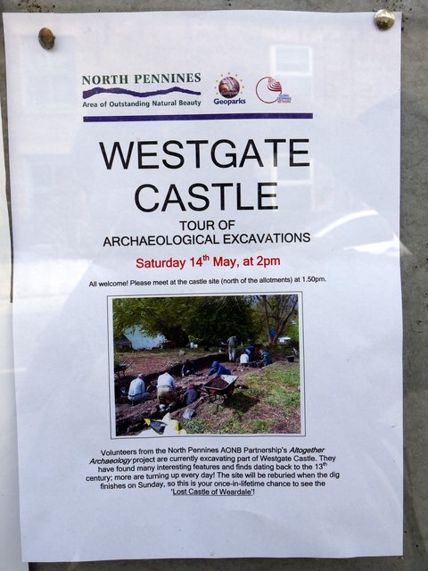
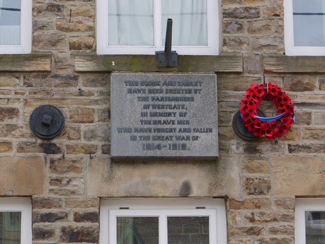
Westgate, County Durham

Westgate is a village in the civil parish of Stanhope, in County Durham, England. It is situated in Weardale between St John's Chapel and Eastgate. In...

North Pennines

The North Pennines is the northernmost section of the Pennine range of hills which runs north–south through northern England. It lies between Carlisle...

Westernhope Burn Wood

Westernhope Burn Wood is a Site of Special Scientific Interest in the Wear Valley district of south-west County Durham, England. It occupies the steeply...

Nearby Amenities

Located within 500m of 54.727784,-2.1196524
Barrier: entrance
Lat/Long: 54.7243425/-2.1207073
High House
Addr City: Bishop Auckland
Addr Postcode: DL13 1SS
Image: https://www.geograph.org.uk/photo/7528849
Place: isolated_dwelling
Source Name: Historic OS mapping
Source Postcode: CodePoint Open
Lat/Long: 54.7302442/-2.1210775
The data included in this document is from www.openstreetmap.org. The data is made available under ODbL.

Have you been to Ley Plantation?

Leave your review of Ley Plantation below (or comments, questions and feedback).