Crookhill

Settlement in Durham

England

Crookhill

Flooded farmland east of Heddon Haughs
Flooded farmland east of Heddon Haughs Credit: Andrew Curtis

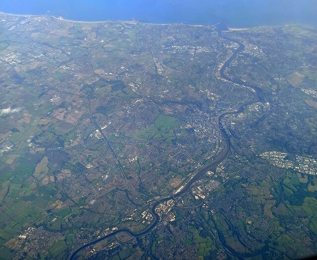
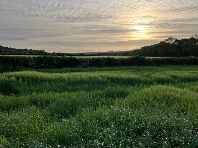
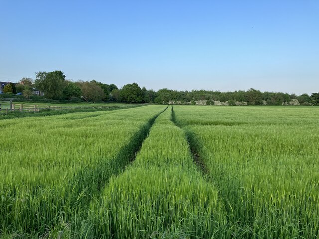
Crookhill is a small village located in County Durham, in the northeast of England. Situated approximately 8 miles southwest of Durham city, it falls within the civil parish of Lanchester. Crookhill is surrounded by picturesque countryside, with rolling hills and green fields providing a scenic backdrop to the village.

Despite its rural setting, Crookhill benefits from its proximity to nearby towns and cities. The village is well-connected, with easy access to major transport routes such as the A691 and A692 roads, which provide links to Durham, Consett, and other surrounding areas. The nearest train station can be found in Lanchester, just a short distance away.

In terms of amenities, Crookhill offers a limited range of facilities. There is a local pub, providing a social hub for residents and visitors alike. For more extensive shopping, entertainment, and dining options, the nearby towns of Consett and Durham offer a wider variety.

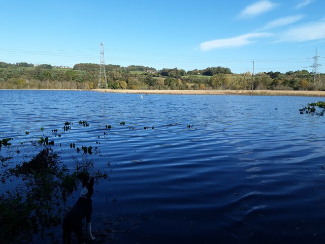
Crookhill is surrounded by beautiful countryside, making it an ideal location for outdoor enthusiasts. The area is known for its walking and cycling trails, providing opportunities to explore the stunning landscapes and enjoy the fresh air. Additionally, the village is close to several nature reserves and country parks, including the popular Derwent Reservoir.

Overall, Crookhill is a tranquil village, offering a peaceful living environment for its residents, while still being within easy reach of the larger towns and cities in the region.

If you have any feedback on the listing, please let us know in the comments section below.
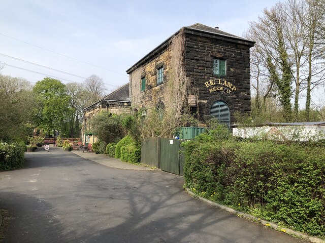
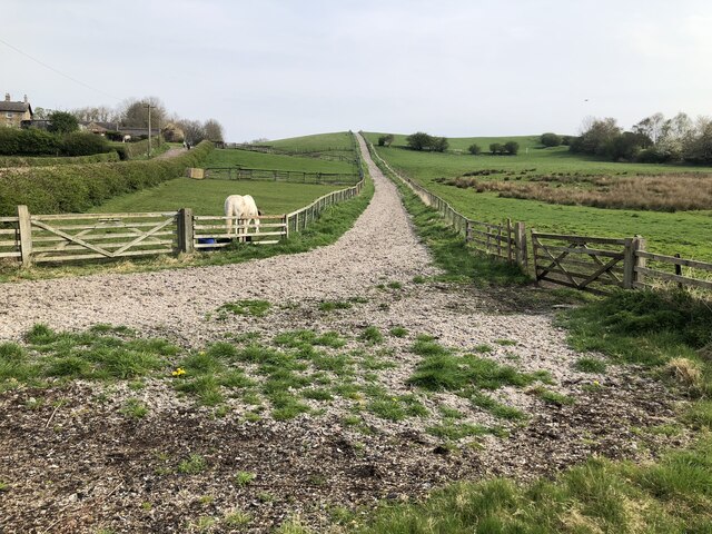
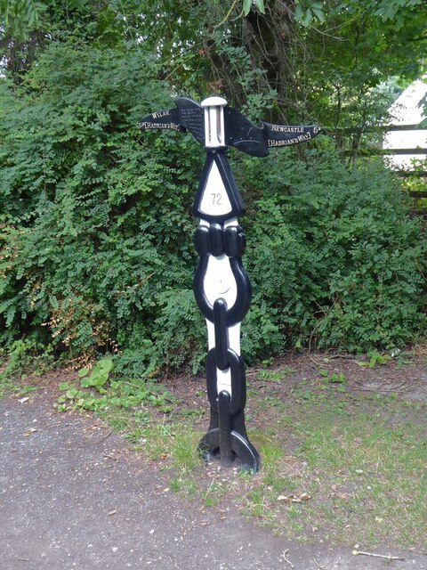
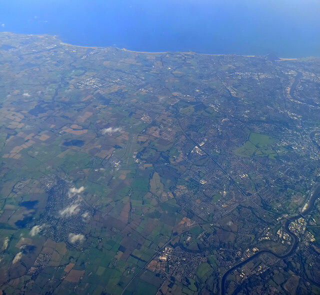
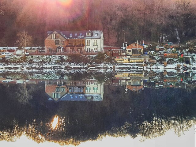
Crookhill Images

Images are sourced within 2km of 54.971729/-1.748458 or Grid Reference NZ1664. Thanks to Geograph Open Source API. All images are credited.

Flooded farmland east of Heddon Haughs
Storm Malik stirs up waters of Tyne
Big Lamp Brewery The Big Lamp Brewery and The Keelman pub are housed in a former water pumping station beside the river Tyne. A link to some history of the building: <span class="nowrap"><a title="https://biglampbrewers.co.uk/keelman-pub/history-keelman-pub/" rel="nofollow ugc noopener" href="https://biglampbrewers.co.uk/keelman-pub/history-keelman-pub/">Link</a><img style="margin-left:2px;" alt="External link" title="External link - shift click to open in new window" src="https://s1.geograph.org.uk/img/external.png" width="10" height="10"/></span>
Big Lamp Brewery
The Big Lamp Brewery and The Keelman pub are housed in a former water pumping station beside the river Tyne. A link to some history of the building: LinkExternal link
Track up Rye Hill
Track up Rye Hill
National Cycle Network milepost at Newburn This milepost stands on Hadrian's Cycleway near Newburn bridge. This milepost (of the so-called "Welsh" design) was repainted as part of the 2021 repainting program. It used to be blue, see <a href="https://www.geograph.org.uk/photo/2895146">NZ1665 : A national cycle route marker</a>.
National Cycle Network milepost at Newburn
This milepost stands on Hadrian's Cycleway near Newburn bridge. This milepost (of the so-called "Welsh" design) was repainted as part of the 2021 repainting program. It used to be blue, see NZ1665 : A national cycle route marker.
Newcastle from the air The north side of the city, with Newcastle Airport visible to the left of centre.

Taken at around 37,000 feet by mobile phone, from a Prague bound flight from Edinburgh.
Newcastle from the air
The north side of the city, with Newcastle Airport visible to the left of centre. Taken at around 37,000 feet by mobile phone, from a Prague bound flight from Edinburgh.
Newcastle from the air Most of the city can be seen in this view.

Taken at around 37,000 feet by mobile phone, from a Prague bound flight from Edinburgh.
Newcastle from the air
Most of the city can be seen in this view. Taken at around 37,000 feet by mobile phone, from a Prague bound flight from Edinburgh.
Ryton Ferry House Colourful reflections in the River Tyne, the waters still, near full tide on a winter's morning with the low rising sun scattered through the trees below the spire of Ryton Church.
Ryton Ferry House
Colourful reflections in the River Tyne, the waters still, near full tide on a winter's morning with the low rising sun scattered through the trees below the spire of Ryton Church.
Late evening sun over arable land at Moor Court
Tramlines in arable crop at Moor Court
Ferndene Park, Ryton
Ryton Bowling Club, Ferndene Park
Site of former Emma Pit, Bar Moor
Blaydon Races Commemoration
Railway bridge over Blaydon Burn
Road bridge over Blaydon Burn
Show me another place!

Crookhill is located at Grid Ref: NZ1664 (Lat: 54.971729, Lng: -1.748458)

Unitary Authority: Gateshead

Police Authority: Northumbria

What 3 Words

///music.deed.locked. Near Newburn, Tyne & Wear

Related Wikis

Addison and Hedgefield Reserve

Addison and Hedgefield Reserve is a woodland area located in the region of Gateshead, United Kingdom, situated to the north of the B6317 to the west of...

Addison and Hedgefield Woods

Addison and Hedgefield Woods is a 14-hectare nature reserve situated in Blaydon, Tyne and Wear, England. The reserve encompasses diverse habitats such...

Crookhill

Crookhill is an area of Ryton in Tyne and Wear, England. The original terraced housing was built mostly as accommodation for NCB workers, and lies to the...

Ryton, Tyne and Wear

Ryton is a village in Tyne and Wear, England. It is in the Metropolitan Borough of Gateshead, historically part of County Durham. In 2011, the population...

Nearby Amenities

Located within 500m of 54.971729,-1.748458
Crossing
Crossing: unmarked
Crossing Island: yes
Tactile Paving: yes
Lat/Long: 54.9727653/-1.7544594
Crossing
Button Operated: yes
Crossing: traffic_signals
Crossing Island: no
Tactile Paving: yes
Traffic Signals Sound: yes
Lat/Long: 54.9724128/-1.7505569
Crossing
Crossing: uncontrolled
Crossing Island: no
Tactile Paving: yes
Lat/Long: 54.9723761/-1.7439435
Crookhill
Is In: Ryton, Gateshead, England, UK
Place: hamlet
Wikidata: Q5187898
Lat/Long: 54.9700822/-1.7495187
Bus Stop
SUMMERHILL CROFT CLOSE
Local Ref: SE
Naptan AtcoCode: 410000013940
Naptan Bearing: SE
Naptan CommonName: SUMMERHILL CROFT CLOSE
Naptan Indicator: SE
Naptan Landmark: OUTSIDE NO.38 CROFT CLOSE
Naptan NaptanCode: twrgtjgm
Naptan Street: CROFT CLOSE
Naptan Verified: no
Source: naptan_import
Lat/Long: 54.9691043/-1.7540992
Bus Stop
STARGATE LANE-HOLLYBUSH GARDENS
Local Ref: NW
Naptan AtcoCode: 410000013976
Naptan Bearing: NW
Naptan CommonName: STARGATE LANE-HOLLYBUSH GARDENS
Naptan Indicator: NW
Naptan Landmark: OPPOSITE PARKINGSON'S COTTAGES
Naptan NaptanCode: twrawjad
Naptan Street: STARGATE LANE
Naptan Verified: no
Source: naptan_import
Lat/Long: 54.9693939/-1.7506765
Bus Stop
Stella Road-Hedgefield Terrace
Bench: no
Bin: no
Bus: yes
Check Date Shelter: 2021-03-04
Lit: yes
Local Ref: W
Naptan AtcoCode: 410000013010
Naptan Bearing: W
Naptan Indicator: W-Bound
Naptan Landmark: Outside Vicarage
Naptan NaptanCode: twratpta
Naptan Street: Stella Road
Naptan Verified: no
Public Transport: platform
Shelter: no
Source: naptan_import
Tactile Paving: no
Lat/Long: 54.9723461/-1.7445635
Bus Stop
Stella Road-High Hedgefield
Bench: no
Bin: no
Bus: yes
Departures Board: timetable
Lit: yes
Local Ref: W
Naptan AtcoCode: 410000013011
Naptan Bearing: W
Naptan Indicator: W-Bound
Naptan Landmark: Opposite High Hedgefield Terrace
Naptan NaptanCode: twratptd
Naptan Street: Stella Road
Naptan Verified: no
Public Transport: platform
Shelter: no
Source: naptan_import
Tactile Paving: no
Lat/Long: 54.9723342/-1.747159
Bus Stop
Ryton Main Road
Bench: yes
Bin: yes
Bus: yes
Departures Board: timetable
Lit: yes
Local Ref: W
Naptan AtcoCode: 410000013012
Naptan Bearing: W
Naptan Indicator: W-Bound
Naptan Landmark: Outside Police House
Naptan NaptanCode: twratptg
Naptan Street: Main Road
Naptan Verified: no
Official Name: Main Road-Runhead Estate
Public Transport: platform
Shelter: yes
Source: naptan_import
Tactile Paving: no
Lat/Long: 54.9727171/-1.7542021
Bus Stop
Stella Bank
Bench: no
Bin: yes
Bus: yes
Departures Board: timetable
Lit: yes
Local Ref: E
Naptan AtcoCode: 410000013017
Naptan Bearing: E
Naptan Indicator: E-Bound
Naptan Landmark: Opposite Runhead Lodge
Naptan NaptanCode: twratpwa
Naptan Street: Stella Bank
Naptan Verified: no
Official Name: Stella Bank-Runhead
Public Transport: platform
Shelter: yes
Source: naptan_import
Tactile Paving: no
Lat/Long: 54.9724783/-1.7501686
Bus Stop
Stella Road
Bench: no
Bin: no
Bus: yes
Departures Board: timetable
Lit: yes
Local Ref: E
Naptan AtcoCode: 410000013018
Naptan Bearing: E
Naptan Indicator: E-Bound
Naptan Landmark: West Of High Hedgefield Terrace
Naptan NaptanCode: twratpwd
Naptan Street: B6317
Naptan Verified: no
Official Name: Stella Road-High Hedgefield
Public Transport: platform
Shelter: no
Source: naptan_import
Tactile Paving: no
Lat/Long: 54.9724322/-1.7465611
Bus Stop
Stella Bank
Bench: yes
Bin: yes
Bus: yes
Departures Board: timetable
Lit: yes
Local Ref: W
Naptan AtcoCode: 410000013019
Naptan Bearing: E
Naptan Indicator: E-Bound
Naptan Landmark: Opposite St Hilda's Church
Naptan NaptanCode: twratpwg
Naptan Street: B6317
Naptan Verified: no
Official Name: Stella Road-Hedgefield Terrace
Public Transport: platform
Shelter: yes
Source: naptan_import
Tactile Paving: no
Lat/Long: 54.9724056/-1.7430826
Bus Stop
Stargate Lane-Main Road
Bench: no
Bin: no
Bus: yes
Lit: yes
Local Ref: S
Naptan AtcoCode: 410000013045
Naptan Bearing: S
Naptan Indicator: S-Bound
Naptan Landmark: South Of River View
Naptan NaptanCode: twratwja
Naptan Street: Stargate Lane
Naptan Verified: no
Public Transport: platform
Shelter: no
Source: naptan_import
Tactile Paving: no
Lat/Long: 54.972144/-1.7507844
Bus Stop
CROOKHILL
Local Ref: S
Naptan AtcoCode: 410000013046
Naptan Bearing: S
Naptan CommonName: CROOKHILL
Naptan Indicator: S
Naptan Landmark: OUTSIDE HOLLY BUSH VILLAS
Naptan NaptanCode: twratwjd
Naptan Street: STARGATE LANE
Naptan Verified: no
Source: naptan_import
Lat/Long: 54.9706082/-1.7512157
Bus Stop
STARGATE LANE-KING EDWARD ROAD
Local Ref: S
Naptan AtcoCode: 410000013047
Naptan Bearing: S
Naptan CommonName: STARGATE LANE-KING EDWARD ROAD
Naptan Indicator: S
Naptan Landmark: OUTSIDE WAR MEMORIAL
Naptan NaptanCode: twratwjg
Naptan Street: STARGATE LANE
Naptan Verified: no
Source: naptan_import
Lat/Long: 54.9684292/-1.7491517
Bus Stop
KING EDWARD ROAD-WAR MEMORIAL
Local Ref: N
Naptan AtcoCode: 410000013048
Naptan Bearing: N
Naptan CommonName: KING EDWARD ROAD-WAR MEMORIAL
Naptan Indicator: N
Naptan Landmark: OUTSIDE AGED MINERS' HOMES
Naptan NaptanCode: twratwjm
Naptan Street: KING EDWARD ROAD
Naptan Verified: no
Source: naptan_import
Lat/Long: 54.9687608/-1.7487278
Bus Stop
HEXHAM OLD ROAD-CLIFTON CLOSE-W/B
Local Ref: W
Naptan AtcoCode: 410000013049
Naptan Bearing: W
Naptan CommonName: HEXHAM OLD ROAD-CLIFTON CLOSE-W/B
Naptan Indicator: W
Naptan Landmark: SOUTH OF CROOKHILL PRIMARY SCHOOL
Naptan NaptanCode: twratwjp
Naptan Street: HEXHAM OLD ROAD
Naptan Verified: no
Source: naptan_import
Lat/Long: 54.9705487/-1.7485292
Bus Stop
HEXHAM OLD ROAD-HOLLY BUSH VILLAS-E/B
Local Ref: E
Naptan AtcoCode: 410000013050
Naptan Bearing: E
Naptan CommonName: HEXHAM OLD ROAD-HOLLY BUSH VILLAS-E/B
Naptan Indicator: E
Naptan Landmark: OPPOSITE PARK VIEW GARDENS JUNCTION
Naptan NaptanCode: twratwjt
Naptan Street: HEXHAM OLD ROAD
Naptan Verified: no
Source: naptan_import
Lat/Long: 54.9714679/-1.7541629
Bus Stop
HEXHAM OLD ROAD-CHURCH RISE-NW/B
Local Ref: NW
Naptan AtcoCode: 410000013055
Naptan Bearing: NW
Naptan CommonName: HEXHAM OLD ROAD-CHURCH RISE-NW/B
Naptan Indicator: NW
Naptan Landmark: OUTSIDE CHURCH RISE
Naptan NaptanCode: twratwmj
Naptan Street: HEXHAM OLD ROAD
Naptan Verified: no
Source: naptan_import
Lat/Long: 54.9710992/-1.7496505
Bus Stop
KING EDWARD ROAD-ALEXANDRA GARDENS
Local Ref: W
Naptan AtcoCode: 410000013056
Naptan Bearing: W
Naptan CommonName: KING EDWARD ROAD-ALEXANDRA GARDENS
Naptan Indicator: W
Naptan Landmark: OUTSIDE SOCIAL CENTRE
Naptan NaptanCode: twratwmp
Naptan Street: KING EDWARD ROAD
Naptan Verified: no
Source: naptan_import
Lat/Long: 54.9682129/-1.7488406
Bus Stop
CROOKHILL
Local Ref: N
Naptan AtcoCode: 410000013057
Naptan Bearing: N
Naptan CommonName: CROOKHILL
Naptan Indicator: N
Naptan Landmark: SOUTH OF HEXHAM OLD ROAD CROSS ROADS
Naptan NaptanCode: twratwmt
Naptan Street: STARGATE LANE
Naptan Verified: no
Source: naptan_import
Lat/Long: 54.9710393/-1.7511193
Bus Stop
KING EDWARD ROAD-TYNE GARDENS
Local Ref: NE
Naptan AtcoCode: 410000013172
Naptan Bearing: NE
Naptan CommonName: KING EDWARD ROAD-TYNE GARDENS
Naptan Indicator: NE
Naptan Landmark: 80M SOUTH OF POST OFFICE
Naptan NaptanCode: twrawdtm
Naptan Street: KING EDWARD ROAD
Naptan Verified: no
Source: naptan_import
Lat/Long: 54.9696223/-1.7481132
Bus Stop
KING EDWARD ROAD-SIMPSON STREET
Local Ref: S
Naptan AtcoCode: 410000013173
Naptan Bearing: S
Naptan CommonName: KING EDWARD ROAD-SIMPSON STREET
Naptan Indicator: S
Naptan Landmark: 50M SOUTH OF POST OFFICE
Naptan NaptanCode: twrawdtp
Naptan Street: KING EDWARD ROAD
Naptan Verified: no
Source: naptan_import
Lat/Long: 54.9697295/-1.7478314
Bus Stop
CROOKHILL THE LONNEN
Local Ref: E
Naptan AtcoCode: 410000060011
Naptan Bearing: E
Naptan CommonName: CROOKHILL THE LONNEN
Naptan Indicator: E
Naptan Landmark: OUTSIDE CROOKHILL PRIMARY SCHOOL
Naptan NaptanCode: twrgpjwa
Naptan Street: HEXHAM OLD ROAD
Naptan Verified: no
Source: naptan_import
Lat/Long: 54.9700408/-1.7462517
Bus Stop
HOLBORN COURT
Local Ref: S
Naptan AtcoCode: 410000060028
Naptan Bearing: S
Naptan CommonName: HOLBORN COURT
Naptan Indicator: S
Naptan Landmark: OPPOSITE THE RUNHEAD PUBLIC HOUSE
Naptan NaptanCode: twrgpmdj
Naptan Street: HOLBURN LANE
Naptan Verified: no
Source: naptan_import
Lat/Long: 54.9732335/-1.75184
Turning Circle
Lat/Long: 54.9700116/-1.7542094
Power: tower
Lat/Long: 54.9716174/-1.7439608
Power: tower
Lat/Long: 54.9684669/-1.7449244
Jack & Jo's
Addr City: Blaydon on Tyne
Addr Street: Main Road
Shop: garden_centre
Lat/Long: 54.9717541/-1.7426066
Power: tower
Lat/Long: 54.9745029/-1.7442752
Restaurant
La Taverna
Addr City: Blaydon-on-Tyne
Addr Postcode: NE21 4LU
Cuisine: tapas
Lat/Long: 54.9716345/-1.7406662
Post Box
Brand: Royal Mail
Brand Wikidata: Q638098
Brand Wikipedia: en:Royal Mail
Collection Times: Mo-Fr 09:00; Sa 07:00
Drive Through: no
Operator: Royal Mail
Operator Wikidata: Q638098
Post Box Type: wall
Ref: NE21 1D
Royal Cypher: VR
Royal Cypher Wikidata: Q33102356
Lat/Long: 54.9724537/-1.7445394
Community Centre
Stargate & Crookhill community Centre
Addr Street: Stargate Lane
Lat/Long: 54.9681212/-1.7487306
Crookhill News
Addr City: Ryton
Addr Housenumber: 16
Addr Postcode: NE40 3ER
Addr Street: Crookhill Terrace
Addr Suburb: Crookhill
Fhrs Id: 843359
Shop: newsagent
Source Addr: FHRS Open Data
Lat/Long: 54.9701541/-1.7472429
Post Box
Ref: NE40 310
Lat/Long: 54.9701655/-1.7471828
Post Box
Brand: Royal Mail
Brand Wikidata: Q638098
Brand Wikipedia: en:Royal Mail
Collection Times: Mo-Fr 09:00; Sa 07:00
Drive Through: no
Operator: Royal Mail
Operator Wikidata: Q638098
Post Box Type: wall
Ref: NE40 195
Royal Cypher: EVIIR
Royal Cypher Wikidata: Q33102324
Lat/Long: 54.9723694/-1.7510899
Traffic Signals
Crossing: no
Traffic Signals Direction: backward
Lat/Long: 54.9724065/-1.7504769
Traffic Signals
Crossing: no
Traffic Signals Direction: forward
Lat/Long: 54.9724193/-1.7506106
Barrier: kissing_gate
Lat/Long: 54.9686431/-1.7437986
Barrier: cycle_barrier
Lat/Long: 54.9697849/-1.7516116
Barrier: cycle_barrier
Lat/Long: 54.9694053/-1.7544149
Give Way
Direction: backward
Lat/Long: 54.9735233/-1.7533991
Give Way
Direction: forward
Lat/Long: 54.9729838/-1.753263
Noexit: yes
Lat/Long: 54.973141/-1.7462334
Noexit: yes
Lat/Long: 54.9731179/-1.7465231
The data included in this document is from www.openstreetmap.org. The data is made available under ODbL.

Have you been to Crookhill?

Leave your review of Crookhill below (or comments, questions and feedback).