Crookham Village

Settlement in Hampshire Hart

England

Crookham Village

Crookham:  Basingstoke Canal, looking west from Chequers Bridge Although it was a lovely day with plenty of sunshine, no boats were seen on this part of the canal
Crookham: Basingstoke Canal, looking west from Chequers Bridge Credit: Dr Neil Clifton

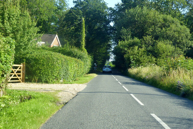
Crookham Village is a quintessential English village located in the county of Hampshire, England. Situated just a few miles south-west of the historic town of Fleet, Crookham Village offers a tranquil and picturesque setting, surrounded by lush countryside and rolling hills.

With a population of around 1,500 residents, Crookham Village exudes a strong sense of community and provides a peaceful and idyllic place to live. The village is known for its charming thatched cottages, traditional brick houses, and well-maintained gardens, which add to its overall appeal.

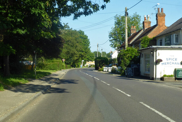
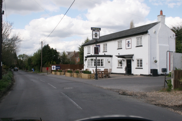
The village boasts a range of amenities and facilities to cater to its residents' needs. There is a local primary school, a village hall that hosts various community events throughout the year, and a village shop that provides essential groceries and services. Additionally, there are several pubs and restaurants in the vicinity, offering a cozy atmosphere and delicious food.

For outdoor enthusiasts, Crookham Village is a haven. The surrounding countryside offers beautiful walking and cycling routes, allowing residents to explore the area's natural beauty. The nearby Basingstoke Canal is a popular spot for boating and fishing, providing further recreational opportunities.

Crookham Village benefits from excellent transport links, with easy access to major road networks, including the nearby M3 motorway. The village is also well-served by public transport, with regular bus services connecting it to neighboring towns and cities.

All in all, Crookham Village is a charming and welcoming place, offering a peaceful and close-knit community, stunning natural surroundings, and convenient amenities for its residents to enjoy.

If you have any feedback on the listing, please let us know in the comments section below.

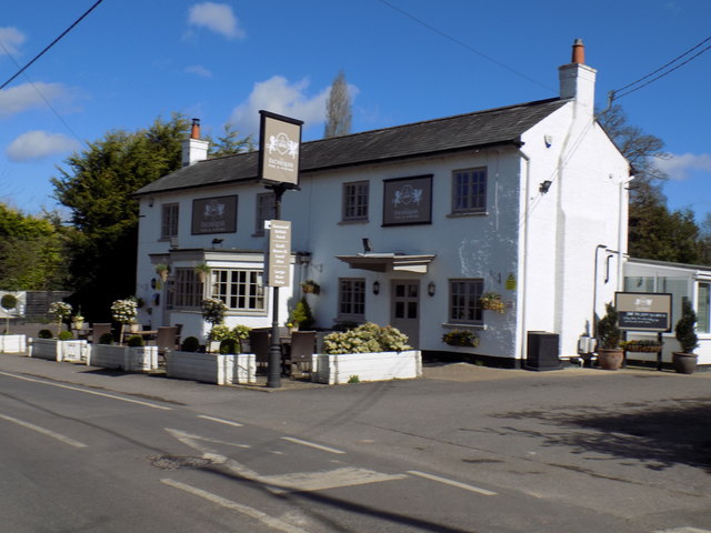
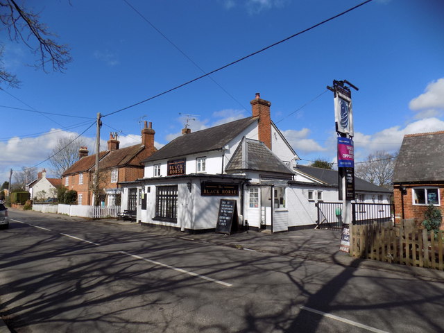
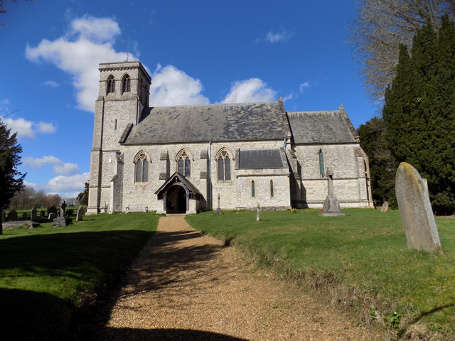
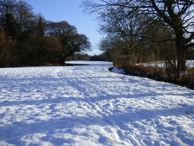
Crookham Village Images

Images are sourced within 2km of 51.267052/-0.861729 or Grid Reference SU7952. Thanks to Geograph Open Source API. All images are credited.

Crookham:  Basingstoke Canal, looking west from Chequers Bridge Although it was a lovely day with plenty of sunshine, no boats were seen on this part of the canal
Crookham: Basingstoke Canal, looking west from Chequers Bridge
Although it was a lovely day with plenty of sunshine, no boats were seen on this part of the canal
Crookham: Basingstoke Canal, Chequers Bridge Looking east.  The towpath beneath the bridge has very little headroom, but walkers can avoid this by crossing the minor (though quite busy) road
Crookham: Basingstoke Canal, Chequers Bridge
Looking east. The towpath beneath the bridge has very little headroom, but walkers can avoid this by crossing the minor (though quite busy) road
Crookham: Basingstoke Canal, Chequers Bridge Looking west.
Crookham: Basingstoke Canal, Chequers Bridge
Looking west.
Crookham:  The 'Exchequer' Somehow, it did not present as the type of pub that I would enjoy, so I did not go in.
Crookham: The 'Exchequer'
Somehow, it did not present as the type of pub that I would enjoy, so I did not go in.
Crookham: The 'Black Horse' This pub is in the middle of the village, but sadly it was closed.  The signs appealing for someone to run it do not auger well for its future.
Crookham: The 'Black Horse'
This pub is in the middle of the village, but sadly it was closed. The signs appealing for someone to run it do not auger well for its future.
Dogmersfield: The 'Queen's Head'
Dogmersfield:  All Saints Church The Parish Church.
Dogmersfield: All Saints Church
The Parish Church.
Old Direction Sign - Signpost by The Street, Crookham Village Annulus finial - 3 arms; Hampshire Parish halo by the UC road, in parish of Crookham Village (Hart District), Crookham Village, on traffic island, junction of The Street and Crondall Road.

To be surveyed

Milestone Society National ID: HA_SU7952
Old Direction Sign - Signpost by The Street, Crookham Village
Annulus finial - 3 arms; Hampshire Parish halo by the UC road, in parish of Crookham Village (Hart District), Crookham Village, on traffic island, junction of The Street and Crondall Road. To be surveyed Milestone Society National ID: HA_SU7952
Farmland, Dogmersfield A narrow field beside Whitlow Alders stretches towards the canal from the footpath to the south of Ormersfield Farm.
Farmland, Dogmersfield
A narrow field beside Whitlow Alders stretches towards the canal from the footpath to the south of Ormersfield Farm.
Farmland, Crookham Village Fields beside the western edge of Fleet.
Farmland, Crookham Village
Fields beside the western edge of Fleet.
Farmland, Dogmersfield A field of stubble beside the footpath north of Pilcot Farm.
Farmland, Dogmersfield
A field of stubble beside the footpath north of Pilcot Farm.
The Street, Crookham Village 'Spice Merchant' on the right is not actually a spice merchant, but a pub.
The Street, Crookham Village
'Spice Merchant' on the right is not actually a spice merchant, but a pub.
Pilcot Road, Dogmersfield Pilcot Bridge ahead, over the River Hart.
Pilcot Road, Dogmersfield
Pilcot Bridge ahead, over the River Hart.
Chatter Alley, Dogmersfield Towards Winchfield Hurst.
Chatter Alley, Dogmersfield
Towards Winchfield Hurst.
Crookham The George and Lobster restaurant on the road from Bowling Alley to Crookham Village.
Crookham
The George and Lobster restaurant on the road from Bowling Alley to Crookham Village.
Hancock's Farm
Hancock's Farm
All Saints church, Dogmersfield This is the only christian church in the village of Dogmersfield, built in 1843.
Dogmersfield derives its name from 'a field by the lake where the waterlilies grow'
All Saints church, Dogmersfield
This is the only christian church in the village of Dogmersfield, built in 1843. Dogmersfield derives its name from 'a field by the lake where the waterlilies grow'
The Queens Head, Dogmersfield
Show me another place!

Crookham Village is located at Grid Ref: SU7952 (Lat: 51.267052, Lng: -0.861729)

Administrative County: Hampshire

District: Hart

Police Authority: Hampshire

What 3 Words

///acrobatic.town.reform. Near Fleet, Hampshire

Related Wikis

Crookham Village

Crookham Village is located south-west of Fleet, in northeast Hampshire, England and lies within the Hart District. == History == Crookham (formerly Crokeham...

Dogmersfield

Dogmersfield is a small village lying between the towns of Fleet and Hartley Wintney in Hampshire, England. The M3 motorway and railway stations at Fleet...

Court Moor School

Court Moor School is one of two secondary schools in the town of Fleet, in Hampshire (UK) for pupils aged 11–16. == History == The 15.7-acre (64,000 m2...

Fleet Town F.C.

Fleet Town Football Club is a semi-professional football club based in Fleet, Hampshire, England. The club are currently members of the Combined Counties...

Calthorpe Park School

Calthorpe Park School is one of two secondary schools in Fleet, Hampshire, England. for pupils aged 11–16. The school was awarded specialist status as...

Church Crookham

Church Crookham is a large suburban village and civil parish, contiguous with the town of Fleet, in northeast Hampshire, England. It is 38 miles (61 km...

Hart District

Hart is a local government district in Hampshire, England, named after the River Hart. Its council is based in Fleet. The district also contains the towns...

St Nicholas' School, Hampshire

St Nicholas' School is a private day school for girls in Church Crookham, a village at the southern edge of Fleet, Hampshire, England. The school educates...

Nearby Amenities

Located within 500m of 51.267052,-0.861729
Bus Stop
The Street
Bench: no
Bin: no
Lit: no
Naptan AtcoCode: 1900HA060120
Naptan Bearing: S
Naptan CommonName: The Street
Naptan Crossing: Pilcot Road
Naptan NaptanCode: hamgtgpj
Naptan Street: Hitches Lane
Naptan Verified: no
Shelter: no
Source: naptan_import
Tactile Paving: no
Lat/Long: 51.2685223/-0.8647736
Bus Stop
The Street
Bench: no
Bin: no
Lit: yes
Naptan AtcoCode: 1900HA060121
Naptan Bearing: NE
Naptan CommonName: The Street
Naptan Crossing: Pilcot Road
Naptan NaptanCode: hamgtgpm
Naptan Street: Hitches Lane
Naptan Verified: no
Shelter: no
Source: naptan_import
Tactile Paving: no
Lat/Long: 51.2688733/-0.8646601
Bus Stop
Crookham Village
Naptan AtcoCode: 1900HA060122
Naptan Bearing: W
Naptan CommonName: Crookham Village
Naptan Crossing: Crondall Road
Naptan NaptanCode: hamgtgtg
Naptan Street: The Street
Naptan Verified: no
Source: naptan_import
Lat/Long: 51.2660314/-0.8627807
Bus Stop
Crookham Village
Naptan AtcoCode: 1900HA060123
Naptan Bearing: E
Naptan CommonName: Crookham Village
Naptan Crossing: Crondall Road
Naptan NaptanCode: hamgtgtj
Naptan Street: The Street
Naptan Verified: no
Source: naptan_import
Lat/Long: 51.2660851/-0.8627508
Bus Stop
Malthouse Bridge
Naptan AtcoCode: 1900HA060124
Naptan Bearing: W
Naptan CommonName: Malthouse Bridge
Naptan Crossing: Veronica Drive
Naptan NaptanCode: hamgtjmp
Naptan Street: The Street
Naptan Verified: no
Source: naptan_import
Lat/Long: 51.2652503/-0.8573676
Bus Stop
Malthouse Bridge
Naptan AtcoCode: 1900HA060125
Naptan Bearing: E
Naptan CommonName: Malthouse Bridge
Naptan Crossing: Crookham Road
Naptan NaptanCode: hamgtjmt
Naptan Street: The Street
Naptan Verified: no
Source: naptan_import
Lat/Long: 51.2652753/-0.8571663
Crookham Village
Is In: Hampshire
Place: village
Lat/Long: 51.2666104/-0.8641165
Barrier: stile
Lat/Long: 51.2652354/-0.8612336
Give Way
Direction: forward
Lat/Long: 51.2664016/-0.8640327
Give Way
Direction: backward
Lat/Long: 51.2662693/-0.8640561
David Harris
Historic: memorial
Openplaques Id: 39763
Lat/Long: 51.2664528/-0.8637039
Crookham Village Parish Council
Information: map
Tourism: information
Lat/Long: 51.2655115/-0.8603901
Give Way
Direction: backward
Source: Bing
Lat/Long: 51.2662973/-0.8637518
Give Way
Source: Bing
Lat/Long: 51.267629/-0.8652704
Material: wood
Power: pole
Lat/Long: 51.270026/-0.8640669
Power: pole
Lat/Long: 51.2673585/-0.8667947
Power: pole
Lat/Long: 51.2670002/-0.8681238
Power: pole
Lat/Long: 51.2640472/-0.8662641
Turning Circle
Turning Circle: square
Lat/Long: 51.2660925/-0.8680043
Milestone
Ref: A3013
Lat/Long: 51.2655996/-0.8606326
Post Box
Brand: Royal Mail
Brand Wikidata: Q638098
Collection Times: Mo-Fr 16:15; Sa 11:45
Drive Through: no
Operator: Royal Mail
Operator Wikidata: Q638098
Post Box Type: pillar
Ref: GU51 144
Royal Cypher: EIIR
Royal Cypher Wikidata: Q33102113
Lat/Long: 51.2655149/-0.8606552
Childcare
Curious Explorers
Addr City: Fleet
Addr Place: Crookham Village
Addr Postcode: GU51 5SG
Addr Street: The Street
Fhrs Id: 1320935
Phone: +441252 988040
Website: https://www.curiousexplorers.co.uk/crookham-village
Lat/Long: 51.2654767/-0.8606509
Booth: K6
Building: booth
Lat/Long: 51.2655036/-0.86037
Traffic Calming: hump
Lat/Long: 51.2676877/-0.8666893
Traffic Calming: hump
Lat/Long: 51.267403/-0.8669011
Fixme: solar panels?
Lat/Long: 51.2666511/-0.8626847
Direction: 200
Generator Method: photovoltaic
Generator Output Electricity: yes
Generator Solar Modules: 14
Generator Source: solar
Generator Type: solar_photovoltaic_panel
Location: roof
Power: generator
Lat/Long: 51.2648561/-0.8600842
Turning Circle
Turning Circle: knuckle
Lat/Long: 51.2649955/-0.8599058
Direction: 200
Fixme: survey for panel count
Generator Method: photovoltaic
Generator Output Electricity: yes
Generator Solar Modules: 9
Generator Source: solar
Generator Type: solar_photovoltaic_panel
Location: roof
Power: generator
Lat/Long: 51.2651665/-0.8578514
Fire Hydrant
Emergency: fire_hydrant
Fire Hydrant Diameter: 75
Fire Hydrant Position: sidewalk
Fire Hydrant Type: underground
Lat/Long: 51.2677249/-0.8652794
The data included in this document is from www.openstreetmap.org. The data is made available under ODbL.

Have you been to Crookham Village?

Leave your review of Crookham Village below (or comments, questions and feedback).