Smearbeck Wood

Wood, Forest in Yorkshire Craven

England

Smearbeck Wood

Benchmark on stone at base of wall on south side of road west of Litton Ordnance Survey rivet benchmark levelled at 257.779m above Newlyn Datum verified 1954
Benchmark on stone at base of wall on south side of road west of Litton Credit: Roger Templeman

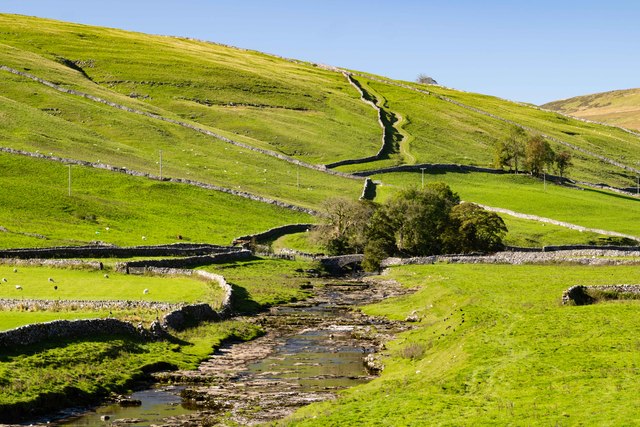
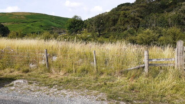
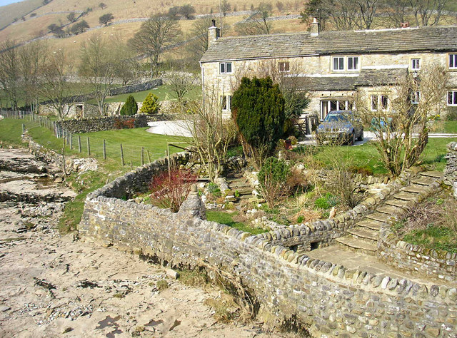
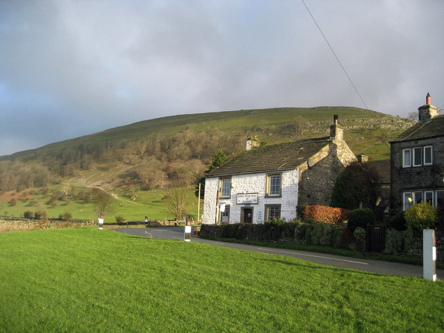
Smearbeck Wood is a picturesque forest located in Yorkshire, England. Covering an area of approximately 500 acres, this woodland is known for its natural beauty and diverse ecosystem. The wood is situated in the heart of the Yorkshire Dales National Park, surrounded by rolling hills and stunning landscapes.

The forest is primarily composed of a mixture of deciduous and coniferous trees, including oak, beech, pine, and birch. These trees create a rich canopy, providing shade and shelter for a wide variety of wildlife. Smearbeck Wood is home to numerous species of birds, including woodpeckers, owls, and various songbirds. Visitors may also catch a glimpse of mammals such as deer, foxes, and squirrels as they explore the woodland.

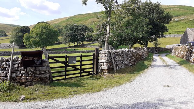
There are a number of well-maintained walking trails that wind through the forest, allowing visitors to immerse themselves in the natural splendor of Smearbeck Wood. These trails range in difficulty, catering to both leisurely strolls and more challenging hikes. Along the way, visitors can enjoy the tranquil atmosphere, breathe in the fresh forest air, and listen to the soothing sounds of nature.

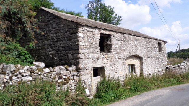
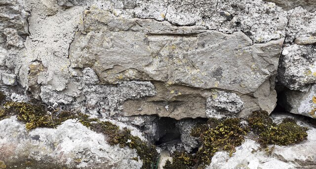
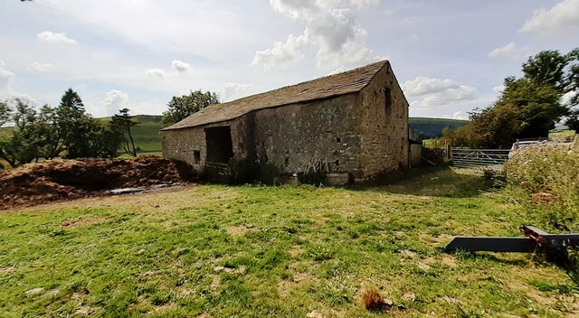
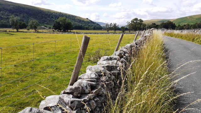
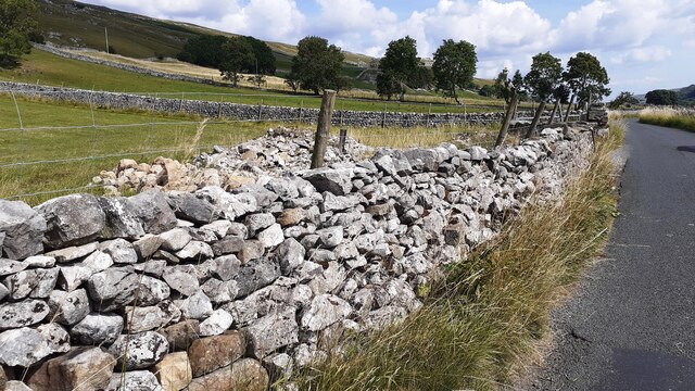
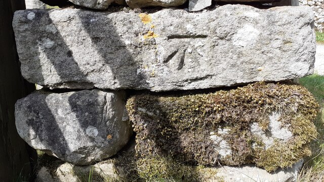
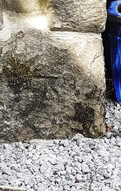
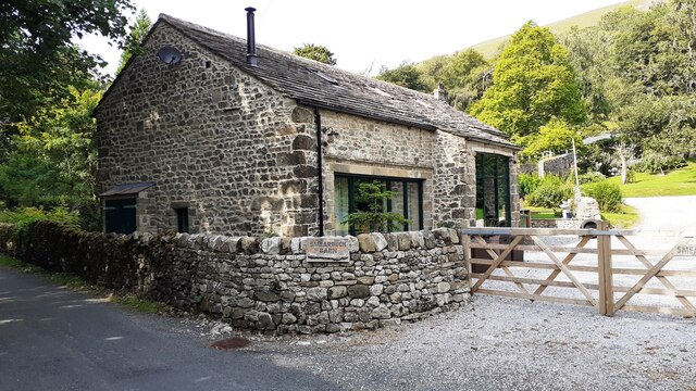
In addition to its natural beauty, Smearbeck Wood has historical significance. It is believed to have been a popular hunting ground for nobility in medieval times. Today, remnants of ancient stone walls and foundations can still be found, adding an intriguing element to the forest's charm.

Whether you are a nature enthusiast, a keen hiker, or simply seeking a peaceful escape from the bustling city, Smearbeck Wood offers a serene and captivating experience in the heart of Yorkshire.

If you have any feedback on the listing, please let us know in the comments section below.

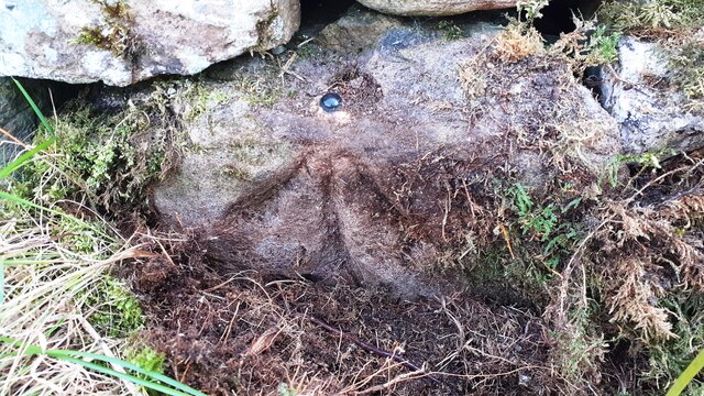
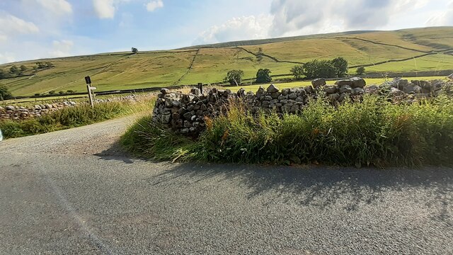
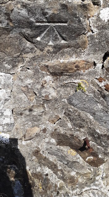
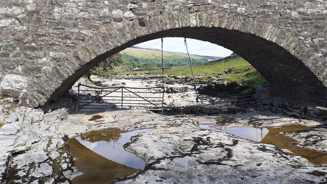
Smearbeck Wood Images

Images are sourced within 2km of 54.15817/-2.1284129 or Grid Reference SD9173. Thanks to Geograph Open Source API. All images are credited.

Benchmark on stone at base of wall on south side of road west of Litton Ordnance Survey rivet benchmark levelled at 257.779m above Newlyn Datum verified 1954
Benchmark on stone at base of wall on south side of road west of Litton
Ordnance Survey rivet benchmark levelled at 257.779m above Newlyn Datum verified 1954
Track towards bridge over River Skirfare from road to Litton There is an Ordnance Survey benchmark <a href="https://www.geograph.org.uk/photo/6926956">SD8974 : Benchmark on stone at base of wall on south side of road west of Litton</a> on the base of the wall about 3 feet from the corner
Track towards bridge over River Skirfare from road to Litton
There is an Ordnance Survey benchmark SD8974 : Benchmark on stone at base of wall on south side of road west of Litton on the base of the wall about 3 feet from the corner
Benchmark on back of west parapet of bridge taking track over River Skirfare Ordnance Survey cut mark benchmark levelled at 254.843m above Newlyn Datum verified 1954
Benchmark on back of west parapet of bridge taking track over River Skirfare
Ordnance Survey cut mark benchmark levelled at 254.843m above Newlyn Datum verified 1954
Bridge taking track over River Skirfare 1km west of Litton There is an Ordnance Survey benchmark <a href="https://www.geograph.org.uk/photo/6927562">SD8974 : Benchmark on back of west parapet of bridge taking track over River Skirfare</a> on the bridge wall on the left hand side of its arch
Bridge taking track over River Skirfare 1km west of Litton
There is an Ordnance Survey benchmark SD8974 : Benchmark on back of west parapet of bridge taking track over River Skirfare on the bridge wall on the left hand side of its arch
New Bridge New Bridge on the River Skirfare.
New Bridge
New Bridge on the River Skirfare.
The Queens Arms
The Queens Arms
Benchmark on roadside barn at Old Cotes Ordnance Survey cut mark benchmark described on the Bench Mark Database at <span class="nowrap"><a title="www.bench.marks.org.uk/bm100719" rel="nofollow ugc noopener" href="http://www.bench.marks.org.uk/bm100719">Link</a><img style="margin-left:2px;" alt="External link" title="External link - shift click to open in new window" src="https://s1.geograph.org.uk/img/external.png" width="10" height="10"/></span>
Benchmark on roadside barn at Old Cotes
Ordnance Survey cut mark benchmark described on the Bench Mark Database at LinkExternal link
Old barn at Old Cotes There is an Ordnance Survey benchmark <a href="https://www.geograph.org.uk/photo/6925709">SD9372 : Benchmark on roadside barn at Old Cotes</a> on the near corner of the building, road face, in a patch of white lichen
Old barn at Old Cotes
There is an Ordnance Survey benchmark SD9372 : Benchmark on roadside barn at Old Cotes on the near corner of the building, road face, in a patch of white lichen
Benchmark on Flats Barn Ordnance Survey cut mark benchmark described on the Bench Mark Database at <span class="nowrap"><a title="www.bench-marks.org.uk/bm58433" rel="nofollow ugc noopener" href="http://www.bench-marks.org.uk/bm58433">Link</a><img style="margin-left:2px;" alt="External link" title="External link - shift click to open in new window" src="https://s1.geograph.org.uk/img/external.png" width="10" height="10"/></span>
Benchmark on Flats Barn
Ordnance Survey cut mark benchmark described on the Bench Mark Database at LinkExternal link
Flats Barn on SW side of road NW of Arncliffe There is an Ordnance Survey benchmark <a href="https://www.geograph.org.uk/photo/6925954">SD9272 : Benchmark on Flats Barn</a> on the near corner, right hand face, of the barn
Flats Barn on SW side of road NW of Arncliffe
There is an Ordnance Survey benchmark SD9272 : Benchmark on Flats Barn on the near corner, right hand face, of the barn
Road towards Litton approaching Cave Barn
Benchmark on roadside rock which was part of Low Fields Barn Ordnance Survey pivot benchmark described on the Bench Mark Database at <span class="nowrap"><a title="www.bench-marks.org.uk/bm100720" rel="nofollow ugc noopener" href="http://www.bench-marks.org.uk/bm100720">Link</a><img style="margin-left:2px;" alt="External link" title="External link - shift click to open in new window" src="https://s1.geograph.org.uk/img/external.png" width="10" height="10"/></span>
Benchmark on roadside rock which was part of Low Fields Barn
Ordnance Survey pivot benchmark described on the Bench Mark Database at LinkExternal link
The remains of Low Fields Barn behind wall on NE side of Littondale road Part of the barn wall is now the roadside wall with its Ordnance Survey benchmark <a href="https://www.geograph.org.uk/photo/6926885">SD9173 : Benchmark on roadside rock which was part of Low Fields Barn</a> on a stone at the base of the wall
The remains of Low Fields Barn behind wall on NE side of Littondale road
Part of the barn wall is now the roadside wall with its Ordnance Survey benchmark SD9173 : Benchmark on roadside rock which was part of Low Fields Barn on a stone at the base of the wall
Benchmark on wall end at gateway on west side of track to Sawyersgarth Cottage Ordnance Survey cut mark benchmark described on the Bench Mark Database at <span class="nowrap"><a title="www.bench-marks.org.uk/bm100723" rel="nofollow ugc noopener" href="http://www.bench-marks.org.uk/bm100723">Link</a><img style="margin-left:2px;" alt="External link" title="External link - shift click to open in new window" src="https://s1.geograph.org.uk/img/external.png" width="10" height="10"/></span>
Benchmark on wall end at gateway on west side of track to Sawyersgarth Cottage
Ordnance Survey cut mark benchmark described on the Bench Mark Database at LinkExternal link
Gateway at junction of road to Litton and track to Sawyersgarth Cottage There is an Ordnance Survey benchmark <a href="https://www.geograph.org.uk/photo/6926937">SD9073 : Benchmark on wall end at gateway on west side of track to Sawyersgarth Cottage</a> on the near end of the wall at the far side of the gate
Gateway at junction of road to Litton and track to Sawyersgarth Cottage
There is an Ordnance Survey benchmark SD9073 : Benchmark on wall end at gateway on west side of track to Sawyersgarth Cottage on the near end of the wall at the far side of the gate
Benchmark on 'Smearbeck Barn' Ordnance Survey cut mark benchmark described on the Bench Mark Database at <span class="nowrap"><a title="www.bench-marks.org.uk/bm100721" rel="nofollow ugc noopener" href="http://www.bench-marks.org.uk/bm100721">Link</a><img style="margin-left:2px;" alt="External link" title="External link - shift click to open in new window" src="https://s1.geograph.org.uk/img/external.png" width="10" height="10"/></span>
Benchmark on 'Smearbeck Barn'
Ordnance Survey cut mark benchmark described on the Bench Mark Database at LinkExternal link
Barn conversion, Smearbeck Barn There is an Ordnance Survey benchmark <a href="https://www.geograph.org.uk/photo/6927288">SD9173 : Benchmark on 'Smearbeck Barn'</a> on the near corner, left hand face, of the house, behind the wall in this image
Barn conversion, Smearbeck Barn
There is an Ordnance Survey benchmark SD9173 : Benchmark on 'Smearbeck Barn' on the near corner, left hand face, of the house, behind the wall in this image
View into Howbeck Wood from NE side of rural road Ordnance Survey records indicate that there was a barn here with a benchmark levelled at 237.668m above Newlyn Datum verified in 1954. Now there are just a few stones left in the field. See <span class="nowrap"><a title="www.bench-marks.org.uk/bm118015" rel="nofollow ugc noopener" href="http://www.bench-marks.org.uk/bm118015">Link</a><img style="margin-left:2px;" alt="External link" title="External link - shift click to open in new window" src="https://s1.geograph.org.uk/img/external.png" width="10" height="10"/></span>
View into Howbeck Wood from NE side of rural road
Ordnance Survey records indicate that there was a barn here with a benchmark levelled at 237.668m above Newlyn Datum verified in 1954. Now there are just a few stones left in the field. See LinkExternal link
Show me another place!

Smearbeck Wood is located at Grid Ref: SD9173 (Lat: 54.15817, Lng: -2.1284129)

Division: West Riding

Administrative County: North Yorkshire

District: Craven

Police Authority: North Yorkshire

What 3 Words

///amazed.brownish.skin. Near Grassington, North Yorkshire

Related Wikis

Scoska Wood

Scoska Wood is an IUCN Category IV – habitat or species management area, a British national nature reserve (NNR), and a Site of Special Scientific Interest...

Litton, North Yorkshire

Litton is a village and civil parish in Littondale in the Yorkshire Dales in England. It lies in the Craven District of North Yorkshire, 1.5 miles (2...

Arncliffe, North Yorkshire

Arncliffe is a small village and civil parish in Littondale, one of the Yorkshire Dales in England. Littondale is a small valley beside Upper Wharfedale...

Birks Fell

Birks Fell is a hill in the Yorkshire Dales, near to Hubberholme in North Yorkshire, England. It is classed as a Marilyn (a hill with topographic prominence...

Hesleden, North Yorkshire

Hesleden is a hamlet in Littondale in the Yorkshire Dales in England. It lies within the civil parish of Halton Gill in the Craven district of North Yorkshire...

Starbotton

Starbotton is a village of around 60 houses in Upper Wharfedale in the Craven district of North Yorkshire, England. It is situated in the Yorkshire Dales...

Kettlewell with Starbotton

Kettlewell with Starbotton is a civil parish in the Craven district of North Yorkshire, England. Kettlewell is a village in Upper Wharfedale, North Yorkshire...

Buckden, North Yorkshire

Buckden is a village and civil parish in the Craven district of North Yorkshire, England. Historically part of the West Riding of Yorkshire, Buckden is...

Nearby Amenities

Located within 500m of 54.15817,-2.1284129
Archaeological Site: building
Description: Building here in mid C19th
Historic: archaeological_site
Source: OS sheet 98,1852
Lat/Long: 54.1588494/-2.1336153
Power: pole
Lat/Long: 54.1543943/-2.1242854
Power: pole
Lat/Long: 54.155376/-2.1261737
Power: pole
Lat/Long: 54.1558833/-2.1271098
Power: pole
Lat/Long: 54.1564409/-2.128129
Power: pole
Lat/Long: 54.1569812/-2.1288532
Power: pole
Lat/Long: 54.1575843/-2.1297115
Power: pole
Lat/Long: 54.1581858/-2.1305323
Power: pole
Lat/Long: 54.1587135/-2.1314791
Power: pole
Lat/Long: 54.159169/-2.1323186
Power: pole
Lat/Long: 54.1596605/-2.1331984
Power: pole
Lat/Long: 54.1601647/-2.1341693
The data included in this document is from www.openstreetmap.org. The data is made available under ODbL.

Have you been to Smearbeck Wood?

Leave your review of Smearbeck Wood below (or comments, questions and feedback).