Bank Wood

Wood, Forest in Yorkshire Richmondshire

England

Bank Wood

Path down to Semer Water There are only two lakes in the Yorkshire Dales, Malham Tarn and Semer Water. Semer Water was formed during the last Ice Age by a moraine which effectively dammed the valley. The lake today is a shadow of its former self but is still three miles in circumference and 45 feet deep. This is the footpath back down to Semer Water in evening sunlight.
Path down to Semer Water Credit: Marathon

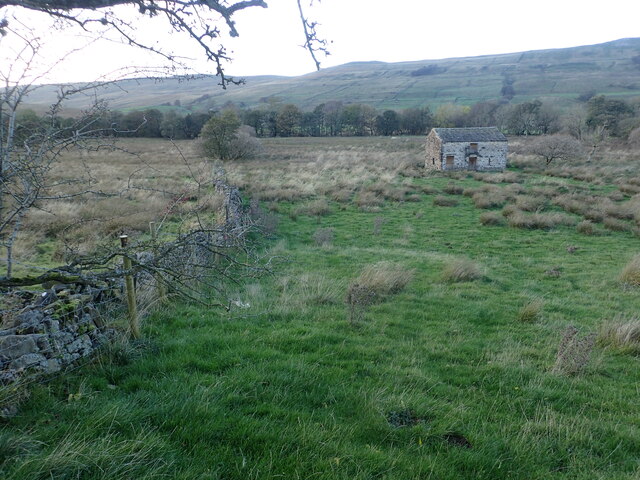
Bank Wood is a picturesque woodland located in Yorkshire, England. It encompasses an area of approximately 50 acres and is situated near the village of Wood. The woodland is part of the larger Yorkshire Forest, which covers a significant portion of the region.

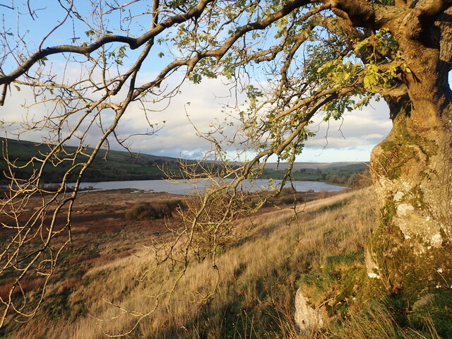
Bank Wood is characterized by its diverse range of tree species, including oak, beech, birch, and pine trees. These trees form a dense canopy that provides shade and shelter for various flora and fauna. The forest floor is adorned with a carpet of wildflowers, adding to the natural beauty of the area.

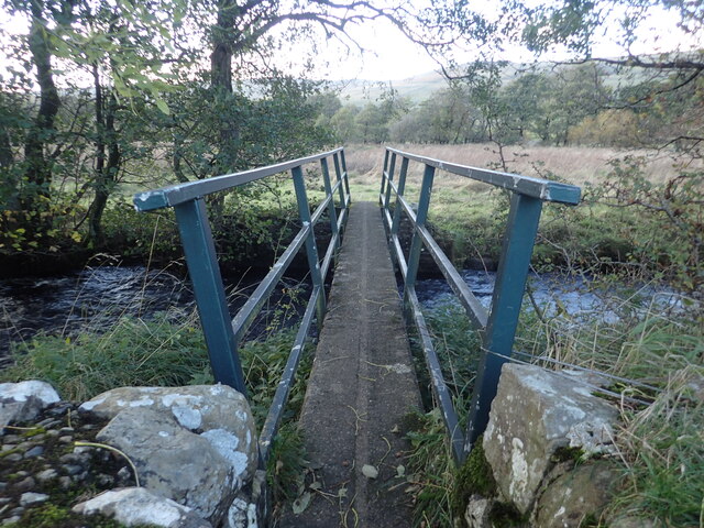
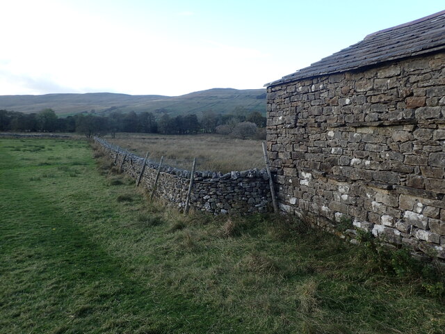
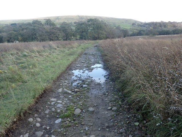
The woodland is a popular destination for nature enthusiasts and walkers looking to explore the tranquil surroundings. There are several well-marked trails, offering visitors the opportunity to immerse themselves in the natural wonders of the forest. The paths wind through the woods, leading to picturesque viewpoints and hidden clearings.

Wildlife thrives in Bank Wood, with an abundance of bird species such as woodpeckers, owls, and finches. Mammals such as deer, foxes, and rabbits can also be spotted within the woodland. The diverse ecosystem provides a habitat for various insects, including butterflies and beetles.

Bank Wood is managed by the local authorities, who ensure its preservation and conservation. Visitors are requested to respect the natural environment by adhering to the designated trails and disposing of any litter responsibly.

Overall, Bank Wood offers a serene and idyllic escape from the hustle and bustle of everyday life. Its natural beauty and rich biodiversity make it a must-visit destination for nature lovers and those seeking a peaceful retreat in the heart of Yorkshire.

If you have any feedback on the listing, please let us know in the comments section below.

Bank Wood Images

Images are sourced within 2km of 54.257444/-2.1287218 or Grid Reference SD9184. Thanks to Geograph Open Source API. All images are credited.

Path down to Semer Water There are only two lakes in the Yorkshire Dales, Malham Tarn and Semer Water. Semer Water was formed during the last Ice Age by a moraine which effectively dammed the valley. The lake today is a shadow of its former self but is still three miles in circumference and 45 feet deep. This is the footpath back down to Semer Water in evening sunlight.
Path down to Semer Water
There are only two lakes in the Yorkshire Dales, Malham Tarn and Semer Water. Semer Water was formed during the last Ice Age by a moraine which effectively dammed the valley. The lake today is a shadow of its former self but is still three miles in circumference and 45 feet deep. This is the footpath back down to Semer Water in evening sunlight.
Footbridge over Cragdale Water The footpath between Stalling Busk and Marsett is wet at the best of times. Cragdale water and then Raydale Beck are crossed by footbridges. This is the first one.
Footbridge over Cragdale Water
The footpath between Stalling Busk and Marsett is wet at the best of times. Cragdale water and then Raydale Beck are crossed by footbridges. This is the first one.
A barn in Raydale This view is from a meeting of footpaths downhill from Stelling Busk on the way to Cragdale Water.
A barn in Raydale
This view is from a meeting of footpaths downhill from Stelling Busk on the way to Cragdale Water.
Track between two streams The track has just crossed Raydale Beck and is heading to the footbridge over Cragdale Water.
Track between two streams
The track has just crossed Raydale Beck and is heading to the footbridge over Cragdale Water.
Isolated barn in a field The barns in the Yorkshire Dales are in varying stages of dilapidation. This one seems in quite good condition and it appears to have a decent roof. This view is from the footpath which leads from Busk Lane towards Semer Water.
Isolated barn in a field
The barns in the Yorkshire Dales are in varying stages of dilapidation. This one seems in quite good condition and it appears to have a decent roof. This view is from the footpath which leads from Busk Lane towards Semer Water.
Fading light near Stalling Busk This view is of the footpath which leads from Semer Water towards Busk Lane.
Fading light near Stalling Busk
This view is of the footpath which leads from Semer Water towards Busk Lane.
Footpath near Stalling Busk This view is of the footpath which leads from Semer Water towards Busk Lane.
Footpath near Stalling Busk
This view is of the footpath which leads from Semer Water towards Busk Lane.
Old stone barn near Semer Water The barns in the Yorkshire Dales are in varying stages of dilapidation. This one seems in reasonably good condition and it appears to have a decent roof. This view is from the footpath which leads from Busk Lane towards Semer Water.
Old stone barn near Semer Water
The barns in the Yorkshire Dales are in varying stages of dilapidation. This one seems in reasonably good condition and it appears to have a decent roof. This view is from the footpath which leads from Busk Lane towards Semer Water.
Stalling Busk Old Church Stalling Busk Old Church (on the right here) above Semer Water in a side valley of Wensleydale was rebuilt in 1822 on the site of an older church which had been founded in 1609 to serve the scattered communities of the dale. It was abandoned when the new church was built in 1909.
Stalling Busk Old Church
Stalling Busk Old Church (on the right here) above Semer Water in a side valley of Wensleydale was rebuilt in 1822 on the site of an older church which had been founded in 1609 to serve the scattered communities of the dale. It was abandoned when the new church was built in 1909.
Fading light near Stalling Busk This view is from the footpath which leads from Semer Water towards Busk Lane, just before Stalling Busk Old Church is reached.
Fading light near Stalling Busk
This view is from the footpath which leads from Semer Water towards Busk Lane, just before Stalling Busk Old Church is reached.
Footpath to Semer Water There are only two lakes in the Yorkshire Dales, Malham Tarn and Semer Water. Semer Water was formed during the last Ice Age by a moraine which effectively dammed the valley. The lake today is a shadow of its former self but is still three miles in circumference and 45 feet deep. Legend has it that there is a drowned village under the water.
Footpath to Semer Water
There are only two lakes in the Yorkshire Dales, Malham Tarn and Semer Water. Semer Water was formed during the last Ice Age by a moraine which effectively dammed the valley. The lake today is a shadow of its former self but is still three miles in circumference and 45 feet deep. Legend has it that there is a drowned village under the water.
Ruined chapel in Raydale The remains of the chapel near Stalling Busk.
Ruined chapel in Raydale
The remains of the chapel near Stalling Busk.
Inside the ruined chapel Inside the ruined chapel near Stalling Busk.
Inside the ruined chapel
Inside the ruined chapel near Stalling Busk.
Ruined chapel information Information sign at the ruined chapel.
Ruined chapel information
Information sign at the ruined chapel.
View from the chapel Looking down Raydale towards Semer Water.
View from the chapel
Looking down Raydale towards Semer Water.
Show me another place!

Bank Wood is located at Grid Ref: SD9184 (Lat: 54.257444, Lng: -2.1287218)

Division: North Riding

Administrative County: North Yorkshire

District: Richmondshire

Police Authority: North Yorkshire

What 3 Words

///regulator.staining.haunts. Near Leyburn, North Yorkshire

Nearby Locations

Shaw Side Bank Wood

Related Wikis

Stalling Busk

Stalling Busk is one of three settlements around Semer Water in the Richmondshire district of North Yorkshire in the small dale of Raydale just off...

St Matthew's Church, Stalling Busk

St Matthew's Church, Stalling Busk is a Grade II listed parish church in the Church of England in Stalling Busk, North Yorkshire. == History == The church...

Marsett

Marsett is one of three settlements in around Semer Water in Raydale, a small side dale off Wensleydale in North Yorkshire, England. Marsett is only a...
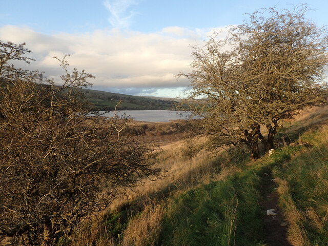
Semerwater

Semerwater () is the second largest natural lake in North Yorkshire, England, after Malham Tarn. It is half a mile (800 m) long, covers 100 acres (0.40...

Yorkshire Dales

The Yorkshire Dales are an upland area of the Pennines in England. Most of the area is in the county of North Yorkshire, but it extends into Cumbria and...

Countersett

Countersett is the largest of the three settlements in Raydale, around Semerwater in the Richmondshire district of North Yorkshire, England. It is in the...

Addlebrough

Addlebrough is a fell in Wensleydale, North Yorkshire, England. It is 481 m (1,578 ft) high. Bronze Age inhabitants built homes and enclosures on the fell...

Wether Fell

Wether Fell (archaically Wetherfell), also known as Drumaldrace (the name of its summit), is a mountain in the Yorkshire Dales National Park, in North...

Have you been to Bank Wood?

Leave your review of Bank Wood below (or comments, questions and feedback).