Arngill Wood

Wood, Forest in Yorkshire Richmondshire

England

Arngill Wood

Swinner Gill Ford This ford at Swinner Gill is found on the bridleway between Muker and Keld. A video of the ford can be viewed at:
<span class="nowrap"><a title="https://youtu.be/pRj-GMUVvRE" rel="nofollow ugc noopener" href="https://youtu.be/pRj-GMUVvRE">Link</a><img style="margin-left:2px;" alt="External link" title="External link - shift click to open in new window" src="https://s1.geograph.org.uk/img/external.png" width="10" height="10"/></span>
Swinner Gill Ford Credit: John Walton

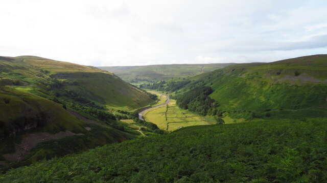
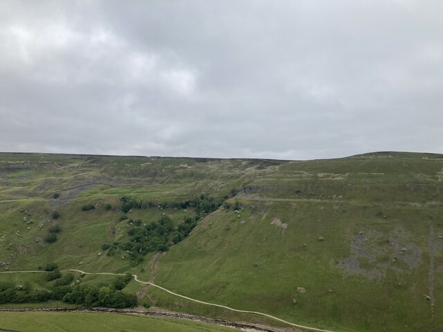
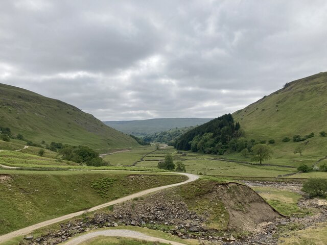
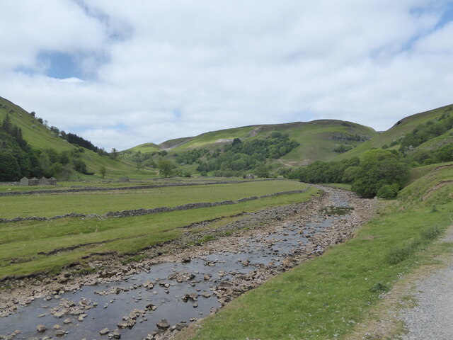
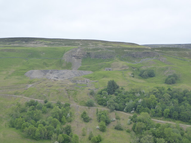
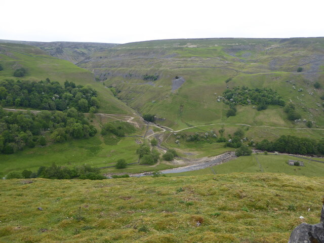
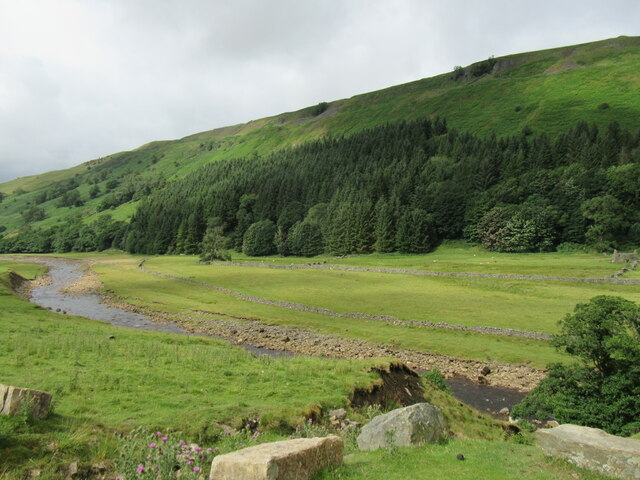
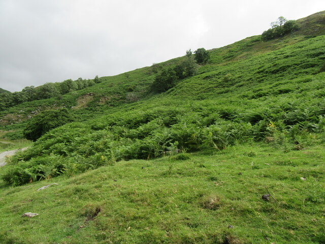
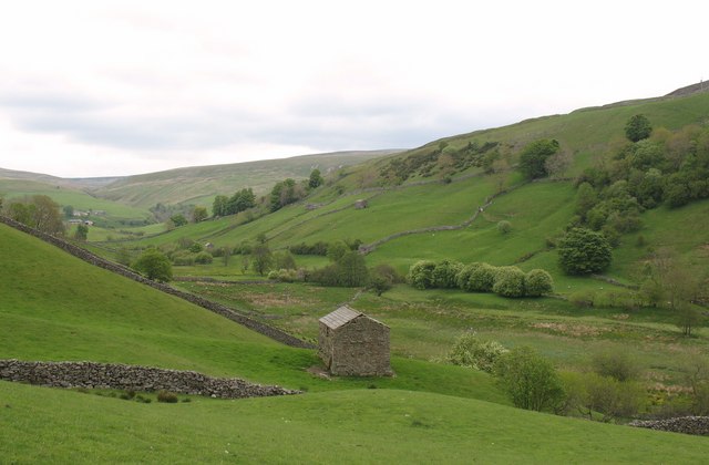
Arngill Wood is a picturesque woodland located in Yorkshire, England. Covering an area of approximately 100 acres, it is nestled in the rolling countryside near the village of Grinton. The wood is situated within the wider Yorkshire Dales National Park, renowned for its stunning landscapes and rich biodiversity.

Arngill Wood is primarily composed of broadleaf trees such as oak, beech, and birch, which create a dense canopy and provide shelter for a diverse range of flora and fauna. The woodland floor is carpeted with bluebells in springtime, creating a colorful and enchanting display.

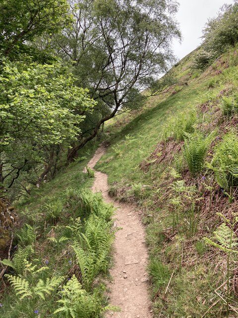
Visitors to Arngill Wood can explore a network of well-maintained footpaths and trails throughout the forest, offering opportunities for leisurely walks and wildlife spotting. The wood is home to a variety of bird species, including woodpeckers, nuthatches, and tawny owls, making it a haven for birdwatchers.

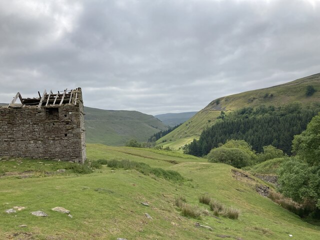
The tranquility and natural beauty of Arngill Wood make it a popular destination for nature enthusiasts and those seeking a peaceful retreat. The wood offers a sense of serenity, with the only sounds being the rustling leaves and the occasional chirping of birds.

Arngill Wood is easily accessible, with ample parking available nearby. It is also conveniently located close to other attractions in the Yorkshire Dales, such as rivers, valleys, and charming villages, making it an ideal starting point for exploring the wider region.

Overall, Arngill Wood is a captivating woodland in Yorkshire, offering visitors a serene escape into nature and a chance to immerse themselves in the breathtaking landscapes of the Yorkshire Dales.

If you have any feedback on the listing, please let us know in the comments section below.
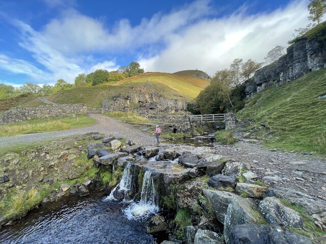
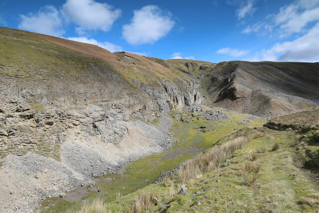
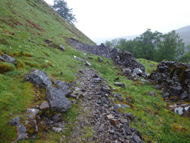
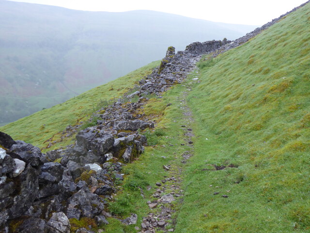
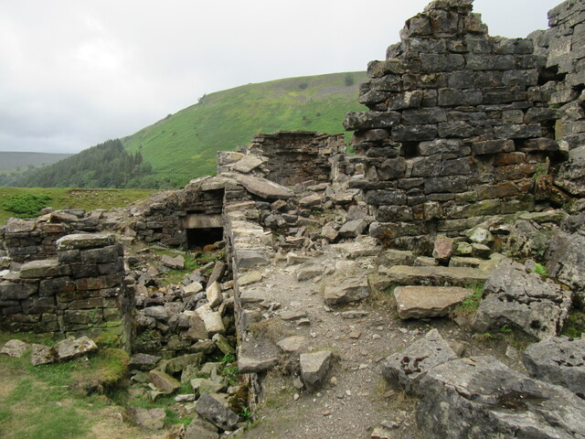
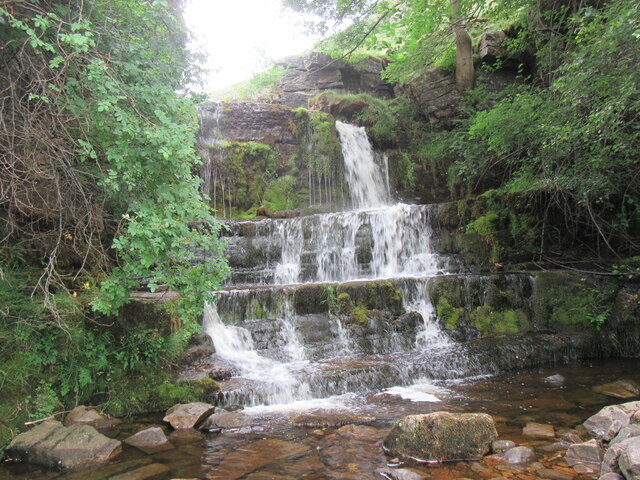
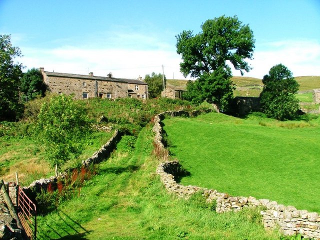
Arngill Wood Images

Images are sourced within 2km of 54.398828/-2.1390535 or Grid Reference NY9100. Thanks to Geograph Open Source API. All images are credited.

Swinner Gill Ford This ford at Swinner Gill is found on the bridleway between Muker and Keld. A video of the ford can be viewed at:
<span class="nowrap"><a title="https://youtu.be/pRj-GMUVvRE" rel="nofollow ugc noopener" href="https://youtu.be/pRj-GMUVvRE">Link</a><img style="margin-left:2px;" alt="External link" title="External link - shift click to open in new window" src="https://s1.geograph.org.uk/img/external.png" width="10" height="10"/></span>
Swinner Gill Ford
This ford at Swinner Gill is found on the bridleway between Muker and Keld. A video of the ford can be viewed at: LinkExternal link
Lead mining scars at Beldi Hill Remarkably invisible from the popular public bridleway along the Swale left bank in Keld Gorge just a quarter kilometre to the south, the Beldi Hill workings have left a huge scar. A large chunk has been washed out of Hall Edge by hushing (a crude but effective form of hydraulic mining) over a long period, with the ore being transported to facilities downhill and to the east for smelting into lead.
Lead mining scars at Beldi Hill
Remarkably invisible from the popular public bridleway along the Swale left bank in Keld Gorge just a quarter kilometre to the south, the Beldi Hill workings have left a huge scar. A large chunk has been washed out of Hall Edge by hushing (a crude but effective form of hydraulic mining) over a long period, with the ore being transported to facilities downhill and to the east for smelting into lead.
The Pennine Way near Rukin Wood
The R Swale valley looking S from E of Crackpot Hall
West Arn Gill from North Gan Scar
The Pennine Way above Rukin Wood
Ruined barn above West Wood
Looking down Swaledale from Swinner Gill
Waterfall in Swinner Gill
Looking up Swinner Gill There are ruined buildings beside the footbridge which are remnants of the lead mining industry.
Looking up Swinner Gill
There are ruined buildings beside the footbridge which are remnants of the lead mining industry.
Looking up Swaledale
Looking across Swaledale towards Crackpot Hall
Looking across Swaledale towards Swinner Gill
Near West Arn Gill Looking SW.
Near West Arn Gill
Looking SW.
Near Swinner Gill In Swaledale.
Near Swinner Gill
In Swaledale.
Ruined mining building in Swinner Gill By the waterfall in Swinner Gill.
Ruined mining building in Swinner Gill
By the waterfall in Swinner Gill.
Swinner Gill waterfall One of the many waterfalls in this area.
Swinner Gill waterfall
One of the many waterfalls in this area.
Show me another place!

Arngill Wood is located at Grid Ref: NY9100 (Lat: 54.398828, Lng: -2.1390535)

Division: North Riding

Administrative County: North Yorkshire

District: Richmondshire

Police Authority: North Yorkshire

What 3 Words

///sourced.spell.sprinkler. Near Bowes, Co. Durham

Nearby Locations

Bell Flats Arngill Wood

Related Wikis

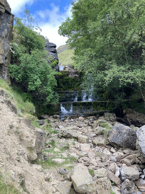
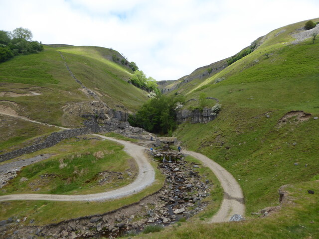
Arn Gill (North Yorkshire)

Arn Gill is a ravine or gully containing a beck of the same name, near the village of Muker in Swaledale, North Yorkshire, England. The ravine and beck...

Kisdon Force

Kisdon Force is a series of waterfalls on the River Swale in Swaledale, England. The falls are situated within the Yorkshire Dales National Park in the...

Kisdon

Kisdon, also called Kisdon Hill, is a fell situated in upper Swaledale in the Yorkshire Dales National Park in North Yorkshire, England. == Geography... ==

East Gill Force

East Gill Force is a waterfall in Swaledale, 330 yards (300 m) east of the hamlet of Keld, in the Yorkshire Dales National Park, North Yorkshire, England...

Catrake Force

Catrake Force is a waterfall on the River Swale in North Yorkshire, England. It is not visible from the road but is accessible via a campsite in Keld....

Keld, North Yorkshire

Keld is a village in the English county of North Yorkshire. It is in Swaledale, and the Yorkshire Dales National Park. The name derives from the Viking...

Angram Bottoms

Angram Bottoms (grid reference SD891999) is a 9.8 hectares (24 acres) biological Site of Special Scientific Interest (SSSI) near to the village of Angram...

Angram, Richmondshire

Angram is a hamlet in the Yorkshire Dales in the Richmondshire district of North Yorkshire, England. It is situated near to Keld to the north and Thwaite...

Nearby Amenities

Located within 500m of 54.398828,-2.1390535
Ford: yes
Lat/Long: 54.4031468/-2.1390781
Barrier: stile
Foot: yes
Stile: stepover
Lat/Long: 54.4027573/-2.1390388
Beldi Hill Smelting Mill
Historic: industrial
Image: https://www.geograph.org.uk/photo/2414959
Mineral: lead
Source: OS OpenData StreetView
Lat/Long: 54.4003879/-2.1416968
Ford: yes
Lat/Long: 54.3949896/-2.1354893
Disused: yes
Image: https://www.geograph.org.uk/photo/1288876
Man Made: adit
Lat/Long: 54.4031737/-2.1391381
Barrier: stile
Foot: designated
Stile: ladder
Lat/Long: 54.3990042/-2.1367574
Ford: yes
Lat/Long: 54.3996038/-2.1367194
Ford: yes
Lat/Long: 54.3970793/-2.1358041
Man Made: cairn
Lat/Long: 54.4013288/-2.1341814
Man Made: cairn
Lat/Long: 54.4000951/-2.1348727
The data included in this document is from www.openstreetmap.org. The data is made available under ODbL.

Have you been to Arngill Wood?

Leave your review of Arngill Wood below (or comments, questions and feedback).