Frogmoor Coppice

Wood, Forest in Dorset

England

Frogmoor Coppice

Grazing off the A35
Grazing off the A35 Credit: JThomas

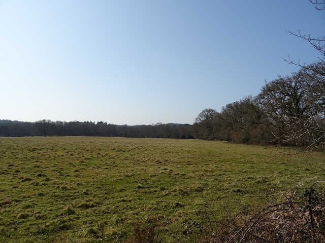
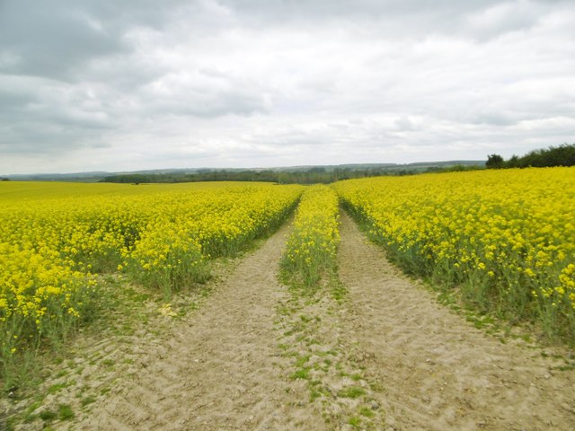
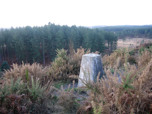
Frogmoor Coppice is a picturesque woodland located in the county of Dorset, England. Covering an area of approximately 50 acres, it is a haven for nature enthusiasts and those seeking tranquility in the heart of the countryside. The coppice is part of the larger Cranborne Chase and West Wiltshire Downs Area of Outstanding Natural Beauty, which further enhances its natural charm and appeal.

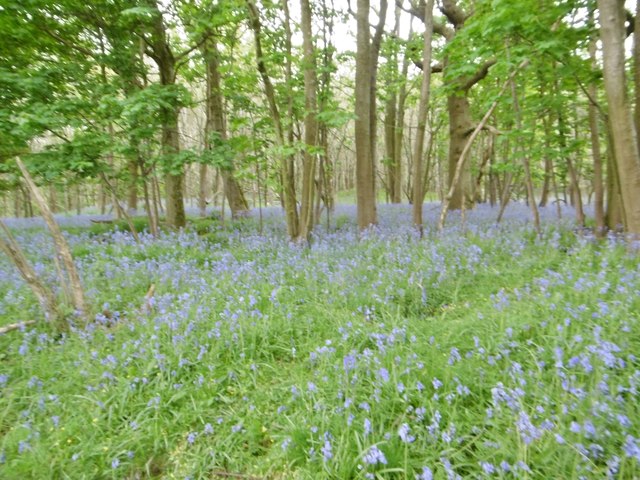
The woodland is predominantly made up of broadleaf trees, including oak, ash, and beech, which create a lush canopy that provides shade and shelter for a diverse range of flora and fauna. Bluebells carpet the forest floor in the spring, adding a burst of color to the already vibrant surroundings.

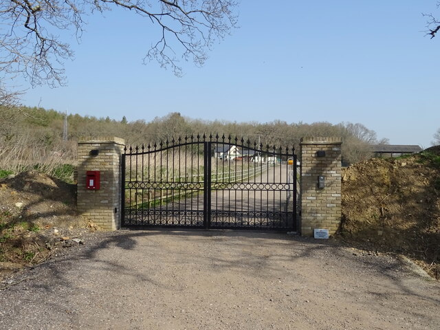
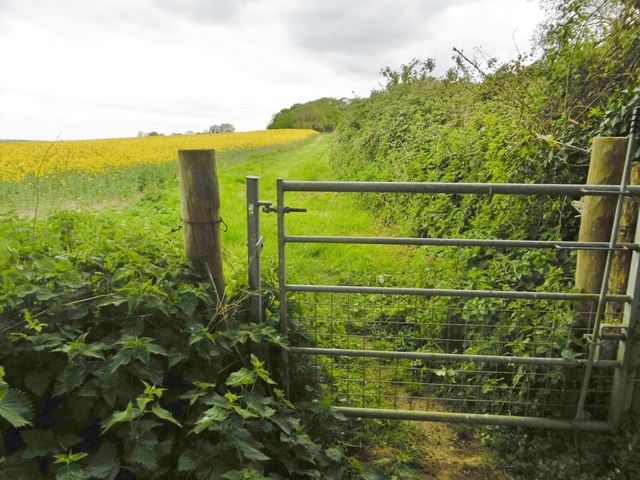
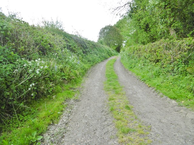
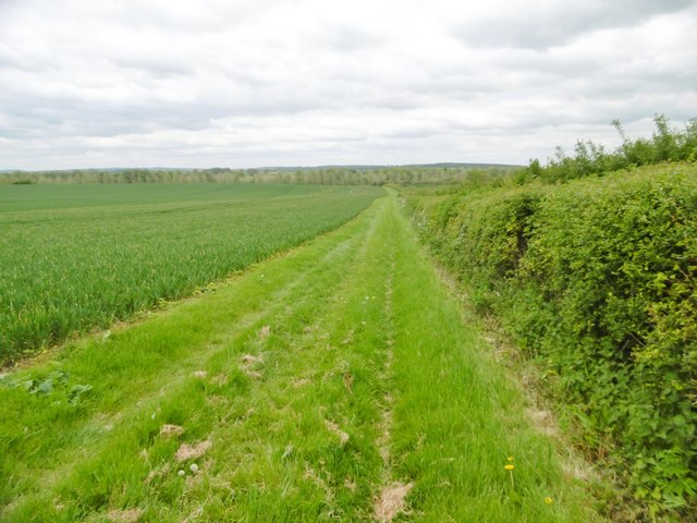
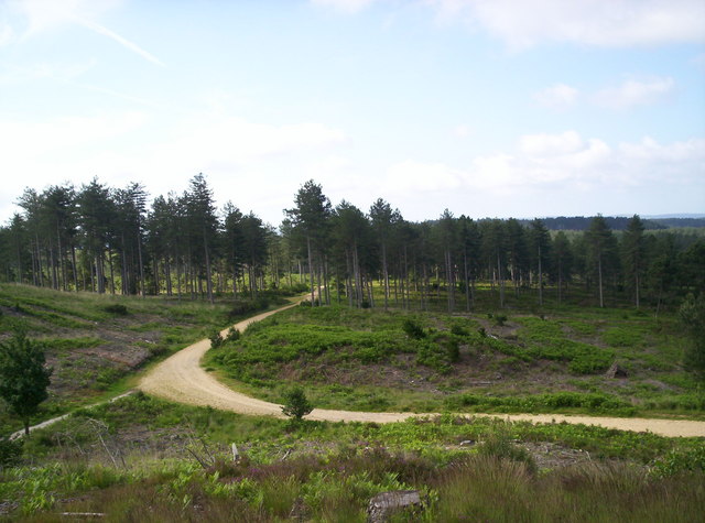
Walking through Frogmoor Coppice, visitors can enjoy a network of well-maintained footpaths that wind their way through the trees. These paths offer a chance to explore the woodland at a leisurely pace, and there are several benches strategically placed for those who wish to rest and take in the peaceful atmosphere.

Wildlife is abundant in the coppice, with sightings of deer, badgers, and foxes not uncommon. Birdwatchers will also be delighted by the variety of species that call this woodland home, including woodpeckers, nuthatches, and tawny owls.

Frogmoor Coppice is a popular destination for outdoor activities such as picnicking, wildlife spotting, and photography. It is lovingly maintained by the local authorities and volunteers, who ensure that the woodland remains a haven for both people and wildlife alike.

If you have any feedback on the listing, please let us know in the comments section below.

Frogmoor Coppice Images

Images are sourced within 2km of 50.749231/-2.1279721 or Grid Reference SY9194. Thanks to Geograph Open Source API. All images are credited.

Grazing off the A35
Grazing off the A35
Gated drive to Snailsbreach Farm
A35 towards Dorchester
East Bloxworth, bluebells On the verge on the lane to the crossroads.
East Bloxworth, bluebells
On the verge on the lane to the crossroads.
Morden, gate On the bridleway to West Morden.
Morden, gate
On the bridleway to West Morden.
Morden, rape field
Morden, rape field
Morden, bluebell wood In a large coppice next to West Morden Farm.
Morden, bluebell wood
In a large coppice next to West Morden Farm.
Morden, public route From the bridleway to Winterborne Zelston to the main highway, passing West Morden Farmhouse.
Morden, public route
From the bridleway to Winterborne Zelston to the main highway, passing West Morden Farmhouse.
Winterborne Zelston, bridleway Along a field margin, towards the village.
Winterborne Zelston, bridleway
Along a field margin, towards the village.
St Mary's Church, East Morden
Sherford, power lines
Sherford, Chitten Hill
Morden, power lines Striding across Morden Bog National Nature Reserve: <span class="nowrap"><a title="https://www.wildlifetrusts.org/who-we-are/history/rothschild-reserves/wareham-heath-dorset" rel="nofollow ugc noopener" href="https://www.wildlifetrusts.org/who-we-are/history/rothschild-reserves/wareham-heath-dorset">Link</a><img style="margin-left:2px;" alt="External link" title="External link - shift click to open in new window" src="https://s1.geograph.org.uk/img/external.png" width="10" height="10"/></span>
Morden, power lines
Striding across Morden Bog National Nature Reserve: LinkExternal link
Morden, bridleway Through scrub from Sherford Bridge to Stroud Bridge.
Morden, bridleway
Through scrub from Sherford Bridge to Stroud Bridge.
Morden, gates Entering Forestry Commission land, on the bridleway to Stroud Bridge.
Morden, gates
Entering Forestry Commission land, on the bridleway to Stroud Bridge.
Morden, scrub Coarse grass, conifers and invasive Rhododendron ponticum.
Morden, scrub
Coarse grass, conifers and invasive Rhododendron ponticum.
Morden, wet heathland
Morden, high seat Used by hunters.
Morden, high seat
Used by hunters.
Show me another place!

Frogmoor Coppice is located at Grid Ref: SY9194 (Lat: 50.749231, Lng: -2.1279721)

Unitary Authority: Dorset

Police Authority: Dorset

What 3 Words

///absorb.eats.envy. Near Lytchett Matravers, Dorset

Related Wikis

Loosebarrow Hundred

Loosebarrow Hundred was a hundred in the county of Dorset, England, containing the following parishes: Almer Morden Spetisbury == See also == List of...

Morden, Dorset

Morden (otherwise Moreden) is a civil parish in the Purbeck district of south Dorset, England. Morden is about 6 miles (10 km) north-west of Poole. At...

Slepe

Slepe is a hamlet in the county of Dorset, England. It is located on the A35 east of Organford. == References ==

Woolsbarrow Hillfort

Woolsbarrow Hillfort is a hillfort on Bloxworth Heath in the district of Purbeck in the county of Dorset, England. It dates to the period from the Late...

Bloxworth

Bloxworth is a village and civil parish in the English county of Dorset, within Wareham Forest on the A35 road 5 miles (8 km) west of Poole. In the 2011...

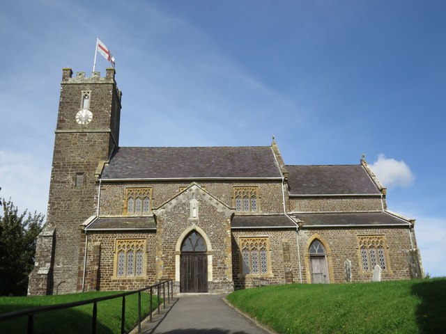
St Mary the Virgin, Lytchett Matravers

St Mary the Virgin is the Church of England parish church of Lytchett Matravers in Dorset. Its parish is part of the Diocese of Salisbury. The building...

Bloxworth House

Bloxworth House is a Grade I listed manor house just northwest of the village of Bloxworth in Dorset, England. It was built in 1608 by George Savage and...

Gore Heath

Gore Heath is an area of coniferous woodland and open heathland forming part of Wareham Forest west of the Poole-Bournemouth conurbation in south Dorset...

Nearby Amenities

Located within 500m of 50.749231,-2.1279721
Material: wood
Power: pole
Ref: 10
Source: bing
Source Ref: interpolation
Lat/Long: 50.7451943/-2.1256626
Material: wood
Power: pole
Ref: 11
Source: bing
Source Ref: interpolation
Lat/Long: 50.7451836/-2.1258251
Material: wood
Power: pole
Ref: 12
Source: bing
Source Ref: interpolation
Lat/Long: 50.7457312/-2.1264054
Material: wood
Power: pole
Ref: 11
Source: bing
Source Ref: interpolation
Lat/Long: 50.7458167/-2.1263014
Material: wood
Power: pole
Ref: 13
Source: bing
Source Ref: interpolation
Lat/Long: 50.7463966/-2.1293416
Material: wood
Power: pole
Ref: 13
Source: bing
Source Ref: survey
Lat/Long: 50.7468109/-2.1306532
Material: wood
Power: pole
Ref: 16
Source: bing
Source Ref: interpolation
Lat/Long: 50.7474186/-2.1337045
Material: wood
Power: pole
Ref: 15
Source: bing
Source Ref: interpolation
Lat/Long: 50.7474924/-2.1336663
Material: wood
Power: pole
Source: bing
Lat/Long: 50.7494704/-2.1346878
Hectors Corner Pumping S
Material: wood
Power: pole
Ref: 57304226
Source: bing
Transformer: distribution
Voltage Primary: 11000
Voltage Secondary: 400
Voltage Tertiary: 230
Lat/Long: 50.7533027/-2.1303233
Material: wood
Power: pole
Source: bing
Lat/Long: 50.7533867/-2.1284254
Material: wood
Power: pole
Source: bing
Lat/Long: 50.7534196/-2.1278081
Material: wood
Power: pole
Source: bing
Lat/Long: 50.7535281/-2.1270791
Fire Hydrant
Emergency: fire_hydrant
Fire Hydrant Diameter: 4 inch
Fire Hydrant Type: underground
Ref: 6227
Source: GPS+GLONASS
Lat/Long: 50.7502759/-2.1233091
Material: wood
Power: pole
Source: bing
Lat/Long: 50.7511296/-2.1226897
Public Bookcase
Morden Book & DVD Exchange
Access: yes
Booth: K6
Disused Amenity: telephone
Historic Amenity: telephone
Historic Operator: BT
Man Made: telephone_box
Old Phone: +44 1929 459336
Opening Hours: 24/7
Public Bookcase Type: phone_box
Ref GB Uprn: 10024741054
Lat/Long: 50.7514966/-2.123904
Post Box
Collection Times: Mo-Fr 17:00; Sa 12:00
Post Box Mounting: brick_pillar
Post Box Type: wall
Ref: BH20 102
Ref GB Uprn: 10015311592
Royal Cypher: GVIR
Royal Cypher Wikidata: Q33102169
Source: GPS+GLONASS
Lat/Long: 50.7515028/-2.1238796
Fire Hydrant
Emergency: fire_hydrant
Fire Hydrant Diameter: 90
Fire Hydrant Type: underground
Ref: 10682
Source: survey
Lat/Long: 50.751605/-2.123836
Material: wood
Power: pole
Ref: 2;57304239
Source: GPS+GLONASS
Lat/Long: 50.7523426/-2.1234731
Material: wood
Power: pole
Ref: 14
Source: bing
Source Ref: survey
Lat/Long: 50.7466986/-2.1306376
Grit Bin
Frogmore Corner
Source: survey
Lat/Long: 50.7533694/-2.1292095
Material: wood
Power: pole
Ref: 57304227;5A
Source: survey
Lat/Long: 50.7533485/-2.1291347
Fire Hydrant
Emergency: fire_hydrant
Fire Hydrant Diameter: 100
Fire Hydrant Type: underground
Ref: 8629
Source: GPS+GLONASS
Lat/Long: 50.753479/-2.128978
Sticklands Farm
Landuse: farm
Lat/Long: 50.7493964/-2.1225461
Board Type: notice
Information: board
Tourism: information
Lat/Long: 50.7518693/-2.1250142
Recycling
Recycling Clothes: yes
Recycling Shoes: yes
Recycling Type: container
Lat/Long: 50.7518946/-2.1251116
Waste Basket
Waste: rubbish
Lat/Long: 50.7515082/-2.123876
Power: pole
Ref: 12
Source: bing
Source Ref: interpolation
Lat/Long: 50.7464982/-2.1293234
Power: pole
Ref: 15
Source: bing
Source Ref: interpolation
Lat/Long: 50.7470958/-2.1322945
Power: pole
Ref: 14
Source: bing
Source Ref: interpolation
Lat/Long: 50.7471925/-2.1322542
Power: pole
Source: bing
Lat/Long: 50.7533961/-2.1260905
Power: pole
Source: bing
Lat/Long: 50.7529778/-2.1292099
Power: pole
Source: bing
Lat/Long: 50.7525696/-2.1294178
Frogmore Corner
Lat/Long: 50.7533952/-2.1291348
Man Made: utility_pole
Material: wood
Note: 2021-11-10
Operator: BT OpenReach
Ref: 4A
Source: survey
Utility: telecom
Lat/Long: 50.7534741/-2.1290564
Man Made: utility_pole
Material: wood
Note: 2021-11-10
Operator: BT OpenReach
Ref: 3A
Source: survey
Utility: telecom
Lat/Long: 50.7537079/-2.1284153
Marker: post
Phone: +44 800 2940078
Ref: PO034SY914942PO160
Source: survey
Utility: gas
Lat/Long: 50.7473919/-2.1231233
Bench
Backrest: no
Colour: brown
Material: wood
Lat/Long: 50.7534635/-2.1290041
Camera Mount: wall
Camera Type: panning
Height: 2
Man Made: surveillance
Surveillance: public
Surveillance Type: camera
Lat/Long: 50.7518372/-2.1249853
Cock and Bottle
Information: guidepost
Ref: 913 094
Tourism: information
Lat/Long: 50.7514132/-2.1237758
Bench
Backrest: yes
Colour: brown
Material: wood
Lat/Long: 50.7514225/-2.1237523
Camera Direction: 122
Camera Mount: wall
Camera Type: fixed
Height: 4
Man Made: surveillance
Surveillance: outdoor
Surveillance Type: camera
Lat/Long: 50.7534944/-2.1257066
Power: pole
Source: survey;bing
Transformer: distribution
Lat/Long: 50.7516109/-2.12336
Colour: green
Man Made: street_cabinet
Operator: Wessex Water
Street Cabinet: water
Lat/Long: 50.7516444/-2.123987
The data included in this document is from www.openstreetmap.org. The data is made available under ODbL.

Have you been to Frogmoor Coppice?

Leave your review of Frogmoor Coppice below (or comments, questions and feedback).